Tag Archive: Flash Flood in USA


Earthquakes

USGS

MAG UTC DATE-TIME
y/m/d h:m:s
LAT
deg
LON
deg
DEPTH
km
 Region
MAP  3.3 2012/09/12 23:24:02   19.578   -64.125 59.0  VIRGIN ISLANDS REGION
MAP  5.4   2012/09/12 21:52:17  -23.915   82.951 10.0  SOUTH INDIAN OCEAN
MAP  2.6 2012/09/12 20:42:00   33.932  -116.730 12.6  SOUTHERN CALIFORNIA
MAP  3.1 2012/09/12 20:10:27   18.872   -64.470 40.0  VIRGIN ISLANDS REGION
MAP  2.6 2012/09/12 19:45:04   59.083  -153.142 85.7  SOUTHERN ALASKA
MAP  5.1   2012/09/12 19:29:56   36.687   71.367 188.6  HINDU KUSH REGION, AFGHANISTAN
MAP  2.8 2012/09/12 17:30:36   52.026  -169.391 56.0  FOX ISLANDS, ALEUTIAN ISLANDS, ALASKA
MAP  3.3 2012/09/12 15:26:46   51.858  -169.319 27.4  FOX ISLANDS, ALEUTIAN ISLANDS, ALASKA
MAP  3.3 2012/09/12 14:48:16   19.331   -64.724 13.0  VIRGIN ISLANDS REGION
MAP  4.9   2012/09/12 14:23:05   10.391   126.716 4.1  PHILIPPINE ISLANDS REGION
MAP  4.6   2012/09/12 13:46:08   51.193   178.670 52.4  RAT ISLANDS, ALEUTIAN ISLANDS, ALASKA
MAP  3.1 2012/09/12 12:10:46   19.534   -64.168 70.0  VIRGIN ISLANDS REGION
MAP  3.1 2012/09/12 11:33:18   18.428   -66.669 128.0  PUERTO RICO
MAP  5.2   2012/09/12 11:27:51  -10.111   161.071 87.4  SOLOMON ISLANDS
MAP  3.1 2012/09/12 10:26:26   19.332   -63.854 47.0  VIRGIN ISLANDS REGION
MAP  3.4 2012/09/12 10:25:07   19.557   -64.386 50.0  VIRGIN ISLANDS REGION
MAP  4.8   2012/09/12 09:37:29   24.990   123.192 15.4  SOUTHWESTERN RYUKYU ISLANDS, JAPAN
MAP  4.7   2012/09/12 09:20:54  -32.484   -68.523 101.8  MENDOZA, ARGENTINA
MAP  4.6   2012/09/12 07:18:43   24.984   123.135 10.2  SOUTHWESTERN RYUKYU ISLANDS, JAPAN
MAP  3.0 2012/09/12 07:08:08   19.419  -155.289 33.1  ISLAND OF HAWAII, HAWAII
MAP  3.8 2012/09/12 06:42:14   60.245  -151.965 68.1  KENAI PENINSULA, ALASKA
MAP  4.8   2012/09/12 06:29:35   9.527   -85.190 35.0  OFF THE COAST OF COSTA RICA 
MAP  2.7 2012/09/12 05:51:11   41.225  -117.486 0.0  NEVADA
MAP  4.6   2012/09/12 05:50:54   41.774   71.954 28.4  KYRGYZSTAN
MAP  4.5   2012/09/12 05:23:18   9.215   -77.788 46.0  NEAR THE NORTH COAST OF COLOMBIA
MAP  4.2 2012/09/12 05:00:25   36.755   24.190 10.1  SOUTHERN GREECE
MAP  3.0 2012/09/12 04:50:39   19.757   -64.314 25.0  NORTH OF THE VIRGIN ISLANDS
MAP  5.6   2012/09/12 04:28:15   -5.067   152.131 65.7  NEW BRITAIN REGION, PAPUA NEW GUINEA
MAP  4.4 2012/09/12 04:10:52   9.635   -85.122 34.9  OFF THE COAST OF COSTA RICA
MAP  2.6 2012/09/12 04:04:37   19.609   -64.379 25.0  VIRGIN ISLANDS REGION
MAP  3.6 2012/09/12 04:02:56   19.648   -64.275 38.0  VIRGIN ISLANDS REGION
MAP  5.5   2012/09/12 03:27:45   34.811   24.064 27.4  CRETE, GREECE
MAP  2.7 2012/09/12 03:11:20   18.046   -65.498 18.0  PUERTO RICO REGION
MAP  5.0   2012/09/12 02:57:26  -40.013   46.035 10.0  SOUTHWEST INDIAN RIDGE
MAP  4.6   2012/09/12 02:13:04   10.197   -85.440 37.3  COSTA RICA
MAP  4.6   2012/09/12 01:13:26   11.955   -88.839 35.0  OFF THE COAST OF CENTRAL AMERICA


Magnitude 5.5 earthquake jolts Islamabad, KPK, Punjab

By

Islamabad: A tremor of moderate earthquake was felt in Islamabad, Peshawar and other parts of Pakistan, however no causalities were reported.

According to the Pakistan Metrological Department (PMD), the intensity of the earthquake was magnitude 5.5 on Richter scale. The earthquake was felt in Islamabad, Peshawar, Rawalpindi, Swat, Malakand, Dir, North Punjab and other parts of Pakistan.

The focal point of the quake was near the Afghan-Tajik border. The tremors created panic among the residents.

LISS – Live Internet Seismic Server

GSN Stations

These data update automatically every 30 minutes. Last update: September 13, 2012 09:19:00 UTC

Seismograms may take several moments to load. Click on a plot to see larger image.

CU/ANWB, Willy Bob, Antigua and Barbuda

 ANWB 24hr plot

CU/BBGH, Gun Hill, Barbados

 BBGH 24hr plot

CU/BCIP, Isla Barro Colorado, Panama

 BCIP 24hr plot

CU/GRGR, Grenville, Grenada

 GRGR 24hr plot

CU/GRTK, Grand Turk, Turks and Caicos Islands

 GRTK 24hr plot

CU/GTBY, Guantanamo Bay, Cuba

 GTBY 24hr plot

CU/MTDJ, Mount Denham, Jamaica

 MTDJ 24hr plot

CU/SDDR, Presa de Sabaneta, Dominican Republic

 SDDR 24hr plot

CU/TGUH, Tegucigalpa, Honduras

 TGUH 24hr plot

IC/BJT, Baijiatuan, Beijing, China

 BJT 24hr plot

IC/ENH, Enshi, China

 ENH 24hr plot

IC/HIA, Hailar, Neimenggu Province, China

 HIA 24hr plot

IC/LSA, Lhasa, China

 LSA 24hr plot

IC/MDJ, Mudanjiang, China

 MDJ 24hr plot

IC/QIZ, Qiongzhong, Guangduong Province, China

 QIZ 24hr plot

IU/ADK, Aleutian Islands, Alaska, USA

 ADK 24hr plot

IU/AFI, Afiamalu, Samoa

 AFI 24hr plot

IU/ANMO, Albuquerque, New Mexico, USA

 ANMO 24hr plot

IU/ANTO, Ankara, Turkey

 ANTO 24hr plot

IU/BBSR, Bermuda

 BBSR 24hr plot

IU/BILL, Bilibino, Russia

 BILL 24hr plot

IU/CASY, Casey, Antarctica

 CASY 24hr plot

IU/CCM, Cathedral Cave, Missouri, USA

 CCM 24hr plot

IU/CHTO, Chiang Mai, Thailand

 CHTO 24hr plot

IU/COLA, College Outpost, Alaska, USA

 COLA 24hr plot

IU/COR, Corvallis, Oregon, USA

 COR 24hr plot

IU/CTAO, Charters Towers, Australia

 CTAO 24hr plot

IU/DAV,Davao, Philippines

 DAV 24hr plot

IU/DWPF,Disney Wilderness Preserve, Florida, USA

 DWPF 24hr plot

IU/FUNA,Funafuti, Tuvalu

 FUNA 24hr plot

IU/FURI, Mt. Furi, Ethiopia

 FURI 24hr plot

IU/GNI, Garni, Armenia

 GNI 24hr plot

IU/GRFO, Grafenberg, Germany

 GRFO 24hr plot

IU/GUMO, Guam, Mariana Islands

 GUMO 24hr plot

IU/HKT, Hockley, Texas, USA

 HKT 24hr plot

IU/HNR, Honiara, Solomon Islands

 HNR 24hr plot

IU/HRV, Adam Dziewonski Observatory (Oak Ridge), Massachusetts, USA

 HRV 24hr plot

IU/INCN, Inchon, Republic of Korea

 INCN 24hr plot

IU/JOHN, Johnston Island, Pacific Ocean

 JOHN 24hr plot

IU/KBS, Ny-Alesund, Spitzbergen, Norway

 KBS 24hr plot

IU/KEV, Kevo, Finland

 KEV 24hr plot

IU/KIEV, Kiev, Ukraine

 KIEV 24hr plot

IU/KIP, Kipapa, Hawaii, USA

 KIP 24hr plot

IU/KMBO, Kilima Mbogo, Kenya

 KMBO 24hr plot

IU/KNTN, Kanton Island, Kiribati

 KNTN 24hr plot

IU/KONO, Kongsberg, Norway

 KONO 24hr plot

IU/KOWA, Kowa, Mali

 KOWA 24hr plot

IU/LCO, Las Campanas Astronomical Observatory, Chile

 LCO 24hr plot

IU/LSZ, Lusaka, Zambia

 LSZ 24hr plot

IU/LVC, Limon Verde, Chile

 LVC 24hr plot

IU/MA2, Magadan, Russia

 MA2 24hr plot

IU/MAJO, Matsushiro, Japan

 MAJO 24hr plot

IU/MAKZ,Makanchi, Kazakhstan

 MAKZ 24hr plot

IU/MBWA, Marble Bar, Western Australia

 MBWA 24hr plot

IU/MIDW, Midway Island, Pacific Ocean, USA

 MIDW 24hr plot

IU/MSKU, Masuku, Gabon

 MSKU 24hr plot

IU/NWAO, Narrogin, Australia

 NWAO 24hr plot

IU/OTAV, Otavalo, Equador

 OTAV 24hr plot

IU/PAB, San Pablo, Spain

 PAB 24hr plot

IU/PAYG Puerto Ayora, Galapagos Islands

 PAYG 24hr plot

IU/PET, Petropavlovsk, Russia

 PET 24hr plot

IU/PMG, Port Moresby, Papua New Guinea

 PMG 24hr plot

IU/PMSA, Palmer Station, Antarctica

 PMSA 24hr plot

IU/POHA, Pohakaloa, Hawaii

 POHA 24hr plot

IU/PTCN, Pitcairn Island, South Pacific

 PTCN 24hr plot

IU/PTGA, Pitinga, Brazil

 PTGA 24hr plot

IU/QSPA, South Pole, Antarctica

 QSPA 24hr plot

IU/RAO, Raoul, Kermandec Islands

 RAO 24hr plot

IU/RAR, Rarotonga, Cook Islands

 RAR 24hr plot

IU/RCBR, Riachuelo, Brazil

 RCBR 24hr plot

IU/RSSD, Black Hills, South Dakota, USA

 RSSD 24hr plot

IU/SAML, Samuel, Brazil

 SAML 24hr plot

IU/SBA, Scott Base, Antarctica

 SBA 24hr plot

IU/SDV, Santo Domingo, Venezuela

 SDV 24hr plot

IU/SFJD, Sondre Stromfjord, Greenland

 SFJD 24hr plot

IU/SJG, San Juan, Puerto Rico

 SJG 24hr plot

IU/SLBS, Sierra la Laguna Baja California Sur, Mexico

 SLBS 24hr plot

IU/SNZO, South Karori, New Zealand

 SNZO 24hr plot

IU/SSPA, Standing Stone, Pennsylvania USA

 SSPA 24hr plot

IU/TARA, Tarawa Island, Republic of Kiribati

 TARA 24hr plot

IU/TATO, Taipei, Taiwan

 TATO 24hr plot

IU/TEIG, Tepich, Yucatan, Mexico

 TEIG 24hr plot

IU/TIXI, Tiksi, Russia

 TIXI 24hr plot

IU/TRIS, Tristan da Cunha, Atlantic Ocean

 TRIS 24hr plot

IU/TRQA, Tornquist, Argentina

 TRQA 24hr plot

IU/TSUM, Tsumeb, Namibia

 TSUM 24hr plot

IU/TUC, Tucson, Arizona

 TUC 24hr plot

IU/ULN, Ulaanbaatar, Mongolia

 ULN 24hr plot

IU/WAKE, Wake Island, Pacific Ocean

 WAKE 24hr plot

IU/WCI, Wyandotte Cave, Indiana, USA

 WCI 24hr plot

IU/WVT, Waverly, Tennessee, USA

 WVT 24hr plot

IU/XMAS, Kiritimati Island, Republic of Kiribati

 XMAS 24hr plot

IU/YAK, Yakutsk, Russia

 YAK 24hr plot

IU/YSS, Yuzhno Sakhalinsk, Russia

 YSS 24hr plot

**********************************************************************************************************

Volcanic Activity

12.09.2012 Volcano Eruption Japan Kagoshima Prefecture, [Sakura-jima Volcano, Island of Kyushu] Damage level Details

Volcano Eruption in Japan on Wednesday, 12 September, 2012 at 11:52 (11:52 AM) UTC.

Description
Described as “a stronger than usual explosion” by volcanic activity specialists, the Sakurajima eruption was captured by four live cameras set up by the Japanese Ministry of Land, Infrastructure and Transport. The volcano, located in Japan’s southern Kagoshima region, erupted at 20:42 local time (11:42GMT) on Tuesday and sent a plume of ash 15,000ft in the air, according to Japanese authorities.

***********************************************************************************************************

Extreme Temperatures/ Weather

CASPER, Wyo. (AP) — Firefighters are taking advantage of cooler, more humid weather to dig in around a wildfire burning on Casper Mountain.

Crews were focusing Wednesday on building containment lines around the northwest corner of the Sheep Herder Hill Fire, the portion closest to most of the 750 homes threatened by the blaze. The fire has destroyed seven homes on the mountain overlooking Casper since breaking out Sunday.

It hasn’t spread much in the last 24 hours and is listed at nearly 25 square miles and 10 percent contained.

Investigators will also be in the fire zone looking into how the fire started. Fire spokeswoman Susan Ford said that’s a standard procedure when there aren’t any obvious signs of how a fire started, such as a lightning strike.

***********************************************************************************************************

Storms / Flooding

  Active tropical storm system(s)
Name of storm system Location Formed Last update Last category Course Wind Speed Gust Wave Source Details
Sanba (17W) Pacific Ocean 11.09.2012 13.09.2012 SuperTyphoon 340 ° 213 km/h 259 km/h 5.79 m JTWC Details

Tropical Storm data

Share:
Storm name: Sanba (17W)
Area: Pacific Ocean
Start up location: N 11° 6.000, E 133° 48.000
Start up: 11th September 2012
Status: Active
Track long: 371.17 km
Top category.:
Report by: JTWC
Useful links:

Past track
Date Time Position Speed
km/h
Wind
km/h
Gust
km/h
Category Course Wave Pressure Source
11th Sep 2012 09:49:04 N 11° 6.000, E 133° 48.000 33 65 83 Tropical Storm 345 20 JTWC
12th Sep 2012 05:03:46 N 12° 42.000, E 131° 48.000 15 102 130 Tropical Storm 310 18 JTWC
12th Sep 2012 10:43:24 N 13° 6.000, E 131° 0.000 17 120 148 Typhoon I. 295 15 JTWC
Current position
Date Time Position Speed
km/h
Wind
km/h
Gust
km/h
Category Course Wave
feet
Pressure Source
13th Sep 2012 11:08:12 N 15° 36.000, E 129° 30.000 17 213 259 SuperTyphoon 340 ° 19 JTWC
Forecast track
Date Time Position Category Wind
km/h
Gust
km/h
Source
14th Sep 2012 06:00:00 N 19° 6.000, E 128° 48.000 SuperTyphoon 259 315 JTWC
14th Sep 2012 18:00:00 N 21° 0.000, E 128° 18.000 SuperTyphoon 259 315 JTWC
15th Sep 2012 06:00:00 N 22° 54.000, E 127° 48.000 SuperTyphoon 250 306 JTWC
16th Sep 2012 06:00:00 N 27° 24.000, E 126° 48.000 SuperTyphoon 222 269 JTWC
17th Sep 2012 06:00:00 N 32° 24.000, E 126° 48.000 Typhoon IV 185 232 JTWC
18th Sep 2012 06:00:00 N 38° 24.000, E 128° 42.000 Typhoon II 130 157 JTWC
Nadine (AL14) Atlantic Ocean 11.09.2012 13.09.2012 Hurricane I 305 ° 111 km/h 139 km/h 5.18 m NOAA NHC Details

 Tropical Storm data

Share:
Storm name: Nadine (AL14)
Area: Atlantic Ocean
Start up location: N 16° 18.000, W 43° 6.000
Start up: 11th September 2012
Status: Active
Track long: 549.85 km
Top category.:
Report by: NOAA NHC
Useful links:

Past track
Date Time Position Speed
km/h
Wind
km/h
Gust
km/h
Category Course Wave Pressure Source
12th Sep 2012 05:01:17 N 17° 48.000, W 45° 12.000 24 65 83 Tropical Storm 300 13 1004 MB NOAA NHC
12th Sep 2012 10:46:22 N 18° 36.000, W 46° 36.000 28 74 93 Tropical Storm 300 15 1001 MB NOAA NHC
Current position
Date Time Position Speed
km/h
Wind
km/h
Gust
km/h
Category Course Wave
feet
Pressure Source
13th Sep 2012 11:12:43 N 21° 30.000, W 51° 18.000 26 111 139 Hurricane I 305 ° 17 990 MB NOAA NHC
Forecast track
Date Time Position Category Wind
km/h
Gust
km/h
Source
14th Sep 2012 06:00:00 N 25° 24.000, W 54° 0.000 Hurricane II 130 157 NOAA NHC
14th Sep 2012 18:00:00 N 27° 36.000, W 54° 12.000 Hurricane II 130 157 NOAA NHC
15th Sep 2012 06:00:00 N 29° 18.000, W 53° 18.000 Hurricane I 120 148 NOAA NHC
16th Sep 2012 06:00:00 N 31° 30.000, W 49° 30.000 Hurricane I 111 139 NOAA NHC
17th Sep 2012 06:00:00 N 32° 30.000, W 44° 0.000 Hurricane I 111 139 NOAA NHC
18th Sep 2012 06:00:00 N 34° 0.000, W 38° 0.000 Hurricane I 111 139 NOAA NHC
Kristy (EP11) Pacific Ocean – East 12.09.2012 13.09.2012 Tropical Depression 295 ° 83 km/h 102 km/h 4.57 m NOAA NHC Details

Tropical Storm data

Share:
Storm name: Kristy (EP11)
Area: Pacific Ocean – East
Start up location: N 16° 42.000, W 106° 0.000
Start up: 12th September 2012
Status: Active
Track long: 128.78 km
Top category.:
Report by: NOAA NHC
Useful links:

Past track
Date Time Position Speed
km/h
Wind
km/h
Gust
km/h
Category Course Wave Pressure Source
Current position
Date Time Position Speed
km/h
Wind
km/h
Gust
km/h
Category Course Wave
feet
Pressure Source
13th Sep 2012 11:10:36 N 18° 30.000, W 108° 30.000 17 83 102 Tropical Depression 295 ° 15 1002 MB NOAA NHC
Forecast track
Date Time Position Category Wind
km/h
Gust
km/h
Source
14th Sep 2012 18:00:00 N 20° 30.000, W 112° 48.000 Hurricane I 111 139 NOAA NHC
14th Sep 2012 06:00:00 N 19° 36.000, W 111° 12.000 Hurricane I 102 120 NOAA NHC
15th Sep 2012 06:00:00 N 21° 42.000, W 114° 30.000 Hurricane I 102 120 NOAA NHC
16th Sep 2012 06:00:00 N 23° 54.000, W 118° 12.000 Tropical Depression 74 93 NOAA NHC
17th Sep 2012 06:00:00 N 25° 0.000, W 120° 30.000 Tropical Depression 46 65 NOAA NHC
18th Sep 2012 06:00:00 N 25° 30.000, W 121° 0.000 Tropical Depression 37 56 NOAA NHC

………………………………………….

USGS Flyover Shows Storm Damage and Marsh Dieback

Link to USGS Newsroom

USGS Flyover Shows Storm Damage and Marsh Dieback

Posted: 11 Sep 2012 06:00 AM PDT

A flyover of southeast Louisiana revealed storm damage from Hurricane Isaac and marsh dieback, some of which was occurring before Hurricane Isaac. The flyover was conducted by the U.S. Geological Survey National Wetlands Research Center (NWRC), U.S. Fish and Wildlife Service, and the U.S. Department of Agriculture Natural Resources Conservation Service.

The flight examined areas from Wax Lake Delta, La., to Ship Island, Miss., and preliminary assessments suggest that Hurricane Isaac damaged coastal wetlands in a manner that is substantial, but not unprecedented. Damage to coastal wetland areas was evident throughout much of southeast Louisiana. The intensity of hurricane effects was most abundant in areas of upper Breton Sound, an area just to the south of the community of Braithwaite, which experienced devastating flooding. Breton Sound had been experiencing some slight recovery from the extensive damage inflicted by Hurricanes Katrina and Gustav; however, scientists observed many of the initial effects of Hurricane Isaac to be reactivations of previous damages in these newly recovering areas. Photos from the flyover are available online.

“The before and after images from coastal flyovers reveal the disappearance of some of the Gulf’s most biologically and economically significant landscape disappearing before our very eyes, on human time scales,” said USGS Director Marcia McNutt. “There are many compounding factors that lead to enhanced coastal vulnerability, with hurricanes sweeping in to deliver the coup de grace.”

Other areas in which physical damage to coastal wetlands was observed include the north shore of Lake Pontchartrain near Slidell, areas surrounding the Rigolets to include the mouth of the Pearl River, and the Chandeleur Islands. The majority of structural changes in these areas appear to be reactivations or intensifications of effects of previous storms. Previous storms such as hurricanes Audrey, Hilda, Betsy, Andrew, Katrina, Rita, Gustav, and Ike are known to have damaged coastal wetlands and contributed to wetland loss, and Isaac appears to have been yet another blow to Louisiana’s fragile but vital coastal wetlands.

“Louisiana’s coastal land loss is the greatest environmental, economic and cultural tragedy on the North American Continent, and marsh dieback exacerbates this ongoing disaster,” said USGS NWRC Director Phil Turnipseed. “The NWRC is dedicated to continuing to investigate the causes of land loss in order to provide decision makers with information that can help reduce land loss in the future.”

The most prevalent effects of Hurricane Isaac observed were expansive wrack fields. Wrack is accumulated organic debris and trash that are transported and deposited by a hurricane’s surge. Wrack deposits from Hurricane Isaac were observed throughout southeast Louisiana, burying existing marsh areas and obstructing infrastructure, such as canals and railroads. Generally wrack deposits eventually decompose and the areas are re-vegetated, but in the short-term wrack can kill the existing wetland vegetation.

Very few downed trees were observed in forested wetlands from Hurricane Isaac, especially compared to that of Hurricane Katrina, which is likely indicative of the lesser intensity of this storm. Even in areas where no physical removal of wetlands or vegetation was evident, the vegetation which did survive was observed to have sustained substantial damage.

Large areas of marsh dieback, termed “brown marsh” or “sudden marsh dieback,” were observed in the Terrebonne and Barataria basins in Louisiana. Previous reports of sudden marsh dieback in the spring and summer of 2012, before Hurricane Isaac, indicate that the dieback in this area has been increasing over time and may be the result of a combination of other stressors. Evidence of vegetation stress, such as widespread discoloration, was also observed in areas that were directly impacted further to the east by hurricane storm surge. The browning and destruction in the marshes east of the Mississippi River in coastal Louisiana appear to be recent, indicating a more direct link to salinity and flooding stress associated with the Hurricane Isaac’s storm surge. The USGS will further investigate the recent history of sudden marsh dieback events in coastal Louisiana. Subsequent aerial surveys will be conducted to quantify the extent of brown marsh and to potentially separate the phenomenon of sudden dieback and the storm surge impacts.

Sudden marsh dieback events have occurred over the last decade in coastal marshes from the Northern Gulf of Mexico to Maine. One of the most severe events occurred in 2000, where almost 25,000 acres (about 400 square miles) of salt marsh were impacted throughout Louisiana’s Mississippi River Delta Plain. The cause of sudden marsh dieback is still under debate, but may be cyclical depending on interactive climate conditions, sea level changes, and other environmental factors.

Marsh dieback can lead to land loss since the roots of the plants help hold the marsh together and, in some cases, increase the elevation of the marsh. As the plants die, the elevation of the marsh sinks when the roots deteriorate, turning marsh to shallow open water.

Louisiana currently experiences more wetland loss then all other states in the U.S. combined. Coastal Louisiana has lost a wetland area the size of Delaware, equaling 1,883 square miles, over the past 78 years, according to a 2011 USGS National Wetlands Research Center study.

Visit NWRC’s hurricane research for more information. To view images collected during post-Hurricane Isaac reconnaissance flights, click on the Hurricane Isaac link. To learn more about brown marsh, visit the Coastal Marsh Dieback (Brown Marsh) website.

12.09.2012 Flash Flood USA State of Utah, [Santa Clara area of Washington County] Damage level Details

Flash Flood in USA on Wednesday, 12 September, 2012 at 03:22 (03:22 AM) UTC.

Description
Stacie Rogers was happy to hear that an employee got the seven preschoolers out of her performing art school and safely home – a flood was coming. Rogers, owner of Talent Sprouts, got word from the city early Tuesday afternoon that her business and others needed to evacuate. Heavy rain in southern Utah Tuesday afternoon caused flooding in the Santa Clara area of Washington County, which was declared a disaster area after an earthen dike broke. Extremely heavy rain fell into a small canyon above Santa Clara, which drained into what used to be a dry wash but has since been developed with homes and businesses, said Pete Wilensky, lead forecaster for the NWS in Salt Lake City. Between Monday evening and Tuesday at 2:44 p.m., 3.41 inches of rain fell in nearby Ivins, according to the NWS website. A retention pond swollen by the torrential rain broke through a canal dike near Sunset Boulevard and North Canyon View Drive, unleashing a flood of muddy red water. Shortly after noon, the city had evacuated 60 homes and 15 businesses threatened by water pouring toward the Santa Clara River. Water flooded at least several homes and businesses near the intersection of Santa Clara Drive and Canyon View Drive, said Chad Hays, director of parks and trails for Santa Clara. The waters flooded at least 10 to 15 homes, though officials were still trying to assess the extent of the damage Tuesday evening. The Red Cross of Utah provided snacks, water and dry ground for evacuees in the first floor of the Santa Clara City Building. Most of the water from the retention pond had stopped flowing by late Tuesday afternoon, and the city allowed people to return to their homes and businesses, some to see the damage for themselves. That included Randy Snow, owner of the Domino’s Pizza at 2311 Santa Clara Drive.
12.09.2012 Flash Flood USA State of Nevada, [Las Vegas area] Damage level Details

Flash Flood in USA on Wednesday, 12 September, 2012 at 03:15 (03:15 AM) UTC.

Description
An intense thunderstorm is flooding streets and washes and prompting 911 calls for swift-water rescues in the Las Vegas area. Clark County spokesman Dan Kulin says rescuers are trying to confirm a report of a person in the water in a wash near Viking Road. That’s northeast of Maryland Parkway and Flamingo Road. But Las Vegas officials say firefighters haven’t confirmed any reports of people being swept away by water. The National Weather Service has issued a flash flood warning until 4 p.m. Tuesday in the central Las Vegas area. Almost an inch of rain was reported at McCarran International Airport just before 2 p.m. Officials say some motorists are reporting high water in intersections around the Las Vegas area.
13.09.2012 Flash Flood Pakistan State of Balochistan, [Balochistan-wide] Damage level Details

Flash Flood in Pakistan on Wednesday, 12 September, 2012 at 03:09 (03:09 AM) UTC.

Description
Torrential rains continued lashing northern and eastern Balochistan, rendering hundreds of families homeless, inundating vast area of agriculture land and cutting off Balochistan from rest of the country. Two dead bodies have also recovered from the rainwater in Dera Murad Jamali and Bolan district while eight people, among them three women were also missing. Provincial government, Pak Army and Frontier Corps have started rescue operation in the rain battered areas of the province. The prevailing spate of intermittent rains which started five days back has badly affected Naseerabad, Jaffarabad, Kohlu, Barkhan, Rakhni, Sibi, Qila Saifullah, Zhob, Harnai, Loralai and Musa Khail districts of Balochistan rendering hundreds of families homeless and suspending train and road network with Punjab, Sindh and Khaibar Pakhtunkhwa. The torrential rains continued lashing parts of Balochistan for fifth consecutive day inundating hundreds of houses, destroying standing crops on millions of acre, injuring hundreds of people.Road network linking Balochistan to rest of the country has suspended as rain has pounded portion of roads in Qila Saifullah, Loralai, Harnai, Naseerabad, Jaffarabad, Zhob, Dera Ghazi Khan, Bolan and Sibi districts. Police official told that flash floods swept away three women namely Rahima, Saeeda and Saeeda in QIla Saifullah. Torrential rains has submerged the portion of railway track at Jacobabad-Sibi Junction, suspending train services in Balochistan. Balochistan is cut- off from rest of the country as road network is already disrupted due to the heavy rains in northern and eastern Balochistan. According to reports pouring in from different areas of the province, rain-battered people are fleeing to safer places. However, the provincial government has declared emergency and dispatched rescue teams to the rain-battered areas. On account of reports of possible breach in the Pat Feeder Canal, the leaves of the Irrigation department staff has been cancelled. PPP Balochistan president while addressing a press conference at his residence said that recent rains have played havoc in Naseerabad district. “Rains have so far claimed 12 lives while 4 lakh people are trapped in Naseerabad he said adding rains left hundreds of families homeless, destroyed 7 lakh acre rice crops. He maintained that rainwater has gushed into the houses in the district and people awaiting response from government and international humanitarian organizations. Meanwhile, under the supervision of Secretary Information Technology Captain retired Mohammad Akbar Durrani, Balochistan government has established relief cell for the masses of the rain battered areas. Relief goods comprising tents, ration, medicine and other stuff has been dispatched to the affected population.

************************************************************************************************************

Radiation / Nuclear

Radioactive fallout detected far from Fukushima

By NOBUTARO KAJI/ Staff Writer

A significant quantity of radioactive cesium, likely from the crippled Fukushima No. 1 nuclear power plant, has turned up in subsea mud about 200 kilometers away, near the mouth of the Shinanogawa River on Japan’s northwestern coast.

Scientists said samples taken in 2011 at Nagaoka, Niigata Prefecture, contained concentrations of up to 460 becquerels per kilogram of dry mud, a level comparable to that detected at a river mouth in Tokyo Bay last year.

Some isotopes of cesium are heavily radioactive. They are produced in uranium fission and deposits are often closely associated with nuclear accidents and atomic weapons tests.

A team sampled coastal seabed mud last August around the mouth of the river’s Okozu diversion canal, which discharges into the Sea of Japan. The team was led by Hideo Yamazaki, a professor of environmental analysis at Kinki University.

The sample sites lay beneath 15, 20 and 30 meters of water. Scientists took mud from those depths, and analyzed cesium concentrations at intervals of 1 centimeter.

The highest concentration was 2-3 cm below the mud surface at a water depth of 30 m. That reading of 460 becquerels per kg compares to samples of over 400 becquerels around the mouth of the Arakawa river in Tokyo Bay in August 2011.

Both readings are dozens of times higher than contamination detected after past atmospheric nuclear tests.

At a depth of 20 m the maximum concentration was 318 becquerels per kg, while at 15 m it was 255 becquerels.

The research results will be published at the fall meeting of the Oceanographic Society of Japan, which opens in Shizuoka on Sept. 13.

***

To read The Asahi Shimbun stories on the survey on seabed mud in Tokyo Bay, visit:

(ajw.asahi.com/article/0311disaster/fukushima/AJ201202080058)

(ajw.asahi.com/article/0311disaster/fukushima/AJ201205100076).

By NOBUTARO KAJI/ Staff Writer

相馬看花:消失的福島 Fukushima:memories of the lost landscape

12.09.2012 Explosion Netherlands North Holland, Velsen-Noord [Nuon Power Plant] Damage level Details

Explosion in Netherlands on Wednesday, 12 September, 2012 at 12:14 (12:14 PM) UTC.

Description
Eight people have been injured in an explosion at a Nuon power plant in Velsen Noord, west of Amsterdam. Three people have been rushed to hospital and one may be seriously injured, news agencies reported. One eyewitness said: ‘There was a big explosion followed by several little ones. There were flames but not a real fire.’ Others told the Telegraaf the incident may have been caused by workers making changes in the high-voltage sub-station. Once the area has been declared safe, fire officers will enter the building and try to establish more.

************************************************************************************************************

Climate Change

Climate change- algal blooms and ‘dead zones’ in the Great Lakes
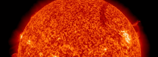
Climate change, algal blooms and 'dead zones' in the Great Lakes

Climate change, algal blooms and ‘dead zones’ in the Great Lakes Enlarge The green scum shown in this image is the worst algae bloom Lake Erie has experienced in decades. Such blooms were common in the lake’s shallow western basin in the 1950s and 60s. Phosphorus from farms, sewage, and industry fertilized the waters so that huge algae blooms developed year after year. The blooms subsided a bit starting in the 1970s, when regulations and improvements in agriculture and sewage treatment limited the amount of phosphorus that reached the lake. But in 2011, a giant bloom spread across the western basin once again. Credit: Jesse Allen and Robert Simmon, using data provided courtesy of the United States Geological Survey (Phys.org)—Climate change is expected to increase the frequency of intense spring rain storms in the Great Lakes region throughout this century and will likely add to the number of harmful algal blooms and “dead zones” in Lake Erie, unless additional conservation actions are taken, according to a University of Michigan aquatic ecologist.
Climate models suggest that the number of intense spring rain storms in the region could double by the end of the century, contributing to an overall 30 to 40 percent increase in spring precipitation, said Donald Scavia, director of the U-M’s Graham Sustainability Institute. That increase, combined with the greater availability of phosphorous due to current agricultural practices in the Midwest, means that increased amounts of the nutrient will be scoured from farmlands and run into rivers that feed Lake Erie, fueling algae blooms and low-oxygen zones known as dead zones. “Climate change is likely to make reducing phosphorous loads even more difficult in the future than it is now, which will likely lead to even more toxic algae blooms and larger dead zones unless more conservation is undertaken,” said Scavia, who will present his latest findings on the topic Wednesday morning during Great Lakes Week events in Cleveland. “Current agricultural practices and climate are conspiring to increase the phosphorous loads that make their way into Lake Erie,” said Scavia, a professor at the U-M School of Natural Resources and Environment. The agricultural practices that contribute to increased availability of phosphorous from fertilizer include no-till farming, a method of planting crops without plowing. The technique reduces soil erosion but also leaves “high concentrations of phosphorous in the upper surface soil, and these intense storms appear to be flushing it out,” Scavia said. The widespread adoption of no-till farming and other agricultural techniques since the mid-1990s have had some positive effects but appear to have also increased the availability of the type of phosphorous, known as soluble reactive phosphorous, that promotes algae blooms, Scavia said. Since the mid-1990s, intense spring rain storms have also become more common in the Great Lakes region, especially in southeast Michigan and northwest Ohio, the regions that provide runoff into Lake Erie, Scavia said. Current agricultural best management practices – such as planting buffer strips around cropland, protecting wetlands and using less fertilizer – applied at the current scales are likely “not going to be sufficient to reduce the phosphorous loads to the levels we need to prevent the blooms and to get rid of the dead zones,” Scavia said. In the late 1960s, 1970s and early 1980s, control strategies focused on reducing phosphorous from specific sources, such as waste-treatment plants. Reductions from those so-called point sources led to major gains in Great Lakes health, including a drop in the frequency and extent of harmful algae blooms and dead zones. Some of those gains have been reversed since the mid-1990s. The increased availability of soluble reactive phosphorous and a surge in extreme rainfall events in the region have contributed to a resurgence of both harmful algal blooms and dead zones in Lake Erie, Scavia said. Algae blooms can foul harbors, clog boat motors, reduce fish populations, and can sometimes be toxic to humans. Dead zones are low-oxygen regions where most aquatic organisms cannot survive. Provided by University of Michigan search and more info website
Glaciers in the eastern and central regions of the Himalayas appear to be retreating at accelerating rates, similar to those in other areas of the world, while glaciers in the western Himalayas are more stable and could be growing, says a new report from the National Research Council.Read more at: http://phys.org/news/2012-09-himalayan-glaciers-retreating-regions.html#jCp
The report examines how changes to glaciers in the Hindu Kush-Himalayan region, which covers eight countries across Asia, could affect the area’s river systems, water supplies, and the South Asian population. The mountains in the region form the headwaters of several major river systems—including the Ganges, Mekong, Yangtze, and Yellow rivers—which serve as sources of drinking water and irrigation supplies for roughly 1.5 billion people. The entire Himalayan climate is changing, but how climate change will impact specific places remains unclear, said the committee that wrote the report. The eastern Himalayas and Tibetan Plateau are warming, and the trend is more pronounced at higher elevations. Models suggest that desert dust and black carbon, a component of soot, could contribute to the rapid atmospheric warming, accelerated snowpack melting, and glacier retreat. While glacier melt contributes water to the region’s rivers and streams, retreating glaciers over the next several decades are unlikely to cause significant change in water availability at lower elevations, which depend primarily on monsoon precipitation and snowmelt, the committee said. Variations in water supplies in those areas are more likely to come from extensive extraction of groundwater resources, population growth, and shifts in water-use patterns. However, if the current rate of retreat continues, high elevation areas could have altered seasonal and temporal water flow in some river basins. The effects of glacier retreat would become evident during the dry season, particularly in the west where glacial melt is more important to the river systems. Nevertheless, shifts in the location, intensity, and variability of both rain and snow will likely have a greater impact on regional water supplies than glacier retreat will.
Melting of glacial ice could play an important role in maintaining water security during times of drought or similar climate extremes, the committee noted. During the 2003 European drought, glacial melt contributions to the Danube River in August were about three times greater than the 100-year average. Water stored as glacial ice could serve as the Himalayan region’s hydrologic “insurance,” adding to streams and rivers when it is most needed. Although retreating glaciers would provide more meltwater in the short term, the loss of glacier “insurance” could become problematic over the long term. Water resources management and provision of clean water and sanitation are already a challenge in the region, and the changes in climate and water availability warrant small-scale adaptations with effective, flexible management that can adjust to the conditions, the committee concluded. Current efforts that focus on natural hazard and disaster reduction in the region could offer useful lessons when considering and addressing the potential for impacts resulting from glacial retreat and changes in snowmelt processes in the region. Many basins in the region are “water-stressed” due to both social changes and environmental factors, and this stress is projected to intensify with large forecasted population growth, the committee concluded. Climate change could exacerbate this stress in the future. Although the history of international river disputes suggests that cooperation is a more likely outcome than violent conflict in this region, social conditions could change. Therefore, modifications in water supplies could play an increasing role in political tensions, especially if existing water management institutions do not evolve to take better account of the region’s social, economic, and ecological complexities, the committee said. More information: Pre-publication copies of Himalayan Glaciers: Climate Change, Water Resources, and Water Security are available from http://www.nap.edu . Provided by National Academy of Sciences search and more info website

************************************************************************************************************

Solar Activity

2MIN News Sept 12. 2012

Published on Sep 12, 2012 by

TODAY’S LINKS
Jupiter Impact: http://www.flickr.com/photos/19299984@N08/7976507568
Pakistan Flooding: http://www.thefrontierpost.com/article/180827/
Leslie on Sat: http://vortex.accuweather.com/adc2004/pub/includes/columns/andrews/2012/400×2…
More Leslie: http://www.torontosun.com/2012/09/11/tropical-storm-leslie-slams-into-newfoun…
Herd Losses: http://www.weather.com/news/isaac-ranch-herd-losses-20120911
Planets Form in Center of Galaxy: http://www.sciencedaily.com/releases/2012/09/120911151936.htm

REPEAT LINKS
Spaceweather: http://spaceweather.com/ [Look on the left at the X-ray Flux and Solar Wind Speed/Density]

HAARP: http://www.haarp.alaska.edu/haarp/data.html [Click online data, and have a little fun]

SDO: http://sdo.gsfc.nasa.gov/data/ [Place to find Solar Images and Videos – as seen from earth]

SOHO: http://sohodata.nascom.nasa.gov/cgi-bin/soho_movie_theater [SOHO; Lasco and EIT – as seen from earth]

Stereo: http://stereo.gsfc.nasa.gov/cgi-bin/images [Stereo; Cor, EUVI, HI – as seen from the side]

SunAEON:http://www.sunaeon.com/#/solarsystem/ [Just click it… trust me]

SOLARIMG: http://solarimg.org/artis/ [All purpose data viewing site]

iSWA: http://iswa.gsfc.nasa.gov/iswa/iSWA.html [Free Application; for advanced sun watchers]

NASA ENLIL SPIRAL: http://iswa.gsfc.nasa.gov:8080/IswaSystemWebApp/iSWACygnetStreamer?timestamp=…
NOAA ENLIL SPIRAL: http://www.swpc.noaa.gov/wsa-enlil/

US Wind Map: http://hint.fm/wind/

NOAA Bouys: http://www.ndbc.noaa.gov/

NOAA Environmental Visualization Laboratory: http://www.nnvl.noaa.gov/Default.php

RSOE: http://hisz.rsoe.hu/alertmap/index2.php [That cool alert map I use]

GOES Xray: http://www.swpc.noaa.gov/sxi/goes15/index.html

JAPAN Radiation Map: http://jciv.iidj.net/map/

LISS: http://earthquake.usgs.gov/monitoring/operations/heliplots_gsn.php

Gamma Ray Bursts: http://grb.sonoma.edu/ [Really? You can’t figure out what this one is for?]

BARTOL Cosmic Rays: http://neutronm.bartol.udel.edu//spaceweather/welcome.html [Top left box, look for BIG blue circles]

TORCON: http://www.weather.com/news/tornado-torcon-index [Tornado Forecast for the day]

GOES Weather: http://rsd.gsfc.nasa.gov/goes/ [Clouds over America]

RAIN RECORDS: http://www.cocorahs.org/ViewData/ListIntensePrecipReports.aspx

EL DORADO WORLD WEATHER MAP: http://www.eldoradocountyweather.com/satellite/ssec/world/world-composite-ir-…

PRESSURE MAP: http://www.woweather.com/cgi-bin/expertcharts?LANG=us&MENU=0000000000&…

HURRICANE TRACKER: http://www.weather.com/weather/hurricanecentral/tracker

INTELLICAST: http://www.intellicast.com/ [Weather site used by many youtubers]

NASA News: http://science.nasa.gov/science-news/science-at-nasa/

PHYSORG: http://phys.org/ [GREAT News Site!]

QUAKES LIST FULL: http://www.emsc-csem.org/Earthquake/seismologist.php

************************************************************************************************************

Space

 Earth approaching objects (objects that are known in the next 30 days)

Object Name Apporach Date Left AU Distance LD Distance Estimated Diameter* Relative Velocity
(2007 PB8) 14th September 2012 1 day(s) 0.1682 65.5 150 m – 340 m 14.51 km/s 52236 km/h
226514 (2003 UX34) 14th September 2012 1 day(s) 0.1882 73.2 260 m – 590 m 25.74 km/s 92664 km/h
(1998 QC1) 14th September 2012 1 day(s) 0.1642 63.9 310 m – 700 m 17.11 km/s 61596 km/h
(2002 EM6) 15th September 2012 2 day(s) 0.1833 71.3 270 m – 590 m 18.56 km/s 66816 km/h
(2002 RP137) 16th September 2012 3 day(s) 0.1624 63.2 67 m – 150 m 7.31 km/s 26316 km/h
(2009 RX4) 16th September 2012 3 day(s) 0.1701 66.2 15 m – 35 m 8.35 km/s 30060 km/h
(2005 UC) 17th September 2012 4 day(s) 0.1992 77.5 280 m – 640 m 7.55 km/s 27180 km/h
(2012 FC71) 18th September 2012 5 day(s) 0.1074 41.8 24 m – 53 m 3.51 km/s 12636 km/h
(1998 FF14) 19th September 2012 6 day(s) 0.0928 36.1 210 m – 480 m 21.40 km/s 77040 km/h
331990 (2005 FD) 19th September 2012 6 day(s) 0.1914 74.5 320 m – 710 m 15.92 km/s 57312 km/h
(2009 SH2) 24th September 2012 11 day(s) 0.1462 56.9 28 m – 62 m 7.52 km/s 27072 km/h
333578 (2006 KM103) 25th September 2012 12 day(s) 0.0626 24.4 250 m – 560 m 8.54 km/s 30744 km/h
(2002 EZ2) 26th September 2012 13 day(s) 0.1922 74.8 270 m – 610 m 6.76 km/s 24336 km/h
(2009 SB170) 29th September 2012 16 day(s) 0.1789 69.6 200 m – 440 m 32.39 km/s 116604 km/h
(2011 OJ45) 29th September 2012 16 day(s) 0.1339 52.1 18 m – 39 m 4.24 km/s 15264 km/h
(2012 JS11) 30th September 2012 17 day(s) 0.0712 27.7 270 m – 600 m 12.60 km/s 45360 km/h
137032 (1998 UO1) 04th October 2012 21 day(s) 0.1545 60.1 1.3 km – 2.9 km 32.90 km/s 118440 km/h
(2012 GV11) 05th October 2012 22 day(s) 0.1830 71.2 100 m – 230 m 6.96 km/s 25056 km/h
(2009 XZ1) 05th October 2012 22 day(s) 0.1382 53.8 120 m – 280 m 16.87 km/s 60732 km/h
(2006 TD) 06th October 2012 23 day(s) 0.1746 68.0 88 m – 200 m 13.03 km/s 46908 km/h
(2009 TK) 06th October 2012 23 day(s) 0.0450 17.5 100 m – 230 m 11.10 km/s 39960 km/h
(2004 UB) 08th October 2012 25 day(s) 0.1995 77.6 240 m – 530 m 14.65 km/s 52740 km/h
277830 (2006 HR29) 11th October 2012 28 day(s) 0.1917 74.6 190 m – 440 m 7.88 km/s 28368 km/h
(2008 BW2) 11th October 2012 28 day(s) 0.1678 65.3 3.1 m – 6.8 m 11.10 km/s 39960 km/h
(2005 GQ21) 12th October 2012 29 day(s) 0.1980 77.0 620 m – 1.4 km 23.86 km/s 85896 km/h
(2012 GV17) 12th October 2012 29 day(s) 0.1500 58.4 160 m – 370 m 16.11 km/s 57996 km/h
1 AU = ~150 million kilometers,1 LD = Lunar Distance = ~384,000 kilometers Source: NASA-NEO

………………………………….

JUPITER SWALLOWS AN ASTEROID

Around the world, amateur astronomers have been scanning the cloudtops of Jupiter for signs of debris from an explosion witnessed by Dan Peterson and George Hall on Sept. 10th. So far the cloud layer is blank. “Several observers have now obtained excellent images on the second and third rotations after the fireball, and there is nothing new nor distinctive at the impact site,” reports John H. Rogers, director of the Jupiter Section of the British Astronomical Association:

The fireball was probably caused by a small asteroid or comet hitting Jupiter. Apparently, the giant planet swallowed the impactor whole.

When fragments of Comet Shoemaker-Levy 9 hit Jupiter in 1994, each major flash observed by NASA’s Galileo spacecraft produced a “bruise,” a murky mixture of incinerated comet dust and chemically altered Jovian gas twisting and swirling among the clouds. In July 2009, amateur astromer Anthony Wesley discovered a similar mark thought to be debris from a rogue asteroid crashing into the planet.

So where is the debris this time? Perhaps the impactor was small, packing just enough punch to make a flash, but without leaving much debris. Indeed, studies suggest that Jupiter is frequently struck by relatively small 10-meter-class asteroids. In such cases, minimal debris is to be expected.

POLAR LIGHTS:

In the Arctic, springtime ended months ago. Nevertheless, butterflies have been sighted. This one appeared last night over Grøtfjord, Norway:

Helge Mortensen took the picture on Sept. 12th. “The auroras were not a strong as some I’ve seen, but it was still nice to be outside and watch such a beautiful apparition,” he says.

This Northern Lepidoptera appeared when a “kink” in the interplanetary magnetic field (IMF) drifted past Earth, briefly opening a crack in our planet’s magnetosphere. Solar wind poured in to fuel the display. At the peak of the storm, the Arctic Circle was glowing from Scandinavia to Iceland to Canada.

Earth’s polar magnetic field is settling down again, but more Arctic auroras are in the offing, especially on Sept 14-15 when a solar wind stream is expected to reach our planet

Dark Energy Mystery Illuminated By Cosmic Lens
The galaxy cluster Abell 1689 is famous for the way it bends light in a phenomenon called gravitational lensing. A new study of the cluster is revealing secrets about how dark energy shapes the universe. Full story.
CREDIT: NASA, ESA, E. Jullo (JPL/LAM), P. Natarajan (Yale) and J-P. Kneib (LAM)

Dark energy, the mysterious substance thought to be accelerating the expansion of the universe, almost certainly exists despite some astronomers’ doubts, a new study says.

After a two-year study, an international team of researchers concludes that the probability of dark energy being real stands at 99.996 percent. But the scientists still don’t know what the stuff is.

“Dark energy is one of the great scientific mysteries of our time, so it isn’t surprising that so many researchers question its existence,” co-author Bob Nichol, of the University of Portsmouth in Engalnd, said in a statement. “But with our new work we’re more confident than ever that this exotic component of the universe is real — even if we still have no idea what it consists of.”

*************************************************************************************************************

Biological Hazards / Wildlife

12.09.2012 Biological Hazard USA State of California, [Along the Klamath River and its reservoirs] Damage level Details

Biological Hazard in USA on Wednesday, 12 September, 2012 at 10:49 (10:49 AM) UTC.

Description
Water quality officials are posting blue-green algae warnings along the Klamath River and its reservoirs, encouraging people to stay out of the water. ”It’s a human health issue,” said Craig Tucker, a Klamath campaign coordinator for the Karuk tribe. “The hotter and drier it is, the worse the algae blooms.” Users are warned to avoid contact with the blue-green algae, which contains the microcystis toxin. Microcystin is a known tumor promoter and liver toxin, according to a press release from the Karuk Tribe Department of Natural Resources. Craig said that the blooms affect reservoirs along the Klamath every year, but do not always contaminate the river downstream. This year, however, posted warning areas include Copco Reservoir, Iron Gate Reservoir and the river itself downstream to Turwar on the Yurok Reservation. The algal blooms usually occur between June and October because shallow, nutrient-rich water trapped behind the Klamath dams heats up. This provides an optimal environment for algae to bloom. ”We think the only way to deal with it is dam removal,” Tucker said. Blooms normally occur while downstream tribes are holding annual World Renewal ceremonies. According to the release, the ceremonies require spiritual leaders to bathe in the river, which puts them at risk of exposure. Tucker said, the Karuk medicine men who do the rituals are at an elevated risk.
Biohazard name: Blue-Green Algae bloom (cyanobacteria)
Biohazard level: 0/4 —
Biohazard desc.: This does not included biological hazard category.
Symptoms:
Status:

**************************************************************************************************************

Articles of Interest

12.09.2012 Technological Disaster Egypt Capital City, Cairo [District of Shubra] Damage level Details

Technological Disaster in Egypt on Wednesday, 12 September, 2012 at 19:37 (07:37 PM) UTC.

Description
At least seven people were killed, eight injured and five remain missing after a five-story building collapsed today in the district of Shubra in the Egyptian capital Cairo. Several such incidents in Egypt have been caused by building violations and bad maintenance.
12.09.2012 Power Outage Canada Province of Newfoundland and Labrador, [Avalon Peninsula] Damage level Details

Power Outage in Canada on Wednesday, 12 September, 2012 at 18:46 (06:46 PM) UTC.

Description
Approximately 9,000 Newfoundland Power customers on the Avalon Peninsula are still without power as of midday Wednesday, one day after tropical storm Leslie hit the island. According to Newfoundland Power spokeswoman Michele Coughlan, 6,000 of those customers are in the St. John’s area, with five main feeders in need of repairs. The remaining 3,000 customers are spread throughout the Avalon Peninsula. Over 60 poles needed replacing as of this morning, according to Coughlan. Trees tangled with power lines and lines downed by fallen trees were continuing to pose problems for the electric utility, she said. Siding detached from various buildings had also caused problems for power lines. Coughlan said the company intends to have all main feeders repaired by Wednesday’s supper hour, adding that isolated outages for some customers may run into Thursday.

…………………………………….

Istanbul and the earthquake risk of a mega-city

by Staff Writers
Munich, Germany (SPX)


Illustration only.

Today the drilling starts for a seismic monitoring network on the Marmara Sea near Istanbul. Specially designed seismic sensors in eight boreholes on the outskirts of Istanbul and around the eastern Marmara Sea will monitor the seismic activity of the region with high precision.

In each of the respective 300 meter deep holes several borehole seismometers will be permanently installed at various depths. These detect even barely perceptible earthquakes with very small magnitudes at a high resolution and can thus provide information about the earthquake rupture processes associated with these.

To determine and monitor the seismic hazard of the region and the processes occurring in the fault zone beneath the Marmara Sea off Istanbul with the latest earthquake monitoring technology, the GONAF plate boundary observatory (Geophysical Observatory at the North Anatolian Fault) was set up under the auspices of the GFZ German Research Centre for Geosciences.

“Istanbul with its more than 13 million inhabitants is located in a region that is extremely vulnerable to earthquakes. A high probability of a strong earthquake of magnitude up to 7.4 is assumed for the region,”explains Professor Georg Dresen from the GFZ, one of the organizers of the project GONAF. “The data of small earthquakes in the region that are measured in the borehole can provide important information about the processes before a major earthquake.”

The data is continuously transmitted in real time to Potsdam and Ankara and evaluated there. A particular difficulty is that the earthquake zone to be monitored lies under the seabed of the Marmara Sea, about 20 kilometers off Istanbul. Only monitoring below ground in bore holes ensures the required precision of the measurementsdue to the much lower noise level.

“This means we have to get as close as possible to the quake source region,” explains GFZ researcher Professor Marco Bohnhoff, director of the project. “With our new, specially developed borehole seismometers the ratio of signal to background noise can be improved by at least a factor of 10, and therefore achieve a much higher resolution.”

The project involves close cooperation with the Disaster and Emergency Management Presidency of Turkey (AFAD). The drilling is implemented as part of the International Continental Scientific Drilling Program ICDP. Engineers and scientists at the GFZ supervise the construction and installation activities.

Upon successful completion and handover of the fully equipped pilot bore hole on the peninsula Tuzla just off Istanbul a first test phase will commence before the remaining seven wells will be drilled. “An earthquake prediction is not the goal of the project,” clarifies Marco Bohnhoff.

“Earthquake prediction is still not possible. But the data gathered in our project of the seismic activity before, during and after the expected strong quake will mean a great advance in the study of earthquakes.”

Related Links
Helmholtz Association of German Research Centres
Bringing Order To A World Of Disasters
When the Earth Quakes
A world of storm and tempest

NASA’s Global Hawk Hurricane Mission Kicks Off

by Staff Writers
Pasadena CA (JPL)


The flight path of the first HS3 Global Hawk unmanned aircraft from NASA’s Dryden Flight Research Center at Edwards Air Force Base, Calif. to NASA’s Wallops Flight Facility in Wallops Island, Va., on Sept. 5-6 included investigations of a tropical disturbance in the Gulf of Mexico and Hurricane Leslie in the Atlantic. Image credit: NASA. For a larger version of this image please go here.

NASA has begun its latest hurricane science field campaign by flying an unmanned Global Hawk aircraft over Hurricane Leslie in the Atlantic Ocean during a day-long flight that began in California and ended in Virginia. With the Hurricane and Severe Storm Sentinel (HS3) mission, NASA for the first time will be flying Global Hawks from the U.S. East Coast.

The Global Hawk took off from NASA’s Dryden Flight Research Center at Edwards Air Force Base, Calif., Thursday and landed at the agency’s Wallops Flight Facility on Wallops Island, Va., Monday at 8:37 a.m. PDT (11:37 a.m. EDT) after spending 10 hours collecting data on Hurricane Leslie. The month-long HS3 mission will help researchers and forecasters uncover information about how hurricanes and tropical storms form and intensify.

NASA will fly two Global Hawks from Wallops during the HS3 mission. The planes, which can stay in the air for as long as 28 hours and fly over hurricanes at altitudes greater than 60,000 feet (18,288 meters), will be operated by pilots in ground control stations at Wallops and Dryden Flight Research Center at Edwards Air Force Base, Calif.

The mission targets the processes that underlie hurricane formation and intensity change. The aircraft help scientists decipher the relative roles of the large-scale environment and internal storm processes that shape these systems.

Studying hurricanes is a challenge for a field campaign like HS3 because of the small sample of storms available for study and the great variety of scenarios under which they form and evolve. HS3 flights will continue into early October of this year and be repeated from Wallops during the 2013 and 2014 hurricane seasons.

The first Global Hawk arrived Sept. 7 at Wallops carrying a payload of three instruments that will sample the environment around hurricanes. A second Global Hawk, scheduled to arrive in two weeks, will look inside hurricanes and developing storms with a different set of instruments. The pair will measure winds, temperature, water vapor, precipitation and aerosols from the surface to the lower stratosphere.

“The primary objective of the environmental Global Hawk is to describe the interaction of tropical disturbances and cyclones with the hot, dry and dusty air that moves westward off the Saharan desert and appears to affect the ability of storms to form and intensify,” said Scott Braun, HS3 mission principal investigator and research meteorologist at NASA’s Goddard Space Flight Center in Greenbelt, Md.

This Global Hawk will carry a laser system called the Cloud Physics Lidar (CPL), the Scanning High-resolution Interferometer Sounder (S-HIS), and the Advanced Vertical Atmospheric Profiling System (AVAPS).

The CPL will measure cloud structure and aerosols such as dust, sea salt and smoke particles. The S-HIS can remotely sense the temperature and water vapor vertical profile along with the sea surface temperature and cloud properties. The AVAPS dropsonde system will eject small sensors tied to parachutes that drift down through the storm, measuring winds, temperature and humidity.

“Instruments on the ‘over-storm’ Global Hawk will examine the role of deep thunderstorm systems in hurricane intensity change, particularly to detect changes in low-level wind fields in the vicinity of these thunderstorms,” said Braun.

These instruments will measure eyewall and rainband winds and precipitation using a Doppler radar and other microwave sensors called the High-altitude Imaging Wind and Rain Airborne Profiler (HIWRAP); the High-Altitude MMIC Sounding Radiometer (HAMSR), developed by NASA’s Jet Propulsion Laboratory, Pasadena, Calif.; and the Hurricane Imaging Radiometer (HIRAD).

HIWRAP measures cloud structure and winds, providing a three-dimensional view of these conditions. HAMSR uses microwave wavelengths to measure temperature, water vapor and precipitation from the top of the storm to the surface. HIRAD measures surface wind speeds and rain rates.

“HAMSR was the first complete scientific instrument to come out of NASA’s Instrument Incubator Program,” said Bjorn Lambrigtsen, HAMSR principal investigator at JPL. “An advanced version of instruments currently flying on satellites such as NASA’s Suomi NPP, HAMSR provides a much more detailed view of the atmospheric conditions in a hurricane than is possible from satellites. HAMSR is one of a number of airborne instruments developed by JPL that are being used to carry out research in a variety of areas.”

The HS3 mission is supported by several NASA centers, including Wallops; Goddard; Dryden; Ames Research Center, Moffett Field, Calif.; Marshall Space Flight Center, Huntsville, Ala.; and JPL. HS3 also has collaborations with partners from government agencies and academia.

Related Links
NASA’s Airborne Science Program
HAMSR
HS3
Bringing Order To A World Of Disasters
When the Earth Quakes
A world of storm and tempest

*************************************************************************************************************

[In accordance with Title 17 U.S.C. Section 107, this material is distributed without profit, for research and/or educational purposes. This constitutes ‘FAIR USE’ of any such copyrighted material.]

Earthquakes

USGS

MAG UTC DATE-TIME
y/m/d h:m:s
LAT
deg
LON
deg
DEPTH
km
 Region
MAP  4.6   2012/09/10 23:17:34   36.656   141.015 18.3  NEAR THE EAST COAST OF HONSHU, JAPAN
MAP  3.7 2012/09/10 23:15:16   19.660   -67.586 58.0  PUERTO RICO REGION
MAP  4.8   2012/09/10 23:14:31   0.522   98.457 52.7  NIAS REGION, INDONESIA
MAP  4.2 2012/09/10 22:03:31   19.509   -67.637 17.0  PUERTO RICO REGION
MAP  4.5   2012/09/10 22:00:01   51.178   157.428 60.5  NEAR THE EAST COAST OF KAMCHATKA, RUSSIA
MAP  2.6 2012/09/10 19:51:24   51.944  -177.653 13.2  ANDREANOF ISLANDS, ALEUTIAN IS., ALASKA
MAP  2.5 2012/09/10 19:33:40   18.162   -67.025 24.0  PUERTO RICO
MAP  4.9   2012/09/10 19:08:46   0.905   92.783 15.4  OFF THE WEST COAST OF NORTHERN SUMATRA
MAP  2.7 2012/09/10 18:55:26   57.166  -157.577 4.9  ALASKA PENINSULA
MAP  2.6 2012/09/10 15:46:03   33.289  -115.706 3.5  SOUTHERN CALIFORNIA
MAP  2.6 2012/09/10 15:45:48   33.282  -115.714 2.8  SOUTHERN CALIFORNIA
MAP  3.3 2012/09/10 15:44:43   33.280  -115.713 3.4  SOUTHERN CALIFORNIA
MAP  5.2   2012/09/10 14:35:43   10.465   93.611 37.7  ANDAMAN ISLANDS, INDIA REGION
MAP  4.6   2012/09/10 14:03:18   39.263   74.211 45.3  SOUTHERN XINJIANG, CHINA
MAP  4.5   2012/09/10 13:16:25   10.488   93.546 62.3  ANDAMAN ISLANDS, INDIA REGION
MAP  4.8   2012/09/10 11:31:16   12.347   -88.630 25.0  OFFSHORE EL SALVADOR
MAP  5.1   2012/09/10 11:23:29   3.993   126.189 42.4  KEPULAUAN TALAUD, INDONESIA
MAP  4.6   2012/09/10 10:43:55   41.733   143.691 30.0  HOKKAIDO, JAPAN REGION
MAP  4.1 2012/09/10 09:08:39   51.896  -171.046 48.7  FOX ISLANDS, ALEUTIAN ISLANDS, ALASKA
MAP  4.7   2012/09/10 07:51:09   -6.561   129.720 143.5  BANDA SEA
MAP  3.2 2012/09/10 06:23:51  -33.487   151.950 0.0  NEAR THE SOUTHEAST COAST OF AUSTRALIA
MAP  4.9   2012/09/10 06:19:20   13.685   92.837 24.0  ANDAMAN ISLANDS, INDIA REGION
MAP  4.7   2012/09/10 05:41:51   24.163   126.191 31.9  RYUKYU ISLANDS, JAPAN
MAP  3.3 2012/09/10 05:09:00   19.684   -64.160 33.0  VIRGIN ISLANDS REGION
MAP  2.8 2012/09/10 05:03:24   17.937   -66.060 13.0  PUERTO RICO REGION
MAP  2.5 2012/09/10 04:54:14   35.375  -118.541 4.5  CENTRAL CALIFORNIA
MAP  3.2 2012/09/10 04:33:39   19.672   -64.386 41.0  VIRGIN ISLANDS REGION
MAP  4.6   2012/09/10 04:32:40   2.952   128.440 178.4  HALMAHERA, INDONESIA
MAP  3.3 2012/09/10 03:28:03   19.654   -64.253 59.0  VIRGIN ISLANDS REGION
MAP  2.6 2012/09/10 02:23:17   32.181  -115.225 7.7  BAJA CALIFORNIA, MEXICO
MAP  4.5   2012/09/10 02:14:05  -20.370   -68.968 122.9  TARAPACA, CHILE
MAP  4.8   2012/09/10 00:38:26  -10.690   114.006 10.0  SOUTH OF BALI, INDONESIA
MAP  4.8   2012/09/10 00:04:45  -20.370  -176.533 250.7  FIJI REGION

MAG UTC DATE-TIME
y/m/d h:m:s
LAT
deg
LON
deg
DEPTH
km
 Region
MAP  2.6 2012/09/09 23:40:17   61.364  -152.700 142.7  SOUTHERN ALASKA
MAP  3.0 2012/09/09 22:35:06   19.009   -64.539 36.0  VIRGIN ISLANDS REGION
MAP  2.5 2012/09/09 22:13:33   40.577  -124.314 21.9  NORTHERN CALIFORNIA
MAP  3.3 2012/09/09 21:57:19   19.674   -64.236 48.0  VIRGIN ISLANDS REGION
MAP  3.4 2012/09/09 21:41:11   56.591  -155.437 27.5  ALASKA PENINSULA
MAP  4.3 2012/09/09 21:37:36   9.795   -84.849 24.9  COSTA RICA
MAP  4.8   2012/09/09 21:29:51  -27.470   -67.282 166.6  CATAMARCA, ARGENTINA
MAP  4.5   2012/09/09 21:06:11   -7.328   128.600 150.8  KEPULAUAN BARAT DAYA, INDONESIA
MAP  4.2 2012/09/09 19:30:22   40.004   24.802 13.6  AEGEAN SEA
MAP  5.3   2012/09/09 19:23:51   52.819   174.936 120.6  NEAR ISLANDS, ALEUTIAN ISLANDS, ALASKA
MAP  4.7   2012/09/09 18:59:39   16.095   -98.097 15.2  OFFSHORE OAXACA, MEXICO
MAP  3.3 2012/09/09 18:56:23   19.454   -64.305 66.0  VIRGIN ISLANDS REGION
MAP  2.8 2012/09/09 18:36:22   59.917  -153.782 136.1  SOUTHERN ALASKA
MAP  4.7   2012/09/09 16:49:21   -3.167   135.036 49.5  PAPUA, INDONESIA
MAP  2.8 2012/09/09 16:31:19   19.105   -66.785 31.0  PUERTO RICO REGION
MAP  4.3 2012/09/09 15:56:57  -21.004   -68.763 119.7  TARAPACA, CHILE
MAP  4.1 2012/09/09 15:21:23   36.197   70.611 109.9  HINDU KUSH REGION, AFGHANISTAN
MAP  5.0   2012/09/09 14:36:37  -30.378  -177.959 56.9  KERMADEC ISLANDS, NEW ZEALAND
MAP  2.5 2012/09/09 13:27:30   36.628  -119.214 25.1  CENTRAL CALIFORNIA
MAP  4.5   2012/09/09 11:27:28   -3.652   144.354 37.1  NEAR NORTH COAST OF NEW GUINEA, P.N.G.
MAP  4.5   2012/09/09 11:08:44   12.560   -88.868 35.0  OFFSHORE EL SALVADOR
MAP  4.3 2012/09/09 10:02:08   23.371   36.375 10.0  RED SEA
MAP  4.2 2012/09/09 09:50:03   12.652   -88.512 35.3  OFFSHORE EL SALVADOR
MAP  4.8   2012/09/09 09:39:15  -10.839   113.817 6.3  SOUTH OF JAVA, INDONESIA
MAP  5.1   2012/09/09 09:36:40   45.281   151.328 30.8  KURIL ISLANDS
MAP  3.1 2012/09/09 09:10:43   19.175   -64.251 26.0  VIRGIN ISLANDS REGION
MAP  4.3 2012/09/09 07:26:07   36.862   24.422 120.3  SOUTHERN GREECE
MAP  6.0   2012/09/09 05:39:21   49.429   155.537 58.7  KURIL ISLANDS
MAP  2.5 2012/09/09 05:33:23   60.625  -147.676 13.9  SOUTHERN ALASKA
MAP  4.7   2012/09/09 05:14:53   16.230   -98.198 11.9  OAXACA, MEXICO
MAP  4.4 2012/09/09 03:30:27  -10.749   114.053 22.2  SOUTH OF BALI, INDONESIA
MAP  3.0 2012/09/09 02:09:00   18.629   -66.737 27.0  PUERTO RICO REGION
MAP  3.4 2012/09/09 01:58:53   35.379   -96.543 4.9  OKLAHOMA
MAP  4.9   2012/09/09 00:13:50  -28.087  -176.526 9.9  KERMADEC ISLANDS REGION

Scores Dead After Quakes Hit Southwest China

By Jack Phillips
Epoch Times Staff Created

A boulder lies on a road in Yiliang, in southwestern China's Yunnan Province, following two shallow quakes that struck the area. (STR/AFP/Getty Images)

A boulder lies on a road in Yiliang, in southwestern China’s Yunnan Province, following two shallow quakes that struck the area. (STR/AFP/Getty Images)

A series of earthquakes on Friday in southwestern China struck a heavily populated area that lacks sound infrastructure, killing at least 64 people and leaving hundreds more injured, with the death toll likely to increase, state-run media reported.

The U.S. Geological Survey confirmed that two 5.6-magnitude earthquakes hit within an hour of one another in the southwestern province of Yunnan, with both epicenters lying near the mountainous city of Zhaoyang. The agency said there were dozens of aftershocks.

Although only moderately powerful, the two quakes struck at a relatively shallow depth, which increases the likelihood of damage.

The quake was felt and did the most damage in Yunnan and Guizhou provinces, state media said. Video footage from state-run CCTV showed piles of rubble, including bricks and pieces of concrete, strewn about streets.

Nearly all of the deaths were reported in Yunnan’s Yiliang County, a heavily populated area with what is said to have poor infrastructure and building construction. The region, considered one of the poorest in China, is mainly occupied by the Yi ethnic group.

“Many of the buildings there are built from bricks and beams, and they don’t have much load-bearing capacity,” Yunnan seismological chief Huang Fugang said, according to Radio Free Asia. “These structures basically aren’t earthquake-proof.”

State media reported that roads, telecommunications lines, medical facilities, schools, power plants, and other infrastructure were damaged in the quakes.

Four years ago, a quake that struck rural Sichuan Province, located north of Yunnan, left nearly 90,000 people dead. Many people blamed the devastation on badly built schools, bridges, and other buildings.

More than 100,000 people were evacuated in affected areas throughout Yunnan, state mouthpiece Xinhua said, adding that more than 6,000 houses were destroyed and 430,000 homes were said to be damaged. Around 200,000 people will likely have to be moved in Yiliang and the lives of 700,000 people were affected, the news agency reported.

Two buses make their way across a road full of fallen rocks after a series of earthquakes hit the area near Zhaotong municipality at the border of southwest China's Yunnan and Guizhou province on September 7, 2012. (STR/AFP/GettyImages)

Two buses make their way across a road full of fallen rocks after a series of earthquakes hit the area near Zhaotong municipality at the border of southwest China’s Yunnan and Guizhou province on September 7, 2012. (STR/AFP/GettyImages)

Mr. Zhu of Maoping village in Yilang County told The Epoch Times that around “a third of the houses have collapses and 90 percent are damaged so badly that people can’t live there.”

The death toll is likely to increase in the coming days due to landslides and mudslides triggered by the quakes.

“The hardest part of the rescue now is [the] traffic [situation],” Li Fuchun, the head of the Luozehe township, located near the epicenter of the quake, told Xinhua. “Roads are blocked and rescuers have to climb the mountains to reach hard-hit villages.”

A settlement located near a zinc mine in Luozehe was also seriously damaged with around two dozen families forced to evacuate due to falling boulders. “It is scary. My brother was killed by falling rocks. The aftershocks struck again and again. We are so afraid,” miner Peng Zhuwen was quoted as saying.

News of the quake reverberated throughout Chinese social media websites, including the Sina Weibo Twitter-like site, where numerous people posted their condolences, prayers, and pictures of candles for the victims in the disaster.

chinareports@epochtimes.com

южные курилы курильские острова остров Кунашир

Photo: RIA Novosti   i

On Sunday, two earthquakes hit Kuril Islands in the Russian Far East. The first quake of 5.6 point magnitude on the Richter scale was recorded near the island of Paramushir, says seismological station in the city of Severo-Kurilsk. Glass-ware ringed in cupboards for ten seconds, and ceiling lamps rocked.

The second earthquake with a magnitude of 5.3 points in Richter scale took place in the deep-water Kurilo-Kamchatka trench. The epicenter was located 270 kilometers east of the city of Kurilsk on the island of Iturup.

There was no tsunami warning.

TASS

Four more tremors at Song Tranh hydro-power plant

 VietNamNet Bridge – In the morning of September 6, thousands of residents of Bac Tra My district, Quang Nam province, panicked because of four consecutive quakes up to 3.4 on the Richter scale. In the last four days, this region suffered from 12 quakes.

Quang Nam: Six earthquakes near hydro-power plant
Earthquakes in Quang Nam have no relation to volcanoes
Quang Nam: in powerful earthquakes, hydro-power plant will create a disaster


Song Tranh 2 dam.

While attending a ceremony to see recruits off, many officials of Bac Tra My district heard big explosions in the earth and fell tremors.

“After the explosion, the ground shook and my car was also shaken,” said Ms. Dung, a district official.

Mr. Tran Van Anh in Phuoc Hiep commune, Phuoc Son district, where is very close to Song Tranh 2 hydro-power plant, said: “At 7.20am, when I was drinking tea with my neighbors, an underground blast exploded. After that the ground shook strongly. We had to run out of the house immediately.”

In Hiep Duc and Nam Tra My districts, hundreds of people fled from their houses because of underground blasts and tremors in the early morning.

The Geo-physic Institute verified that four quakes occurred near the Song Tranh 2 plant in the morning of September 6. The strongest tremor is 3.4 Richter and its epicenter was in Phuoc Hiep commune, which is very close to Song Tranh 2.

According to the institute’s statistics, up to 58 tremors were recorded around Song Tranh 2 plant over the last year. From September 3-6, up to 12 quakes occurred. The strongest tremor was 4.2 Richter. Tremors may come from the Tra Bong or Hung Nhuong-Ta Vi faults, around 3km from Song Tranh 2 dam.

According to a research work by the Geophysics Institute, Song Tranh 2 hydro-power plant is built on the weak layer of the earth’s crust. If strong earthquakes occur, they will cause danger for both the plant and people in the downstream area.

According to the Institute of Science and Technology of Vietnam’s initial conclusion, underground explosions in the region were caused by reservoir induced earthquakes of 3-4 Richter scale from the fault on the left bank of Tranh River.

The capacity of Song Tranh hydro-power plant’s reservoir is over 730 million of cubic meters, which is located over 100m higher than the downstream area. Experts worry that if the dam is broken, it will cause disaster to the downstream region. It is predicted that the reservoir can cause maximal earthquake of up to 5.5 Richter scale.

Prof. Cao Dinh Trieu from the Geophysics Institute says it needs to set up five fixed quake observing stations around the Song Tranh hydro-power plant.

Compiled by Le Ha

LISS – Live Internet Seismic Server

GSN Stations

These data update automatically every 30 minutes. Last update: September 11, 2012 03:18:49 UTC

Seismograms may take several moments to load. Click on a plot to see larger image.

CU/ANWB, Willy Bob, Antigua and Barbuda

 ANWB 24hr plot

CU/BBGH, Gun Hill, Barbados

 BBGH 24hr plot

CU/BCIP, Isla Barro Colorado, Panama

 BCIP 24hr plot

CU/GRGR, Grenville, Grenada

 GRGR 24hr plot

CU/GRTK, Grand Turk, Turks and Caicos Islands

 GRTK 24hr plot

CU/GTBY, Guantanamo Bay, Cuba

 GTBY 24hr plot

CU/MTDJ, Mount Denham, Jamaica

 MTDJ 24hr plot

CU/SDDR, Presa de Sabaneta, Dominican Republic

 SDDR 24hr plot

CU/TGUH, Tegucigalpa, Honduras

 TGUH 24hr plot

IC/BJT, Baijiatuan, Beijing, China

 BJT 24hr plot

IC/ENH, Enshi, China

 ENH 24hr plot

IC/HIA, Hailar, Neimenggu Province, China

 HIA 24hr plot

IC/LSA, Lhasa, China

 LSA 24hr plot

IC/MDJ, Mudanjiang, China

 MDJ 24hr plot

IC/QIZ, Qiongzhong, Guangduong Province, China

 QIZ 24hr plot

IU/ADK, Aleutian Islands, Alaska, USA

 ADK 24hr plot

IU/AFI, Afiamalu, Samoa

 AFI 24hr plot

IU/ANMO, Albuquerque, New Mexico, USA

 ANMO 24hr plot

IU/ANTO, Ankara, Turkey

 ANTO 24hr plot

IU/BBSR, Bermuda

 BBSR 24hr plot

IU/BILL, Bilibino, Russia

 BILL 24hr plot

IU/CASY, Casey, Antarctica

 CASY 24hr plot

IU/CCM, Cathedral Cave, Missouri, USA

 CCM 24hr plot

IU/CHTO, Chiang Mai, Thailand

 CHTO 24hr plot

IU/COLA, College Outpost, Alaska, USA

 COLA 24hr plot

IU/COR, Corvallis, Oregon, USA

 COR 24hr plot

IU/CTAO, Charters Towers, Australia

 CTAO 24hr plot

IU/DAV,Davao, Philippines

 DAV 24hr plot

IU/DWPF,Disney Wilderness Preserve, Florida, USA

 DWPF 24hr plot

IU/FUNA,Funafuti, Tuvalu

 FUNA 24hr plot

IU/FURI, Mt. Furi, Ethiopia

 FURI 24hr plot

IU/GNI, Garni, Armenia

 GNI 24hr plot

IU/GRFO, Grafenberg, Germany

 GRFO 24hr plot

IU/GUMO, Guam, Mariana Islands

 GUMO 24hr plot

IU/HKT, Hockley, Texas, USA

 HKT 24hr plot

IU/HNR, Honiara, Solomon Islands

 HNR 24hr plot

IU/HRV, Adam Dziewonski Observatory (Oak Ridge), Massachusetts, USA

 HRV 24hr plot

IU/INCN, Inchon, Republic of Korea

 INCN 24hr plot

IU/JOHN, Johnston Island, Pacific Ocean

 JOHN 24hr plot

IU/KBS, Ny-Alesund, Spitzbergen, Norway

 KBS 24hr plot

IU/KEV, Kevo, Finland

 KEV 24hr plot

IU/KIEV, Kiev, Ukraine

 KIEV 24hr plot

IU/KIP, Kipapa, Hawaii, USA

 KIP 24hr plot

IU/KMBO, Kilima Mbogo, Kenya

 KMBO 24hr plot

IU/KNTN, Kanton Island, Kiribati

 KNTN 24hr plot

IU/KONO, Kongsberg, Norway

 KONO 24hr plot

IU/KOWA, Kowa, Mali

 KOWA 24hr plot

IU/LCO, Las Campanas Astronomical Observatory, Chile

 LCO 24hr plot

IU/LSZ, Lusaka, Zambia

 LSZ 24hr plot

IU/LVC, Limon Verde, Chile

 LVC 24hr plot

IU/MA2, Magadan, Russia

 MA2 24hr plot

IU/MAJO, Matsushiro, Japan

 MAJO 24hr plot

IU/MAKZ,Makanchi, Kazakhstan

 MAKZ 24hr plot

IU/MBWA, Marble Bar, Western Australia

 MBWA 24hr plot

IU/MIDW, Midway Island, Pacific Ocean, USA

 MIDW 24hr plot

IU/MSKU, Masuku, Gabon

 MSKU 24hr plot

IU/NWAO, Narrogin, Australia

 NWAO 24hr plot

IU/OTAV, Otavalo, Equador

 OTAV 24hr plot

IU/PAB, San Pablo, Spain

 PAB 24hr plot

IU/PAYG Puerto Ayora, Galapagos Islands

 PAYG 24hr plot

IU/PET, Petropavlovsk, Russia

 PET 24hr plot

IU/PMG, Port Moresby, Papua New Guinea

 PMG 24hr plot

IU/PMSA, Palmer Station, Antarctica

 PMSA 24hr plot

IU/POHA, Pohakaloa, Hawaii

 POHA 24hr plot

IU/PTCN, Pitcairn Island, South Pacific

 PTCN 24hr plot

IU/PTGA, Pitinga, Brazil

 PTGA 24hr plot

IU/QSPA, South Pole, Antarctica

 QSPA 24hr plot

IU/RAO, Raoul, Kermandec Islands

 RAO 24hr plot

IU/RAR, Rarotonga, Cook Islands

 RAR 24hr plot

IU/RCBR, Riachuelo, Brazil

 RCBR 24hr plot

IU/RSSD, Black Hills, South Dakota, USA

 RSSD 24hr plot

IU/SAML, Samuel, Brazil

 SAML 24hr plot

IU/SBA, Scott Base, Antarctica

 SBA 24hr plot

IU/SDV, Santo Domingo, Venezuela

 SDV 24hr plot

IU/SFJD, Sondre Stromfjord, Greenland

 SFJD 24hr plot

IU/SJG, San Juan, Puerto Rico

 SJG 24hr plot

IU/SLBS, Sierra la Laguna Baja California Sur, Mexico

 SLBS 24hr plot

IU/SNZO, South Karori, New Zealand

 SNZO 24hr plot

IU/SSPA, Standing Stone, Pennsylvania USA

 SSPA 24hr plot

IU/TARA, Tarawa Island, Republic of Kiribati

 TARA 24hr plot

IU/TATO, Taipei, Taiwan

 TATO 24hr plot

IU/TEIG, Tepich, Yucatan, Mexico

 TEIG 24hr plot

IU/TIXI, Tiksi, Russia

 TIXI 24hr plot

IU/TRIS, Tristan da Cunha, Atlantic Ocean

 TRIS 24hr plot

IU/TRQA, Tornquist, Argentina

 TRQA 24hr plot

IU/TSUM, Tsumeb, Namibia

 TSUM 24hr plot

IU/TUC, Tucson, Arizona

 TUC 24hr plot

IU/ULN, Ulaanbaatar, Mongolia

 ULN 24hr plot

IU/WAKE, Wake Island, Pacific Ocean

 WAKE 24hr plot

IU/WCI, Wyandotte Cave, Indiana, USA

 WCI 24hr plot

IU/WVT, Waverly, Tennessee, USA

 WVT 24hr plot

IU/XMAS, Kiritimati Island, Republic of Kiribati

 XMAS 24hr plot

IU/YAK, Yakutsk, Russia

 YAK 24hr plot

IU/YSS, Yuzhno Sakhalinsk, Russia

 YSS 24hr plot

**********************************************************************************************************

Volcanic Activity

Giant ‘balloon of magma’ inflates under Santorini

Santorini

Volcanic craters at Santorini. Image Wikipedia. A new survey suggests that the chamber of molten rock beneath Santorini’s volcano expanded 10-20 million cubic metres – up to 15 times the size of London’s Olympic Stadium – between January 2011 and April 2012. Ads by Google $1249+ Austin Laser Lipo – Get a Free Liposuction Consult. Liposuction Financing is Available. – SonoBelloAustin.com/Liposuction The growth of this ‘balloon’ of magma has seen the surface of the island rise 8-14 centimetres during this period, a team led by Oxford University scientists has found. The results come from an expedition, funded by the UK’s Natural Environment Research Council, which used satellite radar images and Global Positioning System receivers (GPS) that can detect movements of the Earth’s surface of just a few millimetres. The findings are helping scientists to understand more about the inner workings of the volcano which had its last major explosive eruption 3,600 years ago, burying the islands of Santorini under metres of pumice. However, it still does not provide an answer to the biggest question of all: ‘when will the volcano next erupt?’ A report of the research appears in this week’s Nature Geoscience. In January 2011, a series of small earthquakes began beneath the islands of Santorini. Most were so small they could only be detected with sensitive seismometers but it was the first sign of activity beneath the volcano to be detected for 25 years. Following the earthquakes Michelle Parks, an Oxford University DPhil student, spotted signs of movement of the Earth’s surface on Santorini in satellite radar images. Oxford University undergraduate students then helped researchers complete a new survey of the island. Michelle Parks of Oxford University’s Department of Earth Sciences, an author of the paper, said: ‘During my field visits to Santorini in 2011, it became apparent that many of the locals were aware of a change in the behaviour of their volcano. The tour guides, who visit the volcano several times a day, would update me on changes in the amount of strong smelling gas being released from the summit, or changes in the colour of the water in some of the bays around the islands. On one particular day in April 2011, two guides told me they had felt an earthquake while they were on the volcano and that the motion of the ground had actually made them jump. Locals working in restaurants on the main island of Thera became aware of the increase in earthquake activity due to the vibration and clinking of glasses in their bars.’ Ads by Google Ground Penetrating Radar – Nationwide Ground Penetrating Radar Service – http://www.nationalgpr.com Dr Juliet Biggs of Bristol University, also an author of the paper, said: ‘People were obviously aware that something was happening to the volcano, but it wasn’t until we saw the changes in the GPS, and the uplift on the radar images that we really knew that molten rock was being injected at such a shallow level beneath the volcano. Many volcanologists study the rocks produced by old eruptions to understand what happened in the past, so it’s exciting to use cutting-edge satellite technology to link that to what’s going on in the volcanic plumbing system right now.’ Professor David Pyle of Oxford University’s Department of Earth Sciences, an author of the paper, said: ‘For me, the challenge of this project is to understand how the information on how the volcano is behaving right now can be squared with what we thought we knew about the volcano, based on the studies of both recent and ancient eruptions. There are very few volcanoes where we have such detailed information about their past history.’ The team calculate that the amount of molten rock that has arrived beneath Santorini in the past year is the equivalent of about 10-20 years growth of the volcano. But this does not mean that an eruption is about to happen: in fact the rate of earthquake activity has dropped off in the past few months. More information: A report of this research, entitled ‘Evolution of Santorini Volcano dominated by episodic and rapid fluxes of melt from depth’, is published in the journal Nature Geosience on Sunday 09 September. DOI: 10.1038/ngeo1562 Journal reference: Nature Geoscience search and more info website Provided by Oxford University search and more info website

Dinosaur die-out may have been the second of two massive extinctions: Researchers believe huge underwater volcanoes ‘killed off all the sea-life first’

By Eddie Wrenn
Popular opinion holds that an asteroid struck the Earth 65million years ago, hustling out the Age of Dinosaurs and allowing the mammals – us – to rise.

But new research now paints another picture – with the University of Washington indicating that a separate extinction came shortly first, triggered by volcanic eruptions that warmed the planet and killed life on the ocean floor.

They suggest that by the time of the asteroid impact, life on the seafloor – mostly species of clams and snails – was already perishing, because of the effects of huge volcanic eruptions on the Deccan Plateau, in what is now India.

Round 1: An underwater volcano erupts near Tonga in 2009 - perhaps a reminder of an extinction more than 65million years agoRound 1: An underwater volcano erupts near Tonga in 2009 – perhaps a reminder of an extinction more than 65million years ago

Round 2: An artist’s impression of how the six-mile wide asteroid might have looked as it ploughed into our world, decimating life on the surface

The well-known dinosaur extinction event is believed to have been triggered by an asteroid at least six miles in diameter slamming into Mexico’s Yucatán Peninsula.

Thomas Tobin, a UW doctoral student in Earth and space sciences, said: ‘The eruptions started 300,000 to 200,000 years before the impact, and they may have lasted 100,000 years.’

During the earlier extinction it was primarily life on the ocean floor that died, in contrast to the later extinction triggered by the asteroid impact, which appeared to kill many more free-swimming species.

The eruptions would have filled the atmosphere with fine particles, or aerosols, that initially cooled the planet.

But, more importantly, the eruptions also would have spewed carbon dioxide and other greenhouse gases to produce long-term warming that led to the first of the two mass extinctions.

Thomas Tobin clears sand from around the fossil of a giant ammonite he found in 2009 on James Ross Island in AntarcticaThomas Tobin clears sand from around the fossil of a giant ammonite he found in 2009 on James Ross Island in Antarctica

Thomas Tobin clears sand from around the fossil of a giant ammonite he found in 2009 on James Ross Island in Antarctica

Tobin said: ‘The aerosols are active on a year to 10-year time scale, while the carbon dioxide has effects on a scale of hundreds to tens of thousands of years.

‘The species in the first event are extinct but the groups are all recognisable things you could find around on a beach today,’ he said.

Tobin is the lead author of a paper in the journal Palaeogeography, Palaeoclimatology, Palaeoecology that documents results of research conducted in a fossil-rich area on Seymour Island, off the Antarctic Peninsula.

That particular area has very thick sediment deposits and, for a given interval of time, might contain 10 times more sediment as the well-known Hell Creek Formation in Montana. That means scientists have much greater detail as they try to determine what was happening at the time, Tobin said.

The researchers took small surface core samples from rocks and fossils in the Antarctic sediment and used a method called magnetostratigraphy, employing known changes over time in Earth’s magnetic field to determine when the fossils were deposited. The thicker sediment allowed dating to be done more precisely.

‘I think the evidence we have from this location is indicative of two separate events, and also indicates that warming took place,’ Tobin said.

There is no direct evidence yet that the first extinction event had any effect on the second, but Tobin believes it is possible that surviving species from the first event were compromised enough that they were unable to survive the long-term environmental effects of the asteroid impact.

‘It seems improbable to me that they are completely independent events,’ he added.

11.09.2012 Volcano Eruption Nicaragua Chinandega Department, [ San Cristobal volcano] Damage level Details

Volcano Eruption in Nicaragua on Saturday, 08 September, 2012 at 18:12 (06:12 PM) UTC.

Back

Updated: Sunday, 09 September, 2012 at 03:31 UTC
Description
The San Cristobal volcano in Nicaragua rumbled to life Saturday with three explosions, forcing the evacuation of 3,000 residents, authorities said. Television footage showed a column of smoke and ash rising from the cone of the volcano, Nicaragua’s tallest at 1,745 meters (5,725 feet), in the northeast. The civil defense agency said it readied 50 trucks and 350 troops to support the population in case of greater emergency, while the Nicaraguan Institute of Territorial Studies, or INETER, added they expect “more gas emissions and sporadic explosions.” There are some hamlets perched on the slopes of the volcano, and winds could push the fumes from the eruption there, said the director of the national disaster prevention and mitigation agency, William Gonzalez. He said authorities ordered some 3,000 people living in villages in that zone to evacuate. Ashes fell on the towns of El Viejo, El Chonco, Villa 15 de Julio and Rancheria, according to a statement by INETER, which monitors volcanic activity. San Cristobal, located 135 kilometers (83 miles) northwest of Managua, is one of the country’s most active volcanoes. Since Thursday, when an earthquake of 7.6-magnitude rocked neighboring Costa Rica and was also felt in Nicaragua, INETER began surveillance at several active volcanoes, fearing the powerful quake would have an “impact on the activation” on the volcanoes. Rosario Murillo, the first lady and government spokeswoman, said some US experts have noted that the ash plume reaches 5,000 meters, which could be an indicator of potential for greater activity.

Volcano Eruption in Nicaragua on Saturday, 08 September, 2012 at 18:12 (06:12 PM) UTC.

Back

Updated: Monday, 10 September, 2012 at 03:11 UTC
Description
Nicaragua has begun evacuating around 3,000 people after the country’s largest volcano, San Cristobal, which is located along its Pacific coast, started to erupt with vehemence. Authorities have so far pointed to no immediate reports of injuries or damage, but the government has issued a yellow alert in a sign that emergency plans had been activated following the eruption on Saturday of the volcano, located about 154 kilometers (95 miles) north of the capital Managua, Reuters reported. The volcano has let out an ash plume of up to five kilometers (three miles), which has formed a cloud extending 48 kilometers (30 miles). Firefighter Sergeant Fernando Quintero said, “At this stage, we try to evacuate the people, who are in the neighboring areas, but most resist being evacuated.” The Nicaraguan Institute of Territorial Studies noted in a preliminary report that “more gas emissions and sporadic explosions” could be expected from San Cristobal, and said in its monthly bulletin that the volcano has emitted “abundant gases in a constant manner.”

***********************************************************************************************************

Extreme Temperatures/ Weather / Drought

Kazakhstan falls prey to drought

Published on Sep 9, 2012 by

Kazakhstan’s wheat farmers have suffered from drought affecting grain production with a drop to more than half. An exceptionally dry summer has yielded a miserable harvest amounting to the loss of 600,000 hectares, according to figures. Al Jazeera’s Robin Forestier-Walker reports from the Kostanay region on Kazakhstan’s northern border with Russia.

Today Forest / Wild Fire Canada Province of Alberta, [Blood Reserve] Damage level Details

Forest / Wild Fire in Canada on Tuesday, 11 September, 2012 at 03:41 (03:41 AM) UTC.

Description
More than 3,500 people have been evacuated, at least one building has been destroyed and local states of emergency have been declared in several southern Alberta communities Monday as two huge grass fires are being fueled by powerful winds. The first fire, which officials believe started on the Blood Reserve, near Lethbridge, about 220 kilometres southeast of Calgary, jumped the Oldman River. A second wildfire has now forced the evacuation of Milk River, which is southeast of Lethbridge. A sudden drastic change in winds has pushed about 800 residents to seek refuges in Raymond, to the north, after first being told by officials to flee south, to Coutts, at the U.S. border. That first blaze sparked the evacuation of the nearby town of Coalhurst, where about 500 homes are in the path of the swift-moving fire. Residents had been told to seek refuge to the north along Highway 25 at the Picture Butte Community Centre, but the roadway quickly became clogged with traffic making the escape route slow-going and then, it was closed when “people gawking” at the smoke caused a head-on collision, according to Lethbridge County Reeve Lorne Hickey.

Between 300 and 400 residents of Mountain Meadows and Sunsets Acres as well as Township 8-22 in his county have also been told to get out. Lethbridge Deputy Fire Chief Wayne Johnson said the city and county is throwing every emergency worker at the fire and has called in off-duty firefighters to help. Fire breaks are being dug to try to contain the blaze. While the city of Lethbridge is under a state of emergency, residents in the neighbourhoods of Indian Battle Heights, Heritage Heights and West Highlands are being told to prepare for possible evacuation. A mandatory evacuation ordered was order for the Westside Trailer Court. Affected residents are being told to go to the Fritz Sick Centre or the ENMAX Centre. City officials also told residents to stay off their cell phones to “keep lines clear for emergency services.” In some cases, residents had only minutes to get out. Others are now preparing to leave.

10.09.2012 Forest / Wild Fire USA State of Wyoming, [Casper Mountain] Damage level Details

Forest / Wild Fire in USA on Monday, 10 September, 2012 at 18:29 (06:29 PM) UTC.

Description
A rapidly spreading wildfire has burned at least six structures and forced some 400 people to be evacuated from Casper Mountain. Wyoming State Forester Bill Crapser says still more buildings may have been lost to the Sheep Herder Hill Fire about 10 miles southeast of the Casper city limits. The fire began Sunday afternoon and winds quickly fanned the blaze to more than seven square miles. About 150 homes and cabins remain evacuated Monday. Crapser estimates about three-quarters are year-round homes and the rest are seasonal cabins. Nine families that fled are staying at the Parkway Plaza Hotel in Casper. The Red Cross says it may open a shelter for evacuees. Dry, windy weather has prompted the National Weather Service to put all of Wyoming under a wildfire alert.
10.09.2012 Forest / Wild Fire Russia [Asia] Tomsk Oblast, [Districts of Verkhneketsky, Parabelsky, Barguzinsky ] Damage level Details

Forest / Wild Fire in Russia [Asia] on Monday, 10 September, 2012 at 10:29 (10:29 AM) UTC.

Description
Five forest fires had been raging in Siberia as of Monday morning, the Siberian Federal District Forestry Department said. The fires are 62 hectares in size; the largest of them (44 hectares) in the Verkhneketsky district of the Tomsk region has been confined. There are also fires in the Barguzinsky district of Buryatia, the Parabelsky district of the Tomsk region and the Krasnoyarsk territory. Fires were burning on nine hectares in Siberia on Friday. The fire zone grew 6.9 times by Monday morning. Forest guards had put out 12 forest fires on 22 hectares by Monday. One hundred and twenty-seven people, 39 fire trucks and two aircraft extinguished the fires. “There is no threat to residential areas or economic sites,” the department said.
11.09.2012 Forest / Wild Fire Canada Province of British Columbia, [Peachland region (Trepanier Forest Fire)] Damage level Details

Forest / Wild Fire in Canada on Monday, 10 September, 2012 at 06:47 (06:47 AM) UTC.

Description
More than 900 residents of Peachland, B.C., were forced to flee their homes and hundreds of others were on alert when a forest fire spread through the Okanagan town Sunday. A state of emergency was declared and an evacuation order and alert were put in place by Sunday evening after the Trepanier Forest Fire broke out about 3 p.m. Kari O’Rourke, public information officer with the Emergency Operations Centre, said 593 homes, equating to 950 people in Peachland and the Trepanier Bench area were put on evacuation order, and 375 houses, or 600 residents, south of the Trepanier area were put on alert, including the Ponderosa Golf Club. Under the evacuation alert, residents were told to prepare to leave their homes with little notice should the fire threat increase. Hwy. 97 was closed at Princeton Rd. in Peachland and at Glenrosa Rd. in West Kelowna. Residents affected by the fire were asked to report to the Emergency Support Services Reception Centre set up at the Westbank Lions Community Hall, 2466 Main St. in West Kelowna, B.C. A second reception centre was opened at the Summerland Arena and Curling Club, 8820 Jubilee Road East. Crews from B.C. Wildfire Management, Kelowna and West Kelowna, Peachland were still fighting the flames as of Sunday night but were unsure of what caused the massive blaze. O’Rourke said it was not known how large the fire was as of press time.
10.09.2012 Forest / Wild Fire USA State of Nevada, Dayton Damage level Details

Forest / Wild Fire in USA on Monday, 10 September, 2012 at 06:46 (06:46 AM) UTC.

Description
A wildfire had burned at least 800 acres southeast of Dayton on Sunday as crews worked to keep the flames from threatening homes or structures. Containment is expected Tuesday, Sierra Front reports. The fire was in the Brunswick Canyon area east of Carson City on the boundary with Lyon County Crews were attacking the fire from the air and on the ground, dispatcher Charlie Peters of the Sierra Front fire responders said. Firefighters were called just after noon Sunday to Mount Como, after sagebrush, pinion and juniper were ablaze, Peters said. Officials were concerned that gusty winds could cause the flames to spread. Communication towers and power lines are in the area. NV Energy also was on the scene. The fire on federal land was being attacked by the U.S. Forest Service and Nevada Division of Forestry. Two helicopters, five air tankers, two water tenders, four hand crews and five fire engines are assigned to the fire.

***********************************************************************************************************

Storms / Flooding / Landslides

  Active tropical storm system(s)
Name of storm system Location Formed Last update Last category Course Wind Speed Gust Wave Source Details
Leslie (AL12) Atlantic Ocean 30.08.2012 10.09.2012 Tropical Depression 30 ° 93 km/h 111 km/h 4.57 m NOAA NHC Details

 Tropical Storm data

Share:
Storm name: Leslie (AL12)
Area: Atlantic Ocean
Start up location: N 14° 6.000, W 43° 24.000
Start up: 30th August 2012
Status: Active
Track long: 2,140.00 km
Top category.:
Report by: NOAA NHC
Useful links:

Past track
Date Time Position Speed
km/h
Wind
km/h
Gust
km/h
Category Course Wave Pressure Source
31st Aug 2012 04:48:01 N 14° 42.000, W 46° 48.000 30 83 102 Tropical Storm 280 12 1002 MB NOAA NHC
01st Sep 2012 05:02:48 N 17° 24.000, W 52° 48.000 33 102 120 Tropical Storm 295 19 999 MB NOAA NHC
02nd Sep 2012 05:34:37 N 20° 12.000, W 58° 24.000 30 102 120 Tropical Storm 305 11 998 MB NOAA NHC
03rd Sep 2012 04:53:21 N 23° 24.000, W 61° 42.000 17 93 111 Tropical Storm 325 19 998 MB NOAA NHC
04th Sep 2012 05:13:40 N 24° 0.000, W 63° 6.000 0 102 120 Tropical Storm 0 12 998 MB NOAA NHC
05th Sep 2012 05:20:37 N 25° 12.000, W 62° 48.000 4 102 120 Tropical Storm 345 9 994 MB NOAA NHC
06th Sep 2012 04:44:33 N 26° 12.000, W 62° 30.000 4 120 148 Hurricane I. 10 9 985 MB NOAA NHC
07th Sep 2012 05:21:34 N 26° 30.000, W 62° 12.000 0 120 148 Hurricane I. 0 19 985 MB NOAA NHC
08th Sep 2012 05:14:29 N 27° 36.000, W 62° 18.000 6 102 120 Tropical Storm 350 9 983 MB NOAA NHC
10th Sep 2012 05:41:20 N 34° 24.000, W 61° 48.000 26 93 111 Tropical Storm 15 14 988 MB NOAA NHC
Current position
Date Time Position Speed
km/h
Wind
km/h
Gust
km/h
Category Course Wave
feet
Pressure Source
11th Sep 2012 07:31:46 N 42° 42.000, W 57° 30.000 65 111 139 Hurricane I 25 ° 19 988 MB NOAA NHC
Forecast track
Date Time Position Category Wind
km/h
Gust
km/h
Source
12th Sep 2012 12:00:00 N 59° 48.000, W 38° 36.000 Hurricane I 111 139 NOAA NHC
12th Sep 2012 00:00:00 N 54° 12.000, W 47° 12.000 Hurricane I 111 139 NOAA NHC
13th Sep 2012 00:00:00 N 62° 30.000, W 29° 0.000 Hurricane I 102 120 NOAA NHC
14th Sep 2012 00:00:00 N 62° 30.000, W 10° 0.000 Tropical Depression 93 111 NOAA NHC
Michael (AL13) Atlantic Ocean 04.09.2012 10.09.2012 Hurricane II 275 ° 130 km/h 157 km/h 4.27 m NOAA NHC Details

 Tropical Storm data

Share:
Storm name: Michael (AL13)
Area: Atlantic Ocean
Start up location: N 25° 54.000, W 42° 48.000
Start up: 04th September 2012
Status: Active
Track long: 718.61 km
Top category.:
Report by: NOAA NHC
Useful links:

Past track
Date Time Position Speed
km/h
Wind
km/h
Gust
km/h
Category Course Wave Pressure Source
04th Sep 2012 05:09:18 N 25° 54.000, W 42° 48.000 7 56 74 Tropical Depression 305 8 1012 MB NOAA NHC
05th Sep 2012 05:21:26 N 27° 24.000, W 43° 42.000 0 83 102 Tropical Storm 0 11 1005 MB NOAA NHC
06th Sep 2012 04:47:08 N 29° 18.000, W 42° 12.000 11 120 148 Hurricane I. 50 16 990 MB NOAA NHC
07th Sep 2012 05:20:37 N 30° 48.000, W 40° 48.000 7 167 204 Hurricane II. 25 9 970 MB NOAA NHC
08th Sep 2012 05:11:40 N 31° 48.000, W 41° 48.000 9 157 194 Hurricane II. 320 10 974 MB NOAA NHC
10th Sep 2012 05:44:13 N 33° 36.000, W 44° 24.000 9 139 167 Hurricane I. 265 10 983 MB NOAA NHC
Current position
Date Time Position Speed
km/h
Wind
km/h
Gust
km/h
Category Course Wave
feet
Pressure Source
11th Sep 2012 07:34:11 N 35° 18.000, W 48° 0.000 20 120 148 Hurricane I 345 ° 19 989 MB NOAA NHC
Forecast track
Date Time Position Category Wind
km/h
Gust
km/h
Source
12th Sep 2012 12:00:00 N 47° 12.000, W 41° 36.000 Tropical Depression 74 93 NOAA NHC
12th Sep 2012 00:00:00 N 42° 0.000, W 46° 0.000 Tropical Depression 83 102 NOAA NHC
13th Sep 2012 00:00:00 N 52° 12.000, W 34° 30.000 Tropical Depression 65 83 NOAA NHC

……………………………..

Beijing Floods- Worst in Six Decades- Displace Thousands- Kill at Least 37

Internet users say authorities’ incompetence to blame, at least in part

By Jack Phillips
Epoch Times Staff Created

Flooding leaves many vehicles submerged in water in a residential community in Beijing on July 21. (The Epoch Times Photo Archive)

Flooding leaves many vehicles submerged in water in a residential community in Beijing on July 21. (The Epoch Times Photo Archive)

Some of the worst flooding to hit Beijing in decades left at least 37 people dead and forced more than 30,000 residents to flee, state-run media reported, citing local authorities on Sunday. The number of deaths officially sits at 37, but numbers in China are often political and are likely to not reflect the full toll.

The floods, which state media said were the worst in six decades, came on Saturday afternoon and lasted into the night, leaving 80,000 people stranded as over 500 flights were canceled.

Around 6.7 inches of rain on average fell on Beijing by 6 a.m., but some areas fared worse than others. In suburban Hebei township, 18.1 inches fell. In six townships, Internet access and mobile communication was cut, while train services between Beijing and Guangzhou were shut down because railway sections were inundated.

A lightning strike killed a person, and the head of the police bureau in Fangshan district was shocked by a downed electric wire.

Four people were killed in Shuozhou city in northern Shanxi Province when floods carried their truck into the middle of a river while attempting to cross it. Six people were left dead in southwestern Sichuan Province in rain-caused landslides. Seven counties said they received more than 3.9 inches of rain.

Photos uploaded to the popular Sina Weibo microblogging website showed numerous instances of flooding in Beijing. One showed several dozen men pulling a rope in a tug-of-war fashion, in an attempt to drag out five cars and trying to help one man who was drowning.

One user on Weibo said that some of the figures released by state media, which said that 10 people were killed, may not be correct. The user said that “certainly far more than 10 people” were killed in the floods.

Other posts on the microblogging site blamed local officials for not doing enough to mitigate the disaster and said the city’s draining systems and roads have a problem.

“Lang,” a Weibo user, said that the roads were poorly designed because they could only hold “50 millimeters (1.9 inches) of rainfall,” while Beijing authorities only blame the disaster on “acts of God” rather than admitting that the roads and the city’s infrastructure have problems.

“Bad engineering, corruption, and incompetence forced people to suffer” during the floods, said user “Not to V.”

Another user sarcastically said, “We hoped [authorities] could have established a drainage system that is as effective as deleting the words they dislike,” referring to China’s censorship policy on the Internet.

One user, “Han Zhiguo” said the floods showed that there were “two totally different sides of Beijing,” saying that kind-hearted people spontaneously rescued thousands of people and even provided shelter locations, but the local government provided no shelter locations including hotels or officials buildings.

Even worse, the user said, “toll stations still paid close attention and collected the charges and traffic cops posted tickets on flooded vehicles,” accusing the city’s management of being “inhumane.”

Today Flash Flood Canada Province of Nova Scotia, [NS-wide] Damage level Details

Flash Flood in Canada on Tuesday, 11 September, 2012 at 03:38 (03:38 AM) UTC.

Description
Nova Scotia was pummelled with rain Monday, with upwards of 75 millimetres falling in the central part of the province washing out roads, stranding residents and causing dozens of families to leave their homes. While the rain was letting up Monday evening in the Truro area, it’s just beginning in Cape Breton, according to Peter Coade, CBC’s meteorologist. Upwards of 125 millimetres is expected in Cape Breton overnight. While water levels were receding in central Nova Scotia later Monday evening, officials are watching high tide closely, which began around 9 p.m. AT. In the Indian Brook First Nation, near Shubenacadie, 135 people are stranded as Monday’s heavy rain washed out the two access roads to their community. Forecasters with the Canadian Hurricane Centre said Monday’s rainstorm was not due to tropical storm Leslie — the current storm is blocking Leslie’s progression. Leslie is expected to head for Newfoundland Tuesday morning. Chris Fogarty said the weather would likely get worse overnight as the two systems converge, with Cape Breton getting the highest winds and heaviest rain. Donna Munro, who lives in North River near Truro, was paddled to safety by a neighbour in a canoe as the area around her home flooded with about 1.5 metres of water. Munro said she and her son stepped onto the doorstep and the doorstep started separating from the front of the house. Her son got to safety and she was rescued a short time later by a neighbour with a canoe. “The force of the water, when the tide came in, is what I think really elevated everything on top of all the rain we had too. It just all added to it like a snowball effect,” she said. “It was the force and the viciousness of it, I think, that just sped it along that much quicker.”

Roads and bridges will be inspected by engineers from the Department of Transportation and Infrastructure Renewal as quickly as possible, he said. Motorists should continue to use caution and watch for closed roads and water on roads, according to the provincial release. The Canadian Red Cross has set up two reception centres for area residents who have been displaced by the storm: at the Bible Hill Village Fire Hall at 69 Pictou Rd. and the Immanuel Baptist Church at 295 Young St. However, the reception centres are not serving as shelters at the moment, according to Mona O’Brien, district community supervisor for the Canadian Red Cross in Truro. The flooding in central Nova Scotia Monday posed some concern in the Salmon River area, according to the Emergency Management Office. Water levels are on the decline in some areas, but the area isn’t in the clear yet. “The water has subsided quite a bit in the North River and the Salmon River,” according to Bob Taylor, mayor of the municipality of Colchester. “Having said that, there’s still a lot of water from the uplands, also we don’t know how much the tide is going to affect us.” People are being asked to stay away from flooding areas because of the high tide.

Today Flash Flood China Province of Sichuan, [Guangyuan and Suining] Damage level Details

Flash Flood in China on Tuesday, 11 September, 2012 at 03:34 (03:34 AM) UTC.

Description
A new round of torrential rains that started Sunday night inundated parts of Southwest China’s Sichuan province, leaving six people dead and four missing, local authorities said Monday. The victims were reported in the cities of Guangyuan and Suining, the Sichuan provincial flood control office said in a statement. Rainstorms continued into Monday night and a township in Shehong county of Suining reported the largest precipitation of 257.3 mm in just six hours Monday, it said. The rains also left parts of the county seats of Daying and Shehong in Suining submerged under waters of up to two meters deep. The rains are forecast to last till 8 am Wednesday, according to the provincial meteorological center.
10.09.2012 Flash Flood Pakistan MultiStates, [States of Punjab and North West Frontier] Damage level Details

Flash Flood in Pakistan on Monday, 10 September, 2012 at 10:07 (10:07 AM) UTC.

Description
At least 78 people died and dozens were injured as torrential rains and flash floods wreaked havoc in Pakistan over the past three days, a government spokesman said Monday. Heavy monsoon rains which began falling last week destroyed more than 1,600 houses while damaging a further 5,000, Irshad Bhatti, a spokesman for the country’s National Disaster Management Authority (NDMA) reported. “A total of 78 people have died and 68 injured in rains and flash floods in the country so far,” he said, adding that the casualties were caused mostly by houses collapsing and people being caught in floods. The worst-hit region was Khyber Pakhtunkhwa province where 32 people have died and 26 were injured in several districts, he said, adding that 83 houses were totally destroyed and another 4,200 were partially damaged, he said. In the northwestern district of Swabi eight Afghan refugees were killed when the roof of their mud house collapsed overnight, police official Mohammad Ali said. The dead, who were members of the same family, included two women and six children aged between one and 12 years he said. In Pakistan-administered Kashmir, flash flood killed at least 31 people, Bhatti said. Rains killed at least 26 people in that region last month. A state of emergency, meanwhile has been declared in the Dera Ghazi Khan and Rajanpur districts of the Punjab province, where army troops have been called to join rescue work, local administration officials aid. Weather officials predict heavy rain in the next two days in southern Sindh and Baluchistan provinces. Rescue teams are closely monitoring the situation, Bhatti said. Floods in Pakistan in the summer of 2011 affected 5.8 million people, with flood waters killing livestock, destroying crops, homes and infrastructure as the nation struggled to recover from record inundations the previous year.
10.09.2012 Flash Flood USA State of Arizona, [Great Phoenix region] Damage level Details

Flash Flood in USA on Monday, 10 September, 2012 at 05:46 (05:46 AM) UTC.

Description
Thunderstorms struck parts of the north and west Valley Sunday evening, and forecasters at the National Weather Service said there was a chance of more rain overnight. Charlotte Dewey, a meteorologist at the Weather Service’s Phoenix office, said two storm systems — one starting near Circle City, northwest of Phoenix, and the other near North Mountain Park — moved on a northwest trajectory. Those storms began diminishing at about 8 p.m., but forecasters called for a 30 percent chance of measurable rain in the metro area overnight. The temperature on Sunday hit a high of 93 degrees at about 3:50 p.m. The chance of thunderstorms on Monday was 50 percent, according to the Weather Service’s website. Those odds grow to 60 percent going into Monday night and on Tuesday. Weather experts predicted Monday’s high to hit 94 degrees, and Tuesday’s predicted high is 92 degrees. Rain chances decrease later in the week and Thursday is expected to be sunny with a high of 95 degrees, according to the Weather Service’s website. The Weather Service reported flash floods in the northwest and southwest ends of the state Sunday. Mike Bruce, a meteorologist, said blowing dust and wind, downed power lines and street flooding was reported in the Yuma area.

The strongest wind gust was reported to be 65 miles an hour at the Yuma International Airport, Bruce said. Jose Guerrero, a Yuma resident living near Interstate 8 and 16th Street, said he did not see much rain but the gusting wind knocked down some neighbors’ patio furniture. Clay Morgan, a meteorologist at the National Weather Service in Las Vegas, said his office got reports of several flooded and impassible roads in Golden Valley, a town just west of Kingman. The water was reported to be as high as 2 feet in some areas. The agency had issued a flash flood watch at about 3:45 p.m. Sunday. Santana Madrid, an employe at a Subway restaurant at Marana Road and State Route 68 in Golden Valley, said his tires were nearly submerged driving into work Sunday evening. Madrid said some the dirt roads in the town got it the worst. Morgan said the reason for the flooding was due to washes that flow northeast-southwest through the town. Morgan said flash-flood watches remained in effect for the area Monday and Monday night as the storm system currently buffeting Yuma makes its way north.

……………………..

10.09.2012 Complex Emergency Vietnam Province of Yen Bai, [Yen Bai-wide] Damage level Details

Complex Emergency in Vietnam on Monday, 10 September, 2012 at 05:57 (05:57 AM) UTC.

Description
Officials say landslides and flooding caused by heavy rains have killed 29 people and left four missing in northern and central Vietnam. Disaster official Ngo Van Hung of northern Yen Bai province said Monday that 16 villagers from the mostly poor Hmong ethnic minority group died in a landslide while they were illegally collecting tin ore from a mine operated by a private company. Authorities are searching for two other people missing from Friday’s incident, he added. The government disaster agency says flooding killed another 13 people and left two missing in central Vietnam over the past week. The agency says on its website that flooding caused by heavy rains has caused an estimated $22 million in damage to rice crops and infrastructure.

************************************************************************************************************

Radiation

26.33 microSv/h- Tomioka-Naraha- Border- R6 Barricade for Fukushima Daiichi- Sep 2012

Published on Sep 9, 2012 by

On 9 Sep 2012, I measured radiation at Tomioka-Naraha, Border, of Fukushima prefecture Japan.
I monitored 0.86 micro Sievert per hour in air at chest hight, 26.33 on road side dust.
The monitorinig place is 16km (10 miles) from Fukushima Daiichi Nuclear power plant.
Along the national road route 6, No Entory barricade for Fukushima Daiich nuclear power plant.
Young policemen sent from a west region of Japan are guarding this place standing outside for long hours, only wearing “family use” masks.
This Route-6 barricade has been moved 6km (4 miles) closer to Fukushima Daiich since Aug of 2012. They, the young policemen also have been faced to higher risk of internal exposure.
The map shown in the video is from “Radiation counter map of the Fukushima Daiich accident, the 7th edition” by Prof. Yukio HAYAKAWA of Gunma university, Japan.
Measuring instrument is made of Ukraine, ECOTEST MKS-05.
26.33μSv/h 富岡-楢葉町境 国道6号通行止地点 路上砂 2012.9.9


#Fukushima I Nuke Plant: Pipe Shavings Causing the Decrease in Water Flow- TEPCO Thinks

Incurious TEPCO’s conclusion for now is that the white pieces floating in the buffer tank and caught by the strainer are the shavings of plastic pipes and they are the cause of the decreased water flow into the reactors.

From Yomiuri Shinbun (9/6/2012):

福島第一の注水量低下、配管の削りかすが原因か

Decrease in the amount of water injected [into the reactor] caused by shavings from the pipes?

福島第一原子力発電所1~3号機の原子炉を冷やす注水量が必要量を下回った問題で、東京電力は6日、ポリエチレン製配管の削りかすが弁や配管などに詰まった可能性が高いと発表した。

TEPCO announced on September 6 that it was likely that the shavings from the polyethylene pipes were clogging up the valves and pipes and causing the amounts of water injected into the reactors at Fukushima I Nuclear Power Plant to fall below the necessary amounts for cooling.

東電はこれまで、鉄さびが配管につまった可能性を示唆していたが、注水量の低下は、処理した汚染水を冷却用タンクに移す全長2・7キロ・メートルの配管 を8月30日にポリ塩化ビニール製からポリエチレン製(直径15センチ・メートル)に切り替えた後に起こったことを重視。削りかすは配管の切断作業などで 出たとみられる。タンク内や、冷却装置のフィルター部分からは、削りかすとみられる白い物質が見つかっている。

TEPCO had hinted at the possibility of metal rust clogging the pipes. However, the company thought it important that the problem started to happen after August 30, when the 2.7-kilometer pipes that transport the treated water to the cooling tanks were switched from polyvinyl chloride pipes [probably Kanaflex] to polyethylene pipes (15 centimeter in diameter). The shavings are considered to have been generated when the pipes were being cut. White substances that looks like the shavings have been found inside the [buffer] tank and on the filter of the cooling equipment.

If it is true, I don’t know what to say, other than that TEPCO is fast running out of money and quality subcontractors. This is decidedly not the “nuclear plant” spec.

Posted by arevamirpal::laprimavera


#Radioactive Japan: Radiation Exposure Offers Many “Educational” Opportunities for Children

Exactly one and a half year since the start of the nuclear accident on March 11, 2011, this is where Japan stands. All the lip service to “protecting children” or “children are our future” is, well, lip service.

The mayor of a big city in Kanagawa Prefecture declares eating food containing radioactive cesium in the school lunches is part of children’s education. A large city in Fukushima Prefecture in the highly contaminated Nakadori (middle third) refuses to install air conditioning systems in the city’s public schools because children should not miss the opportunity to learn about global warming. A city in Tokyo has just started feeding children with milk from Fukushima for their school lunch program. A professor in a college in Shizuoka Prefecture with the PhD in tourism sends her students to Fukushima to buy Fukushima produce and goods to dispel “baseless rumors”.

It is worse than the worst that Professor Kunihiko Takeda of Chubu University feared exactly a year ago, with his short poetic prose titled “A girl doesn’t talk“; he pleaded with teachers and educators to do all they could to protect children. His plea has fallen on totally deaf ears, and here we are. This has got to be the end.

First, for Takao Abe, Mayor of Kawasaki City in Kanagawa Prefecture, making children eat food that has been proven to contain radioactive cesium of Fukushima origin is nothing but highly educational, and the parents should just shut up (Tokyo Shinbun 9/5/2012):

Mayor Takao Abe said during the regular press conference on September 4 that it was important for children to learn that they were living in dangers, and that he would continue to use the frozen oranges from Kanagawa and canned apples from Yamagata that were found with radioactive cesium in the school lunches in the elementary schools in Kawasaki City, emphasizing the educational aspect of using food [known to be contaminated with radioactive cesium].

According to the city’s inspection, 9.1 Bq/kg of radioactive cesium was found in the frozen oranges [from Kanagawa], and 1.6 Bq/kg in the canned apple [from Aomori]. However, since the levels are below the national safety limit (100 Bq/kg) the city has been serving the frozen oranges in the school lunches since April this year. The city will start using the canned apple in September.

When asked about Yokohama City and Kamakura City not using the frozen oranges, Mayor Abe responded, “It is a mistake to teach children to be afraid of such a trivial level [of radioactive cesium].” He further commented, “On the road, there is a danger of being hit by a car. A total stranger may stab you. Do you teach children not to walk past a stranger?”

There are parents who are not convinced, but to them, the mayor said, “Don’t be a chicken.”

Mayor Abe was born and raised in Fukushima, by the way. But that has nothing to do with anything, right?

Koriyama City in high-radiation Nakadori of Fukushima Prefecture refused to install air conditioning systems in the city’s schools because it was important for children to suffer to learn about “ecology” (tweet from one of my followers, about an NHK program on the topic):

郡山の学校、エアコン設置が認められないと、6月東電説明会でもあった。教育委員会からも「こどもにエコを学ばせたい」と言われたとのこと。先の動画から。放射能汚染と猛暑の中の児童を心配する親からの嘆願を、市議会も東電も教育委員会も却下。

They don’t allow installation of air conditioning systems in schools in Koriyama City. It was talked about in the meeting with TEPCO in June. The city’s Board of Education also said [to the parents], “We want children to learn ecology.” From the video. The Koriyama City Assembly, TEPCO, and Board of Education all turned down the petition from the parents who worried about their children in the radiation contamination and the severe heat of the summer.

When the Japanese say “ecology“, all they mean is “energy-saving to prevent global warming“. Global warming.

Then, it is more important for Fuchu City in western Tokyo to help Fukushima recover from the “baseless rumors” than protecting children from potentially contaminated food; or good deal with a major milk supplier (Snow Brand Megmilk) cannot be ditched (the link goes to a page with the handout from the Board of Education). The latter, more likely. So, starting September 10, Fuchu City’s milk from Snow Brand Megmilk will contain milk from Fukushima, in addition to Kanagawa, Chiba, Tochigi, Gunma, Iwate, Miyagi, Yamagata, Aomori. In for a penny, in for a pound, or literally, “Eat poison, lick the platter that serves the poison”.

And lastly, Professor Akane Okubo got her PhD in tourism (I never heard of such a thing until I checked her bio), and teaches at Fuji Tokoha University in Shizuoka Prefecture while she continue to work for the research institute of Japan Travel Bureau (JTB), one of the largest tour operators in Japan. In the past, she worked for another tourism outfit (Jalan). How does she educate her students? By sending them off to Fukushima to buy up produce and goods in Fukushima to counter “baseless rumors”. She must have gotten a lucrative grant from the national government for her “research”. From Yomiuri Shinbun (9/10/2012):

大久保教授は「地元の人に話を聞いて、自分で何ができるか考えることが重要。風評被害の払拭に少しでも役に立てれば」と話した。

Professor Okubo said, “It is important for the student to listen to the local people and to think about what they can do. We would like to do any small thing to help dispel baseless rumors.”

Now that’s unintentionally funny. “Japanese university students” and “think” clearly don’t go together.

The pace of descending into deeper and deeper lunacy seems to be accelerating in Japan. Maybe this is what people must have felt like in the 1930s, right before the last world war.

Posted by arevamirpal::laprimavera

************************************************************************************************************

Epidemic Hazards  /  Diseases

Vietnam hit by new ‘highly-toxic’ bird flu

HANOI: A new highly-toxic strain of the potentially deadly bird flu virus has appeared in Vietnam and is spreading fast, according to state media reports.

The strain appeared to be a mutation of the H5N1 virus which swept through the country’s poultry flocks last year, forcing mass culls of birds in affected areas, according to agriculture officials.

The new virus “is quickly spreading and this is the big concern of the government”, Deputy Minister of Agriculture and Rural Development Diep Kinh Tan said, according to a Thursday report in the VietnamNet online newspaper.

Experts cited in the report said the new virus appeared in July and had spread through Vietnam’s northern and central regions in August.

Outbreaks have been detected in six provinces so far and some 180,000 birds have been culled, the Animal Health department said.

The Central Veterinary Diagnosis Center said the virus appeared similar to the standard strains of bird flu but was more toxic.The center will test how much protection existing vaccines for humans offer, the report said.

Some experts suggested that the new strain resulted from widespread smuggling of poultry from China into the northern parts of Vietnam.

According to the World Health Organization, Vietnam has recorded one of the highest numbers of fatalities from bird flu in southeast Asia, with at least 59 deaths since 2003.

The avian influenza virus has killed more than 330 people around the world, and scientists fear it could mutate into a form readily transmissible between humans, with the potential to cause millions of deaths. — AFP

Today Epidemic Hazard China Hong Kong Special Administrative Region, Hong Kong [Chai Wan District] Damage level Details

Epidemic Hazard in China on Tuesday, 11 September, 2012 at 03:22 (03:22 AM) UTC.

Description
A rare superbug first linked to travel to India has been found in a 78-year-old Burmese man who died of pneumonia, the Centre for Health Protection revealed yesterday. The man, a Hong Kong resident who lived in Eastern District, died on Friday 10 days after being admitted to Pamela Youde Nethersole Eastern Hospital, Chai Wan, with fever, shortness of breath and a cough. His urine specimen tested positive for NDM-1, in reference to New Delhi. The man visited Burma from March 21 to June 24 and was treated there for an infection. A center spokesman said NDM is an enzyme, which can inactivate antibiotics carbapenems and other beta-lactams such as penicillin. The case was the 11th detected here since a worldwide health alert was sounded in 2008. The first fatality was recorded two years later. The spokesman said proper use of antibiotics and personal hygiene, especially hand cleansing, are required to prevent contagion. Meanwhile, the center has warned travelers to Sichuan province of a bubonic plague outbreak. It received notification from the Ministry of Health yesterday that three villagers in Ganzizhou ate a dead marmot on September 2. One of them suffered painful swelling to the lymph nodes two days later and died on Friday. The provincial health authority confirmed the case as bubonic plague and has traced 59 close contacts. None, including the other two villagers who ate the animal, has shown symptoms. Plague is transmitted from infected animals, mainly rodents, to man through the bite of a flea from an infected animal. Humans may also contract plague when cuts or other breaks in their skin come into contact with the body fluid or tissue of infected animals. The center spokesman reminded travelers to avoid visiting plague- endemic areas. Those who need to visit such areas should be vigilant, wear long-sleeved shirts and trousers to avoid being bitten by fleas and apply insect repellent.
Biohazard name: Metallo-beta-lactamase-1 (NDM-1)
Biohazard level: 3/4 Hight
Biohazard desc.: Bacteria and viruses that can cause severe to fatal disease in humans, but for which vaccines or other treatments exist, such as anthrax, West Nile virus, Venezuelan equine encephalitis, SARS virus, variola virus (smallpox), tuberculosis, typhus, Rift Valley fever, Rocky Mountain spotted fever, yellow fever, and malaria. Among parasites Plasmodium falciparum, which causes Malaria, and Trypanosoma cruzi, which causes trypanosomiasis, also come under this level.
Symptoms:
Status: confirmed
Today Epidemic Hazard China Municipality of Shanghai, Shanghai [Changqiao area in Xuhui District] Damage level Details

Epidemic Hazard in China on Tuesday, 11 September, 2012 at 03:12 (03:12 AM) UTC.

Description
Over 400 residents in the Changqiao area in Xuhui District received emergency measles shots after a migrant woman from Anhui Province living in the neighborhood was detected with the infectious disease on Monday last week, local news portal eastday.com said yesterday. More than 400 nearby residents received measles shots within four hours. The woman is the first measles case detected in the community this year.
Biohazard name: Measles
Biohazard level: 2/4 Medium
Biohazard desc.: Bacteria and viruses that cause only mild disease to humans, or are difficult to contract via aerosol in a lab setting, such as hepatitis A, B, and C, influenza A, Lyme disease, salmonella, mumps, measles, scrapie, dengue fever, and HIV. “Routine diagnostic work with clinical specimens can be done safely at Biosafety Level 2, using Biosafety Level 2 practices and procedures. Research work (including co-cultivation, virus replication studies, or manipulations involving concentrated virus) can be done in a BSL-2 (P2) facility, using BSL-3 practices and procedures. Virus production activities, including virus concentrations, require a BSL-3 (P3) facility and use of BSL-3 practices and procedures”, see Recommended Biosafety Levels for Infectious Agents.
Symptoms:
Status: confirmed
Today Epidemic Hazard Tanzania Mwanza Region, [District of Mwanza] Damage level Details

Epidemic Hazard in Tanzania on Tuesday, 11 September, 2012 at 03:02 (03:02 AM) UTC.

Description
With summer season at its prime, one of Malawi’s border districts, Mwanza, has been hit by chickenpox outbreak which according to health officials has already attacked 100 people. Chickenpox, according to various health journals Nyasa Times accessed, is a contagious viral infection in which a person develops extremely itchy blisters all over the body. It used to be one of the classic childhood diseases before the introduction of the chickenpox vaccine. Mwanza district health office spokesperson Taonga Kasomekera told private owned radio Zodiak that the situation is serious as over 100 people have already been given treatment. The situation is under control and as we are speaking our medical team is on the ground administering medical treatment,” said Kasomekera. Meanwhile, the development according to Kasomekera has affected the official opening of some schools in the district. Malawi school calendar got underway on September 3. He added that this is the case because the disease is spread easily to others through coughing or sneezing as well as touching fluids from the blisters. Moses Jumbe a teachers at Matope primary school said that District Education Manager for Neno Reuben Menyere has since advised the Primary Education Advisors for the area not to open the schools for the new term for new term following the out break. “Chickenpox can be spread very easily to others. You may get chickenpox from touching the fluids from a chickenpox blister, or if someone with the disease coughs or sneezes near you. Even those with mild illness may be contagious,” said Kasomekera. Added he: “A person with chickenpox becomes contagious 1 to 2 days before their blisters appear. They remain contagious until all the blisters have crusted over. So I guess that is the reason why some schools especially in most affected areas have not commenced classes.” The disease, according to information Nyasa Times sourced on World Health Organization (WHO) website, mostly occurs in children younger than 10. However, it becomes more deadly when it attacks older children as they get sicker than kids.
Biohazard name: Chickenpox
Biohazard level: 2/4 Medium
Biohazard desc.: Bacteria and viruses that cause only mild disease to humans, or are difficult to contract via aerosol in a lab setting, such as hepatitis A, B, and C, influenza A, Lyme disease, salmonella, mumps, measles, scrapie, dengue fever, and HIV. “Routine diagnostic work with clinical specimens can be done safely at Biosafety Level 2, using Biosafety Level 2 practices and procedures. Research work (including co-cultivation, virus replication studies, or manipulations involving concentrated virus) can be done in a BSL-2 (P2) facility, using BSL-3 practices and procedures. Virus production activities, including virus concentrations, require a BSL-3 (P3) facility and use of BSL-3 practices and procedures”, see Recommended Biosafety Levels for Infectious Agents.
Symptoms:
Status: confirmed


************************************************************************************************************

Solar Activity

2MIN News Sept 9. 2012

Published on Sep 9, 2012 by

TODAY’S LINKS
NYC Tornados: http://www.cnn.com/2012/09/08/us/northeast-severe-weather/index.html
Nicaragua Volcano: http://youtu.be/xoIXBaevn8k

REPEAT LINKS
Spaceweather: http://spaceweather.com/ [Look on the left at the X-ray Flux and Solar Wind Speed/Density]

HAARP: http://www.haarp.alaska.edu/haarp/data.html [Click online data, and have a little fun]

SDO: http://sdo.gsfc.nasa.gov/data/ [Place to find Solar Images and Videos – as seen from earth]

SOHO: http://sohodata.nascom.nasa.gov/cgi-bin/soho_movie_theater [SOHO; Lasco and EIT – as seen from earth]

Stereo: http://stereo.gsfc.nasa.gov/cgi-bin/images [Stereo; Cor, EUVI, HI – as seen from the side]

SunAEON:http://www.sunaeon.com/#/solarsystem/ [Just click it… trust me]

SOLARIMG: http://solarimg.org/artis/ [All purpose data viewing site]

iSWA: http://iswa.gsfc.nasa.gov/iswa/iSWA.html [Free Application; for advanced sun watchers]

NASA ENLIL SPIRAL: http://iswa.gsfc.nasa.gov:8080/IswaSystemWebApp/iSWACygnetStreamer?timestamp=…
NOAA ENLIL SPIRAL: http://www.swpc.noaa.gov/wsa-enlil/

NOAA Bouys: http://www.ndbc.noaa.gov/

NOAA Environmental Visualization Laboratory: http://www.nnvl.noaa.gov/Default.php

RSOE: http://hisz.rsoe.hu/alertmap/index2.php [That cool alert map I use]

GOES Xray: http://www.swpc.noaa.gov/sxi/goes15/index.html

JAPAN Radiation Map: http://jciv.iidj.net/map/

LISS: http://earthquake.usgs.gov/monitoring/operations/heliplots_gsn.php

Gamma Ray Bursts: http://grb.sonoma.edu/ [Really? You can’t figure out what this one is for?]

BARTOL Cosmic Rays: http://neutronm.bartol.udel.edu//spaceweather/welcome.html [Top left box, look for BIG blue circles]

TORCON: http://www.weather.com/news/tornado-torcon-index [Tornado Forecast for the day]

GOES Weather: http://rsd.gsfc.nasa.gov/goes/ [Clouds over America]

RAIN RECORDS: http://www.cocorahs.org/ViewData/ListIntensePrecipReports.aspx

EL DORADO WORLD WEATHER MAP: http://www.eldoradocountyweather.com/satellite/ssec/world/world-composite-ir-…

PRESSURE MAP: http://www.woweather.com/cgi-bin/expertcharts?LANG=us&MENU=0000000000&…

HURRICANE TRACKER: http://www.weather.com/weather/hurricanecentral/tracker

INTELLICAST: http://www.intellicast.com/ [Weather site used by many youtubers]

NASA News: http://science.nasa.gov/science-news/science-at-nasa/

PHYSORG: http://phys.org/ [GREAT News Site!]

QUAKES LIST FULL: http://www.emsc-csem.org/Earthquake/seismologist.php


2MIN News Sept 10. 2012: Global Update, Spaceweather

Published on Sep 10, 2012 by

US Wind Map: http://hint.fm/wind/

TODAY’S LINKS
Santorini Volcano: http://phys.org/news/2012-09-giant-balloon-magma-inflates-santorini.html
US Economy: http://www.reuters.com/article/2012/09/10/us-usa-fed-idUSBRE88807C20120910
EU Economy: http://www.reuters.com/article/2012/09/10/us-eurozone-idUSBRE88805520120910
China Economy: http://www.reuters.com/article/2012/09/09/us-china-economy-output-idUSBRE8880…

REPEAT LINKS
Spaceweather: http://spaceweather.com/ [Look on the left at the X-ray Flux and Solar Wind Speed/Density]

HAARP: http://www.haarp.alaska.edu/haarp/data.html [Click online data, and have a little fun]

SDO: http://sdo.gsfc.nasa.gov/data/ [Place to find Solar Images and Videos – as seen from earth]

SOHO: http://sohodata.nascom.nasa.gov/cgi-bin/soho_movie_theater [SOHO; Lasco and EIT – as seen from earth]

Stereo: http://stereo.gsfc.nasa.gov/cgi-bin/images [Stereo; Cor, EUVI, HI – as seen from the side]

SunAEON:http://www.sunaeon.com/#/solarsystem/ [Just click it… trust me]

SOLARIMG: http://solarimg.org/artis/ [All purpose data viewing site]

iSWA: http://iswa.gsfc.nasa.gov/iswa/iSWA.html [Free Application; for advanced sun watchers]

NASA ENLIL SPIRAL: http://iswa.gsfc.nasa.gov:8080/IswaSystemWebApp/iSWACygnetStreamer?timestamp=…
NOAA ENLIL SPIRAL: http://www.swpc.noaa.gov/wsa-enlil/

NOAA Bouys: http://www.ndbc.noaa.gov/

NOAA Environmental Visualization Laboratory: http://www.nnvl.noaa.gov/Default.php

RSOE: http://hisz.rsoe.hu/alertmap/index2.php [That cool alert map I use]

GOES Xray: http://www.swpc.noaa.gov/sxi/goes15/index.html

JAPAN Radiation Map: http://jciv.iidj.net/map/

LISS: http://earthquake.usgs.gov/monitoring/operations/heliplots_gsn.php

Gamma Ray Bursts: http://grb.sonoma.edu/ [Really? You can’t figure out what this one is for?]

BARTOL Cosmic Rays: http://neutronm.bartol.udel.edu//spaceweather/welcome.html [Top left box, look for BIG blue circles]

TORCON: http://www.weather.com/news/tornado-torcon-index [Tornado Forecast for the day]

GOES Weather: http://rsd.gsfc.nasa.gov/goes/ [Clouds over America]

RAIN RECORDS: http://www.cocorahs.org/ViewData/ListIntensePrecipReports.aspx

EL DORADO WORLD WEATHER MAP: http://www.eldoradocountyweather.com/satellite/ssec/world/world-composite-ir-…

PRESSURE MAP: http://www.woweather.com/cgi-bin/expertcharts?LANG=us&MENU=0000000000&…

HURRICANE TRACKER: http://www.weather.com/weather/hurricanecentral/tracker

INTELLICAST: http://www.intellicast.com/ [Weather site used by many youtubers]

NASA News: http://science.nasa.gov/science-news/science-at-nasa/

PHYSORG: http://phys.org/ [GREAT News Site!]

QUAKES LIST FULL: http://www.emsc-csem.org/Earthquake/seismologist.php

************************************************************************************************************

Space


Earth approaching objects (objects that are known in the next 30 days)

Object Name Apporach Date Left AU Distance LD Distance Estimated Diameter* Relative Velocity
(2008 CO) 11th September 2012 0 day(s) 0.1847 71.9 74 m – 160 m 4.10 km/s 14760 km/h
(2007 PB8) 14th September 2012 3 day(s) 0.1682 65.5 150 m – 340 m 14.51 km/s 52236 km/h
226514 (2003 UX34) 14th September 2012 3 day(s) 0.1882 73.2 260 m – 590 m 25.74 km/s 92664 km/h
(1998 QC1) 14th September 2012 3 day(s) 0.1642 63.9 310 m – 700 m 17.11 km/s 61596 km/h
(2002 EM6) 15th September 2012 4 day(s) 0.1833 71.3 270 m – 590 m 18.56 km/s 66816 km/h
(2002 RP137) 16th September 2012 5 day(s) 0.1624 63.2 67 m – 150 m 7.31 km/s 26316 km/h
(2009 RX4) 16th September 2012 5 day(s) 0.1701 66.2 15 m – 35 m 8.35 km/s 30060 km/h
(2005 UC) 17th September 2012 6 day(s) 0.1992 77.5 280 m – 640 m 7.55 km/s 27180 km/h
(2012 FC71) 18th September 2012 7 day(s) 0.1074 41.8 24 m – 53 m 3.51 km/s 12636 km/h
(1998 FF14) 19th September 2012 8 day(s) 0.0928 36.1 210 m – 480 m 21.40 km/s 77040 km/h
331990 (2005 FD) 19th September 2012 8 day(s) 0.1914 74.5 320 m – 710 m 15.92 km/s 57312 km/h
(2009 SH2) 24th September 2012 13 day(s) 0.1462 56.9 28 m – 62 m 7.52 km/s 27072 km/h
333578 (2006 KM103) 25th September 2012 14 day(s) 0.0626 24.4 250 m – 560 m 8.54 km/s 30744 km/h
(2002 EZ2) 26th September 2012 15 day(s) 0.1922 74.8 270 m – 610 m 6.76 km/s 24336 km/h
(2009 SB170) 29th September 2012 18 day(s) 0.1789 69.6 200 m – 440 m 32.39 km/s 116604 km/h
(2011 OJ45) 29th September 2012 18 day(s) 0.1339 52.1 18 m – 39 m 4.24 km/s 15264 km/h
(2012 JS11) 30th September 2012 19 day(s) 0.0712 27.7 270 m – 600 m 12.60 km/s 45360 km/h
137032 (1998 UO1) 04th October 2012 23 day(s) 0.1545 60.1 1.3 km – 2.9 km 32.90 km/s 118440 km/h
(2012 GV11) 05th October 2012 24 day(s) 0.1830 71.2 100 m – 230 m 6.96 km/s 25056 km/h
(2009 XZ1) 05th October 2012 24 day(s) 0.1382 53.8 120 m – 280 m 16.87 km/s 60732 km/h
(2006 TD) 06th October 2012 25 day(s) 0.1746 68.0 88 m – 200 m 13.03 km/s 46908 km/h
(2009 TK) 06th October 2012 25 day(s) 0.0450 17.5 100 m – 230 m 11.10 km/s 39960 km/h
(2004 UB) 08th October 2012 27 day(s) 0.1995 77.6 240 m – 530 m 14.65 km/s 52740 km/h
1 AU = ~150 million kilometers,1 LD = Lunar Distance = ~384,000 kilometers Source: NASA-NEO


*************************************************************************************************************

Mysterious  Rumblings / Noises

PTI
Thane,

Heavy rains washed away a culvert at Takav in Chelavali region of Palghar taluka as people residing near rivers and creeks here shifted to safer locations, the district control room said.

Meanwhile, geological experts visited Jawhar on Monday to study so called ‘tremors’ in the

area and submit their report to the collector directly.The Thane district additional collector Ashok Shingare told PTI that told this correspondent that the intensity of loud sounds were on the rise causing concern among citizens.

Seismologists from IMB Mumbai and Pune as well other experts will also be visiting Jawhar on Tuesday to study the situation, he said.

For the past ten days, Jawhar town’s residents have been running out of their houses after hearing mysterious loud sounds like ‘tremors’ throughout the day on Monday.

The Jawhar municipal council also announced that there was no cause for fear and people should not panic, after they complained of their cots, vessels and even the walls, windows, tables and chairs shaking badly due to ‘tremors’, though walls have not developed any cracks.

The Nationalist Congress Party’s (NCP) state unit secretary Advocate Rajaram Mukne told PTI that there were at least seven ‘tremors’ accompanies by loud sounds.

Jawhar MLA Chintaman Wanga who represents the area also told PTI that locals are of the opinion that these were ‘tremors’.

related stories

6 killed in Maharashtra downpour; heavy rains likely for next 2 days

*************************************************************************************************************

Biological Hazards /Wildlife / Environmental Pollution / Hazmat

Today Biological Hazard Canada Province of Ontario, [Goose Islands, West Nipissing] Damage level Details

Biological Hazard in Canada on Tuesday, 11 September, 2012 at 03:18 (03:18 AM) UTC.

Description
The North Bay Parry Sound District Health Unit is advising all cottagers and visitors at the Goose Islands in Lake Nipissing that a bloom of blue-green algae has been detected at latitude 46.1539 N, longitude 79.4350 W. Sample results indicate that this bloom is toxin producing, and the bacteria toxin concentration is above the limit for drinking water.
Biohazard name: Blue-Green (cyanobacteria) Algae bloom
Biohazard level: 0/4 —
Biohazard desc.: This does not included biological hazard category.
Symptoms:
Status:

………………………………..

Today Environment Pollution USA State of Washington, Richland [Hanford Nuclear Reservation] Damage level Details

Environment Pollution in USA on Tuesday, 11 September, 2012 at 03:17 (03:17 AM) UTC.

Description
The Department of Energy has found evidence that a tank at the Hanford Nuclear Reservation maybe leaking radioactive material. More unknown material has been found in a third place between the two shells of Tank AY-102, which went into use in 1971. A photo taken of the same spot in 2006 shows that the area was clean then. The finding this week of a third spot increases concerns that the tank, one of Hanford’s 28 double shell tanks, has a leak from its inner shell. The tanks are needed to hold high level radioactive waste for up to 40 more years until the last of the waste can be treated for disposal. Tank AY-102 has a capacity of about 1 million gallons but currently stores about 707,000 gallons of liquid waste and 151,00 gallons of waste sludge.
Today HAZMAT India State of Karnataka, Belgaum Damage level Details

HAZMAT in India on Tuesday, 11 September, 2012 at 02:56 (02:56 AM) UTC.

Description
As many as 42 persons, including 38 children of Government High School at Benkatti in Saundatti taluk of Belgaum district were hospitalized due to suspected water poisoning on Monday. The affected included a teacher, a peon and two workers. The condition of all the affected persons is stable and out of danger, Deputy Director of Public Instruction Diwakar Shetty said. Mr. Diwakar Shetty said that children and staff of the school complained of stomach ache and vomiting after consuming water. He suspected that someone had poured about 2 litres of endosulfan into the overhead water tank, thus poisoning the water. Of the victims, 14 were shifted to the government hospital in Saundatti town and 28 were shifted to the district government hospital in Belgaum city. Block Education Officer Srishail Karikatti rushed to the spot and collected water samples to send it for testing. He lodged a complaint with the local police station. The police are investigating. To a question, Mr. Shetty said there was no immediate history of the school staff or members of the School Development and Monitoring Committee having any dispute with anybody.

**************************************************************************************************************

Articles of Interest

10.09.2012 Power Outage Cuba Capital City, Havanna Damage level Details

Power Outage in Cuba on Monday, 10 September, 2012 at 03:08 (03:08 AM) UTC.

Description
Power failed across a large swath of western Cuba on Sunday night, plunging millions of people into darkness including those in the capital of Havana and at the popular bearch resort of Varadero. The outage knocked out air-conditioning units and electric fans on a sweltering late-summer Caribbean night. Other cities in central and eastern Cuba also had outages, but for only brief spans. “We were on our balcony waiting for our TV program,” said Richard Laredo, a 47-year-old Havana resident who quickly transferred food from the refrigerator to the freezer. “Nobody knows what happened, but people are worried about what they have in their refrigerators.” There was no immediate word on what caused the blackout, which struck a little after 8 p.m. in the middle of the nightly news on state television and was still out more than two hours later. The lights were back on in at least one eastern Havana suburb after about 2 and half hours. State radio said power was gradually being restored but urged people not to use power-hungry appliances. Calls to the electrical system’s headquarters met busy signals.

Officials in the national government were not immediately able to offer an explanation. In the capital, home to about 2 million people, the lights went out in a 24-mile-wide (40-kilometer) stretch from Havana’s western residential neighborhoods across the city’s center and Old Havana district and on to suburbs on the other side of the bay. In the Vedado entertainment and business district, the only buildings with visible light were tourist hotels and upscale apartment towers, which have backup generators. Problems extended well beyond Havana’s city limits, including in the popular tourist resort of Varadero. “We are on our generators, but our guests are not having any problems,” said a receptionist who answered the phone at the Arenas Doradas hotel in Varadero but would not give her full name. Outages that began at the same time as Havana’s were reported as far away as Santiago, the nation’s second-largest metropolis about 475 miles (740 kilometers) away at the other end of the island. The power in Santiago returned after only a few minutes, however. Electricity was out for about 20 minutes in the central cities of Ciego de Avila and Santa Clara. The western city of Pinar del Rio was also without power.

*************************************************************************************************************

[In accordance with Title 17 U.S.C. Section 107, this material is distributed without profit, for research and/or educational purposes. This constitutes ‘FAIR USE’ of any such copyrighted material.]

Earthquakes

USGS

MAG UTC DATE-TIME
y/m/d h:m:s
LAT
deg
LON
deg
DEPTH
km
 Region
MAP  3.5 2012/09/05 23:27:54   18.989   -68.409 46.0  DOMINICAN REPUBLIC REGION
MAP  3.7 2012/09/05 22:52:52   44.785  -110.937 7.3  YELLOWSTONE NATIONAL PARK, WYOMING
MAP  4.6   2012/09/05 22:46:36   10.129   -85.411 37.3  COSTA RICA
MAP  4.5   2012/09/05 22:11:24   10.023   -85.588 35.0  COSTA RICA
MAP  3.2 2012/09/05 22:02:11   19.844   -64.180 39.0  NORTH OF THE VIRGIN ISLANDS
MAP  3.4 2012/09/05 21:21:51   19.647   -64.159 44.0  VIRGIN ISLANDS REGION
MAP  3.0 2012/09/05 21:15:00   60.830  -150.091 29.9  KENAI PENINSULA, ALASKA
MAP  2.5 2012/09/05 20:39:54   45.419  -112.615 5.9  WESTERN MONTANA
MAP  5.1   2012/09/05 20:36:33   12.065   46.280 10.0  GULF OF ADEN
MAP  4.1 2012/09/05 17:16:04   60.377  -152.232 84.4  SOUTHERN ALASKA
MAP  2.6 2012/09/05 16:09:56   63.004  -151.029 121.0  CENTRAL ALASKA
MAP  4.4 2012/09/05 15:58:41   9.923   -85.564 21.8  OFF THE COAST OF COSTA RICA
MAP  4.5   2012/09/05 15:12:40   9.645   -84.754 35.9  COSTA RICA
MAP  7.6   2012/09/05 14:42:08   9.996   -85.318 40.2  OFF THE COAST OF COSTA RICA
MAP  2.9 2012/09/05 13:38:33   40.284  -124.456 19.1  OFFSHORE NORTHERN CALIFORNIA
MAP  6.0   2012/09/05 13:09:08  -12.510   166.497 17.6  SANTA CRUZ ISLANDS
MAP  2.8 2012/09/05 12:31:07   35.329  -119.498 0.1  CENTRAL CALIFORNIA
MAP  2.9 2012/09/05 11:55:41   31.334  -115.419 6.0  BAJA CALIFORNIA, MEXICO
MAP  2.6 2012/09/05 11:35:27   37.533  -118.824 6.9  CENTRAL CALIFORNIA
MAP  4.4 2012/09/05 10:45:58   14.520   -93.656 36.9  OFF THE COAST OF CHIAPAS, MEXICO
MAP  4.4 2012/09/05 09:24:35   14.756   -93.565 40.7  OFFSHORE CHIAPAS, MEXICO
MAP  3.3 2012/09/05 07:33:44   18.773   -64.475 20.0  VIRGIN ISLANDS REGION
MAP  3.6 2012/09/05 06:33:55   60.015  -152.951 110.8  SOUTHERN ALASKA
MAP  4.8   2012/09/05 05:32:11  -12.377   166.515 49.9  SANTA CRUZ ISLANDS
MAP  2.6 2012/09/05 03:56:47   19.963  -156.188 11.0  HAWAII REGION, HAWAII
MAP  4.5   2012/09/05 03:45:30   23.953   122.378 28.7  TAIWAN REGION
MAP  3.4 2012/09/05 02:43:04   19.782   -64.191 31.0  NORTH OF THE VIRGIN ISLANDS
MAP  3.0 2012/09/05 01:32:59   38.836  -122.805 3.1  NORTHERN CALIFORNIA
MAP  4.9   2012/09/05 00:48:04  -10.794   113.869 10.0  SOUTH OF JAVA, INDONESIA
MAP  5.2   2012/09/05 00:35:31   11.614   126.705 35.0  PHILIPPINE ISLANDS REGION
MAP  5.2   2012/09/05 00:24:49   19.704   -64.257 28.0  VIRGIN ISLANDS REGION

………………………….

Quake Hits Southern Iran

TEHRAN (FNA)- An earthquake measuring 5.3 on the Richter scale jolted the town of Ahal in Fars province, Southern Iran, on Thursday.

The Seismological center of Fars province affiliated to the Geophysics Institute of Tehran University registered the quake at 06:27 hours local time (0157 GMT).

The epicenter of the quake was located in an area 53.8 degrees in longitude and 26.9 degrees in latitude.

There are yet no reports on the number of possible casualties or damage to properties by the quake.

Iran sits astride several major faults in the earth’s crust, and is prone to frequent earthquakes, many of which have been devastating.

The worst in recent times hit Bam in southeastern Kerman province in December 2003, killing 31,000 people – about a quarter of its population – and destroying the city’s ancient mud-built citadel.

The deadliest quake in the country was in June 1990 and measured 7.7 on the Richter scale. About 37,000 people were killed and more than 100,000 injured in the northwestern provinces of Gilan and Zanjan. It devastated 27 towns and about 1,870 villages.

Last month, two quakes in Northwestern Iran also claimed the lives of 306 people and injured more than 4500 others.

An earthquake measuring 6.2 on the Richter scale jolted Ahar in East Azerbaijan province at 16:00 hours local time (1130GMT) on August 11. The epicenter of the quake was located in an area 46.8 degrees in longitude and 38.4 degrees in latitude.

Almost an hour later another quake with magnitude 6 on the Richter scale jolted Varzaqan at 17:04 hours local time (1234GMT) in the same province. The epicenter of the quake was located in an area 46.7 degrees in longitude and 38.4 degrees in latitude.

Costa Rica

Date Time Depth Magnitude location Map
2012-09-05 20:30:22 5 2.5 Near FINCA COLONIA de Pococí de Limón mapa
2012-09-05 20:20:56 14 2.5 Near  CERRO NEGRO de Nicoya de Guanacaste mapa
2012-09-05 20:07:22 14 2.5 Near COLIBLANCO de Alvarado de Cartago mapa
2012-09-05 19:42:36 17 2.4 1 km NE of ANGOSTURA de Hojancha de Guanacaste mapa
2012-09-05 19:27:35 10 3.6 10 km South of BAJO ESCONDIDO de Nicoya de Guanacaste mapa
2012-09-05 19:13:58 15 2.6 1 km NE of CANAAN (RESPINGUE) de Puntarenas de Puntarenas mapa
2012-09-05 19:09:53 15 4.2 Near ZARAGOZA (SANTA ROSA) de Nicoya de Guanacaste mapa
2012-09-05 19:07:36 17 3.7 17 km SW of  GUIONES de Nicoya de Guanacaste mapa
2012-09-05 19:00:26 10 3 14 km South of BAJO ESCONDIDO de Nicoya de Guanacaste mapa
2012-09-05 18:46:07 19 3.9 2 km NE of SAN ISIDRO de Puntarenas de Puntarenas mapa
2012-09-05 18:39:48 17 2.7 1 km West of COROZALITO de Nandayure de Guanacaste mapa
2012-09-05 18:35:42 18 2.9 1 km NW of COROZALITO de Nandayure de Guanacaste mapa
2012-09-05 18:28:03 26 2.5 3 km South West of CANGREJAL de Nicoya de Guanacaste mapa
2012-09-05 18:24:17 15 2.6 2 km North of RIO MONTANA de Nicoya de Guanacaste mapa
2012-09-05 17:44:47 20 3.1 Near SANTA TERESA de Nicoya de Guanacaste mapa
2012-09-05 17:38:32 21 2.7 Near CANGREJAL de Nicoya de Guanacaste mapa
2012-09-05 17:33:31 16 3.1 1 km SE of DELICIAS de Puntarenas de Puntarenas mapa
2012-09-05 17:11:44 16 3.3 1 km NE of QUEBRADA SECA de Nandayure de Guanacaste mapa
2012-09-05 17:09:08 22 2.7 1 km NE of TRIUNFO de Nandayure de Guanacaste mapa
2012-09-05 16:56:37 29 3.9 9 km SW of PLAYA NEGRA de Santa Cruz de Guanacaste mapa

Globe with Earthquake Location

7.6 Mww – COSTA RICA

Preliminary Earthquake Report
Magnitude 7.6 Mww
Date-Time
  • 5 Sep 2012 14:42:10 UTC
  • 5 Sep 2012 08:42:10 near epicenter
  • 5 Sep 2012 08:42:10 standard time in your timezone
Location 10.120N 85.347W
Depth 40 km
Distances
  • 60 km (38 miles) SSE (167 degrees) of Liberia, Costa Rica
  • 127 km (79 miles) SSW (209 degrees) of San Carlos, Nicaragua
  • 141 km (88 miles) W (276 degrees) of SAN JOSE, Costa Rica
Location Uncertainty Horizontal: 13.6 km; Vertical 6.2 km
Parameters Nph = 737; Dmin = 136.0 km; Rmss = 1.42 seconds; Gp = 17°
M-type = Mww; Version = F
Event ID us c000cfsd

For updates, maps, and technical information, see:
Event Page
or
USGS Earthquake Hazards Program

National Earthquake Information Center
U.S. Geological Survey
http://neic.usgs.gov/

Tectonic Summary

The September 5th 2012 M 7.6 earthquake beneath the Nicoya Peninsula, Costa Rica, occurred as the result of thrust faulting on or near the subduction zone interface between the Cocos and Caribbean plates. At the latitude of this earthquake, the Cocos plate moves north-northeast with respect to the Caribbean plate at a velocity of approximately 77 mm/yr, and subducts beneath Central America at the Middle America Trench.

Over the past 40 years, the region within 250 km of the September 5th earthquake has experienced approximately 30 earthquakes with M 6 or greater; two of these were larger than M 7, and neither caused documented fatalities. The first was a M 7.2 in August of 1978, 9 km to the north-northeast of the September 5th 2012 event; the second had a magnitude of M 7.3, and struck a region just over 50 km to the east-southeast in March 1990. The earthquake of October 5, 1950, M 7.8, occurred in the general area of the September 5th 2012 earthquake, although the hypocenter of the earlier earthquake is not known to high precision. The 1950 earthquake caused damage in northwestern Costa Rica and in the Valle Central of Costa Rica, but no reported casualties. The closest earthquake to cause fatalities in recent history was the M 6.5 April 1973 earthquake approximately 80 km to the northeast, which resulted in 26 fatalities and over 100 injuries.

Seismotectonics of the Caribbean Region and Vicinity

Extensive diversity and complexity of tectonic regimes characterizes the perimeter of the Caribbean plate, involving no fewer than four major plates (North America, South America, Nazca, and Cocos). Inclined zones of deep earthquakes (Wadati-Benioff zones), ocean trenches, and arcs of volcanoes clearly indicate subduction of oceanic lithosphere along the Central American and Atlantic Ocean margins of the Caribbean plate, while crustal seismicity in Guatemala, northern Venezuela, and the Cayman Ridge and Cayman Trench indicate transform fault and pull-apart basin tectonics.

Along the northern margin of the Caribbean plate, the North America plate moves westwards with respect to the Caribbean plate at a velocity of approximately 20 mm/yr. Motion is accommodated along several major transform faults that extend eastward from Isla de Roatan to Haiti, including the Swan Island Fault and the Oriente Fault. These faults represent the southern and northern boundaries of the Cayman Trench. Further east, from the Dominican Republic to the Island of Barbuda, relative motion between the North America plate and the Caribbean plate becomes increasingly complex and is partially accommodated by nearly arc-parallel subduction of the North America plate beneath the Caribbean plate. This results in the formation of the deep Puerto Rico Trench and a zone of intermediate focus earthquakes (70-300 km depth) within the subducted slab. Although the Puerto Rico subduction zone is thought to be capable of generating a megathrust earthquake, there have been no such events in the past century. The last probable interplate (thrust fault) event here occurred on May 2, 1787 and was widely felt throughout the island with documented destruction across the entire northern coast, including Arecibo and San Juan. Since 1900, the two largest earthquakes to occur in this region were the August 4, 1946 M8.0 Samana earthquake in northeastern Hispaniola and the July 29, 1943 M7.6 Mona Passage earthquake, both of which were shallow thrust fault earthquakes. A significant portion of the motion between the North America plate and the Caribbean plate in this region is accommodated by a series of left-lateral strike-slip faults that bisect the island of Hispaniola, notably the Septentrional Fault in the north and the Enriquillo-Plantain Garden Fault in the south. Activity adjacent to the Enriquillo-Plantain Garden Fault system is best documented by the devastating January 12, 2010 M7.0 Haiti strike-slip earthquake, its associated aftershocks and a comparable earthquake in 1770.

Moving east and south, the plate boundary curves around Puerto Rico and the northern Lesser Antilles where the plate motion vector of the Caribbean plate relative to the North and South America plates is less oblique, resulting in active island-arc tectonics. Here, the North and South America plates subduct towards the west beneath the Caribbean plate along the Lesser Antilles Trench at rates of approximately 20 mm/yr. As a result of this subduction, there exists both intermediate focus earthquakes within the subducted plates and a chain of active volcanoes along the island arc. Although the Lesser Antilles is considered one of the most seismically active regions in the Caribbean, few of these events have been greater than M7.0 over the past century. The island of Guadeloupe was the site of one of the largest megathrust earthquakes to occur in this region on February 8, 1843, with a suggested magnitude greater than 8.0. The largest recent intermediate-depth earthquake to occur along the Lesser Antilles arc was the November 29, 2007 M7.4 Martinique earthquake northwest of Fort-De-France.

The southern Caribbean plate boundary with the South America plate strikes east-west across Trinidad and western Venezuela at a relative rate of approximately 20 mm/yr. This boundary is characterized by major transform faults, including the Central Range Fault and the Bocon?-San Sebastian-El Pilar Faults, and shallow seismicity. Since 1900, the largest earthquakes to occur in this region were the October 29, 1900 M7.7 Caracas earthquake, and the July 29, 1967 M6.5 earthquake near this same region. Further to the west, a broad zone of compressive deformation trends southwestward across western Venezuela and central Columbia. The plate boundary is not well defined across northwestern South America, but deformation transitions from being dominated by Caribbean/South America convergence in the east to Nazca/South America convergence in the west. The transition zone between subduction on the eastern and western margins of the Caribbean plate is characterized by diffuse seismicity involving low- to intermediate-magnitude (M<6.0) earthquakes of shallow to intermediate depth.

The plate boundary offshore of Colombia is also characterized by convergence, where the Nazca plate subducts beneath South America towards the east at a rate of approximately 65 mm/yr. The January 31, 1906 M8.5 earthquake occurred on the shallowly dipping megathrust interface of this plate boundary segment. Along the western coast of Central America, the Cocos plate subducts towards the east beneath the Caribbean plate at the Middle America Trench. Convergence rates vary between 72-81 mm/yr, decreasing towards the north. This subduction results in relatively high rates of seismicity and a chain of numerous active volcanoes; intermediate-focus earthquakes occur within the subducted Cocos plate to depths of nearly 300 km. Since 1900, there have been many moderately sized intermediate-depth earthquakes in this region, including the September 7, 1915 M7.4 El Salvador and the October 5, 1950 M7.8 Costa Rica events.

The boundary between the Cocos and Nazca plates is characterized by a series of north-south trending transform faults and east-west trending spreading centers. The largest and most seismically active of these transform boundaries is the Panama Fracture Zone. The Panama Fracture Zone terminates in the south at the Galapagos rift zone and in the north at the Middle America trench, where it forms part of the Cocos-Nazca-Caribbean triple junction. Earthquakes along the Panama Fracture Zone are generally shallow, low- to intermediate in magnitude (M<7.2) and are characteristically right-lateral strike-slip faulting earthquakes. Since 1900, the largest earthquake to occur along the Panama Fracture Zone was the July 26, 1962 M7.2 earthquake.

References for the Panama Fracture Zone:
Molnar, P., and Sykes, L. R., 1969, Tectonics of the Caribbean and Middle America Regions from Focal Mechanisms and Seismicity: Geological Society of America Bulletin, v. 80, p. 1639-1684.

More information on regional seismicity and tectonics

06.09.2012 Earthquake Costa Rica Canton de Hojancha, Hojancha Damage level Details

Earthquake in Costa Rica on Wednesday, 05 September, 2012 at 17:01 (05:01 PM) UTC.

Back

Updated: Wednesday, 05 September, 2012 at 17:06 UTC
Description
A preliminary review revealed some structural damage near the epicenter, but no reports of deaths or injuries, said Douglas Salgado, a geographer with Costa Rica’s National Commission of Risk Prevention and Emergency Attention. He said a tsunami alert had been called off for Costa Rica. The review also uncovered a landslide on the main highway that connects the capital of San Jose to the Pacific coast city of Puntarenas, Salgado said. Hotels and other structures suffered cracks in walls and saw items knocked off shelves. “There’s chaos in San Jose because it was a strong earthquake of long duration,” Salgado said. “It was pretty strong and caused collective chaos.” Michelle Landwer, owner of the Belvedere Hotel in Samara, north of the epicenter, said she was having breakfast with about 10 people when the earthquake struck. “The whole building was moving, I couldn’t even walk,” Landwer said. “Here in my building there was no real damage. Everything was falling, like glasses and everything.” At the Hotel Punta Islita in the Guanacaste area, “everybody is crying a lot and the telephone lines are saturated,” said worker Diana Salas, speaking by telephone, but she said was no damage there. In the coastal town of Nosara, roughly 50 miles (80 kilometers) north of the epicenter, trees shook violently and light posts swayed. Teachers chased primary school students outside as the quake hit. Roads cracked and power lines fell to the ground. A tsunami warning was in effect for Costa Rica, Panama and Nicaragua, the Pacific Tsunami Warning Center said in a bulletin. It said it was unknown if a tsunami was generated, but the warning was based on the size of the earthquake.

Earthquake in Costa Rica on Wednesday, 05 September, 2012 at 17:01 (05:01 PM) UTC.

Back

Updated: Thursday, 06 September, 2012 at 02:40 UTC
Description
Three people, two from heart attacks, when a major earthquake hit northwestern Costa Rica on Wednesday, authorities said. At least 20 people were injured and two others were missing, but the Red Cross said those numbers could rise as damage assessment teams reached more areas. Costa Rican President Laura Chinchilla, however, said there were no deaths caused by the earthquake, contradicting the Red Cross. The quake — initially rated at magnitude 7.9 but then revised by the the U.S. Geological Survey to 7.6 — struck at 10:42 a.m. ET at a depth of about 25 miles about 7 miles southeast of Nicoya. The town of 15,000 people is near the Pacific coast, about 90 miles from the capital, San Jose. Government buildings, including the National Assembly complex in San Jose, were under evacuation orders, the newspaper La Nacion reported. Thousands of youngsters were sent home from school as a precaution against aftershocks. The Pacific Tsunami Warning Center canceled tsunami warnings for Costa Rica, Panama and Nicaragua.A man died in Nicoya when a wall fell on him, said Vanessa Rosales, president of the National Emergency Commission. He wasn’t immediately identified. A second person, identified only as an elderly man named Smith, died of a heart attack in San Antonio in Desamparados province, authorities said. A woman from the Pacific coastal town of Carrillo also died from a heart attack during the quake, Eva Camargo, director of the hospital in Filadelfia, told the news service Terra. The woman was about 55 years old and had the surnames Rodriguez Machado. Camargo said the hospital was treating at least 20 people for quake-related injuries. Two other people suffered minor injuries at the Hotel Barceló Tambor Beach in Playa Tambor, said Alcides Gonzalez, mayor of the coastal town of Paquera. The nature of their injuries wasn’t immediately known, but Gonzalez told La Nacion that the resort hotel was damaged when a pipe collapsed. It couldn’t be immediately determined whether the victims were tourists or hotel employees. Costa Rican President Laura Chinchilla Miranda met with the National Emergency Council and the International Committee of the Red Cross later in the morning. In a news conference monitored by NBC News, Chinchilla confirmed that several buildings had been damaged in the capital and called on residents of the western coast to remain calm.Power was out in Puntarenas, capital of the province of the same name, where Monsignor Sanabria Hospital was evacuated for a structural review amid visible signs of damage. A bridge over the Sucio River collapsed in the town of Sarapiqui, local media reported. Some roads were blocked by landslides, and the Red Cross said rescue teams were unable to reach some areas.

Earthquake in Costa Rica on Wednesday, 05 September, 2012 at 17:01 (05:01 PM) UTC.

Back

Updated: Thursday, 06 September, 2012 at 08:30 UTC
Description
A powerful earthquake rocked Costa Rica on Wednesday, causing the deaths of at least two people, damaging buildings, and briefly triggering a tsunami warning. Unconfirmed media reports of people being treated for injuries. A spokesman for the local Red Cross said two people died during the earthquake, one from a heart attack. He was not immediately able to confirm media reports the other person had been crushed under a collapsing wall. The center had earlier warned of tsunamis for as far afield as Mexico and Peru. The quake’s epicenter was in western Costa Rica about 87 miles (140 km) from San Jose, the US Geological Survey (USGS) said, and it was felt as far away as Nicaragua and Panama. The Guanacaste region around the epicenter is known for its beaches, surf and volcanoes.

…………………………………

LISS – Live Internet Seismic Server

GSN Stations

These data update automatically every 30 minutes. Last update: September 6, 2012 09:49:41 UTC

Seismograms may take several moments to load. Click on a plot to see larger image.

CU/ANWB, Willy Bob, Antigua and Barbuda

 ANWB 24hr plot

CU/BBGH, Gun Hill, Barbados

 BBGH 24hr plot

CU/BCIP, Isla Barro Colorado, Panama

 BCIP 24hr plot

CU/GRGR, Grenville, Grenada

 GRGR 24hr plot

CU/GTBY, Guantanamo Bay, Cuba

 GTBY 24hr plot

CU/MTDJ, Mount Denham, Jamaica

 MTDJ 24hr plot

CU/TGUH, Tegucigalpa, Honduras

 TGUH 24hr plot

IC/BJT, Baijiatuan, Beijing, China

 BJT 24hr plot

IC/ENH, Enshi, China

 ENH 24hr plot

IC/HIA, Hailar, Neimenggu Province, China

 HIA 24hr plot

IC/LSA, Lhasa, China

 LSA 24hr plot

IC/MDJ, Mudanjiang, China

 MDJ 24hr plot

IC/QIZ, Qiongzhong, Guangduong Province, China

 QIZ 24hr plot

IU/ADK, Aleutian Islands, Alaska, USA

 ADK 24hr plot

IU/AFI, Afiamalu, Samoa

 AFI 24hr plot

IU/ANMO, Albuquerque, New Mexico, USA

 ANMO 24hr plot

IU/ANTO, Ankara, Turkey

 ANTO 24hr plot

IU/BBSR, Bermuda

 BBSR 24hr plot

IU/CASY, Casey, Antarctica

 CASY 24hr plot

IU/CCM, Cathedral Cave, Missouri, USA

 CCM 24hr plot

IU/CHTO, Chiang Mai, Thailand

 CHTO 24hr plot

IU/COLA, College Outpost, Alaska, USA

 COLA 24hr plot

IU/COR, Corvallis, Oregon, USA

 COR 24hr plot

IU/CTAO, Charters Towers, Australia

 CTAO 24hr plot

IU/DAV,Davao, Philippines

 DAV 24hr plot

IU/DWPF,Disney Wilderness Preserve, Florida, USA

 DWPF 24hr plot

IU/FUNA,Funafuti, Tuvalu

 FUNA 24hr plot

IU/GNI, Garni, Armenia

 GNI 24hr plot

IU/GRFO, Grafenberg, Germany

 GRFO 24hr plot

IU/GUMO, Guam, Mariana Islands

 GUMO 24hr plot

IU/HKT, Hockley, Texas, USA

 HKT 24hr plot

IU/HNR, Honiara, Solomon Islands

 HNR 24hr plot

IU/HRV, Adam Dziewonski Observatory (Oak Ridge), Massachusetts, USA

 HRV 24hr plot

IU/INCN, Inchon, Republic of Korea

 INCN 24hr plot

IU/JOHN, Johnston Island, Pacific Ocean

 JOHN 24hr plot

IU/KBS, Ny-Alesund, Spitzbergen, Norway

 KBS 24hr plot

IU/KEV, Kevo, Finland

 KEV 24hr plot

IU/KIEV, Kiev, Ukraine

 KIEV 24hr plot

IU/KIP, Kipapa, Hawaii, USA

 KIP 24hr plot

IU/KMBO, Kilima Mbogo, Kenya

 KMBO 24hr plot

IU/KNTN, Kanton Island, Kiribati

 KNTN 24hr plot

IU/KONO, Kongsberg, Norway

 KONO 24hr plot

IU/KOWA, Kowa, Mali

 KOWA 24hr plot

IU/LCO, Las Campanas Astronomical Observatory, Chile

 LCO 24hr plot

IU/LSZ, Lusaka, Zambia

 LSZ 24hr plot

IU/LVC, Limon Verde, Chile

 LVC 24hr plot

IU/MA2, Magadan, Russia

 MA2 24hr plot

IU/MAJO, Matsushiro, Japan

 MAJO 24hr plot

IU/MAKZ,Makanchi, Kazakhstan

 MAKZ 24hr plot

IU/MBWA, Marble Bar, Western Australia

 MBWA 24hr plot

IU/MIDW, Midway Island, Pacific Ocean, USA

 MIDW 24hr plot

IU/NWAO, Narrogin, Australia

 NWAO 24hr plot

IU/OTAV, Otavalo, Ecuador

 OTAV 24hr plot

IU/PAB, San Pablo, Spain

 PAB 24hr plot

IU/PAYG Puerto Ayora, Galapagos Islands

 PAYG 24hr plot

IU/PET, Petropavlovsk, Russia

 PET 24hr plot

IU/PMG, Port Moresby, Papua New Guinea

 PMG 24hr plot

IU/PMSA, Palmer Station, Antarctica

 PMSA 24hr plot

IU/POHA, Pohakaloa, Hawaii

 POHA 24hr plot

IU/PTCN, Pitcairn Island, South Pacific

 PTCN 24hr plot

IU/PTGA, Pitinga, Brazil

 PTGA 24hr plot

IU/QSPA, South Pole, Antarctica

 QSPA 24hr plot

IU/RAO, Raoul, Kermadec Islands

 RAO 24hr plot

IU/RAR, Rarotonga, Cook Islands

 RAR 24hr plot

IU/RCBR, Riachuelo, Brazil

 RCBR 24hr plot

IU/RSSD, Black Hills, South Dakota, USA

 RSSD 24hr plot

IU/SAML, Samuel, Brazil

 SAML 24hr plot

IU/SBA, Scott Base, Antarctica

 SBA 24hr plot

IU/SDV, Santo Domingo, Venezuela

 SDV 24hr plot

IU/SFJD, Sondre Stromfjord, Greenland

 SFJD 24hr plot

IU/SJG, San Juan, Puerto Rico

 SJG 24hr plot

IU/SLBS, Sierra la Laguna Baja California Sur, Mexico

 SLBS 24hr plot

IU/SNZO, South Karori, New Zealand

 SNZO 24hr plot

IU/SSPA, Standing Stone, Pennsylvania USA

 SSPA 24hr plot

IU/TARA, Tarawa Island, Republic of Kiribati

 TARA 24hr plot

IU/TATO, Taipei, Taiwan

 TATO 24hr plot

IU/TEIG, Tepich, Yucatan, Mexico

 TEIG 24hr plot

IU/TIXI, Tiksi, Russia

 TIXI 24hr plot

IU/TRIS, Tristan da Cunha, Atlantic Ocean

 TRIS 24hr plot

IU/TRQA, Tornquist, Argentina

 TRQA 24hr plot

IU/TSUM, Tsumeb, Namibia

 TSUM 24hr plot

IU/TUC, Tucson, Arizona

 TUC 24hr plot

IU/ULN, Ulaanbaatar, Mongolia

 ULN 24hr plot

IU/WAKE, Wake Island, Pacific Ocean

 WAKE 24hr plot

IU/WCI, Wyandotte Cave, Indiana, USA

 WCI 24hr plot

IU/WVT, Waverly, Tennessee, USA

 WVT 24hr plot

IU/XMAS, Kiritimati Island, Republic of Kiribati

 XMAS 24hr plot

IU/YSS, Yuzhno Sakhalinsk, Russia

 YSS 24hr plot

 Tsunami Information

Pacific Ocean Region

Date/Time (UTC) Message Location Magnitude Depth Status Details
05.09.2012 17:02 PM Fixed Regional Tsunami Warning Cancellation Off Coast Of Costa Rica 7.6 46 km Details

Fixed Regional Tsunami Warning Cancellation in Off Coast Of Costa Rica, Pacific Ocean

GuID: pacific.TSUPAC.2012.09.05.1702
Date/Time: 2012-09-05 17:02:41
Source: PTWC
Area: Pacific Ocean
Location: Off Coast Of Costa Rica
Magnitude: M 7.6
Depth: 46 km
Tsunami observed: Yes, tsunami wave has been observed.

Fixed Regional Tsunami Warning Cancellation in Off Coast Of Costa Rica, Pacific Ocean

000
WEPA40 PHEB 051702
TSUPAC

TSUNAMI BULLETIN NUMBER 004
PACIFIC TSUNAMI WARNING CENTER/NOAA/NWS
ISSUED AT 1702Z 05 SEP 2012

THIS BULLETIN APPLIES TO AREAS WITHIN AND BORDERING THE PACIFIC
OCEAN AND ADJACENT SEAS...EXCEPT ALASKA...BRITISH COLUMBIA...
WASHINGTON...OREGON AND CALIFORNIA.

... TSUNAMI WARNING CANCELLATION ...

THE TSUNAMI WARNING AND/OR WATCH ISSUED BY THE PACIFIC TSUNAMI
WARNING CENTER IS NOW CANCELLED FOR

 COSTA RICA / PANAMA / NICARAGUA

THIS BULLETIN IS ISSUED AS ADVICE TO GOVERNMENT AGENCIES.  ONLY
NATIONAL AND LOCAL GOVERNMENT AGENCIES HAVE THE AUTHORITY TO MAKE
DECISIONS REGARDING THE OFFICIAL STATE OF ALERT IN THEIR AREA AND
ANY ACTIONS TO BE TAKEN IN RESPONSE.

AN EARTHQUAKE HAS OCCURRED WITH THESE PRELIMINARY PARAMETERS

 ORIGIN TIME -  1442Z 05 SEP 2012
 COORDINATES -   9.9 NORTH   85.5 WEST
 DEPTH       -   46 KM
 LOCATION    -  OFF COAST OF COSTA RICA
 MAGNITUDE   -  7.6

MEASUREMENTS OR REPORTS OF TSUNAMI WAVE ACTIVITY

 GAUGE LOCATION        LAT   LON
 -------------------  ----- ------
 ACAJUTLA SV          13.6N  89.8W  NO TSUNAMI WAS OBSERVED

 LAT  - LATITUDE (N-NORTH, S-SOUTH)
 LON  - LONGITUDE (E-EAST, W-WEST)
 TIME - TIME OF THE MEASUREMENT (Z IS UTC IS GREENWICH TIME)
 AMPL - TSUNAMI AMPLITUDE MEASURED RELATIVE TO NORMAL SEA LEVEL.
        IT IS ...NOT... CREST-TO-TROUGH WAVE HEIGHT.
        VALUES ARE GIVEN IN BOTH METERS(M) AND FEET(FT).
 PER  - PERIOD OF TIME IN MINUTES(MIN) FROM ONE WAVE TO THE NEXT.

EVALUATION

 ALTHOUGH SEA LEVEL READINGS DO NOT INDICATE THAT A TSUNAMI WAS
 GENERATED... THERE MAY HAVE BEEN DESTRUCTIVE WAVES ALONG COASTS
 NEAR THE EARTHQUAKE EPICENTER.

 FOR THOSE AREAS - WHEN NO MAJOR WAVES ARE OBSERVED FOR TWO HOURS
 AFTER THE ESTIMATED TIME OF ARRIVAL OR DAMAGING WAVES HAVE NOT
 OCCURRED FOR AT LEAST TWO HOURS THEN LOCAL AUTHORITIES CAN ASSUME
 THE THREAT IS PASSED. DANGER TO BOATS AND COASTAL STRUCTURES CAN
 CONTINUE FOR SEVERAL HOURS DUE TO RAPID CURRENTS. AS LOCAL
 CONDITIONS CAN CAUSE A WIDE VARIATION IN TSUNAMI WAVE ACTION THE
 ALL CLEAR DETERMINATION MUST BE MADE BY LOCAL AUTHORITIES.

 NO TSUNAMI THREAT EXISTS FOR OTHER COASTAL AREAS IN THE PACIFIC
 ALTHOUGH SOME OTHER AREAS MAY EXPERIENCE SMALL SEA LEVEL CHANGES.
 THE TSUNAMI WARNING IS NOW CANCELLED FOR ALL AREAS COVERED BY
 THIS CENTER.

THIS WILL BE THE FINAL BULLETIN ISSUED FOR THIS EVENT UNLESS
ADDITIONAL INFORMATION BECOMES AVAILABLE.

THE WEST COAST/ALASKA TSUNAMI WARNING CENTER WILL ISSUE PRODUCTS
FOR ALASKA...BRITISH COLUMBIA...WASHINGTON...OREGON...CALIFORNIA.

Caribbean Sea Region

Date/Time (UTC) Message Location Magnitude Depth Status Details
05.09.2012 14:50 PM Tsunami Watch Cancellation Off Coast Of Costa Rica 7.9 0 km Details

Hawaii Region

Date/Time (UTC) Message Location Magnitude Depth Status Details
05.09.2012 14:51 PM Tsunami Information Statement Off Coast Of Costa Rica 7.9 0 km Details

**********************************************************************************************************

Volcanic Activity

06.09.2012 Volcano Eruption Indonesia Sunda Strait, [Anak Krakatoa Volcano] Damage level Details

Volcano Eruption in Indonesia on Monday, 03 September, 2012 at 18:44 (06:44 PM) UTC.

Back

Updated: Thursday, 06 September, 2012 at 03:10 UTC
Description
Clouds of volcanic ash from Anak Krakatau, or child of Krakatau, have become so prominent in recent days that Indonesian authorities have issued a warning for local residents and tourists. “The ash was carried by wind from the southeast to the south, reaching Bandarlampung,” Nurhuda, head of the observation and information section of the Meteorology, Climatology and Geophysics Agency (BMKG) in Lampung province told state news agency Antara. The major population center of Bandarlampung is the capital of the Lampung province and is the same distance from the volcano as the Indonesian capital of Jakarta. “We also advise fishermen and tourists not to come within a radius of 3 kilometers of Anak Krakatau. The thick plumes of smoke sent off by Krakatau contain toxic material that is hazardous for your health,” said Andi Suhardi, head of the Anak Krakatau observation post in Hargo Pancuran village. Officials advised residents to wear masks when traveling outdoors to protect themselves against the ash. Short term effects of volcanic ash could include respiratory discomfort, including nose and throat irritation. Those with pre-existing respiratory conditions could be susceptible to more long term effects.In addition to having negative effects on the human population, volcanic ash has also been proven to be harmful to livestock. The ash has been observed causing cosmetic damage, such as abrasion of the teeth, as well as more dire impacts like fluorine poisoning from the heightened levels of hydrogen fluoride found in volcanic debris. Following the 1995 Mount Ruapehu eruptions in New Zealand, two thousand sheep died after being affected by fluorosis while grazing on land littered with the ash. The added weight of ash in the animals’ wool also led to widespread fatigue affecting the flocks. Observations of Anak Krakatau could be hinting toward a major eruption as the volcanology office in Bandung has recorded almost 90 eruptions per day over the past week. In addition, Nurhuda added that the volcano has been observed spewing red hot lava up almost 1000 feet above its peak in recent days. A major eruption of the tiny island volcano would be the first one for Indonesia since the eruption of Mount Merapi. In October 2010, the Indonesian government sounded the alarm regarding Mount Merapi and warned villagers in threatened areas to move to safe areas. The evacuation orders affected at least 19,000 people, but by the time volcanic activity had subsided, over 350,000 people were displaced.The eruptions would eventually claim the lives of 353 people with a number of victims succumbing to severe burns and some bodies being found on the volcano’s slopes. The mountain continued to erupt until November 2010 and on December 3rd the official alert status was reduced to level 3, from level 4, the highest possible level. After the eruptions at Mount Merapi subsided, officials declared them the worst the country had seen since the 1870s. In addition to death, damage and displacement, the volcanic activity also disrupted air travel, grounding flights from Indonesia and Australia for over a month.
05.09.2012 Volcano Eruption Guatemala Departmento de Sacatepequez, [Volcan of Fuego] Damage level Details

Volcano Eruption in Guatemala on Wednesday, 05 September, 2012 at 02:58 (02:58 AM) UTC.

Description
The Fuego volcano in central Guatemala is continuing to erupt, shooting lava and columns of ash into the air, and causing concerns of a possible ash cloud that could halt flights in the area. The volcano overlooks the tourist city of Antigua and is one of central America’s most active volcanoes. Lava flows of around 1000m are being spewed out down the west and east sides of the volcano. No evacuations have been ordered, but aviation authorities have been alerted about a potential ash cloud, and air traffic is expected to be hindered.

***********************************************************************************************************

Extreme Temperatures/ Weather

Severe weather watch after ‘amazing’ storm in Christchurch, New Zealand

ONE News

lightnong storm Christchurch

© Aaron Campbell Photography
Lightning display in Christchurch.

A severe weather watch is in place for Canterbury today, after Christchurch was hit by freakish weather last night leaving conservatories damaged and lifting a roof off a house.

Emergency services in Christchurch were kept on their toes when lightning, thunder, rain and hail the size of golf balls hit the region shortly after 6pm. It finished just after 7pm.

MetService said that the weather watch covers the possibility of northwesterlies gusting to severe gale strength at times in inland parts of Canterbury, Otago and Southland from late Wednesday through Thursday.

The Fire Service received about 20 callouts during and after the storm last night, about damage to roofs and conservatories from the hail, but many were false alarms triggered by the weather.

“Two conservatories collapsed because of the hail, and we had to assist one family whose roof had begun to lift,” a Fire Service spokesman told NZ Newswire.

The spectacular show could be seen and heard over most of the city, with MetService reporting more than 200 lightning flashes during the storm.

Joy Hartley-Anderson commented on the ONE News Facebook page that the storm “was awesome”.

“Just something special for us from mother nature to mark the two year anniversary of shaking the crap out of us.. :-),” she posted.

On September 4, 2010, a 7.1 magnitude earthquake shook the ground beneath Christchurch more strongly than it had for thousands of years.

Flo Brown posted that the weather display was “amazing” and a “very special light display”.

However, Tania Ake said it was “pretty bad at Redwood” and freaked her out.

The storm caused a power outage in the Southbridge, but electricity company Orion managed to restore power to all but four customers.

The last time Canterbury had a hail storm of this size, there were a huge number of insurance claims for hail damage on vehicles.

Meanwhile, MetService said strong westerlies should remain over central New Zealand this morning.

The forecaster said westerlies could become severe gale strength at times in central Hawkes Bay and northern Wairarapa this morning.


Today Extreme Weather USA State of Kentucky, [Louisville and Jeffersonville] Damage level Details

Extreme Weather in USA on Thursday, 06 September, 2012 at 03:23 (03:23 AM) UTC.

Description
A severe thunderstorm rumbled through the region Wednesday afternoon, knocking out power for more than 6,000 people in Jefferson County and causing temporary flooding of some Louisville streets. Lightning strikes from the storm caused two house fires in Jefferson County, said Jody Johnson Duncan, a spokeswoman for MetroSafe Communications. The fires, at 2201 Deveron Drive in Shively and 7007 Windham Parkway in Prospect, were reported between 3:30 and 4:30 p.m. No injuries were reported from the fires. The storm also caused several blown electrical transformers and knocked down wires around the city, Johnson Duncan said. Two people had to be rescued from their vehicles after driving into high water at South 7th Street and Berry Boulevard. The Jefferson County Public Schools delayed releasing elementary students while the storm passed through, said Rick Caple, the transportation director. The weather service issued a severe thunderstorm warning for the storm, which it said was capable of producing damaging winds of more than 60 mph. The Metropolitan Sewer District, which tracks rainfall closely at several monitors, said that the storm produced 1.25 inches of rain in about 30 minutes, with some areas getting up to a half inch in as little as five minutes. Water pressure from the storm blew the covers off about 10 manholes, but all MSD storm water and sewer facilities were operating after the storm, said MSD spokesman Steve Tedder. He said a few pumping stations used backup power. Several trees were reported down in Jeffersonville, the weather service said. A weather spotter also reported a large tree down on a railroad track in Anchorage and another person reported on Facebook that a small car was crushed at Woodbourne Avenue. More than 6,000 electric customers in Jefferson County were without service at 6 p.m., according to Louisville Gas & Electric. The outages were spread across the county, with the outages tracking the path of the storm. The weather service also issued a tornado warning for northeastern Shelby County that was in effect until 5:05 p.m. There were no immediate reports of tornadoes.
Today Extreme Weather USA State of Alaska, Anchorage Damage level Details

Extreme Weather in USA on Thursday, 06 September, 2012 at 03:11 (03:11 AM) UTC.

Description
An overnight wind storm with gusts of over 100 miles an hour at high elevations knocked out power to at least half of Alaska’s largest city in the biggest outage in Anchorage’s center in decades, municipal and utility officials said on Wednesday. “It’s incredibly substantial. A huge proportion of Anchorage is affected,” said Dawn Brantley, emergency program manager for the Municipality of Anchorage. She said she did not know yet what percentage of the city overall had been affected but called the outage the biggest for downtown Anchorage in decades. Electricity was cut to at least half of Anchorage, including nearly all customers of the utility that serves the central part of the city, the officials said. Tens of thousands of homes and businesses remained without power by midday on Wednesday, Brantley said. Both of Anchorage’s electrical utilities, city-owned Municipal Light and Power and member-owned Chugach Electric Association, suffered outages. Power outages caused schools, local colleges and state offices to close on Wednesday. Access to Joint Base Elemendorf-Richardson was limited to essential workers. But municipal offices were open, Brantley said. The storm knocked down large trees and caused some property damage, but no storm-related injuries were reported, she said.

……………………………………

Portugal gets foreign help battling wildfires amid hot weather, wind and drought

(Francisco Seco/ Associated Press ) – A firefighter steps back while working to douse a fire in Alvaiazere, center Portugal, Tuesday, Sept. 4, 2012. A Portuguese official says authorities have asked other European countries to send help as the country’s firefighters struggle to contain forest blazes being fueled by high temperatures and strong winds. More than 1,700 firefighters, almost 500 vehicles and 13 aircraft fought blazes mostly in the north of the country.

By Associated Press, Published: September 4

LISBON, Portugal — Water-dumping aircraft from Spain and France on Tuesday joined Portugal’s battle to halt the spread of wildfires through thick woodland in the country’s north left tinder-dry by months of drought.Spain and France sent two aircraft each, Portugal’s Civil Protection Service said, a day after authorities appealed for help for fire crews struggling to contain blazes amid high temperatures and strong winds.
At mid-afternoon Tuesday, the Civil Protection Service said just over 1,000 firefighters were tackling 10 blazes in steep hills and dense forests in northern Portugal.More than 350 vehicles and 19 aircraft, including those from Spain and France, were on duty, it said on its website.Interior Minister Miguel Macedo met with national fire officials at their command center just outside Lisbon and said the temperatures above 30 degrees Celsius (86 Fahrenheit), high winds and difficult terrain “have produced what firefighters call a perfect storm.”He said the difficult conditions were forecast to continue another 48 hours.Portugal is in the grip of one of its worst droughts in recent memory. At the end of July, 58 percent of Portugal was enduring extreme drought conditions and 26 percent was in severe drought, the two highest classifications, according to the Meteorological Institute.The lack of rain has left forests vulnerable. Between January and July, fires scorched some 67,000 hectares (165,550 acres) of forest and scrubland — triple the amount recorded in the same period last year, the National Forest Authority said in its latest report.The Civil Protection Service said firefighters extinguished two major forest blazes that had burned for more than 30 hours from Sunday and claimed the life of one person.In remote villages, locals used buckets and garden hoses to douse flames encroaching on their homes as black smoke billowed across blue skies.Despite the difficulties, Tuesday was quieter than the previous day when more than 7,300 firefighters and almost 2,000 vehicles attended 289 major forest blazes.The largest outbreak was in Ourem, near Leiria, where a blaze that started midday Sunday killed a 54-year-old farmer trying to protect his property. That fire was brought under control early Tuesday.

***********************************************************************************************************

Storms, Flooding

Active tropical storm system(s)
Name of storm system Location Formed Last update Last category Course Wind Speed Gust Wave Source Details
Leslie (AL12) Atlantic Ocean 30.08.2012 06.09.2012 Hurricane I 360 ° 120 km/h 148 km/h 3.35 m NOAA NHC Details

Tropical Storm data

Share:
Storm name: Leslie (AL12)
Area: Atlantic Ocean
Start up location: N 14° 6.000, W 43° 24.000
Start up: 30th August 2012
Status: Active
Track long: 1,485.98 km
Top category.:
Report by: NOAA NHC
Useful links:

Past track
Date Time Position Speed
km/h
Wind
km/h
Gust
km/h
Category Course Wave Pressure Source
31st Aug 2012 04:48:01 N 14° 42.000, W 46° 48.000 30 83 102 Tropical Storm 280 12 1002 MB NOAA NHC
31st Aug 2012 10:58:20 N 15° 12.000, W 47° 48.000 26 102 120 Tropical Storm 285 17 999 MB NOAA NHC
01st Sep 2012 05:02:48 N 17° 24.000, W 52° 48.000 33 102 120 Tropical Storm 295 19 999 MB NOAA NHC
02nd Sep 2012 05:34:37 N 20° 12.000, W 58° 24.000 30 102 120 Tropical Storm 305 11 998 MB NOAA NHC
02nd Sep 2012 10:50:12 N 20° 48.000, W 59° 30.000 24 111 139 Tropical Storm 310 13 994 MB NOAA NHC
03rd Sep 2012 04:53:21 N 23° 24.000, W 61° 42.000 17 93 111 Tropical Storm 325 19 998 MB NOAA NHC
03rd Sep 2012 10:59:40 N 23° 48.000, W 62° 6.000 13 93 111 Tropical Storm 335 14 998 MB NOAA NHC
04th Sep 2012 05:13:40 N 24° 0.000, W 63° 6.000 0 102 120 Tropical Storm 0 12 998 MB NOAA NHC
04th Sep 2012 10:49:52 N 24° 42.000, W 62° 30.000 7 102 120 Tropical Storm 360 9 994 MB NOAA NHC
05th Sep 2012 05:20:37 N 25° 12.000, W 62° 48.000 4 102 120 Tropical Storm 345 9 994 MB NOAA NHC
05th Sep 2012 11:05:13 N 25° 24.000, W 62° 54.000 4 102 120 Tropical Storm 340 7 992 MB NOAA NHC
Current position
Date Time Position Speed
km/h
Wind
km/h
Gust
km/h
Category Course Wave
feet
Pressure Source
06th Sep 2012 11:00:55 N 26° 18.000, W 62° 24.000 2 120 148 Hurricane I 360 ° 11 985 MB NOAA NHC
Forecast track
Date Time Position Category Wind
km/h
Gust
km/h
Source
07th Sep 2012 18:00:00 N 27° 6.000, W 62° 42.000 Hurricane III 148 185 NOAA NHC
07th Sep 2012 06:00:00 N 26° 42.000, W 62° 30.000 Hurricane II 139 167 NOAA NHC
08th Sep 2012 06:00:00 N 27° 42.000, W 63° 0.000 Hurricane III 157 194 NOAA NHC
09th Sep 2012 06:00:00 N 31° 0.000, W 63° 0.000 Hurricane III 167 204 NOAA NHC
10th Sep 2012 06:00:00 N 36° 30.000, W 61° 30.000 Hurricane III 167 204 NOAA NHC
11th Sep 2012 06:00:00 N 43° 0.000, W 59° 0.000 Hurricane III 148 185 NOAA NHC
Micahel (AL13) Atlantic Ocean 04.09.2012 06.09.2012 Hurricane IV 45 ° 185 km/h 222 km/h 4.88 m NOAA NHC Details

Tropical Storm data

Share:
Storm name: Micahel (AL13)
Area: Atlantic Ocean
Start up location: N 25° 54.000, W 42° 48.000
Start up: 04th September 2012
Status: Active
Track long: 264.28 km
Top category.:
Report by: NOAA NHC
Useful links:

Past track
Date Time Position Speed
km/h
Wind
km/h
Gust
km/h
Category Course Wave Pressure Source
04th Sep 2012 05:09:18 N 25° 54.000, W 42° 48.000 7 56 74 Tropical Depression 305 8 1012 MB NOAA NHC
04th Sep 2012 10:28:47 N 25° 54.000, W 42° 48.000 7 56 74 Tropical Depression 305 9 1012 MB NOAA NHC
04th Sep 2012 10:51:48 N 26° 30.000, W 43° 18.000 9 56 74 Tropical Depression 310 10 1012 MB NOAA NHC
05th Sep 2012 05:21:26 N 27° 24.000, W 43° 42.000 0 83 102 Tropical Storm 0 11 1005 MB NOAA NHC
05th Sep 2012 11:03:29 N 28° 6.000, W 43° 54.000 7 83 102 Tropical Storm 360 9 1005 MB NOAA NHC
Current position
Date Time Position Speed
km/h
Wind
km/h
Gust
km/h
Category Course Wave
feet
Pressure Source
06th Sep 2012 11:01:20 N 29° 36.000, W 41° 42.000 11 185 222 Hurricane IV 45 ° 16 965 MB NOAA NHC
Forecast track
Date Time Position Category Wind
km/h
Gust
km/h
Source
07th Sep 2012 18:00:00 N 31° 24.000, W 41° 54.000 Hurricane IV 185 222 NOAA NHC
07th Sep 2012 06:00:00 N 30° 54.000, W 41° 18.000 Hurricane IV 194 241 NOAA NHC
08th Sep 2012 06:00:00 N 32° 0.000, W 42° 30.000 Hurricane IV 176 213 NOAA NHC
09th Sep 2012 06:00:00 N 33° 6.000, W 43° 30.000 Hurricane III 167 204 NOAA NHC
10th Sep 2012 06:00:00 N 34° 30.000, W 44° 30.000 Hurricane III 148 185 NOAA NHC
11th Sep 2012 06:00:00 N 36° 0.000, W 45° 30.000 Hurricane I 120 148 NOAA NHC

………………………..

Leslie upgraded to a hurricane, on path towards Bermuda


Hurricane Leslie (NOAA) Tropical storm Leslie added 5 mph to its peak wind speed (up to 75 mph), becoming the 6th hurricane in the Atlantic in the 2012 season. It’s positioned 465 miles south-southeast of Bermuda and slowly headed in that direction. It may be in the island’s vicinity Saturday or Sunday.

Link: Hurricane Tracker

The 6 hurricanes so far in 2012 matches the average number in an entire season slightly less than half way through. NOAA’s updated hurricane forecast called for 5-8 hurricanes, 2 to 3 of which would be major (category 3 or higher). So far, there have been no major hurricanes.

While forecasting hurricane intensity is highly uncertain, Leslie has the potential to strengthen into a major hurricane. By Saturday, the National Hurricane Center predicts its peak winds will be 110 mph – which is right at the major hurricane threshold (category 3 storms have maximum winds of at least 111 mph).

We’ll have more on Leslie and the rest of the tropics tomorrow.

Tropics: Leslie and Michael strengthen, while Isaac may come back for an encore

By Brian McNoldy

The extremely active 2012 Atlantic hurricane season continues. Leslie and Michael are swirling in the open sea, while a piece of Isaac’s remnants might regenerate into tropical storm Nadine.


Model forecasts for tropical storm Leslie steer it towards Bermuda Saturday into SundayBermuda, Nova Scotia and Newfoundland need to be on-guard for possible impacts from Leslie. The northern Gulf Coast should keep an eye on the ghost of Isaac.

Leslie

In the past six days, Leslie has been in a moderate-to-high shear environment, limiting its intensity, but not dismantling it. Now, models are in fairly good agreement that the shear should subside and the storm will finally become a hurricane.

While the track remains far off the U.S. East Coast, Leslie could impact Bermuda later this weekend, and likely as a rather strong hurricane.

The latest suite of model runs keeps a tight cluster centered on the tiny island. At 11 a.m. this morning, Leslie’s maximum sustained winds were 70 mph; it was centered about 470 miles south-southeast of Bermuda and drifting north at 2mph. In the longer term, Nova Scotia and Newfoundland need to be on the lookout.

Michael


Michael formed on Monday afternoon as a depression, but was quickly upgraded to the 13th named storm of the season on Tuesday morning.

It’s a very small system, with tropical storm force winds extending just 35 miles from the center (recall Isaac’s typically extended about 200 miles from the center). It is very far from any land, but the best reference point would be the Azores islands, 1155 miles to the northeast.

Michael is a 50 mph tropical storm and is not forecast to change much in the coming days… perhaps gradually strengthening as it meanders generally northward.

Isaac/Nadine

Finally, in an unusual fashion, the remnants of Isaac may be making a comeback… over the northern Gulf coast!

Tracing the low-level circulation (850mb vorticity – area of spin about 5,000 feet aloft) over the past week reveals a complex history of what was once Hurricane Isaac. After moving inland across Louisiana, Arkansas, and Missouri, the circulation was distorted and ripped apart by a trough.


I simplified the events that transpired in the crude diagram shown here (to the right). Sometime around Monday, it appears that a part of the circulation split off to the northeast and a part split off to the south. This was not a clean separation, and someone else might analyze the circulation tracks slightly differently. But the basic point is that there is a disturbance re-entering the northern Gulf of Mexico that has some of Isaac in its “genes”. However, should this disturbance become a tropical storm, it would get a new name – Nadine – because there is not enough of Isaac’s circulation in its pedigree. As the National Hurricane Center described on its Facebook page:

There have been quite a few inquiries about whether the name “Isaac” would be given to the area of disturbed weather currently located along the northern coast of the Gulf of Mexico, if it were to develop into a tropical cyclone. The short answer is no, it would get a new name.


As of this morning, the disturbance is certainly active and producing heavy rain (regional radar loop) across parts of LA, MS, AL, and FL, but the bulk of the thunderstorm activity is offshore. For the most part, model guidance suggests that it will continue to drift toward the Gulf, then get nudged back east toward northern Florida… making “landfall” this weekend. Even if it doesn’t get named or develop beyond what it is now, it should still be a big rain maker for the northeast Gulf coast over the next few days.

Seasonal update

As an update to my post on Friday regarding seasonal activity and Accumulated Cyclone Energy (ACE), as of 8 a.m. this morning, ACE stands at 66.3, compared to the average (1981-2010 base) 39.7 by the beginning of September 5 —- a whopping 167% of average for this date.

We’re also already on the 13th named storm as of September 4th, which isn’t a record, but it’s really close. The only years to beat that date are 2005 and 2011 when the 13th named storm formed on September 2nd. Since records began 160 years ago, only about 8% of years even reach the 13th named storm by the END of the season, let alone prior to the peak.

But, in terms of major hurricanes (Category 3+), this season is definitely lagging behind its peers. By this date in 2005, we already had three major hurricanes (Dennis, Emily, and Katrina), and by this date in 2011, we had one major hurricane (Katia). This year, we have had none.

* Brian McNoldy is a senior researcher at the University of Miami’s Rosenstiel School of Marine and Atmospheric Science.

Swamp Rats & Baby Dolphins! How Hurricanes Impact Animals

Stephanie Pappas
LiveScience

Nutria Carcasses

© Mississippi Department of Environmental Quality
Clean-up crews are removing the rotting nutria carcasses with pitchforks and front-end loaders. The smell is reportedly terrible.

The aftermath of Hurricane Isaac has washed ashore tens of thousands of dead “swamp rats,” invasive species whose rotting corpses are now presenting a health hazard in Mississippi.

The drowned rodents, known as nutria, are a stark reminder of the effects of hurricanes on wildlife, which can range from mass death to – surprisingly enough – dolphin baby booms. In the case of the nutria, the drownings may be a blessing for the Gulf Coast, where the beaver-like creatures wreck havoc on native marsh vegetation.

The clean-up, though, is proving unpleasant.

“They’re actually starting to swell up and bust,” Hancock County Supervisor David Yarborough told local news station WLOX. “It smells really bad.”

Nutria Carcasses_1

© Mississippi Department of Environmental Quality
Piles of nutria carcasses line beaches in Mississippi after Hurricane Isaac flooded the invasive rodents’ marsh habitats.

Animals and hurricanes

Nutria aren’t the only animals to suffer after hurricanes. A study of alligators in southwest Louisiana after Hurricane Rita hit in 2005 found that the reptiles were physically stressed a month after the initial storm surge inundated their marshy habitat. Blood tests on the gators showed elevated stress hormones as well as other signs of ill health, the researchers reported in February 2010 in the Journal of Experimental Zoology Part A: Ecological Genetics and Physiology.

Research on Florida manatees has suggested that docile “sea cows” die more frequently during years with extreme storms, perhaps due to immediate causes like getting swept out to sea, or perhaps due to post-hurricane environmental changes such as cooling in coastal waters, according to a 2006 paper published in the journal Estuaries and Coasts. That study tracked a handful of manatees through the 2004 and 2005 hurricane seasons and found that the animals tended to “ride out” the storms in place rather than attempt to avoid them.

Other studies have found changes in fish populations right after hurricanes, as well as changes in phytoplankton, the algal basis of the ocean food chain, though these changes are short-lived. Sometimes, though, hurricane effects echo over long time periods. A 2010 study on bottlenose dolphins found that two years after Hurricane Katrina, the number of baby dolphins in the Gulf of Mexico suddenly skyrocketed.

Some of the jump could be explained by dolphin mamas getting pregnant sooner than usual after losing their previous calves in the storm, the researchers reported in the journal Marine Mammal Science. But the storm had another effect: It destroyed a significant chunk of the Gulf of Mexico fishing fleet. Fewer fishermen meant more food for dolphins and their young, the researchers concluded.

Nutria death zone

Mississippi’s nutria population took a hit from Isaac. Sanitation workers have been cleaning up the carcasses with pitchforks and front-end loaders.

“Estimates are there will be over 20,000 carcasses, but that is unclear now,” Robbie Wilbur, a spokesman for the Mississippi Department of Environmental Quality, told LiveScience. “Eventually, the totals will be numerated in tons when they’re all disposed.”

The carcasses are being sent to the Pecan Grove landfill in Harrison County, Miss., Wilbur added.

“It’s starting to get bad,” said Mark Williams of the Department of Environmental Quality’s Solid Waste Management branch. “It’s heated up over the last two or three days, and of course that really expedites the degradation process.”

Nutria are native to South America, but the rodents were brought to North America in the late 1800s and farmed for their fur. Escaped and released nutria established themselves in the marshes of the Gulf Coast, where they gnaw the roots of marsh plants, destroying the vegetal web that keeps the marshes from washing away.

Hurricane Isaac likely won’t set Mississippi’s nutria population back for long. Nutria can produce litters with as many as 13 babies, and they’re capable of reproducing twice a year starting at as early as four months of age. Baby nutria begin supplementing their mother’s milk with marsh vegetation within hours of birth.

Wild storm dumps torrential rain, hail on Perth, South-West Australia – more coming

PerthNow

hail

© PerthNow / Twitter

Thousands of homes were without power across Perth this afternoon in the aftermath of a cold front that lashed the city today.

A Western Power spokeswoman said thousands of homes had without power at different times during the day, but the number was steadily decreasing.

Midland, Upper Swan and Pickering Brook were the worst affected areas.

Many home owners are tonight counting the cost of damage caused by the storm.

Nine News reports that a lightning strike caused a fire at a house in Bellevue caused more than $100,000 in damage, while wild winds brought down trees, including one in Forrestfield that crushed a car.

Meanwhile, the Bureau of Meteorology warns that widespread damaging winds could tonight affect areas in a line south from Augusta to Lake Grace to Israelite Bay, including people in or near Bridgetown, Albany, Katanning and Esperance.

A deep low south of Bremer Bay will move eastwards during the evening, producing winds up to 100km/h which could result in damage to homes and property.

Dangerous gusts in excess of 125 km/h could cause significant damage or destruction to homes and property in localised areas.

Isolated thunderstorms and small hail is also possible.

The Bureau warned of dangerous surf conditions which could cause significant beach erosion.

Broad cold front sweeps over Western Australia

A cold front, which crossed the coast from Geraldton, 450km north of Perth, to Bremer Bay, 500km southeast, late yesterday brought widespread heavy rains and hail today.

There were numerous reports of small, but intense hailstorms across the metro area, including the city, Ellenbrook, Woodvale and Midland to the east.

One PerthNow commenter, from Midland, said a fierce hailstorm had left the ground white, as if it had snowed.

Today’s cold, wintry weather comes after yesterday’s strong cold front brought squally thunderstorms packing potential wind gusts up to 125km/h which swept across the South West and metropolitan area yesterday afternoon, hitting areas from Geraldton to Narrogin to Albany last night.

The State Emergency Service received 35 calls for help during and after the storm, mainly in the metro area for minor damage to homes and fallen trees on patios.

Heavy rain in South-West, Perth Hills

In the South West Forest Grove recorded 50mm, Cowaramup 47mm; Witchcliffe, just south of Margaret River, and Donnybrook had 43mm; Cape Naturaliste 33mm and Bunbury 27mm, with many centres receiving 20mm or more.

Further north, Dwellingup, 97km south of Perth, got 52mm; Bickley in the Perth Hills received a drenching with 67mm; Swanbourne 41mm and Jandakot 33mm. Perth city recorded 27mm and Perth Airport 31mm.

Most stations in the Hills received 40mm or more, with Pickering Brook 56mm; Karnet and Mundaring 46mm.

Strong winds buffeted most of the South West and the city with gusts recorded over 100km/h. Mandurah had a gust of 102km/h and Rottnest Island 96km/h.

Good rainfalls reached most of the Wheatbelt with farmers welcoming much-needed falls of 15mm to 30mm to boost yields on all grain crops.

In the Central West, Dandaragan had 24mm; Badgingarra 22mm, Northampton 18mm, Mingenew 17mm; and Morawa 11mm, with Geraldton Airport recording just over 8mm. But much of the region received 15mm or more.

In the Great Southern Wandering got 35mm, Williams 27mm, Katanning 25mm, Narrogin 24mm, Brookton 21mm and Lake Grace 10mm.

In the Central Wheatbelt, where farmers are desperate for rain, York got 26mm, Wongan Hills 17mm; Northam 16mm.

Sheep farmers warning

Sheep farmers in the Lower West, Great Southern, Southwest, South Coastal,Southeast Coastal, and the southern parts of the Central Wheat Belt and Central West districts are advised that wet and windy conditions are expected during Tuesday as a deep low pressure system moves to the south of the state. There is a serious risk of sheep or lamb losses.

Today Hailstorm South Africa State of Gauteng, Johannesburg Damage level Details

Hailstorm in South Africa on Thursday, 06 September, 2012 at 05:34 (05:34 AM) UTC.

Description
A hailstorm has battered Johannesburg, with several road accidents being reported. Radio 702’s early morning show has been inundated with calls and SMSes from people reporting heavy hail and rain. Several said road conditions were very poor and urged motorists to drive with extreme caution. Presenter Ray White said he had heard of a fatal accident in Randfontein. A caller said she was stuck behind a three-car pile-up. One man, calling from Rosebank, said: “It’s white, white, white.” Another woman said that even though she was driving at 50km/h, her brakes were not working because of the slipperiness of the roads. On Twitter at 5.57am, the SA Weather Service posted this warning: “Severe thunderstorm over N. Joburg and Centurion with possible heavy falls that might lead to road flooding within the next 30min.”
Today Flash Flood USA State of Massachusetts, Fall River Damage level Details

Flash Flood in USA on Thursday, 06 September, 2012 at 04:48 (04:48 AM) UTC.

Description
Heavy rain and a high tide caused flooded streets in Fall River on Wednesday. Trucks, cars and ambulances tried to navigate streets that looked more like rivers. Flash floods forced people to abandon cars and even trapped some people inside Bruce Morrow’s sporting goods store. “We were inside and people all of a sudden the people inside said, ‘Hey the water is coming in the doors,’” said Morrow. Close to 40 people were trapped in the store during the torrential downpour and flash flooding. “He told us we could leave, but where were we going to go? Honestly, the water was all the way up. Where were you going to go? Swim across to a truck that’s submerged?” said Melonie O’Brien, who was trapped in the store. Some drivers plowed through flooded streets, leaving small wakes in their path. Roads were closed; cars were diverted or abandoned in the middle of the madness. “My car is here. Now I have to walk to work because I can’t get by anywhere,” said Shannon Sousa, who abandoned her car. “Just made it here, but all over it’s completely flooded. It’s ridiculous. It’s like the whole city is shut down right now.” The ramp to 24 at Exit 8A was waterlogged and closed to traffic. The only way people were getting around at the height of the storm was on foot and without shoes. Everything in the town was soaked. “This is the worst it’s ever been in the last 22 years since we’ve been here. Just two weeks ago it was almost this bad. This is the worst,” said John Norfolk, who is cleaning up after his store flooded. The Red Cross is on the scene trying to help some of the stores and businesses that have been drenched with the torrential rains.
Today Flash Flood Pakistan Multiple areas, [Karachi (Sindh), Lahore (Punjab)] Damage level Details

Flash Flood in Pakistan on Thursday, 06 September, 2012 at 03:13 (03:13 AM) UTC.

Description
Torrential rains and floods yesterday killed at least 15 people in Pakistan, officials said. Pakistan-administered Kashmir in the north and the southern port city of Karachi were among the worst-hit areas. Police officer Malik Shafiq said “13 people, including three women, were swept away” by a flooded stream in Machhera village, about 35kms from the Kahmir capital Muzaffarabad. “So far we recovered one body while efforts were underway to find others,” Shafiq said. Rescue work was underway, he added. He adding there were also reports of landslide in the area. “The water level is still very high and has hampered the rescue operation. It seems that there is no chance for any survival,” Ansar Yaqoob, a senior government official added. Two people died when the roof of their house collapsed due to rain in the Hafizabad district of Punjab province. Police said more people were still trapped under the debris. In Karachi, prolonged power cuts and gridlocks were reported after heavy rainfall as officials struggled to restore electricity to the financial hub with a population of more than 18mn. Chief meteorologist Arif Mehmood said his department had forecast heavier monsoon rains than the previous year.

************************************************************************************************************

Radiation / Nuclear

06.09.2012 Nuclear Event France Province of Alsace, Fessenheim [Fessenheim Nuclear Power Plant] Damage level Details

Nuclear Event in France on Wednesday, 05 September, 2012 at 16:03 (04:03 PM) UTC.

Description
A steam leak brought on by an involuntary chemical reaction at France’s oldest nuclear plant has led to two people being slightly burnt, officials say. The accident occurred at the Fessenheim nuclear power plant in northeastern France within 1.5 kilometres of the border with Germany and about 40 kilometres from Switzerland. “It was not a fire,” the local prefecture said. “There was an outlet of oxygenated steam” produced after hydrogen peroxide reacted with water in a reservoir. About 50 firefighters have been deployed, an official from the service said. French power supplier EDF said “two people were slightly burnt through their gloves.”

************************************************************************************************************

Epidemic Hazards / Diseases

05.09.2012 Epidemic Hazard New Zealand Northland, Auckland Damage level Details

Epidemic Hazard in New Zealand on Wednesday, 05 September, 2012 at 14:02 (02:02 PM) UTC.

Description
Five people in the Auckland region have been diagnosed with potentially fatal meningococcal disease in the past week. Auckland Regional Public Health Service said no-one had died from it and no links between the cases had been established. Since January, 16 people in Auckland have contracted meningococcal disease – less than the 23 patients diagnosed with it during the same period in 2011. The last death from meningococcal disease reported in Auckland was in August last year. Meningococcal disease can be life threatening if it is not treated early. The health service is encouraging Aucklanders to remain alert for flu-like symptoms that become worse within two or three days. On Monday, a Wellington teenager died from suspected meningococcal disease. It is the first suspected meningococcal death in that region this year. Amanda Crook-Barker had the day off school after feeling “a little bit sick”. The 12-year-old vomited in the morning and developed a rash around 3pm. Ambulance staff were called after her symptoms worsened and she died in hospital at 5pm.
Biohazard name: Neisseria meningitidis
Biohazard level: 3/4 Hight
Biohazard desc.: Bacteria and viruses that can cause severe to fatal disease in humans, but for which vaccines or other treatments exist, such as anthrax, West Nile virus, Venezuelan equine encephalitis, SARS virus, variola virus (smallpox), tuberculosis, typhus, Rift Valley fever, Rocky Mountain spotted fever, yellow fever, and malaria. Among parasites Plasmodium falciparum, which causes Malaria, and Trypanosoma cruzi, which causes trypanosomiasis, also come under this level.
Symptoms:
Status: confirmed

************************************************************************************************************

Solar Activity

2MIN News Sept 5. 2012: Spaceweather / Quakes / Global Update

Published on Sep 5, 2012 by

TODAY’S LINKS
GOES Xray: http://www.swpc.noaa.gov/sxi/goes15/index.html
Organic Food: http://www.weather.com/health/study-sees-no-edge-in-organics-20120904
Old Penguin Story: http://www.vulkaner.no/n/birds/penguin/afric.html
Portugal wildfire: http://www.washingtonpost.com/world/europe/portuguese-firefighters-get-upper-…

REPEAT LINKS
Spaceweather: http://spaceweather.com/ [Look on the left at the X-ray Flux and Solar Wind Speed/Density]

HAARP: http://www.haarp.alaska.edu/haarp/data.html [Click online data, and have a little fun]

SDO: http://sdo.gsfc.nasa.gov/data/ [Place to find Solar Images and Videos – as seen from earth]

SOHO: http://sohodata.nascom.nasa.gov/cgi-bin/soho_movie_theater [SOHO; Lasco and EIT – as seen from earth]

Stereo: http://stereo.gsfc.nasa.gov/cgi-bin/images [Stereo; Cor, EUVI, HI – as seen from the side]

SunAEON:http://www.sunaeon.com/#/solarsystem/ [Just click it… trust me]

SOLARIMG: http://solarimg.org/artis/ [All purpose data viewing site]

iSWA: http://iswa.gsfc.nasa.gov/iswa/iSWA.html [Free Application; for advanced sun watchers]

NASA ENLIL SPIRAL: http://iswa.gsfc.nasa.gov:8080/IswaSystemWebApp/iSWACygnetStreamer?timestamp=…
NOAA ENLIL SPIRAL: http://www.swpc.noaa.gov/wsa-enlil/

NOAA Bouys: http://www.ndbc.noaa.gov/

NOAA Environmental Visualization Laboratory: http://www.nnvl.noaa.gov/Default.php

RSOE: http://hisz.rsoe.hu/alertmap/index2.php [That cool alert map I use]

JAPAN Radiation Map: http://jciv.iidj.net/map/

LISS: http://earthquake.usgs.gov/monitoring/operations/heliplots_gsn.php

Gamma Ray Bursts: http://grb.sonoma.edu/ [Really? You can’t figure out what this one is for?]

BARTOL Cosmic Rays: http://neutronm.bartol.udel.edu//spaceweather/welcome.html [Top left box, look for BIG blue circles]

TORCON: http://www.weather.com/news/tornado-torcon-index [Tornado Forecast for the day]

GOES Weather: http://rsd.gsfc.nasa.gov/goes/ [Clouds over America]

RAIN RECORDS: http://www.cocorahs.org/ViewData/ListIntensePrecipReports.aspx

EL DORADO WORLD WEATHER MAP: http://www.eldoradocountyweather.com/satellite/ssec/world/world-composite-ir-…

PRESSURE MAP: http://www.woweather.com/cgi-bin/expertcharts?LANG=us&MENU=0000000000&…

HURRICANE TRACKER: http://www.weather.com/weather/hurricanecentral/tracker

INTELLICAST: http://www.intellicast.com/ [Weather site used by many youtubers]

NASA News: http://science.nasa.gov/science-news/science-at-nasa/

PHYSORG: http://phys.org/ [GREAT News Site!]

************************************************************************************************************

Space

 Earth approaching objects (objects that are known in the next 30 days)

Object Name Apporach Date Left AU Distance LD Distance Estimated Diameter* Relative Velocity
(2007 PS25) 06th September 2012 0 day(s) 0.0497 19.3 23 m – 52 m 8.50 km/s 30600 km/h
329520 (2002 SV) 08th September 2012 2 day(s) 0.1076 41.9 300 m – 670 m 9.17 km/s 33012 km/h
(2011 ES4) 10th September 2012 4 day(s) 0.1792 69.8 20 m – 44 m 12.96 km/s 46656 km/h
(2008 CO) 11th September 2012 5 day(s) 0.1847 71.9 74 m – 160 m 4.10 km/s 14760 km/h
(2007 PB8) 14th September 2012 8 day(s) 0.1682 65.5 150 m – 340 m 14.51 km/s 52236 km/h
226514 (2003 UX34) 14th September 2012 8 day(s) 0.1882 73.2 260 m – 590 m 25.74 km/s 92664 km/h
(1998 QC1) 14th September 2012 8 day(s) 0.1642 63.9 310 m – 700 m 17.11 km/s 61596 km/h
(2002 EM6) 15th September 2012 9 day(s) 0.1833 71.3 270 m – 590 m 18.56 km/s 66816 km/h
(2002 RP137) 16th September 2012 10 day(s) 0.1624 63.2 67 m – 150 m 7.31 km/s 26316 km/h
(2009 RX4) 16th September 2012 10 day(s) 0.1701 66.2 15 m – 35 m 8.35 km/s 30060 km/h
(2005 UC) 17th September 2012 11 day(s) 0.1992 77.5 280 m – 640 m 7.55 km/s 27180 km/h
(2012 FC71) 18th September 2012 12 day(s) 0.1074 41.8 24 m – 53 m 3.51 km/s 12636 km/h
(1998 FF14) 19th September 2012 13 day(s) 0.0928 36.1 210 m – 480 m 21.40 km/s 77040 km/h
331990 (2005 FD) 19th September 2012 13 day(s) 0.1914 74.5 320 m – 710 m 15.92 km/s 57312 km/h
(2009 SH2) 24th September 2012 18 day(s) 0.1462 56.9 28 m – 62 m 7.52 km/s 27072 km/h
333578 (2006 KM103) 25th September 2012 19 day(s) 0.0626 24.4 250 m – 560 m 8.54 km/s 30744 km/h
(2002 EZ2) 26th September 2012 20 day(s) 0.1922 74.8 270 m – 610 m 6.76 km/s 24336 km/h
(2009 SB170) 29th September 2012 23 day(s) 0.1789 69.6 200 m – 440 m 32.39 km/s 116604 km/h
(2011 OJ45) 29th September 2012 23 day(s) 0.1339 52.1 18 m – 39 m 4.24 km/s 15264 km/h
(2012 JS11) 30th September 2012 24 day(s) 0.0712 27.7 270 m – 600 m 12.60 km/s 45360 km/h
137032 (1998 UO1) 04th October 2012 28 day(s) 0.1545 60.1 1.3 km – 2.9 km 32.90 km/s 118440 km/h
(2012 GV11) 05th October 2012 29 day(s) 0.1830 71.2 100 m – 230 m 6.96 km/s 25056 km/h
(2009 XZ1) 05th October 2012 29 day(s) 0.1382 53.8 120 m – 280 m 16.87 km/s 60732 km/h
1 AU = ~150 million kilometers,1 LD = Lunar Distance = ~384,000 kilometers Source: NASA-NEO

………………………

Meteoroids Change Atmospheres of Earth, Mars, Venus

Nola Taylor Redd
Space.com

Perseid Meteor

© Jeff Berkes
Astrophotographer Jeff Berkes caught this Perseid meteor over the Hawaiian island of Kauai in 2010.

Meteoroids streaking through the atmospheres of planets such as Earth, Mars and Venus can change these worlds’ air, in ways that researchers are just now beginning to understand.

Most planetary atmospheres are made up of simple, low-mass elements and compounds such as carbon dioxide, oxygen and nitrogen. But when a debris particle, or meteoroid, passes through, it can shed heavier, more exotic elements such as magnesium, silicon and iron.

Such elements can have a significant impact on the circulation and dynamics of winds in the atmosphere, researchers say.

“That opens up a whole new network of chemical pathways not usually there,” said Paul Withers of Boston University.

Contaminating the outer layers

Part of a planet’s upper atmosphere, the ionosphere contains plasma – a mixture of positively charged (ionized) atoms or molecules and the negatively charged electrons stripped from them. When simple elements such as oxygen move into this outer shell, they break apart easily, decaying in a matter of minutes.

But meteoroids streaking toward a planet’s surface carry heavier metals that can be removed in a variety of ways. A grain of dust, for instance, may rapidly burn up, shedding already-ionized magnesium as it falls. Or, neutral magnesium may be torn from the small rock, then receive a charge from sunlight or from stripping an electron from another particle. The newly charged elements can take as much as a full day to decay.

Meteoroids that blaze a trail through the atmosphere are called meteors, or shooting stars. Only those that make it to the ground are meteorites.

“When we add metal ions to the ionosphere as a result of this meteoroid input, we create plasma in regions where there wasn’t any plasma there to start out with,” Withers told SPACE.com.

In a recent article for Eos, the American Geophysical Union’s newspaper covering Earth and space sciences, Withers discusses important questions raised by the recent wealth of research on the upper atmosphere of Mars and Venus.

Shocking similarities, strange differences

Over the last decade, scientists have collected more and more information about the ionospheres of Mars and Venus. Though one might envision the composition and location of the two planets would create different interactions in the ionosphere, the two are actually very similar, scientists say.

“If you stand at the surface of the two planets, they are very different,” Withers said. “But up at about 100 kilometers (62 miles), conditions are surprisingly similar.”

The pressures, temperatures, and chemistry at high altitudes are comparable for the two planets. So too are many of the properties of the layers of charged particles shed by meteoroids.

“The plasma densities are quite similar on average on all three planets, which is not what you might expect on the first impression,” Withers said, referring to Earth, Mars and Venus.

Since the sun is the ultimate driving force for most ionization processes, it’s tempting to assume that Venus has more particles in a given area than Mars does because it orbits twice as closely to our star. Instead, the two planets have similar densities, which differ from Earth’s measurements by only a factor of ten.

At the same time, the layers affected by the meteoroids on Earth are very narrow, maybe only a mile or two wide, while Venus and Mars both have layers stretching six to eight miles.

According to Withers, the difference may come from the presence of Earth’s strong magnetic field, a feature lacking on the other two planets. But scientists aren’t certain how much of a role the field actually plays.

Finding the source

To study Earth’s ionosphere, scientists can launch rockets to take measurements in the region. But the process is more complicated for other planets.

As a spacecraft travels through the solar system, a targeted radio signal sent back to Earth can be aimed through the ionosphere of a nearby planet. Plasma in the ionosphere causes small but detectable changes in the signal that allow scientists to learn about the upper atmosphere.

This process – known as radio occultation – doesn’t require any fancy equipment, only the radio the craft already uses to communicate with scientists on Earth.

“It’s really one of the workhorse planetary science instruments,” Withers said.

Because it is so simple, the process has been applied to every planet ever visited by spacecraft.

Only in recent years has enough data come back on Venus and Mars to seriously examine their upper atmospheres. As of yet, no numerical simulations have been created to explain some of the differences, but Withers expressed hope that this would change in the near future. Such simulations could help answer some of the questions that the observations have raised.

Withers also hopes that, in time, a detailed understanding of the ionosphere could even help scientists engage in a kind of “atmospheric archeology” for Venus and Mars.

One day, scientists may be able to track the history of comets in the solar system by measuring how planetary atmospheres have been affected by the icy wanderers’ shed dust and gas. But conclusions drawn by this sort of sleuthing are probably a ways down the road, Withers said.

*************************************************************************************************************

Biological Hazards / Wildlife / Environmental Pollution

05.09.2012 Biological Hazard Vietnam MultiProvinces, [Provinces of Haiphong, Ha Tinh, Ninh Binh, Nam Dinh, Bac Kan, Thanh Hoa and Quang Ngai] Damage level Details

Biological Hazard in Vietnam on Wednesday, 05 September, 2012 at 13:32 (01:32 PM) UTC.

Description
A new strain of avian flu virus that was found in China two months ago has appeared in Vietnam, health experts have confirmed. The new strain, 2.3.2.1 C, which has been detected through epidemic investigations, is highly toxic and therefore extremely deadly, Diep Kinh Tan, Deputy Minister of Agriculture and Rural Development, said at a meeting on September 4 to review the epidemic situation. The 2.3.2.1 C strain has recently spread to Vietnam and is now present in affected areas in seven provinces and cities, namely Haiphong, Ha Tinh, Ninh Binh, Nam Dinh, Bac Kan, Thanh Hoa and Quang Ngai, said Hoang Van Nam, head of the Department of Animal Health (DoAH). As the new strain is different from the A/H5N1 virus, the ministry is to conduct experiments and tests to confirm if the vaccines that are being used to combat A/H5N1 are also effective against the new strain.If the existing medication is ineffective, studies on new vaccines against the new strain should be conducted soon, Tan said, adding that he has asked the DoAH to isolate the virus for this purpose. The Central Veterinary Diagnosis Center is also monitoring and looking into the new strain to help find a specific medication against it. The avian flu has so far this year severely impacted the seven above-mentioned provinces and cities, with more than 181,000 ducks and chicken having died or been culled, the DoAH reported. Most of these provinces are involved in smuggling poultry from China that might have carried pathogens that were then spread to domestic poultry, the department said.
Biohazard name: H5N1 (2.3.2.1 C) – Very highly pathogenic avian influenza virus – New strain
Biohazard level: 4/4 Hazardous
Biohazard desc.: Viruses and bacteria that cause severe to fatal disease in humans, and for which vaccines or other treatments are not available, such as Bolivian and Argentine hemorrhagic fevers, H5N1(bird flu), Dengue hemorrhagic fever, Marburg virus, Ebola virus, hantaviruses, Lassa fever, Crimean-Congo hemorrhagic fever, and other hemorrhagic or unidentified diseases. When dealing with biological hazards at this level the use of a Hazmat suit and a self-contained oxygen supply is mandatory. The entrance and exit of a Level Four biolab will contain multiple showers, a vacuum room, an ultraviolet light room, autonomous detection system, and other safety precautions designed to destroy all traces of the biohazard. Multiple airlocks are employed and are electronically secured to prevent both doors opening at the same time. All air and water service going to and coming from a Biosafety Level 4 (P4) lab will undergo similar decontamination procedures to eliminate the possibility of an accidental release.
Symptoms:
Status: confirmed
06.09.2012 Biological Hazard Canada Province of Ontario, [From Port Stanley in Elgin County to the village of Morpeth in Chatham-Kent] Damage level Details

Biological Hazard in Canada on Wednesday, 05 September, 2012 at 03:06 (03:06 AM) UTC.

Description
Tens of thousands of rotting fish are lining a 40-kilometre stretch of shoreline along Lake Erie, reports the provincial environment ministry, which is investigating the cause. A spokesperson for the Ontario Ministry of Environment said Tuesday the kill was reported on the weekend. So far it appears the fish may have died from the affects of a naturally occurring lake inversion rather than a spill, but cautioned the investigation is continuing. The question now is which agency is responsible for cleaning up the rotting carcasses of thousands of yellow perch, carp, sheepshead, catfish, big head buffalo and suckers, which kept untold beachgoers from enjoying their Labour Day weekend. “It (the water) was quite putrid really … I had never experienced anything like this,” said Neville Knowles, of London, Ont. and cottager at Rondeau Provincial Park for more than 50 years. The dead fish stretch from west of the fishing village of Port Stanley in Elgin County to the village of Morpeth in Chatham-Kent or just east of Rondeau. “There was a significant number of fish, tens of thousands,” the environment ministry’s Kate Jordan told the Star. Jordan said the ministry officials took fish and water samples for analysis, “but all observations made at the site … did not show anything unusual and we did not see any evidence of … a spill to the lake or man-made pollution … so we are considering natural causes, including a lake inversion.” She explained that an inversion happens when the surface water cools down dramatically, sinks and displaces the bottom layer, which has lower oxygen content. As the bottom layer is displaced, it rises and robs fish of oxygen needed to survive. The phenomenon is also referred to as the lake “rolling over.” Even so, some residents are suspicious just the same that run-off from a large pig operation along the stretch may have caused the fish to die, said Knowles, who quickly added there is nothing to support that position.
Biohazard name: Mass. Die-off (fishes)
Biohazard level: 0/4 —
Biohazard desc.: This does not included biological hazard category.
Symptoms:
Status: confirmed
05.09.2012 Environment Pollution USA State of Louisiana, [Plaquemines Parish] Damage level Details

Environment Pollution in USA on Wednesday, 05 September, 2012 at 03:25 (03:25 AM) UTC.

Description
The Coast Guard is investigating about 90 reports of oil and chemical releases associated with Hurricane Isaac, including a leak from a closed storage facility in Plaquemines Parish that killed several brown pelicans, officials said Tuesday. Separately, the Louisiana Department of Wildlife & Fisheries closed a stretch of coastline from Elmer’s Island to Belle Pass after a tar mat appeared in the Gulf of Mexico and tar balls washed ashore. The closure affects commercial and recreational fisheries from the shore to one mile offshore. The agency and Department of Environmental Quality will determine the source of the oil, but its location has stoked concerns that it is remnants of the 2010 Deepwater Horizon explosion and subsequent oil leak. The Coast Guard did not address Tuesday’s coastal closure, which happened hours after senior officers, including Coast Guard Commandant Adm. Robert Papp, held a press conference at Coast Guard Sector New Orleans’s headquarters in Algiers. But Coast Guard officials said that in addition to causing new spills, hurricanes do stir up oil resting the seabed. “It often happens, particularly down here in the Gulf area,” Papp said. Oil samples have been sent to a Coast Guard laboratory in New London, Conn., for analysis, which is expected to take a week, Lt. Lily Zepeda said. The Coast Guard is responding to “several different reports of oil,” including at Myrtle Grove in Plaquemines Parish, said Rear Adm. Roy Nash, commander of the 8th Coast Guard District, whose headquarters is in New Orleans.A “defunct” terminal with storage tanks at Myrtle Grove leaked oil that has been contained, said Capt. Peter Gautier, commander of Coast Guard Sector New Orleans and captain of the port of New Orleans. But the oil contaminated seven or eight brown pelicans. “Several of those are dead,” he said. Other reports range from lose barrels to overturned rail cars and tanks that are not leaking, Gautier said. He also cited a chemical release in Braithwaite, the scene of some of Isaac’s most serious flooding that left two people dead and scores of others homeless when the storm surge topped a parish-owned levee. Incidents reported to the Coast Guard’s National Response Center last week include an oil storage barge carrying 1,646 barrels of crude oil that was missing from an oil production facility in Barataria Bay; a discharge from an offshore platform near South Pass; and a release from a platform near High Island because of an equipment malfunction after the platform was evacuated. U.S. Sen. Mary Landrieu, D-La., also at the press conference, called Isaac’s hovering on the region for 60 hours “unprecedented.””It could have been a lot worse, considering he infrastructure,” Landrieu said of the region’s petroleum industry. She also used Isaac to renew her call to provide hurricane protection to communities such as Venice in Lower Plaquemines, home to people who work in the offshore industry and maritime commerce. “This is a very strategic area for the United States of America,” Landrieu said. Papp, the senior most Coast Guard officer, said he traveled to the Gulf Coast “to thank my Coast Guard people” for their response to Isaac. He also said Coast Guard personnel stationed in the region were impacted by the storm like everyone else.

**************************************************************************************************************

Articles of Interest

Today Technological Disaster China Province of Hubei, Wuhan [Qiaokou district] Damage level Details

Technological Disaster in China on Thursday, 06 September, 2012 at 04:51 (04:51 AM) UTC.

Description
A cave-in at a construction site injured eight workers and trapped at least one other in Wuhan, Hubei province, on Wednesday, local authorities said. The collapse happened at 7:30 am in the underground structure of a planned market for home furnishings and building materials in Qiaokou district. A staff member of the market, who declined to give a name, said that the workers were pouring concrete over the roof of the building when the collapse happened. At least one worker remained trapped in the rubble and a search by three teams of firefighters continued, said an official surnamed Tong from the fire control department of Wuhan on Wednesday. The cave-in caused a clutter of steel bars and concrete that made the rescue work difficult, Tong said. Eight injured people pulled from the debris were sent to Wuhan No 10 Hospital for treatment. Six workers were slightly injured and two critically, a doctor at the hospital said. A resident surnamed Wang who lives near the construction site said that he heard a loud bang and felt a tremor when the site collapsed. The construction company for the project is Zhejiang Baoye Construction Group.


*************************************************************************************************************

[In accordance with Title 17 U.S.C. Section 107, this material is distributed without profit, for research and/or educational purposes. This constitutes ‘FAIR USE’ of any such copyrighted material.]

Earthquakes

RSOE EDIS

Date/Time (UTC) Magnitude Area Country State/Prov./Gov. Location Risk Source Details
30.08.2012 10:46:02 4.3 North America United States Alaska Atka There are volcano(s) nearby the epicenter. VulkĂĄn 0 VulkĂĄn 0 USGS-RSOE Details
30.08.2012 10:25:41 4.9 South America Chile Bío-Bío Arauco VulkĂĄn 0 There are airport(s) nearby the epicenter. VulkĂĄn 0 USGS-RSOE Details
30.08.2012 09:35:39 2.4 North America United States California Weott VulkĂĄn 0 VulkĂĄn 0 VulkĂĄn 0 USGS-RSOE Details
30.08.2012 09:36:08 2.5 North America United States California Yorba Linda VulkĂĄn 0 There are airport(s) nearby the epicenter. There are nuclear facilities nearby the epicenter. USGS-RSOE Details
30.08.2012 09:25:32 2.4 North America United States Alaska Petersville VulkĂĄn 0 VulkĂĄn 0 VulkĂĄn 0 USGS-RSOE Details
30.08.2012 09:36:32 4.4 Indonesian archipelago Indonesia Mas VulkĂĄn 0 VulkĂĄn 0 VulkĂĄn 0 USGS-RSOE Details
30.08.2012 09:55:29 4.4 Indonesian Archipelago Indonesia Mas VulkĂĄn 0 VulkĂĄn 0 VulkĂĄn 0 EMSC Details
30.08.2012 09:20:28 5.2 Indonesian archipelago Indonesia Mas VulkĂĄn 0 VulkĂĄn 0 VulkĂĄn 0 USGS-RSOE Details
30.08.2012 09:56:02 5.3 Indonesian Archipelago Indonesia Mas VulkĂĄn 0 VulkĂĄn 0 VulkĂĄn 0 EMSC Details
30.08.2012 08:55:24 2.0 Asia Turkey Mu?la Ula VulkĂĄn 0 There are airport(s) nearby the epicenter. VulkĂĄn 0 EMSC Details
30.08.2012 08:15:26 2.0 North America United States California Cobb There are volcano(s) nearby the epicenter. VulkĂĄn 0 VulkĂĄn 0 USGS-RSOE Details
30.08.2012 08:50:28 3.6 Caribbean British Virgin Islands Road Town VulkĂĄn 0 VulkĂĄn 0 VulkĂĄn 0 USGS-RSOE Details
30.08.2012 07:35:36 2.2 North America United States California Ponderosa There are volcano(s) nearby the epicenter. There are airport(s) nearby the epicenter. VulkĂĄn 0 USGS-RSOE Details
30.08.2012 07:50:26 2.5 Asia Turkey Mu?la Datca There are volcano(s) nearby the epicenter. There are airport(s) nearby the epicenter. VulkĂĄn 0 EMSC Details
30.08.2012 09:36:56 2.8 Caribbean British Virgin Islands Road Town VulkĂĄn 0 VulkĂĄn 0 VulkĂĄn 0 USGS-RSOE Details
30.08.2012 07:20:34 2.3 North America United States California Yorba Linda VulkĂĄn 0 There are airport(s) nearby the epicenter. There are nuclear facilities nearby the epicenter. USGS-RSOE Details
30.08.2012 07:15:57 2.3 North America United States Alaska Pedro Bay There are volcano(s) nearby the epicenter. VulkĂĄn 0 VulkĂĄn 0 USGS-RSOE Details
30.08.2012 07:10:53 2.5 North America United States Alaska Tyonek There are volcano(s) nearby the epicenter. VulkĂĄn 0 VulkĂĄn 0 USGS-RSOE Details
30.08.2012 06:50:26 2.2 North America United States California Brawley There are volcano(s) nearby the epicenter. There are airport(s) nearby the epicenter. VulkĂĄn 0 USGS-RSOE Details
30.08.2012 06:45:19 2.5 Europe France Rhône-Alpes Saint-Bonnet-le-Chateau VulkĂĄn 0 There are airport(s) nearby the epicenter. There are nuclear facilities nearby the epicenter. EMSC Details
30.08.2012 08:55:49 2.3 Europe Albania Dibër Duricaj VulkĂĄn 0 There are airport(s) nearby the epicenter. VulkĂĄn 0 EMSC Details
30.08.2012 07:50:48 2.5 Europe Greece North Aegean Agios Dimitrios VulkĂĄn 0 There are airport(s) nearby the epicenter. VulkĂĄn 0 EMSC Details
30.08.2012 07:52:00 3.4 Caribbean British Virgin Islands Road Town VulkĂĄn 0 VulkĂĄn 0 VulkĂĄn 0 USGS-RSOE Details
30.08.2012 07:05:35 3.4 Caribbean British Virgin Islands Road Town VulkĂĄn 0 VulkĂĄn 0 VulkĂĄn 0 USGS-RSOE Details
30.08.2012 05:25:47 4.9 South America Peru Ucayali Campoverde VulkĂĄn 0 There are airport(s) nearby the epicenter. VulkĂĄn 0 USGS-RSOE Details
30.08.2012 05:45:20 5.0 South-America Peru Ucayali Campoverde VulkĂĄn 0 There are airport(s) nearby the epicenter. VulkĂĄn 0 EMSC Details
30.08.2012 05:45:43 3.3 Europe Greece Peloponnese Koroni VulkĂĄn 0 There are airport(s) nearby the epicenter. VulkĂĄn 0 EMSC Details
30.08.2012 04:46:13 2.0 North America United States California Brawley There are volcano(s) nearby the epicenter. There are airport(s) nearby the epicenter. VulkĂĄn 0 USGS-RSOE Details
30.08.2012 04:35:46 2.3 North America United States California Brawley There are volcano(s) nearby the epicenter. There are airport(s) nearby the epicenter. VulkĂĄn 0 USGS-RSOE Details
30.08.2012 07:11:17 3.7 Caribbean British Virgin Islands Road Town VulkĂĄn 0 VulkĂĄn 0 VulkĂĄn 0 USGS-RSOE Details
30.08.2012 05:15:28 3.8 Caribbean British Virgin Islands Road Town VulkĂĄn 0 VulkĂĄn 0 VulkĂĄn 0 USGS-RSOE Details
30.08.2012 07:51:07 2.5 Asia Turkey Antalya Kalkan VulkĂĄn 0 There are airport(s) nearby the epicenter. VulkĂĄn 0 EMSC Details
30.08.2012 03:50:31 2.1 North America United States California Brawley There are volcano(s) nearby the epicenter. There are airport(s) nearby the epicenter. VulkĂĄn 0 USGS-RSOE Details
30.08.2012 04:25:43 3.8 Caribbean British Virgin Islands Road Town VulkĂĄn 0 VulkĂĄn 0 VulkĂĄn 0 USGS-RSOE Details
30.08.2012 03:35:29 2.5 North America United States California Brawley There are volcano(s) nearby the epicenter. There are airport(s) nearby the epicenter. VulkĂĄn 0 USGS-RSOE Details
30.08.2012 03:05:32 2.0 North America United States California Westmorland There are volcano(s) nearby the epicenter. There are airport(s) nearby the epicenter. VulkĂĄn 0 USGS-RSOE Details
30.08.2012 03:45:21 3.1 South-America Chile Atacama Vallenar VulkĂĄn 0 VulkĂĄn 0 VulkĂĄn 0 EMSC Details
30.08.2012 03:45:43 3.9 South-America Bolivia Potosí Villa Alota There are volcano(s) nearby the epicenter. There are airport(s) nearby the epicenter. VulkĂĄn 0 EMSC Details
30.08.2012 04:45:20 4.4 Middle-America Nicaragua Chinandega Jiquilillo VulkĂĄn 0 VulkĂĄn 0 VulkĂĄn 0 EMSC Details
30.08.2012 04:30:26 4.4 Middle America Nicaragua Chinandega Jiquilillo VulkĂĄn 0 VulkĂĄn 0 VulkĂĄn 0 USGS-RSOE Details
30.08.2012 02:40:21 2.1 Europe Italy Emilia-Romagna San Prospero VulkĂĄn 0 There are airport(s) nearby the epicenter. VulkĂĄn 0 EMSC Details
30.08.2012 04:45:46 4.3 Middle-America El Salvador Usulután Puerto El Triunfo VulkĂĄn 0 VulkĂĄn 0 VulkĂĄn 0 EMSC Details
30.08.2012 04:46:37 4.3 Middle America El Salvador Usulután Puerto El Triunfo VulkĂĄn 0 VulkĂĄn 0 VulkĂĄn 0 USGS-RSOE Details
30.08.2012 08:56:11 3.3 Europe Greece South Aegean Karpathos VulkĂĄn 0 There are airport(s) nearby the epicenter. VulkĂĄn 0 EMSC Details
30.08.2012 02:40:47 2.3 Europe Italy Sicily Saponara Villafranca There are volcano(s) nearby the epicenter. There are airport(s) nearby the epicenter. VulkĂĄn 0 EMSC Details
30.08.2012 01:35:25 3.1 Asia Turkey Mu?la Sarigerme VulkĂĄn 0 There are airport(s) nearby the epicenter. VulkĂĄn 0 EMSC Details
30.08.2012 01:05:31 2.0 North America United States California Brawley There are volcano(s) nearby the epicenter. There are airport(s) nearby the epicenter. VulkĂĄn 0 USGS-RSOE Details
30.08.2012 01:00:29 2.5 North America United States California King City VulkĂĄn 0 VulkĂĄn 0 VulkĂĄn 0 USGS-RSOE Details
30.08.2012 00:50:37 2.1 North America United States California Pearsonville There are volcano(s) nearby the epicenter. There are airport(s) nearby the epicenter. VulkĂĄn 0 USGS-RSOE Details
30.08.2012 00:35:40 4.2 Caribbean British Virgin Islands Road Town VulkĂĄn 0 VulkĂĄn 0 VulkĂĄn 0 USGS-RSOE Details

……………………………………………..

Yorba Linda earthquake a likely aftershock from earlier cluster

The 4.1 earthquake that jolted Yorba Linda on Wednesday afternoon appears to be an aftershock of the cluster of quakes that hit the region earlier this month, seismologists said.

The jolted area included southeastern Los Angeles County, Orange County and the Inland Empire. The quake occurred in about the same location of an earthquake doublet, two 4.5 quakes that occurred on Aug. 7 at 11:23 p.m. and Aug. 8 at 9:33 a.m. The area was also hit by a 4.0 quake on June 14.

Wednesday’s quake, which hit at 1:31 p.m., was located near the center point of the magnitude-5.5 Chino Hills earthquake that reverberated through the Los Angeles Basin in the summer of 2008, U.S. Geological Survey seismologist Lucy Jones told The Times.

Wednesday’s quake appeared to be located in the “Yorba Linda trend,” a seismic area identified by Caltech geophysicist Egill Hauksson in 1990, that might be a buried fault.

Many who felt the quake said it was relatively mild.

At Vinjon’s Kennel in Yorba Linda, the quake hit just as Carisa Feeney, 22, was giving a bath to a year-and-a-half-old boxer mix. When the quake delivered its single strong jolt, the dog leaped up in the tub –- and both quickly ran outside.

“I’m pretty much covered in water,” Feeney said.

Nancy Ferguson, who owns SGO Designer Glass in Old Town Yorba Linda, said, “We had a big jolt, just for a few seconds, then everything just kind of swayed.”

Ferguson, who has hundreds of pieces of glass on display in her store, said she holds her breath every time there’s an earthquake. “But nothing fell over today, so we’re feeling pretty lucky,” she said.

It is unlikely that the earthquake swarm that has hit Imperial County with hundreds of quakes since the weekend is related to Wednesday’s quake in Yorba Linda, Jones said.

Southern California town declares emergency over quake swarm

LOS ANGELES

Aug 29 (Reuters) – The southern California town of Brawley has taken the unusual step of declaring a state of emergency after a swarm of earthquakes rattled nearly 20 mobile homes off their blocks and forced a slaughterhouse to close, the mayor said on Wednesday.

It is uncommon for quake-hardy California cities to declare emergencies due to tremors, but Brawley mayor George Nava said the earthquake swarm is a unique case because it has lasted for days and caused millions of dollars in damage.

The cluster of relatively small quakes, which are caused by water and other fluids moving around in the Earth’s crust, began on Saturday evening and climaxed the next day with a 5.5 temblor, according to the U.S. Geological Survey.

The tremors were continuing on Wednesday and geologists say there have been hundreds in total.

Nava said leaders in Brawley, a city of 25,000 residents south of the state’s inland Salton Sea and 170 miles (275 km) southeast of Los Angeles, declared a local emergency late on Tuesday. Officials with surrounding Imperial County made a similar declaration on Wednesday.

Nineteen mobile homes were knocked off their blocks and their residents forced out, Nava said. The auditorium at Brawley Union High School has been damaged and closed off, and the National Beef slaughter plant in Brawley has been temporarily shut down due to damage, he said.

Local businesses have suffered millions of dollars in losses from closures and from customers staying away, Nava said. But he could not give an exact account of quake-related losses.

The Red Cross and local government agencies will offer services to residents on Friday and Saturday at a local center. The emergency declaration allows Brawley to receive more assistance from Imperial County, Nava said.

At one point, about 10,000 residents in the city were without power, and the quakes have also caused water line disruptions, Nava said.

“When you don’t have an AC or running water, it’s just not a good thing in this weather,” he said.

Jeanne Hardebeck, research seismologist for the U.S. Geological Survey, said earlier this week that the cluster of quakes is not a sign that a larger temblor is imminent. (Reporting By Alex Dobuzinskis; Editing by Tim Gaynor and Sandra Maler)

30.08.2012 Earthquake USA State of California, [Imperial County] Damage level Details

Earthquake in USA on Monday, 27 August, 2012 at 03:20 (03:20 AM) UTC.

Back

Updated: Wednesday, 29 August, 2012 at 03:10 UTC
Description
An unusual swarm of hundreds of mostly small earthquakes has struck Southern California over the last three days and shaken the nerves of quake-hardy residents, but scientists say the cluster is not a sign a larger temblor is imminent. The earthquakes, the largest of which measured magnitude 5.5, began on Saturday evening and have been centered near the town of Brawley close to the state’s inland Salton Sea, said Jeanne Hardebeck, research seismologist for the U.S. Geological Survey. Scientists were monitoring the earthquake cluster, which continued on Tuesday, to see if it approaches the Imperial Fault, about three miles away. A destructive and deadly earthquake of magnitude 7.0 struck on that fault in 1940, she said. “We don’t have any reason to believe that the (earthquake) storm is going to trigger on the Imperial Fault, but there’s a minute possibility that it could,” Hardebeck said, adding that the swarm of quakes was not moving closer to that fault.The Brawley quake cluster, which is caused by hot fluid moving around in the Earth’s crust, is different than a typical earthquake, in which two blocks of earth slip past each other along a tectonic fault line. After that kind of an earthquake of magnitude 5.5 or above, there is a 5 percent chance a larger quake will follow, Hardebeck said. But she added the same kinds of probability estimates were not possible with earthquake clusters caused by the movement of hot fluid. “We understand them even less than we understand normal earthquakes,” Hardebeck said, adding that scientists do not know why a cluster of earthquakes will occur at one time rather than another. The swarm led to jangled nerves in Brawley, a town of about 25,000 residents 170 miles southeast of Los Angeles near the border with Mexico. “It’s pretty bad. We had to evacuate the hotel just for safety,” Rowena Rapoza, office manager of a local Best Western Hotel, said on Sunday. There were two earthquakes on Sunday afternoon, one with a 5.5 magnitude and one measuring 5.3, Hardebeck said. Those were the largest quakes in the cluster amid hundreds of others, she said.

In the past, earthquake clusters have gone on for as long as two weeks, Hardebeck said. Before this recent cluster in Brawley, the last swarm of this size to hit the area was in 1981, she said. Earlier this month, a pair of moderate-sized earthquakes both registering a magnitude 4.5 struck the California town of Yorba Linda within 10 hours of each other, but no damage was reported. Yorba Linda, the birthplace of the late President Richard Nixon, is 145 miles northwest of Brawley.

Earthquake in USA on Monday, 27 August, 2012 at 03:20 (03:20 AM) UTC.

Back

Updated: Wednesday, 29 August, 2012 at 19:21 UTC
Description
Earthquake swarms continued Wednesday in Imperial County as the city of Brawley declared an emergency to deal with the damage. The swarm that began Sunday morning showed signs of slowing down Wednesday, with fewer quakes reported by the U.S. Geological Survey than on recent days. The magnitude of the quakes is also declining. There was scattered damage around Brawley, but officials have not yet compiled a full estimate of the costs. The Brawley City Council on Tuesday declared a local emergency, according to the Imperial Valley Press. More than 400 earthquakes greater than magnitude 1.0 have been recorded in Imperial County since Saturday evening, said U.S. Geological Survey geophysicist Elizabeth Cochran. The largest were a 5.3 and a 5.5 about midday Sunday. Scientists say the reason is not fully understood, but there is a clue: Earthquake faults work much differently south of the Salton Sea than they do closer to Los Angeles. Take, for instance, the San Andreas fault as it runs through Los Angeles County. It’s a fault where, generally speaking, two plates of the Earth’s crust are grinding past each other. The Pacific plate is moving to the northwest, while the North American plate is pushing to the southeast.South of the Salton Sea, the fault dynamic changes. The Pacific and North American plates start to pull away from each other, Cochran told The Times from her Pasadena office. (That movement is what created the Gulf of California, which separates Baja California from the rest of Mexico.) So Imperial County is caught between these two types of faults in what is called the “Brawley Seismic Zone,” which can lead to an earthquake swarm, Cochran said. The last major swarm was in 2005, Cochran said, when the largest magnitude was a 5.1. The largest swarm before last weekend’s occurred in 1981, when the biggest quake topped out at 5.8. Before that, there were swarms in the 1960s and 1970s. Brawley school officials told the Imperial Valley Press that Palmer Auditorium, a performance facility it manages with a local arts group, has been shut down after an inspection. “We were told by engineers it needs to be shut down because there were huge structural damages,” school Supt. Hasmik Danielian told the paper. Crews would have a better idea of the total damage caused by the quakes in the coming days, said Maria Peinado, a spokeswoman for the Imperial County Public Health Department, but so far the list of affected structures includes about 20 mobile homes shifted from their foundations. The earthquakes also caused “cosmetic” damage to at least three buildings dating to the 1930s in downtown Brawley, said Capt. Jesse Zendejas of the Brawley Fire Department. A few displaced residents spent Sunday night at an American Red Cross shelter at the Imperial Valley College gymnasium, Peinado said.

Earthquake in USA on Monday, 27 August, 2012 at 03:20 (03:20 AM) UTC.

Back

Updated: Thursday, 30 August, 2012 at 02:56 UTC
Description
The southern California town of Brawley has taken the unusual step of declaring a state of emergency after a swarm of earthquakes rattled nearly 20 mobile homes off their blocks and forced a slaughterhouse to close, the mayor said on Wednesday. It is uncommon for quake-hardy California cities to declare emergencies due to tremors, but Brawley mayor George Nava said the earthquake swarm is a unique case because it has lasted for days and caused millions of dollars in damage. The cluster of relatively small quakes, which are caused by water and other fluids moving around in the Earth’s crust, began on Saturday evening and climaxed the next day with a 5.5 temblor, according to the U.S. Geological Survey. The tremors were continuing on Wednesday and geologists say there have been hundreds in total.Nava said leaders in Brawley, a city of 25,000 residents south of the state’s inland Salton Sea and 170 miles (275 km) southeast of Los Angeles, declared a local emergency late on Tuesday. Officials with surrounding Imperial County made a similar declaration on Wednesday. Nineteen mobile homes were knocked off their blocks and their residents forced out, Nava said. The auditorium at Brawley Union High School has been damaged and closed off, and the National Beef slaughter plant in Brawley has been temporarily shut down due to damage, he said. Local businesses have suffered millions of dollars in losses from closures and from customers staying away, Nava said. But he could not give an exact account of quake-related losses. The Red Cross and local government agencies will offer services to residents on Friday and Saturday at a local center. The emergency declaration allows Brawley to receive more assistance from Imperial County, Nava said. At one point, about 10,000 residents in the city were without power, and the quakes have also caused water line disruptions, Nava said. “When you don’t have an AC or running water, it’s just not a good thing in this weather,” he said. Jeanne Hardebeck, research seismologist for the U.S. Geological Survey, said earlier this week that the cluster of quakes is not a sign that a larger temblor is imminent.
29.08.2012 Earthquake British Virgin Islands Atlantic Ocean, [Between 94 to 108 kilometers of the Road Town] Damage level Details

Earthquake in British Virgin Islands on Wednesday, 29 August, 2012 at 07:42 (07:42 AM) UTC.

Description
A total of 104 earthquakes were observed in the last four days, British Virgin Islands area. The smallest was M2.0 and the strongest quake was M4.8 on the Richter scale. The center of the earthquake at a distance of 94 to 108 kilometers and the depth were between 5 and 90 kilometers.

***********************************************************************************************************

Extreme Temperatures/ Weather

Today Heat Wave USA State of South Dakota, [SD-wide] Damage level Details

Heat Wave in USA on Thursday, 30 August, 2012 at 03:25 (03:25 AM) UTC.

Description
South Dakota students are used to extreme cold and having classes called off because of winter blizzards, but the weather that caused their school day to be cut short Wednesday was intense for a different reason: the triple-digit temperatures. More than two dozen school districts across the state shut down early Wednesday as temperatures rose above 100 degrees, turning classrooms into saunas. “The major factor in the decision is the safety and welfare of students and staff members. It’s tough to learn in an environment when a room is 100 degrees,” said Eureka Superintendent Bo Beck, whose north-central South Dakota district joined others in dismissing students a few hours early because their classrooms lack air conditioning. Eureka and other districts have called off classes due to late-summer heat in past years, but school closures are more common in winter months when snow, frigid temperatures and howling winds make travel unsafe, Beck said. Scott Doering, a meteorologist with the National Weather Service in Aberdeen, said high temperatures Wednesday were expected to range from the low 90s in northeastern South Dakota to as high as 107 in the center of the state as a ridge of high pressure made the northern and central Plains area the nation’s hotspot.Some places in central South Dakota could break or come close to breaking records before temperatures start to drop to the 80s and lower 90s Thursday, Doering said. He said temperatures topping 100 sometimes persist in South Dakota, even into September. “It’s unusual, but not highly unusual,” he added, referring to Wednesday’s heat. Don Hotalling, superintendent for the Stanley County School District, said all students in Fort Pierre were being sent home at 1 p.m. because some classrooms are not air-conditioned. That problem will be solved after a new building is completed next year, he said. “With 106 degrees forecast for today, we knew it really was going to be miserable for some of the students,” Hotalling said. “With the humidity and the heat, it’s very uncomfortable. Not much learning is going to be going on later in the afternoon, when it gets hotter.” Stanley County eighth-grader Madison Bogue was happy her Fort Pierre school ended the day early. “It’s really awesome. It’s better than sitting in there all day,” the 13-year-old said. The district used fans to try to cool buildings Tuesday, when a lot of parents picked up their kids and took them home to beat the heat, Hotalling said. Staff encouraged students to drink plenty of water, but some students complained Tuesday of headaches, he said. Deputy state Education Secretary Mary Stadick Smith said she didn’t know how many schools were closing because of the heat, but at least two dozen schools from northeastern South Dakota to Rapid City in the west let radio and television stations know of early closures.

“Typically in South Dakota, schools are closed because of cold weather and blizzards that kind of thing, so it is a little unusual,” Stadick Smith said. Schools will not have to make up the missed time as long as they meet annual requirements for hours spent in classrooms, she said. The Rapid City Journal reported that schools in that city also were closing early because 15 of the 25 public schools do not have air conditioning. “When we start reaching temperatures above 90 degrees in classrooms, we have concerns as to trying to do something to relieve that stress on the teachers and the students that have been trying to work in those rooms,” Rapid City Area Schools Superintendent Tim Mitchell told the newspaper. Principal Robin Gillespie said teachers at Rapid City’s Wilson Elementary have been beating the heat with fans, low lights, water breaks and Popsicles. Many South Dakota residents seemed to take the heat in stride.

……………………………….

Image Location
Image Location
More in this Event (view all)

Left

Wildfires in Idaho Mustang Complex Fires in Idaho

Right

Mustang Complex Fires in Idaho

acquired August 28, 2012 download large image (3 MB, JPEG, 4000×5200)
acquired August 28, 2012 download GeoTIFF file (37 MB, TIFF)
acquired August 28, 2012 download Google Earth file (KMZ)

Sparked by lightning in July, the Mustang Complex fire had burned 149,828 acres (60,633 hectares) of rugged terrain near Salmon, Idaho, by August 29, 2012. The fire burned in steep, inaccessible terrain.

This natural-color satellite image shows thick smoke from the fires streaming northeast toward Montana. It was collected by the Moderate Resolution Imaging Spectroradiometer (MODIS) aboard the Aqua satellite on August 28, 2012. Actively burning areas, detected by MODIS’s thermal bands, are outlined in red.

By August 23, more than 1,106,545 acres (447,803 hectares) had burned in Idaho—more than any other state except for Oregon. By August 29, more than 7,277,838 acres (2,945,236 hectares) had burned throughout the United States in what has proven to be one of the most severe wildfire seasons in the last decade.

  1. Reference

  2. Inciweb. (2012, August 29). Mustang Complex Fire. Accessed August 29, 2012.
  3. National Interagency Fire Center. (2012, August 29). Year-to-Date Statistics. Accessed August 29, 2012.
  4. National Interagency Fire Center. (2012, August 29). National Year-to-Date Statistics on Fires and Acres Burned by State. Accessed August 29, 2012.
  1. Further Reading

  2. Idaho Press-Tribune. (2012, August 29). Black Bear Cub Treated for Burn Injuries. Accessed August 29, 2012.

NASA image courtesy Jeff Schmaltz, LANCE MODIS Rapid Response. Caption by Adam Voiland.

Instrument: Aqua – MODIS
Today Forest / Wild Fire USA State of Montana, [Near to Butte and Roscoe] Damage level Details

Forest / Wild Fire in USA on Thursday, 30 August, 2012 at 03:16 (03:16 AM) UTC.

Description
Crews dug in Wednesday against another round of Montana wildfires as evacuations were ordered ahead of blazes near Butte and Roscoe that authorities said threatened at least 130 houses. Searing heat set in across much of the drought-parched state, and gusting winds pushed flames through tinder-dry stands of timber and grasslands. The dangerous conditions prompted Gov. Brian Schweitzer to declare a statewide fire emergency. Eight large fires were burning on more than 73 square miles Wednesday, and more than 1,300 square miles already have burned in Montana this summer. Most of that destruction has been in the rain-starved eastern half of the state. Compounding residents’ woes are plumes of smoke pouring into mountain valleys from local fires and blazes in neighboring Idaho. The air quality has deteriorated most significantly in Hamilton, where it was listed as unhealthy by state officials. In Butte, Helena, Great Falls and Bozeman, officials downgraded the air quality to unhealthy for sensitive groups. About 10 miles south of Butte, the 19 Mile fire torched at least two homes and two outbuildings after growing to several square miles. Officials said the exact size was hard to determine because of all the smoke. Residents of the Whiskey Gulch and Friends Road area were told to evacuate Wednesday, after people living on Upper and Lower Radar Creek and Toll Mountain roads were advised to leave Tuesday. A spokeswoman for the fire, Mariah Leuschen with the U.S. Forest Service, said the evacuations covered roughly 150 people living in about 80 homes. But the Federal Emergency Management Agency put the figure higher – 275 people living in 103 homes, with another 100 to 110 houses put on pre-evacuation notice. The reason for the discrepancy was not immediately clear. State officials sought and received federal help to pay for the effort against the fire. That authorizes FEMA to pay 75 percent of the state’s firefighting costs on the blaze, but does not provide assistance to individual homes or business owners.
29.08.2012 Forest / Wild Fire USA State of Oregon, [Malheur National Forest] Damage level Details

Forest / Wild Fire in USA on Wednesday, 29 August, 2012 at 09:41 (09:41 AM) UTC.

Description
A wildfire that broke out Tuesday afternoon in the Malheur National Forest spread to at least 2,500 acres before sundown, officials said. The fire ignited at about 2:30 p.m. near Parish Cabin Campground, about 10 miles east of Seneca. No injuries have been reported — as of late evening, the fire remained in the center of the forest and mainly was a threat to campgrounds and historic buildings in the immediate area, said Mike Stearly, information officer for Malheur National Forest. “It’s in some prime timber growth areas…the conditions are right,” Stearly said. He said the fire grew to between 2,500 acres and 3,000 acres through the afternoon and evening. Crews will be working through the night to fight the blaze, and spike camps have been set up. A Type 2 incident management team is coming in Wednesday morning, Stearly said. The goal is to hold the fire south of the Strawberry Mountain Wilderness. Firefighters and the Grant’s County Sheriff’s Department evacuated Parish Cabin Campground. Evacuees included a number of bow hunters in the area for archery season, Stearly said. The cause of the fire remains unknown.

*****************************************************************************************************

Storms / Flooding  / Tornadoes

  Active tropical storm system(s)
Name of storm system Location Formed Last update Last category Course Wind Speed Gust Wave Source Details
Tembin (15W) Pacific Ocean 19.08.2012 29.08.2012 Tropical Depression 15 ° 83 km/h 102 km/h 6.71 m JTWC Details

 Tropical Storm data

Share:
Storm name: Tembin (15W)
Area: Pacific Ocean
Start up location: N 17° 42.000, E 124° 36.000
Start up: 19th August 2012
Status: Active
Track long: 1,166.36 km
Top category.:
Report by: JTWC
Useful links:

Past track
Date Time Position Speed
km/h
Wind
km/h
Gust
km/h
Category Course Wave Pressure Source
19th Aug 2012 05:28:29 N 17° 42.000, E 124° 36.000 9 56 74 Tropical Depression 190 11 JTWC
19th Aug 2012 10:11:34 N 17° 30.000, E 124° 48.000 6 83 102 Tropical Storm 135 9 JTWC
20th Aug 2012 05:16:05 N 18° 0.000, E 124° 48.000 6 139 167 Typhoon I. 360 9 JTWC
20th Aug 2012 10:35:24 N 18° 24.000, E 124° 54.000 7 176 213 Typhoon II. 15 9 JTWC
21st Aug 2012 04:48:23 N 20° 12.000, E 125° 18.000 13 213 259 Typhoon IV. 360 15 JTWC
21st Aug 2012 10:41:18 N 21° 0.000, E 125° 24.000 15 204 250 Typhoon III. 5 16 JTWC
22nd Aug 2012 10:16:00 N 22° 30.000, E 124° 12.000 9 167 204 Typhoon II. 310 15 JTWC
23rd Aug 2012 04:49:56 N 22° 30.000, E 123° 36.000 4 204 232 Typhoon III. 270 9 JTWC
23rd Aug 2012 10:42:38 N 22° 42.000, E 123° 6.000 9 194 241 Typhoon III. 295 15 JTWC
24th Aug 2012 05:23:44 N 22° 6.000, E 120° 30.000 19 185 232 Typhoon III. 245 19 JTWC
24th Aug 2012 10:05:02 N 22° 18.000, E 119° 48.000 13 111 139 Tropical Storm 285 17 JTWC
25th Aug 2012 05:19:01 N 22° 24.000, E 118° 6.000 13 139 167 Typhoon I. 260 17 JTWC
26th Aug 2012 05:24:20 N 21° 0.000, E 116° 54.000 7 157 194 Typhoon II. 155 14 JTWC
27th Aug 2012 04:54:48 N 20° 18.000, E 117° 36.000 11 157 194 Typhoon II. 125 19 JTWC
27th Aug 2012 10:50:55 N 20° 30.000, E 118° 6.000 9 148 185 Typhoon I. 90 15 JTWC
28th Aug 2012 04:53:36 N 23° 0.000, E 121° 54.000 28 102 130 Tropical Storm 35 19 JTWC
28th Aug 2012 10:29:05 N 24° 6.000, E 122° 42.000 26 102 130 Tropical Storm 30 19 JTWC
29th Aug 2012 04:47:41 N 27° 48.000, E 124° 0.000 22 83 102 Tropical Storm 10 19 JTWC
29th Aug 2012 10:39:33 N 29° 6.000, E 124° 6.000 24 93 120 Tropical Storm 5 21 JTWC
Current position
Date Time Position Speed
km/h
Wind
km/h
Gust
km/h
Category Course Wave
feet
Pressure Source
30th Aug 2012 10:50:31 N 34° 30.000, E 126° 30.000 43 65 83 Tropical Depression 25 ° 0 JTWC
Forecast track
Date Time Position Category Wind
km/h
Gust
km/h
Source
31st Aug 2012 00:00:00 N 41° 42.000, E 131° 24.000 Tropical Depression 56 74 JTWC
Isaac (AL09) Atlantic Ocean 21.08.2012 30.08.2012 Tropical Depression 325 ° 74 km/h 93 km/h 0.00 m NOAA NHC Details

Tropical Storm data

Share:
Storm name: Isaac (AL09)
Area: Atlantic Ocean
Start up location: N 15° 12.000, W 51° 12.000
Start up: 21st August 2012
Status: Active
Track long: 2,761.47 km
Top category.:
Report by: NOAA NHC
Useful links:

Past track
Date Time Position Speed
km/h
Wind
km/h
Gust
km/h
Category Course Wave Pressure Source
21st Aug 2012 10:45:53 N 15° 12.000, W 51° 12.000 31 56 74 Tropical Depression 270 12 1007 MB NOAA NHC
22nd Aug 2012 04:54:04 N 15° 36.000, W 55° 36.000 30 65 83 Tropical Storm 275 16 1006 MB NOAA NHC
23rd Aug 2012 05:06:43 N 15° 48.000, W 63° 0.000 31 74 93 Tropical Storm 270 22 1003 MB NOAA NHC
24th Aug 2012 05:17:31 N 16° 42.000, W 68° 42.000 28 74 93 Tropical Storm 290 19 1001 MB NOAA NHC
25th Aug 2012 05:21:33 N 17° 42.000, W 72° 30.000 22 111 139 Tropical Storm 310 15 990 MB NOAA NHC
26th Aug 2012 06:01:20 N 22° 6.000, W 77° 12.000 28 93 111 Tropical Storm 305 19 997 MB NOAA NHC
27th Aug 2012 04:49:08 N 24° 12.000, W 82° 54.000 22 102 120 Tropical Storm 285 19 993 MB NOAA NHC
28th Aug 2012 05:00:18 N 27° 6.000, W 87° 0.000 17 111 139 Tropical Storm 310 19 310 MB NOAA NHC
29th Aug 2012 04:56:03 N 29° 0.000, W 89° 42.000 13 130 157 Hurricane I. 310 17 968 MB NOAA NHC
Current position
Date Time Position Speed
km/h
Wind
km/h
Gust
km/h
Category Course Wave
feet
Pressure Source
30th Aug 2012 10:48:30 N 30° 54.000, W 91° 36.000 13 74 93 Tropical Depression 325 ° 0 983 MB NOAA NHC
Forecast track
Date Time Position Category Wind
km/h
Gust
km/h
Source
31st Aug 2012 12:00:00 N 34° 54.000, W 93° 36.000 Tropical Depression 46 65 NOAA NHC
31st Aug 2012 00:00:00 N 32° 48.000, W 92° 54.000 Tropical Depression 56 74 NOAA NHC
01st Sep 2012 00:00:00 N 37° 18.000, W 93° 24.000 Tropical Depression 37 56 NOAA NHC
02nd Sep 2012 00:00:00 N 39° 30.000, W 91° 18.000 Tropical Depression 28 37 NOAA NHC
03rd Sep 2012 00:00:00 N 40° 0.000, W 87° 0.000 Tropical Depression 28 37 NOAA NHC
04th Sep 2012 00:00:00 N 40° 30.000, W 83° 0.000 Tropical Depression 28 37 NOAA NHC
Ileana (EP09) Pacific Ocean – East 28.08.2012 30.08.2012 Hurricane I 325 ° 120 km/h 148 km/h 4.27 m NOAA NHC Details

  Tropical Storm data

Share:
Storm name: Ileana (EP09)
Area: Pacific Ocean – East
Start up location: N 15° 30.000, W 107° 42.000
Start up: 28th August 2012
Status: Active
Track long: 434.23 km
Top category.:
Report by: NOAA NHC
Useful links:

Past track
Date Time Position Speed
km/h
Wind
km/h
Gust
km/h
Category Course Wave Pressure Source
28th Aug 2012 04:45:33 N 15° 30.000, W 107° 42.000 19 74 93 Tropical Storm 290 15 1000 MB NOAA NHC
29th Aug 2012 04:37:35 N 17° 0.000, W 111° 6.000 17 93 111 Tropical Storm 305 11 997 MB NOAA NHC
29th Aug 2012 10:41:45 N 17° 36.000, W 111° 48.000 15 102 120 Tropical Storm 315 18 995 MB NOAA NHC
Current position
Date Time Position Speed
km/h
Wind
km/h
Gust
km/h
Category Course Wave
feet
Pressure Source
30th Aug 2012 10:47:41 N 19° 42.000, W 113° 30.000 13 120 148 Hurricane I 325 ° 14 987 MB NOAA NHC
Forecast track
Date Time Position Category Wind
km/h
Gust
km/h
Source
31st Aug 2012 12:00:00 N 21° 30.000, W 115° 30.000 Tropical Depression 93 111 NOAA NHC
31st Aug 2012 00:00:00 N 20° 48.000, W 114° 42.000 Hurricane I 111 139 NOAA NHC
01st Sep 2012 00:00:00 N 22° 30.000, W 116° 30.000 Tropical Depression 74 93 NOAA NHC
02nd Sep 2012 00:00:00 N 23° 30.000, W 119° 0.000 Tropical Depression 56 74 NOAA NHC
03rd Sep 2012 00:00:00 N 24° 30.000, W 122° 0.000 Tropical Depression 37 56 NOAA NHC
04th Sep 2012 00:00:00 N 25° 0.000, W 125° 30.000 Tropical Depression 37 56 NOAA NHC
Kirk (AL02) Atlantic Ocean 29.08.2012 30.08.2012 Hurricane I 310 ° 102 km/h 120 km/h 5.79 m NOAA NHC Details

 Tropical Storm data

Share:
Storm name: Kirk (AL02)
Area: Atlantic Ocean
Start up location: N 23° 54.000, W 45° 0.000
Start up: 29th August 2012
Status: Active
Track long: 248.65 km
Top category.:
Report by: NOAA NHC
Useful links:

Past track
Date Time Position Speed
km/h
Wind
km/h
Gust
km/h
Category Course Wave Pressure Source
29th Aug 2012 04:44:17 N 23° 54.000, W 45° 0.000 19 74 93 Tropical Storm 280 15 1007 MB NOAA NHC
29th Aug 2012 10:42:14 N 24° 18.000, W 45° 18.000 15 74 93 Tropical Storm 290 16 1007 MB NOAA NHC
Current position
Date Time Position Speed
km/h
Wind
km/h
Gust
km/h
Category Course Wave
feet
Pressure Source
30th Aug 2012 10:48:04 N 26° 30.000, W 49° 0.000 17 102 120 Hurricane I 310 ° 19 997 MB NOAA NHC
Forecast track
Date Time Position Category Wind
km/h
Gust
km/h
Source
31st Aug 2012 12:00:00 N 30° 36.000, W 50° 48.000 Hurricane I 120 148 NOAA NHC
31st Aug 2012 00:00:00 N 28° 36.000, W 50° 30.000 Hurricane I 111 139 NOAA NHC
01st Sep 2012 00:00:00 N 33° 18.000, W 49° 42.000 Hurricane II 130 157 NOAA NHC
02nd Sep 2012 00:00:00 N 39° 24.000, W 43° 42.000 Hurricane III 148 185 NOAA NHC
03rd Sep 2012 00:00:00 N 47° 6.000, W 34° 54.000 Hurricane II 130 157 NOAA NHC
30.08.2012 Tropical Storm USA State of Louisiana, [Southern Region] Damage level Details

Tropical Storm in USA on Wednesday, 29 August, 2012 at 07:29 (07:29 AM) UTC.

Description
Nearly 100,000 homes and businesses lost power after Hurricane Isaac landed in the southeastern part of the U.S. state of Louisiana later Tuesday, local media reported. And among the homes and businesses being left without power, near half are in Orleans Parish, the reports said. Utility companies in the southwestern U.S. state on Tuesday morning started bringing in extra crews to help restore power in case strong winds bring down power lines. New Orleans Mayor Mitch Landrieu warned residents about the dangers of approaching downed power lines. “These are serious threats, as I have said many times, which can cause fatalities,” Landrieu said. State authorities have mobilized more than 4,100 troops, with 680 of them in Orleans Parish. A further 35,000 troops and almost 100 aircraft are available for mobilization, according to reports on the website of NOLA.com. The troops are assisting with the setting up of evacuation shelters, including a “mega-shelter” with about 2,500 cots in the inland city of Alexandria. Some 300 soldiers will work as bus drivers in Metairie, supporting the state departments of transportation and education. At a press conference on Tuesday, Luisiana Governor Bobby Jindal said the State National Guard posted 23 liaison teams with local governments, adding that 13 communications teams will deployed in the region, along with 921 security vehicles, 531 high-water vehicles, 40 aircraft and 74 boats.
29.08.2012 Tropical Storm USA State of Louisiana, New Orleans Damage level Details

Tropical Storm in USA on Wednesday, 29 August, 2012 at 19:36 (07:36 PM) UTC.

Description
In New Orleans, streets were flooding and up to 85% of residents were without power, Mayor Mitch Landrieu said. “One of the great challenges with this storm … is that it’s going so slowly … which means that it’s going to hover over us,” he told the Weather Channel on Wednesday morning. “The longer the rain and the greater the wind … (that) continues to concern us. That wind is really, really heavy, which is why it’s important you stay inside.” “We’re asking people to be patient,” he said. New Orleans, devastated by Katrina seven years ago to the day, was reporting 60-mph winds and drenching rains. Landrieu said about 1,000 National Guard troops are positioned in the city, working with police, firefighters and standing by for rescue operations. The historic French Quarter that forms the heart of New Orleans’ tourism industry appeared to have dodged the worst of Isaac. Downed tree limbs, minor flooding at intersections and a brief electrical outage overnight were the main problems confronting the residents who stayed , and stayed mostly indoors. “Honestly, man, it’s just been rain,” said Huggington “Huggy” Behr, manager of Flanagan’s Pub on St. Phillips, which stayed open through the night and served “about a dozen” patrons. “To us, we’ve seen the worst, so it’s business as usual.”
29.08.2012 Tropical Storm USA State of Mississippi, [Southern region] Damage level Details

Tropical Storm in USA on Wednesday, 29 August, 2012 at 19:35 (07:35 PM) UTC.

Description
Southern Mississippi was still feeling the effects of the storm but emergency management officials along the coast said they got through the night relatively unharmed. No injuries or deaths were reported overnight in the coastal counties of Hancock or Harrison, which were two of the hardest hit by Hurricane Katrina seven years ago. The biggest worry overnight from Hurricane Isaac? “We’re in the process of picking two people up who got stranded by the water and they’re scared,” Hancock County Emergency Management Director Brian Adam said Wednesday morning. With sustained winds throughout the region topping out at about 40 mph, the main concern remains flooding from a constantly driving storm surge and what is expected to be prolonged rainfall for several days. In Harrison County, the rising waters knocked a boat off its moorings. County Emergency Management Director Rupert Lacy said the boat slammed into Popps Ferry Bridge, forcing officials to shut it down until crews can inspect the integrity of the bridge. The bridge is one of two connecting Biloxi from the mainland, but Lacy said it could be a long time before an inspection can be done. “We cautioned our public safety employees … that you don’t need to be out there if the winds are too high,” Lacy said.

……………………………..

Twelve dead. 10 missing as typhoon pounds S. Korea

SHAKE AND BLOW

by Staff Writers
Seoul (AFP)


Twelve people were killed and 10 were missing after a strong typhoon pounded South Korea Tuesday, uprooting trees, sinking ships and cutting power to almost 200,000 homes.

By early evening Typhoon Bolaven — the strongest to hit the South for almost a decade — had moved to North Korea, which is still struggling to recover from deadly floods earlier this summer.

Hundreds of flights in the South were grounded, ferry services were suspended and schools in Seoul and several other areas were closed.

Bolaven left a trail of death and damage in southwestern and south-central regions of the country, although it was little felt in central parts of Seoul.

Off the southern island of Jeju, the storm drove two Chinese fishing ships aground early Tuesday, sparking a dramatic rescue operation.

Coastguards wearing wetsuits struggled through high waves and then used a line-launcher to fire ropes to one ship, a coastguard spokesman said. The other boat broke apart.

Rescuers saved 12 people while six swam ashore, but 10 crew members are still missing, the spokesman said. Five bodies were recovered.

In the southern county of Wanju, a 48-year-old man was killed by a shipping container flipped over by gale-force winds, the public administration ministry said.

An elderly woman was crushed to death when a church spire collapsed onto her house in the southwestern city of Gwangju, while another elderly woman was blown off the roof of her home in the western county of Seocheon.

A workman fell from the roof of a hospital in the southwestern port of Mokpo. At Imsil county in North Jeolla province, a 51-year-old man died while clearing toppled trees.

In Yeongkwang county west of Gwangju, a 72-year-old man suffered fatal head injuries when his house wall collapsed. At Buyeo city in South Chungcheong province, a woman aged 75 died after falling due to strong winds.

A 77,000-tonne bulk carrier broke in two off the southeastern port of Sacheon but no casualties were reported, the public administration ministry said.

The transport ministry said all 87 sea ferry services had been halted. A total of 247 flights — 183 domestic and 64 international — have been cancelled since Monday.

The typhoon — packing winds of 144 kilometres (90 miles) per hour at one time — brought heavy rain and strong winds to southern and western areas. It toppled street lights and signs, shattered windows, uprooted trees and tore off shop signs.

The National Emergency Management Agency said 197,751 homes in Jeju and the southwest and south-central regions lost power.

A total of 83 people, mostly in the southwest, were evacuated from their homes and taken to shelters. Some 21 homes were damaged.

The US and South Korean armed forces called a temporary halt to a large-scale joint military exercise that began last week.

After sweeping up the Yellow Sea to the west of South Korea, Bolaven made landfall in North Korea in the early evening.

The impoverished nation is already struggling to recover from a devastating summer drought, followed by floods which killed 169 people, left about 400 missing and made 212,000 people homeless, according to official figures.

Weather officials said Typhoon Tembin was also threatening the Korean peninsula, and was forecast to be some 200 kilometres west of Jeju early Friday.

Related Links
Bringing Order To A World Of Disasters
When the Earth Quakes
A world of storm and tempest

Hurricane Isaac pounds Louisiana, water pours over levee

By Rick Jervis, USA TODAY

NEW ORLEANS – Hurricane Isaac pounded Louisiana with heavy rains and damaging winds Wednesday as forecasters said the storm surge and serious flooding will likely continue through the night.

  • Hurricane Issac landed at 3:15 a.m. EST just west of Port Fourchon, about 60 miles south-southwest of New Orleans.USA TODAYHurricane Issac landed at 3:15 a.m. EST just west of Port Fourchon, about 60 miles south-southwest of New Orleans.

USA TODAY

Hurricane Issac landed at 3:15 a.m. EST just west of Port Fourchon, about 60 miles south-southwest of New Orleans.

Isaac was still maintaining Category 1 hurricane strength, but just barely, with sustained winds of 75 mph, the National Hurricane Center reported. It was located directly over Houma, La., which is about 45 miles southwest of New Orleans.

The storm was crawling to the northwest at just 6 mph. It is expected to weaken to a tropical storm later Wednesday.

Widespread flooding was reported in New Orleans and other coastal cities.

One of the worst hit areas was Plaquemines Parish, about 50 miles southeast of New Orleans, where water spilled over a levee. Isaac passed directly over the region of marshland, fishing towns and marinas, peeling off roofs and flooding some areas.

The northern part of the parish is ringed in by the area’s hurricane protection system of fortified levees and floodwalls. But stretches of it on the east bank of the Mississippi River and further south lie outside the protection system, making it vulnerable to storm surge and flooding, Parish Councilman Kirk Lepine said.

Isaac came up the western edge of the parish, lashing at the area with powerful winds and storm surge, Lepine said.

“It came in at the worse scenario we can imagine,” he said. “There’s nowhere for that water to go than here.”

Rescue efforts were focused Wednesday in the small enclave of Braithwaite, on the east bank of the Mississippi River in Plaquemines Parish. Sheriff Deputies there were conducting rescue missions of residents trapped in homes, as flooding from Isaac overtook the area, said Trooper Melissa Matey, a Louisiana State Police spokeswoman.

Braithwaite was under a mandatory evacuation order prior to Isaac but some residents chose to stay, she said.

Early Wednesday, state police troopers were escorting National Guard troops with high-water vehicles down to that area to help in rescue efforts, state police spokesman Capt. Doug Cain said. Many of the roads in the area had become impassable.

Flanked by marshes and water, low-lying Plaquemines Parish has been repeatedly hit by disasters – from Katrina to Gustav to the 2010 BP oil spill, Cain said. Isaac late Tuesday passed directly over the area, pummeling the parish with powerful winds and a strong storm surge.

“The geography of it makes it vulnerable,” Cain said. “But talk about a resilient people. They’ve been through this before, and they’re going to make it through this one.”

Isaac also forced the closures of major roadways throughout the area, including US 90 at the Jefferson Parish/St. Charles Parish line, the causeway over Lake Pontchartrain and LA-73 south of Plaquemines, he said.

Besides dealing with downed trees across roadways from New Orleans to Baton Rouge, state police also encountered residents who may have underestimated the storm, he said. Troopers kept busy throughout the night with highway accidents, broken down cars and several DWI arrests.

“People aren’t adhering to the warnings,” Cain said. “Today, we’re really encouraging people to shelter in place.”

The Federal Amergency Management Agency has staged supplies throughout the south in Mississippi, Alabama, Georgia, Florida, Arkansas and South Carolina. At Mississippi’s Camp Shelby, FEMA has 54 generators and 256,000 ready-to-eat meals. At Maxwell Air Force Base in Alabama, FEMA has 1.2 million meals, 2,134 cots and 3,800 tarps.

Volunteer organizations such as the American Red Cross and the Salvation Army can provide 65,000 hot meals a day in Louisiana, FEMA said in its daily briefing report.

So far the 350 miles of levees and floodwalls surrounding and meandering through New Orleans were holding back storm surge water as designed early Wednesday, city spokesman Hayne Rainey said. The city had not received any reports of levee breaches or calls for rescues, he said.

Early reports from Isaac’s effects were far different from the events that unfolded around Hurricane Katrina— which slammed the region seven years to the day and led to levee breaches and mass flooding of the city. The U.S. Army Corps of Engineers rebuilt the levee and floodwall system in the New Orleans area to be much stronger at a cost of $14.45 billion.

“All reports are indicating the federal levees protecting the city of New Orleans are holding,” he said.

The storm landed at 3:15 a.m. ET just west of Port Fourchon, about 60 miles south-southwest of New Orleans, said the National Hurricane Center.

Isaac, upgraded from a tropical storm to a Category 1 hurricane midday Tuesday, first touched land in Plaquemines Parish, about 90 miles southeast of New Orleans on Tuesday evening before heading back over the Gulf of Mexico.

Because it is moving so slowly, the storm system could dump up to 20 inches of rain in some areas. The hurricane center said Mississippi and southeastern Louisiana could see peak surges of 12 feet.

In New Orleans, streets were flooding and up to 75% of residents were without power, Mayor Mitch Landrieu said.

“One of the great challenges with this storm … is that it’s going so slowly … which means that it’s going to hover over us,” he told the Weather Channel on Wednesday morning. “The longer the rain and the greater the wind … (that) continues to concern us. That wind is really, really heavy, which is why it’s important you stay inside.”

“We’re asking people to be patient,” he said.

New Orleans, devastated by Katrina seven years ago to the day, was reporting 60-mph winds and drenching rains. Landrieu said about 1,000 National Guard troops are positioned in the city, working with police, firefighters and standing by for rescue operations.

More than 470,000 homes and businesses have lost power, including 156,000 in New Orleans and 162,000 in the New Orleans suburbs, Entergy reported.

The company, which serves most of southern Louisiana, said its crews would begin restoring power as soon as sustained wind speeds fall below 30 mph.

“We expect outages to last several days,” the company said on its storm center website. “Severe weather conditions are expected across Louisiana and Mississippi through early Thursday morning.”

Officials in coastal Alabama were heading out Wednesday morning to assess damage from the storm.

“Right now, we are compiling our assessment teams,” said Paula Tillman, spokeswoman for the Baldwin County Emergency Management Agency. “As soon as it gets good and daylight, we’ll be sending them out.”

Some roads along the coast were closed because of flooding. “Those are down in those lower areas near Fort Morgan, right in the beach area,” Tillman said. “Those roads are pretty typical for flooding.”

At 6:30 a.m. central time, there had been no reports of injuries or deaths from the storm in Alabama. In Baldwin County, which includes the resort communities of Gulf Shores and Orange Beach, 243 people were in two county evacuation shelters.

In Mobile, there was virtually no evidence of storm impact.

Officials were warning residents that flooding from storm surges and heavy rainfall expected with the storm could still pose a threat.

Southern Mississippi still has a long way to go before Hurricane Isaac moves past, but emergency management officials along the coast say they got through the night relatively unharmed.

No injuries or deaths were reported overnight in the coastal counties of Hancock or Harrison, which were two of the hardest hit by Hurricane Katrina seven years ago.

The biggest worry overnight from Hurricane Isaac?

“We’re in the process of picking two people up who got stranded by the water and they’re scared,” Hancock County Emergency Management Director Brian Adam said Wednesday morning.

With sustained winds throughout the region topping out at about 40 mph, the main concern remains flooding from a constantly-driving storm surge and what is expected to be prolonged rainfall for several days.

In Harrison County, the rising waters knocked a boat off its moorings. County Emergency Management Director Rupert Lacy said the boat slammed into Popps Ferry Bridge, forcing officials to shut it down until crews can inspect the integrity of the bridge. The bridge is one of two connecting Biloxi from the mainland, but Lacy said it could be a long time before an inspection can be done.

“We cautioned our public safety employees…that you don’t need to be out there if the winds are too high,” Lacy said.

Read Full Article Here

Isaac 50 miles south of Sinkhole
Credits:
Google Maps
Isaac 50 miles south of Sinkhole

Although Hurricane Isaac‘s path has shifted a small degree, officials state Monday morning that all advisories released by the Assumption Parish Office of Homeland Security & Emergency Service remain, to expect the eye wall of Isaac to pass “right over” the parish, home of Louisiana’s giant sinkhole. Hard rains are causing concerning flooding of low-lying areas and power outages.

“Please note that as predicted, this update still shows 75 mph winds in Assumption parish at 1:00 p.m. today,” officials reported at 5:45 a.m. Wednesday.

“The track has shifted a bit; however, all advisories released by the Assumption Office of Homeland Security & Emergency Preparedness remain.”

Tuesday evening, Assumption Parish officials state that the latest update put the track of Hurricane Isaac‘s eye wall “right over Assumption Parish.”

A hurricane’s eye wall is located just outside of the eye. The eye wall is where the most damaging winds and intense rainfall is found.

The eye is typically the most calm location. It passes a vulnerable area in the hurricane path before the worst damage hits, thus the cliche, “The calm before the storm.”

“By 6:00 a.m., we should be experiencing tropical storm force winds,” officials advised.

“At noon, the forecast shows we will experience the strongest winds as the forecast predicts the eye wall to be right over us at that time,” the parish alert stated.

Up to 20 inches of rain could pound the already vulnerable giant sinkhole in Louisiana.

Rains were anticipated to make “flooding of low lying areas a concern,” WAFB reports Wednesday.

Isaac’s core is expected to pass over the sinkhole area west of New Orleans with winds close to 80 mph.

Winds could gust up to 100 mph at times.

“The hurricane is expected to gradually weaken, but only after dumping 7 to 14 inches of rain across the state, with some places receiving up to 20 inches,” reports Associated Press Wednesday morning.

Jeff Morrow with the WAFB Storm Team says that high winds will also cause widespread power outages, and “if that happens find the battery operated radio and tune to Tiger Country 100.7 FM as we will be simulcasting our advisories there.”

Katrina haunts thousands of residents

In New Orleans, Mayor Mitch Landrieu said evacuations would not be ordered and told residents to prepare carefully and ride it out. Nevertheless, Monday and Tuesday, traffic was bumper to bumper heading out of New Orleans.

In those vehicles were people too hurt and fearful to risk unpredictability of high waters and no power at home, with only hours away from the seventh anniversary of Hurricane Katrina.

By midafternoon Tuesday, 400 residents of Plaquemines Parish, where Isaac made landfall southeast of New Orleans, were calling a hurricane shelter in Belle Chasse home.

Arriving on the eve of Hurricane Katrina’s seventh anniversary, Isaac is the first hurricane to hit Louisiana since Ike in 2008.

Everything reminds you of Katrina. When the wind howls, I think of Katrina. I don’t think of Isaac,” explained CNN iReporter Eileen Romero, a student in New Orleans who survived Katrina in 2005 but lost everything during it.

Romero still lives in New Orleans, in a different neighborhood and in a house built in 1908.

After going out Tuesday to take photographs, she said, “I am not seeing people real concerned to be honest. I think there is a false sense of security.

“Everybody talks about how we party all the time. When hurricanes are coming, people have hurricane parties.”

Many residents of public housing apartments never returned after 2005.

“Where are the people who lived here prior to Katrina?” she asked. “I don’t think they have a place to come back to.”

Assumption Parish officials ordered a mandatory evacuation. Monday morning, officials there ask that people who remained in the area to “please abide by the curfew and remain sheltered in place.”

Sources: CNN, Assumption Parish Police Jury, Associated Press, ABC News

Related topics

29.08.2012 Storm Surge USA State of Missouri, [Hancock and Harrison counties] Damage level Details

Storm Surge in USA on Wednesday, 29 August, 2012 at 14:25 (02:25 PM) UTC.

Description
Isaac inundated low-lying areas along Mississippi’s Gulf Coast on Wednesday as hurricane-driven water rose several feet in some spots while thousands waited out the storm in shelters. Officials in Hancock and Harrison counties extended curfews until 9 a.m. to keep off roads until after the high tide passes at around 8 a.m. Harrison County emergency management director Rupert Lacy said the storm surge coupled with the high tide could lead to more extensive flooding. Lacy said coastal rivers also were beginning to rise from the rainfall. More than 15,000 people remained without power in coastal areas.
29.08.2012 Flash Flood United Kingdom Scotland, Edinburgh Damage level Details

Flash Flood in United Kingdom on Wednesday, 29 August, 2012 at 19:42 (07:42 PM) UTC.

Description
A flood warning has been issued for the Capital after torrential rain battered the city this afternoon. Thunder and lightning storms were accompanied by the heavy rains at around 2.30pm. Environmental Agency SEPA issued a flood alert and warned that standing water was likely to pose a hazard to drivers and urged travellers to check the Traffic Scotland website before setting out. A spokesman for SEPA said: “ Due to the showery nature of the rainfall, it is difficult to predict which areas are most at risk, however, the overall risk is expected to decline during the early hours of Thursday morning.”
Today Flash Flood USA State of Mississippi, Pearlington Damage level Details

Flash Flood in USA on Thursday, 30 August, 2012 at 02:54 (02:54 AM) UTC.

Description
Mississippi wildlife officers and National Guard soldiers rescued at least 75 people from Isaac’s flooding Wednesday in Hancock County, including an 88-year-old man who had a stroke as the storm dumped heavy rains on his isolated neighborhood in Pearlington, near the Louisiana state line. The stroke victim was the last person brought out of the neighborhood, about 7:30 p.m. CDT, and Mississippi National Guard 1st Sgt. William Maddox said the man’s house is about six miles off the main thoroughfare, U.S. Highway 90. Rescuers spent hours trying to reach him, attempting with several vehicles. A paramedic waded through chest-deep water to get to the house, and then guided a large military truck to the man. Maddox said the man appeared to be in stable condition and was taken care of by paramedics at the scene. It was not immediately clear whether the man would be taken to a hospital. With a steady rain falling, wildlife officers used small motorboats to rescue at least two dozen people in Pearlington, including several members of an extended family. More than a dozen National Guard soldiers also helped with the rescues, as did ambulance crews and other emergency responders.One of those plucked from a rural neighborhood that had become a lake was 63-year-old Dianne Burton. She told The Associated Press that she and members of her extended family didn’t leave before Isaac because they didn’t expect so much water. She has lived there 46 years and said the only other time the area flooded was during Hurricane Katrina in 2005. “Everything is under water. We picked up the furniture and stuff, as much as we could. I can’t believe it. The road and everything was dry yesterday,” Burton said after officers deposited her, her 82-year-old mother, her 46-year-old disabled daughter and two grandchildren, ages 10 and 12, safely on dry land. Those rescued were put onto school buses and were taken to shelters on higher ground. Mississippi Gov. Phil Bryant said Wednesday afternoon that officers from the state Department of Wildlife, Fisheries and Parks had rescued at least 58 people in Hancock County, which borders Louisiana. The rescue of Burton, her relatives and at least 20 other people was happening at the same time Bryant was doing a press briefing in Gulfport, and his initial figures didn’t include them.
Today Flash Flood United Kingdom England, Egremont [Cumbria] Damage level Details

Flash Flood in United Kingdom on Thursday, 30 August, 2012 at 07:19 (07:19 AM) UTC.

Description
Parts of Cumbria have been hit by flash flooding after a night of heavy rain. The west of the county appears to have been worst affected, with police and fire crews reporting cars partially submerged in the Egremont area. About 20 elderly residents were moved to an emergency shelter at Egremont Market Hall, after a power cut. Cumbria Fire Service said it received more than 100 calls for help, mainly involving requests for sandbags. Forecasters say the rain is now easing. Northern Rail services between Whitehaven and Barrow have been cancelled after a landslip near St Bees and some roads are only passable with care because of debris left by floodwaters. A spokesman for Cumbria Police said drains were unable to cope with the amount of water after the River Ehen and several becks in the Egremont area burst their banks. The Environment Agency said one flood alert remained in force for the River Ehen in Copeland. The police spokesman said: “We started getting calls from about 1am, mainly from people concerned that water was coming into their homes and asking for sandbags.”We also had calls from the fire and ambulance services asking for our assistance in reaching some areas and had to close some roads for a time. “The Egremont and Middletown areas appear to have had the worst of it.” Emma Jane Taylor said floodwater began entering her St Bees home shortly before midnight. She said: “We’ve had heavy rain here before, but it’s never been this bad before. “I alerted some neighbours, but within 30 minutes it was through my front door and coming up through my floorboards. “It’s lifted the block paving from my grandmother’s house nearby and was also coming through her French windows. “We just hope the rain doesn’t come back because the drains are full to the top and wouldn’t be able to take any more.” Wasdale Mountain Rescue volunteers also assisted the fire service to pump out several properties in the Egremont area. Earlier this week the rear of a four-storey house house in Egremont collapsed into the River Ehen after heavy rain.
Today Tornado USA State of Mississippi, Ocean Springs Damage level Details

Tornado in USA on Thursday, 30 August, 2012 at 03:32 (03:32 AM) UTC.

Description
A tornado touched down in an Ocean Springs neighborhood about 7:30 p.m. tonight, the Jackson County Emergency Management Agency said. While EMA officials said that initial reports indicated that the tornado knocked down trees and power lines, at least one witness told the Mississippi Press that at least one house was reported damaged. Two houses on East Simmons Bayou in Gulf Park Estates have sustained damage, according to Jackson County Sheriff Mike Byrd who is en route to the scene. Byrd said there were no injuries reported. “There’s extensive damage at two houses,” Byrd said. “There’s a roof off one house and a shed was taken away from another one. We have deputies on the scene assessing the situation. In addition to the tornado, Jackson County emergency officials announced waterspouts have been spotted at Miss. 57 and I-10, headed northeast.

************************************************************************************************************

Radiation


New York Guard training for dirty bomb attack
Credits:
Ng.mil
New York Guard training for dirty bomb attack

A non-government group is urging Bayou Corne sinkhole area residents to use a new record log as a veteran radiation expert says Louisiana environmental officials are “in denial” over hazards posed by elevated radium levels that are actually fifteen times higher than the state limit, a “worst nightmare coming true,” according to an environmental attorney.

Stanley Waligora, a New Mexico-based radiation protection consultant and leading authority on health risks of naturally occurring radioactive material (NORM) has confirmed that radium levels at Bayou Corne’s sinkhole are not within safe limits, but instead, roughly 15 times higher than the state’s acceptable level, according to one of the nation’s leading environmental attorney’s Stuart Smith.


State officials are saying NORM is is below hazardous levels, but the independent findings indicate other actions need to be taken, including residents using Louisiana Environmental Action Network’s report logs to record signs and symptoms of ill health.


The information about radium is buried in a state news release, poorly written, “and goes out of its way to downplay the results,” Smith said Wednesday.


This week, after state officials released the results of samples taken 80 feet under the surface of the growing, slurry-filled pit, Marco Kaltofen, a civil engineer and president of Boston Chemical Data Corp., noted those results posted by the Louisiana Department of Environmental Quality, or DEQ, show elevated rates of NORM in the sinkhole.


NORM is a frequent byproduct of the oil and gas drilling process, creating wastes that industry has often then dumped improperly, according to Smith who specializes in this area of environmental law.


Kaltofen’s analysis of the situation in Bayou Corne includes:


“Radium in the body is absorbed because it is chemically similar to calcium. The normal maximum guideline level for radium in surface water is 5 picoCuries per liter, (pCi/L). The state’s testing found 82 pCi/L in the water of the growing sinkhole. Radium gives off alpha’ radiation. This form of radiation is extremely dangerous if inhaled or ingested, and less dangerous if exposed by skin contact.”


When radium decays, it produces the dangerous radioactive gas, radon. EPA warns that radon gas causes lung cancer, and exposure can be as hazardous to your lungs as a serious cigarette habit.


“Waligora said officials with the Louisiana Department of Environmental Quality need to launch immediate additional testing to ensure that the hazardous radium is not leaking into nearby groundwater and posing a threat to human health as well as livestock,” Smith has stated Friday.


Waligora’s recommendations come two days after Smith’s blog first reported that analysis of DEQ test results from Bayou Corne, posted by the LEANouisiana Environmental Action Network (LEAN), revealed elevated radium levels and airborne chemicals associated with highly volatile butane stored by Crosstex in a cavern near the sinkhole.


They also come two days after Homeland Security Louisiana announced that officials are stepping up around-the-clock emergency operations near Bayou Corne’s sinkhole, including extra Hazardous Materials & Explosive Units.


LEAN, after reporting lethal contaminants found in the sinkhole area, is urging residents to use the new report log it has for recording signs and symptoms of poisoning, as reported by the Examiner on Wednesday.


The Advocate reports Friday, “In two statements released Tuesday, LEAN noted air monitoring by the Louisiana Department of Environmental Quality since Aug. 4 over the sinkhole and in the neighborhoods near the sinkhole had picked up, depending on the location, benzene, toluene, ethylbenzene, other volatile organic compounds and components of natural gas.”


‘Worst nightmare coming true,’ says attorney


If the butane in the sinkhole vicinity exploded, it would meet, according to the National Terror Alert, the definition of a dirty bomb.


“I sought an analysis of the recent DEQ test results from Waligora, who since a stint as a nuclear weapons officer in the U.S. military has been teaching, consulting and testifying as an expert witness in radiation litigation for more than 45 years,” asserted Smith Friday.


He expressed concern that the state reported its findings of radium-226 and radium-228 as “below acceptable levels,” when in fact, the results were 15 times higher than the state’s own standard for soil contamination.


“Well, once again the Louisiana DEQ is in denial because they don’t know what to do about the radioactive contamination in the Bayou Corne subsidence,” Waligora wrote, adding the following findings:


There are immediate radiation dose concerns, not only cumulative toxin concerns.


“The release could reach the usable aquifer and contaminate drinking water along with livestock and irrigated crops,” Waligora says. “The DEQ must sample ground water to assess any transport. Airborne particulate might become entrained and cause contamination to be inhaled by the public. DEQ must collect air samples to assess the airborne radioactive particulate. Radon gas emanating from the radium could be inhaled by members of the public. DEQ needs to monitor airborne radon.


“A long range plan must be developed for remedial action. Funding should be provided by the oil companies that used the cavern for disposal,” asserted Waligora.


Waligora reports being concerned about DEQ understating of the Bayou Corne risks because of what he has witnessed in other cases handled by the troubled agency:


“This is reminiscent of the illegal waste disposal that was discovered several years ago at St. Gabriel. The community complained about illegal disposal of radioactive waste. DEQ sent a team to investigate who determined that there was no problem. Complaints continued and a second DEQ team investigated and again said that there was no problem. Finally, a legal action attracted the EPA who found widespread contamination. The responsible party had no worth so the site was cleaned up with Superfund support. The cleanup took over one year and cost over $1million. Quite a bit for ‘no problem.’”


Earlier this year, Smith joined the Louisiana Bucket Brigade in calling for the EPA to intervene and assume responsibility from DEQ because the agency was “overwhelmed and “in the back pocket of the businesses it’s supposed to be regulating.”


“Although company officials informed the Louisiana Department of Natural Resources in early 2011 of significant problems at the cavern, local residents and authorities were not told of the risk even after they began complaining this summer of shaking homes and noxious orders,” Smith says.


National Terror Alert (NTA) recently reported that due to recent terrorist events, people have expressed concern about a possible terrorist attack involving radioactive materials, possibly through the use of a “dirty bomb,” and the harmful effects of radiation from such an event.


The NTA developed a dirty bomb fact sheet including:


“A dirty bomb, or radiological dispersion device, is a bomb that combines conventional explosives, such as dynamite, with radioactive materials inthe form of powder or pellets. The idea behind a dirty bomb is to blast radioactive material into the area around the explosion. This could possibly cause buildings and people to be exposed to radioactive material. The main purpose of a dirty bomb is to frighten people and make buildings or land unusable for a long period of time.


“In Bayou Corne, we are witnessing our worst nightmares coming true,” Smith asserted Friday. “It’s time for the EPA and other outside authorities to step in and make sure that proper testing is done and that emergency measures are carried out.”


The sinkhole, now the size of three football fields, shaped like an upside-down Superdome Stadium, and filled with liquid slurry is blamed on Texas Brine Co.’s failed salt cavern near Bayou Corne.


“There’s no excuse for allowing this new Louisiana catastrophe to get any worse,” Smith says.


Sources: The Advocate, Stuart Smith, Louisiana Environmental Action Network


Want more articles by human rights journalist Deborah Dupré?Subscribe here and follow Dupré on Twitter


Related Louisiana sinkhole disaster articles by Deborah Dupré


Sinkhole prompts Homeland Security oversight, extra explosive unit staff


Monster sinkhole swallows boat, 50 more feet: Workers rescued, work halts

Officials: Sinkhole butane explosion possible

Louisiana sinkhole: Butane well company’s worst-case scenario report required

Louisiana sinkhole local sheds light inside mystery disaster area

Sinkhole: H-Bomb explosion equivalent in Bayou Corne possible

Sinkhole: DNR alerted weeks ago, could have been prevented, company says

Gov. Jindal’s DNR official resigns amid Sinkhole Disaster, State of Emergency

Sinkhole cavern is not gas bubbles source, environmentalists say

DNR demands Texas Brine drill near sinkhole, Again promises to come clean

Bayou Corne sinkhole 10 to 20 feet larger, ‘No natural radioactive materials’

Explosion monitor in Bayou Corne sinkhole area ‘goes off’

Bayou Sinkhole: Radioactive dome issues covered up over a year


************************************************************************************************************

Epidemic Hazards / Diseases

A thief in Uganda has contracted Ebola after stealing the mobile phone of a hospital patient suffering from the potentially fatal infection.

Security and medical officials in Kibaale District, mid-west Uganda, told the Daily Monitor website that the man went into the isolation ward at Kagadi Hospital and stole a cellular phone from one of the Ebola patients.

The patient, who later died from the hemorrhagic fever, reported the theft.

Police began tracking the thief when he started using the phone, the Daily Monitor reported.

But by the time they found him he had gone to hospital with symptoms similar to those of Ebola.

He reportedly confessed to stealing the phone.

Kibaale District Health Officer Dr Dan Kyamanywa, told the Daily Monitor: “The suspect is admitted at Kagadi Hospital with clinical signs of Ebola.” “He is receiving medication. We have obtained samples from him,” Mr Kyamanywa added.

The Uganda Virus Research Institute is yet to release the results of the tests.

West Nile Cases Still Rising, 66 Dead: CDC

Texas bears the brunt of the outbreak, which has yet to peak, experts say

By Steven Reinberg
HealthDay Reporter

WEDNESDAY, Aug. 29 (HealthDay News) — One of the worst outbreaks of West Nile virus to ever hit the United States continues to expand, with 66 deaths and 1,590 illnesses reported as of Tuesday, according to the U.S. Centers for Disease Control and Prevention.

Cases have jumped 40 percent nationwide since just last week, the agency added.

Cases have now reached their highest level since the mosquito-borne virus was first found in the United States in 1999, agency officials said in a Wednesday press briefing.

While almost all states have reported at least one case of West Nile illness, over 70 percent of cases have come from six states — Texas, South Dakota, Mississippi, Oklahoma, Louisiana, and Michigan.

The outbreak has hit hardest in Texas, where nearly half (45 percent) of the total U.S. cases have been reported.

“The number of people reported with West Nile virus continues to rise,” said Dr. Lyle Petersen, director of the CDC’s Division of Vector-Borne Infectious Diseases. “We have seen this trend in previous West Nile epidemics, so the increase is not unexpected,” he added. “In fact, we think the reported numbers will get higher through October.”

According to Peterson, of the cases reported so far, 56 percent are what is called neuroinvasive disease, when the virus enters the nervous system causing conditions such as meningitis or encephalitis. The remaining reported cases (44 percent) are non-neuroinvasive.

“These numbers represent a 40 percent increase of last week’s report of 1,118 total cases and 41 deaths,” Petersen said.

These numbers can be somewhat misleading since most cases of West Nile are non-neuroinvasive and are mostly unreported, the CDC said. That means that the number of unreported cases probably far exceeds reported ones.

Neuroinvasive disease is the most serious for of West Nile infection and these patients usually are hospitalized, Petersen said. The size of the outbreak is based on these cases since they are the ones easily identifiable, he added.

The only states that have not reported cases are Alaska and Hawaii, he said.

“Based on current reports, we think the number of cases may come close to, or even exceed, the total number reported in the epidemic years of 2002 and 2003, when more than 3,000 cases of neuroinvasive disease and more than 260 deaths were reported each year,” Petersen said.

The reasons for a major outbreak this year aren’t clear, Petersen said. The drought in Texas may have played a role, but there were probably other factors as well, he added.

The best way to avoid the virus is to wear insect repellant and support local programs to eradicate misquotes, Petersen said.

There is currently no treatment for West Nile virus and no vaccine to prevent it, he added.

Speaking at the press conference, Dr. David L. Lakey, Commissioner of the Texas Department of State Health Services said that, “As I look at the data, I am not convinced that we have peaked.”

Since last week, there have been 197 new cases and 10 more deaths in Texas, Lakey said. “Those numbers will continue to go up,” he added.

Generally speaking, 80 percent of people who are infected with West Nile virus develop no or few symptoms, while 20 percent develop mild symptoms such as headache, joint pain, fever, skin rash and swollen lymph glands.

Less than 1 percent will develop neurological illnesses, such as encephalitis or meningitis, and develop paralysis or cognitive difficulties that can last for years, if not for life.

People older than 50 and those with certain medical conditions, such as cancer, diabetes, hypertension, kidney disease and organ transplants, are at greater risk for serious illness, according to the CDC.

There are no specific treatments for West Nile virus; the greatest risk for infection with West Nile virus typically occurs from June through September, with cases peaking in mid-August.

And because reporting lags behind actual infections, “we expect many more cases to occur and the risk of West Nile infection will probably continue through the end of September,” said Petersen.

Although most people with mild cases of West Nile virus will recover on their own, the CDC recommends that anyone who develops symptoms should see their doctor right away. The best way to protect yourself from West Nile virus is to avoid getting bitten by mosquitoes, which can pick up the disease from infected birds.

30.08.2012 Epidemic Hazard USA State of Colorado, [Cimarrona Campground, Archuleta County] Damage level Details

Epidemic Hazard in USA on Wednesday, 29 August, 2012 at 15:48 (03:48 PM) UTC.

Description
In the first confirmed case of bubonic plague in Colorado since 2006, an Archuleta County resident has tested positive for the disease. The last human case in Archuleta County, which borders on New Mexico, was in 1998. It is believed that the person contracted the plague during a family outing in the Cimarrona Campground northwest of Pagosa Springs, but the investigation is ongoing, according to a news release from the San Juan Basin Health Department. The gender and age of the victim were not released, the paper reported. In 2006, Colorado had four cases of plague, all in La Plata County, Joe Fowler, a disease-control nurse with the San Juan Basin Health Department said. Most human cases of plague tend to occur in rural areas in two regions — northern Arizona and New Mexico and southern Colorado or in California, southern Oregon and western Nevada. One human case has been reported in New Mexico so far this year – in a 78-year-old Torrance County man who contracted the disease in May, in what state health officials called the nation’s first human plague case of the yea
Biohazard name: Plague
Biohazard level: 4/4 Hazardous
Biohazard desc.: Viruses and bacteria that cause severe to fatal disease in humans, and for which vaccines or other treatments are not available, such as Bolivian and Argentine hemorrhagic fevers, H5N1(bird flu), Dengue hemorrhagic fever, Marburg virus, Ebola virus, hantaviruses, Lassa fever, Crimean-Congo hemorrhagic fever, and other hemorrhagic or unidentified diseases. When dealing with biological hazards at this level the use of a Hazmat suit and a self-contained oxygen supply is mandatory. The entrance and exit of a Level Four biolab will contain multiple showers, a vacuum room, an ultraviolet light room, autonomous detection system, and other safety precautions designed to destroy all traces of the biohazard. Multiple airlocks are employed and are electronically secured to prevent both doors opening at the same time. All air and water service going to and coming from a Biosafety Level 4 (P4) lab will undergo similar decontamination procedures to eliminate the possibility of an accidental release.
Symptoms:
Status: confirmed

Epidemic Hazard in USA on Wednesday, 29 August, 2012 at 15:48 (03:48 PM) UTC.

Back

Updated: Thursday, 30 August, 2012 at 03:20 UTC
Description
A camper near Pagosa Springs has contracted bubonic plague. The Durango Herald reports that the person contracted the plague during a family outing in the Cimarrona Campground. The San Juan Basin Health Department did not give the victim’s age or gender. Warning signs are being posted in the campground, The Centers for Disease Control and Prevention reports an average of seven cases of plague each year across the country. Most human cases tend to occur in rural areas in the Southwest. Symptoms of plague begin two to six days after a person is bitten by an infected flea, rodent or cat. The plague can be successfully treated if diagnosed promptly.
Today Epidemic Hazard Haiti [Statewide] Damage level Details

Epidemic Hazard in Haiti on Thursday, 30 August, 2012 at 07:23 (07:23 AM) UTC.

Description
Ouest Haiti Department reported new cases of cholera as aftermath of the tropical storm Isaac, but Public Health Ministry General Director Guirlene Raymond sustains that so far the numbers do not match outbreak ratings.
Dr. Donald Francis, Ministry official on the matter, said the percentage of cases remain stable. Early July official statistics from the initial 2010 outbreak says the death rate climbed to 7,418, while the WHO talks of more than 42,000 new cases this year, blaming low budget and the rain season which undermines anti-epidemic efforts. The specialists think that enforcement and continuity of health promotional programs, access to drinkable water, sanitation and hygiene will stall propagation. US investigators suggested in June as source of the outbreak two distinctive cholera breads, not just one as they originally announced. Earlier studies indicated as source a microorganism -already reported in Asia- introduced by Nepalese soldiers working for the Minustah (UN Mission for the Stabilization of Haiti). However, a group of geneticists from Maryland University have found a new breed, seemingly of local origin and thought unable to stimulate epidemics. V. cholerae 01/0139 is part of the common populace in streams and lakes in the Western Hemisphere. It may cause diarrheas but only in very few cases. Just two percent of Haiti 10 million population has access to clean water and the majority defecates outdoors and in water sources like rivers and next to their homes.
Biohazard name: Cholera
Biohazard level: 2/4 Medium
Biohazard desc.: Bacteria and viruses that cause only mild disease to humans, or are difficult to contract via aerosol in a lab setting, such as hepatitis A, B, and C, influenza A, Lyme disease, salmonella, mumps, measles, scrapie, dengue fever, and HIV. “Routine diagnostic work with clinical specimens can be done safely at Biosafety Level 2, using Biosafety Level 2 practices and procedures. Research work (including co-cultivation, virus replication studies, or manipulations involving concentrated virus) can be done in a BSL-2 (P2) facility, using BSL-3 practices and procedures. Virus production activities, including virus concentrations, require a BSL-3 (P3) facility and use of BSL-3 practices and procedures”, see Recommended Biosafety Levels for Infectious Agents.
Symptoms:
Status: confirmed
29.08.2012 Epidemic Hazard Pakistan North Waziristan, [Danada Derpakhel area] Damage level Details

Epidemic Hazard in Pakistan on Wednesday, 29 August, 2012 at 14:24 (02:24 PM) UTC.

Description
The epidemic of measles in North Waziristan Agency claimed the lives of two minor girls in Danada Derpakhel area on Wednesday while dozens of infected children are being brought to the Miranshah Headquarters Hospital for treatment. Talking to INP, Agency Surgeon Dr Mohammad Sadiq said that dozens of measles infected children have been admitted to the Miranshah Headquarters Hospital for treatment, adding that measles vaccine is not available in the tribal region to control the infection. “Around 40 children are infected by measles in three weeks that are brought to the hospital for treatment and two minor girls fell prey to the infection in Danda Derpakhel area of the tribal region,” Dr Mohammad Sadiq said. He said that health department should initiate measures on war footing in the area to control the spread of measles in the tribal region where vaccines of measles are short.
The agency surgeon said that not only from North Waziristan but children infected by measles are being brought from across the border to Miranshah for treatment, adding that scarcity of vaccines was creating problem in controlling the spread of epidemic.
Biohazard name: Measles (fatal)
Biohazard level: 2/4 Medium
Biohazard desc.: Bacteria and viruses that cause only mild disease to humans, or are difficult to contract via aerosol in a lab setting, such as hepatitis A, B, and C, influenza A, Lyme disease, salmonella, mumps, measles, scrapie, dengue fever, and HIV. “Routine diagnostic work with clinical specimens can be done safely at Biosafety Level 2, using Biosafety Level 2 practices and procedures. Research work (including co-cultivation, virus replication studies, or manipulations involving concentrated virus) can be done in a BSL-2 (P2) facility, using BSL-3 practices and procedures. Virus production activities, including virus concentrations, require a BSL-3 (P3) facility and use of BSL-3 practices and procedures”, see Recommended Biosafety Levels for Infectious Agents.
Symptoms:
Status: confirmed

************************************************************************************************************

Solar Activity

2MIN News August 29. 2012: NASA Sees Another NLC-Space Connection

Published on Aug 29, 2012 by

TODAY’S LINKS
Jupiter’s Energy Toroid: http://www.science20.com/news_articles/now_broadcasting_radio_jupiter-93369 Similar older story: http://www.science20.com/news_articles/new_radiation_belt_discovered_around_s…
Shuttle Exhaust Makes Clouds: http://phys.org/news/2012-08-bright-arctic-clouds-exhaust-space.html
Financial Issues: http://www.reuters.com/article/2012/08/28/us-spain-economy-idUSBRE87R08D20120828
Tropic Watch: http://www.weather.com/news/weather-hurricanes/tropics-watch-hurricane-season…

REPEAT LINKS
Spaceweather: http://spaceweather.com/ [Look on the left at the X-ray Flux and Solar Wind Speed/Density]

HAARP: http://www.haarp.alaska.edu/haarp/data.html [Click online data, and have a little fun]

SDO: http://sdo.gsfc.nasa.gov/data/ [Place to find Solar Images and Videos – as seen from earth]

SOHO: http://sohodata.nascom.nasa.gov/cgi-bin/soho_movie_theater [SOHO; Lasco and EIT – as seen from earth]

Stereo: http://stereo.gsfc.nasa.gov/cgi-bin/images [Stereo; Cor, EUVI, HI – as seen from the side]

SunAEON:http://www.sunaeon.com/#/solarsystem/ [Just click it… trust me]

SOLARIMG: http://solarimg.org/artis/ [All purpose data viewing site]

iSWA: http://iswa.gsfc.nasa.gov/iswa/iSWA.html [Free Application; for advanced sun watchers]

NASA ENLIL SPIRAL: http://iswa.gsfc.nasa.gov:8080/IswaSystemWebApp/iSWACygnetStreamer?timestamp=…
NOAA ENLIL SPIRAL: http://www.swpc.noaa.gov/wsa-enlil/

NOAA Bouys: http://www.ndbc.noaa.gov/

RSOE: http://hisz.rsoe.hu/alertmap/index2.php [That cool alert map I use]

JAPAN Radiation Map: http://jciv.iidj.net/map/

LISS: http://earthquake.usgs.gov/monitoring/operations/heliplots_gsn.php

Gamma Ray Bursts: http://grb.sonoma.edu/ [Really? You can’t figure out what this one is for?]

BARTOL Cosmic Rays: http://neutronm.bartol.udel.edu//spaceweather/welcome.html [Top left box, look for BIG blue circles]

TORCON: http://www.weather.com/news/tornado-torcon-index [Tornado Forecast for the day]

GOES Weather: http://rsd.gsfc.nasa.gov/goes/ [Clouds over America]

RAIN RECORDS: http://www.cocorahs.org/ViewData/ListIntensePrecipReports.aspx

EL DORADO WORLD WEATHER MAP: http://www.eldoradocountyweather.com/satellite/ssec/world/world-composite-ir-…

PRESSURE MAP: http://www.woweather.com/cgi-bin/expertcharts?LANG=us&MENU=0000000000&…

HURRICANE TRACKER: http://www.weather.com/weather/hurricanecentral/tracker

INTELLICAST: http://www.intellicast.com/ [Weather site used by many youtubers]

NASA News: http://science.nasa.gov/science-news/science-at-nasa/

PHYSORG: http://phys.org/ [GREAT News Site!]

************************************************************************************************************

Space

  Earth approaching objects (objects that are known in the next 30 days)

Object Name Apporach Date Left AU Distance LD Distance Estimated Diameter* Relative Velocity
(2012 LU7) 02nd September 2012 3 day(s) 0.1200 46.7 440 m – 990 m 8.16 km/s 29376 km/h
(2012 FS35) 02nd September 2012 3 day(s) 0.1545 60.1 2.3 m – 5.2 m 2.87 km/s 10332 km/h
(2012 HG31) 03rd September 2012 4 day(s) 0.0716 27.9 440 m – 990 m 10.33 km/s 37188 km/h
(2012 PX) 04th September 2012 5 day(s) 0.0452 17.6 61 m – 140 m 9.94 km/s 35784 km/h
(2012 EH5) 05th September 2012 6 day(s) 0.1613 62.8 38 m – 84 m 9.75 km/s 35100 km/h
(2011 EO11) 05th September 2012 6 day(s) 0.1034 40.2 9.0 m – 20 m 8.81 km/s 31716 km/h
(2007 PS25) 06th September 2012 7 day(s) 0.0497 19.3 23 m – 52 m 8.50 km/s 30600 km/h
329520 (2002 SV) 08th September 2012 9 day(s) 0.1076 41.9 300 m – 670 m 9.17 km/s 33012 km/h
(2011 ES4) 10th September 2012 11 day(s) 0.1792 69.8 20 m – 44 m 12.96 km/s 46656 km/h
(2008 CO) 11th September 2012 12 day(s) 0.1847 71.9 74 m – 160 m 4.10 km/s 14760 km/h
(2007 PB8) 14th September 2012 15 day(s) 0.1682 65.5 150 m – 340 m 14.51 km/s 52236 km/h
226514 (2003 UX34) 14th September 2012 15 day(s) 0.1882 73.2 260 m – 590 m 25.74 km/s 92664 km/h
(1998 QC1) 14th September 2012 15 day(s) 0.1642 63.9 310 m – 700 m 17.11 km/s 61596 km/h
(2002 EM6) 15th September 2012 16 day(s) 0.1833 71.3 270 m – 590 m 18.56 km/s 66816 km/h
(2002 RP137) 16th September 2012 17 day(s) 0.1624 63.2 67 m – 150 m 7.31 km/s 26316 km/h
(2009 RX4) 16th September 2012 17 day(s) 0.1701 66.2 15 m – 35 m 8.35 km/s 30060 km/h
(2005 UC) 17th September 2012 18 day(s) 0.1992 77.5 280 m – 640 m 7.55 km/s 27180 km/h
(2012 FC71) 18th September 2012 19 day(s) 0.1074 41.8 24 m – 53 m 3.51 km/s 12636 km/h
(1998 FF14) 19th September 2012 20 day(s) 0.0928 36.1 210 m – 480 m 21.40 km/s 77040 km/h
331990 (2005 FD) 19th September 2012 20 day(s) 0.1914 74.5 320 m – 710 m 15.92 km/s 57312 km/h
(2009 SH2) 24th September 2012 25 day(s) 0.1462 56.9 28 m – 62 m 7.52 km/s 27072 km/h
333578 (2006 KM103) 25th September 2012 26 day(s) 0.0626 24.4 250 m – 560 m 8.54 km/s 30744 km/h
(2002 EZ2) 26th September 2012 27 day(s) 0.1922 74.8 270 m – 610 m 6.76 km/s 24336 km/h
1 AU = ~150 million kilometers,1 LD = Lunar Distance = ~384,000 kilometers Source: NASA-NEO

*************************************************************************************************************

Biological Hazards / Wildlife

Today Biological Hazard USA State of West Virginia, [Calhoun County] Damage level Details

Biological Hazard in USA on Thursday, 30 August, 2012 at 04:52 (04:52 AM) UTC.

Description
State wildlife officials believe hemorrhagic disease killed several deer in Calhoun County and the cases are being treated as an outbreak. There also have been reports of the disease in Roane County, said Jeff McCrady, a wildlife biologist with the Division of Natural Resources. “I think it is probably positive, based on the outward appearance of the deer,” McCradysaid. “…We are proceeding as if it is.” Samples of lung and spleen tissue from the Calhoun County deer were sent to the University of Georgia for testing. The testing requires fresh samples. “Seeing a deer two days ago in this heat is too late. … It is not easy to confirm,” McCrady said. The disease, which is transmitted by gnats, causes deer to hemorrhage internally and dehydrate. Infected deer head to water and more than one carcass found near water indicates the disease’s presence. “Usually multiple deer is an automatic trigger in our minds that it is hemorrhagic disease,” McCrady said. Hemorrhagic disease cannot be transmitted to humans but “it can kill a fair number of deer,” he said. “We probably have it every year somewhere in the state, it’s not like it is a real rare thing,” There is no treatment for hemorrhagic disease. Most cases appear in late summer or early fall, several months after deer are bitten. The disease’s spread stops when freezing temperatures arrive.
Biohazard name: Undefined Hemorrhagic disease (deer)
Biohazard level: 3/4 Hight
Biohazard desc.: Bacteria and viruses that can cause severe to fatal disease in humans, but for which vaccines or other treatments exist, such as anthrax, West Nile virus, Venezuelan equine encephalitis, SARS virus, variola virus (smallpox), tuberculosis, typhus, Rift Valley fever, Rocky Mountain spotted fever, yellow fever, and malaria. Among parasites Plasmodium falciparum, which causes Malaria, and Trypanosoma cruzi, which causes trypanosomiasis, also come under this level.
Symptoms:
Status: confirmed
Today Biological Hazard USA State of Missouri, [St. Joseph region] Damage level

Biological Hazard in USA on Thursday, 30 August, 2012 at 03:22 (03:22 AM) UTC.

Description
A new virus, dubbed “Heartland virus,” is being spread to people by ticks common in the Southeast, the CDC reports. The only known cases are two northwestern Missouri men who fell ill in 2009. Ticks had bitten both men, but they did not get better after treatment with antibiotics. Tests later showed that the men did not have any tick-borne bacterial diseases. But CDC researcher Laura K. McMullan, PhD, and colleagues did find something else: a previously unknown virus in the patients’ blood. “This virus could be a more common cause of human illness than is currently recognized,” they said. The two men, one age 57 and the other age 67, lived on different farms. The first had only a single tick bite. The second said that over a two-week period he’d received some 20 tick bites a day. Both men had fever, fatigue, diarrhea, and low levels of blood platelets and white blood cells. The symptoms are similar to those of ehrlichiosis, a relatively common tick-borne disease that is caused by bacteria. The first patient spent 10 days in the hospital. Two years later, he’s still feeling tired and often has headaches. At first he had memory problems and loss of appetite, both of which slowly got better. The second patient was in the hospital for 12 days. Over the next four to six weeks he had memory problems, fatigue, and loss of appetite. All of these symptoms went away and did not come back over the next two years.The new virus is related to a tick-borne virus recently discovered in central and northeastern China. That virus, called SFTSV, causes fever and loss of blood platelets. The most common ticks in northwestern Missouri, where the two men were infected with Heartland virus, are lone star ticks. These ticks are found throughout the Southeast and up the Atlantic coast to Maine. No ticks carrying Heartland virus have been found. It’s not clear whether a person infected with the new virus can spread it to another person, or whether a tick bite is necessary. “Although these two patients had severe disease, the incidence of infection with the novel virus and range of disease severity are currently unknown,” McMullan and colleagues write. They warn health professionals to be on the lookout for people who fall ill after getting tick bites and who do not get better after antibiotic treatment.
Biohazard name: Heartland Virus (new strain)
Biohazard level: 3/4 Hight
Biohazard desc.: Bacteria and viruses that can cause severe to fatal disease in humans, but for which vaccines or other treatments exist, such as anthrax, West Nile virus, Venezuelan equine encephalitis, SARS virus, variola virus (smallpox), tuberculosis, typhus, Rift Valley fever, Rocky Mountain spotted fever, yellow fever, and malaria. Among parasites Plasmodium falciparum, which causes Malaria, and Trypanosoma cruzi, which causes trypanosomiasis, also come under this level.
Symptoms:
Status: confirmed
Today Biological Hazard USA State of Texas, San Antonio [Bexar County Jail] Damage level Details

Biological Hazard in USA on Thursday, 30 August, 2012 at 03:18 (03:18 AM) UTC.

Description
Bexar County sources are calling it an outbreak of Salmonella poisoning at the Bexar County Jail. But jail administrators will only refer to these cases as “severe food poisoning”. The outbreak happened inside the main jail facility downtown. The number of inmates affected is between 70 and 100. Four men were sent to a local hospital for treatment. And as of today, three out of those four inmates had been treated and released. At this point, the jail is working with Aramark to figure out how happened. But our sources tell us they are closely looking at meat the inmates were served late last week. Since last Friday, all of the inmates at the main jail have been given Gatorade to help speed up the recovery process. Metro health has confirmed they are investigating a foodborne illness situation and the problem has been contained to the jail. Jail administrators have not received a complaint in the last day. So, they do believe the problem has been fixed.
Biohazard name: Mass. Food Poisoning
Biohazard level: 0/4 —
Biohazard desc.: This does not included biological hazard category.
Symptoms:
Status: confirmed
29.08.2012 Biological Hazard India State of West Bengal, [Swarupnagar in North 24-Parganas] Damage level Details

Biological Hazard in India on Wednesday, 29 August, 2012 at 19:22 (07:22 PM) UTC.

Description
A team of Animal Resource and Husbandry Department (ARD) on Wednesday visited Swarupnagar in North 24-Parganas to collect blood samples of dead chickens as reports of widespread deaths of poultry were reported from the area, triggering fear of an outbreak of bird flu. In the last 22 days, around 50,000 chickens have reportedly died in the four blocks of Swarupnagar — Baduria, Kakrasuti, Lakshmikantapur and Nayabandh. “I am closely monitoring the situation and the blood samples have been sent to Belgachia government laboratory for test,” said Chief Medical Officer (Health) of North 24-Parganas Susanta Kumar Sil. ARD Minister Noor -E- Alam Chowdhury urged people not to panic and said the government is prepared to tackle any outbreak of bird flu. “Yes, birds have died, but there can be a number of reasons behind it. We are prepared to tackle any such outbreak,” he said. Senior officials said if the blood samples of the dead birds are found positive of Avian Influenza Virus (H5N1) then it would be sent to National Institute of Virology in Pune for confirmation. Positive result from Pune lab would lead to beginning of culling operation within three days. Rapid response teams will be formed to carry out surveillance of bird deaths, said an official. Lime and bleaching powder are being sprayed in the area as a preventive measure. Leaflets containing dos and don’ts are being distributed. “We have started an awareness campaign in the area and asked villagers to dispose of the carcasses of the birds in a pit,” said an official. Villagers are being told to wear gloves while feeding their poultry or wild birds.
Biohazard name: Highly pathogenic avian influenza virus (H5N1)
Biohazard level: 4/4 Hazardous
Biohazard desc.: Viruses and bacteria that cause severe to fatal disease in humans, and for which vaccines or other treatments are not available, such as Bolivian and Argentine hemorrhagic fevers, H5N1(bird flu), Dengue hemorrhagic fever, Marburg virus, Ebola virus, hantaviruses, Lassa fever, Crimean-Congo hemorrhagic fever, and other hemorrhagic or unidentified diseases. When dealing with biological hazards at this level the use of a Hazmat suit and a self-contained oxygen supply is mandatory. The entrance and exit of a Level Four biolab will contain multiple showers, a vacuum room, an ultraviolet light room, autonomous detection system, and other safety precautions designed to destroy all traces of the biohazard. Multiple airlocks are employed and are electronically secured to prevent both doors opening at the same time. All air and water service going to and coming from a Biosafety Level 4 (P4) lab will undergo similar decontamination procedures to eliminate the possibility of an accidental release.
Symptoms:
Status: confirmed

**************************************************************************************************************

Articles of Interest

AP News

Remote Alaska to stockpile food, just in case

By Becky Bohrer

JUNEAU, Alaska (AP) — Alaska is known for pioneering, self-reliant residents who are accustomed to remote locations and harsh weather. Despite that, Gov. Sean Parnell worries a major earthquake or volcanic eruption could leave the state’s 720,000 residents stranded and cut off from food and supply lines. His answer: Build giant warehouses full of emergency food and supplies, just in case.

For some in the lower 48, it may seem like an extreme step. But Parnell says this is just Alaska.

In many ways, the state is no different than the rest of America. Most people buy their groceries at stores, and rely on a central grid for power and heat. But, unlike the rest of the lower 48, help isn’t a few miles away. When a fall storm cut off Nome from its final fuel supply last winter, a Russian tanker spent weeks breaking through thick ice to reach the remote town.

Weather isn’t the only thing that can wreak havoc in Alaska, where small planes are a preferred mode of transportation and the drive from Seattle to Juneau requires a ferry ride and 38 hours in a car. The state’s worst natural disaster was in 1964, when a magnitude-9.2 earthquake and resulting tsunami killed 131 people and disrupted electrical systems, water mains and communication lines in Anchorage and other cities.

“We have a different motivation to do this, because help is a long ways away,” said John Madden, Alaska’s emergency management director.

The state plans two food stockpiles in or near Fairbanks and Anchorage, two cities that also have military bases. Construction on the two storage facilities will begin this fall, and the first food deliveries are targeted for December. The goal is to have enough food to feed 40,000 people for up to a week, including three days of ready-to-eat meals and four days of bulk food that can be prepared and cooked for large groups. To put that number into perspective, Alaska’s largest city, Anchorage, has about 295,000 people, according to the U.S. Census Bureau, and Juneau, its third largest, about 31,000.

It’s not unusual for states that routinely experience hurricanes or other large-scale disasters to have supplies like water, ready-to-eat meals, cots and blankets. But Alaska is interested in stocking food with at least a five-year shelf life that meets the nutrition, health and cultural requirements of the state’s unique demographics. That means, as part of the effort, trying to incorporate cultural foods like salmon for Alaska Natives as well as foods that would be more common in urban areas, state emergency management spokesman Jeremy Zidek said.

An estimated 90 percent of commodities entering Alaska are delivered through the Port of Anchorage. Air service is also a critical link to the outside world and generally the only way to reach many rural communities. A volcanic blast emitting a large amount of smoke and ash could disrupt supply lines by air and water for an extended period, Madden said, and an earthquake could knock out airport runways or ports. Those are just some of the disasters that might require emergency supplies.

Parnell has made disaster readiness a priority of his administration. His spokeswoman said he has experienced firsthand the devastation of natural disasters, including heavy flooding that knocked some buildings off foundations in Eagle in 2009, when he was lieutenant governor, and the Joplin, Mo., tornado last year. Parnell and his wife visited Joplin with members of the relief organization Samaritan’s Purse.

Madden said Alaska’s readiness is better than it once was and it continues to improve.

State officials have been working to encourage individual responsibility, with talks at schools and public gatherings. Emergency management officials plan to have a booth at the Alaska State Fair. A statewide disaster drill is planned for October.

Over the past year, the state has acquired or purchased water purification units and generators designed to work in cold climates, including units that could power facilities like hospitals, Madden said. Officials also are determining what the state needs in terms of emergency medical supplies and shelter, he said.

Delivery of the food stockpiles would be staggered over three years. It would be replaced after it’s used or expired, and it’s entirely possible that much of the food will never be needed. It is not clear what the state will do with the expired, unused food.

The project has a budget of around $4 million and hasn’t generated any real controversy.

Allen Geiger, enjoying hot dogs from a street vendor Tuesday in Anchorage’s Town Square Park, said he had no objections to the plan.

“It seems like an OK idea,” Geiger said. “The scale of it is not too huge.”

___

Associated Press writer Dan Joling in Anchorage contributed to this report.

29.08.2012 Power Outage USA State of Louisiana, [Southern Regions] Damage level Details

Power Outage in USA on Wednesday, 29 August, 2012 at 19:33 (07:33 PM) UTC.

Description
More than half a million Louisiana homes and businesses lost power during Isaac and most will stay that way for at least several days, Entergy spokesman Chanel Lagarde said. As of noon Wednesday, 552,000 customers were without electricity, including 85% of New Orleans, Lagarde said. Entergy, which serves most of Louisiana, initially planned to dispatch 4,000 workers to repair the power lines once the storm passed. But with outages so widespread, the company said it will need 10,000 workers. Crews from power companies in 24 states, through mutual aid agreements, will pitch in, he said. “The one thing that’s really hampering us is that the winds are still here. The storm is just hanging around,” Lagarde said. “Looks like it won’t be until tomorrow (Thursday) that we can get out there.” Workers cannot go up in bucket trucks to do repairs until the winds drop below 30 mph. Entergy expects it will take “several days” before the company can restore power to most of its customers. The company will not have a more accurate estimate until the storm subsides and workers can assess the damage, Lagarde said. Lagarde also said the number of outages will continue to rise as the storm travels north through the state.

*************************************************************************************************************

[In accordance with Title 17 U.S.C. Section 107, this material is distributed without profit, for research and/or educational purposes. This constitutes ‘FAIR USE’ of any such copyrighted material.]

Earthquakes


RSOE EDIS


Date/Time (UTC) Magnitude Area Country State/Prov./Gov. Location Risk Source Details
26.08.2012 08:10:33 2.5 North America United States California Yountville There are volcano(s) nearby the epicenter. There are airport(s) nearby the epicenter. VulkĂĄn 0 USGS-RSOE Details
26.08.2012 07:40:21 3.2 Asia Turkey Manisa Golmarmara There are volcano(s) nearby the epicenter. There are airport(s) nearby the epicenter. VulkĂĄn 0 EMSC Details
26.08.2012 06:43:26 2.0 North America United States California Brawley There are volcano(s) nearby the epicenter. There are airport(s) nearby the epicenter. VulkĂĄn 0 USGS-RSOE Details
26.08.2012 06:43:50 2.0 North America United States Alaska Nanwalek There are volcano(s) nearby the epicenter. VulkĂĄn 0 VulkĂĄn 0 USGS-RSOE Details
26.08.2012 06:44:07 2.0 North America United States California Brawley There are volcano(s) nearby the epicenter. There are airport(s) nearby the epicenter. VulkĂĄn 0 USGS-RSOE Details
26.08.2012 06:31:48 2.7 North America United States Hawaii Pahala There are volcano(s) nearby the epicenter. VulkĂĄn 0 VulkĂĄn 0 USGS-RSOE Details
26.08.2012 07:40:42 3.2 Asia Turkey Manisa Golmarmara There are volcano(s) nearby the epicenter. There are airport(s) nearby the epicenter. VulkĂĄn 0 EMSC Details
26.08.2012 06:40:27 3.1 Asia Turkey Manisa Golmarmara There are volcano(s) nearby the epicenter. There are airport(s) nearby the epicenter. VulkĂĄn 0 EMSC Details
26.08.2012 06:40:54 3.0 South-America Chile Valparaíso Los Andes There are volcano(s) nearby the epicenter. There are airport(s) nearby the epicenter. VulkĂĄn 0 EMSC Details
26.08.2012 07:41:24 2.7 Asia Turkey Kütahya Saphane There are volcano(s) nearby the epicenter. There are airport(s) nearby the epicenter. VulkĂĄn 0 EMSC Details
26.08.2012 06:41:13 2.2 Europe Norway Nordland Hemnesberget VulkĂĄn 0 There are airport(s) nearby the epicenter. VulkĂĄn 0 EMSC Details
26.08.2012 07:41:42 2.2 Asia Turkey Malatya Arguvan VulkĂĄn 0 There are airport(s) nearby the epicenter. VulkĂĄn 0 EMSC Details
26.08.2012 05:40:27 4.6 Atlantic Ocean – North Greenland Kujalleq Prins Christians Sund VulkĂĄn 0 VulkĂĄn 0 VulkĂĄn 0 EMSC Details
26.08.2012 05:42:57 4.8 Atlantic Ocean Greenland Kujalleq Prins Christians Sund VulkĂĄn 0 VulkĂĄn 0 VulkĂĄn 0 USGS-RSOE Details
26.08.2012 05:40:52 4.6 Atlantic Ocean – North Greenland Kujalleq Prins Christians Sund VulkĂĄn 0 VulkĂĄn 0 VulkĂĄn 0 EMSC Details
26.08.2012 05:36:02 4.6 Atlantic Ocean Greenland Kujalleq Prins Christians Sund VulkĂĄn 0 VulkĂĄn 0 VulkĂĄn 0 USGS-RSOE Details
26.08.2012 05:41:14 2.1 Europe Italy Emilia-Romagna San Prospero VulkĂĄn 0 There are airport(s) nearby the epicenter. VulkĂĄn 0 EMSC Details
26.08.2012 04:00:34 2.4 North America United States Alaska Nanwalek There are volcano(s) nearby the epicenter. VulkĂĄn 0 VulkĂĄn 0 USGS-RSOE Details
26.08.2012 07:42:08 3.0 Asia Turkey Mu?la Ula VulkĂĄn 0 There are airport(s) nearby the epicenter. VulkĂĄn 0 EMSC Details
26.08.2012 07:42:26 2.8 Asia Turkey Tokat Yesilyurt VulkĂĄn 0 There are airport(s) nearby the epicenter. VulkĂĄn 0 EMSC Details
26.08.2012 03:30:28 2.3 North America United States California Markleeville VulkĂĄn 0 VulkĂĄn 0 VulkĂĄn 0 USGS-RSOE Details
26.08.2012 03:35:25 2.5 Europe Greece Central Greece Kastrakion VulkĂĄn 0 There are airport(s) nearby the epicenter. VulkĂĄn 0 EMSC Details
26.08.2012 03:35:43 2.9 Europe Greece South Aegean Oia There are volcano(s) nearby the epicenter. There are airport(s) nearby the epicenter. VulkĂĄn 0 EMSC Details
26.08.2012 02:45:30 2.1 North America United States Washington Danville VulkĂĄn 0 There are airport(s) nearby the epicenter. VulkĂĄn 0 USGS-RSOE Details
26.08.2012 02:35:39 2.0 Europe Spain Andalusia Villarrubia VulkĂĄn 0 There are airport(s) nearby the epicenter. VulkĂĄn 0 EMSC Details
26.08.2012 01:50:31 2.0 North America United States Hawaii Pahala There are volcano(s) nearby the epicenter. VulkĂĄn 0 VulkĂĄn 0 USGS-RSOE Details
26.08.2012 02:36:01 3.2 Asia Turkey Kütahya Simav There are volcano(s) nearby the epicenter. There are airport(s) nearby the epicenter. VulkĂĄn 0 EMSC Details
26.08.2012 01:25:34 2.1 North America United States Alaska Four Mile Road VulkĂĄn 0 VulkĂĄn 0 VulkĂĄn 0 USGS-RSOE Details
26.08.2012 06:41:31 2.2 Asia Turkey Malatya Doganyol VulkĂĄn 0 There are airport(s) nearby the epicenter. VulkĂĄn 0 EMSC Details
26.08.2012 00:15:28 2.7 Middle America Mexico Baja California Alberto Oviedo Mota There are volcano(s) nearby the epicenter. There are airport(s) nearby the epicenter. VulkĂĄn 0 USGS-RSOE Details
26.08.2012 02:55:27 2.1 North America United States California Bertsch-Oceanview VulkĂĄn 0 VulkĂĄn 0 VulkĂĄn 0 USGS-RSOE Details
26.08.2012 00:40:26 3.0 Caribbean British Virgin Islands Road Town VulkĂĄn 0 There are airport(s) nearby the epicenter. VulkĂĄn 0 USGS-RSOE Details
26.08.2012 00:20:22 2.4 Europe Italy Sicily Letoianni There are volcano(s) nearby the epicenter. There are airport(s) nearby the epicenter. VulkĂĄn 0 EMSC Details
26.08.2012 06:41:50 2.6 Asia Turkey ?zmir Seferihisar VulkĂĄn 0 There are airport(s) nearby the epicenter. VulkĂĄn 0 EMSC Details
25.08.2012 23:20:20 2.3 South-America Chile Antofagasta Tocopilla VulkĂĄn 0 There are airport(s) nearby the epicenter. VulkĂĄn 0 EMSC Details
25.08.2012 23:05:40 3.1 Caribbean Puerto Rico Rincon Stella VulkĂĄn 0 VulkĂĄn 0 VulkĂĄn 0 USGS-RSOE Details
25.08.2012 23:20:49 3.5 South-America Argentina San Juan Calingasta VulkĂĄn 0 VulkĂĄn 0 VulkĂĄn 0 EMSC Details
26.08.2012 06:42:08 2.2 Asia Turkey Van Toyga There are volcano(s) nearby the epicenter. There are airport(s) nearby the epicenter. VulkĂĄn 0 EMSC Details
25.08.2012 22:20:25 2.7 Europe Croatia Splitsko-Dalmatinska Strazica VulkĂĄn 0 There are airport(s) nearby the epicenter. VulkĂĄn 0 EMSC Details
26.08.2012 06:42:27 2.2 Asia Turkey Van Yuvacik There are volcano(s) nearby the epicenter. There are airport(s) nearby the epicenter. VulkĂĄn 0 EMSC Details
25.08.2012 21:50:42 3.3 North America United States Alaska Port Alsworth There are volcano(s) nearby the epicenter. VulkĂĄn 0 VulkĂĄn 0 USGS-RSOE Details
26.08.2012 06:42:46 2.6 Asia Turkey ?zmir Candarli VulkĂĄn 0 There are airport(s) nearby the epicenter. VulkĂĄn 0 EMSC Details
25.08.2012 21:00:36 5.1 Asia Japan Fukushima Iwaki VulkĂĄn 0 There are airport(s) nearby the epicenter. There are nuclear facilities nearby the epicenter. USGS-RSOE Details
25.08.2012 21:15:21 5.1 Asia Japan Fukushima Iwaki There are volcano(s) nearby the epicenter. There are airport(s) nearby the epicenter. There are nuclear facilities nearby the epicenter. EMSC Details
25.08.2012 21:15:44 2.5 Europe Greece Peloponnese Velon There are volcano(s) nearby the epicenter. There are airport(s) nearby the epicenter. VulkĂĄn 0 EMSC Details
26.08.2012 06:43:05 2.6 Asia Turkey Kütahya Saphane VulkĂĄn 0 There are airport(s) nearby the epicenter. VulkĂĄn 0 EMSC Details
26.08.2012 05:41:34 2.3 Asia Turkey Kütahya Simav There are volcano(s) nearby the epicenter. There are airport(s) nearby the epicenter. VulkĂĄn 0 EMSC Details
25.08.2012 19:45:37 4.2 Middle America Mexico Sonora Puerto Penasco VulkĂĄn 0 There are airport(s) nearby the epicenter. VulkĂĄn 0 USGS-RSOE Details
25.08.2012 20:15:26 4.2 Middle-America Mexico Sonora Puerto Penasco VulkĂĄn 0 There are airport(s) nearby the epicenter. VulkĂĄn 0 EMSC Details
25.08.2012 20:15:46 2.9 Europe Spain Canary Islands La Restinga There are volcano(s) nearby the epicenter. There are airport(s) nearby the epicenter. VulkĂĄn 0 EMSC Details


……………………………….

Mild Quake Hits Southwestern Iran

TEHRAN (FNA)- An earthquake measuring 3.3 on the Richter scale hit the town of Lali in Khuzestan province, Southwestern Iran, on Friday.

The Seismological center of Khuzestan province affiliated to the Geophysics Institute of Tehran University registered the quake at 08:02 hours local time (0332 GMT).

The epicenter of the quake was located in an area 49.2 degrees in longitude and 33.6 degrees in latitude.

Iran sits astride several major faults in the earth’s crust, and is prone to frequent earthquakes, many of which have been devastating.

The worst in recent times hit Bam in southeastern Kerman province in December 2003, killing 31,000 people – about a quarter of its population – and destroying the city’s ancient mud-built citadel.

The deadliest quake in the country was in June 1990 and measured 7.7 on the Richter scale. About 37,000 people were killed and more than 100,000 injured in the northwestern provinces of Gilan and Zanjan. It devastated 27 towns and about 1,870 villages.

Tehran alone sits on two major fault lines, and the capital’s 14 million residents fear a major quake.


Tremors jolt Rolpa villages

HIMALAYAN NEWS SERVICE

ROLPA: Villages in Rolpa got up this morning to an earthquake to the 10 consecutive time, locals said.

According to local Jay Prakash Rokamagar, they felt the shake for at least 10 times till 9.45 today morning. “Villagers have been staying out in the open since the first tremor,” he said.

With the quake’s epicenter in the border areas of Rukum and Baglung, the tremor of the first quake was felt in Kathmandu at 10.15 pm yesterday for 23 seconds. Its magnitude was 5 on the Richter Scale.

The tremor, measured at 28.699 degree North, 82.693 degree East and 38.3 kilometre depth, was mostly felt around Rukum and Rolpa’s eastern region and Rolpa’s northern areas, District Police Office Inspector, Rolpa, Rupesh Khadka said.

Newly build Thawang-4-based Bir Balbhadra Higher Secondary School and two-storey hostel building of Thawang Higher Secondary School have been collapsed by the quake. After the incident, all the students were shifted to safer places.

Likewise, Thawang VDC’s health post’s wall and Area Police Office building were also cracked by the tremors, DSP Kedar Rajaure informed.

More than a dozen houses, including Thawang-8’s Dil Bahadur Pariyar’s house and shed, Ramu Pariyar’s and Utte Pariyar’s houses and Kureli-8’s Reg Bahadur Budha’s two storey house were damaged by the shake.

Almost all the people of headquarters Libang and Rolpa are said to be staying in open after the tremor of the first quake.

The details of the further destruction are yet to arrive, District Police Office said.

**********************************************************************************************************

Volcanic Activity

Tangkubanperahu volcano (West Java): increased earthquakes prompt rise of alert level

BY: T

An increase in seismic activity at Tangkubanperahu volcano near Bandung, the capital of West Java, has been detected since 13 August and promted the Indonesian Volcanological survey (PVMBG) to increase the alert level of the volcano from 1 (normal) to 2 (alert) on 23 August.

Between 1 July and 23 Aug, 264 volcanic earthquakes were recorded, which is almost double to values measured during similar periods of time at the beginning of the year. In addition, pulses of volcanic tremor could be recognized.
Tangkubanperahu has 2 main craters, each about 1000 m wide and 400 m deep, filled by crater lakes, Kawah Ratu (queen) and Kawah Upas, respectively. The craters and lakes along with fumaroles and warm springs are popular tourist destinations. (It is recommended not to climb the volcano’s crater, which is a popular tourist destination in the area.
The last eruptions of the Tangkubanperahu were phreatic explosions in 1994.


Links / Sources:

***********************************************************************************************************

Extreme Temperatures/ Weather

Bosnia on red alert during hottest summer on record

by Staff Writers
Sarajevo (AFP)

Bosnian authorities put the entire country on red alert Thursday against a heatwave that has seen the Balkan nation bake in its hottest summer on record, the national weather institute said.

Meteorologist Dzenan Zulum said the months of June, July and August had been the hottest since measurements were first recorded 120 years ago.

In some places, the mercury has soared to 41 degrees Celsius (105.8 Fahrenheit) and temperatures in the capital Sarajevo have in recent days been about seven degrees Celsius warmer than normal.

“We predict a similar temperature for the next two or three days followed by a slight cooling from Sunday,” Zulum said.

Farmers say between 50-80 percent of their crops have been damaged in the heatwave, and water distribution to several towns has been disrupted.

Bosnia is also battling dozens of forest fires in the south and east of the country, with many hundreds of hectares (acres) of land burned.

Related Links
Weather News at TerraDaily.com


25.08.2012 Forest / Wild Fire Greece Region of Attica, [Near to Afidnes] Damage level
Details


Forest / Wild Fire in Greece on Saturday, 25 August, 2012 at 13:08 (01:08 PM) UTC.

Description
Firefighters on Saturday managed to partially control a large forest fire that broke out on the northeastern outskirts of Athens, officials said. “I believe we are going well,” Pavlos Papageorgiou, a senior fire department officer, told state television NET. “The only front is in a ravine near the town of Afidnes, we are moving forces from other areas where the fire is under control,” he said. The fire broke out before dawn near Afidnes, clouding the skies over the capital’s northern suburbs with smoke and ash. It had earlier threatened an army camp and an industrial park in the vicinity. NET said a number of homes and vehicles had been burnt in the community of Drosopigi and that local residents had heard explosions before the fire broke out, suggesting that arson was involved. Traffic police briefly diverted traffic on the national highway leading north of Athens as a precaution. The same area had also been ravaged by fires in 2009. Greece suffers from a large number of summer fires usually aided by high temperatures and strong winds and are often attributed to arson. The Athens national observatory this week said the months of June and July were among the hottest on record. The worst disaster this season occurred on the Aegean island of Chios where scores of mastic orchards were destroyed by a fire burning for a week.


***********************************************************************************************************

Storms / Flooding


 Active tropical storm system(s)
Name of storm system Location Formed Last update Last category Course Wind Speed Gust Wave Source Details
Tembin (15W) Pacific Ocean 19.08.2012 26.08.2012 Typhoon III 155 ° 157 km/h 194 km/h 4.27 m JTWC Details


Tropical Storm data

Share:
Storm name: Tembin (15W)
Area: Pacific Ocean
Start up location: N 17° 42.000, E 124° 36.000
Start up: 19th August 2012
Status: Active
Track long: 551.01 km
Top category.:
Report by: JTWC
Useful links:

Past track
Date Time Position Speed
km/h
Wind
km/h
Gust
km/h
Category Course Wave Pressure Source
19th Aug 2012 05:28:29 N 17° 42.000, E 124° 36.000 9 56 74 Tropical Depression 190 11 JTWC
20th Aug 2012 05:16:05 N 18° 0.000, E 124° 48.000 6 139 167 Typhoon I. 360 9 JTWC
21st Aug 2012 04:48:23 N 20° 12.000, E 125° 18.000 13 213 259 Typhoon IV. 360 15 JTWC
23rd Aug 2012 04:49:56 N 22° 30.000, E 123° 36.000 4 204 232 Typhoon III. 270 9 JTWC
24th Aug 2012 05:23:44 N 22° 6.000, E 120° 30.000 19 185 232 Typhoon III. 245 19 JTWC
25th Aug 2012 05:19:01 N 22° 24.000, E 118° 6.000 13 139 167 Typhoon I. 260 17 JTWC
Current position
Date Time Position Speed
km/h
Wind
km/h
Gust
km/h
Category Course Wave
feet
Pressure Source
26th Aug 2012 05:24:20 N 21° 0.000, E 116° 54.000 7 157 194 Typhoon III 155 ° 14 JTWC
Forecast track
Date Time Position Category Wind
km/h
Gust
km/h
Source
27th Aug 2012 12:00:00 N 21° 24.000, E 119° 42.000 Typhoon IV 176 213 JTWC
27th Aug 2012 00:00:00 N 20° 36.000, E 118° 24.000 Typhoon IV 185 232 JTWC
28th Aug 2012 00:00:00 N 22° 48.000, E 120° 54.000 Typhoon II 130 157 JTWC
29th Aug 2012 00:00:00 N 26° 36.000, E 122° 18.000 Typhoon I 102 130 JTWC
30th Aug 2012 00:00:00 N 30° 18.000, E 121° 36.000 Tropical Depression 83 102 JTWC
31st Aug 2012 00:00:00 N 34° 12.000, E 120° 0.000 Tropical Depression 65 83 JTWC


Bolaven (16W) Pacific Ocean 20.08.2012 26.08.2012 SuperTyphoon 315 ° 213 km/h 259 km/h 5.79 m JTWC Details


Tropical Storm data

Share:
Storm name: Bolaven (16W)
Area: Pacific Ocean
Start up location: N 17° 18.000, E 141° 30.000
Start up: 20th August 2012
Status: Active
Track long: 947.93 km
Top category.:
Report by: JTWC
Useful links:

Past track
Date Time Position Speed
km/h
Wind
km/h
Gust
km/h
Category Course Wave Pressure Source
20th Aug 2012 05:13:46 N 17° 18.000, E 141° 30.000 13 56 74 Tropical Depression 330 12 JTWC
21st Aug 2012 04:47:46 N 18° 12.000, E 140° 30.000 9 93 120 Tropical Storm 295 10 JTWC
23rd Aug 2012 04:49:02 N 19° 42.000, E 135° 36.000 9 167 204 Typhoon II. 280 10 JTWC
24th Aug 2012 05:22:54 N 21° 0.000, E 133° 36.000 11 194 241 Typhoon III. 325 16 JTWC
25th Aug 2012 05:16:28 N 23° 30.000, E 132° 6.000 15 232 278 Typhoon IV. 325 18 JTWC
Current position
Date Time Position Speed
km/h
Wind
km/h
Gust
km/h
Category Course Wave
feet
Pressure Source
26th Aug 2012 05:21:23 N 25° 18.000, E 129° 30.000 17 213 259 SuperTyphoon 315 ° 19 JTWC
Forecast track
Date Time Position Category Wind
km/h
Gust
km/h
Source
27th Aug 2012 12:00:00 N 32° 12.000, E 125° 18.000 Typhoon IV 185 232 JTWC
27th Aug 2012 00:00:00 N 29° 0.000, E 126° 36.000 Typhoon IV 194 241 JTWC
28th Aug 2012 00:00:00 N 36° 6.000, E 125° 0.000 Typhoon III 157 194 JTWC
29th Aug 2012 00:00:00 N 43° 42.000, E 128° 6.000 Tropical Depression 65 83 JTWC
30th Aug 2012 00:00:00 N 50° 30.000, E 136° 18.000 Tropical Depression 56 74 JTWC


Isaac (AL09) Atlantic Ocean 21.08.2012 26.08.2012 Tropical Depression 305 ° 93 km/h 111 km/h 5.79 m NOAA NHC Details


 Tropical Storm data

Share:
Storm name: Isaac (AL09)
Area: Atlantic Ocean
Start up location: N 15° 12.000, W 51° 12.000
Start up: 21st August 2012
Status: Active
Track long: 1,763.96 km
Top category.:
Report by: NOAA NHC
Useful links:

Past track
Date Time Position Speed
km/h
Wind
km/h
Gust
km/h
Category Course Wave Pressure Source
22nd Aug 2012 04:54:04 N 15° 36.000, W 55° 36.000 30 65 83 Tropical Storm 275 16 1006 MB NOAA NHC
23rd Aug 2012 05:06:43 N 15° 48.000, W 63° 0.000 31 74 93 Tropical Storm 270 22 1003 MB NOAA NHC
24th Aug 2012 05:17:31 N 16° 42.000, W 68° 42.000 28 74 93 Tropical Storm 290 19 1001 MB NOAA NHC
25th Aug 2012 05:21:33 N 17° 42.000, W 72° 30.000 22 111 139 Tropical Storm 310 15 990 MB NOAA NHC
Current position
Date Time Position Speed
km/h
Wind
km/h
Gust
km/h
Category Course Wave
feet
Pressure Source
26th Aug 2012 06:01:20 N 22° 6.000, W 77° 12.000 28 93 111 Tropical Depression 305 ° 19 997 MB NOAA NHC
Forecast track
Date Time Position Category Wind
km/h
Gust
km/h
Source
27th Aug 2012 12:00:00 N 25° 48.000, W 83° 42.000 Hurricane II 139 167 NOAA NHC
27th Aug 2012 00:00:00 N 24° 36.000, W 81° 48.000 Hurricane I 120 148 NOAA NHC
28th Aug 2012 00:00:00 N 27° 12.000, W 85° 12.000 Hurricane III 157 194 NOAA NHC
29th Aug 2012 00:00:00 N 29° 30.000, W 86° 30.000 Hurricane III 167 204 NOAA NHC
30th Aug 2012 00:00:00 N 31° 30.000, W 86° 30.000 Tropical Depression 93 111 NOAA NHC
31st Aug 2012 00:00:00 N 34° 0.000, W 86° 0.000 Tropical Depression 46 65 NOAA NHC


…………………………………..

Heavy rain, floods kill 26 in Pakistan: officials

by Staff Writers
Muzaffarabad, Pakistan (AFP)

Flash floods and landslides triggered by heavy rain have killed at least 26 people and destroyed hundreds of houses in northern Pakistan, officials said on Thursday.

Chaudhry Abdul Majeed, the prime minister of Pakistan-administered Kashmir said at least 17 people have been killed and nine others injured in six districts since Monday.

“Some 685 houses and 125 shops have been damaged and roads washed away,” Majeed said, adding that a request has been made to the federal government for financial help.

Irshad Bhatti, a spokesman for the country’s National Disaster Management Authority, said the extent of the damage was still being assessed.

The majority of the deaths in Kashmir came when buildings collapsed due to the rains, and a further nine people died in flooding in the northwestern province of Khyber Pakhtunkhwa, officials said.

Adnan Khan, an official from the Khyber Pakhtunkhwa, said he feared the death toll there could rise.

“Dozens of families have suffered and their houses were destroyed, several people are still missing” Khan told AFP.

Weather officials are predicting heavy rain in the next three days and rescue teams are closely monitoring the situation, Bhatti said.

Floods in Pakistan in the summer of 2011 affected 5.8 million people, with floodwaters killing livestock, destroying crops, homes and infrastructure as the nation struggled to recover from record inundations the previous year.

Related Links
Bringing Order To A World Of Disasters
When the Earth Quakes
A world of storm and tempest


Tropical Storm Isaac hugs Cuba coast, expected to be Cat 2 hurricane in Gulf

Florida’s governor declares a state of emergency as residents and tourists flee Key West. Storm preparations are under way all along the Gulf Coast. NBC’s Thanh Truong reports.

By NBC News and wire services

Updated at 6 p.m. ET: Tropical Storm Isaac was hugging the northern coastline of eastern Cuba on Saturday after claiming at least four lives in Haiti. Isaac should become a Category 1 hurricane on Sunday just as it nears the Florida Keys, the U.S. National Hurricane Center said, and then grow into an even stronger Category 2 storm with 100 mph winds.

Isaac “could be significantly stronger than currently forecast” once it enters the Gulf of Mexico, the center said in an advisory.

It will first sweep past southwest Florida and the Florida Keys, where “hurricane conditions are expected … Sunday,” it said in a separate update.

Isaac is a massive storm, with tropical storm-force winds extending 230 miles from the center. Key West International Airport was halting all flights at 7 p.m. Saturday until the storm had passed.

Tropical Storm Isaac is picking up steam as it barrels through the Caribbean. The Weather Channel’s Mike Seidel reports on the storm’s effects.

In Haiti, a woman and a child in the town of Souvenance were killed in the storm, a local official reported. A woman in the southern coastal city of Jacmel was crushed to death when a tree fell on her house, government officials said.

In the capital Port-au-Prince — where some 350,000 people are still living in tents or shelters after the 2010 Haiti earthquake — a girl, 10, was killed when a wall fell on her.

Power outages and flooding were reported as Isaac moved across the hilly and severely deforested Caribbean country.

“There’s a lot of rain, a lot of wind,” said Magdala Jean-Baptiste, who huddled with her frightened children in their home in the southern coastal city of Jacmel. “We haven’t had any power since the storm started yesterday. We passed the night with no sleep.”

Tropical Storm Isaac lashes the island of Hispaniola, killing at least three people in Haiti, where thousands still live in tents after an earthquake over two years ago. NBC’s Mark Potter reports.

In neighboring Dominican Republic, Isaac felled power and phone lines and left at least a dozen towns cut off by flood waters. The most severe damage was reported along the south coast, including the capital Santo Domingo, where more than half the city was without power.

Cuba prepared by closing beaches and evacuating tourists in vulnerable areas, NBC’s Mary Murray and The Weather Channel’s Mike Seidel reported from Havana. Flights across Cuba were also suspended.

In Baracoa, a city on Cuba’s eastern side, high seas began topping the seawall Friday night, Radio Baracoa reported.

Now with 60-mph winds, Isaac should exit Cuba on Sunday and then move south of the Florida Keys and into the Gulf.

Dieu Nalio Chery / AP

Residents wade through a flooded street in Port-au-Prince, Haiti, on Saturday.

Florida Gov. Rick Scott on Saturday declared a state of emergency to make sure local and state agencies would be ready. Republicans effectively canceled the first day of their national convention in Tampa, on Florida’s central Gulf Coast, deciding to gavel it open on Monday, then immediately recess to some time on Tuesday.

Gulf of Mexico operators began shutting down offshore oil and gas rigs on Friday ahead of the storm.

Follow Isaac’s path with our storm tracker
Live updates and analysis from weather.com

Tampa’s weather forecast includes rain and high winds Sunday night and into Monday, The Weather Channel reported. The winds could gust up to 60 mph.

The Weather Channel’s Bryan Norcross tracks Tropical Storm Isaac’s movement and predictions about where it is headed.

Monday and Tuesday include a risk of tornadoes across south Florida.

Officials were handing out sandbags to residents in the Tampa area, which often floods when heavy rainstorms hit. Sandbags also were being handed out in Homestead, 20 years after Hurricane Andrew devastated the community there. Otherwise, however, convention preparations were moving ahead as usual.

Isaac’s exact path is still unclear, but the hurricane center said models suggest it will make landfall somewhere between the Florida Panhandle and New Orleans on Tuesday night.

The storm’s anticipated path did shift closer to the Keys than previously forecast and emergency managers urged tourists to leave the islands if they could do so safely. A single road links the chain of islands to the Florida Peninsula.

Reuters and The Associated Press contributed to this report.

Walter Michot / AP

Tropical Storm Isaac rakes the Dominican Republic, Haiti and Cuba as it makes its way toward Florida, where Tampa will be hosting the Republican National Convention.

Launch slideshow


Have Swedish Forests Recovered from the Storm Gudrun?


ScienceDaily


File:Korpimäcki.JPG


In January 2005, the storm Gudrun hit Sweden. It has been estimated to have caused an overall economic damage of 2.4 billion euros in Swedish forestry alone. But has there been more damage to the forest than was clearly visible? A recently published study by Seidl and Blennow shows that Gudrun caused not only immediate damage corresponding to 110% of the average annual harvest in Sweden from only 16% of the country’s forest area but also pervasive effects in terms of growth reduction.


In recent decades, the frequency and severity of natural disturbances by e.g., strong winds and insect outbreaks has increased considerably in many forest ecosystems around the world. Future climate change is expected to further intensify disturbance regimes, which makes addressing disturbances in ecosystem management a top priority. As a prerequisite a broader understanding of disturbance impacts and ecosystem responses is needed. With regard to the effects of strong winds — the most detrimental disturbance agent in central and northern Europe — monitoring and management has focused on structural damage, i.e., tree mortality from uprooting and stem breakage. Effects on the functioning of trees surviving the storm (e.g., their productivity and allocation) have been rarely accounted for to date.

Seidl and Blennow show that growth reduction following the storm was significant and pervasive in a 6.79 million hectare forest landscape. Wind-related growth reduction in Norway spruce forests surviving the storm exceeded 10% in the worst hit regions. At the landscape scale, wind-related growth reduction amounted to 3.0 million m3 in the three years following Gudrun. It thus exceeds the annual long-term average storm damage from uprooting and stem breakage in Sweden and is in the same order of magnitude as the volume damaged by spruce bark beetles after Gudrun.

Seidl and Blennow conclude that the impact of strong winds on forest ecosystems is not limited to the immediately visible area of structural damage, and call for a broader consideration of disturbance effects on ecosystem structure and functioning in the context of forest management and climate change mitigation.


Today Tropical Storm Japan Island of Okinawa, [Okinawa-wide] Damage level
Details


Tropical Storm in Japan on Sunday, 26 August, 2012 at 04:38 (04:38 AM) UTC.

Description
An unusually powerful typhoon packing 250-kilometre per hour gusts is approaching the southern Japanese island of Okinawa. Okinawa weather officials projected that Typhoon Bolaven would be the strongest typhoon to hit the island in several years. The Japan Meteorological Agency said the typhoon was centered about 200 kilometres southeast of Okinawa and was expected to pass directly over the island by this evening, dumping as much as 500 millimetres of rain over a 24-hour period. Public broadcaster NHK warned that the storm’s strong winds could produce heavy damage and told residents to stay indoors and away from windows.


Today Flash Flood China Ningxia Hui Autonomous Region, [Helan Mountain] Damage level
Details


Flash Flood in China on Sunday, 26 August, 2012 at 03:47 (03:47 AM) UTC.

Description
Six tourists died and more than 30 were evacuated after a flash flood that soaked a mountain ravine in Northwest China’s Ningxia Hui autonomous region Saturday, local authorities said. The flash flood, triggered by torrential rains in Inner Mongolia Autonomous Region, hit the Leek Ravine in the Helan Mountain that borders Inner Mongolia’s Alxa League and Shizuishan city of Ningxia at 12 pm, Ningxia’s regional drought relief and flood control headquarters said in a statement. Nine tourists were washed away while playing near a waterfall in the ravine. Six of them were found dead by rescuers and the other three were hospitalized with injuries, it said. At least 30 other tourists were evacuated to the city proper for safety considerations, said Xu Dongtao, an officer with Ningxia’s fire prevention headquarters who led the rescue operation. More than 100 officers and fire fighters joined the search and rescue. The city government of Shizuishan warned citizens Saturday of more mountain torrents and landslides in the Helan Mountain this flood season


25.08.2012 Flash Flood USA State of North Carolina, Roanoke Rapids Damage level
Details


Flash Flood in USA on Saturday, 25 August, 2012 at 14:34 (02:34 PM) UTC.

Description
At least 15 roads in the Roanoke Rapids area became impassable Saturday morning after flash floods swept through the city following at least one hour of heavy rainfall, according to a Halifax County official. Authorities are asking all residents to stay in their homes and, if they have to drive, to never attempt to pass through any high water. A flash flood warning remains in effect for Halifax County until noon. One shelter is open in the city, at the T.J. Davis Recreation Center, 600 E. 6th St., authorities said. No injuries have been reported, said Roanoke Rapids Police Chief Jeff Hinton. He estimated that some streets are covered with up to 4 feet of water. Flooded roads were also reported in Northampton County. Rain, along with warn temperatures and partly cloudy skies, are on tap throughout central North Carolina for the weekend. The rainfall started Friday night in many areas, including Wake County. Temperatures will climb to the upper 70s on Saturday and the mid-80s on Sunday. Monday’s high temperature could reach the low 90s. Tropical Storm Isaac could end up having an impact on North Carolina later this week. As of 8 p.m. Friday, the storm had maximum sustained winds of 65 mph and was expected to make landfall on Haiti late Friday and could lose some of its intensity over the weekend, as it moves over mountainous terrain. “It may get ripped apart so much that by the time it makes its way into the Gulf of Mexico, it may have a difficult time to reorganize,” WRAL meteorologist Mike Maze said. The storm, however, is expected to strengthen again in the Gulf to a Category 1 hurricane, and if it does, that could mean rain for the Triangle.


************************************************************************************************************

Epidemic Hazards / Diseases


25.08.2012 Epidemic Hazard Nepal Khimna VDC, Palanta [Kalikot District] Damage level
Details


Epidemic Hazard in Nepal on Saturday, 25 August, 2012 at 14:11 (02:11 PM) UTC.

Description
Four school girls have died from an unknown disease at Khimna VDC in Palanta area of Kalikot district. Over 65 students have fallen sick due to a breakout of mysterious disease. The victims were the students at the local Kalika Lower Secondary School. Following an outbreak of mysterious illness, an emergency meeting of the school management on last Wednesday decided to close the school until the situation comes under control, said school principal Man Bahadur Budha. Principal Budha has complained that the District Public Health Office has turned a deaf ear towards frequent calls by the school management to take measures to investigate the causes of mass illness and take the situation under control. “The local health centers here are not able to provide even Citamol tablets for the sick,” he said. The locals have submitted an application at the District Administration Office and the District Education Office demanding that lives of the students be saved. Meanwhile, a man who, was found dead on the bank of a glacier at Phoimahadev Ward No-1 in the district few days back, has been identified, said the District Police Office, Jumla. He is Surya Hamal, 29, of Narakot-2 in the district. Mentally ill Hamal had left his home some two weeks ago, said the family source. His body was handed to the family today and his final rites were conducted today itself.
Biohazard name: Unidentified fatal disease
Biohazard level: 4/4 Hazardous
Biohazard desc.: Viruses and bacteria that cause severe to fatal disease in humans, and for which vaccines or other treatments are not available, such as Bolivian and Argentine hemorrhagic fevers, H5N1(bird flu), Dengue hemorrhagic fever, Marburg virus, Ebola virus, hantaviruses, Lassa fever, Crimean-Congo hemorrhagic fever, and other hemorrhagic or unidentified diseases. When dealing with biological hazards at this level the use of a Hazmat suit and a self-contained oxygen supply is mandatory. The entrance and exit of a Level Four biolab will contain multiple showers, a vacuum room, an ultraviolet light room, autonomous detection system, and other safety precautions designed to destroy all traces of the biohazard. Multiple airlocks are employed and are electronically secured to prevent both doors opening at the same time. All air and water service going to and coming from a Biosafety Level 4 (P4) lab will undergo similar decontamination procedures to eliminate the possibility of an accidental release.
Symptoms:
Status: suspected


………………………………………..

New Strain of Hand, Foot and Mouth Virus Worries Parents, Pediatricians


ScienceDaily


Your child goes to bed in perfect health. The next morning she wakes up with high fever, malaise and bright red blisters erupting all over her body. Johns Hopkins Children’s Center dermatologists say the disturbing scenario has become quite common in the last few months, sending scared parents to their pediatrician’s office or straight to the emergency room.


Bernard Cohen, M.D., director of pediatric dermatology at Johns Hopkins Children’s Center, and colleague Kate Puttgen, M.D., have seen or consulted on close to 50 such cases in the last few months and have received countless phone calls from scared parents and concerned physicians. Cohen believes this number may be just the tip of the iceberg with primary care pediatricians seeing the bulk of new cases.

Cohen and Puttgen want to reassure parents that most cases of the disease are benign and that nearly all patients recover in seven to 10 days without treatment and without serious complications.

“What we are seeing is relatively common viral illness called hand-foot-and-mouth disease but with a new twist,” Cohen says.

The culprit is an unusual strain of the common coxsackie virus that usually causes the disease. The new strain, coxsackie A6, previously found only in Africa and Asia, is now cropping up all over the United States.

The coxsackie virus strikes infants and children under age 5 in the summer and autumn months. Symptoms include fever and malaise and, a day or two later, a non-itchy skin rash with flat or raised red spots on the hands and feet and/or mouth sores. The new strain, however, behaves somewhat differently from its homegrown cousin, Cohen says. It carries a slightly higher risk for more serious illness and more widespread rash that can involve the arms, legs, face and diaper area. The new strain also seems to affect older as well as younger children.

“We’ve talked with many of our pediatric dermatology colleagues around the country and the number of cases and the severity of the rash is clearly new and different from the typical hand, foot and mouth disease we are used to seeing,” adds Puttgen. “The good news is that it looks bad but hasn’t actually caused severe symptoms for our patients.”

The new virus can also cause a rash that mimics lesions of herpes simplex virus, which requires treatment with antivirals.

“It can look like disseminated herpes simplex, and parents may panic if they don’t know what it is,” Cohen says. “But unlike herpes simplex, this rash evolves very fast. It’s bad for a few days and then gets better very quickly without any treatment at all.”

To reduce the spread of the virus, Cohen and Puttgen advise frequent hand washing and good general hygiene. Pediatricians need not refer patients to a specialist if they recognize the rash for what it is and if the child is otherwise healthy, they say. “If the child has low-grade fever, but is otherwise well, waiting and watching is appropriate,” Cohen says. “If the child is having problems with feeding or drinking or acting ill, it’s time to call the doctor.” Specifically, Cohen says, children with immune deficiencies, cancer or other serious illness should be followed closely by their pediatrician to avoid or promptly treat any complications.

************************************************************************************************************

Climate Change


Good News from the Bad Drought: Gulf ‘Dead Zone’ Smallest in Years


ScienceDaily


The worst drought to hit the United States in at least 50 years does have one benefit: it has created the smallest “dead zone” in the Gulf of Mexico in years, says a Texas A&M University researcher who has just returned from gulf waters.


Less oxygen dissolved in the water is often referred to as a “dead zone” (in red above) because most marine life either dies, or, if they are mobile such as fish, leave the area. Habitats that would normally be teeming with life become, essentially, biological deserts. (Credit: NOAA)

Oceanography professor Steve DiMarco, one of the world’s leading authorities on the dead zone, says he and other Texas A&M researchers and graduate students analyzed the Gulf Aug. 15-21 and covered more than 1,200 miles of cruise track, from Texas to Louisiana. The team found no hypoxia off the Texas coast while only finding hypoxia near the Mississippi River delta on the Louisiana coast.

“We had to really hunt to find any hypoxia at all and Texas had none,” he explains.

“The most severe hypoxia levels were found near Terrabonne Bay and Barataria Bay off the coast of southeast Louisiana.

“In all, we found about 1,580 square miles of hypoxia compared to about 3,400 square miles in August 2011. What has happened is that the drought has caused very little fresh-water runoff and nutrient load into the Gulf, and that means a smaller region for marine life to be impacted.”

DiMarco has made 27 research trips to investigate the dead zone since 2003.

DiMarco says the size of the dead zone off coastal Louisiana has been routinely monitored for about 25 years. Previous research has also shown that nitrogen levels in the Gulf related to human activities have tripled over the past 50 years. During the past five years, the dead zone has averaged about 5,700 square miles and has reached as high as 9,400 square miles.

Hypoxia is when oxygen levels in seawater drop to dangerously low levels, defined as concentrations less than 2 milligrams per liter, and persistent hypoxia can potentially result in fish kills and harm marine life, thereby creating a “dead zone” of life in that particular area.

The Mississippi is the largest river in the United States, draining 40 percent of the land area of the country. It also accounts for almost 90 percent of the freshwater runoff into the Gulf of Mexico.

“These findings confirm what we found in a trip to the Gulf back in June, and also what other researchers in Louisiana have discovered, so there is general agreement that the dead zone this year is a very, very small one.

“But the situation could certainly change by next spring,” DiMarco adds.

“The changes we see year to year are extreme. For example, last year, record flooding of the Mississippi River and westerly winds in the Gulf led to a much larger hypoxic area, particularly earlier in the summer. We’ll just have to wait and see what kind of rainfall is in store for the Midwest over the next 8-10 months.”


************************************************************************************************************

Solar Activity

3MIN News August 25. 2012

Published on Aug 25, 2012 by

Spaceweather: http://spaceweather.com/ [Look on the left at the X-ray Flux and Solar Wind Speed/Density]

HAARP: http://www.haarp.alaska.edu/haarp/data.html [Click online data, and have a little fun]

SDO: http://sdo.gsfc.nasa.gov/data/ [Place to find Solar Images and Videos – as seen from earth]

SOHO: http://sohodata.nascom.nasa.gov/cgi-bin/soho_movie_theater [SOHO; Lasco and EIT – as seen from earth]

Stereo: http://stereo.gsfc.nasa.gov/cgi-bin/images [Stereo; Cor, EUVI, HI – as seen from the side]

SunAEON:http://www.sunaeon.com/#/solarsystem/ [Just click it… trust me]

SOLARIMG: http://solarimg.org/artis/ [All purpose data viewing site]

iSWA: http://iswa.gsfc.nasa.gov/iswa/iSWA.html [Free Application; for advanced sun watchers]

NASA ENLIL SPIRAL: http://iswa.gsfc.nasa.gov:8080/IswaSystemWebApp/iSWACygnetStreamer?timestamp=…
NOAA ENLIL SPIRAL: http://www.swpc.noaa.gov/wsa-enlil/

NOAA Bouys: http://www.ndbc.noaa.gov/

RSOE: http://hisz.rsoe.hu/alertmap/index2.php [That cool alert map I use]

JAPAN Radiation Map: http://jciv.iidj.net/map/

LISS: http://earthquake.usgs.gov/monitoring/operations/heliplots_gsn.php

Gamma Ray Bursts: http://grb.sonoma.edu/ [Really? You can’t figure out what this one is for?]

BARTOL Cosmic Rays: http://neutronm.bartol.udel.edu//spaceweather/welcome.html [Top left box, look for BIG blue circles]

TORCON: http://www.weather.com/news/tornado-torcon-index [Tornado Forecast for the day]

GOES Weather: http://rsd.gsfc.nasa.gov/goes/ [Clouds over America]

EL DORADO WORLD WEATHER MAP: http://www.eldoradocountyweather.com/satellite/ssec/world/world-composite-ir-…

PRESSURE MAP: http://www.woweather.com/cgi-bin/expertcharts?LANG=us&MENU=0000000000&…

HURRICANE TRACKER: http://www.weather.com/weather/hurricanecentral/tracker

INTELLICAST: http://www.intellicast.com/ [Weather site used by many youtubers]

NASA News: http://science.nasa.gov/science-news/science-at-nasa/

PHYSORG: http://phys.org/ [GREAT News Site!]

************************************************************************************************************

Space


 Earth approaching objects (objects that are known in the next 30 days)

Object Name Apporach Date Left AU Distance LD Distance Estimated Diameter* Relative Velocity
(2009 AV) 26th August 2012 0 day(s) 0.1615 62.8 670 m – 1.5 km 22.51 km/s 81036 km/h
331769 (2003 BQ35) 28th August 2012 2 day(s) 0.1585 61.7 240 m – 530 m 4.64 km/s 16704 km/h
(2010 SC) 28th August 2012 2 day(s) 0.1679 65.3 16 m – 36 m 9.56 km/s 34416 km/h
4769 Castalia 28th August 2012 2 day(s) 0.1135 44.2 1.4 km 12.06 km/s 43416 km/h
(2012 LU7) 02nd September 2012 7 day(s) 0.1200 46.7 440 m – 990 m 8.16 km/s 29376 km/h
(2012 FS35) 02nd September 2012 7 day(s) 0.1545 60.1 2.3 m – 5.2 m 2.87 km/s 10332 km/h
(2012 HG31) 03rd September 2012 8 day(s) 0.0716 27.9 440 m – 990 m 10.33 km/s 37188 km/h
(2012 PX) 04th September 2012 9 day(s) 0.0452 17.6 61 m – 140 m 9.94 km/s 35784 km/h
(2012 EH5) 05th September 2012 10 day(s) 0.1613 62.8 38 m – 84 m 9.75 km/s 35100 km/h
(2011 EO11) 05th September 2012 10 day(s) 0.1034 40.2 9.0 m – 20 m 8.81 km/s 31716 km/h
(2007 PS25) 06th September 2012 11 day(s) 0.0497 19.3 23 m – 52 m 8.50 km/s 30600 km/h
329520 (2002 SV) 08th September 2012 13 day(s) 0.1076 41.9 300 m – 670 m 9.17 km/s 33012 km/h
(2011 ES4) 10th September 2012 15 day(s) 0.1792 69.8 20 m – 44 m 12.96 km/s 46656 km/h
(2008 CO) 11th September 2012 16 day(s) 0.1847 71.9 74 m – 160 m 4.10 km/s 14760 km/h
(2007 PB8) 14th September 2012 19 day(s) 0.1682 65.5 150 m – 340 m 14.51 km/s 52236 km/h
226514 (2003 UX34) 14th September 2012 19 day(s) 0.1882 73.2 260 m – 590 m 25.74 km/s 92664 km/h
(1998 QC1) 14th September 2012 19 day(s) 0.1642 63.9 310 m – 700 m 17.11 km/s 61596 km/h
(2002 EM6) 15th September 2012 20 day(s) 0.1833 71.3 270 m – 590 m 18.56 km/s 66816 km/h
(2002 RP137) 16th September 2012 21 day(s) 0.1624 63.2 67 m – 150 m 7.31 km/s 26316 km/h
(2009 RX4) 16th September 2012 21 day(s) 0.1701 66.2 15 m – 35 m 8.35 km/s 30060 km/h
(2005 UC) 17th September 2012 22 day(s) 0.1992 77.5 280 m – 640 m 7.55 km/s 27180 km/h
(2012 FC71) 18th September 2012 23 day(s) 0.1074 41.8 24 m – 53 m 3.51 km/s 12636 km/h
(1998 FF14) 19th September 2012 24 day(s) 0.0928 36.1 210 m – 480 m 21.40 km/s 77040 km/h
331990 (2005 FD) 19th September 2012 24 day(s) 0.1914 74.5 320 m – 710 m 15.92 km/s 57312 km/h
(2009 SH2) 24th September 2012 29 day(s) 0.1462 56.9 28 m – 62 m 7.52 km/s 27072 km/h
1 AU = ~150 million kilometers,1 LD = Lunar Distance = ~384,000 kilometers Source: NASA-NEO


……………………………………

A quick check of Hubble’s gallery shows just 1,300 images; however more than raw 700,000 images reside in a vast archive with hundreds of potentially jaw-dropping astronomical scenes just waiting to be uncovered. That was the idea behind the European Space Agency’s international contest called Hubble’s Hidden Treasures. And now with the hard work of amateur astronomers and more than 3,000 submissions, some of Hubble’s incredible celestial treasures are revealed.

“The response was impressive, with almost 3000 submissions,” the ESA said in a press release. “More than a thousand of these images were fully processed: a difficult and time-consuming task. We’ve already started featuring the best of these in our Hubble Picture of the Week series.”

The top 10 images selected in the Hubble Hidden Treasures basic imaging category. Top row: NGC 6300 by Brian Campbell, V* PV Cephei by Alexey Romashin, IRAS 14568-6304 by Luca Limatola, NGC 1579 by Kathlyn Smith, B 1608+656 by Adam Kill Bottom row: NGC 4490 by Kathy van Pelt, NGC 6153 by Ralf Schoofs, NGC 6153 by Matej Novak, NGC 7814 by Gavrila Alexandru, NGC 7026 by Linda Morgan-O’Connor

Credit: NASA & ESA

Judges ranked images from two categories, an image processing category and basic image searching category. Judges sifted through 1189 entries in the image processing category; a painstaking process of finding promising data and creating an attractive image using professional imaging software. But even if contestants didn’t have the technical know-how to create large mosaics and combine color filters, they could find stunning images in the Hubble archive using using simple online tools. The ESA received more than 1600 entries in this category.

“Every week, we search the archive for hidden treasures, process the scientific data into attractive images and publish them as the Hubble Picture of the Week,” says the ESA on their Hidden Treasures website. “But the archive is so vast that nobody really knows the full extent of what Hubble has observed.”

Josh Lake of the United States won with this awesome image of NGC 1763, part of the N11 star-forming region of the Large Magellanic Cloud.

First place in the processed category, which asked contestants to find promising data within the archive and process that scene into an attractive image, went to Josh Lake, from the United States. The image, which won the public vote, narrowly edged out other images. Lake produced a bold two-color image that is not in natural colors but contrasts light from glowing hydrogen and nitrogen. In natural colors, the two glowing gasses produce almost indistinguishable shades of red. Lake’s image separates them out into red and blue offering a dramatic view of the structure.

Messier 77 produced by Andre van der Hoeven, of the Netherlands came in a close second.

Andre van der Hoeven of the Netherlands came in a close second. The jury noted the impressive nature of Messier 77 in the image as well as the processing which combines several datasets from separate instruments to create the amazing image.

“This was my hardest job until now,” van der Hoeven says on the Flickr page. “Combining the different datasets to get equal colors was really hard. M77 was not fully covered by one dataset, so I had to combine channels of the WFPC2 with different wavelengths and tune the colors to get them to fit. But the result is in my opinion quite astonishing.”

We are as surprised as him that this image had not been released before.

Judy Schmidt of the United States entered this image of XZ Tauri, a new star lighting up a nearby cloud of gas and dust. She entered several images into the contest.

Third place went to an interesting image of XZ Tauri, a newborn star spraying gas into its surroundings as well as lighting up a nearby cloud of gas. The panel said it was a challenging dataset to process because Hubble captured only two colors in the region. “Nevertheless, the end result is an attractive image, and an unusual object that we would never have found without her help,” the panel said.

Revealing the challenge of many Hubble mosaics, the jury was impressed with the technical achievement Renaud Houdinet showed in putting together this ambitious view. He called this “The Great Mosaic Disaster in Chamaeleon. “Sometimes, things don’t turn out as they ought,” Houdinet admits on the Flickr description. Chamaeleon 1 is a large nebula near the south celestial pole and was not covered in one single Hubble image.

Robert Gendler took fifth place with an image of spiral galaxy Messier 96. You may know Gendler’s work as his version of Hubble’s image of NGC 3190 is the default image on the desktop of new Apple computers.

Top image caption: Top ten images selected in the Hubble Hidden Treasures image processing competition. Top row: NGC 1763 by Josh Lake, M 77 by Andre van der Hoeven, XZ Tauri by Judy Schmidt, Chamaeleon I by Renaud Houdinet, M 96 by Robert Gendler. Bottom row: SNR 0519-69 by Claude Cornen, PK 111-2.1 by Josh Barrington, NGC 1501 by kyokugaisha1, Abell 68 by Nick Rose, IC 10 by Nikolaus Sulzenauer. Credit: NASA & ESA

Links:

About the Author: John Williams is owner of TerraZoom, a Colorado-based web development shop specializing in web mapping and online image zooms. He also writes the award-winning blog, StarryCritters, an interactive site devoted to looking at images from NASA’s Great Observatories and other sources in a different way. A former contributing editor for Final Frontier, his work has appeared in the Planetary Society Blog, Air & Space Smithsonian, Astronomy, Earth, MX Developer’s Journal, The Kansas City Star and many other newspapers and magazines.


*************************************************************************************************************

Biological Hazards / Wildlife / Hazmat


25.08.2012 Biological Hazard Italy Region of Veneto, [Veneto-wide] Damage level
Details


Biological Hazard in Italy on Saturday, 25 August, 2012 at 16:22 (04:22 PM) UTC.

Description
Italian researchers said a new strain of West Nile virus appeared to be spreading in the northeast area of the country. A new report from the University of Padua said the strain of West Nile first detected last month was different from the virus that caused outbreaks in Italy’s Veneto region in 2008 and 2009. Health officials in the area were urged by the researchers to increase their surveillance of mosquito-borne West Nile. West Nile has been appearing more frequently in the Mediterranean and Eastern European nations in recent years. The Padua study published in Eurosurveillance concluded the new virus had found a hospitable home in the area. “This shows that the virus is able to winter in wetland areas near rivers, where it probably has established its endemic cycle”, said Giorgio Palu, one of the authors of the study.
Biohazard name: West Nile virus
Biohazard level: 0/4 —
Biohazard desc.: This does not included biological hazard category.
Symptoms:
Status:


25.08.2012 Biological Hazard USA State of Maryland, [Poplar Island] Damage level
Details


Biological Hazard in USA on Saturday, 25 August, 2012 at 13:18 (01:18 PM) UTC.

Description
Poplar Island attracts hundreds of species of birds, from shorebirds to waterfowl to birds of prey. But some of them are in trouble. Avian botulism is sickening and killing some of the shorebirds and waterfowl at Poplar, according to the U.S. Fish and Wildlife Services one of the government agencies involved in restoring the Chesapeake Bay island as a wildlife sanctuary. This summer’s heat waves and lack of rain have allowed avian botulism to thrive on the island, where dredged material is being used to reclaim the island as a wildlife habitat, said Chris Guy, a biologist with the Fish and Wildlife Service’s Chesapeake Bay office in Annapolis. Avian botulism is not harmful to humans but can cause lethargy and dehydration in birds. If left untreated, it can be fatal to birds. The concern started Aug. 2 when a black-neck stilt, a large black-and-white shorebird, was spotted with signs of avian botulism. In recent weeks, biologists from the U.S. Fish and Wildlife Service and the Maryland Environmental Service have collected nearly 300 sick or dying birds, mostly sandpipers and mallards. A total of 78 birds have been sent to Tri-State Bird Rescue and Research in Delaware for treatment. The goal is to eventually allow the birds to be released. Biologists think they caught the outbreak in time to prevent a large-scale loss of birds. “By recognizing warning signs and taking decisive action, we were able to keep the number of birds harmed by this event very low,” said Pete McGowan, a biologist with the U.S. Fish and Wildlife Service. More than 130 species of birds have been spotted nesting, feeding or resting at Poplar Island. It has a particularly robust population of cormorants, as well as many egrets, terns and ducks.
Biohazard name: Avian botulism
Biohazard level: 2/4 Medium
Biohazard desc.: Bacteria and viruses that cause only mild disease to humans, or are difficult to contract via aerosol in a lab setting, such as hepatitis A, B, and C, influenza A, Lyme disease, salmonella, mumps, measles, scrapie, dengue fever, and HIV. “Routine diagnostic work with clinical specimens can be done safely at Biosafety Level 2, using Biosafety Level 2 practices and procedures. Research work (including co-cultivation, virus replication studies, or manipulations involving concentrated virus) can be done in a BSL-2 (P2) facility, using BSL-3 practices and procedures. Virus production activities, including virus concentrations, require a BSL-3 (P3) facility and use of BSL-3 practices and procedures”, see Recommended Biosafety Levels for Infectious Agents.
Symptoms:
Status: confirmed


25.08.2012 Biological Hazard USA State of California, Burbank [700 block of Screenland Drive] Damage level
Details


Biological Hazard in USA on Thursday, 23 August, 2012 at 06:35 (06:35 AM) UTC.

Back

Updated: Saturday, 25 August, 2012 at 03:38 UTC
Description
Health officials are trying to stop the spread of the potentially deadly disease Typhus, primarily transmitted by fleas. “Murine typhus, which is a disease transmitted primarily by fleas, has been slowly increasing in Los Angeles County,” said Dr. Jonathan Fielding, director of the L.A. County Department of Health. “It is not an epidemic. We had a total of 38 cases reported last year. We’ve had 15 confirmed this year and another 17 that we’re investigating.” Health officials say people can get typhus when their pets come in contact with wild, flea-infested animals like possums, rats, feral cats and others. “And some of the fleas have moved from those animals to your animals,” said Fielding. If one of those fleas from your pet bites you, you could end up with typhus. Health officials say the symptoms of typhus are similar to a bad case of the flu: headaches, high fever, chills, muscle aches and more. Another sign of typhus is a rather large rash that can break out over your body. “The good news is when it’s diagnosed it’s very treatable with antibiotics,” said Fielding. At least one human infection had been confirmed so far this year in Burbank, and two have been verified in the San Fernando Valley. Another three cases are under investigation, according to public health officials. In Los Angeles County, 15 cases of typhus have been confirmed so far this year, while another 17 were still under investigation, according to Fielding. The latest infections are part of a trend in which county officials have noticed a slight increase in flea-borne typhus cases over the past five to six years.


Today HAZMAT USA State of Texas, Mount Pleasant Damage level
Details


HAZMAT in USA on Sunday, 26 August, 2012 at 04:05 (04:05 AM) UTC.

Description
[This event happened on 24.08.2012] An ammonia leak at the Pilgrim’s Pride poultry packing plant on FM 127 in Mount Pleasant Friday afternoon resulted in a general evacuation and sent at least 17 people to the hospital. The leak happened about 2:30 p.m. Friday at the plant. Pilgrim’s spokeswoman Margaret McDonald said that contract workers were performing maintenance on the plant roof when the leak began and the plant was evacuated. Titus County first responders provided oxygen and chilled water for the employees as they were examined. Folding cots were also provided for the employees described by the incident as the “walking wounded”. The plant’s cafeteria was re-opened to allow the workers get some relief from the heat; at least 40 employees took advantage of the air conditioning. Because of the large emergency response, FM 127 (Monticello Road) was closed temporarily to through traffic. McDonald says all workers taken to the hospital were examined, treated and released, and the leak was repaired by 3:30 p.m. The incident was formally terminated by Titus County emergency services at 4:10 p.m., although some first responders remained a little longer. TRMC spokesman Shannon Norfleet told the Associated Press says the examinations were precautionary and no serious injuries or illnesses were found.


25.08.2012 Environment Pollution Sri Lanka Capital City, Colombo [Wellawatte] Damage level
Details


Environment Pollution in Sri Lanka on Saturday, 25 August, 2012 at 13:38 (01:38 PM) UTC.

Description
A patch of oil reached the coast of Wellawatte, a zone of Colombo popular with local swimmers, the coast conservation department said. The national Disaster Management Centre (DMC) has said the slick is about 10 kilometres (six miles) long and warned that areas popular with tourists could be at risk. But the spill had not reached any such areas on Saturday and the conservation department said it did not pose a great danger. “The spill is manageable and the leak from the sunken ship had stopped from last night,” department chief Anil Premarathne told AFP. “About 10 or 15 people would be enough for this clean up.” The rusting 15,000-tonne Thmothrmopolyseara, a Cyprus-flagged carrier, went down late Thursday after remaining anchored outside the Colombo harbour since 2009 following a dispute over its cargo of steel, local officials said. The DMC said it had mobilised 500 volunteers, including security personnel, for a coastal clean up if the problem got worse.

Centre director Sarath Kumara said much of the 600 tonnes of oil from the ship had been pumped out before it sank and only a small residue remained aboard. The coast line from Mount Lavinia, a popular tourist resort just south of the capital Colombo, and Negombo, the first beach resort opened for tourism in the early 1970s, was at risk, the DMC said. The vessel had been detained by Sri Lankan courts following litigation over the cargo of steel valued at over $300 million, according to local media reports. It was not clear who owned the vessel. Sri Lanka’s merchant shipping authority director Ajith Seneviratne said they were ready to tow the ship away to a salvage yard in the island’s east, but were prevented by a court order against the removal.


**************************************************************************************************************

Articles of Interest


25.08.2012 Explosion Venezuela Departmento de Falcon, [Paraguana Refinery Complex] Damage level
Details


Explosion in Venezuela on Saturday, 25 August, 2012 at 12:56 (12:56 PM) UTC.

Description
A huge explosion rocked Venezuela’s biggest oil refinery early Saturday, killing at least 19 people and injuring more than 50 others in the deadliest disaster in memoryfor the country’s key oil industry. Balls of fire rose over the Amuay refinery, one of the largest in the world, in video posted on the Internet by people who were nearby at the time. Those killed included a 10-year-old boy, and at least 53 people were injured, Falcon state Gov. Stella Lugo said on state television. She said firefighters had controlled the flames at the refinery on the Paraguana Peninsula in western Venezuela, where large clouds of smoke were rising. “The areas that had to be evacuated were evacuated,” Lugo said, according to the state-run Venezuelan News Agency. “The situation is controlled. Of course they’re still a fire rising very high, but … the specialists tell me there is no risk of another explosion.” The blast occurred after 1 a.m. when a gas leak created a cloud that ignited, Oil Minister Rafael Ramirez said. Some nearby houses were damaged by the blast, he said on television. “That gas generated a cloud that later exploded and has caused fires in at least two tanks of the refinery and surrounding areas,” Ramirez said on state television. “The blast wave was of a significant magnitude.”

Images in state media showed the flames casting an orange glow against the night sky. One photograph showed an injured man being wheeled away on a stretcher. Ramirez said oil workers will determine what caused the gas leak and were inspecting the damage along with troops. He said supplies of fuel had been cut off to the part of the refinery that was still in flames. Troops were securing the area at the refinery, Lugo said. Vice President Elias Jaua said on his Twitter account that the military was deployed to the area and that air ambulances were dispatched to ferry the wounded. The defense minister was traveling to the refinery along with Ramirez and other officials, Jaua said. Amuay is part of the Paraguana Refinery Complex, which also includes the adjacent Cardon refinery. Together, the two refineries process about 900,000 barrels of crude a day and 200,000 barrels of gasoline. It was unclear to what extent the explosion might affect oil shipments from Venezuela, a member of the Organization of Petroleum Exporting Countries.


Explosion in Venezuela on Saturday, 25 August, 2012 at 12:56 (12:56 PM) UTC.

Back

Updated: Saturday, 25 August, 2012 at 13:42 UTC
Description
A gas leak caused an explosion that killed at least 19 people at Venezuela’s biggest oil refinery on Saturday and wounded more than 50 in the OPEC nation’s worst industrial accident in recent memory. The deadly blast follows a string of minor accidents and unplanned stoppages that have afflicted state oil company PDVSA over the last decade, prompting critics to accuse President Hugo Chavez’s government of mismanagement. It was not immediately clear how the blast would affect operations at the 645,000-barrels-per-day (bpd) Amuay facility, which makes up two-thirds of the world’s second-largest refinery complex, nor for how long output might be affected. State TV showed footage of smoke billowing from the refinery as dawn broke, and emergency workers were on the scene. Stella Lugo, the governor of local Falcon state, said the explosion had also hit homes in the area and that a 10-year-old child was among the dead. “We are deploying our whole fire service team, all our health team, the whole contingency plan on the orders of Comandante Chavez to first of all care for the people affected by this emergency,” Lugo told state TV.

Located on a peninsula overlooking the Caribbean sea in the west of Venezuela, Amuay is part of the Paraguana Refining Center, the second-biggest refinery complex in the world with an overall capacity of 955,000 bpd. “A cloud of gas exploded,” Energy Minister Rafael Ramirez told state TV. “It was a significant explosion. There is appreciable damage to infrastructure and to houses opposite the refinery.” Both Ramirez and Lugo said the situation was under control several hours after the explosion at about 1 a.m. local time. “There’s no risk of another explosion,” Lugo said. Ivan Freites, a union leader at the Paraguana complex, said foam had been used to control the blaze. PDVSA has struggled with repeated refinery problems in recent years, crimping its capacity and its ability to fulfill ambitious expansion plans. Power faults, accidents and stoppages for maintenance have also curbed exports of oil products.


*************************************************************************************************************

[In accordance with Title 17 U.S.C. Section 107, this material is distributed without profit, for research and/or educational purposes. This constitutes ‘FAIR USE’ of any such copyrighted material.]

Earthquakes

RSOE  EDIS

Date/Time (UTC) Magnitude Area Country State/Prov./Gov. Location Risk Source Details
24.08.2012 05:56:57 2.3 North America United States Alaska Petersville VulkĂĄn 0 VulkĂĄn 0 VulkĂĄn 0 USGS-RSOE Details
24.08.2012 05:50:58 2.4 North America United States Hawaii Fern Forest There are volcano(s) nearby the epicenter. VulkĂĄn 0 VulkĂĄn 0 USGS-RSOE Details
24.08.2012 05:55:45 2.6 Europe Greece Peloponnese Methoni VulkĂĄn 0 There are airport(s) nearby the epicenter. VulkĂĄn 0 EMSC Details
24.08.2012 05:56:05 4.1 Europe Greece Peloponnese Methoni VulkĂĄn 0 VulkĂĄn 0 VulkĂĄn 0 EMSC Details
24.08.2012 04:20:30 2.6 North America United States Alaska Anchor Point There are volcano(s) nearby the epicenter. VulkĂĄn 0 VulkĂĄn 0 USGS-RSOE Details
24.08.2012 04:50:20 2.3 Europe Czech Republic Horni Sucha VulkĂĄn 0 There are airport(s) nearby the epicenter. VulkĂĄn 0 EMSC Details
24.08.2012 03:05:36 2.5 North America United States California Mammoth Lakes There are volcano(s) nearby the epicenter. VulkĂĄn 0 VulkĂĄn 0 USGS-RSOE Details
24.08.2012 03:50:19 2.5 Europe Greece West Greece Kaminia VulkĂĄn 0 There are airport(s) nearby the epicenter. VulkĂĄn 0 EMSC Details
24.08.2012 02:20:24 2.3 North America United States California Redwood Valley There are volcano(s) nearby the epicenter. VulkĂĄn 0 VulkĂĄn 0 USGS-RSOE Details
24.08.2012 02:10:28 2.4 North America United States California Pearsonville There are volcano(s) nearby the epicenter. There are airport(s) nearby the epicenter. VulkĂĄn 0 USGS-RSOE Details
24.08.2012 01:10:27 2.0 North America United States Alaska Lake Minchumina VulkĂĄn 0 VulkĂĄn 0 VulkĂĄn 0 USGS-RSOE Details
24.08.2012 00:40:24 3.1 Europe Greece West Greece Andritsaina VulkĂĄn 0 There are airport(s) nearby the epicenter. VulkĂĄn 0 EMSC Details
24.08.2012 02:45:31 2.1 Asia Turkey Van Yuvacik There are volcano(s) nearby the epicenter. There are airport(s) nearby the epicenter. VulkĂĄn 0 EMSC Details
24.08.2012 02:45:53 2.1 Asia Turkey Van Yuvacik VulkĂĄn 0 There are airport(s) nearby the epicenter. VulkĂĄn 0 EMSC Details
24.08.2012 00:25:30 2.1 North America Canada British Columbia Princeton VulkĂĄn 0 There are airport(s) nearby the epicenter. VulkĂĄn 0 USGS-RSOE Details
24.08.2012 01:45:44 2.1 Europe Greece North Aegean Agios Dimitrios VulkĂĄn 0 There are airport(s) nearby the epicenter. VulkĂĄn 0 EMSC Details
24.08.2012 03:25:26 3.3 North America United States Alaska False Pass VulkĂĄn 0 VulkĂĄn 0 VulkĂĄn 0 USGS-RSOE Details
23.08.2012 22:40:22 2.1 Europe Italy Sicily Panarea There are volcano(s) nearby the epicenter. There are airport(s) nearby the epicenter. VulkĂĄn 0 EMSC Details
23.08.2012 23:40:26 2.2 Europe Czech Republic Albrechtice VulkĂĄn 0 There are airport(s) nearby the epicenter. VulkĂĄn 0 EMSC Details
23.08.2012 22:40:50 2.6 Europe Italy Veneto Galzignano VulkĂĄn 0 There are airport(s) nearby the epicenter. VulkĂĄn 0 EMSC Details
23.08.2012 22:41:12 2.0 Asia Turkey Edirne Enez VulkĂĄn 0 There are airport(s) nearby the epicenter. VulkĂĄn 0 EMSC Details
23.08.2012 21:40:25 3.0 South-America Chile Maule Molina VulkĂĄn 0 There are airport(s) nearby the epicenter. VulkĂĄn 0 EMSC Details
23.08.2012 21:40:47 2.4 Europe Italy Emilia-Romagna San Prospero VulkĂĄn 0 There are airport(s) nearby the epicenter. VulkĂĄn 0 EMSC Details
23.08.2012 22:41:56 4.2 Indonesian Archipelago Indonesia Maluku Utara Tobelo VulkĂĄn 0 There are airport(s) nearby the epicenter. VulkĂĄn 0 EMSC Details
23.08.2012 20:56:11 2.6 Middle America Mexico Baja California Progreso There are volcano(s) nearby the epicenter. There are airport(s) nearby the epicenter. VulkĂĄn 0 USGS-RSOE Details
23.08.2012 20:40:21 3.3 Europe Romania Racovita VulkĂĄn 0 There are airport(s) nearby the epicenter. VulkĂĄn 0 EMSC Details
23.08.2012 20:40:43 2.4 Europe Italy Calabria Salerni VulkĂĄn 0 VulkĂĄn 0 VulkĂĄn 0 EMSC Details
23.08.2012 19:30:32 2.8 North America United States Alaska Aleneva There are volcano(s) nearby the epicenter. VulkĂĄn 0 VulkĂĄn 0 USGS-RSOE Details
23.08.2012 19:30:56 2.6 North America United States Alaska Mentasta Lake VulkĂĄn 0 VulkĂĄn 0 VulkĂĄn 0 USGS-RSOE Details
23.08.2012 19:35:24 4.6 Indonesian Archipelago Indonesia Komodo VulkĂĄn 0 VulkĂĄn 0 VulkĂĄn 0 EMSC Details
23.08.2012 19:35:48 2.1 Montenegro Trsa VulkĂĄn 0 There are airport(s) nearby the epicenter. VulkĂĄn 0 EMSC Details
23.08.2012 19:01:24 5.0 North Pole Nepal Tulsipur VulkĂĄn 0 VulkĂĄn 0 VulkĂĄn 0 USGS-RSOE Details
23.08.2012 19:36:08 5.1 Asia Nepal Tulsipur VulkĂĄn 0 VulkĂĄn 0 VulkĂĄn 0 EMSC Details
23.08.2012 17:35:30 3.4 North America United States Alaska Aleneva There are volcano(s) nearby the epicenter. VulkĂĄn 0 VulkĂĄn 0 USGS-RSOE Details
23.08.2012 18:30:47 2.4 Europe Italy Emilia-Romagna Solignano Nuovo VulkĂĄn 0 There are airport(s) nearby the epicenter. VulkĂĄn 0 EMSC Details
23.08.2012 17:20:28 2.1 North America United States Hawaii Waimea There are volcano(s) nearby the epicenter. VulkĂĄn 0 VulkĂĄn 0 USGS-RSOE Details
23.08.2012 17:25:26 2.0 Asia Turkey Mu?la Yatagan VulkĂĄn 0 There are airport(s) nearby the epicenter. VulkĂĄn 0 EMSC Details
23.08.2012 18:31:28 3.7 Europe Russia Sakhalin Vostok VulkĂĄn 0 VulkĂĄn 0 VulkĂĄn 0 EMSC Details
23.08.2012 17:25:48 3.8 Asia Kazakhstan Zhambyl Khantau VulkĂĄn 0 VulkĂĄn 0 VulkĂĄn 0 EMSC Details
23.08.2012 16:15:33 2.4 North America United States Alaska Ugashik There are volcano(s) nearby the epicenter. VulkĂĄn 0 VulkĂĄn 0 USGS-RSOE Details
23.08.2012 16:16:01 2.1 North America United States California Cobb There are volcano(s) nearby the epicenter. VulkĂĄn 0 VulkĂĄn 0 USGS-RSOE Details
23.08.2012 16:25:21 3.2 Europe Greece Crete Platanos VulkĂĄn 0 There are airport(s) nearby the epicenter. VulkĂĄn 0 EMSC Details
23.08.2012 15:10:39 2.1 North America United States Alaska Ninilchik There are volcano(s) nearby the epicenter. VulkĂĄn 0 VulkĂĄn 0 USGS-RSOE Details
23.08.2012 13:10:35 2.2 North America United States California Indio Hills VulkĂĄn 0 There are airport(s) nearby the epicenter. VulkĂĄn 0 USGS-RSOE Details
23.08.2012 13:25:51 4.4 Asia Russia Shikotan VulkĂĄn 0 VulkĂĄn 0 VulkĂĄn 0 USGS-RSOE Details
23.08.2012 14:20:19 4.8 Europe Russia Shikotan VulkĂĄn 0 VulkĂĄn 0 VulkĂĄn 0 EMSC Details
23.08.2012 13:45:38 4.7 Pacific Ocean Fiji Northern Lambasa VulkĂĄn 0 VulkĂĄn 0 VulkĂĄn 0 USGS-RSOE Details
23.08.2012 14:20:47 4.6 Pacific Ocean – East Fiji Northern Lambasa VulkĂĄn 0 VulkĂĄn 0 VulkĂĄn 0 EMSC Details
23.08.2012 19:36:43 2.3 North America United States California Furnace Creek VulkĂĄn 0 VulkĂĄn 0 VulkĂĄn 0 USGS-RSOE Details
23.08.2012 12:10:34 2.3 North America United States California Furnace Creek VulkĂĄn 0 VulkĂĄn 0 VulkĂĄn 0 USGS-RSOE Details

……………………………..

East Coast earthquake created a ‘new normal’

BEN NUCKOLS, Associated Press, STEVE SZKOTAK, Associated Press
  • FILE - In this Aug. 23, 2011, file photo, a U.S. Park Service helicopter flies between the Washington Monument and the Capitol on the National Mall in Washington, following an earthquake in the Washington area. The unexpected jolt cracked the Washington Monument in spots and toppled delicate masonry high atop the National Cathedral. The shaking was felt far along the densely populated Eastern seaboard from Georgia to New England. While West Coast earthquake veterans scoffed at what they viewed as only a moderate temblor, last year’s quake has forever changed the way officials along the East Coast view emergency preparedness. Photo: AP / AP
    FILE – In this Aug. 23, 2011, file photo, a U.S. Park Service helicopter flies between the Washington Monument and the Capitol on the National Mall in Washington, following an earthquake in the Washington area. The unexpected jolt cracked the Washington Monument in spots and toppled delicate masonry high atop the National Cathedral. The shaking was felt far along the densely populated Eastern seaboard from Georgia to New England. While West Coast earthquake veterans scoffed at what they viewed as only a moderate temblor, last year’s quake has forever changed the way officials along the East Coast view emergency preparedness. Photo: AP / AP

MINERAL, Va. (AP) — When the “Big One” rocked the East Coast one year ago, the earthquake centered on this rural Virginia town cracked ceiling tiles and damaged two local school buildings so badly that they had to be shuttered for good. Now as the academic year gets under way, students are reciting a new safety mantra: Drop, cover, and hold on.

Earthquake drills are now as ubiquitous as fire drills at Louisa County schools in central Virginia, where 4,600 students were attending classes when the 5.8-magnitude quake struck nearby on Aug. 23, 2011. Miraculously, no one was seriously hurt.

“It’s the new normal,” Superintendent Deborah D. Pettit said of the earthquake drills. “It’s become a normal part of the school routine and safety.”

One such drill is planned for Thursday at 1:51 p.m. EDT — the precise moment a year ago when the quake struck.

The unexpected jolt cracked the Washington Monument in spots and toppled delicate masonry high atop the National Cathedral. The shaking was felt far along the densely populated Eastern seaboard from Georgia to New England.

While West Coast earthquake veterans scoffed at what they viewed as only a moderate temblor, last year’s quake has changed the way officials along the East Coast view emergency preparedness.

Emergency response plans that once focused on hurricanes, tornadoes, flooding and snow are being revised to include quakes. Some states have enacted laws specifically related to the quake, and there is anecdotal evidence of a spike in insurance coverage for earthquake damage.

The quake was centered 3 to 4 miles beneath Mineral, a town of fewer than 500 people about 50 miles northwest of Richmond. Yet it was believed to have been felt by more people than any other in U.S. history.

The damage, estimated at more than $200 million, extended far beyond rural Louisa County. In the nation’s capital, the Washington Monument sustained several large cracks and remains closed indefinitely.

The National Park Service plans next month to finalize the contract to repair the Washington Monument. Repairs are expected to cost $15 million and require a massive scaffolding, and the landmark obelisk is likely to remain closed until 2014.

The National Cathedral reopened last November, but repairs are expected to take years and cost $20 million. The cathedral announced Thursday that it has received a $5 million grant from the Indianapolis-based Lilly Endowment Inc. With that funding in place, stonemasons were scheduled to begin active restoration Thursday afternoon. Previously, they had been stabilizing the damaged components and cataloging the damage.

In Virginia, the North Anna Power Station became the first operating U.S. nuclear power plant shut down because of an earthquake.

Was it a once-in-a-century anomaly, or are there more quakes to come?

Scientists are trying to answer that question as they pore over the data and survey the epicenter from the air.

According to the U.S. Geological Survey, much of central Virginia has been labeled for decades as an area of elevated seismic hazard. But last year’s quake was the largest known to occur in that seismic zone.

“Scientists would like to know if this earthquake was Virginia’s ‘Big One,'” said J. Wright Horton of the USGS.

Meanwhile, the quake prompted several jurisdictions to revise their emergency response plans.

“We learned a lot, that’s for sure,” said Laura Southard, a spokeswoman for the Virginia Department of Emergency Management. One lesson, she said: the need to conduct post-quake assessments to size up damage.

Ultimately, 6,400 homeowners and renters in nine Virginia localities received $16.5 million from the Federal Emergency Management Agency.

**********************************************************************************************************

Volcanic Activity

Tungurahua Volcano, Ecuador, activity update: increasing explosive activity

BY: T

Photographs of the inner crater inside the outer crater, the presence of magma inside the inner crater and pyroclastic deposits in the crater. (S. Vallejo and MF. Naranjo, OVT-IGEPN)

Photographs of the inner crater inside the outer crater, the presence of magma inside the inner crater and pyroclastic deposits in the crater. (S. Vallejo and MF. Naranjo, OVT-IGEPN)

Small pyroclastic flow on the western flank of the volcano in the afternoon of August 21, 2012 (IGEPN)

Small pyroclastic flow on the western flank of the volcano in the afternoon of August 21, 2012 (IGEPN)

Thermal image of the continuous emission of gases and ash accompanied by expulsion of incandescent material (Source: S. Vallejo, OVT-IG)

Thermal image of the continuous emission of gases and ash accompanied by expulsion of incandescent material (Source: S. Vallejo, OVT-IG)

Thermal image of the northern flank of the volcano with fresh pyroclastic deposits and the trace of the lava flow recorded on Saturday August 18 (S. Vallejo, OVT-IGEPN)

Thermal image of the northern flank of the volcano with fresh pyroclastic deposits and the trace of the lava flow recorded on Saturday August 18 (S. Vallejo, OVT-IGEPN)

Current seismic signal (RETU station, IG)

Current seismic signal (RETU station, IG)

Tremor signal on current seismic recording (RETU station, IG)

Tremor signal on current seismic recording (RETU station, IG)

SO2 plume from Tungurahua yesterday 21 Aug (NOAA)

SO2 plume from Tungurahua yesterday 21 Aug (NOAA)

Tungurahua’s eruption continues. This morning, a tall ash plume was rising to 32,000 ft (ca. 10 km) altitude and drifting west. A slight decrease in tremor is visible on the latest seismograms.
So far, effects of the eruption have been limited to ash fall. In canton Quero, the ash fall during the past days has damaged more than 5000 hectares of plant cultivations and hit about 2.000 families.
In the meanwhile, scientists from the volcano observatory have made an overflight of the volcano and posted the following interesting update (freely translated) for 20-21 Aug:

The volcano emits a neary constant eruption column, associated with explosions, that reached a maximum height of 5 km and an average height of 1.5 km above the crater, with moderate ash content, drifting to the west. There were no new reports of ash fall.
An increase in the number and size of the explosions was observed since 15:00 local time on 20 Aug. Until 16:00 on 21 Aug, there were 16 large explosions producing strong cannon-shot noises heard in villages near the volcano and in cities as far away as Ambato, Riobamba and Miracle.
The seismic activity at Tungurahua shows a constant tremor signal associated with steam, gas and ash emissions.
Otherwise, the roaring noises have decreased in intensity and duration with respect to the previous days.
In the evening observatory staff observed constant expulsion of hot material in jets. Lava blocks landed outside the crater and rolled up to 1.5 km from the top of the volcano’s flanks.

An explosion at 14:11 on 21 Aug generated an ash column rising 4 km above the crater, that produced a small pyroclastic flow that descended approximately 2.5 km along the Achupashal creek.

Staff of the Geophysical Institute of the National Polytechnic School conducted an overflight of the volcano yesterday afternoon for thermal and visual monitoring of the activity in the crater area and top of the mountain. They observed that that much of the western and southwestern flank have been covered by fresh ash and blocks.
Thermal images show near continuous explosive activity from the inner crater, ejecting incandescent material onto the the upper flanks of the volcano, where temperatures ranged between 116 and 150°C.

The morphology of the summit consists of an outer crater containing an inner crater about 80 m wide, and a few dozend meters distance from the outside crater. The inner crater was observed to be almost filled with fresh lava. Numerous large meter sized hot blocks could be identified in the crater area and the upper flanks. Temperatures measured at the crater raned between 550°C for the inner crater and 236°C at the outer crater.

Many fresh lava blocks have accumulated in ravines on the south-west, west and north-west upper flanks of the volcano. These could be mobilized to form avalanches IG scientists warn.

The thermal image analysis confirmed that during the night of Saturday, August 18, a lava flow and an incandescent avalanche of blocks that had accumulated in the north-western flank flew down through the Cusu canyon as had been observed then.

IG recommends the authorities and the general public to maintain protective and preparative measures in case the activity escalates further which is a possibility. Most danger during the ongoing activity comes from pyroclastic flows, lahars and ash fall.


Links / Sources:

***********************************************************************************************************

Extreme Temperatures/ Weather

Climate vs. weather: Extreme events narrow the doubts

An aerial view of New Yorkers taking in the sun on a beach at Coney Island on August 4, 2012 in the Brooklyn borough of New York City. (Mario Tama/Getty Images/AFP)

PARIS: Heat waves, drought and floods that have struck the northern hemisphere for the third summer running are narrowing doubts that man-made warming is disrupting Earth’s climate system, say some scientists.

Climate experts as a group are reluctant to ascribe a single extreme event or season to global warming.

Weather, they argue, has to be assessed over far longer periods to confirm a shift in the climate and whether natural factors or fossil-fuel emissions are the cause.

But for some, such caution is easing.

A lengthening string of brutal weather events is going hand in hand with record-breaking rises in temperatures and greenhouse-gas levels, an association so stark that it can no longer be dismissed as statistical coincidence, they say.

“We prefer to look at average annual temperatures on a global scale, rather than extreme temperatures,” said Jean Jouzel, vice chairman of the U.N.’s Nobel-winning scientists, the Intergovernmental Panel on Climate Change.

Even so, according to computer models, “over the medium and long term, one of the clearest signs of climate change is a rise in the frequency of heat waves”, he said.

“Over the last 50 years, we have seen that as warming progresses, heat waves are becoming more and more frequent,” Jouzel said.

“If we don’t do anything, the risk of a heat wave occurring will be 10 times higher by 2100 compared with the start of the century.”

The past three months have seen some extraordinary weather in the United States, Europe and East and Southeast Asia.

The worst drought in more than 50 years hit the U.S. Midwest breadbasket while forest fires stoked by fierce heat and dry undergrowth erupted in California, France, Greece, Italy, Croatia and Spain.

Heavy rains flooded Manila and Beijing and China’s eastern coast was hit by three typhoons in a week.

Last month was the warmest ever recorded for land in the northern hemisphere and a record high for the contiguous United States, according to the U.S. National Oceanic and Atmospheric Administration.

Globally, the temperature in July was the fourth highest since records began in 1880, it said.

James Hansen, arguably the world’s most famous climate scientist (and a bogeyman to climate skeptics), contends the link between extreme heat events and global warming is now all but irrefutable.

The evidence, he says, comes not from computer simulations but from weather observations themselves.

In a study published this month in the peer-reviewed U.S. journal Proceedings of the National Academy of Sciences, Hansen and colleagues compared temperatures over the past three decades to a baseline of 1951-80, a period of relative stability.

Over the last 30 years, there was 0.5-0.6 C (0.9-1.0 F) of warming, a rise that seems small but “is already having important effects”, said Hansen, director of NASA’s Goddard Institute for Space Studies.

During the baseline period, cold summers occurred about a third of the time, but this fell to about 10 percent in the 30-year period that followed.

Hot summers, which during the baseline period occurred 33 percent of the time, rose to about 75 percent in the three decades that followed.

Even more remarkable, though, was the geographical expansion of heat waves. During the baseline period, an unusually hot summer would yield a heat wave that would cover just a few tenths of 1 percent of the world’s land area.

Today, though, an above average summer causes heat waves that in total affect about 10 percent of the land surface.

“The extreme summer climate anomalies in Texas in 2011, in Moscow in 2010 and in France in 2003 almost certainly would not have occurred in the absence of global warming with its resulting shift of the anomaly situation,” says the paper.

In March, an IPCC special report said there was mounting evidence of a shift in patterns of extreme events in some regions, including more intense and longer droughts and rainfall.

But it saw no increases in the frequency, length or severity of tropical storms.

Costs of big wildfire season hurting some states

Budgets leave governments in tough spot to get people, planes, bulldozers to beat back flames

Image: Burned debris near Manton, Calif.

Jeff Barnard  /  AP

A damaged truck sits among other remains on Wednesday at a rural house site outside Manton, Calif., where a huge wildfire burned through on Saturday, forcing residents to evacuate.

By Jeff Barnard and Nicholas K. Geranios

MANTON, Calif. — Twisted sheets of metal, the hulks of pickup trucks and brick walls were all that was left of homes once sheltered by green pine and cedar trees.

In a rural Northern California subdivision that was the latest to feel the wrath of massive western wildfires, long pine needles bent back on themselves, unburned but dried to a brittle dusty gray by the intensive heat of the Ponderosa fire.

Thousands of residents of tiny rural communities just outside Lassen Volcanic National Park who had been forced to flee soon after the fire was ignited by lighting on Saturday were allowed to return home on Wednesday. But hundreds of other homes were threatened as the fire burned a new front on the southern flank.

The blaze has grown to 44 square miles in the hills about 30 miles east of Redding.

Bob Folsom, who works at a nearby hydroelectric facility, tended the gasoline generator that is keeping his refrigerator running while utility crews worked to replace power lines destroyed by the blaze when it roared through the area last weekend.

“I was ready for this day,” he said. “I try to be self-sufficient.”

Folsom and his son never left their home as the fire burned within a half mile of them last weekend, close enough that they heard trees exploding and the flames roaring like a freight train. Over the past 10 years, they had thinned hundreds of trees, dug a pond to store water, and installed hydrants to fill fire hoses.

“When it comes through, it’s gonna come fast,” he said. “You don’t have time to cut down trees.”

Fires across the West have left some states with thin budgets to scramble to get people, planes, bulldozers and other tools on fire lines to beat back the flames.

And that’s with about a third of the annual wildfire season remaining.

Video: Ponderosa blaze prompts state of emergency (on this page)According to the National Interagency Fire Center in Boise, Idaho, the nation as of Wednesday had seen 42,927 wildfires this year, which burned just over 7 million acres.

While the number of fires is down from the 10-year average of 54,209 as of Aug. 22, the acreage was well above the average of 5.4 million acres, said Don Smurthwaite, a NIFC spokesman.

“The fires are bigger,” he said.

In Colorado Springs, Colo., this summer, about 350 homes were burned in the most destructive wildfire in state history. Another fire in northern Colorado just before it scorched 257 homes.

The costs have mounted, not just in the damage to houses and other buildings.

In Utah, for example, officials have spent $50 million as of mid-August to fight more than 1,000 wildfires, far surpassing the $3 million a year the Legislature budgeted for fighting wildfires.

The state’s share is estimated at $16 million, said Roger Lewis of the Utah Division of Forestry, Fire and State Lands. He said lawmakers will need to figure out how to come up with $13 million.

That’s the largest-ever supplemental appropriation request needed for firefighting in the state, agency spokesman Jason Curry said. He said, “It’s obviously been a big year.”

Washington state fire officials project that they will spend about $19.8 million on emergency fire suppression activities in the current fiscal year that ends next June.

That is expected to far surpass the $11.2 million the agency was allotted for such work, meaning the Department of Natural Resources will have to ask the Legislature for supplemental funds.

Not all Western states are seeing their budgets busted because of fires.

In Oregon, the state estimated it had spent $3.4 million through last Saturday to fight wildfires, with more than two months of the season left. Last year, it spent $6.6 million.

In Montana, forest managers told Gov. Brian Schweitzer that long-term forecasts call for fire conditions through the end of September, which is longer than normal.

The Northern Rockies Coordination Center put the total cost of fighting large wildfires in Montana, including costs to federal and state agencies, at $64 million so far this season. The state’s share is about $25 million to fight fires that have burned about 1,100 square miles.

Schweitzer said the state has already burned through cash reserves set aside for such natural disasters, but that plenty of money is available from surplus general funds.

While parts of the Southwest, particularly Southern California, still have three months of fire season left, Smurthwaite said, shorter days, declining temperatures and higher humidity will help curtail fires.

“That’s almost like putting a little wet blanket over a fire,” he said.

Firefighters in Northern California on Thursday made progress in containing a huge wildfire that has burned 80 homes and other buildings and is threatening 900 more. It was 57 percent contained on Thursday.

Fire crews assessing the rural area determined Thursday that 84 buildings had been destroyed since it was sparked by lightning Saturday. It was unclear when the structures burned and how many were homes.

More than 2,500 firefighters were battling the fire near several remote towns about 170 miles north of Sacramento.

Elsewhere in California, a large wildfire in Plumas National Forest continued to expand, helped by gusty winds.

In Washington state, fire crews still hoped to fully contain a week-old wildfire that has destroyed 51 homes and 26 outbuildings and damaged at least six other homes, authorities said.

The fire, about 75 miles east of Seattle, has caused an estimated $8.3 million in property damage.

In south-central Idaho, authorities have spent more than $23 million fighting a fire near the towns of Pine and Featherville and another in a forest near the resort town of Stanley.

Those wildfires have each consumed about 150 square miles, and will not be extinguished for some time, Smurthwaite said.

“We expect to be managing them for weeks to come,” he said.

Associated Press writers Haven Daley in Manton Calif., Jonathan Cooper in Salem, Ore., Brian Skoloff in Salt Lake City, Terry Collins, John S. Marshall and Terence Chea in San Francisco, Shannon Dininny in Yakima, Wash., Mike Baker in Olympia, Wash., and Jessie Bonner in Boise, Idaho, contributed to this report.

23.08.2012 Forest / Wild Fire USA State of California, [Plumas National Forest] Damage level Details

Forest / Wild Fire in USA on Wednesday, 01 August, 2012 at 02:59 (02:59 AM) UTC.

Back

Updated: Thursday, 23 August, 2012 at 05:11 UTC
Description
California Governor Jerry Brown declared a state of emergency in three Northern California counties on Wednesday after officials said wildfires in the region had destroyed at least 50 buildings and were threatening hundreds more. Some 3,000 people have been evacuated as the so-called Ponderosa fire burned through more than 24,000 acres (9,700 hectares) of steep, rugged terrain in the rural counties of Tehama and Shasta, about 125 miles (200 km) north of state capital Sacramento. The blaze is 50-percent contained, fire officials said. Brown also declared a state of emergency in nearby Plumas County, where a fire has burned through 47,000 acres (19,000 hectares). Declaring a state of emergency frees up funds to help battle the fires. Firefighters on Wednesday were expected to start inspecting the damage from the Ponderosa fire, which they surveyed by air on Tuesday. Efforts to prevent the fire from overrunning the rural towns of Manton and Shingletown have succeeded so far despite high winds and heat, fire officials said.
23.08.2012 Forest / Wild Fire USA State of Washington, [Ahtanum Forest, Yakima County] Damage level Details

Forest / Wild Fire in USA on Thursday, 23 August, 2012 at 09:54 (09:54 AM) UTC.

Description
State officials have closed part of Ahtanum State Forest to help fight a wildfire burning in a closed section of the Yakama reservation about 15 miles northwest of White Swan. Steep terrain is hampering firefighters efforts to contain the blaze, said Sarah Foster, a spokeswoman for the state fire management team that took over the 331-acre fire early Wednesday. The team’s staging camp is in the closed state forest land, which covers Ahtanum Meadows, Ahtanum Campground, Whites Ridge Trailhead and Middle Fork Road. The closures, which were enacted by the state Department of Natural Resources, are expected to last through the weekend, Foster said. Other parts of the state forest, including South Fork Road, Nasty Creek Road, North Fork Road and Jackass Road, are still open to the public. Lightning sparked the fire Sunday. About 200 firefighters and support people are working to contain the flames, which are burning in lodge pole pine trees in the Diamond Butte area. There are no structures in the area. The fire’s commanders want to keep the flames from reaching forested land with heavy infestation of mountain pine beetles. The insects’ activity kill trees, which creates ready fuel for wildfire, Foster said. “Those dead trees burn really rapidly.” Calm weather conditions are expected until Friday, when a cool front will bring lower temperatures and higher winds, she said. Helicopters and nine hand crews worked Wednesday to make progress on the fire. The helicopters are flying out of an area a couple miles outside Tampico. As many as 350 firefigthers could be called in to corral the fire, she said. Some of them could come from the Taylor Bridge Fire, where the incident commanders are starting to reduce the number of crews. In Washington, firefighters can work 14 days on a fire, then have to take 24 hours off before going back out.

***********************************************************************************************************

Storms / Flooding

  Active tropical storm system(s)
Name of storm system Location Formed Last update Last category Course Wind Speed Gust Wave Source Details
Tembin (15W) Pacific Ocean 19.08.2012 24.08.2012 Typhoon IV 245 ° 185 km/h 232 km/h 5.79 m JTWC Details

 Tropical Storm data

Share:
Storm name: Tembin (15W)
Area: Pacific Ocean
Start up location: N 17° 42.000, E 124° 36.000
Start up: 19th August 2012
Status: Active
Track long: 403.97 km
Top category.:
Report by: JTWC
Useful links:

Past track
Date Time Position Speed
km/h
Wind
km/h
Gust
km/h
Category Course Wave Pressure Source
19th Aug 2012 05:28:29 N 17° 42.000, E 124° 36.000 9 56 74 Tropical Depression 190 11 JTWC
20th Aug 2012 05:16:05 N 18° 0.000, E 124° 48.000 6 139 167 Typhoon I. 360 9 JTWC
21st Aug 2012 04:48:23 N 20° 12.000, E 125° 18.000 13 213 259 Typhoon IV. 360 15 JTWC
23rd Aug 2012 04:49:56 N 22° 30.000, E 123° 36.000 4 204 232 Typhoon III. 270 9 JTWC
Current position
Date Time Position Speed
km/h
Wind
km/h
Gust
km/h
Category Course Wave
feet
Pressure Source
24th Aug 2012 05:23:44 N 22° 6.000, E 120° 30.000 19 185 232 Typhoon IV 245 ° 19 JTWC
Forecast track
Date Time Position Category Wind
km/h
Gust
km/h
Source
25th Aug 2012 06:00:00 N 22° 30.000, E 118° 36.000 Typhoon III 167 204 JTWC
26th Aug 2012 06:00:00 N 21° 48.000, E 118° 18.000 Typhoon III 148 185 JTWC
27th Aug 2012 06:00:00 N 21° 30.000, E 118° 48.000 Typhoon II 130 157 JTWC
28th Aug 2012 06:00:00 N 22° 0.000, E 119° 42.000 Typhoon I 102 130 JTWC
Bolaven (16W) Pacific Ocean 20.08.2012 24.08.2012 Typhoon IV 325 ° 194 km/h 241 km/h 4.88 m JTWC Details

Tropical Storm data

Share:
Storm name: Bolaven (16W)
Area: Pacific Ocean
Start up location: N 17° 18.000, E 141° 30.000
Start up: 20th August 2012
Status: Active
Track long: 575.15 km
Top category.:
Report by: JTWC
Useful links:

Past track
Date Time Position Speed
km/h
Wind
km/h
Gust
km/h
Category Course Wave Pressure Source
20th Aug 2012 05:13:46 N 17° 18.000, E 141° 30.000 13 56 74 Tropical Depression 330 12 JTWC
21st Aug 2012 04:47:46 N 18° 12.000, E 140° 30.000 9 93 120 Tropical Storm 295 10 JTWC
23rd Aug 2012 04:49:02 N 19° 42.000, E 135° 36.000 9 167 204 Typhoon II. 280 10 JTWC
Current position
Date Time Position Speed
km/h
Wind
km/h
Gust
km/h
Category Course Wave
feet
Pressure Source
24th Aug 2012 05:22:54 N 21° 0.000, E 133° 36.000 11 194 241 Typhoon IV 325 ° 16 JTWC
Forecast track
Date Time Position Category Wind
km/h
Gust
km/h
Source
25th Aug 2012 06:00:00 N 24° 0.000, E 130° 12.000 SuperTyphoon 222 269 JTWC
26th Aug 2012 06:00:00 N 26° 36.000, E 127° 48.000 SuperTyphoon 213 259 JTWC
27th Aug 2012 06:00:00 N 31° 18.000, E 125° 30.000 Typhoon IV 194 241 JTWC
28th Aug 2012 06:00:00 N 37° 12.000, E 123° 36.000 Typhoon II 139 167 JTWC
Isaac (AL09) Atlantic Ocean 21.08.2012 24.08.2012 Tropical Depression 290 ° 74 km/h 93 km/h 5.79 m NOAA NHC Details

Tropical Storm data

Share:
Storm name: Isaac (AL09)
Area: Atlantic Ocean
Start up location: N 15° 12.000, W 51° 12.000
Start up: 21st August 2012
Status: Active
Track long: 1,166.86 km
Top category.:
Report by: NOAA NHC
Useful links:

Past track
Date Time Position Speed
km/h
Wind
km/h
Gust
km/h
Category Course Wave Pressure Source
22nd Aug 2012 04:54:04 N 15° 36.000, W 55° 36.000 30 65 83 Tropical Storm 275 16 1006 MB NOAA NHC
23rd Aug 2012 05:06:43 N 15° 48.000, W 63° 0.000 31 74 93 Tropical Storm 270 22 1003 MB NOAA NHC
Current position
Date Time Position Speed
km/h
Wind
km/h
Gust
km/h
Category Course Wave
feet
Pressure Source
24th Aug 2012 05:17:31 N 16° 42.000, W 68° 42.000 28 74 93 Tropical Depression 290 ° 19 1001 MB NOAA NHC
Forecast track
Date Time Position Category Wind
km/h
Gust
km/h
Source
25th Aug 2012 12:00:00 N 20° 12.000, W 75° 24.000 Tropical Depression 83 102 NOAA NHC
25th Aug 2012 00:00:00 N 18° 48.000, W 73° 6.000 Tropical Depression 83 102 NOAA NHC
26th Aug 2012 00:00:00 N 21° 48.000, W 77° 42.000 Tropical Depression 83 102 NOAA NHC
27th Aug 2012 00:00:00 N 24° 48.000, W 82° 0.000 Hurricane I 102 120 NOAA NHC
28th Aug 2012 00:00:00 N 27° 30.000, W 85° 30.000 Hurricane II 130 157 NOAA NHC
29th Aug 2012 00:00:00 N 30° 0.000, W 88° 0.000 Hurricane III 148 185 NOAA NHC
Joyce (AL10) Atlantic Ocean 22.08.2012 24.08.2012 Tropical Depression 300 ° 56 km/h 74 km/h 5.18 m NOAA NHC Details

Tropical Storm data

Share:
Storm name: Joyce (AL10)
Area: Atlantic Ocean
Start up location: N 12° 24.000, W 36° 18.000
Start up: 22nd August 2012
Status: Active
Track long: 563.51 km
Top category.:
Report by: NOAA NHC
Useful links:

Past track
Date Time Position Speed
km/h
Wind
km/h
Gust
km/h
Category Course Wave Pressure Source
23rd Aug 2012 05:05:37 N 13° 48.000, W 39° 30.000 28 56 74 Tropical Depression 295 15 1007 MB NOAA NHC
Current position
Date Time Position Speed
km/h
Wind
km/h
Gust
km/h
Category Course Wave
feet
Pressure Source
24th Aug 2012 05:18:15 N 16° 18.000, W 43° 42.000 22 56 74 Tropical Depression 300 ° 17 1008 MB NOAA NHC
Forecast track
Date Time Position Category Wind
km/h
Gust
km/h
Source
25th Aug 2012 12:00:00 N 20° 42.000, W 52° 12.000 Tropical Depression 56 74 NOAA NHC
25th Aug 2012 00:00:00 N 18° 54.000, W 48° 54.000 Tropical Depression 56 74 NOAA NHC
26th Aug 2012 00:00:00 N 22° 48.000, W 55° 30.000 Tropical Depression 56 74 NOAA NHC
27th Aug 2012 00:00:00 N 27° 0.000, W 62° 0.000 Tropical Depression 65 83 NOAA NHC
28th Aug 2012 00:00:00 N 31° 30.000, W 64° 30.000 Tropical Depression 83 102 NOAA NHC
29th Aug 2012 00:00:00 N 36° 0.000, W 58° 0.000 Tropical Depression 93 111 NOAA NHC

………………………..

Tropical Storm Isaac takes aim at Puerto Rico, threatens Haiti

TODAY’s Al Roker tracks Tropical Storms Isaac’s current path as it takes aim at Puerto Rico and the eastern Caribbean.

By Weather.com and wire reports

Updated at 11:12 a.m. ET: Tropical Storm Isaac brought rain and gusty winds to Puerto Rico and the eastern Caribbean Islands and was expected to gradually strengthen as it moved west through the northeastern Caribbean on Thursday.

Forecasters said it was too soon to gauge Isaac’s potential impact on Tampa on Florida’s Gulf Coast, where the Republican National Convention is to run from Monday through Thursday.

Related: Track Tropical Storm Isaac

Some computer models showed Isaac shifting slightly to the west and eventually moving parallel to Florida’s western coastline. Others forecast the storm to make landfall in South Florida and then move inland.

Forecasters predict Isaac will become a hurricane by Friday morning, but perhaps the more ominous threat in the short term is the potential for extremely heavy rainfall over the islands near Isaac’s path, weather.com reported.

More than a foot of rainfall, and potentially as much as 20 inches in some places, was possible on the island of Hispaniola, home to Haiti and the Dominican Republic. Life-threatening flash floods and mudslides could result from that amount of rain.

Residents and visitors of the northern Caribbean, Yucatan Peninsula, southeastern United States and the central/eastern Gulf Coast should watch the progress of Isaac closely over the next week or more, weather.com reported.

Numerous watches and warnings have been issued, including a hurricane warning for Haiti and the south coast of the Dominican Republic. Puerto Rico was under a tropical storm warning, and it was expected to see its greatest impacts from Isaac on Thursday.

Get the latest on this story from weather.com

On Thursday, Isaac was passing just south of Puerto Rico. As the storm approached, Puerto Rico Governor Luis Fortuno declared a state of emergency, canceled classes, closed government agencies and activated the National Guard.

The government also froze prices on basic necessities such as food, batteries and other supplies and prepared emergency shelters at schools and other facilities.

Despite Tropical Storm Isaac’s threatening winds and rains ahead of the GOP convention in Florida, Mitt Romney and running mate Paul Ryan are taking aim at President Obama and his handling of the economy. NBC’s Peter Alexander reports.

Isaac was projected to weaken to a tropical storm over Haiti and then pass over Cuba before strengthening into a hurricane in the Florida Straits between Cuba and Florida. Its exact path after that remained uncertain.

Heavy rainfall, flooding and mudslides will be threats in all of the northern Caribbean islands regardless of how strong the system becomes, weather.com reported.

Isaac may also threaten U.S. energy interests in the Gulf of Mexico, weather experts said. It was centered about 265 miles southeast of San Juan, Puerto Rico, early on Thursday, the U.S. National Hurricane Center said. Isaac had top sustained winds of 45 miles per hour.

From weather.com: Isaac’s looming US threat

At the Guantanamo Bay U.S. Naval Base in southeast Cuba on Wednesday, authorities said Isaac forced the postponement of pretrial hearings that were to begin on Thursday for five prisoners accused of plotting the September 11 attacks.

The U.S. military was preparing flights to evacuate the base of lawyers, paralegals, interpreters, journalists, rights monitors and family members of 9/11 victims who had traveled there for the hearings.

From weather.com: Track Isaac’s path

Lixion Avila, a senior hurricane specialist at the hurricane center, suggested it would be foolish for anyone to think Tampa — where Republicans will nominate Mitt Romney as their presidential candidate — was out of harm’s way.

Hurricane expert Jeff Masters of private forecaster Weather Underground said Tampa had a 9 percent chance of getting hit with tropical storm-force winds for a 24-hour period ending on the morning the Republican convention kicks off. But that could make the storm a non-event in terms of the convention itself.

“I put the odds of an evacuation occurring during the convention in the current situation at 3 percent,” Masters said in his blog on the weatherunderground.com website.

Tropical Storm Isaac churns over Caribbean, could threaten GOP convention

Orange juice prices rise
Florida has not been hit by a major hurricane since 2005 and forecasts showed Isaac was not expected to strengthen beyond a weak Category 1, with top sustained wind speeds of about 80 mph.

The threat to Florida triggered a nearly 6 percent jump in orange juice prices on Wednesday as they surged to a six-week high in trading in New York.

Florida produces more than 75 percent of the U.S. orange crop and accounts for about 40 percent of the world’s orange juice supply.

Lurking behind Isaac, the hurricane center said another tropical depression grew into Tropical Storm Joyce on Thursday.

Located about 1,045 miles west of the Cape Verde Islands, it was packing winds of 40 mph and was moving northwest at 17 mph.

Forecasts predicted it will eventually veer toward the open Atlantic and away from the Caribbean. No coastal watches or warnings were in effect for Joyce.

Reuters and weather.com contributed to this report.

2pm Update: Isaac not strengthening … yet

Isaac remains disorganized

Tropical Storm Isaac has strengthened slightly, data from the hurricane hunters show, but the storm remains disorganized and difficult to forecast. If you have to make decisions based upon what Isaac will do, I highly recommend that you wait until at least Friday morning to make a decision, if at all possible, as the forecasts then should be of significantly higher accuracy. Isaac continues to have a large area of light winds about 50 miles across near its center. This makes the storm subject to reformations of the center closer to areas of heavy thunderstorms that form, resulting in semi-random course changes. Until Isaac consolidates, the lack of a well-defined center will make forecasts of the storm’s behavior less accurate than usual. An Air Force Reserve hurricane hunter aircraft is in Isaac this afternoon, and has found that surface tropical storm-force winds on the east side of the storm, south of Puerto Rico, have undergone a modest expansion. These winds were mostly in the 40 mph range, with a few areas of 45 mph winds. The surface pressure remained fairly high, at 1004 mb. Infrared and visible satellite loops show that Isaac has fairly symmetric circular cloud pattern, with developing spiral bands that are contracting towards the center, which suggests intensification. However, the storm has a very clumpy appearance, and is a long way from being a hurricane. Given the storm’s continued reluctance to organize, Isaac is unlikely to reach hurricane strength before encountering Haiti and Cuba. An analysis of upper level winds from the University of Wisconsin CIMSS shows an upper-level outflow channel well-established to the north, and an intermittent outflow channel to the south. Radar imagery from Puerto Rico shows some weak low-level spiral bands that haven’t changed much in intensity or organization this afternoon. NOAA buoy 42060 reported 1-minute mean winds of 35 mph and a wind gust of 40 early this afternoon. At St. Thomas in the Virgin Islands, wind gusts up to 45 mph were observed early this afternoon. Isaac’s rains caused major flooding last night in Trinidad and Tobago, the southernmost islands of the Lesser Antilles chain, according to the Trinidad Express. Isaac’s rains have not been heavy enough today to cause flooding problems on other islands.


Figure 1. True-color MODIS image of Isaac taken at 1:40 pm EDT August 23, 2012. Image credit: NASA.

Latest model runs for Isaac
The latest set of 12Z (8 am EDT) model runs have shifted to the west compared to the previous set of runs. The models continue to show a west-northwestward track to a point on the south coast of Hispaniola, then across eastern Cuba and into the Florida Straits between Florida and Cuba. A trough of low pressure is then expected to pull Isaac to the northwest and then north, towards the Florida Panhandle. The big news in this model cycle is that both of our top models–the GFS and ECMWF–predict that 5 – 6 days from now, the trough of low pressure pulling Isaac to the north may not be strong enough to finish the job. These models predict that the trough will lift out and a ridge of high pressure will build in, forcing Isaac more to the west. The GFS predicts this will occur after Isaac makes landfall in the Florida Panhandle, resulting in Isaac moving slowly to the west over land, from Georgia to Alabama. The ECMWF predicts the westward motion will happen while Isaac is in the northern Gulf of Mexico, resulting in an eventual landfall near the Louisiana/Texas border on Thursday. There are some huge issues to resolve to make an accurate long-range track forecast for Isaac. Where will its center consolidate? How will the interaction with the mountains of Hispaniola and Cuba will affect it? Where will Isaac pop off the coast of Cuba? Hopefully, the data being collected by the NOAA jet this afternoon will give us a more unified set of model forecasts early Friday morning. For now, pay attention to the cone of uncertainty. If you’re in the cone, you might get hit.

By Wang Qian  (China Daily)

A worker tapes the window of a convenience store in Hualien, Taiwan province, on Wednesday, in preparation for typhoon Tembin. (Photo/China Daily)

Two powerful typhoons are heading toward China, putting the weather-beaten nation on alert again after four storms have caused landfalls across the country since the start of August.

“Typhoons Tembin and Bolaven may have a combined impact on coastal areas in the coming 10 days,” Zhang Chang’an, chief forecaster at the China Meteorological Administration, said on Wednesday.

Both storms are strengthening, with Bolaven expected to be the strongest typhoon to hit China this year if it lands in the country, Zhang said, adding that the storm will bring maximum winds of 220 km/h.

The National Commission on Disaster Reduction issued a typhoon alert on Wednesday, warning authorities to make emergency plans.

Tembin was about 2,000 km from the coast of Zhejiang province on Wednesday, moving at a speed of 5 km/h.

The administration has asked authorities in potential affected areas to set up warning signs in high-risk areas such as construction sites and low-lying areas, and open emergency shelters including schools and stadiums for evacuation of affected people.

The Fujian Meteorological Bureau urged boats to take shelter in ports by Wednesday to avoid possible damage brought by Tembin.

Oregon Coast residents stash tsunami survival kits on high ground

By The Associated Press Published 
Oregon Coast residents stash tsunami survival kits on high ground


Cannon Beach City Councilor Sam Steidel displays the three containers residents can choose from to store their emergency supplies on Aug. 10, 2012 in Cannon Beach, Ore. By Oct. 18, when a statewide earthquake drill called the “Great Oregon Shakeout” is planned, city officials expect to complete the placement of at least one shipping container on Elk Creek Road, east of U.S. Highway 101. (AP Photo/The Daily Astorian, Nancy McCarthy)
 

CANNON BEACH, Ore. (AP) — What does one stash for a tsunami? Residents of Cannon Beach are thinking about that.

They’re planning to store drums full of survival gear far enough inland and high enough to be safe if the big one hits the Oregon coast and sends a tsunami wave ashore.

The Daily Astorian reports
the city is offering residents space in a shipping container and various sizes of drums, barrels and buckets that can be stored inside.

Cannon Beach held a workshop on how to pack for the days after the big one, the equivalent of last year’s Japanese earthquake that could send a deadly tsunami across West Coast beaches and flood coastal towns.

Essential items would include a shelter, such as a tent or tarp; sleeping bags or blankets; food with a long shelf life, such as ready-to-eat meals or canned goods, and a can opener; a basic first-aid kit, either pre-assembled or one containing personal medical items; a survival knife; axe or hatchet; garden trowel or folding shovel; flashlights with extra batteries; matches or lighter with a fire starter; water purification; and bottles or canteens for water storage.

“We’re encouraging people not to turn this into a big to-do,” said City Council member Sam Steidel. “Most things they will need they can find at rummage sales, or they could be surplus stuff they find around the house that they’re not using all the time.”

“I have packed my barrel with enough things for a two-person camp,” said Steidel, who participates in Civil War re-enactments. “The things are pretty much up-to-date items that are in the re-enactment trailer. A simple pot or Dutch oven is all you really need to cook with. Just about everyone has an old cast iron fry pan.”

Cannon Beach is a popular tourist destination on the north Oregon coast, at the other end of a highway from Portland. It’s also known for thinking hard and creatively about tsunamis — something critics say has been lacking along the West Coast.

A few years ago, Cannon Beach looked at the idea of rebuilding City Hall on stilts to provide refuge for people fleeing a tsunami. Computer modeling showed that the location wasn’t the best, and a study of alternative ideas continues.

Recently, state and federal officials said they plan to use Cannon Beach in a pilot study of how landscape and a town’s demographics affect how long it takes for people to flee a tsunami.

For the storage exercise, the city is preparing a 2,000-square-foot pad for at least one, and perhaps two shipping containers, each 20 feet long, 8 feet wide and 8 feet high. The pad is inland, east of the coastal highway, and planned for an elevation above the expected inundation level.

Each shipping container could hold at least 50 of the largest containers offered, those of 55-gallon capacity, Steidel said.

There also are 30-gallon plastic barrels and five-gallon buckets.

In October, the shipping container is to be opened for families to store their emergency stashes. Unless there’s a disaster, the container wouldn’t be reopened until spring, when the caches could be restocked.

Earlier this year, 53 people at a forum signed up for the small containers, and orders are being accepted for more. City officials said some families are buying more than one.

In addition to a purchase fee, the city is charging an annual maintenance fee based on capacity. A 55-gallon plastic barrel costs $57.90, and the annual fee is $55.

___

Information from: The Daily Astorian, http://www.dailyastorian.com

Related Content

Fresh flood kills four in southern Russia

by Staff Writers
Moscow (AFP)

Russian authorities said Wednesday that a flash flood had killed four people in the southern Krasnodar region where 172 people drowned in rising waters last month, many trapped in their homes.

“Four people have died,” a spokeswoman for the regional emergency situations ministry told AFP.

“Three people are listed as missing,” the Krasnodar regional government said in a statement.

Heavy rain battered the coastal Tuapse area overnight causing many rivers to overflow and flood the houses and apartments of around 1,837 people, the regional authorities said.

In July, 172 people were found dead after severe flooding in the Krymsk area not far from Tuapse. Around 35,000 people lost some or all of their possessions.

The local authorities faced widespread censure for their failure to warn people in time of the need to evacuate. Three officials have been arrested and accused of negligence leading to the deaths.

On Wednesday the regional government stressed that this time the warning system had functioned “in time” so that the public was not caught unaware by the flooding.

“There will not be a second Krymsk,” the regional government promised, saying that residents had been warned this time with an onscreen message on local television and officials driving the streets with loudspeakers.

Related Links
Bringing Order To A World Of Disasters
When the Earth Quakes
A world of storm and tempest

23.08.2012 Flash Flood Pakistan MultiStates, [States of Punjab and North West Frontier ] Damage level Details

Flash Flood in Pakistan on Thursday, 23 August, 2012 at 04:53 (04:53 AM) UTC.

Description
Punjab and Khyber Pakhtunkhwa are facing the threat of floods because of heavy rains which various districts of the two provinces are likely to receive over the next two days. The late spell of monsoon has already claimed 11 lives in parts of Khyber Pakhtunkhwa and Bajaur Agency while eight people have died in Azad Kashmir. Officials said that torrential rains triggered flash floods in hill torrents in Nowshera, Mansehra and Bajaur Agency. The provincial disaster management authority said that floods had killed three people in Nowshera and six in Mansehra districts. A landslide blocked a portion of the main highway near Garhi Habibullah, Mansehra district. In Rawalpindi’s Kotli Sattiyan area, Ahmed Nawaz, a retired army man, lost three children-a son and two daughters- when a wall of their room collapsed after heavy rain. The three children were asleep when the wall collapsed on them, killing them on the spot. National Disaster Management Authority chairman Dr Zafar Iqbal Qadir told Dawn on Wednesday that catchment areas of Chenab and Ravi rivers’ distributaries were expected to receive heavy rains over the next two days. This may cause floods in Lahore, Faisalabad and Gujranwala divisions. He said the District Management Authority had been placed on alert.Areas around Jhelum river are also likely to receive rains which will raise the level of Mangla dam and will be of benefit to agriculture. He said the level at Mangla had risen by five feet over the past three days to reach 1,173 feet and was expected to go up by another 10-15 feet during the upcoming spell – sufficient for the irrigation requirements. He said there were fears of flash flood in urban areas of Khyber Pakhtunkhwa, particularly in Nowshera, Peshawar, Mardan, Swat and Buner. He said the PDMA was fully operational in the province and working round the clock to cope with any situation and minimise losses. In reply to a question, he said the threat of drought was not yet fully over, but it had substantially fallen. He said Makran, Kharan, Chaghai and Washuk areas in Balochistan were not receiving rains and might face drought if the dry weather persisted. “There is no possibility of massive flooding and the heavy downpour is likely to cause medium-level floods.” The country saw worst flooding of its history in 2010. It affected one-fifth of the population and rendered several hundred thousand people homeless right from Himalayas in the north to the deserts of Sindh in the south. The following year, comparatively low-intensity floods hit the country again, especially parts of lower Sindh. This year the monsoon spell in the middle of July and August was predicted to cause disaster with a forecast of 15 per cent more than the usual rains, but the situation suddenly changed and the threat of flood turned into one of drought. The situation has once again changed and now moderate floods are likely in at least two provinces.According to the Flood Forecasting Division (FFD), heavy rains triggered a low flood in the Ravi river at Shahdara on Wednesday. The Ravi, Jhelum and Chenab rivers were expected to attain medium to high flood by Friday. The three rivers swelled because of rains in their catchment areas during Eid holidays. The FFD centre in Lahore forecast fairly widespread thunderstorm/rain, with isolated heavy to very heavy falls (extremely heavy at one or two places) over Azad Kashmir, northern and north-eastern Punjab (mostly areas falling within Lahore, Gujranwala and Rawalpindi divisions) for Thursday. Azad Kashmir covers the upper and low catchments of the Jhelum river while northern and north-eastern Punjab constitutes the lower catchments of the Chenab and Ravi. The rain forecast means the water level will shoot up by Friday. Riaz Khan, the FFD chief, however said the situation was not alarming.

Rain in the Jhelum catchments would help fill Mangla Dam. The Chenab and Ravi were approaching flood level because of rain in their lower catchments in Pakistan while rain in their upper catchments in India was being stored in dams. “Hence there is no threat of devastating floods.” The FFD reported that a peak of 40,000 cusecs was passing the Ravi at Shahdara on Wednesday evening and the level was rising. The river was in low flood and was expected to attain medium flood level on Thursday. The FFD expected medium to high flood in Jhelum river at Mangla and in Chenab at Marala and Khanki on Thursday or Friday. Heavy rains flooded the Dek and Basantar nullahs in Sialkot region, submerging hundreds of acres of agricultural land. Traffic also remained suspended on Narowal-Pasrur road because of the flooding. The FFD expected more flooding of almost all nullahs in the region over 24 hours.

The Met office reported that Kakul had received 84mm of rain, Murree 77mm, Jhelum 76mm, Sialkot airport 74mm, Mandi Bahauddin 60mm, Mangla 39mm, Kotli 37mm, Sialkot Cantt 32mm, Cherat 29mm, Saidu Sharif 21mm, Islamabad 14mm, Rawlakot 12mm, Muzaffarabad 10mm, Gujranwala 8mm, and Balakot 4mm.

It also forecast scattered thunderstorm/rain with isolated heavy showers over Khyber Pakhtunkhwa as well as Sahiwal, Faisalabad and Sargodha divisions of Punjab for Thursday. Azad Kashmir Prime Minister Chaudhry Abdul Majeed on Wednesday appealed to the federal government to help his administration in rehabilitation of rain victims. A spell of relentless rain since Sunday has displaced thousands of people in the region, besides leaving eight dead. In Muzaffarabad, the capital, one person was killed and landslides threatened over 100 families living on the outskirts of the city. Within the city area, many areas were virtually buried under a huge rock that the gushing rainwater had brought with it. Four people were killed in Bagh district on Eid day and two children died in Mirpur on Wednesday in incidents of house collapse and drowning. Officials said almost all inter-city roads had been cleared for traffic.

Today Flash Flood USA State of Nevada, [Henderson and Las Vegas region] Damage level Details

Flash Flood in USA on Friday, 24 August, 2012 at 03:33 (03:33 AM) UTC.

Description
A teenager was missing Thursday after heavy rain in southern Nevada brought flash flooding to both Las Vegas and Henderson. The 17-year-old disappeared late Wednesday morning in Henderson. He was swept into flood waters in Pittman Wash. Firefighters say the teen was with friends who witnessed his disappearance. Bud Cranor, a spokesman for the city, said a search for him turned up nothing. “I noticed a man go right through, right in the middle of it,” Mike Harms said. “I got in the car and rode down. I saw him one more time, he was waving his arms and yelling for help, but it was hopeless because he was going so fast, he was gone.” While the water had receded in most areas, it left debris behind. The Desert Rose Golf Course in Las Vegas was covered with trash, including a shopping cart and bottles. For some daredevils, the flood was a chance to show off, authorities said. A Metro Las Vegas helicopter pilot, sent to check out a report of teens riding an air mattress down a flooded wash, saw them leave the water without injury

************************************************************************************************************

Radiation

Fukushima fish carrying 258 times the ‘safe’ level of radiation

An official from Thailand's Food and Drug Administration takes a sample from a shipment of frozen fish imported from Japan to test for possible radiation contamination at Ladkrabang customs in Bangkok (Reuters/Sukree Sukplang)

An official from Thailand’s Food and Drug Administration takes a sample from a shipment of frozen fish imported from Japan to test for possible radiation contamination at Ladkrabang customs in Bangkok (Reuters/Sukree Sukplang)

A pair of fish captured near Japan’s crippled Fukushima nuclear plant have shown to be carrying record levels of radiation. The pair of greenlings are contaminated with 258 times the level government deems safe for consumption.

­The fish, which were captured just 12 miles from the nuclear plant, registered 25,800 becquerels of caesium per kilo, according to Tokyo Electric Power Company (TEPCO).

TEPCO says the high levels may be due to the fish feeding in radioactive hotspots. The company plans on capturing and testing more of the fish, as well as their feed, and the seabed soil to determine the exact cause of the high radiation.

The findings were surprising for officials, who had previously seen much lower levels of radiation in contaminated fish.

Fishermen been allowed to cast their reels in the nearby waters on an experimental basis since June – but only in areas more than 31 miles from the plant.

Previously, the highest recorded radiation seen in the captured wildlife was 18,700 becquerels per kilo in cherry salmons, according to the Japanese Fisheries Agency.

The radiation was caused by a meltdown of three reactors at the Fukushima power plant after it was damaged by an earthquake and tsunami in March 2011.

The disaster was so intense that contaminated fish were caught all the way across the Pacific Ocean, on the California coast.

But it’s not only aquatic life that is suffering from side effects of the leaked radiation.

According to researchers, the radiation has caused mutations in some butterflies, giving them dented eyes, malformed legs and antennae, and stunted wings.

The results show the butterflies were deteriorating both physically and genetically.

But the harmful risks don’t stop with butterflies. The radioactivity which seeped into the region’s air and water has left humans facing potentially life threatening health issues.

Over a third of Fukushima children are at risk of developing cancer, according to the Sixth Report of Fukushima Prefecture Health Management Survey.

­The report shows that nearly 36 per cent of children in the Fukushima Prefecture have abnormal thyroid growths which pose a risk of becoming cancerous.

The World Health Organization warns that young people are particularly prone to radiation poisoning in the thyroid gland. Infants are most at risk because their cells divide at a higher rate.

************************************************************************************************************

Epidemic Hazards / Diseases

Bahamas reports 5 new cases amid bacteria outbreak

NASSAU, Bahamas: The health minister of the Bahamas says he has ordered an investigation into a bacteria outbreak at a local hospital following the death of two babies and amid reports of new cases.

Perry Gomez says four adults and one child in the general intensive care unit of Princess Margaret Hospital in Nassau are carrying the bacteria.

About a month ago, the acinetobacter bamannii outbreak sickened eight babies in the neonatal intensive care unit, killing two.

Gomez announced in Parliament Thursday that the ministry will hire a physician to investigate the outbreak.

The hospital reported a similar outbreak in August 1996 that killed three infants and infected five others.

The bacteria enter the body through open wounds, breathing tubes and catheters and are highly resistant to antibiotics.


Written by UN News Service Wednesday, 22 August 2012 15:39

altThe United Nations health agency today reported that the cholera outbreak in Sierra Leone was escalating and stressed the need to rapidly scale up the response to the spread of the of the frequently fatal water and food-borne disease.

In a press briefing in Geneva, Glenn Thomas, a spokesperson for the World Health Organization (WHO), confirmed the spread of cholera to an additional two districts of the West African country, noting that since the beginning of 2012, there had been 11,189 reported cases and 203 deaths due to the outbreak.

Mr. Thomas told reporters that the WHO was supporting the Government of Sierra Leone in the areas of epidemiology and social mobilization and had sent three cholera experts form its regional office to respond to the deteriorating crisis, UN News Service reports.

Cholera is an acute intestinal infection caused by eating food or drinking water contaminated with the bacterium known as vibrio cholerae. The disease has a short incubation period and produces a toxin that causes continuous watery diarrhoea, a condition that can quickly lead to severe dehydration and death if treatment is not administered promptly. Vomiting also occurs in most patients.

In his briefing, Mr. Thomas also provided an update on the outbreak of Ebola virus in the Democratic Republic of the Congo (DRC), where a total of 15 cases of viral contamination, including nine deaths, have been reported.

He said that the WHO was supporting the DRC Ministry of Health in conducting a series of epidemiological investigations as well as surveillance, public information and social mobilization initiatives.

Ebola is transmitted by direct contact with the blood, secretions, other bodily fluids or organs of infected persons or animals such as chimpanzees, gorillas, monkeys and antelopes, and it has an incubation period of two to 21 days.

Sufferers can experience fever, intense weakness, muscle pain, headaches and a sore throat, as well as vomiting, diarrhoea, rashes and impaired kidney and liver function. In the most severe cases, the virus leads to both external and internal bleeding. The most recent outbreak happened last month in Uganda with a total of 20 cases, including 14 deaths, reported across the western part of the country.

In its briefing, the WHO added that it did not recommend that any travel or trade restrictions be applied to the DRC because of the outbreak.

West Nile Is Spreading Farther and Faster This Season, CDC Says

PHOTO: Mosquitos are sorted at the Dallas County mosquito lab in Dallas, in this Aug. 16, 2012 file photo.
West Nile Virus: 47 States Exposed

Aerial mosquito spraying is underway in Dallas County and Houston to prevent the spread of West Nile virus while the disease spreads farther, faster and earlier in the season than ever before, according to the U.S. Centers for Disease Control and Prevention.

Only 29 cases were reported a month ago. Now, the CDC is reporting 1,118 cases spread across 47 states, with 41 deaths.

Seventy-five percent of the cases have been reported from five states: Texas, Mississippi, Louisiana, Oklahoma and Illinois. Texas appears to be the hardest hit, with 586 reported cases in total. The death toll in Texas was 21 as of Wednesday, with Dallas County hit hardest, for a total of 270 cases and 11 deaths.

No place is striking back harder against the West Nile virus than Texas, which has launched an aerial assault against mosquitoes despite objections from environmental groups. Overnight, planes carrying pesticides took to the skies dousing more than 63,000 acres of land in Dallas and Houston to battle the disease.

“These kinds of chemicals are most toxic to young children, infants and babies,” said Jennifer Sass, senior scientist at the Natural Resources Defense Council.

Watch videos here

PHOTO: Mosquitos are sorted at the Dallas County mosquito lab in Dallas, in this Aug. 16, 2012 file photo.
LM Otero/AP Photo
Mosquitos are sorted at the Dallas County… View Full Size
West Nile Virus ‘Exploding’ in U.S. Watch Video
West Nile Virus Danger Watch Video
Dallas Fights West Nile Virus With Aerial Spray Watch Video

The CDC and health officials in Texas insist the worries about the spray are overblown and pale in comparison to the devastating effects of the disease. Harris County Mosquito Control Director Dr. Rudy Bueno told ABC News that the spray is “very safe and effective.”

“We normally kill 90, 95 percent of the mosquitoes that are out flying the night we put this out,” pilot Malcolm Williams said.

The CDC says this outbreak is on track to be the worst in the country’s history. The worst year on record is 2003, in which the country saw 9,862 cases of West Nile virus infection and 264 deaths.

Many experts point to last year’s mild winter for the drastic outbreak and the scorching temperatures this summer, helping the mosquitoes thrive.

Eighty percent of the people who contract the West Nile virus have no symptoms and their body eventually gets rid of it, according to the CDC. The remaining 20 percent experience flu-like symptoms.

One in 150 people will develop more severe forms of the disease and experience neurological symptoms and brain swelling, according to ABC News’ Dr. Richard Besser.

Patient Garrick Larson told ABC News affiliate WDAY in Minnesota, “I woke up with a headache like I have never come close to feeling before. The pain was immense. I knew I was in trouble.”

Larson, a cross country coach in Moorhead, Minn., was hospitalized for a week with a high fever and meningitis.

Deputy White House Press Secretary Josh Earnest briefed reporters aboard Air Force One as President Obama traveled from Las Vegas to New York Wednesday.

“The president’s been briefed on the increase in the number of West Nile virus cases,” he said. “[The] White House staff are at regular contact with the experts at the CDC, and the president will continue to receive updates as necessary.”

Researchers identify rare adult immune disease in Asia

By Saundra Young, CNN
These are common disease manifestations in patients with anti-interferon-γ autoantibodies, according to researchers.

STORY HIGHLIGHTS
  • Patients with disease are making antibodies that attack their immune system
  • Cases date back to 2004, with most of them occurring in Thailand and Taiwan
  • Scientists do not believe the disease is contagious
  • The NIH has seen about 12 cases, all in people of Asian descent

(CNN) — Researchers at the National Institutes of Health (NIH) have identified a new disease among people in Asia that causes AIDS-like symptoms but is not associated with HIV.

The study, released in the New England Journal of Medicine Thursday, found patients with the disease were making antibodies that attacked their immune systems.

“We all make molecules and proteins in the body that tell our immune system how to function properly,” said Dr. Sarah Browne, a clinical investigator at the National Institute of Allergy and Infectious Diseases at NIH and the lead author on the study.

“They tell different immune cells when to turn on and when to start fighting infection,” she said. “We found a large number of the patients that we studied with serious opportunistic infections make an antibody that blocks the function of one of these molecules, which is interferon-gamma.”

Without functioning interferon-gamma, people become more susceptible to certain types of infections — infections people with working immune systems normally don’t get, she said.

The disease is being called an adult-onset immunodeficiency syndrome because it strikes adults. Cases date back to 2004, with most of them occurring in Thailand and Taiwan. The NIH has been studying the disease since 2005.

“It’s rare — more prevalent over in Southeast Asia,” Browne told CNN. “But we have been diagnosing it here in the U.S. in individuals of Asian descent.”

So far NIH has seen about 12 cases, all of them in people of Asian descent. According to Browne, most patients survive. There have been deaths in other countries, she said, but did not know how many. No one has died in the United States.

Dr. Anthony Fauci, director of NIAID, says it’s important to note the disease is not contagious.

“It is not a virus, that’s the first thing. It’s not a new AIDS-like virus,” Fauci said. “It’s a syndrome that was noticed and discovered in Asia where people get opportunistic infections similar to HIV/AIDS, but the cause of the syndrome is not an infection like HIV.”

Fauci said researchers “found the people have an autoimmunity, where their bodies are making antibodies against a protein that’s important in fighting infection.

“The reason the body is making that antibody is unclear but it isn’t a virus like HIV that’s causing it,” he said. ” It’s autoimmune disease, and people get secondary infections similar to AIDS.”

The study was already in the early stages in 2009, when Kim Nguyen, a 62-year-old Vietnamese woman from Tennessee, came to NIH suffering from symptoms that would be linked to the mystery disease.

A little more than 200 people — almost exclusively from Thailand and Taiwan between the ages of 18 and 78 — were studied. All were HIV-negative.

“We want to understand what triggers people to make these antibodies in the first place,” Browne said. “And we want to use that information to guide treatment — because really, when you treat the infection you’re treating the symptom. You’re not treating the underlying cause.”

Right now, doctors are simply treating the infections. For many of the patients, that’s sufficient, Browne said, but for those cases where it’s not, they are trying to find ways to target the antibodies themselves by lowering the antibody levels and trying to reverse the immunodeficiency.

Both Fauci and Browne believe a combination of both genetic and environmental factors are most likely at play, but don’t yet know what those factors are.

“Overall it appears to be a chronic disease, but we have not yet studied it for a long enough period of time to know the long-term prognosis,” Browne said. “We don’t yet know what factors may distinguish those with mild versus those with severe disease.”

19.08.2012 Epidemic Hazard Democratic Republic of the Congo Province of Orientale, [Haut Uele District] Damage level Details

Epidemic Hazard in Democratic Republic of the Congo on Friday, 17 August, 2012 at 03:03 (03:03 AM) UTC.

Back

Updated: Wednesday, 22 August, 2012 at 03:06 UTC
Description
The Ebola virus has killed 10 people in the Democratic Republic of Congo, the World Health Organization said Tuesday. As of Monday, WHO said, the deaths are among 13 probable and two confirmed Ebola cases reported in Orientale province in eastern Congo. The Congolese Ministry of Health has set up a task force to deal with the outbreak and is working with WHO, UNICEF, Doctors Without Borders and the Centers for Disease Control and Prevention. Twelve cases and eight deaths occurred in the area of Isiro, a town in Congo’s north, WHO said. The fatalities included three health care workers. One death each occurred in Congo’s Pawa and Dungu regions. Congo’s Orientale province borders western Uganda, where 24 probable and confirmed cases, including 16 deaths, have been reported since the beginning of July.But WHO spokesman Gregory Hartl told CNN that there’s no connection between the outbreaks in Uganda and Congo. The viruses, he said, are two different Ebola strains. There are five strains of the virus, a highly infectious and often fatal agent spread through direct contact with bodily fluids And, Hartl said, it is extremely difficult to travel between Isiro, for example, and Kiballe, the western Ugandan district where an outbreak emerged last month. That’s because it is heavily forested with impassable roads, and the only viable way to travel is going 10 to 15 kilometers per hour via motorbike. So it is unlikely there would be contact between Ugandans and Congolese that would lead to infection. The natural habitat of the Ebola virus is in the central African forest belt region, Hartl said. It’s “either by chance” or from “more surveying” for the disease, he said, that “we see these two outbreaks concurrently.” Health agencies have embarked on an aggressive approach in Uganda to deal with the cases. WHO has asked countries bordering Uganda to “enhance surveillance” for the virus. The last confirmed case in Uganda was admitted to an isolation facility on August 4, WHO said.


************************************************************************************************************

Solar Activity

2MIN News August 23. 2012: Fukushima Fish. 5min Colorado Rain Record

Published on Aug 23, 2012 by

TODAY’S LINKS
China Econ + Ours = More Easing: http://www.reuters.com/article/2012/08/23/us-china-economy-idUSBRE87M06620120823
Fukushima Fish: http://rt.com/news/fukushima-nuclear-radiation-fish-238/
California Wildfire: http://www.reuters.com/article/2012/08/23/us-usa-wildfires-west-idUSBRE87L0XU…
Vegas Flooding: http://www.weather.com/news/las-vegas-flooding-20120822
Colorado Rain Record: http://www.rssweather.com/wx/us/co/new%20liberty/wx.php
Weather Records: http://www.cocorahs.org/ViewData/ListIntensePrecipReports.aspx

REPEAT LINKS
Spaceweather: http://spaceweather.com/ [Look on the left at the X-ray Flux and Solar Wind Speed/Density]

HAARP: http://www.haarp.alaska.edu/haarp/data.html [Click online data, and have a little fun]

SDO: http://sdo.gsfc.nasa.gov/data/ [Place to find Solar Images and Videos – as seen from earth]

SOHO: http://sohodata.nascom.nasa.gov/cgi-bin/soho_movie_theater [SOHO; Lasco and EIT – as seen from earth]

Stereo: http://stereo.gsfc.nasa.gov/cgi-bin/images [Stereo; Cor, EUVI, HI – as seen from the side]

SunAEON:http://www.sunaeon.com/#/solarsystem/ [Just click it… trust me]

SOLARIMG: http://solarimg.org/artis/ [All purpose data viewing site]

iSWA: http://iswa.gsfc.nasa.gov/iswa/iSWA.html [Free Application; for advanced sun watchers]

NASA ENLIL SPIRAL: http://iswa.gsfc.nasa.gov:8080/IswaSystemWebApp/iSWACygnetStreamer?timestamp=…
NOAA ENLIL SPIRAL: http://www.swpc.noaa.gov/wsa-enlil/

NOAA Bouys: http://www.ndbc.noaa.gov/

RSOE: http://hisz.rsoe.hu/alertmap/index2.php [That cool alert map I use]

JAPAN Radiation Map: http://jciv.iidj.net/map/

LISS: http://earthquake.usgs.gov/monitoring/operations/heliplots_gsn.php

Gamma Ray Bursts: http://grb.sonoma.edu/ [Really? You can’t figure out what this one is for?]

BARTOL Cosmic Rays: http://neutronm.bartol.udel.edu//spaceweather/welcome.html [Top left box, look for BIG blue circles]

TORCON: http://www.weather.com/news/tornado-torcon-index [Tornado Forecast for the day]

GOES Weather: http://rsd.gsfc.nasa.gov/goes/ [Clouds over America]

EL DORADO WORLD WEATHER MAP: http://www.eldoradocountyweather.com/satellite/ssec/world/world-composite-ir-…

PRESSURE MAP: http://www.woweather.com/cgi-bin/expertcharts?LANG=us&MENU=0000000000&…

HURRICANE TRACKER: http://www.weather.com/weather/hurricanecentral/tracker

INTELLICAST: http://www.intellicast.com/ [Weather site used by many youtubers]

NASA News: http://science.nasa.gov/science-news/science-at-nasa/

PHYSORG: http://phys.org/ [GREAT News Site!]

************************************************************************************************************

Space

Earth approaching objects (objects that are known in the next 30 days)

Object Name Apporach Date Left AU Distance LD Distance Estimated Diameter* Relative Velocity
(2012 BB14) 24th August 2012 0 day(s) 0.1234 48.0 27 m – 60 m 2.58 km/s 9288 km/h
(2012 FM52) 25th August 2012 1 day(s) 0.0599 23.3 510 m – 1.1 km 17.17 km/s 61812 km/h
66146 (1998 TU3) 25th August 2012 1 day(s) 0.1265 49.2 3.0 km – 6.8 km 16.03 km/s 57708 km/h
(2009 AV) 26th August 2012 2 day(s) 0.1615 62.8 670 m – 1.5 km 22.51 km/s 81036 km/h
331769 (2003 BQ35) 28th August 2012 4 day(s) 0.1585 61.7 240 m – 530 m 4.64 km/s 16704 km/h
(2010 SC) 28th August 2012 4 day(s) 0.1679 65.3 16 m – 36 m 9.56 km/s 34416 km/h
4769 Castalia 28th August 2012 4 day(s) 0.1135 44.2 1.4 km 12.06 km/s 43416 km/h
(2012 LU7) 02nd September 2012 9 day(s) 0.1200 46.7 440 m – 990 m 8.16 km/s 29376 km/h
(2012 FS35) 02nd September 2012 9 day(s) 0.1545 60.1 2.3 m – 5.2 m 2.87 km/s 10332 km/h
(2012 HG31) 03rd September 2012 10 day(s) 0.0716 27.9 440 m – 990 m 10.33 km/s 37188 km/h
(2012 PX) 04th September 2012 11 day(s) 0.0452 17.6 61 m – 140 m 9.94 km/s 35784 km/h
(2012 EH5) 05th September 2012 12 day(s) 0.1613 62.8 38 m – 84 m 9.75 km/s 35100 km/h
(2011 EO11) 05th September 2012 12 day(s) 0.1034 40.2 9.0 m – 20 m 8.81 km/s 31716 km/h
(2007 PS25) 06th September 2012 13 day(s) 0.0497 19.3 23 m – 52 m 8.50 km/s 30600 km/h
329520 (2002 SV) 08th September 2012 15 day(s) 0.1076 41.9 300 m – 670 m 9.17 km/s 33012 km/h
(2011 ES4) 10th September 2012 17 day(s) 0.1792 69.8 20 m – 44 m 12.96 km/s 46656 km/h
(2008 CO) 11th September 2012 18 day(s) 0.1847 71.9 74 m – 160 m 4.10 km/s 14760 km/h
(2007 PB8) 14th September 2012 21 day(s) 0.1682 65.5 150 m – 340 m 14.51 km/s 52236 km/h
226514 (2003 UX34) 14th September 2012 21 day(s) 0.1882 73.2 260 m – 590 m 25.74 km/s 92664 km/h
(1998 QC1) 14th September 2012 21 day(s) 0.1642 63.9 310 m – 700 m 17.11 km/s 61596 km/h
(2002 EM6) 15th September 2012 22 day(s) 0.1833 71.3 270 m – 590 m 18.56 km/s 66816 km/h
(2002 RP137) 16th September 2012 23 day(s) 0.1624 63.2 67 m – 150 m 7.31 km/s 26316 km/h
(2009 RX4) 16th September 2012 23 day(s) 0.1701 66.2 15 m – 35 m 8.35 km/s 30060 km/h
(2005 UC) 17th September 2012 24 day(s) 0.1992 77.5 280 m – 640 m 7.55 km/s 27180 km/h
(2012 FC71) 18th September 2012 25 day(s) 0.1074 41.8 24 m – 53 m 3.51 km/s 12636 km/h
(1998 FF14) 19th September 2012 26 day(s) 0.0928 36.1 210 m – 480 m 21.40 km/s 77040 km/h
331990 (2005 FD) 19th September 2012 26 day(s) 0.1914 74.5 320 m – 710 m 15.92 km/s 57312 km/h
1 AU = ~150 million kilometers,1 LD = Lunar Distance = ~384,000 kilometers Source: NASA-NEO

*************************************************************************************************************

Mysterious Bubbles and  Sinkholes

Officials Find Another “Bubbles on the Bayou” Site in Louisiana Near Bayou Corne


The Assumption Parish Police Jury said it was discovered Monday between two previous sites in Grand Bayou.

A news release classified the bubbling as small and added it will be monitored daily.

A meeting is scheduled for Friday at St. Joseph the Worker Church Hall in Pierre Part at 6:30 p.m.

Tuesday is day four of drilling at the observation well near the giant South Louisiana sink hole in Assumption Parish. The company believed to be responsible for the sink hole, Texas Brine, brought members of the news media to examine what they hope will be a good piece of evidence as to what exactly happened at the sink hole 18 days ago.

The observation well is being used to show Louisiana DEQ officials exactly what happened to create the sink hole, or what they call a slurry.

Texas Brine is hooking its wagon to a 140-foot, 10-story drilling rig, and placed just 1,000 feet from the sink hole. The plan is for the well to drill to the salt dome believed to be responsible for the sink hole, and take observations of the dome. Those observations will be sent topside for analysis.

John Boudreaux is tired, he has worked 18 straight days at the staging area in Bayou Corne. Because the drilling will last at least another 40 days, he hopes things will be quiet.

“You have really two different events. You have the drilling, the observation event as they call it, but you have the sink hole and monitoring that and make sure that doesn’t expand or move any further,” said Boudreaux.

“We’ve got the casing, they are now drilling into the cap rock which covers the salt dome and I think once they get through that, things may move a little more rapidly,” said Sonny Cranch with Texas Brine.

Cap rock is being pulled out of the hold at 486 feet. It is pulverized by the drill bit before being sucked out of the ground. They are drilling 24 hours a day, seven days a week and Texas Brine is hoping they get some answers once the dome is pierced.

“All we want to know is what has happened,” said Cranch.

The drilling platform will be drilling for at least another 40 days. Texas Brine says 40 days is an optimistic goal.

Officials said the site of the slurry is still off limits and the cleanup remains halted.

The parish has requested Texas Brine provide a plan for continued cleanup.

*************************************************************************************************************

Biological Hazards / Wildlife / Hazmat

23.08.2012 Biological Hazard USA State of California, Burbank [700 block of Screenland Drive] Damage level Details

Biological Hazard in USA on Thursday, 23 August, 2012 at 06:35 (06:35 AM) UTC.

Description
Health officials have confirmed four people have contracted Murine typhus in Burbank. Two cases originated in the 700 block of Screenland Drive. Both of those men were treated at local hospitals and released. Murine typhus is also called endemic typhus and is transmitted by fleas. While rat fleas are the most common transmitters, cat fleas and mouse fleas can also transmit the Murine typhus virus.
Biohazard name: Murine typhus
Biohazard level: 2/4 Medium
Biohazard desc.: Bacteria and viruses that cause only mild disease to humans, or are difficult to contract via aerosol in a lab setting, such as hepatitis A, B, and C, influenza A, Lyme disease, salmonella, mumps, measles, scrapie, dengue fever, and HIV. “Routine diagnostic work with clinical specimens can be done safely at Biosafety Level 2, using Biosafety Level 2 practices and procedures. Research work (including co-cultivation, virus replication studies, or manipulations involving concentrated virus) can be done in a BSL-2 (P2) facility, using BSL-3 practices and procedures. Virus production activities, including virus concentrations, require a BSL-3 (P3) facility and use of BSL-3 practices and procedures”, see Recommended Biosafety Levels for Infectious Agents.
Symptoms:
Status: confirmed
24.08.2012 HAZMAT USA State of Washington, Richland [Hanford Nuclear Reservation] Damage level Details

HAZMAT in USA on Wednesday, 22 August, 2012 at 03:18 (03:18 AM) UTC.

Description
As part of the biggest, costliest environmental cleanup project in the nation’s history – disposing of 53 million gallons of radioactive waste at the Hanford Nuclear Reservation in Washington state – one thing was supposed to be sure: Waste stored in the sturdy, double-wall steel tanks that hold part of the toxic ooze wasn’t going anywhere. But that reassurance has been thrown into question with the discovery of a 3-foot-long piece of radioactive material between the inner and outer steel walls of one of the storage tanks, prompting new worries at the troubled cleanup site. “We’re taking it seriously, and we’re doing an investigation so we can better understand what it is,” Department of Energy spokeswoman Lori Gamache said. The discovery marks the first time material has been found outside the inner wall of one of the site’s 28 double-shell tanks, thought to be relatively secure interim storage for the radioactive material generated when Hanford was one of the nation’s major atomic production facilities. It opened in 1943 and began a gradual shutdown in 1964. Cleanup started in 1989. The $12.2-billion cleanup project eventually aims to turn most of the waste stored at Hanford into glass rods at a high-tech vitrification plant scheduled to be operational in 2019, assuming the formidable design and engineering hurdles can be overcome. In the meantime, plant engineers have been gathering waste stored in the facility’s 149 aging, leaky single-wall storage tanks and redepositing them in the double0-shell tanks for safekeeping. Over the years, more than 1 million gallons of waste has leaked out of 67 single-wall tanks into the surrounding soil.”There’s been this presumption that the double-shell tanks at least are sound and won’t fail, and they’ll be there for us,” said Tom Carpenter of the advocacy group Hanford Challenge. Several days ago the group obtained a memo from the cleanup site detailing discovery of the mysterious substance. “This changes everything. It is alarming that there is now solid evidence that Hanford double-shell has leaked,” Carpenter said in a separate statement on the discovery. The 42-year-old tank, known as AY-102, holds about 857,000 gallons of radioactive and other toxic chemical waste, much of it removed several years ago from a single-shell storage tank where it was considered unsafe. Workers who relocated the material fell ill simply from inhaling the fumes, Carpenter said. Department of Energy officials said none of the material has leaked outside the outer steel wall or the concrete casing that surrounds the structure, and there is no present hazard to workers or groundwater. They said they were trying to determine whether the material leaked from the inner tank or oozed from a nearby pit into the space between the two walls, known as the annulus. “There’s no evidence of it leaking the liquid from the inner shell right now,” Gamache said. The material – a mound 2 feet by 3 feet by 8 inches — is dry and doesn’t appear to be growing. It was discovered during a routine video inspection of the annulus conducted last month from a viewpoint not normally used. The possibility that it could have come as overflow from a nearby pit arises because a pipe runs into the annulus from the pit, Gamache said.But Carpenter, who has talked extensively with workers at Hanford and was briefed Tuesday by one of the Department of Energy’s senior officials at the tank farm, said he believed the evidence was strong that there was a leak. “I know Hanford would like it not to be so. But the people I’m talking to at the Hanford site say, no, it really does look like a leak,” he said. “From what I’m being told and looking at the pictures, it appears it’s coming from under the tank and going up. Which is a far cry from it coming from the pit.” Gamache said an initial sample of the material revealed that “the contamination levels were higher than expected” and it definitely contained radioactive waste. “There wasn’t enough material to fully characterize the material, so we’re preparing to pull another sample. That will probably happen around the mid-September time frame,” she said. Carpenter said that if the inner tank leaked, it would probably prompt the need to reevaluate expectations that the tanks could safely act as interim storage vessels for several decades.


*************************************************************************************************************

[In accordance with Title 17 U.S.C. Section 107, this material is distributed without profit, for research and/or educational purposes. This constitutes ‘FAIR USE’ of any such copyrighted material.]

Earthquakes

Date/Time (UTC) Magnitude Area Country State/Prov./Gov. Location Risk Source Details
22.08.2012 09:05:52 2.7 North America United States Alaska Clam Gulch There are volcano(s) nearby the epicenter. VulkĂĄn 0 VulkĂĄn 0 USGS-RSOE Details
22.08.2012 08:55:25 2.6 South-America Chile Antofagasta Calama There are volcano(s) nearby the epicenter. There are airport(s) nearby the epicenter. VulkĂĄn 0 EMSC Details
22.08.2012 08:55:45 4.6 Asia Japan Hutami VulkĂĄn 0 VulkĂĄn 0 VulkĂĄn 0 EMSC Details
22.08.2012 08:21:02 4.4 Asia Japan Hutami VulkĂĄn 0 VulkĂĄn 0 VulkĂĄn 0 USGS-RSOE Details
22.08.2012 07:50:29 4.3 Asia Armenia Syunik? Meghri VulkĂĄn 0 VulkĂĄn 0 VulkĂĄn 0 EMSC Details
22.08.2012 08:00:28 4.1 Middle East Iran East Azarbaijan `Ajab Shir There are volcano(s) nearby the epicenter. VulkĂĄn 0 VulkĂĄn 0 USGS-RSOE Details
22.08.2012 07:50:53 2.3 Europe Italy Calabria Salerni VulkĂĄn 0 VulkĂĄn 0 VulkĂĄn 0 EMSC Details
22.08.2012 06:50:50 3.5 South-America Bolivia Potosí Villa Alota There are volcano(s) nearby the epicenter. VulkĂĄn 0 VulkĂĄn 0 EMSC Details
22.08.2012 05:56:07 4.5 Indonesian archipelago Papua New Guinea Morobe Finschhafen There are volcano(s) nearby the epicenter. VulkĂĄn 0 VulkĂĄn 0 USGS-RSOE Details
22.08.2012 06:51:08 4.5 Indonesian Archipelago Papua New Guinea Morobe Finschhafen There are volcano(s) nearby the epicenter. VulkĂĄn 0 VulkĂĄn 0 EMSC Details
22.08.2012 05:20:37 2.0 North America United States California Cabazon VulkĂĄn 0 There are airport(s) nearby the epicenter. VulkĂĄn 0 USGS-RSOE Details
22.08.2012 04:30:28 2.2 North America United States California Laguna Hills VulkĂĄn 0 There are airport(s) nearby the epicenter. There are nuclear facilities nearby the epicenter. USGS-RSOE Details
22.08.2012 04:50:26 3.1 Europe Albania Vlorë Selenice VulkĂĄn 0 There are airport(s) nearby the epicenter. VulkĂĄn 0 EMSC Details
22.08.2012 03:51:35 5.0 Asia Japan Hokkaid? Shizunai VulkĂĄn 0 VulkĂĄn 0 VulkĂĄn 0 USGS-RSOE Details
22.08.2012 03:50:20 5.2 Asia Japan Hokkaid? Shizunai There are volcano(s) nearby the epicenter. VulkĂĄn 0 VulkĂĄn 0 EMSC Details
22.08.2012 03:50:42 2.4 Asia Turkey Mu?la OEluedeniz VulkĂĄn 0 There are airport(s) nearby the epicenter. VulkĂĄn 0 EMSC Details
22.08.2012 03:15:28 2.6 North America United States Alaska Kokhanok There are volcano(s) nearby the epicenter. VulkĂĄn 0 VulkĂĄn 0 USGS-RSOE Details
22.08.2012 03:51:10 2.1 Asia Turkey Bal?kesir Marmara VulkĂĄn 0 There are airport(s) nearby the epicenter. VulkĂĄn 0 EMSC Details
22.08.2012 02:30:30 2.0 North America United States Alaska Hope VulkĂĄn 0 VulkĂĄn 0 VulkĂĄn 0 USGS-RSOE Details
22.08.2012 00:40:24 2.0 Europe France Corsica Aleria VulkĂĄn 0 There are airport(s) nearby the epicenter. VulkĂĄn 0 EMSC Details
22.08.2012 02:45:48 2.0 North America United States California Chester There are volcano(s) nearby the epicenter. There are airport(s) nearby the epicenter. VulkĂĄn 0 USGS-RSOE Details
22.08.2012 00:40:57 4.6 Europe Russia Kuril’sk There are volcano(s) nearby the epicenter. VulkĂĄn 0 VulkĂĄn 0 EMSC Details
21.08.2012 23:55:26 4.6 Asia Russia Kuril’sk There are volcano(s) nearby the epicenter. VulkĂĄn 0 VulkĂĄn 0 USGS-RSOE Details
21.08.2012 23:45:58 3.3 North America United States Colorado El Jebel There are volcano(s) nearby the epicenter. VulkĂĄn 0 VulkĂĄn 0 USGS-RSOE Details
21.08.2012 23:35:24 2.1 Asia Turkey Ankara Gudul VulkĂĄn 0 There are airport(s) nearby the epicenter. VulkĂĄn 0 EMSC Details
22.08.2012 01:45:59 3.3 North America United States Alaska Petersville VulkĂĄn 0 VulkĂĄn 0 VulkĂĄn 0 USGS-RSOE Details
22.08.2012 00:41:17 3.7 North-America United States Alaska Petersville VulkĂĄn 0 VulkĂĄn 0 VulkĂĄn 0 EMSC Details
22.08.2012 00:00:34 3.7 North America United States Alaska Petersville VulkĂĄn 0 VulkĂĄn 0 VulkĂĄn 0 USGS-RSOE Details
21.08.2012 22:35:24 4.4 Pacific Ocean – West Philippines Davao Pondaguitan VulkĂĄn 0 VulkĂĄn 0 VulkĂĄn 0 EMSC Details
21.08.2012 22:35:43 2.4 Asia Turkey Kütahya Simav VulkĂĄn 0 There are airport(s) nearby the epicenter. VulkĂĄn 0 EMSC Details
21.08.2012 22:36:03 2.6 Europe Greece Peloponnese Gerakas VulkĂĄn 0 There are airport(s) nearby the epicenter. VulkĂĄn 0 EMSC Details
21.08.2012 22:36:22 2.6 Europe Italy Emilia-Romagna San Prospero VulkĂĄn 0 There are airport(s) nearby the epicenter. VulkĂĄn 0 EMSC Details
21.08.2012 21:35:21 2.1 Asia Turkey Hatay Uchagyz VulkĂĄn 0 VulkĂĄn 0 VulkĂĄn 0 EMSC Details
22.08.2012 00:10:26 2.0 North America United States Washington Methow There are volcano(s) nearby the epicenter. VulkĂĄn 0 VulkĂĄn 0 USGS-RSOE Details
22.08.2012 00:41:36 2.4 Europe Romania Nehoiu VulkĂĄn 0 VulkĂĄn 0 VulkĂĄn 0 EMSC Details
22.08.2012 00:41:56 3.9 Asia Japan Hokkaid? Nemuro VulkĂĄn 0 VulkĂĄn 0 VulkĂĄn 0 EMSC Details
21.08.2012 21:35:46 2.3 Asia Turkey Mu?la Ula VulkĂĄn 0 There are airport(s) nearby the epicenter. VulkĂĄn 0 EMSC Details
21.08.2012 21:36:14 3.7 South-America Chile Antofagasta Calama There are volcano(s) nearby the epicenter. There are airport(s) nearby the epicenter. VulkĂĄn 0 EMSC Details
22.08.2012 01:46:50 2.3 North America United States Alaska Petersville VulkĂĄn 0 VulkĂĄn 0 VulkĂĄn 0 USGS-RSOE Details
21.08.2012 21:36:38 2.2 Europe Bulgaria Pernik Batanovtsi VulkĂĄn 0 There are airport(s) nearby the epicenter. VulkĂĄn 0 EMSC Details
21.08.2012 20:25:31 2.0 North America United States California Johannesburg VulkĂĄn 0 There are airport(s) nearby the epicenter. VulkĂĄn 0 USGS-RSOE Details
22.08.2012 01:47:13 2.2 North America United States Alaska Petersville VulkĂĄn 0 VulkĂĄn 0 VulkĂĄn 0 USGS-RSOE Details
21.08.2012 20:35:19 5.0 Indonesian Archipelago Indonesia Aceh Sinabang VulkĂĄn 0 VulkĂĄn 0 VulkĂĄn 0 EMSC Details
21.08.2012 20:40:59 5.0 Indonesian archipelago Indonesia Aceh Sinabang VulkĂĄn 0 VulkĂĄn 0 VulkĂĄn 0 USGS-RSOE Details
21.08.2012 20:00:31 5.3 Indonesian archipelago Indonesia Aceh Sinabang VulkĂĄn 0 VulkĂĄn 0 VulkĂĄn 0 USGS-RSOE Details
21.08.2012 20:35:47 5.3 Indonesian Archipelago Indonesia Aceh Sinabang VulkĂĄn 0 VulkĂĄn 0 VulkĂĄn 0 EMSC Details
21.08.2012 19:25:32 2.0 North America United States California Penngrove There are volcano(s) nearby the epicenter. There are airport(s) nearby the epicenter. VulkĂĄn 0 USGS-RSOE Details
21.08.2012 19:21:33 3.3 Pacific Ocean New Zealand West Coast Reefton VulkĂĄn 0 There are airport(s) nearby the epicenter. VulkĂĄn 0 GEONET Details
21.08.2012 20:15:35 4.7 South America Venezuela Vargas Caraballeda VulkĂĄn 0 VulkĂĄn 0 VulkĂĄn 0 USGS-RSOE Details
21.08.2012 20:36:10 4.7 South-America Venezuela Vargas Caraballeda VulkĂĄn 0 VulkĂĄn 0 VulkĂĄn 0 EMSC Details

…………………………

Indonesian quake death toll rises to six

by Staff Writers
Jakarta (AFP)

The death toll from a strong earthquake that struck central Indonesia at the weekend has risen to six, an official said Tuesday, after rescuers reached villages that had been cut off by a landslide.

“Six people have died, including a nine-year-old boy, and 43 are injured. More than 400 homes are now damaged,” National Disaster Mitigation Agency spokesman Sutopo Purwo Nugroho told AFP.

“There is still an area that we haven’t accessed, so we’ll send two helicopters there to distribute aid and assess the damage there. It’s possible the death toll could rise, but we’re hoping for the best.”

The 6.3-magnitude struck the island of Sulawesi Saturday evening at a depth of around 20 kilometres (12 miles), the US Geological Survey said, close to villages in the districts of Parigi Moutong and Sigi.

Landslides had blocked access to 14 villages in surrounding districts, and 300 soldiers and heavy equipment, including bulldozers, had been deployed to remove the debris, Sutopo said.

Indonesia sits on the Pacific “Ring of Fire” where continental plates collide, causing frequent seismic and volcanic activity.

Related Links
Bringing Order To A World Of Disasters
When the Earth Quakes
A world of storm and tempest

Earthquake Swarm in Southwest Iceland

A series of minor earthquakes was picked up by sensor by the geothermal area Krýsuvík on Reykjanes peninsula in Southwest Iceland on Saturday. The strongest of the earthquakes had a magnitude of 2.1 but most of them were below one.

krysuvik03_esa

Krýsuvík. Photo by ESA.

The series started shortly before 4 pm and lasted for three hours. The epicenter of the earthquakes was below the southern end of Kleifarvatn Lake, ruv.is reports.

Geophysicist Kristín Waagfjörð at the Icelandic Meteorological Office said earthquake swarms like these are very common in the Krýsuvík area.

In 2010 and 2011 there was constant uplift at Krýsuvík of a total of eight centimeters. At the end of last year, the land started sinking again.

Earth scientists are monitoring the uplift closely. It might either be related to pressure from geothermal heat or magma which could lead to volcanic activity.

Vulcanologist Haraldur Sigurðsson writes about the conditions at Krýsuvík in the latest issue of the print edition of Iceland Review, and the risk of lava flows reaching the capital.

**********************************************************************************************************

Volcanic Activity

Mountain of God: Ol Doinyo Lengai

If volcanoes could speak…
tanzania volcano

Planet Earth is riddled with unmonitored volcanoes. Many could erupt with scant notice to the world, causing anything from minor inconveniences to famines or catastrophic death and destruction. Yet when they blow up, these little-known volcanoes don’t usually make headlines for two reasons: 1) The people affected by the eruptions are poor, few in number and tend to be ignored by the world at large, and 2) the remote locations of the volcanoes and lack of monitoring equipoment make details of eruptions scarce.

One very unusual example of such a volcano is Ol Doinyo Lengai of Tanzania. The name means “Mountain of God.” After spending the previous four decades in relative rest, the mountain erupted violently in late 2007 and continued erupting through early 2008 with the coldest lava on Earth. Still, it’s lava and it made life pretty difficult when the ash and rocks rained down on nearby Masai villages like Naiyobi, seen in this image. The villages were evacuated for a while. When people returned they found their water fouled and many grazing lands unusable — a hard blow for people who depend on their cattle for their living.

In Jan. 2009, U.S. Geological Survey scientists David Sherrod, Thomas Casadevall and Gari Mayberry answered a call from the government of Tanzania for technical assistance in assessing the danger of Ol Doinyo Lengai. The following are some of their images and reflections from the expedition.

Credit: Gari Mayberry/USGS

Cleveland Sees 20th Explosion Since Christmas

Cleveland Volcano experienced yet another explosion on Friday morning – its twentieth since Christmas.

Cleveland is one of the Aleutian Islands’ most active volcanoes. It’s been on watch for the better part of the past two years, and in June it blew ash 35,000 feet high.

Today’s explosion was small by comparison and didn’t produce a visible ash cloud, according to the Alaska Volcano Observatory. Since there isn’t any real-time monitoring equipment on Cleveland, the explosion was detected using infrasound and seismic equipment on nearby volcanoes.

Cleveland lies on uninhabited Chuginadak Island, about 115 miles away from Unalaska and 900 miles from Anchorage. While there isn’t a population center near the volcano, it does lie below a major international flight path and could cause major air traffic problems in the event of a serious eruption.

***********************************************************************************************************

Extreme Temperatures/ Weather

Today Heat Wave Bosnia and Herzegovina [Statewide] Damage level Details

Heat Wave in Bosnia and Herzegovina on Wednesday, 22 August, 2012 at 02:57 (02:57 AM) UTC.

Description
Authorities on Tuesday declared a state of emergency around a town in Bosnia’s northeast and a tourist area was evacuated in the country’s south as a heat wave fuelled wildfires across the Balkans and left people suffering heat exhaustion. Bratunac Mayor Nedeljko Mladjenovic declared the emergency as he said wildfires from several directions were threatening his town. Around 50 residents are helping firefighters and forest rangers fight a blaze creeping towards the suburb of Slapasnica, and the town’s civil protection agency has asked for help from the army and residents. In the country’s south, firefighters are battling four blazes around the town of Konjic and townsfolk and tourists have begun evacuating houses near Boracko Lake as the extreme heat and strong winds have hindered the extinguishing of approaching blazes. Many tourists staying at the lake are Bosnians who live in Germany, returning home for the holidays. Zorica Muskovic arrived last week from Munich. “This is really not pleasant at all, I am scared. I want to leave as soon as possible,” she said.Aida Gakic from the Bosnian capital Sarajevo, who earlier evacuated two of her children from the resort, said she and her husband were unsure of the local fire brigade’s capabilities, so decided to stay put and protect their property. “We are terrified of the fire and rocks falling down from the mountain. I evacuated my children, and I only stayed behind to defend my weekend house, ‘ she said. Many of the fires swept through fields still dotted with mines from the Bosnian War, which took place in the region between 1992 and 1995. The resort is situated on a former frontline. Tourists said that they could hear loud explosions from the forest as the mines were set off by the blaze Such fires have been burning in several areas of Bosnia for weeks and the fight to extinguish them has been complicated by the country’s hilly terrain, strong winds, little rainfall and a 40-Celsius (104 Fahrenheit) heat wave which is forcing people to seek medical assistance. In the Bosnian capital, Dr. Tigran Elezovic of Sarajevo’s emergency service said Tuesday that since the start of the summer, around 600 people have sought daily help for heat-related health problems. “We are constantly instructing people to limit their outdoor activity in the period between 10 a.m. to 7 p.m., and to finish whatever they need to do outdoors before 10 in the morning,” he said.

……………………

Mercury hits record high in Czech Republic

by Staff Writers
Prague (AFP)

The mercury hit an all-time high of 40.4 degrees Celsius (104.7 degrees Fahrenheit) in the Czech village of Dobrichovice, south-west of the capital Prague, the CHMI state meteorological service said Monday.

Temperatures soared to a searing 40 degrees Celsius in several other towns across the country, according to the Czech CTK news agency.

Monday’s national high tops the previous record of 40.2 degrees Celsius set on July 27, 1983, in the Prague-Uhrineves suburb.

Hot air masses from Morocco and Spain are responsible for the ongoing heatwave searing the Czech Republic, meteorologists said, also predicting it would last several days.

Local authorities have issued heat stroke warnings for the elderly and the ill.

Related Links
Weather News at TerraDaily.com

Summer Wildfires Sweep Europe Again

by Staff Writers
Rome (AFP)


56,000 hectares of land ravaged in Croatia fires
Zagreb (AFP) Aug 20, 2012 – Some 56,000 hectares (138,379 acres) of land were ravaged in fires in Croatia since January, 55 percent more than during the same period last year, the national rescue services (DUZS) said Monday.The number of blazes has risen to more than 7,800, an increase of 25 percent compared with January-August 2011, the Hina news agency reported, citing the DUZS statement.Most of the fires were registered along the coast where almost 24,000 hectares were burnt, while more than 32,000 hectares of land were ravaged in continental Croatia, it added.Croatia has been hit by dozens of fires that have burned several thousand hectares along the scenic coastline since July.On Monday, about 140 firefighters battled a blaze in the coastal area around Sibenik, where some 500 hectares were in flames.

An Italian firefighter died and another was injured on Monday when they were overcome by fumes from one of dozens of wildfires raging in the country as a heatwave reaches its peak, officials said.

The man was killed in the Campania region near Naples, which has been the worst hit by forest fires this season with regional officials saying around 1,500 hectares (3,700 acres) of land have been scorched there this month.

The fire service reported there were a total of 155 forest fires across Italy on Sunday including in the central Tuscany and Lazio regions.

The civil protection agency said planes and helicopters had to be called out to 30 separate incidents times on Monday to help battle the blazes.

Related Links
Dirt, rocks and all the stuff we stand on firmly

***********************************************************************************************************

Storms/ Flooding/Mudflow

Active tropical storm system(s)
Name of storm system Location Formed Last update Last category Course Wind Speed Gust Wave Source Details
Tembin (15W) Pacific Ocean 19.08.2012 21.08.2012 Typhoon IV 345 ° 185 km/h 232 km/h 4.88 m JTWC Details

 Tropical Storm data

Share:
Storm name: Tembin (15W)
Area: Pacific Ocean
Start up location: N 17° 42.000, E 124° 36.000
Start up: 19th August 2012
Status: Active
Track long: 332.60 km
Top category.:
Report by: JTWC
Useful links:

Past track
Date Time Position Speed
km/h
Wind
km/h
Gust
km/h
Category Course Wave Pressure Source
19th Aug 2012 05:28:29 N 17° 42.000, E 124° 36.000 9 56 74 Tropical Depression 190 11 JTWC
19th Aug 2012 10:11:34 N 17° 30.000, E 124° 48.000 6 83 102 Tropical Storm 135 9 JTWC
20th Aug 2012 05:16:05 N 18° 0.000, E 124° 48.000 6 139 167 Typhoon I. 360 9 JTWC
20th Aug 2012 10:35:24 N 18° 24.000, E 124° 54.000 7 176 213 Typhoon II. 15 9 JTWC
21st Aug 2012 04:48:23 N 20° 12.000, E 125° 18.000 13 213 259 Typhoon IV. 360 15 JTWC
21st Aug 2012 10:41:18 N 21° 0.000, E 125° 24.000 15 204 250 Typhoon III. 5 16 JTWC
Current position
Date Time Position Speed
km/h
Wind
km/h
Gust
km/h
Category Course Wave
feet
Pressure Source
22nd Aug 2012 10:16:00 N 22° 30.000, E 124° 12.000 9 167 204 Typhoon III 310 ° 15 JTWC
Forecast track
Date Time Position Category Wind
km/h
Gust
km/h
Source
23rd Aug 2012 18:00:00 N 23° 36.000, E 120° 54.000 Typhoon II 130 157 JTWC
23rd Aug 2012 06:00:00 N 23° 18.000, E 122° 6.000 Typhoon III 157 194 JTWC
24th Aug 2012 06:00:00 N 23° 36.000, E 119° 36.000 Typhoon I 120 148 JTWC
25th Aug 2012 06:00:00 N 23° 12.000, E 117° 12.000 Typhoon I 111 139 JTWC
26th Aug 2012 06:00:00 N 22° 24.000, E 115° 18.000 Typhoon I 93 120 JTWC
27th Aug 2012 06:00:00 N 21° 36.000, E 113° 36.000 Tropical Depression 83 102 JTWC
Bolaven (16W) Pacific Ocean 20.08.2012 21.08.2012 Typhoon I 295 ° 120 km/h 148 km/h 4.57 m JTWC Details

Tropical Storm data

Share:
Storm name: Bolaven (16W)
Area: Pacific Ocean
Start up location: N 17° 18.000, E 141° 30.000
Start up: 20th August 2012
Status: Active
Track long: 242.03 km
Top category.:
Report by: JTWC
Useful links:

Past track
Date Time Position Speed
km/h
Wind
km/h
Gust
km/h
Category Course Wave Pressure Source
20th Aug 2012 05:13:46 N 17° 18.000, E 141° 30.000 13 56 74 Tropical Depression 330 12 JTWC
20th Aug 2012 10:34:54 N 17° 48.000, E 141° 24.000 11 65 83 Tropical Storm 330 16 JTWC
21st Aug 2012 04:47:46 N 18° 12.000, E 140° 30.000 9 93 120 Tropical Storm 295 10 JTWC
21st Aug 2012 10:38:01 N 18° 24.000, E 140° 24.000 7 102 130 Tropical Storm 285 11 JTWC
Current position
Date Time Position Speed
km/h
Wind
km/h
Gust
km/h
Category Course Wave
feet
Pressure Source
22nd Aug 2012 10:13:54 N 19° 12.000, E 138° 24.000 15 148 185 Typhoon III 285 ° 19 JTWC
Forecast track
Date Time Position Category Wind
km/h
Gust
km/h
Source
23rd Aug 2012 00:00:00 N 20° 30.000, E 135° 6.000 Typhoon III 167 204 JTWC
23rd Aug 2012 12:00:00 N 21° 12.000, E 133° 24.000 Typhoon IV 176 213 JTWC
24th Aug 2012 00:00:00 N 21° 54.000, E 131° 48.000 Typhoon IV 185 232 JTWC
25th Aug 2012 00:00:00 N 23° 12.000, E 128° 54.000 Typhoon IV 185 232 JTWC
26th Aug 2012 00:00:00 N 24° 12.000, E 126° 54.000 Typhoon IV 194 241 JTWC
27th Aug 2012 00:00:00 N 25° 42.000, E 125° 36.000 Typhoon IV 194 241 JTWC
Isaac (AL09) Atlantic Ocean 21.08.2012 22.08.2012 Tropical Depression 275 ° 65 km/h 83 km/h 4.88 m NOAA NHC Details

Tropical Storm data

Share:
Storm name: Isaac (AL09)
Area: Atlantic Ocean
Start up location: N 15° 12.000, W 51° 12.000
Start up: 21st August 2012
Status: Active
Track long: 294.34 km
Top category.:
Report by: NOAA NHC
Useful links:

Past track
Date Time Position Speed
km/h
Wind
km/h
Gust
km/h
Category Course Wave Pressure Source
21st Aug 2012 10:45:53 N 15° 12.000, W 51° 12.000 31 56 74 Tropical Depression 270 12 1007 MB NOAA NHC
Current position
Date Time Position Speed
km/h
Wind
km/h
Gust
km/h
Category Course Wave
feet
Pressure Source
22nd Aug 2012 11:01:55 N 15° 30.000, W 57° 18.000 30 74 93 Tropical Depression 270 ° 19 1003 MB NOAA NHC
Forecast track
Date Time Position Category Wind
km/h
Gust
km/h
Source
23rd Aug 2012 18:00:00 N 16° 48.000, W 65° 42.000 Hurricane I 120 148 NOAA NHC
23rd Aug 2012 06:00:00 N 16° 18.000, W 62° 48.000 Hurricane I 102 120 NOAA NHC
24th Aug 2012 06:00:00 N 17° 18.000, W 68° 24.000 Hurricane II 139 167 NOAA NHC
25th Aug 2012 06:00:00 N 18° 48.000, W 73° 12.000 Hurricane I 120 148 NOAA NHC
26th Aug 2012 06:00:00 N 21° 48.000, W 77° 6.000 Hurricane I 120 148 NOAA NHC
27th Aug 2012 06:00:00 N 24° 48.000, W 80° 0.000 Hurricane III 148 185 NOAA NHC

…………………………….

Typhoon Tembin might make landfall Thursday

Typhoon Tembin might make landfall Thursday
Tropical Storm Tembin (天枰) has been upgraded to a typhoon and is likely to turn northwest toward Taiwan today, the Central Weather Bureau said yesterday.

TAIPEI — Tropical Storm Tembin (天枰) has been upgraded to a typhoon and is likely to turn northwest toward Taiwan today, the Central Weather Bureau said yesterday.

If the typhoon turns as forecast, its eye may make landfall on Taiwan’s east coast Thursday, according to the weather bureau.

As of 8 a.m., the eye of Tembin was located 620 kilometers southeast of Eluanbi, off the southernmost tip of Taiwan, moving at a speed of 8 km per hour in a northerly direction.

Tembin, the 14th storm of the Pacific typhoon season, is packing winds of 119 kph, with gusts of up to 155 kph, and has a radius of 150 km, the bureau said.

The typhoon is likely to move toward Taiwan on a northwesterly track Tuesday and take a more westerly turn Wednesday, the bureau said.

A sea warning for Tembin is likely to be issued Tuesday morning and areas around Taiwan should be prepared for strong winds and heavy rain Wednesday to Friday, the bureau warned.

Meanwhile, a tropical depression that formed near Guam on Sunday was still located 2,300 km from Taiwan as of 8 a.m. Monday and it may strengthen into a tropical storm over the next two days, the bureau said.

Tropical Storm Bolaven Forms, May Move Toward Taiwan

A tropical depression near Guam has been upgraded into Tropical Storm Bolaven (布拉萬) and may move toward Taiwan on a west-northwesterly track over the next few days, the Central Weather Bureau said yesterday.

Bolaven formed a day after Typhoon Tembin developed at sea east of Luzon near the northern Philippines.

As of 2 p.m. Monday, Bolaven, the 15th storm of the Pacific typhoon season, was centered 2,200 kilometers southeast of Taiwan near Guam, according to the bureau’s latest statistics.

It is moving at a speed of 9 km per hour, packing winds of 65 kph, with gusts of up to 90 kph and a radius of 100 km.

The bureau said it remains to be seen what kind of influence the storm will have on Taiwan.

Meanwhile, Typhoon Tembin continues its northerly path toward the sea east of Taiwan. It is forecast to turn northwest toward Taiwan on Tuesday.

As of 2 p.m. Monday, the eye of Tembin was located 590 km southeast of Eluanbi on Taiwan’s southern tip, moving in a northerly direction at a speed of 11 kph.

It was packing winds of 144 kph, with gusts reaching 180 kph, said the bureau.

As the storm and typhoon are located 1,700 km apart from each other, there are currently no signs that they will interact with each other, it said.

Also on Monday, the Taipei City Department of Health called on the public to prepare for the typhoon by stocking up on food and water supplies to last for three days.

Bolaven is the Laotian word for plateau or mesa, while Tembin is Japanese for the constellation Libra

Typhoon kills 17 in Vietnam

by Staff Writers
Hanoi (AFP)


Hurricane Gordon weakens on approach to Azores
Miami (AFP) Aug 19, 2012 – Hurricane Gordon weakened to a category one storm on Sunday but was expected to retain hurricane-strength winds as it passed over or near the Azores islands, US forecasters said.The Miami-based National Hurricane Center said Gordon, the Atlantic season’s third hurricane, was some 220 miles (360 kilometers) southwest of the archipelago at 1800 GMT and was expected to strike sometime Monday.Gordon was packing maximum winds of 90 miles (150 kilometers) per hour, making it a category one storm on the Saffir-Simpson hurricane wind scale.A hurricane warning was in effect for the eastern Azores.”Preparations to protect life and property should be rushed to completion,” the NHC said.The weather center predicted hurricane-like conditions Sunday night and into Monday, with heavy rains and dangerous waves along the coast.

Strong wind and rain in northern Vietnam unleashed by Typhoon Kai-Tak have killed at least 17 people, damaged thousands of houses and submerged valuable crops, authorities said Monday.

The typhoon, which made landfall late Friday, brought winds of about 100 kilometres (62 miles) per hour, according to the national committee on flood and storm control.

Many of the dead are believed to have been killed in landslides or while attempting to cross rivers swollen by heavy rain.

In the capital Hanoi, about 200 trees were uprooted and a huge sinkhole appeared in the middle of a major road.

According to an official update, more than 12,000 houses were damaged and 30,500 hectares (75,000 acres) of cropland were flooded nationwide.

The storm was downgraded to a tropical depression on Saturday.

Before slamming into Vietnam, the typhoon killed four people in the Philippines and two in China, where the authorities relocated 530,000 people, according to state media there.

Typhoon brings flashfloods, landslides to Philippines
Manila (AFP) Aug 20, 2012 – Typhoon Tembin brought heavy rains to the northern Phillipines on Monday, triggering landslides and flashfloods just weeks after a series of deadly storms and monsoon rains, the government said.

The storm, which was upgraded from a tropical storm, was moving slowly northwards off the northern tip of the main Philippine island of Luzon while battering the mountainous region with powerful downpours.

The heavy rain caused landslides that damaged eight major highways, the National Disaster Risk Reduction and Management Council said in a statement. There were no immediate reports of casualties.

Tembin, packing maximum winds of 130 kilometres (681 miles) per hour with gusts of up to 160 kph, was expected to remain off the northern tip of Luzon for more than a day, the council added.

Local communities were warned to monitor the levels of rivers and streams in their area and prepare for evacuations in case they begin to rise.

Storms and flooding from torrential rains have left at least 170 people dead this month.

An average of 20 tropical storms or typhoons hit the Philippines each year.

Related Links
Bringing Order To A World Of Disasters
When the Earth Quakes
A world of storm and tempest

Today Flash Flood Malaysia State of Selangor, [Kampung Sungai Pinang Bandar in ] Damage level Details

Flash Flood in Malaysia on Tuesday, 21 August, 2012 at 16:38 (04:38 PM) UTC.

Description
Some of the families had to spend much time cleaning up the mess caused by the flood which also damaged household appliances. Several of the families which chose to celebrate Aidilfitri in villages elsewhere could not be reached to be informed of the natural disaster. A villager, Kartini alias Hawa Kamarudin, 59, said the flood damaged electrical equipment such as the refrigerator and washing machine as well as cupboards and carpets. Abd Rahman Mustapa, 55, said he was informed of the flood by a neighbour at 4.30 pm while he was on the way to Kuala Lumpur. “I returned home 30 minutes later, but could not do anything as the floodwaters had entered the house and damaged much of the furniture,” he said. Adnan Rahmat, 42, said he was able to save his electrical appliances as he was at home when the flood struck. Meanwhile, Klang municipal councillor Lee Sack Chuan, when contacted, said he had gathered information on the flood and would raise the matter with the district office for aid to be given to the victims.
21.08.2012 Flash Flood Malaysia State of Selangor, [Kampung Sungai Pinang Bandar in ] Damage level Details

Flash Flood in Malaysia on Tuesday, 21 August, 2012 at 16:38 (04:38 PM) UTC.

Description
Some of the families had to spend much time cleaning up the mess caused by the flood which also damaged household appliances. Several of the families which chose to celebrate Aidilfitri in villages elsewhere could not be reached to be informed of the natural disaster. A villager, Kartini alias Hawa Kamarudin, 59, said the flood damaged electrical equipment such as the refrigerator and washing machine as well as cupboards and carpets. Abd Rahman Mustapa, 55, said he was informed of the flood by a neighbour at 4.30 pm while he was on the way to Kuala Lumpur. “I returned home 30 minutes later, but could not do anything as the floodwaters had entered the house and damaged much of the furniture,” he said. Adnan Rahmat, 42, said he was able to save his electrical appliances as he was at home when the flood struck. Meanwhile, Klang municipal councillor Lee Sack Chuan, when contacted, said he had gathered information on the flood and would raise the matter with the district office for aid to be given to the victims.
21.08.2012 Flash Flood China MultiProvinces, [Provinces of Guizhou, Chongqing Municipality and Hunan ] Damage level Details

Flash Flood in China on Tuesday, 21 August, 2012 at 11:35 (11:35 AM) UTC.

Description
Heavy rains and storms are forecast to hit southern regions of China on Tuesday, the National Meteorological Center (NMC) said. The national weather observatory said heavy rains will hit areas in Chongqing Municipality and Guizhou province in the southwest of the country. Hunan province, in particular, will suffer storms that are likely to bring up to 160 millimeters of rain, according to the NMC. The center said the cold front moving south is expected to alleviate the baking temperatures that have hit the southern regions in previous days. However, it warned that measures should be taken to guard against flooding and landslides, which are likely to be caused by the weather. The NMC also forecasts that storms will hit most parts of Taiwan on Thursday.
21.08.2012 Flash Flood USA State of Texas, [Amarillo and Channing] Damage level Details

Flash Flood in USA on Tuesday, 21 August, 2012 at 11:31 (11:31 AM) UTC.

Description
Two flash flood warnings have been issued for Potter and Randall counties. In Amarillo emergency personnel are responding to many stranded motorists and are redirecting traffic along I-40 and I-27. In residential streets, we’re receiving many reports of fallen trees that have hit houses and cars, and some major flooding. Police and city officials are encouraging people to stay home and not travel. Wes Reeves with Xcel Energy says that an estimated 8,500 people are without power in Amarillo and Channing.

Raw Footage of Gigantic Mudflow in Austria


************************************************************************************************************

Epidemic Hazards / Diseases

Two more people are dead, amid of a total of 40 infections, in an outbreak of legionnaires’ disease in Quebec City, public health officials said Monday.

A microscopic image from the U.S. Centers for Disease Control shows a large grouping of Legionella pneumophila bacteria, the pathogen behind legionnaires' disease. A microscopic image from the U.S. Centers for Disease Control shows a large grouping of Legionella pneumophila bacteria, the pathogen behind legionnaires’ disease. (Janice Haney Carr/Associated Press)That’s more than twice the number of cases that had previously been disclosed, and surpasses the last outbreak in the city, in 1995, when 12 people fell ill and one died.

Officials didn’t name or provide details about the two new fatalities, which bring the death toll to three. The first to die was an 88-year-old Quebec City woman.

Dr. François Desbiens, the director of public health for the Quebec City region, said authorities have begun inspecting downtown buildings that use a cooling tower as part of their ventilation.

Public-health officials had already sent 2,700 letters to building owners in the downtown core asking them to clean their cooling systems, but the emergence of new cases — a dozen since Friday afternoon — is prompting the inspections.

“We’re still seeing cases despite the fact that we’ve asked building owners to take steps,” Desbiens said. “So we’ve decided to go further and investigate every tower again, and for those that haven’t had maintenance, to identify them, to inspect them to take a water sample. And to order a disinfection.”

Bacteria spread in mist

Legionnaires, also known as legion fever, is a flu-like pneumonia that affects people with lung problems or weak immune systems. It is caused by bacteria that thrive in warm temperatures and can breed in the stagnant water of cooling towers, before spreading in the mist released by those systems.

It’s not contagious and presents no risk to people in good health. The disease got its name in the 1970s after an outbreak of pneumonia among people attending a convention of the American Legion.

Earlier this month, Desbiens guessed there were about 200 cooling towers in the area where people became sick that could be the source of the infection, but officials said Monday they’ve narrowed their area of concern down to 22 cooling towers in a core area that will be inspected by the end of the week, and 19 more in a different area that will be inspected after.

Tests on the water in those towers will take two to three days to get results confirming an infection with legionella bacteria.

There are normally two to three isolated cases of legionnaires’ disease a year in the Quebec City region.

19.08.2012 Epidemic Hazard Democratic Republic of the Congo Province of Orientale, [Haut Uele District] Damage level Details

Epidemic Hazard in Democratic Republic of the Congo on Friday, 17 August, 2012 at 03:03 (03:03 AM) UTC.

Back

Updated: Tuesday, 21 August, 2012 at 14:41 UTC
Description
Uganda’s Ministry of Health has sent medical experts to the neighboring country of Congo to help contain an outbreak of the ebola virus. Last month Uganda was hit with its own outbreak, and the country’s officials are eager to stem the spread of another one. Officials note that the Congo virus strain is unrelated to the strain recently detected in Uganada. “We are just coming out of battling Ebola. We have to take all measures, including the possibility of sending a team there to help them stop it and ensuring that it does not spill over here,” Dr. Asuman Lukwago, the Ministry’s permanent secretary, told Uganda’s New Vision yesterday. “We usually co-operate with our neighbours as well as the international organisations when such outbreaks happen,” he added. Nine people have already died in Congo from health complications related to ebola, spurning several international organizations into action including the WHO, Doctors without Borders and the Centers for Disease Control and Prevention. Efforts typically center on identifying the cause and sequestering those individuals associated therewith. Currently, doctors are focused on an area roughly 30 miles from the Ugandan border. Ebola is transmitted by close contact and body fluids such as saliva, vomit, faeces, sweat, semen and blood. The onset of illness is abrupt and is characterized by fever, headache, joint and muscle aches, sore throat, and weakness, followed by diarrhea, vomiting, and stomach pain. There is no cure for the disease.

************************************************************************************************************

Solar Activity

2MIN News August 20. 2012

Published on Aug 20, 2012 by

TODAY’S LINKS
Canary Quakes; http://www.01.ign.es/ign/layoutIn/volcaListadoTerremotos.do?zona=2&cantid…
http://www.guardian.co.uk/environment/blog/2009/oct/01/china-cloud-seeding-pa… [old article]

REPEAT LINKS
Spaceweather: http://spaceweather.com/ [Look on the left at the X-ray Flux and Solar Wind Speed/Density]

HAARP: http://www.haarp.alaska.edu/haarp/data.html [Click online data, and have a little fun]

SDO: http://sdo.gsfc.nasa.gov/data/ [Place to find Solar Images and Videos – as seen from earth]

SOHO: http://sohodata.nascom.nasa.gov/cgi-bin/soho_movie_theater [SOHO; Lasco and EIT – as seen from earth]

Stereo: http://stereo.gsfc.nasa.gov/cgi-bin/images [Stereo; Cor, EUVI, HI – as seen from the side]

SunAEON:http://www.sunaeon.com/#/solarsystem/ [Just click it… trust me]

SOLARIMG: http://solarimg.org/artis/ [All purpose data viewing site]

iSWA: http://iswa.gsfc.nasa.gov/iswa/iSWA.html [Free Application; for advanced sun watchers]

NASA ENLIL SPIRAL: http://iswa.gsfc.nasa.gov:8080/IswaSystemWebApp/iSWACygnetStreamer?timestamp=…
NOAA ENLIL SPIRAL: http://www.swpc.noaa.gov/wsa-enlil/

NOAA Bouys: http://www.ndbc.noaa.gov/

RSOE: http://hisz.rsoe.hu/alertmap/index2.php [That cool alert map I use]

JAPAN Radiation Map: http://jciv.iidj.net/map/

LISS: http://earthquake.usgs.gov/monitoring/operations/heliplots_gsn.php

Gamma Ray Bursts: http://grb.sonoma.edu/ [Really? You can’t figure out what this one is for?]

BARTOL Cosmic Rays: http://neutronm.bartol.udel.edu//spaceweather/welcome.html [Top left box, look for BIG blue circles]

TORCON: http://www.weather.com/news/tornado-torcon-index [Tornado Forecast for the day]

GOES Weather: http://rsd.gsfc.nasa.gov/goes/ [Clouds over America]

EL DORADO WORLD WEATHER MAP: http://www.eldoradocountyweather.com/satellite/ssec/world/world-composite-ir-…

PRESSURE MAP: http://www.woweather.com/cgi-bin/expertcharts?LANG=us&MENU=0000000000&…

HURRICANE TRACKER: http://www.weather.com/weather/hurricanecentral/tracker

INTELLICAST: http://www.intellicast.com/ [Weather site used by many youtubers]

NASA News: http://science.nasa.gov/science-news/science-at-nasa/

PHYSORG: http://phys.org/ [GREAT News Site!]

2MIN News August 21. 2012: Nibooboo mentioned Twice 🙂 Watches Ramp Up Again 22nd-25th

Published on Aug 21, 2012 by

Symbols of an Alien Sky: http://youtu.be/OH7lrjixaNA

TODAY’S LINKS
Jupiter Magnetic Field: http://www.planetaryexploration.net/jupiter/io/jupiter’s_magnetosphere.html

Asia Satellite: http://www.weather.com/maps/maptype/satelliteworld/asiasatellite_large.html
Ecuador Volcano: http://photoblog.nbcnews.com/_news/2012/08/19/13366108-tungurahua-volcano-eru…
Chile Waves: http://www.weather.com/weather/videos/news-41/top-stories-169/powerful-waves-… also this: http://www.reuters.com/video/2012/08/16/chilean-coast-pounded-by-giant-waves?…
Jet Stream: http://www.weatherbank.com/free/grafx/jsnh.gif
Water Temp: http://www.ssec.wisc.edu/data/sst/latest_sst.gif
Moon Atmosphere: http://www.universetoday.com/96913/seeking-the-moons-rare-atmosphere/

REPEAT LINKS
Spaceweather: http://spaceweather.com/ [Look on the left at the X-ray Flux and Solar Wind Speed/Density]

HAARP: http://www.haarp.alaska.edu/haarp/data.html [Click online data, and have a little fun]

SDO: http://sdo.gsfc.nasa.gov/data/ [Place to find Solar Images and Videos – as seen from earth]

SOHO: http://sohodata.nascom.nasa.gov/cgi-bin/soho_movie_theater [SOHO; Lasco and EIT – as seen from earth]

Stereo: http://stereo.gsfc.nasa.gov/cgi-bin/images [Stereo; Cor, EUVI, HI – as seen from the side]

SunAEON:http://www.sunaeon.com/#/solarsystem/ [Just click it… trust me]

SOLARIMG: http://solarimg.org/artis/ [All purpose data viewing site]

iSWA: http://iswa.gsfc.nasa.gov/iswa/iSWA.html [Free Application; for advanced sun watchers]

NASA ENLIL SPIRAL: http://iswa.gsfc.nasa.gov:8080/IswaSystemWebApp/iSWACygnetStreamer?timestamp=…
NOAA ENLIL SPIRAL: http://www.swpc.noaa.gov/wsa-enlil/

NOAA Bouys: http://www.ndbc.noaa.gov/

RSOE: http://hisz.rsoe.hu/alertmap/index2.php [That cool alert map I use]

JAPAN Radiation Map: http://jciv.iidj.net/map/

LISS: http://earthquake.usgs.gov/monitoring/operations/heliplots_gsn.php

Gamma Ray Bursts: http://grb.sonoma.edu/ [Really? You can’t figure out what this one is for?]

BARTOL Cosmic Rays: http://neutronm.bartol.udel.edu//spaceweather/welcome.html [Top left box, look for BIG blue circles]

TORCON: http://www.weather.com/news/tornado-torcon-index [Tornado Forecast for the day]

GOES Weather: http://rsd.gsfc.nasa.gov/goes/ [Clouds over America]

EL DORADO WORLD WEATHER MAP: http://www.eldoradocountyweather.com/satellite/ssec/world/world-composite-ir-…

PRESSURE MAP: http://www.woweather.com/cgi-bin/expertcharts?LANG=us&MENU=0000000000&…

HURRICANE TRACKER: http://www.weather.com/weather/hurricanecentral/tracker

INTELLICAST: http://www.intellicast.com/ [Weather site used by many youtubers]

NASA News: http://science.nasa.gov/science-news/science-at-nasa/

PHYSORG: http://phys.org/ [GREAT News Site!]

************************************************************************************************************

Space

Today Event into space Honduras Department of El Paraiso, [Trojes area] Damage level Details

Event into space in Honduras on Wednesday, 22 August, 2012 at 03:02 (03:02 AM) UTC.

Description
Specialists with the Permanent Contingency Commission (COPECO) are now in Trojes area, in the eastern Honduran department of El Paraíso, to investigate the alleged crash of a meteorite. According to the inhabitants of that region near the border with Nicaragua, a fireball crossed the sky on Saturday night and then they heard a loud explosion. A COPECO statement clarified that no specialized agency reported a meteorite passing by the Central American region, nor has reported the loss of an aircraft. Copeco and the astronomical observatory of the National Autonomous University of Honduras said their experts in the field are investigating what happened in that region and will report as soon as possible, while they called on people not to generate speculation to avoid uncertainty.

  Earth approaching objects (objects that are known in the next 30 days)

Object Name Apporach Date Left AU Distance LD Distance Estimated Diameter* Relative Velocity
(2012 BB14) 24th August 2012 2 day(s) 0.1234 48.0 27 m – 60 m 2.58 km/s 9288 km/h
(2012 FM52) 25th August 2012 3 day(s) 0.0599 23.3 510 m – 1.1 km 17.17 km/s 61812 km/h
66146 (1998 TU3) 25th August 2012 3 day(s) 0.1265 49.2 3.0 km – 6.8 km 16.03 km/s 57708 km/h
(2009 AV) 26th August 2012 4 day(s) 0.1615 62.8 670 m – 1.5 km 22.51 km/s 81036 km/h
331769 (2003 BQ35) 28th August 2012 6 day(s) 0.1585 61.7 240 m – 530 m 4.64 km/s 16704 km/h
(2010 SC) 28th August 2012 6 day(s) 0.1679 65.3 16 m – 36 m 9.56 km/s 34416 km/h
4769 Castalia 28th August 2012 6 day(s) 0.1135 44.2 1.4 km 12.06 km/s 43416 km/h
(2012 LU7) 02nd September 2012 11 day(s) 0.1200 46.7 440 m – 990 m 8.16 km/s 29376 km/h
(2012 FS35) 02nd September 2012 11 day(s) 0.1545 60.1 2.3 m – 5.2 m 2.87 km/s 10332 km/h
(2012 HG31) 03rd September 2012 12 day(s) 0.0716 27.9 440 m – 990 m 10.33 km/s 37188 km/h
(2012 PX) 04th September 2012 13 day(s) 0.0452 17.6 61 m – 140 m 9.94 km/s 35784 km/h
(2012 EH5) 05th September 2012 14 day(s) 0.1613 62.8 38 m – 84 m 9.75 km/s 35100 km/h
(2011 EO11) 05th September 2012 14 day(s) 0.1034 40.2 9.0 m – 20 m 8.81 km/s 31716 km/h
(2007 PS25) 06th September 2012 15 day(s) 0.0497 19.3 23 m – 52 m 8.50 km/s 30600 km/h
329520 (2002 SV) 08th September 2012 17 day(s) 0.1076 41.9 300 m – 670 m 9.17 km/s 33012 km/h
(2011 ES4) 10th September 2012 19 day(s) 0.1792 69.8 20 m – 44 m 12.96 km/s 46656 km/h
(2008 CO) 11th September 2012 20 day(s) 0.1847 71.9 74 m – 160 m 4.10 km/s 14760 km/h
(2007 PB8) 14th September 2012 23 day(s) 0.1682 65.5 150 m – 340 m 14.51 km/s 52236 km/h
226514 (2003 UX34) 14th September 2012 23 day(s) 0.1882 73.2 260 m – 590 m 25.74 km/s 92664 km/h
(1998 QC1) 14th September 2012 23 day(s) 0.1642 63.9 310 m – 700 m 17.11 km/s 61596 km/h
(2002 EM6) 15th September 2012 24 day(s) 0.1833 71.3 270 m – 590 m 18.56 km/s 66816 km/h
(2002 RP137) 16th September 2012 25 day(s) 0.1624 63.2 67 m – 150 m 7.31 km/s 26316 km/h
(2009 RX4) 16th September 2012 25 day(s) 0.1701 66.2 15 m – 35 m 8.35 km/s 30060 km/h
(2005 UC) 17th September 2012 26 day(s) 0.1992 77.5 280 m – 640 m 7.55 km/s 27180 km/h
(2012 FC71) 18th September 2012 27 day(s) 0.1074 41.8 24 m – 53 m 3.51 km/s 12636 km/h
(1998 FF14) 19th September 2012 28 day(s) 0.0928 36.1 210 m – 480 m 21.40 km/s 77040 km/h
331990 (2005 FD) 19th September 2012 28 day(s) 0.1914 74.5 320 m – 710 m 15.92 km/s 57312 km/h
1 AU = ~150 million kilometers,1 LD = Lunar Distance = ~384,000 kilometers Source: NASA-NEO

*************************************************************************************************************

Biological Hazards / Wildlife / Hazmat

21.08.2012 Biological Hazard USA State of Ohio, [Buckeye Lake State Park, Fairfield Beach] Damage level Details

Biological Hazard in USA on Tuesday, 21 August, 2012 at 08:31 (08:31 AM) UTC.

Description
State park officials have posted signs at a central Ohio beach to warn visitors about toxic blue-green algae in the water. The Columbus Dispatch reports officials at Buckeye Lake State Park posted the health warnings at Brooks Beach after recent water samples showed a type of toxin in the algae was at a concentration exceeding a state health standard. The posts specifically target the elderly and the very young, as well as people with weakened immune systems. Health signs warning about toxic blue-green algae also were posted at four beaches in Grand Lake St. Marys in western Ohio in May.
Biohazard name: Blue-Green Algae bloom (cyanobacteria)
Biohazard level: 0/4 —
Biohazard desc.: This does not included biological hazard category.
Symptoms:
Status:

21.08.2012 Biological Hazard United Kingdom England, [River Weaver, Cheshire] Damage level Details

Biological Hazard in United Kingdom on Tuesday, 21 August, 2012 at 16:01 (04:01 PM) UTC.

Description
Thousands of dead fish have been found in the River Weaver in Cheshire. The Environment Agency was notified of “fish in distress” near Winsford by anglers on Saturday. Tests showed low oxygen levels in the water, so environmental officers have been pumping oxygen into the river. Tom Thornett from the Environment Agency, which is investigating the matter, said: “Potential causes could be naturally occurring algae that is known to starve water of oxygen.” Mr Thornett added: “Oxygen levels have been restored significantly and we are in the process of carrying out ongoing tests to identify what caused the oxygen levels in the water to drop. “Hydrogen peroxide is used to increase oxygen levels in the water and, in this case, may have created a build-up of foam because of reaction with small traces of detergent found in the water. “Although this might look unpleasant, it does not pose a risk to health or the environment.” Six species of fish including bream, roach, silverfish, carp, tench and perch have been affected. Steve Beech, of Winsford And District Angling Association, said: “The impact long term will be many years, tens of thousands of fish we cannot replace overnight. “We’ve lost generations of breeding stock.”
Biohazard name: Mass. Die-off (fishes)
Biohazard level: 0/4 —
Biohazard desc.: This does not included biological hazard category.
Symptoms:
Status: confirmed
21.08.2012 Biological Hazard Spain Multiple areas, [Galicia and Asturias beaches] Damage level Details

Biological Hazard in Spain on Tuesday, 21 August, 2012 at 16:44 (04:44 PM) UTC.

Description
Beaches across Galicia and Asturias on Spain’s northern Atlantic coast were affected as hundreds of thousands of the gelatinous creatures were washed towards shore. At least a hundred Portuguese man o’war have been spotted floating close to the shore across the region as well as enormous blooms of Pelagia Noctiluca – mauve stinger jellyfish – that more usually plague the beaches of the Mediterranean. The man o’war – not strictly a jellyfish but a floating colony of microscopic hydrozoans – has tentacles that can reach 30 yards long and are barbed with a sting that typically cause painful welts lasting up to three days. In some cases the sting can cause an allergic reaction and in rare cases, heart failure. Even when washed up on the sand the stings still contain venom. Authorities are also worried about the unprecedented number of mauve stingers, bright purple invertebrates that emit a yellowish glow at night which are swarming along the northwestern coast this summer.
Biohazard name: Portuguese man O War Jellyfish invasion
Biohazard level: 0/4 —
Biohazard desc.: This does not included biological hazard category.
Symptoms:
Status: confirmed
Today Biological Hazard USA State of Arizona, Glendale Damage level Details

Biological Hazard in USA on Wednesday, 22 August, 2012 at 03:04 (03:04 AM) UTC.

Description
A woman and her 4-year-old granddaughter went to the hospital after being stung by bees on Tuesday morning, according to a spokesman for the Glendale Fire Department. It happened at about 9 a.m. at the grandmother’s home in a neighborhood near 59th and Northern avenues. According to firefighters, the little girl used her grandmother’s emergency notification necklace to notify authorities after her grandmother was attacked outside her home by a swarm of bees. “Her four year old granddaughter was with her inside the home and recognized that her grandma was in trouble and activated grandma’s Life Alert, and was able to talk to dispatchers and tell them that she was in need of help,” said Michael Young with the Glendale Fire Department. The little girl also ended up getting stung as did the family dog, Chico, a Chihuahua. All are expected to be okay. Firefighters wearing protective gear used foam to kill the swarming bees. The adult bee attack victim was transported to the hospital by paramedics. The little girl’s mother took the child to the hospital. As firefighters searched for a bee hive they discovered that a beekeeper lives in the home behind the home where the victims were attacked. They reported seeing four hives in that backyard. The resident of that home first refused to let the firefighters in the backyard to access the hives, but later allowed them in. “He did let us know that it is his family business and that he was a bee keeper,” said Young. A search of records show there is not a business registered to the homeowner at that address. Glendale Police are now looking into the legality of the home owner’s bee operation in that yard. A spokesman says it’s possible the man could be cited under city code as a public nuisance or illegal use of residential land.
Biohazard name: Bees attack
Biohazard level: 0/4 —
Biohazard desc.: This does not included biological hazard category.
Symptoms:
Status:
Today HAZMAT Egypt Governorate of Menoufiya, Sansafat Damage level Details

HAZMAT in Egypt on Tuesday, 21 August, 2012 at 16:41 (04:41 PM) UTC.

Description
Fifty-three people in the town of Sansafat in Egypt’s Menoufiya governorate were hospitalised on Tuesday after drinking poisoned drinking water. Angry citizens confronted Health Minister Mohamed Mustafa at the Manouf hospital, where the victims are undergoing treatment. The health minister and Ashraf Hilal, the governor of Menoufiya, were then held hostage by the victims’ families in the hospital for 45 minutes before being released by the police. The minister was also given a bottle of polluted water by one angry resident to show him what had caused the sickness. In response, Mustafa called for the closure all unlicensed water stations in the affected governorate. A primary analysis of the water found it had not been purified with chlorine, according to Amr Qandil, head of the preventive medicine at the health ministry.
Today HAZMAT Nepal Farwestern Region, [Doti district] Damage level Details

HAZMAT in Nepal on Wednesday, 22 August, 2012 at 03:11 (03:11 AM) UTC.

Description
Four infants between nine and 14 months have died within 24 hours after they were administered measles and DPT vaccines at a village in Doti district. The parents of the deceased said their children showed signs of pallor and vomited profusely a few hours after receiving the vaccinations, but district health officials said it was too early to conclude that the deaths were linked to the vaccines. Senior Public Health Officer at District Health Office Mahendra Dhowj Adhikari informed that the four infants were administered vaccines at the Deuledanda vaccination centre by health personnel from Kadamandau Sub-health post on Sunday. The deceased have been identified as Hira Damai’s 14-month-old son Milan, Suntali Nepali’s one-year-old daughter Sujata, Indari Chiral’s nine-month-old daughter Gauri and Pashupati BK’s 10-month-old daughter Manju. While Manju, Milan and Sujata were administered measles vaccine, Gauri was vaccinated against DPT (diphtheria, pertussis and tetanus). Suntali, mother of one of the deceased, complained that her daughter’s body and face had started swelling a few hours after receiving the injection. “She vomited continuously and turned pale.” “It has not been established whether the vaccines had anything to do with the deaths,” said Ramswartha Yadav, supervisor of the health camp in Sanagaun, where the children were vaccinated. “If there were indeed a connection between the deaths and the vaccines, then other children would have also shown similar symptoms, why only four?” Dr Sandip Shrestha of District Health Office said the there might have been some negligence on the part of the health workers while preparing the vaccine. “We have started an investigation into the incident,” he added. Health workers said the vaccines were to be administered within six hours after they were taken out of storage. The health office stated that the campaign was being conducted in the whole district, but complaints were not reported from other places. Maternal health worker Amrita Bogati, who had administered the vaccines, could not be reached.

*************************************************************************************************************

[In accordance with Title 17 U.S.C. Section 107, this material is distributed without profit, for research and/or educational purposes. This constitutes ‘FAIR USE’ of any such copyrighted material.]

Earthquakes


RSOE EDIS


Date/Time (UTC) Magnitude Area Country State/Prov./Gov. Location Risk Source Details
20.08.2012 19:25:26 3.5 Europe Greece Peloponnese Methoni VulkĂĄn 0 There are airport(s) nearby the epicenter. VulkĂĄn 0 EMSC Details
20.08.2012 19:25:49 5.2 Asia Japan Fukushima Iwaki VulkĂĄn 0 There are airport(s) nearby the epicenter. There are nuclear facilities nearby the epicenter. EMSC Details
20.08.2012 19:10:36 5.1 Asia Japan Fukushima Iwaki VulkĂĄn 0 VulkĂĄn 0 There are nuclear facilities nearby the epicenter. USGS-RSOE Details
20.08.2012 19:26:08 4.0 Indonesian Archipelago Papua New Guinea East New Britain Rabaul There are volcano(s) nearby the epicenter. VulkĂĄn 0 VulkĂĄn 0 EMSC Details
20.08.2012 19:15:35 4.0 Indonesian archipelago Papua New Guinea East New Britain Rabaul There are volcano(s) nearby the epicenter. VulkĂĄn 0 VulkĂĄn 0 USGS-RSOE Details
20.08.2012 18:25:26 2.1 Europe Portugal Setúbal Sines VulkĂĄn 0 There are airport(s) nearby the epicenter. VulkĂĄn 0 EMSC Details
20.08.2012 18:25:53 2.5 Europe Portugal Azores Madalena There are volcano(s) nearby the epicenter. There are airport(s) nearby the epicenter. VulkĂĄn 0 EMSC Details
20.08.2012 18:26:15 4.4 Middle-America Guatemala Escuintla Puerto San Jose VulkĂĄn 0 There are airport(s) nearby the epicenter. VulkĂĄn 0 EMSC Details
20.08.2012 18:01:31 4.4 Middle America Guatemala Escuintla Puerto San Jose VulkĂĄn 0 There are airport(s) nearby the epicenter. VulkĂĄn 0 USGS-RSOE Details
20.08.2012 17:25:26 2.3 Europe Italy Sicily Calatafimi There are volcano(s) nearby the epicenter. There are airport(s) nearby the epicenter. VulkĂĄn 0 EMSC Details
20.08.2012 16:10:53 2.2 North America United States California Marina del Rey VulkĂĄn 0 There are airport(s) nearby the epicenter. VulkĂĄn 0 USGS-RSOE Details
20.08.2012 16:25:23 3.0 Europe Portugal Azores Ribeira Grande There are volcano(s) nearby the epicenter. There are airport(s) nearby the epicenter. VulkĂĄn 0 EMSC Details
20.08.2012 15:35:28 2.3 Middle America Mexico Baja California Delta There are volcano(s) nearby the epicenter. There are airport(s) nearby the epicenter. VulkĂĄn 0 USGS-RSOE Details
20.08.2012 17:25:50 4.1 South-America Colombia Santander Jordan VulkĂĄn 0 VulkĂĄn 0 VulkĂĄn 0 EMSC Details
20.08.2012 16:30:36 4.1 South America Colombia Santander Jordan VulkĂĄn 0 VulkĂĄn 0 VulkĂĄn 0 USGS-RSOE Details
20.08.2012 15:35:55 3.1 Caribbean Dominican Republic La Altagracia Boca de Yuma VulkĂĄn 0 There are airport(s) nearby the epicenter. VulkĂĄn 0 USGS-RSOE Details
20.08.2012 15:25:27 3.4 South-America Bolivia Potosí Villa Alota There are volcano(s) nearby the epicenter. There are airport(s) nearby the epicenter. VulkĂĄn 0 EMSC Details
20.08.2012 14:27:19 2.6 North America United States Alaska Tyonek There are volcano(s) nearby the epicenter. VulkĂĄn 0 VulkĂĄn 0 USGS-RSOE Details
20.08.2012 14:51:38 2.3 Caribbean U.S. Virgin Islands Saint Thomas Island Charlotte Amalie VulkĂĄn 0 There are airport(s) nearby the epicenter. VulkĂĄn 0 USGS-RSOE Details
20.08.2012 14:25:18 2.4 Asia Turkey I?d?r Karakoyunlu There are volcano(s) nearby the epicenter. There are airport(s) nearby the epicenter. There are nuclear facilities nearby the epicenter. EMSC Details
20.08.2012 14:25:42 2.7 Europe Spain Canary Islands La Restinga There are volcano(s) nearby the epicenter. There are airport(s) nearby the epicenter. VulkĂĄn 0 EMSC Details
20.08.2012 14:05:45 5.0 Asia Japan Chiba Sawara VulkĂĄn 0 There are airport(s) nearby the epicenter. There are nuclear facilities nearby the epicenter. USGS-RSOE Details
20.08.2012 14:26:07 5.3 Asia Japan Ibaraki Fujishiro VulkĂĄn 0 There are airport(s) nearby the epicenter. There are nuclear facilities nearby the epicenter. EMSC Details
20.08.2012 14:26:27 2.0 Europe Italy Calabria Siderno Superiore VulkĂĄn 0 There are airport(s) nearby the epicenter. VulkĂĄn 0 EMSC Details
20.08.2012 14:10:34 4.9 Indonesian archipelago Indonesia Aceh Meulaboh VulkĂĄn 0 VulkĂĄn 0 VulkĂĄn 0 USGS-RSOE Details
20.08.2012 14:26:48 5.0 Indonesian Archipelago Indonesia Aceh Meulaboh VulkĂĄn 0 VulkĂĄn 0 VulkĂĄn 0 EMSC Details
20.08.2012 13:20:26 2.5 Asia Turkey Van Toyga There are volcano(s) nearby the epicenter. There are airport(s) nearby the epicenter. VulkĂĄn 0 EMSC Details
20.08.2012 13:20:50 3.5 South-America Chile Bío-Bío Arauco VulkĂĄn 0 VulkĂĄn 0 VulkĂĄn 0 EMSC Details
20.08.2012 11:15:20 2.1 Asia Turkey Mu?la Datca There are volcano(s) nearby the epicenter. There are airport(s) nearby the epicenter. VulkĂĄn 0 EMSC Details
20.08.2012 11:15:51 4.2 Indonesian Archipelago Indonesia Central Java Bulakamba There are volcano(s) nearby the epicenter. There are airport(s) nearby the epicenter. VulkĂĄn 0 EMSC Details
20.08.2012 11:16:15 3.3 Asia Turkey Van Yuvacik There are volcano(s) nearby the epicenter. There are airport(s) nearby the epicenter. VulkĂĄn 0 EMSC Details
20.08.2012 11:16:37 2.7 Asia Turkey Erzurum Askale VulkĂĄn 0 There are airport(s) nearby the epicenter. VulkĂĄn 0 EMSC Details
20.08.2012 10:05:28 2.3 North America United States California Coalinga VulkĂĄn 0 There are airport(s) nearby the epicenter. VulkĂĄn 0 USGS-RSOE Details
20.08.2012 11:16:59 4.7 Indonesian Archipelago Indonesia Maluku Tual VulkĂĄn 0 VulkĂĄn 0 VulkĂĄn 0 EMSC Details
20.08.2012 11:30:41 4.4 Indonesian archipelago Indonesia Maluku Tual VulkĂĄn 0 VulkĂĄn 0 VulkĂĄn 0 USGS-RSOE Details
20.08.2012 12:20:57 2.2 Europe Albania Lezhë Kurbnesh VulkĂĄn 0 There are airport(s) nearby the epicenter. VulkĂĄn 0 EMSC Details
20.08.2012 10:10:25 3.1 Europe Greece Thessaly Patitirion VulkĂĄn 0 There are airport(s) nearby the epicenter. VulkĂĄn 0 EMSC Details
20.08.2012 09:25:38 2.1 North America United States California Milford There are volcano(s) nearby the epicenter. VulkĂĄn 0 VulkĂĄn 0 USGS-RSOE Details
20.08.2012 10:11:18 2.6 Europe Italy Emilia-Romagna Predappio Alta VulkĂĄn 0 There are airport(s) nearby the epicenter. VulkĂĄn 0 EMSC Details
20.08.2012 09:10:22 2.0 Asia Turkey ?anl?urfa Oranli VulkĂĄn 0 There are airport(s) nearby the epicenter. VulkĂĄn 0 EMSC Details
20.08.2012 09:11:35 2.3 Asia Turkey Mu?la Datca There are volcano(s) nearby the epicenter. There are airport(s) nearby the epicenter. VulkĂĄn 0 EMSC Details
20.08.2012 09:11:57 3.8 South-America Chile Antofagasta Taltal VulkĂĄn 0 VulkĂĄn 0 VulkĂĄn 0 EMSC Details
20.08.2012 09:12:19 2.0 Europe Italy Emilia-Romagna Predappio Alta VulkĂĄn 0 There are airport(s) nearby the epicenter. VulkĂĄn 0 EMSC Details
20.08.2012 10:05:49 2.8 Caribbean Puerto Rico Culebra Culebra VulkĂĄn 0 VulkĂĄn 0 VulkĂĄn 0 USGS-RSOE Details
20.08.2012 10:11:41 4.2 Europe Russia Sakhalin Severo-Kuril’sk VulkĂĄn 0 VulkĂĄn 0 VulkĂĄn 0 EMSC Details
20.08.2012 08:10:23 3.1 South-America Chile Bío-Bío Canete VulkĂĄn 0 VulkĂĄn 0 VulkĂĄn 0 EMSC Details
20.08.2012 07:35:25 3.0 North America United States Alaska Akhiok VulkĂĄn 0 VulkĂĄn 0 VulkĂĄn 0 USGS-RSOE Details
20.08.2012 10:30:32 3.0 Caribbean British Virgin Islands Road Town VulkĂĄn 0 There are airport(s) nearby the epicenter. VulkĂĄn 0 USGS-RSOE Details
20.08.2012 08:10:47 2.6 Europe Albania Fier Lushnje VulkĂĄn 0 There are airport(s) nearby the epicenter. VulkĂĄn 0 EMSC Details
20.08.2012 07:25:24 2.1 North America United States California Pittsburg VulkĂĄn 0 There are airport(s) nearby the epicenter. VulkĂĄn 0 USGS-RSOE Details


………………….

Today Earthquake Indonesia Central Sulawesi, Palu Damage level
Details

Earthquake in Indonesia on Monday, 20 August, 2012 at 04:16 (04:16 AM) UTC.

Description
An earthquake that struck rural Indonesia left at least four people dead, authorities said Sunday. At least seven others were injured, according to the National Disaster Management Agency. The 6.6-magnitude hit Saturday near the city of Palu on the island of Sulawesi, the U.S. Geological Survey said. Three of the hardest-hit districts are still unreachable because landslides triggered by the quake are blocking the roads. Heavy equipment and bulldozers are helping clear the roads. Disaster, health and social welfare officials, including the Red Cross, are headed to the area to provide emergency assistance, trucks and ambulances.
…………………………….

Globe with Earthquake Location

6.2 Mwp – NEAR N COAST OF NEW GUINEA, PNG.

Preliminary Earthquake Report
Magnitude 6.2 Mwp
Date-Time
  • 19 Aug 2012 22:41:50 UTC
  • 20 Aug 2012 08:41:50 near epicenter
  • 19 Aug 2012 16:41:50 standard time in your timezone
Location 4.849S 144.583E
Depth 77 km
Distances
  • 115 km (72 miles) NNE (19 degrees) of Mount Hagen, New Guinea, PNG
  • 145 km (90 miles) WNW (288 degrees) of Madang, New Guinea, PNG
  • 165 km (103 miles) NW (326 degrees) of Goroka, New Guinea, PNG
  • 341 km (212 miles) NW (308 degrees) of Lae, New Guinea, PNG
  • 589 km (366 miles) NNW (330 degrees) of PORT MORESBY, Papua New Guinea
Location Uncertainty Horizontal: 13.5 km; Vertical 5.8 km
Parameters Nph = 126; Dmin = 438.5 km; Rmss = 1.15 seconds; Gp = 25°
M-type = Mwp; Version = 9
Event ID us c000c350

For updates, maps, and technical information, see:
Event Page
or
USGS Earthquake Hazards Program

National Earthquake Information Center
U.S. Geological Survey
http://neic.usgs.gov/


**********************************************************************************************************

Volcanic Activity


Today Volcano Eruption Ecuador Cordillera Oriental, [Tungurahua Volcano] Damage level Photo available! Details


Volcano Eruption in Ecuador on Monday, 20 August, 2012 at 14:12 (02:12 PM) UTC.

Description
Areas in Ecuador’s Quito region have been evacuated as the Tungurahua volcano continues to erupt. Authotiries have been forced onto making plans to evacuate residents of Ecuador’s Banos region as the Tungurahua volcano continues to erupt. Local cities and farms have been covered in volanic ash as the massive eruptions shoe no signs of abating.


***********************************************************************************************************

Extreme Temperatures/ Weather


Today Forest / Wild Fire USA State of California, [Manton, Shingletown and Viola] Damage level
Details


Forest / Wild Fire in USA on Monday, 20 August, 2012 at 04:14 (04:14 AM) UTC.

Description
Thousands of people were told to leave their homes Sunday as a growing wildfire burning out of control in thick forest threatened rural communities in far Northern California. The fire that started Saturday has destroyed seven homes and consumed nearly 19 square miles near the towns of Manton, Shingletown and Viola, fire spokesman Daniel Berlant said. About 3,000 homes spread out across a rural area along the border of Tehama and Shasta counties were threatened as the fire continued to expand, he said. “A good majority are immediately threatened, and a good number are in the path of the fire,” Berlant said Sunday. “We will be battling it hard today to protect as many of those homes as possible.”The fire’s cause had not been determined, but officials said it started after a series of lightning strikes in the area. Nearly 1,000 firefighters were battling the flames. No part of the blaze was contained Sunday evening, and fire activity had picked up, Berlant said. John Cluff, 42, told the Redding Record Searchlight that he was forced to flee his home before the evacuations were issued. He went back for his dog about 3:30 p.m. “The fire basically chased me out of the property,” he said. “All I could see was black smoke and flames.” The Shasta County Sheriff’s Department has declared a State of Emergency for the county, with evacuations expected to continue through Sunday. The agency also was closing some local roads. The Red Cross set up an evacuation center in Redding, about 35 miles to the west of the blaze. The fire, burning in a rugged area of thick forests about 170 miles north of Sacramento, is one of handful of new fires in Northern California.


Today Forest / Wild Fire Australia State of New South Wales, [Clarence Valley region] Damage level
Details


Forest / Wild Fire in Australia on Monday, 20 August, 2012 at 03:32 (03:32 AM) UTC.

Description
A Bushfire Emergency has been declared in the Clarence Valley, on the New South Wales north coast. The Rural Fire Service (RFS) says crews in the Clarence have battled about 20 fires per day over the weekend. It says the key problem was hazard reduction burns on private land running out of control. The Bushfire Emergency or Section 44 declaration means the area can now access fire fighting equipment and personnel from across the state, with the state government covering the cost. RFS spokesman Brian Daly says dangerous conditions are forecast to ease off this week. “The last two days have been horrendous, with winds up around 50 to 60 kilometres an hour, from the northwest or north nor west,” he said. “They were just terrible conditions for fires.” Mr Daly says there are bushfires along the north coast near Casino, Coffs, Kempsey and Taree but the worst problems are in the Clarence. “We’re getting upwards of 20 ignitions a day, some of them are growing significantly and are still burning in remote areas,” he said. “Others our crews are getting onto and extinguishing quite quickly. “At the moment we’ve got about 18 fires listed as either going or contained and that’s just Clarence Valley.”


***********************************************************************************************************

Storms / Waterspouts / Flooding /Landslides


  Active tropical storm system(s)
Name of storm system Location Formed Last update Last category Course Wind Speed Gust Wave Source Details
Gordon (AL08) Atlantic Ocean 16.08.2012 20.08.2012 Hurricane I 60 ° 102 km/h 120 km/h 5.18 m NOAA NHC Details


Tropical Storm data

Share:
Storm name: Gordon (AL08)
Area: Atlantic Ocean
Start up location: N 29° 54.000, W 55° 6.000
Start up: 16th August 2012
Status: Active
Track long: 1,956.90 km
Top category.:
Report by: NOAA NHC
Useful links:

Past track
Date Time Position Speed
km/h
Wind
km/h
Gust
km/h
Category Course Wave Pressure Source
16th Aug 2012 04:16:29 N 29° 54.000, W 55° 6.000 30 56 74 Tropical Depression 355 9 1013 MB NOAA NHC
16th Aug 2012 04:55:06 N 31° 18.000, W 55° 30.000 28 56 74 Tropical Depression 345 15 1012 MB NOAA NHC
16th Aug 2012 10:46:15 N 32° 12.000, W 54° 48.000 22 65 83 Tropical Storm 15 15 1011 MB NOAA NHC
16th Aug 2012 16:45:48 N 33° 18.000, W 53° 48.000 26 83 102 Tropical Storm 45 17 1005 MB NOAA NHC
17th Aug 2012 04:47:05 N 34° 36.000, W 50° 18.000 28 111 139 Tropical Storm 85 15 995 MB NOAA NHC
17th Aug 2012 10:55:39 N 34° 36.000, W 48° 6.000 30 102 120 Tropical Storm 90 14 998 MB NOAA NHC
17th Aug 2012 16:39:57 N 34° 30.000, W 46° 18.000 30 102 120 Tropical Storm 95 19 997 MB NOAA NHC
18th Aug 2012 05:56:05 N 34° 12.000, W 42° 6.000 30 111 139 Tropical Storm 90 16 990 MB NOAA NHC
18th Aug 2012 16:23:59 N 34° 0.000, W 40° 42.000 30 120 148 Hurricane I. 90 22 988 MB NOAA NHC
19th Aug 2012 05:24:37 N 34° 30.000, W 33° 54.000 35 176 213 Hurricane II. 80 19 965 MB NOAA NHC
19th Aug 2012 16:53:31 N 35° 30.000, W 29° 42.000 335 157 194 Hurricane II. 75 18 973 MB NOAA NHC
Current position
Date Time Position Speed
km/h
Wind
km/h
Gust
km/h
Category Course Wave
feet
Pressure Source
20th Aug 2012 16:57:06 N 38° 18.000, W 22° 18.000 26 102 120 Hurricane I 60 ° 17 990 MB NOAA NHC
Forecast track
Date Time Position Category Wind
km/h
Gust
km/h
Source
21st Aug 2012 18:00:00 N 39° 12.000, W 18° 42.000 Tropical Depression 65 83 NOAA NHC
21st Aug 2012 06:00:00 N 38° 54.000, W 20° 6.000 Tropical Depression 83 102 NOAA NHC
22nd Aug 2012 06:00:00 N 39° 12.000, W 17° 18.000 Tropical Depression 56 74 NOAA NHC


Tembin (15W) Pacific Ocean 19.08.2012 20.08.2012 Typhoon IV 20 ° 204 km/h 250 km/h 4.57 m JTWC Details


 Tropical Storm data

Share:
Storm name: Tembin (15W)
Area: Pacific Ocean
Start up location: N 17° 42.000, E 124° 36.000
Start up: 19th August 2012
Status: Active
Track long: 24.54 km
Top category.:
Report by: JTWC
Useful links:

Past track
Date Time Position Speed
km/h
Wind
km/h
Gust
km/h
Category Course Wave Pressure Source
19th Aug 2012 05:28:29 N 17° 42.000, E 124° 36.000 9 56 74 Tropical Depression 190 11 JTWC
19th Aug 2012 10:11:34 N 17° 30.000, E 124° 48.000 6 83 102 Tropical Storm 135 9 JTWC
19th Aug 2012 15:55:17 N 17° 24.000, E 125° 0.000 4 83 102 Tropical Storm 120 9 JTWC
Current position
Date Time Position Speed
km/h
Wind
km/h
Gust
km/h
Category Course Wave
feet
Pressure Source
20th Aug 2012 16:28:34 N 18° 54.000, E 125° 6.000 9 204 250 Typhoon IV 20 ° 15 JTWC
Forecast track
Date Time Position Category Wind
km/h
Gust
km/h
Source
21st Aug 2012 12:00:00 N 21° 48.000, E 124° 54.000 Typhoon IV 204 250 JTWC
21st Aug 2012 00:00:00 N 20° 30.000, E 125° 6.000 Typhoon IV 194 241 JTWC
22nd Aug 2012 00:00:00 N 22° 36.000, E 124° 12.000 SuperTyphoon 213 259 JTWC
23rd Aug 2012 00:00:00 N 23° 30.000, E 121° 42.000 SuperTyphoon 213 259 JTWC
24th Aug 2012 00:00:00 N 23° 30.000, E 118° 24.000 Typhoon II 130 157 JTWC
25th Aug 2012 00:00:00 N 23° 18.000, E 114° 48.000 Typhoon I 93 120 JTWC


Bolaven (16W) Pacific Ocean 20.08.2012 20.08.2012 Tropical Depression 325 ° 65 km/h 83 km/h 3.05 m JTWC Details


 Tropical Storm data

Share:
Storm name: Bolaven (16W)
Area: Pacific Ocean
Start up location: N 17° 18.000, E 141° 30.000
Start up: 20th August 2012
Status: Active
Track long: 0.00 km
Top category.:
Report by: JTWC
Useful links:

Past track
Date Time Position Speed
km/h
Wind
km/h
Gust
km/h
Category Course Wave Pressure Source
Current position
Date Time Position Speed
km/h
Wind
km/h
Gust
km/h
Category Course Wave
feet
Pressure Source
20th Aug 2012 15:57:41 N 18° 0.000, E 141° 24.000 9 65 83 Tropical Depression 325 ° 10 JTWC
Forecast track
Date Time Position Category Wind
km/h
Gust
km/h
Source
21st Aug 2012 12:00:00 N 19° 30.000, E 138° 42.000 Typhoon I 102 130 JTWC
21st Aug 2012 00:00:00 N 19° 18.000, E 140° 12.000 Typhoon I 93 120 JTWC
22nd Aug 2012 00:00:00 N 19° 42.000, E 137° 12.000 Typhoon I 111 139 JTWC
23rd Aug 2012 00:00:00 N 20° 6.000, E 134° 0.000 Typhoon II 130 157 JTWC
24th Aug 2012 00:00:00 N 20° 36.000, E 132° 6.000 Typhoon II 139 167 JTWC
25th Aug 2012 00:00:00 N 21° 24.000, E 130° 18.000 Typhoon III 157 194 JTWC


…………………………..

Today Tropical Storm Azori Islands (Port.) [Azores Islands-wide] Damage level
Details


Tropical Storm in Azori Islands (Port.) on Monday, 20 August, 2012 at 14:09 (02:09 PM) UTC.

Description
Authorities say Hurricane Gordon has passed Portugal’s mid-Atlantic Azores Islands without causing major damage and is losing strength. The head of the Azores Civil Protection Service, Pedro Carvalho, says there were no reports of significant damage as Gordon passed by Santa Maria and Sao Miguel, two of the archipelago’s nine islands, Sunday night. He told public broadcaster Radiotelevisao Portuguesa on Monday that emergency services responded to some calls about localized flooding amid torrential rain. Nobody was reported hurt. Authorities had warned locals to take precautions ahead of the arrival of the hurricane, which formed Saturday.

……………………..

Satellite imagery hints that Tropical Depression 7 may be reborn

Phys.org

Satellite imagery hints that Tropical Depression 7 may be reborn Enlarge On Aug. 17, 2012, NOAA’s GOES-13 satellite captured visible images of Tropical Depression 7’s remnants at 9:45 am EDT. Showers and thunderstorm activity has increased over the Bay of Campeche. Credit: Credit: NASA GOES Project Satellite imagery on August 17 is showing signs of re-organization in the remnants of Tropical Depression 7 (TD7). TD7 has moved into the warm waters of the Bay of Campeche where it is regaining strength and appears much more organized. Ads by Google Emergency Water Filter – Energy-Free Ceramic Water Purifier Use Raw Lake, River, and Rain Water – http://www.aquarain.com NASA’s GOES Project created a visible image of the remnants of Tropical Depression 7 from August 17 at 9:45 a.m. EDT (1345 UTC) from NOAA’s GOES-13 satellite. The image showed several areas of stronger thunderstorms. The stronger thunderstorms appear brighter white in the imagery and are located around the center and to the northeast of the center of circulation. NASA’s GOES Project is located at the NASA Goddard Space Flight Center in Greenbelt, Md. The Bay of Campeche is located on the western side of Mexico’s Yucatan Peninsula, and is part of the southwestern Gulf of Mexico. The Bay is surrounded on three sides by the Mexican states of Campeche, Veracruz and Tabasco. Shower and thunderstorm activity picked up during the morning hours (Eastern Daylight Time) on August 17 in the southwestern Gulf of Mexico and Bay of Campeche. The National Hurricane Center (NHC) noted “surface observations and radar data indicate that the circulation has also become a little better defined and environmental conditions appear conducive for development.” The remnants of TD7 are moving to the west-northwestward to northwestward at around 10 mph. The NHC stated that a tropical depression could re-form before the low pressure area makes another landfall in Mexico over the weekend. So the remnants have a 70 percent chance of becoming a tropical depression again. A tropical storm watch or warning could be needed for part of the Gulf coast of Mexico. Provided by NASA’s Goddard Space Flight Center search and more info website

Nine waterspouts spotted on Lake Michigan; forecasters say more possible Sunday

hollandspouts72712.jpgCourtesy Photo | Derek DennisWaterspouts formed over Lake Michigan near Holland on July 27. Similar phenomena were spotted on Saturday morning off South Haven.

UPDATE: The National Weather Service is now reporting nine waterspouts from two separate storms were witnessed on Lake Michigan.

SOUTH HAVEN, MI — Waterspouts have been spotted over Lake Michigan today and forecasters say it’s possible more could spawn tonight and Sunday night.

The National Weather Service said three of the tornado-like vortices were reported to them shortly before noon on Saturday, by people who were out on a fishing boat in Lake Michigan this morning.

The spouts were spotted about 24 miles west of the South Haven lighthouse.

The storms that caused them were small, 15-minute “pop-ups,” said William Moreno, a meteorologist in the NWS office in Grand Rapids.

Conditions were right this morning for the waterspouts, Moreno said, with a land breeze converging over lake water warmed by the summer heat.

The water in that part of the lake, the widest part of Lake Michigan, is about 72 degrees, he said. Winds in spout areas often reach 40 to 60 mph. Boaters or swimmers are advised to seek shelter when they are spotted.

Waterspouts are relatively rare, but have been seen already this summer off Holland.

Related: ‘Ingredients were just right’ for Holland waterspouts, experts explain

Scattered storms have been moving over the central Lower Peninsula on Saturday. Clusters have moved east from Muskegon through Montcalm and Isabella counties, said Moreno.

The outflow boundary from the storm cluster has been darkening skies over southern Kent County and the Grand Rapids area, and that could produce a storm in the next few hours, he said.

Tonight and Sunday night, the air over Wisconsin and Michigan will cool again, said Moreno, and the situation that produced the spouts could be repeated,

National Weather Service offices in Milwaukee, Gaylord and Chicago are forecasting waterspouts on Sunday, he said.

“Tomorrow is better because we have a cold front coming south. The convection will be deeper and that will encourage more in the way of waterspouts.”

Related: Waterspout reaches land in Minnesota, becomes Duluth’s 1st tornado

Related: Weather Network: Eastern Great Lakes also on the lookout for waterspouts


Today Flash Flood USA State of Texas, Dallas Damage level
Details


Flash Flood in USA on Monday, 20 August, 2012 at 03:23 (03:23 AM) UTC.

Description
Strong thunderstorms dumping as much as 4 inches of rain have flooded streets, trapped drivers and collapsed buildings in Dallas. The storms rolled over the city on Saturday night. National Weather Service meteorologist Jesse Moore says some areas got as much as 4 inches of rain. Authorities have not confirmed any deaths related to the storms, but people told WFAA-TV they saw a man fall into a creek and get swept away about 7 p.m. The Dallas Morning News says two building collapses have been reported, including a partial cave-in at the Urban Inter-Tribal Center of Texas. Dallas Fire-Rescue rescued one driver trapped in high water near the city’s downtown, and several were stranded in flooded streets near Baylor University Medical Center.


Today Landslide India State of Himachal Pradesh, [Kullu-Manali-Rohtang highway] Damage level
Details


Landslide in India on Monday, 20 August, 2012 at 03:28 (03:28 AM) UTC.

Description
Several parts of Himachal Pradesh experienced heavy rainfall during the past 24 hours, triggering landslides at various places and disrupting vehicular traffic in the state. The Kullu-Manali-Rohtang highway was blocked for several hours due to landslides while hundreds of tourists remained stranded in the tribal Kaza area as landslides blocked the roads linking the valley from other parts of the state. However, all the roads in the tribal areas and also the national highways were opened later. “The traffic which was suspended since last night due to landslides was cleared this afternoon,” Rakesh Kumar, Deputy Superintendent of Police, Kaza said. Meanwhile, traffic on the Chandigarh-Manali highway, which remained suspended for several hours due to a massive landslide near Mandi town, was resumed this evening after clearing the debris from the road. “The highway was closed due to massive landslides triggered by incessant rain in the region for the past two days,” a police official said. The local MeT office has warned of heavy to very heavy rains in many parts of Himachal during the next 48 hours resulting in a sharp rise in levels of major rivers and their tributaries. The tourist towns of Shimla, Narkanda, Kufri, Kalpa, Kasauli, Chamba, Dharamsala, Palampur and Manali may receive rains in the next few days, the MeT office added. Mandi was the wettest in the region with 86 mm of rains while Sujanpur Tira had 80 mm of rains, followed by Malraun and Nehri 73 mm, Kahu 69 mm, Sihunta 59 mm, Sundernagar 52 mm, Shahpur 49 mm, Ramshar 34 mm, Gaggal Airport 33 mm, Thana Plaun Ghumarwin 28 mm and Dharamsala, Hamirpur and Berthin 22 mm each.


************************************************************************************************************

Solar Activity

2MIN News August 19. 2012

Published on Aug 19, 2012 by

Earthquake/Solar Flare Watch: http://youtu.be/zd7Z6dmABf8 [August 12-18, 2012]
[EXPLANATION Video For Earthquake Watches] Last Quake Watch: http://youtu.be/SMiHsOYwdCs

TODAY’S LINKS
Wildfire smoke: http://earthobservatory.nasa.gov/IOTD/view.php?id=78881
SS Terra Nova: http://phys.org/news/2012-08-legendary-ship-greenland.html

REPEAT LINKS
Spaceweather: http://spaceweather.com/ [Look on the left at the X-ray Flux and Solar Wind Speed/Density]

HAARP: http://www.haarp.alaska.edu/haarp/data.html [Click online data, and have a little fun]

SDO: http://sdo.gsfc.nasa.gov/data/ [Place to find Solar Images and Videos – as seen from earth]

SOHO: http://sohodata.nascom.nasa.gov/cgi-bin/soho_movie_theater [SOHO; Lasco and EIT – as seen from earth]

Stereo: http://stereo.gsfc.nasa.gov/cgi-bin/images [Stereo; Cor, EUVI, HI – as seen from the side]

SunAEON:http://www.sunaeon.com/#/solarsystem/ [Just click it… trust me]

SOLARIMG: http://solarimg.org/artis/ [All purpose data viewing site]

iSWA: http://iswa.gsfc.nasa.gov/iswa/iSWA.html [Free Application; for advanced sun watchers]

NASA ENLIL SPIRAL: http://iswa.gsfc.nasa.gov:8080/IswaSystemWebApp/iSWACygnetStreamer?timestamp=…
NOAA ENLIL SPIRAL: http://www.swpc.noaa.gov/wsa-enlil/

NOAA Bouys: http://www.ndbc.noaa.gov/

RSOE: http://hisz.rsoe.hu/alertmap/index2.php [That cool alert map I use]

JAPAN Radiation Map: http://jciv.iidj.net/map/

LISS: http://earthquake.usgs.gov/monitoring/operations/heliplots_gsn.php

Gamma Ray Bursts: http://grb.sonoma.edu/ [Really? You can’t figure out what this one is for?]

BARTOL Cosmic Rays: http://neutronm.bartol.udel.edu//spaceweather/welcome.html [Top left box, look for BIG blue circles]

TORCON: http://www.weather.com/news/tornado-torcon-index [Tornado Forecast for the day]

GOES Weather: http://rsd.gsfc.nasa.gov/goes/ [Clouds over America]

EL DORADO WORLD WEATHER MAP: http://www.eldoradocountyweather.com/satellite/ssec/world/world-composite-ir-…

PRESSURE MAP: http://www.woweather.com/cgi-bin/expertcharts?LANG=us&MENU=0000000000&…

HURRICANE TRACKER: http://www.weather.com/weather/hurricanecentral/tracker

INTELLICAST: http://www.intellicast.com/ [Weather site used by many youtubers]

NASA News: http://science.nasa.gov/science-news/science-at-nasa/

PHYSORG: http://phys.org/ [GREAT News Site!]

SIGNIFICANT SOLAR FLARE, NOT EARTH-DIRECTED:

A magnetic filament snaking over the sun’s northeastern limb erupted on August 18th (01:02 UT), producing a significant M5.5-class solar flare. Click to view a movie of the eruption recorded by NASA’s Solar Dynamics Observatory:

A coronal mass ejection (CME) flew away from the blast site, but the cloud is not heading for Earth. This eruption was not geoeffective.

The magnetic filament reformed, post-eruption, and appears to be connected to an active sunspot group on the farside of the sun. Although the sunspot is hidden behind the limb, the Solar Dynamics Observatory can see the sunspot’s towering magnetic canopy flashing and hurling plasma over the edge of the sun. Click on the image to set the scene in motion:

A great way to see the hidden sunspot is using NASA’s 3D Sun app, which shows our star as a 3-dimensional globe that you can spin and inspect from any angle. Data for the app come from a fleet of three spacecraft (SDO + STEREO) that surround the sun. Download the app and look around the globe for a hot spot labeled ‘farside AR.’ (AR=”active region”)

Soon, the sun’s rotation will turn the sunspot from the farside to the Earthside of the sun. A significant uptick in geoeffective solar activity is possible in the days ahead.

************************************************************************************************************

Space


 Earth approaching objects (objects that are known in the next 30 days)

Object Name Apporach Date Left AU Distance LD Distance Estimated Diameter* Relative Velocity
(2012 EC) 20th August 2012 0 day(s) 0.0815 31.7 56 m – 130 m 5.57 km/s 20052 km/h
(2006 CV) 20th August 2012 0 day(s) 0.1744 67.9 290 m – 640 m 13.24 km/s 47664 km/h
162421 (2000 ET70) 21st August 2012 1 day(s) 0.1503 58.5 670 m – 1.5 km 12.92 km/s 46512 km/h
(2007 WU3) 21st August 2012 1 day(s) 0.1954 76.0 56 m – 120 m 5.25 km/s 18900 km/h
(2012 BB14) 24th August 2012 4 day(s) 0.1234 48.0 27 m – 60 m 2.58 km/s 9288 km/h
(2012 FM52) 25th August 2012 5 day(s) 0.0599 23.3 510 m – 1.1 km 17.17 km/s 61812 km/h
66146 (1998 TU3) 25th August 2012 5 day(s) 0.1265 49.2 3.0 km – 6.8 km 16.03 km/s 57708 km/h
(2009 AV) 26th August 2012 6 day(s) 0.1615 62.8 670 m – 1.5 km 22.51 km/s 81036 km/h
331769 (2003 BQ35) 28th August 2012 8 day(s) 0.1585 61.7 240 m – 530 m 4.64 km/s 16704 km/h
(2010 SC) 28th August 2012 8 day(s) 0.1679 65.3 16 m – 36 m 9.56 km/s 34416 km/h
4769 Castalia 28th August 2012 8 day(s) 0.1135 44.2 1.4 km 12.06 km/s 43416 km/h
(2012 LU7) 02nd September 2012 13 day(s) 0.1200 46.7 440 m – 990 m 8.16 km/s 29376 km/h
(2012 FS35) 02nd September 2012 13 day(s) 0.1545 60.1 2.3 m – 5.2 m 2.87 km/s 10332 km/h
(2012 HG31) 03rd September 2012 14 day(s) 0.0716 27.9 440 m – 990 m 10.33 km/s 37188 km/h
(2012 PX) 04th September 2012 15 day(s) 0.0452 17.6 61 m – 140 m 9.94 km/s 35784 km/h
(2012 EH5) 05th September 2012 16 day(s) 0.1613 62.8 38 m – 84 m 9.75 km/s 35100 km/h
(2011 EO11) 05th September 2012 16 day(s) 0.1034 40.2 9.0 m – 20 m 8.81 km/s 31716 km/h
(2007 PS25) 06th September 2012 17 day(s) 0.0497 19.3 23 m – 52 m 8.50 km/s 30600 km/h
329520 (2002 SV) 08th September 2012 19 day(s) 0.1076 41.9 300 m – 670 m 9.17 km/s 33012 km/h
(2011 ES4) 10th September 2012 21 day(s) 0.1792 69.8 20 m – 44 m 12.96 km/s 46656 km/h
(2008 CO) 11th September 2012 22 day(s) 0.1847 71.9 74 m – 160 m 4.10 km/s 14760 km/h
(2007 PB8) 14th September 2012 25 day(s) 0.1682 65.5 150 m – 340 m 14.51 km/s 52236 km/h
226514 (2003 UX34) 14th September 2012 25 day(s) 0.1882 73.2 260 m – 590 m 25.74 km/s 92664 km/h
(1998 QC1) 14th September 2012 25 day(s) 0.1642 63.9 310 m – 700 m 17.11 km/s 61596 km/h
(2002 EM6) 15th September 2012 26 day(s) 0.1833 71.3 270 m – 590 m 18.56 km/s 66816 km/h
(2002 RP137) 16th September 2012 27 day(s) 0.1624 63.2 67 m – 150 m 7.31 km/s 26316 km/h
(2009 RX4) 16th September 2012 27 day(s) 0.1701 66.2 15 m – 35 m 8.35 km/s 30060 km/h
(2005 UC) 17th September 2012 28 day(s) 0.1992 77.5 280 m – 640 m 7.55 km/s 27180 km/h
(2012 FC71) 18th September 2012 29 day(s) 0.1074 41.8 24 m – 53 m 3.51 km/s 12636 km/h
1 AU = ~150 million kilometers,1 LD = Lunar Distance = ~384,000 kilometers Source: NASA-NEO


………………………..

RETURN OF THE ARCTIC AURORAS:

It has been a while since sky watchers around the Arctic Circle have enjoyed the Northern Lights. Auroras are hard to see through the glare of the midnight sun. As summer comes to an end, however, aurora season is beginning again. On August 16th, B.Art Braafhart spotted a splash of green over Salla in the Finnish Lapland:

“Finally, after three nights hunting for ‘the green lights,’ I made the first catch of the new season,” says Braafhart. “The nice temperature (+12C) was accompanied by zooming mosquitos around midnight. The apparition was brief, the colors thin and light, but after an absence of 4 months exciting again!”

Fair Daughter of the Dawn

Thunderbolts.Info

The Northern Lights above Lake Superior. Photographer unknown.

Recent X-class solar flares have ignited the polar lights.

An electrically active magnetotail (or plasma tail) extends for millions of kilometers from Earth. Charged particles from the Sun, otherwise known as the solar wind, together with ions generated by the Earth, gather in a plasma sheet inside the magnetotail. Earth’s magnetic field causes these particles to spiral around the poles as well as to bounce between them. Some ions circle the Earth in two bands at low latitudes. Electrons move in one direction and protons in the opposite direction.

Solar ions flowing down into the polar cusps excite atmospheric molecules. Red light is emitted from oxygen molecules at high altitudes, while green light shines from oxygen in the lower atmosphere. Auroral blue comes from nitrogen.

Electromagnetic disturbances accompany bright aurorae because electric charge flows parallel to the auroral formation. Since electricity must move in a circuit, the electric currents travel into the aurorae from space and then back out to space, magnetically guided along the auroral arcs.

As mentioned in a previous Picture of the day, a magnetometer launched in 1973 by the U.S. Navy onboard the Triad satellite found two electric current sheets above Earth’s ionosphere charged with more than a million amperes. One plasma sheet descended from the aurora’s morning side and the other ascended from the evening side.

Kristian Birkeland’s research at the beginning of the twentieth century predicted the connection between Earth and space, so the plasma sheets are known as “Birkeland currents.” Birkeland’s polar electric currents are linked with electric currents moving within the geomagnetic field into and away from the Arctic and Antarctic regions.

On March 7, 2012 the Sun unleashed the second largest solar flare recorded in this active cycle. The X5.4 flare released a gigantic coronal mass ejection that headed for Earth at hundreds of kilometers per second. A geomagnetic storm occurred on March 8, increasing the auroral brightness and extending its visibility as far south as the Great Lakes.

As mentioned in past articles, auroral brightness and frequency tend to increase when CMEs meet Earth’s magnetic field, so logic would assume that the solar discharges are a flow of ionic particles. Heliophysicists tend to refer to those ions as a “wind” that “rain downs” on Earth. However, the fact that they follow the polar magnetic field establishes their electrical nature.

Solar flares are sometimes observed to leave the Sun with rapid acceleration. One CME burst was clocked at a velocity greater than 70,000 kilometers per second. A confirmation of the Electric Universe theory in that measurement was that material continued to accelerate as it left the Sun. Shock waves and “acoustic wave guides” could not have been responsible, otherwise the blast would have decelerated as it rushed toward Earth. Since the opposite effect was seen, an electric field phenomenon must have been at work and not kinetic effects.

Stephen Smith

Editor’s note: Title taken from The Iliad of Homer by Alexander Pope (1688-1744).


*************************************************************************************************************

Biological / Wildlife


Today Biological Hazard India State of Kerala, Peerumade [Kottayam school] Damage level
Details


Biological Hazard in India on Monday, 20 August, 2012 at 14:24 (02:24 PM) UTC.

Description
The Government Model Residential School, Peerumade, was closed on Monday after over 60 students were admitted to various hospitals since Sunday, due to alleged food poisoning. The condition of none of the students was serious, reports reaching here said. The authorities at the Peerumade taluk hospital said that students started to arrive at the hospital with complaints of vomiting, head ache and fever symptoms by evening on Sunday. When the number of casualties increased by Monday, the hospital authorities referred those having severe symptoms to the Kottayam Medical College Hospital. 14 students were admitted there, 29 at the Institute of Child Health and Hospital for Children, Kottayam, 22 at the observation unit of the Taluk hospital, Kanjirappally and two at the Taluk hospital, Peerumade. Of them, 32 are male. The Tamil medium residential school accommodates students from standard V to Plus-I after it was upgraded this academic year. Students of Scheduled Caste and general category from Vandiperiyar, Kumily and Munnar are admitted at the school.

A team of physicians led by District Medical Officer P.J.Aloxious checked all the students at the school after opening a temporary medical unit at the school office. The preliminary inquiry shows that students showed symptoms of vomiting and giddiness after having evening food on Sunday at the hostel. An official of the medical team which visited the school said that stale food served could have been the cause and added that food samples had been collected and sent for analytical tests at the Regional Analytical Laboratory, Kakkanad. He said that water samples were also collected in addition to the samples of milk served to the students. District Collector T.Bhaskaran who visited the hostel and the hospitals told The Hindu that an inquiry has been ordered and if anyone was found guilty, action will be taken. He said that health officials have been directed to visit government residential schools in the district on a routine basis and ensure that quality food is served to the students in other hostels also. He said that a meeting of the peoples representatives, parents and teachers will be convened at the school on August 22 to address the problems being faced by it. The school has been closed till September 3. By noon, parents of the students started reaching the school to accompany their wards home. About 250 students are accommodated at various classes in the school which cater exclusively for Tamil medium students.

Biohazard name: Mass. Food Poisoning
Biohazard level: 1/4 Low
Biohazard desc.: Bacteria and viruses including Bacillus subtilis, canine hepatitis, Escherichia coli, varicella (chicken pox), as well as some cell cultures and non-infectious bacteria. At this level precautions against the biohazardous materials in question are minimal, most likely involving gloves and some sort of facial protection. Usually, contaminated materials are left in open (but separately indicated) waste receptacles. Decontamination procedures for this level are similar in most respects to modern precautions against everyday viruses (i.e.: washing one’s hands with anti-bacterial soap, washing all exposed surfaces of the lab with disinfectants, etc). In a lab environment, all materials used for cell and/or bacteria cultures are decontaminated via autoclave.
Symptoms:
Status: confirmed


**************************************************************************************************************

Articles of Interest


Today Technological Disaster South Africa State of Gauteng, Mamelodi Damage level
Details


Technological Disaster in South Africa on Monday, 20 August, 2012 at 08:32 (08:32 AM) UTC.

Description
More than 800 people were evacuated when a main water supply pipe burst on Monday in Mamelodi, east of Pretoria, Tshwane emergency services said. Spokesman Johan Pieterse said the Phomolong informal settlement was flooded when the pipe burst at around 1am on Monday. “We are still busy on the scene with a search and rescue mission as some of the people were missing family members.” He said one person was taken to hospital in a critical condition while five others sustained minor injuries. “The Hans Strijdom drive have been closed from the Hinterland Avenue to the Pretoria Avenue. Traffic will be affected as the road will only be opened much later on Monday.” Motorists were advised to take alternative routes. Pieterse said they would soon know which suburbs have been affected with water supply.


*************************************************************************************************************

[In accordance with Title 17 U.S.C. Section 107, this material is distributed without profit, for research and/or educational purposes. This constitutes ‘FAIR USE’ of any such copyrighted material.]

Earthquakes

RSOE EDIS

Date/Time (UTC) Magnitude Area Country State/Prov./Gov. Location Risk Source Details
16.08.2012 20:25:34 2.4 North America United States Alaska Pedro Bay There are volcano(s) nearby the epicenter. VulkĂĄn 0 VulkĂĄn 0 USGS-RSOE Details
16.08.2012 20:10:24 2.5 North America United States Alaska Pedro Bay There are volcano(s) nearby the epicenter. VulkĂĄn 0 VulkĂĄn 0 USGS-RSOE Details
16.08.2012 20:10:44 2.6 North America United States Alaska Pedro Bay There are volcano(s) nearby the epicenter. VulkĂĄn 0 VulkĂĄn 0 USGS-RSOE Details
16.08.2012 20:15:19 2.5 Asia Georgia Bakurianis Andeziti There are volcano(s) nearby the epicenter. VulkĂĄn 0 VulkĂĄn 0 EMSC Details
16.08.2012 19:56:29 2.0 North America United States California Cobb There are volcano(s) nearby the epicenter. VulkĂĄn 0 VulkĂĄn 0 USGS-RSOE Details
16.08.2012 20:15:41 4.4 Asia Taiwan Taiwan Buli There are volcano(s) nearby the epicenter. VulkĂĄn 0 VulkĂĄn 0 EMSC Details
16.08.2012 20:16:02 2.6 Europe Greece West Greece Aitoliko VulkĂĄn 0 There are airport(s) nearby the epicenter. VulkĂĄn 0 EMSC Details
16.08.2012 20:16:21 2.5 Europe Greece Central Greece Kamena Vourla VulkĂĄn 0 There are airport(s) nearby the epicenter. VulkĂĄn 0 EMSC Details
16.08.2012 20:16:40 4.5 Middle-East Iran East Azarbaijan Ahar There are volcano(s) nearby the epicenter. VulkĂĄn 0 VulkĂĄn 0 EMSC Details
16.08.2012 19:11:36 2.0 North America United States Washington Ashford There are volcano(s) nearby the epicenter. There are airport(s) nearby the epicenter. VulkĂĄn 0 USGS-RSOE Details
16.08.2012 19:10:25 2.4 Asia Turkey Sakarya Ferizli VulkĂĄn 0 There are airport(s) nearby the epicenter. VulkĂĄn 0 EMSC Details
16.08.2012 18:35:55 2.0 North America United States Alaska Nanwalek There are volcano(s) nearby the epicenter. VulkĂĄn 0 VulkĂĄn 0 USGS-RSOE Details
16.08.2012 19:10:50 2.2 Asia Turkey I?d?r Karakoyunlu There are volcano(s) nearby the epicenter. VulkĂĄn 0 VulkĂĄn 0 EMSC Details
16.08.2012 18:10:20 3.7 Middle-East Iran East Azarbaijan Ahar VulkĂĄn 0 VulkĂĄn 0 VulkĂĄn 0 EMSC Details
16.08.2012 18:10:48 2.6 Europe Italy Sicily Acque Dolci There are volcano(s) nearby the epicenter. There are airport(s) nearby the epicenter. VulkĂĄn 0 EMSC Details
16.08.2012 18:11:07 4.0 Indonesian Archipelago East Timor Gunung Dilarini VulkĂĄn 0 VulkĂĄn 0 VulkĂĄn 0 EMSC Details
16.08.2012 17:10:21 2.6 Europe Greece Peloponnese Khora VulkĂĄn 0 There are airport(s) nearby the epicenter. VulkĂĄn 0 EMSC Details
16.08.2012 17:10:50 5.2 Africa Sierra Leone Southern Province Bonthe VulkĂĄn 0 VulkĂĄn 0 VulkĂĄn 0 EMSC Details
16.08.2012 16:35:31 5.3 Africa Sierra Leone Southern Province Bonthe VulkĂĄn 0 VulkĂĄn 0 VulkĂĄn 0 USGS-RSOE Details
16.08.2012 16:10:23 2.2 Asia Turkey Sivas Nasir VulkĂĄn 0 There are airport(s) nearby the epicenter. VulkĂĄn 0 EMSC Details
16.08.2012 16:10:46 4.9 South-America Chile Ostrov Paskhi VulkĂĄn 0 VulkĂĄn 0 VulkĂĄn 0 EMSC Details
16.08.2012 15:55:34 4.9 South America Chile Ostrov Paskhi VulkĂĄn 0 VulkĂĄn 0 VulkĂĄn 0 USGS-RSOE Details
16.08.2012 15:05:20 2.3 Europe Italy Sicily Acque Dolci There are volcano(s) nearby the epicenter. There are airport(s) nearby the epicenter. VulkĂĄn 0 EMSC Details
16.08.2012 15:05:47 4.9 South-America Brazil Ceará Acarau VulkĂĄn 0 VulkĂĄn 0 VulkĂĄn 0 EMSC Details
16.08.2012 15:08:28 4.9 South America Brazil Ceará Acarau VulkĂĄn 0 VulkĂĄn 0 VulkĂĄn 0 USGS-RSOE Details
16.08.2012 15:06:06 4.4 Pacific Ocean – East Fiji Northern Lambasa VulkĂĄn 0 VulkĂĄn 0 VulkĂĄn 0 EMSC Details
16.08.2012 15:00:57 4.4 Pacific Ocean Fiji Northern Lambasa VulkĂĄn 0 VulkĂĄn 0 VulkĂĄn 0 USGS-RSOE Details
16.08.2012 15:06:26 3.5 Asia Turkey Kahramanmara? Pazarcik There are volcano(s) nearby the epicenter. There are airport(s) nearby the epicenter. VulkĂĄn 0 EMSC Details
16.08.2012 15:06:48 3.4 Asia Turkey Kahramanmara? Pazarcik There are volcano(s) nearby the epicenter. There are airport(s) nearby the epicenter. VulkĂĄn 0 EMSC Details
16.08.2012 14:30:31 4.9 South America Brazil Ceará Acarau VulkĂĄn 0 VulkĂĄn 0 VulkĂĄn 0 USGS-RSOE Details
16.08.2012 15:07:09 4.9 South-America Brazil Ceará Acarau VulkĂĄn 0 VulkĂĄn 0 VulkĂĄn 0 EMSC Details
16.08.2012 14:00:22 2.2 Europe Croatia Istarska Banjole VulkĂĄn 0 There are airport(s) nearby the epicenter. VulkĂĄn 0 EMSC Details
16.08.2012 13:05:37 3.0 North America United States Alaska Karluk There are volcano(s) nearby the epicenter. VulkĂĄn 0 VulkĂĄn 0 USGS-RSOE Details
16.08.2012 12:56:52 2.0 North America United States Alaska Anchor Point There are volcano(s) nearby the epicenter. VulkĂĄn 0 VulkĂĄn 0 USGS-RSOE Details
16.08.2012 12:55:25 2.8 Europe Greece Peloponnese Elafonisos VulkĂĄn 0 There are airport(s) nearby the epicenter. VulkĂĄn 0 EMSC Details
16.08.2012 12:55:49 4.8 Asia Japan Akita Kakudate There are volcano(s) nearby the epicenter. There are airport(s) nearby the epicenter. VulkĂĄn 0 EMSC Details
16.08.2012 12:20:32 4.3 Asia Japan Akita Takanosu There are volcano(s) nearby the epicenter. There are airport(s) nearby the epicenter. VulkĂĄn 0 USGS-RSOE Details
16.08.2012 11:50:28 2.1 Asia Turkey Mu?la Yatagan VulkĂĄn 0 There are airport(s) nearby the epicenter. VulkĂĄn 0 EMSC Details
16.08.2012 11:50:48 3.0 Asia Turkey Van Toyga There are volcano(s) nearby the epicenter. There are airport(s) nearby the epicenter. VulkĂĄn 0 EMSC Details
16.08.2012 11:51:09 2.0 Asia Turkey Bingöl Yayladere VulkĂĄn 0 VulkĂĄn 0 VulkĂĄn 0 EMSC Details
16.08.2012 10:47:37 3.7 North America United States Hawaii Volcano There are volcano(s) nearby the epicenter. VulkĂĄn 0 VulkĂĄn 0 USGS-RSOE Details
16.08.2012 10:45:29 2.8 Europe Greece Peloponnese Methoni VulkĂĄn 0 There are airport(s) nearby the epicenter. VulkĂĄn 0 EMSC Details
16.08.2012 10:45:55 2.1 Asia Turkey Adana Kadirli VulkĂĄn 0 VulkĂĄn 0 VulkĂĄn 0 EMSC Details
16.08.2012 10:46:26 3.0 Asia Turkey Gaziantep Yalnizbag There are volcano(s) nearby the epicenter. There are airport(s) nearby the epicenter. VulkĂĄn 0 EMSC Details
16.08.2012 10:46:49 2.2 Asia Turkey ?zmir Karaburun VulkĂĄn 0 There are airport(s) nearby the epicenter. VulkĂĄn 0 EMSC Details
16.08.2012 10:47:11 2.2 Europe Greece North Aegean Agios Ilias VulkĂĄn 0 There are airport(s) nearby the epicenter. VulkĂĄn 0 EMSC Details
16.08.2012 09:45:24 2.4 Europe Italy Sicily Rodi There are volcano(s) nearby the epicenter. There are airport(s) nearby the epicenter. VulkĂĄn 0 EMSC Details
16.08.2012 09:10:36 2.3 North America United States California Lake Elsinore VulkĂĄn 0 There are airport(s) nearby the epicenter. There are nuclear facilities nearby the epicenter. USGS-RSOE Details
16.08.2012 09:45:53 2.2 Europe Italy Sicily Acque Dolci There are volcano(s) nearby the epicenter. There are airport(s) nearby the epicenter. VulkĂĄn 0 EMSC Details
16.08.2012 08:50:32 5.0 Pacific Ocean Fiji Northern Lambasa VulkĂĄn 0 VulkĂĄn 0 VulkĂĄn 0 USGS-RSOE Details

**********************************************************************************************************

Volcanic Activity

Popocatépetl volcano

Volcano Discovery

Stratovolcano 5426 m / 17,802 ft
Central Mexico, 19.02°N / -98.62°W
Current status: erupting (4 out of 5)
Popocatépetl webcams / live data
Last update: 14 Aug 2012 (1-2 weak explosions per hour)
Typical eruption style: Dominantly explosive, construction of lava domes. Plinian eruptions at intervals of several centuries or few thousands of years, vulcanian and strombolian activity in intermittent phases.
Popocatépetl volcano eruptions: 1345-47, 1354, 1363(?), 1488, 1504, 1509(?), 1512, 1518, 1519-23(?), 1528, 1530, 1539-40, 1542, 1548, 1571, 1580, 1590, 1592-94, 1642, 1663-65, 1666-67, 1697, 1720, 1802-04, 1827(?), 1834(?), 1852(?), 1919-22, 1923-24, 1925-27(?), 1933, 1942-43, 1947, 1994-95, 1996-2003, 2004-ongoing
Last earthquakes nearby: No recent earthquakes

Popocatepetl is one of Mexico’s most active volcanoes. After almost 50 years of dormancy, “Popo” came back to life in 1994 and has since then been producing powerful explosions at irregular intervals.
In the past centuries befor European invasions, large eruptions produced giant mud flows that have buried Atzteque settlements, even entire pyramids.

Background:

Volcán Popocatépetl, whose name is the Aztec word for smoking mountain, towers to 5426 m 70 km SE of Mexico City to form North America’s 2nd-highest volcano. The glacier-clad stratovolcano contains a steep-walled, 250-450 m deep crater. The generally symmetrical volcano is modified by the sharp-peaked Ventorrillo on the NW, a remnant of an earlier volcano.
At least three previous major cones were destroyed by gravitational failure during the Pleistocene, producing massive debris-avalanche deposits covering broad areas south of the volcano. The modern volcano was constructed to the south of the late-Pleistocene to Holocene El Fraile cone. Three major plinian eruptions, the most recent of which took place about 800 AD, have occurred from Popocatépetl since the mid Holocene, accompanied by pyroclastic flows and voluminous lahars that swept basins below the volcano. Frequent historical eruptions, first recorded in Aztec codices, have occurred since precolumbian time.

Source: GVP, Smithsonian Institution – Popocatepetl information

Today Volcano Eruption Russia [Asia] Kuril Islands, [Complex volcanoes of Ivan Grozny] Damage level Details
16.08.2012 01:58 PM Kuril Islands, Russia [Asia] Complex volcanoes of Ivan Grozny Volcano Eruption 0900-07= Complex volcanoes No. 0 Details

Volcano Eruption in Russia [Asia] on Thursday, 16 August, 2012 at 13:58 (01:58 PM) UTC.

Description
A volcano erupted on one of Russia’s far eastern Kuril Islands, releasing a cloud of noxious fumes and raising temperatures in the surrounding area. Emergency officials said in a statement on their website that the volcano, called Ivan the Terrible and located on the sparsely populated island of Iturup to the south of the Kuril archipelago, erupted Wednesday due to increased water flows rushing into the volcano after heavy downpours. Officials stressed that the volcano had released no lava and that it erupts regularly, adding that the last major eruption was in 1989. According to the statement, Iturup residents were exposed to a slight smell of hydrogen peroxide and noticed ash falling as a result of the eruption. By Thursday, the hydrogen peroxide fumes and ash were no longer noticeable. Emergency officials advised citizens to steer clear of Ivan the Terrible and said they were monitoring the volcano’s activity.

***********************************************************************************************************

Extreme Temperatures/ Weather

The Mississippi River Is Drying Up As Food Prices Continue To Surge (MOO, DBA, UNG, USO, JJG)

EFT Daily News

Michael Snyder: The worst drought in more than 50 years is having a devastating impact on the Mississippi River.  The Mississippi has become very thin and very narrow, and if it keeps on dropping there is a very real possibility that all river traffic could get shut down.  And considering the fact that approximately 60 percent of our grain (NYSEARCA:JJG), 22 percent of our oil (NYSEARCA:USO) and natural gas (NYSEARCA:UNG), and and one-fifth of our coal travel down the Mississippi River, that would be absolutely crippling for our economy.  It has been estimated that if all Mississippi River traffic was stopped that it would cost the U.S. economy 300 million dollars a day.  So far most of the media coverage of this historic drought has focused on the impact that it is having on farmers and ranchers, but the health of the Mississippi River is also absolutely crucial to the economic success of this nation, and right now the Mississippi is in incredibly bad shape.  In some areas the river is already 20 feet below normal and the water is expected to continue to drop.  If we have another 12 months of weather ahead of us similar to what we have seen over the last 12 months then the mighty Mississippi is going to be a complete and total disaster zone by this time next year.

Most Americans simply do not understand how vitally important the Mississippi River is to all of us.  If the Mississippi River continues drying up to the point where commercial travel is no longer possible, it would be an absolutely devastating blow to the U.S. economy.

Unfortunately, vast stretches of the Mississippi are already dangerously low.  The following is an excerpt from a transcript of a CNN report that aired on August 14th….

The Euro’s Demise Has Been Set in Motion: Are you protected?

“Nationalism will emerge. Healthier countries will not see fit to spend their hard earned money to bail out their less responsible neighbors.”

CLICK HERE to get your Free E-Book, “Why It’s Curtains for the Euro”

You might think this is some kind of desert just outside of Memphis. It’s not. I’m actually standing on the exposed bottom of the Mississippi River. That’s how dramatic the drought impact is being felt here. Hard to believe, a year ago we were talking about record flooding. Now, they are worried about a new kind of record: a record low. The river was three miles wide here, it’s now down to three tenths of a mile. And that’s causing all kinds of problems. There are some benefits, I mean, take a look over here: new beach front. In fact, some quip that now the Mississippi River has more beaches than the entire state of Florida, which would be funny if it didn’t have an impact on trade.

A lot of stuff we use goes up and down the Mississippi River. We are talking steel, coal, ore, grain. The problem is now a lot of those barges have had to lighten their loads, and even doing that, they are still running aground. There is a real fear that there could be a possibility of closing the Mississippi River. If that happens, well, all that product that used to be carried cheaply by barge is now going to be carried more expensively by truck or train. And guess who is going to pay for all of that.

You can see video footage of what is happening along the Mississippi right here.

It really is amazing that last year we were talking about historic flooding along the Mississippi and this year we are talking about the Mississippi possibly drying up.

As I mentioned earlier, there are some areas along the river that are already 20 feet below normal levels.  The following is from a recent article posted on inquisitr.com….

Just outside of Memphis the river is 13 feet below normal depth while the National Weather Service says Vicksburg, Mississippi is 20 feet below normal levels. Overall the Mississippi is 13 feet below normal averages for this time of year.

The drying up river is forcing barge, tugboat and towboat operators to navigate narrower and more shallow spots in the river, slowing their speeds as they pass dangerously close to one another. In some parts of the Mississippi the river is so narrow that one-way traffic is being utilized.

A lot of barges have been forced to go with greatly reduced loads so that they will sit higher in the river, and other commercial craft have been forced to stop operating completely.

For example, the Mississippi has dropped so low at this point that the famous American Queen Steamboat can no longer safely navigate the river.

Down south, the Mississippi River has gotten so low that saltwater is actually starting to move upriver.  The U.S. Army Corps of Engineers is fighting hard to keep that contained.

Other waterways in the middle part of the country are in even worse shape.

For example, a 100 mile stretch of the Platte River has already dried up.  Millions of fish are dying as rivers and streams all over the country continue to get shallower and warmer as a result of the ongoing drought.

The last time the condition of the Mississippi River was this bad was back in 1988.  At that time, a lot of barge traffic was stopped completely and the shipping industry lost approximately a billion dollars.

If a similar thing were to happen now, the consequences could potentially be far worse.

As I wrote about recently, a standstill along the Mississippi would cost the U.S. economy about 300 million dollars a day.

In fact, one towing company that works on the Mississippi says that it has already been losing about $500,000 a month since May.

In the end, who is going to pay for all of this?

You and I will. GET A FREE TREND ANALYSIS FOR ANY STOCK HERE!

In fact, this crisis could end up costing American consumers a whole lot of money….

So here’s the math. If you want to raise the average barge one inch above the water, you’ve got to take off 17-tons of cargo. To raise it a foot, you’re talking 200 tons.

And since, according to the American Waterways Operators, moving cargo by river is $11 a ton cheaper than by train or truck. The more that now has to be moved on land, well, the more the costs go up. Steven Barry says, “And, eventually, the consumer’s gonna pay that price somewhere along the line.”

And considering the fact that we are already facing a potential food crisis due to the drought, the last thing we need is for the Mississippi River to dry up.

So is there any hope on the horizon for the Mississippi?

Unfortunately, things do not look promising.

The fall and the winter are typically drier than the summer is along the Mississippi River.  That means that conditions along the river could actually get even worse in the months ahead.  The following is from a recent Time Magazine article….

But without significant rainfall, which isn’t in any long-range forecasts, things are likely to get worse. As summer turns to fall, the weather tends to get drier. Lower temperatures generally mean fewer thunderstorms and less rainfall.

“Take away the thunderstorm mechanism and you run into more serious problems,” says Alex Sosnowski, expert senior meteorologist for AccuWeather.com. And while droughts tend to be a temporary setback, longer-range forecasts are troublesome. Sosnowski says he is anticipating an El Niño weather pattern next year, which would mean below-normal snowfall and above-average temperatures.

Let us hope and pray that we don’t see another 12 months similar to the 12 months that we have just been through.

The U.S. economy is already in bad enough shape.

We don’t need any more major problems on top of what we are already dealing with.

So what do you think about this?  Please feel free to post a comment with your thoughts below….

Related: PowerShares DB Agriculture (NYSEARCA:DBA), Market Vectors Agribusiness ETF (NYSEARCA:MOO).

Written By Michael Snyder From The Economic Collapse

Michael has an undergraduate degree in Commerce from the University of Virginia and a law degree from the University of Florida law school.   He also has an LLM from the University of Florida law school. Michael has worked for some of the largest law firms in Washington D.C., but now is mostly focus on trying to make a difference in the world.

Today Extreme Weather Artic [Arctic Ocean] Damage level Photo available! Details

Extreme Weather in Artic on Thursday, 16 August, 2012 at 04:53 (04:53 AM) UTC.

Description
An unusually strong storm formed off the coast of Alaska on August 5 and tracked into the center of the Arctic Ocean, where it slowly dissipated over the next several days. The Moderate Resolution Imaging Spectroradiometer (MODIS) on NASA’s Aqua satellite captured this natural-color mosaic image on Aug. 6, 2012. The center of the storm at that date was located in the middle of the Arctic Ocean. The storm had an unusually low central pressure area. Paul A. Newman, chief scientist for Atmospheric Sciences at NASA’s Goddard Space Flight Center in Greenbelt, Md., estimates that there have only been about eight storms of similar strength during the month of August in the last 34 years of satellite records. “It’s an uncommon event, especially because it’s occurring in the summer. Polar lows are more usual in the winter,” Newman said. Arctic storms such as this one can have a large impact on the sea ice, causing it to melt rapidly through many mechanisms, such as tearing off large swaths of ice and pushing them to warmer sites, churning the ice and making it slushier, or lifting warmer waters from the depths of the Arctic Ocean. “It seems that this storm has detached a large chunk of ice from the main sea ice pack. This could lead to a more serious decay of the summertime ice cover than would have been the case otherwise, even perhaps leading to a new Arctic sea ice minimum,” said Claire Parkinson, a climate scientist with NASA Goddard. “Decades ago, a storm of the same magnitude would have been less likely to have as large an impact on the sea ice, because at that time the ice cover was thicker and more expansive.” Aqua passes over the poles many times a day, and the MODIS Rapid Response System stitches together images from throughout each day to generate a daily mosaic view of the Arctic. This technique creates the diagonal lines that give the image its “pie slice” appearance.

……………………………..

Today Forest / Wild Fire Canada Province of British Columbia, [About 15 kilometres northeast of Squamish] Damage level Details

Forest / Wild Fire in Canada on Thursday, 16 August, 2012 at 08:26 (08:26 AM) UTC.

Description
A small forest fire ignited on a cliff face about 15 kilometres northeast of Squamish on Wednesday afternoon, engulfing a five-hectare stretch of trees but posing no threat to people or buildings. Shortly after 4 p.m., the Wildfire Management Branch sent in a repel crew – a three-person initial attack team – to climb down to the blaze from helicopter ropes. With a steep cliff face and no roads, the mountain allows no access except via helicopter, said Coastal Fire Centre spokeswoman Donna MacPherson. A shallow fissure running along the cliff face accelerated the flames – reported by Squamish residents – and funnelled them upward, she said. “If you look closely it looks like there’s an indentation on the cliff.We call it a chimney. And it acts just like a chimney, so that hot air has a tendency to rise up those chimneys that are on the sunny slope,” she said. “It created quite a plume, I guess the people in Squamish could see it.” The repel team later called in an air crew to establish a retardant line at the “head” of the blaze, which had nearly spread into the alpine, by dropping hundreds of gallons of retardant. “They put a retardant line on the top because the fire was going uphill – fire has a tendency to burn uphill,” MacPherson said. As night fell, the repel crew was constructing a makeshift helicopter pad by clearing a small area of forest and building a deck using logs like stilts to prop up the structure on the steeply sloped mountain side, she said. “They’ll feel the trees and cut the logs and then build a little log structure,” MacPherson said, adding the battle will likely continue for several days. “It’s going to be hard work for the crews. It’s incredibly hot up there and we’re going into a hot weekend. Also, we won’t be able to get any machinery in there at all, it’s going to be done all by hand I think the crews are going to have a rough time on this one,” she said. Where terrain allows, crews will typically employ bulldozers, excavators and “feller bunchers” – claw-like industrial arms atop a pair treads – to make no-cross fire trenches more quickly.MacPherson said Coastal Fire Centre members were figuring out a plan Wednesday night for how to battle the blaze Thursday. A lightning storm moved through the Squamish area over a week ago, making a tinderbox of the mountainous region by sparking embers that didn’t ignite immediately into a full-blown wildfire. “When that kind of thing happens, the fire will be retarded. It will smoulder underground or inside of a tree, and it will wait until things are dry enough that it pops to the surface,” MacPherson said. Crews normally stationed in the Interior recently came to the coast in anticipation of area fires.
Today Forest / Wild Fire Bulgaria Burgas Region, [Nesebar and Pomorie] Damage level Details

Forest / Wild Fire in Bulgaria on Thursday, 16 August, 2012 at 17:08 (05:08 PM) UTC.

Description
An emergency situation has been called in southern Bulgarian Black Sea resorts of Nesebar and Pomorie just south of Sunny Beach over a sizeable wildfire blazing for a second day. Some 2,500 acres of of pine and deciduous forests and dry grass and bushes along the road in the Dyulinski Pass. Over 150 firefighters and military servicemen have taken part in extinguishing the fire, aided by two helicopters. However, the situation has been complicated by the arid weather and especially by the hard terrain, leading Burgas Region vice-governor Atanas Terziev to declare an emergency situation in the two municipalities. Work for managing the fire is continuing Thursday evening. There is no danger for nearby settlements and resorts, report authorities.
Today Forest / Wild Fire USA State of Idaho, [Trinity Ridge] Damage level Details

Forest / Wild Fire in USA on Thursday, 16 August, 2012 at 08:16 (08:16 AM) UTC.

Description
Hundreds of residents of two small Idaho towns were packing their belongings and clearing out of the way of a massive wildfire burning in a gulch a few miles away and expected to hit the towns later this week. Not only are more of the nation’s wildfires occurring in the West this year than last, but the fires have gotten bigger, said Jennifer Smith of the National Interagency Fire Center in Boise, Idaho. As of Wednesday, 42,933 wildfires have been reported in the nation this season, burning 6.4 million acres. The 10-year average for this period is 52,535 fires, but covering only 5 million acres, she said. “Nevada has been hammered, and Idaho has some big ones that are going to burn until the snow falls,” Smith said. Idaho’s Trinity Ridge fire has burned more than 100 square miles in the past two weeks. It’s bearing down on Pine and Featherville, recreation getaways in the mountains two hours northeast of Boise. On Wednesday, there was a steady stream of traffic, with people leaving Featherville and Pine. The area has 450 homes. About half are inhabited year-round, while the others are summer homes and weekend retreats. Fire crews are battling a total of nine big fires in Idaho, including one in the Salmon-Challis National Forest that stranded 250 rafters floating the Middle Fork of the Salmon River.
Today Forest / Wild Fire USA State of California, [East County] Damage level Details

Forest / Wild Fire in USA on Thursday, 16 August, 2012 at 05:20 (05:20 AM) UTC.

Description
Lightning-sparked wildfires in rural East County spread to over 15,000 acres Wednesday and hundreds of residents were still evacuated from their homes. The evacuees, residents of the small towns of Ranchita and San Felipe, got phone calls late Tuesday afternoon by the county’s “reverse 911” emergency system, directing them to clear out of their homes and advising them to the availability of a makeshift shelter at Warner Springs High School. The evacuation orders remained in effect Wednesday evening. Road and highway closures between Borrego Springs, Julian and Ranchita also were in effect through the day. By early evening, the following routes remained off-limits to the public: San Felipe Road from State Route 79 to SR-78; Montezuma Valley Road from San Felipe Road to Palm Canyon; Yaqui Pass Road from Rams Hill Road to SR- 78; and SR-78 between Scissors Crossing and Borrego Springs. No structural damages had been reported by 6 p.m., but two firefighters have suffered minor injuries, including heat exhaustion, Cal Fire Capt. Mike Mohler said. Firefighters were concerned about 69-kilovolt electrical distribution lines that run through Grapevine Canyon and serve Borrego Springs, Ranchita and Warner Springs, but they remained intact Wednesday night, according to Cal Fire. The fires — collectively known as the Vallecito Lightning Complex — had scorched 15,525 acres as of Wednesday evening and was 35 percent contained, according to the agency. The first of the blazes to begin spreading through the remote northeastern reaches of San Diego County was the Vallecito Fire, which charred roughly 520 acres since about 8 p.m. Sunday and was 100 percent contained as of Tuesday night, Cal Fire reported.
Today Forest / Wild Fire USA State of California, [Calaveras County] Damage level Details

Forest / Wild Fire in USA on Thursday, 16 August, 2012 at 03:01 (03:01 AM) UTC.

Description
A forest fire near Highway 4 in eastern Calaveras County grew to more than 1,000 acres overnight. Fire crews have just 15 percent containment starting the day, though no structures have been destroyed. An out-of-control campfire near the North Fork of the Stanislaus River started the blaze Saturday. Most of the burned area is south of Highway 4, near Dorrington, though there have been embers blown to the north side of the road. Fire crews have quickly put out those flames. People traveling on Highway 4 should expect extended delays and partial closures due the fire crews, fire and heavy smoke across the road. The fire is burning slowly to the east. More than 300 fire personnel are on scene; they are using helicopters, air tankers and bulldozers to try and contain the flames. There have been three minor injuries fighting the fire.
16.08.2012 Forest / Wild Fire USA State of California, Aguanga [Riverside County (San Jacinto foothills)] Damage level Details

Forest / Wild Fire in USA on Wednesday, 15 August, 2012 at 07:24 (07:24 AM) UTC.

Description
A fast-moving wildfire stoked by triple-digit temperatures burned 3,000 acres Tuesday in the foothills of the San Jacinto Mountains, creeping perilously close to tinder-dry areas of the San Bernardino National Forest, officials said. At least four structures, including one home, were destroyed by the blaze, which spread rapidly through dry brush and grasslands in a sparsely populated area south of Hemet and east of Temecula. The fire, just 5% contained as of Tuesday evening, was spreading rapidly through the rocky hills and desert scrub, and was within a mile of forest lands west of Anza, where drought has heightened fire danger all summer. “Of course we’re concerned,” said John Miller, spokesman for the San Bernardino National Forest. “This year our big concern is the fact that rainfall and that includes snow for our forest was somewhere between 50% to 70% of normal.” Mandatory evacuations were ordered in the sparsely populated area near Aguanga, and more than 30 homes have been evacuated, according to Jody Hagemann of the California Department of Forestry and Fire Protection. Two firefighters suffered minor injuries and were taken to a hospital, according to radio dispatch reports. One man who lived in a trailer was seriously burned and taken by helicopter to a local hospital. Authorities said the man, whose home was in a remote area, apparently had not received a notice to evacuate.South of the Riverside County fire, fast-moving blazes, some started by lightning strikes from heat-born thunderstorms, have burned more than 2,300 acres in northeast San Diego County, leading to evacuations in the rural communities of Ranchita and the San Felipe area off California 78. The four San Diego County fires are being fought by more than 500 firefighters, along with air tankers and water-dropping helicopters. No structures have yet been reported damaged. “We have very dry vegetation, brush and grass and things like that. Now we have multiple days of very high temperatures,” said Chief Julie Hutchinson, spokeswoman for the state fire agency. “It’s like lighting your fireplace with a blowtorch.” The fire in Riverside County was reported just before 1 p.m. in the community of Aguanga. More than 210 firefighters were working to extinguish the blaze, and six water-carrying helicopters and six water-tender aircraft as well as a DC-10 were assisting, state fire officials said. Crews from the Sierra Nevada mountains areas are being dispatched to assist firefighters. “That’s one thing that’s unique about California. We have a state fire agency, and we’re able to move resources up and down the state,” said Hutchinson, adding that crews from the U.S. Forest Service, local departments and the California National Guard are playing a role in the statewide firefighting efforts. Although flames are more than 14 miles away from Idyllwild, residents and fire officials in the artsy mountain community have been nervously watching television news reports.

***********************************************************************************************************

Storms, Flooding

 Active tropical storm system(s)
Name of storm system Location Formed Last update Last category Course Wind Speed Gust Wave Source Details
Hector (EP08) Pacific Ocean – East 11.08.2012 16.08.2012 Tropical Depression 335 ° 46 km/h 65 km/h 2.74 m NOAA NHC Details

Tropical Storm data

Share:
Storm name: Hector (EP08)
Area: Pacific Ocean – East
Start up location: N 17° 30.000, W 106° 0.000
Start up: 11th August 2012
Status: 12th August 2012
Track long: 665.62 km
Top category.:
Report by: NOAA NHC
Useful links:

Past track
Date Time Position Speed
km/h
Wind
km/h
Gust
km/h
Category Course Wave Pressure Source
11th Aug 2012 19:00:40 N 17° 30.000, W 106° 0.000 11 56 74 Tropical Depression 270 10 1002 MB NOAA NHC
12th Aug 2012 05:40:34 N 18° 30.000, W 108° 6.000 20 65 83 Tropical Storm 290 11 999 MB NOAA NHC
12th Aug 2012 16:49:25 N 18° 18.000, W 110° 0.000 17 74 93 Tropical Storm 270 15 997 MB NOAA NHC
13th Aug 2012 04:46:16 N 18° 6.000, W 110° 42.000 9 74 93 Tropical Storm 270 10 993 MB NOAA NHC
13th Aug 2012 10:38:02 N 18° 6.000, W 111° 24.000 11 65 83 Tropical Storm 270 16 994 MB NOAA NHC
13th Aug 2012 16:43:16 N 18° 6.000, W 112° 12.000 11 65 83 Tropical Storm 270 16 994 MB NOAA NHC
14th Aug 2012 04:58:09 N 18° 0.000, W 113° 12.000 9 74 93 Tropical Storm 270 10 993 MB NOAA NHC
14th Aug 2012 10:50:22 N 17° 54.000, W 114° 0.000 9 74 93 Tropical Storm 265 10 997 MB NOAA NHC
14th Aug 2012 16:39:58 N 18° 6.000, W 114° 24.000 9 74 93 Tropical Storm 280 10 997 MB NOAA NHC
15th Aug 2012 05:01:39 N 17° 12.000, W 115° 6.000 4 65 83 Tropical Storm 260 10 999 MB NOAA NHC
15th Aug 2012 11:18:06 N 17° 12.000, W 115° 12.000 4 65 83 Tropical Storm 20 9 1002 MB NOAA NHC
15th Aug 2012 16:40:23 N 17° 48.000, W 115° 12.000 7 65 83 Tropical Storm 360 9 1002 MB NOAA NHC
Current position
Date Time Position Speed
km/h
Wind
km/h
Gust
km/h
Category Course Wave
feet
Pressure Source
16th Aug 2012 16:46:49 N 19° 42.000, W 115° 54.000 7 46 65 Tropical Depression 335 ° 9 1004 MB NOAA NHC
Forecast track
Date Time Position Category Wind
km/h
Gust
km/h
Source
17th Aug 2012 18:00:00 N 21° 42.000, W 116° 54.000 Tropical Depression 37 56 NOAA NHC
17th Aug 2012 06:00:00 N 20° 48.000, W 116° 30.000 Tropical Depression 37 56 NOAA NHC
18th Aug 2012 06:00:00 N 22° 24.000, W 117° 12.000 Tropical Depression 28 37 NOAA NHC
19th Aug 2012 06:00:00 N 23° 0.000, W 117° 30.000 Tropical Depression 28 37 NOAA NHC
Kai-tak (14W) Pacific Ocean 12.08.2012 16.08.2012 Typhoon I 285 ° 120 km/h 148 km/h 4.27 m JTWC Details

Tropical Storm data

Share:
Storm name: Kai-tak (14W)
Area: Pacific Ocean
Start up location: N 16° 36.000, E 128° 30.000
Start up: 12th August 2012
Status: Active
Track long: 949.65 km
Top category.:
Report by: JTWC
Useful links:

Past track
Date Time Position Speed
km/h
Wind
km/h
Gust
km/h
Category Course Wave Pressure Source
12th Aug 2012 16:47:05 N 16° 36.000, E 128° 30.000 30 46 65 Tropical Depression 270 12 JTWC
13th Aug 2012 04:30:32 N 16° 30.000, E 127° 48.000 19 56 74 Tropical Depression 265 15 JTWC
13th Aug 2012 10:04:19 N 16° 36.000, E 126° 36.000 24 65 83 Tropical Storm 275 17 JTWC
13th Aug 2012 16:29:46 N 16° 24.000, E 125° 42.000 20 74 93 Tropical Storm 255 18 JTWC
14th Aug 2012 04:58:47 N 17° 30.000, E 125° 36.000 20 83 102 Tropical Storm 275 11 JTWC
14th Aug 2012 10:49:50 N 18° 0.000, E 124° 18.000 22 83 102 Tropical Storm 265 15 JTWC
14th Aug 2012 15:54:55 N 17° 12.000, E 123° 36.000 19 93 120 Tropical Storm 230 10 JTWC
15th Aug 2012 05:22:45 N 18° 6.000, E 122° 0.000 24 130 0 Typhoon I. 55 20 JTWC
15th Aug 2012 11:18:34 N 18° 54.000, E 120° 42.000 28 102 130 Tropical Storm 305 17 JTWC
15th Aug 2012 15:17:15 N 19° 30.000, E 119° 0.000 31 102 130 Tropical Storm 290 17 JTWC
Current position
Date Time Position Speed
km/h
Wind
km/h
Gust
km/h
Category Course Wave
feet
Pressure Source
16th Aug 2012 16:07:31 N 19° 42.000, E 114° 24.000 26 120 148 Typhoon I 285 ° 14 JTWC
Forecast track
Date Time Position Category Wind
km/h
Gust
km/h
Source
17th Aug 2012 18:00:00 N 21° 36.000, E 107° 6.000 Tropical Depression 83 102 JTWC
17th Aug 2012 06:00:00 N 21° 0.000, E 110° 0.000 Typhoon I 111 139 JTWC
18th Aug 2012 06:00:00 N 22° 0.000, E 104° 12.000 Tropical Depression 37 56 JTWC
Gordon (AL08) Atlantic Ocean 16.08.2012 16.08.2012 Tropical Depression 45 ° 83 km/h 102 km/h 5.18 m NOAA NHC Details

 Tropical Storm data

Share:
Storm name: Gordon (AL08)
Area: Atlantic Ocean
Start up location: N 29° 54.000, W 55° 6.000
Start up: 16th August 2012
Status: Active
Track long: 0.00 km
Top category.:
Report by: NOAA NHC
Useful links:

Past track
Date Time Position Speed
km/h
Wind
km/h
Gust
km/h
Category Course Wave Pressure Source
Current position
Date Time Position Speed
km/h
Wind
km/h
Gust
km/h
Category Course Wave
feet
Pressure Source
16th Aug 2012 16:45:48 N 33° 18.000, W 53° 48.000 26 83 102 Tropical Depression 45 ° 17 1005 MB NOAA NHC
Forecast track
Date Time Position Category Wind
km/h
Gust
km/h
Source
17th Aug 2012 18:00:00 N 34° 30.000, W 46° 18.000 Hurricane I 102 120 NOAA NHC
17th Aug 2012 06:00:00 N 34° 36.000, W 50° 12.000 Tropical Depression 93 111 NOAA NHC
18th Aug 2012 06:00:00 N 34° 24.000, W 42° 30.000 Hurricane I 120 148 NOAA NHC
19th Aug 2012 06:00:00 N 35° 0.000, W 34° 30.000 Hurricane I 120 148 NOAA NHC
20th Aug 2012 06:00:00 N 36° 48.000, W 27° 0.000 Hurricane I 102 120 NOAA NHC
21st Aug 2012 06:00:00 N 39° 30.000, W 20° 30.000 Tropical Depression 83 102 NOAA NHC

Tropical Storm Gordon Forms in Atlantic

Andrea Thompson, OurAmazingPlanet Managing Editor – Aug 16, 2012 09:56 AM ET
Follow Us
Tropical Storm Gordon before it fully developed
NASA’s Aqua satellite captured infrared data on Tropical Storm Gordon on Aug. 15, 2012, when it was still a low pressure system. The purple areas indicate the coldest, strongest thunderstorms and are areas where heavy rain is likely falling. It appears that there was a band of strong thunderstorms northwest of the center.
CREDIT: NASA/JPL, Ed Olsen

A low pressure system out over the Atlantic Ocean that has been watched closely by hurricane forecasters has now developed into Tropical Storm Gordon as expected. It is the seventh named storm of the 2012 Atlantic hurricane season.

As of yesterday (Aug. 15), the low pressure system was given a 90 percent chance of developing into a tropical cyclone, the blanket term for tropical storms, hurricanes and typhoons. Sure enough, the 5 a.m. Atlantic Standard Time update from the U.S. National Hurricane Center (NHC) announced that the system had intensified and was now classified as a tropical storm.

Gordon was the next name on the 2012 Atlantic season name list, which is set by the World Meteorological Organization. Lists are drawn up for seven seasons out and the lists rotate. Names alternate between male and female names.

Discover What Federal Agents & The Army Don’t Want You To Know
Tides, Currents, Tsunami, Oceans NOS-Approved, GOES Satellite

As of the 5 a.m. update, Gordon had maximum sustained winds of 40 mph (65 kph) and was located about 580 miles (940 kilometers) east of Bermuda and 1,600 miles (2,600 km) west of the Azores.

The storm is not currently a threat to any land areas, but it is moving toward the north-northeast and could threaten the Azores early next week.

Gordon is expected to strengthen over the next 48 hours as it moves over warmer ocean waters, according to the NHC, and could become a hurricane over the weekend. Current projections though have it weakening into an extratropical storm (meaning it lacks tropical characteristics) before it reaches the Azores, though intensity forecasts that far out are highly subject to change.

The NHC update noted that Gordon is a small storm, with tropical-storm force winds extending out for only 25 miles (35 km).

If Gordon doe become a hurricane, it will be the third one of the 2012 Atlantic season. The National Oceanic and Atmospheric Administration, which runs the NHC, updated their forecast for the season last week, upping the number of storms expected. The forecast now estimates that there will be between 12 and 17 named storms, of which five to eight are expected to become hurricanes.

……………………………….

Today Hailstorm Russia [Asia] Kemerovskaya Oblast, [Siberia] Damage level Details

Hailstorm in Russia [Asia] on Thursday, 16 August, 2012 at 08:42 (08:42 AM) UTC.

Description
[This event happened on 14th Aug.] At least 20 people were injured and more than 100 cars damaged in a sudden mid-summer hailstorm in a Russian Siberian town on Tuesday (August 14). The weather suddenly changed in the evening with wind bringing a torrential downpour of huge hailstones, some larger than chicken eggs. Witnesses said some hailstones reached seven centimeters in diameter. Town residents had literally to save themselves and run to nearby buildings to find cover. Big hailstones pierced holes in car windows, sometimes smashing the glass altogether. Meteorologists said they believed the sudden summer storm was caused by a sharp temperature drop from 32 degrees Celsius at lunchtime to just 16 degrees Celsius by the evening. The town is located in the Kemerovo region in Central Siberia some 3,800 km east of Moscow.
Today Flash Flood USA State of Kentucky, [Floyd County] Damage level Details

Flash Flood in USA on Thursday, 16 August, 2012 at 08:31 (08:31 AM) UTC.

Description
Folks in Floyd County it came out of nowhere. “A downpour just opened up from the sky. I was traveling up the hollow, noticed that the water was coming down the hollow,” said Roger Varney. Varney says he was driving up Alum Lick Road and before he knew it he was trapped by rising water. “I noticed that I couldn’t travel any further up through there. I looked in my rear view mirror to back up, and I couldn’t get out. The water was up on the door,” he said. Melinda Hager and her dog came to his rescue. “The dog she was throwing a fit so I got up to check and see what was going on and a guy was sitting in my driveway and the flood waters were coming up. I knew he was in trouble if I didn’t get down there and open up the gate to give him room to come up in,” she said. “I was able to pull up into the driveway over here and save the car, keep from having to bail out of it. By the time it was over with the water was probably four or five feet deep in the road,” said Varner. People who live here on Alum Lick Road say this is the forth time since the spring the roads have flooded like this, and they say with just a little more rain they fear it could cause some major home damage. “There’s no creek bank. The creek is full. There’s just nowhere for it to go except out into the road and then into our yard. All you can do is stand and watch and pray that it doesn’t keep coming up,” said Hager. They say they are thankful this time the water receded before it caused any damage.
Today Flash Flood USA State of New York, [Brooklyn and Queens] Damage level Details

Flash Flood in USA on Thursday, 16 August, 2012 at 03:00 (03:00 AM) UTC.

Description
Flash flood warnings have been issued until 5:30pm today for Brooklyn and Queens amid severe thunderstorms. And they weren’t kidding! Multiple reports from Twitter show that some pretty impressive flooding has hit Brooklyn. The photo above was posted to Twitter by Jezerfic and was taken on Woodbine street in Bushwick, Brooklyn. I’ve also seen pictures from Williamsburg Gowanus and Park Slope.
16.08.2012 Flood Canada Province of Saskatchewan, [James Smith First Nation] Damage level Details

Flood in Canada on Wednesday, 15 August, 2012 at 07:22 (07:22 AM) UTC.

Description
A state of emergency has been declared by the James Smith Cree Nation following continued high rainfall and flooding. Local officials are calling for increased assistance from the federal and provincial governments. The drinking water of nine homes has been contaminated due to the high water levels and some roads have flooded over, says a news release issued Tuesday by James Smith. The continued rainfall is adding to the problems caused by last year’s flooding, said the release. “The high rains are destroying what’s left of our roads and water systems, and this is creating dangerous health conditions for our people, especially very young children and our elders,” said James Smith Chief Wally Burns. “We’ve been trying to get assistance since the 2011 flood, but have so far received minimal support.” Last month officials with the provincial disaster assistance program met with band leadership. The program provided $110,000 to repair damage from previous years of flooding, but the band estimates $3.2 million is needed. James Smith is located about 180 kilometres northeast of Saskatoon.

…………………………………………….

Flooding in central Nigeria kills at least 28 people

by Staff Writers
Jos, Nigeria (AFP)


Make-shift homes of cattle dealers are submerged in floods at the Kara slum on Lagos -Ibadan highway, October 23, 2011. Many homes were submerged in floods and valuable properties were destroyed in Lagos following a torrential downpur that lasted for hours during the weekend. The floods that cut across some parts of the city was further aggravated by the overflow of the Odo Ogun River Basin, which has rendered families homeless and ignited traffic log jam in the affected areas. Photo courtesy AFP.

Flooding caused by heavy rains in central Nigeria has killed at least 28 people, with many others still missing, while also destroying homes, bridges and farmland, officials said Tuesday.

“I have counted 28 bodies and many people are still missing after the flood,” said Kemi Nshe, local government chairman for the Shendam district in central Nigeria’s Plateau state.

He said some 1,500 people were displaced from the rains, the worst of which occurred Sunday.

A Red Cross official in the area said relief workers were having difficulties accessing flooded areas, which he said included around five communities. He said heavy rain began Saturday night and continued into Sunday.

“Flooding has affected close to five (districts), and a lot of bridges have been broken, a lot of people have lost their houses,” said Manasseh Panpe.

He said a Red Cross team was able to visit one displaced camp so far where more than 200 people had relocated to.

“They need blankets,” said Panpe. “They need food, water.”

Last month in another area of Plateau state, heavy rainfall forced a dam to overflow, causing flooding that left at least 35 people dead and destroyed or damaged some 200 homes.

Much of Africa’s most populous nation has been affected by heavy seasonal rainfall, and officials have warned more flooding is likely to occur in a number of areas in the coming days.

The rainy season typically runs from March to September.

Also in July, at least three people were killed by flood waters some 150 kilometres (90 miles) north of the economic capital Lagos in Ibadan, an area of southwestern Nigeria where 102 died following torrential rains last year.

At least 20 people died from flooding in Lagos last year, while 24 were killed after rains inundated a neighbourhood in Nigeria’s largest northern city of Kano.

Nigerian officials have faced criticism for failing to put in place measures to mitigate the impact of the annual, often severe floods.

The largest cities in Nigeria are overcrowded, with many residents living in haphazardly constructed slums. Drainage systems are also often poorly maintained and contribute to the problem.

In 2010, flooding affected roughly half a million people in two-thirds of Nigeria’s 36 states.

Seasonal flooding also affects the west African region, with 2010 having been a particularly harsh year.

More than 300 people were killed in the 2010 rainy season in western and central Africa and at least 680,000 people were affected by the floods in neighbouring Benin, a country of some nine million.

The flooding also raises the risk of the spread of diseases such as cholera.

Related Links
Bringing Order To A World Of Disasters
When the Earth Quakes
A world of storm and tempest

************************************************************************************************************

Radiation /  Nuclear

Today HAZMAT Japan Prefecture of Fukushima, [Fukushima Daiichi Nuclear Power Plant] Damage level Details

HAZMAT in Japan on Thursday, 16 August, 2012 at 03:05 (03:05 AM) UTC.

Description
Tokyo Electric Power Co. on Tuesday morning discovered possibly highly radioactive water on the first floor of the No. 4 reactor turbine building at its disaster-crippled Fukushima No. 1 nuclear power plant. The company believes the water leaked from a pipe that is transferring highly radioactive water from the basement of the No. 3 reactor’s turbine building. A TEPCO worker found the water on the floor of a power control room in the No. 4 reactor turbine building at 11:15 a.m. The company confirmed that the leak had stopped by about 1 p.m. after the radioactive water transfer was suspended at 12:20 p.m. According to TEPCO, a puddle of water about one centimeter deep had collected on the floor of the 350-square-meter power control room. There was no water leak outside the room, the company added. The water is estimated to contain tens of thousands of becquerels of radioactive cesium per cubic centimeter, according to the firm.

************************************************************************************************************

Epidemic Hazards / Diseases

Dallas Approves Aerial Spraying to Fight West Nile

By By SARAH KUTA
DALLAS

Dallas Mayor Mike Rawlings on Wednesday declared the city’s recent West Nile virus outbreak to be a state of emergency and authorized the first aerial spraying of insecticide in the city in more than 45 years.

Dallas and other North Texas cities have agreed to the rare use of aerial spraying from planes to combat the nation’s worst outbreak of West Nile virus so far this year. Dallas last had aerial spraying in 1966, when more than a dozen deaths were blamed on encephalitis.

More than 200 cases of West Nile and 10 deaths linked to the virus have been reported across Dallas County, where officials authorized aerial spraying last week. State health department statistics show 381 cases and 16 deaths related to West Nile statewide.

“The number of cases, the number of deaths are remarkable, and we need to sit up and take notice,” Rawlings said during a city council briefing. “We do have a serious problem right now.”

Aerial spraying for mosquitoes could begin Thursday evening, depending on weather conditions. The state health department, which will pay for the $500,000 aerial spraying with emergency funds, has a contract with national spraying company Clarke. Clarke officials have said two to five planes will be used in Dallas County.

Dallas City Council members voiced concerns about aerial spraying’s health effects on humans and animals. Rawlings said the aerial dosage will be much lower than the dosage used so far during ground spraying. He also said aerial spraying recently has been safely used in California, Massachusetts and New York.

The city charter allows Rawlings to declare a state of emergency and request aerial spraying, but the City Council would have to approve additional action beyond seven days.

State health commissioner Dr. David Lakey, who participated in the briefing via telephone, reiterated the seriousness of the situation in Dallas, saying half of all West Nile cases in the United States so far this year are in Texas.

“There is a public health emergency related to West Nile right now,” Lakey said. “The risk of air-based spraying is minimal versus the ongoing spread of West Nile.”

************************************************************************************************************

Climate Change

Forecast: Big snow in Eastern U.S. cities

by Staff Writers
State College, Pa. (UPI)


disclaimer: image is for illustration purposes only

After a 2011-2012 winter that saw little snow, the mid-Atlantic and southern New England states will get a snow dump this winter, forecasters say.

Above-normal snowfall during winter 2012-2013 is forecast for the major I-95 cities including New York, Philadelphia, Baltimore and Washington, AccuWeather.com reported Wednesday.

“The I-95 cities could get hit pretty good,” forecaster Paul Pastelok said. “It’s a matter of getting the cold to phase in with the huge systems that we are going to see coming out of the southern branch of the jet stream this year.”

The presence — and strength — of El Nino conditions in the Pacific Ocean are used to project how active the winter season will be, forecasters said.

El Nino warming of ocean water and the air above it causes weather patterns to change globally, and El Nino winters feature a strong southern branch of the jet stream across the United States, AccuWeather.com said.

When the strong southern jet stream phases with the northern branch of the jet stream, meteorologists said, big storms can hit the east coast.

Related Links
It’s A White Out at TerraDaily.com

Greenland ice more resistant to climate change than feared, study shows

by: J. D. Heyes
ice

(NaturalNews) The ice in Greenland appears to be less vulnerable than earlier believed to uncontrolled melting that some scientists and climatologists said would drive up sea levels and lead to a host of environmental issues, according to a new study that found a spike in loss of ice had declined.

Kurt Kjaer of the University of Copenhagen, lead author of the new study, said in a statement of findings recently in the journal Science that “it is too early to proclaim that the ‘ice sheet’s future doom'” due to climate change being imminent.

Researchers from the Netherlands, Britain and Denmark wrote that they examined aerial photos taken from aircraft which showed stark glacial thinning in northwest Greenland between 1985 and 1993. They also said another spike in loss of ice took place between 2005 and 2010.

A wash of warm air

From that data some scientists, environmentalists and climatologists had concluded that Greenland could be headed towards a perpetual, endless meltdown of its glacial ice – a phenomenon many experts have attributed to man-made global warming.

In fact, in the latter part of July, scientists at NASA recorded an unprecedented warming event in Greenland, where – over the span of just a few days – nearly the country’s entire massive ice sheet began melting.

“You literally had this wave of warm air wash over the Greenland ice sheet and melt it,” NASA ice scientist Tom Wagner told reporters in describing the phenomenon.

The ice melt area expanded from 40 percent to nearly 97 percent over the span of four days, said NASA scientists, adding that three separate satellites recorded the occurrence that they have yet to be able to explain.

“When we see melting in places that we haven’t seen before, at least in a long period of time, it makes you sit up and ask what’s happening?” said NASA chief scientist Waleed Abdalati.

Until then, scientists had only witnessed a 55 percent melt. Even Greenland’s coldest region, which is also its highest, experienced melting; according to ice core readings, that hasn’t happened since 1889 and only occurs about once every 150 years, The Associated Press reported.

Many scientists and environmentalists have, for years, believed that man-caused activities have contributed to global warming, a debate that has been given new life this summer as record heat blanketed – and continues to blanket – much of the nation.

NASA scientist James Hansen said earlier this month that the likelihood of such temperatures occurring from the 1950s through the 1980s was about 1 in 300, but that likelihood has increased to 1 in 10 today.

“This is not some scientific theory. We are now experiencing scientific fact,” he told AP.

Still, the results of the recent study by Kjaer and his team appears to have at least muddled the debate, for they do not jibe with earlier projections that Greenland’s ice caps – which would raise global sea levels by seven meters if all of it did melt – are on an unstoppable, man-caused course to extinction.

More droughts, heat waves coming?

“It starts and then it stops,” Kjaer told Reuters in reference to the periods of ice loss. “This is a break from thinking that it is something that starts, accelerates and will consume Greenland all at once.”

And, since the sudden melting phenomenon NASA witnessed last month, Greenland’s ice seems to be freezing again.

That said, Kjaer noted in the study that the polar nation’s ice sheet did not get bigger in the pause between the spurts of ice loss.

A panel of United Nations climate scientists still maintains that man-caused activities are creating warming conditions around the world. They say that’s being caused mainly by the burning of fossil fuels, and that the activity will eventually lead to more flooding, rising seas, droughts and heat waves.

Sources:

http://www.reuters.com

http://www.usatoday.com

http://www.chicagotribune.com

************************************************************************************************************

Solar Activity

3MIN News August 15, 2012: Sprites, Floods, Sunspot Analysis

Published on Aug 15, 2012 by

Earthquake/Solar Flare Watch: http://youtu.be/zd7Z6dmABf8 [August 12-18, 2012]
[EXPLANATION Video For Earthquake Watches] Last Quake Watch: http://youtu.be/SMiHsOYwdCs

TODAY’S LINKS
Sprites: http://www.nasa.gov/mission_pages/sunearth/news/seeing-sprites.html
STANFORD VLF GROUP: http://vlf.stanford.edu/
Reuters – Japan Flooding: http://youtu.be/Y-m8uh4Jbl4
Nigeria Flood: http://allafrica.com/stories/201208140218.html
Fukushima Butterflies: http://ca.news.yahoo.com/fukushima-caused-mutant-butterflies-scientists-07134…
Heat Bloom: http://weather.unisys.com/surface/sfc_con_heat.gif

REPEAT LINKS
Spaceweather: http://spaceweather.com/ [Look on the left at the X-ray Flux and Solar Wind Speed/Density]

HAARP: http://www.haarp.alaska.edu/haarp/data.html [Click online data, and have a little fun]

SDO: http://sdo.gsfc.nasa.gov/data/ [Place to find Solar Images and Videos – as seen from earth]

SOHO: http://sohodata.nascom.nasa.gov/cgi-bin/soho_movie_theater [SOHO; Lasco and EIT – as seen from earth]

Stereo: http://stereo.gsfc.nasa.gov/cgi-bin/images [Stereo; Cor, EUVI, HI – as seen from the side]

SunAEON:http://www.sunaeon.com/#/solarsystem/ [Just click it… trust me]

SOLARIMG: http://solarimg.org/artis/ [All purpose data viewing site]

iSWA: http://iswa.gsfc.nasa.gov/iswa/iSWA.html [Free Application; for advanced sun watchers]

NASA ENLIL SPIRAL: http://iswa.gsfc.nasa.gov:8080/IswaSystemWebApp/iSWACygnetStreamer?timestamp=…
NOAA ENLIL SPiral: http://www.swpc.noaa.gov/wsa-enlil/

NOAA Bouys: http://www.ndbc.noaa.gov/

RSOE: http://hisz.rsoe.hu/alertmap/index2.php [That cool alert map I use]

JAPAN Radiation Map: http://jciv.iidj.net/map/

LISS: http://earthquake.usgs.gov/monitoring/operations/heliplots_gsn.php

Gamma Ray Bursts: http://grb.sonoma.edu/ [Really? You can’t figure out what this one is for?]

BARTOL Cosmic Rays: http://neutronm.bartol.udel.edu//spaceweather/welcome.html [Top left box, look for BIG blue circles]

TORCON: http://www.weather.com/news/tornado-torcon-index [Tornado Forecast for the day]

GOES Weather: http://rsd.gsfc.nasa.gov/goes/ [Clouds over America]

EL DORADO WORLD WEATHER MAP: http://www.eldoradocountyweather.com/satellite/ssec/world/world-composite-ir-…

PRESSURE MAP: http://www.woweather.com/cgi-bin/expertcharts?LANG=us&MENU=0000000000&…

HURRICANE TRACKER: http://www.weather.com/weather/hurricanecentral/tracker

INTELLICAST: http://www.intellicast.com/ [Weather site used by many youtubers]

NASA News: http://science.nasa.gov/science-news/science-at-nasa/

PHYSORG: http://phys.org/ [GREAT News Site!]

************************************************************************************************************

Space

 Earth approaching objects (objects that are known in the next 30 days)

Object Name Apporach Date Left AU Distance LD Distance Estimated Diameter* Relative Velocity
4581 Asclepius 16th August 2012 0 day(s) 0.1079 42.0 220 m – 490 m 13.48 km/s 48528 km/h
(2008 TC4) 18th August 2012 2 day(s) 0.1937 75.4 140 m – 300 m 17.34 km/s 62424 km/h
(2012 OP4) 18th August 2012 2 day(s) 0.1039 40.4 300 m – 670 m 22.54 km/s 81144 km/h
(2012 EC) 20th August 2012 4 day(s) 0.0815 31.7 56 m – 130 m 5.57 km/s 20052 km/h
(2006 CV) 20th August 2012 4 day(s) 0.1744 67.9 290 m – 640 m 13.24 km/s 47664 km/h
162421 (2000 ET70) 21st August 2012 5 day(s) 0.1503 58.5 670 m – 1.5 km 12.92 km/s 46512 km/h
(2007 WU3) 21st August 2012 5 day(s) 0.1954 76.0 56 m – 120 m 5.25 km/s 18900 km/h
(2012 BB14) 24th August 2012 8 day(s) 0.1234 48.0 27 m – 60 m 2.58 km/s 9288 km/h
(2012 FM52) 25th August 2012 9 day(s) 0.0599 23.3 510 m – 1.1 km 17.17 km/s 61812 km/h
66146 (1998 TU3) 25th August 2012 9 day(s) 0.1265 49.2 3.0 km – 6.8 km 16.03 km/s 57708 km/h
(2009 AV) 26th August 2012 10 day(s) 0.1615 62.8 670 m – 1.5 km 22.51 km/s 81036 km/h
331769 (2003 BQ35) 28th August 2012 12 day(s) 0.1585 61.7 240 m – 530 m 4.64 km/s 16704 km/h
(2010 SC) 28th August 2012 12 day(s) 0.1679 65.3 16 m – 36 m 9.56 km/s 34416 km/h
4769 Castalia 28th August 2012 12 day(s) 0.1135 44.2 1.4 km 12.06 km/s 43416 km/h
(2012 LU7) 02nd September 2012 17 day(s) 0.1200 46.7 440 m – 990 m 8.16 km/s 29376 km/h
(2012 FS35) 02nd September 2012 17 day(s) 0.1545 60.1 2.3 m – 5.2 m 2.87 km/s 10332 km/h
(2012 HG31) 03rd September 2012 18 day(s) 0.0716 27.9 440 m – 990 m 10.33 km/s 37188 km/h
(2012 PX) 04th September 2012 19 day(s) 0.0452 17.6 61 m – 140 m 9.94 km/s 35784 km/h
(2012 EH5) 05th September 2012 20 day(s) 0.1613 62.8 38 m – 84 m 9.75 km/s 35100 km/h
(2011 EO11) 05th September 2012 20 day(s) 0.1034 40.2 9.0 m – 20 m 8.81 km/s 31716 km/h
(2007 PS25) 06th September 2012 21 day(s) 0.0497 19.3 23 m – 52 m 8.50 km/s 30600 km/h
329520 (2002 SV) 08th September 2012 23 day(s) 0.1076 41.9 300 m – 670 m 9.17 km/s 33012 km/h
(2011 ES4) 10th September 2012 25 day(s) 0.1792 69.8 20 m – 44 m 12.96 km/s 46656 km/h
(2008 CO) 11th September 2012 26 day(s) 0.1847 71.9 74 m – 160 m 4.10 km/s 14760 km/h
(2007 PB8) 14th September 2012 29 day(s) 0.1682 65.5 150 m – 340 m 14.51 km/s 52236 km/h
226514 (2003 UX34) 14th September 2012 29 day(s) 0.1882 73.2 260 m – 590 m 25.74 km/s 92664 km/h
(1998 QC1) 14th September 2012 29 day(s) 0.1642 63.9 310 m – 700 m 17.11 km/s 61596 km/h
1 AU = ~150 million kilometers,1 LD = Lunar Distance = ~384,000 kilometers Source: NASA-NEO

*************************************************************************************************************

Technological Disasters

Today Technological Disaster USA State of New York, Brentwood [Prospect Drive] Damage level Details

Technological Disaster in USA on Thursday, 16 August, 2012 at 08:18 (08:18 AM) UTC.

Description
Authorities are now investigating the reason behind the explosion and the ensuing collapse of the house, but so far, they have not found any. The house was a two-story building that was located on Prospect Drive in Brentwood and it was razed to the ground due to the explosion. The collapse took place before noon on Tuesday and at that time several people were around the house, due to which the number of people injured was quite high. An 18-month-old toddler by the name of Rah-quan Palmer died in the collapse, while his parents, Christina Morgan, 23, and Rashamel Palmer, 28, were badly injured. Both Palmer and Morgan are still hospitalized along with their tenants, Calvin Harris, 23 and Irving Justiniano, 63.In addition to the occupants of the house, a State Farm Insurance agent and a plumber were also injured in the collapse because they were present at the house at that time to assess a recent claim submitted for flooding of the house. These two people are identified as 46-year-old Patricia Salegna-Maqueda and 48-year-old Michael Ray. A total of 11 people were injured outside the house. They include seven police officers, two firefighters and two neighbors. The injuries of the people outside the house were minor and they were released after getting treated from the hospital. One of the neighbors described a very tragic and chaotic scene when the house collapsed. “One of them came out, and his clothes were all ripped, his face was all bloody,” said Anthony Acevedo, according to a report by nbcnews.com. “The mother of the baby that came out, she was bloody and crying, and she kept screaming, ‘My baby’s in there, my baby’s in there.'”The firefighters promptly arrived at the scene to extricate people from under the rubble, but sadly, the toddler had already died when they got to him. The cause behind this house collapse is still being investigated, but it has been reported that the house was in a very bad condition and the owner had already been summoned for quite a few times for code violations.
Today Technological Disaster Democratic Republic of the Congo Province of Orientale , [AngloGold Ashanti and Randgold Gold Mine, Mambasa territory] Damage level Details

Technological Disaster in Democratic Republic of the Congo on Thursday, 16 August, 2012 at 05:23 (05:23 AM) UTC.

Description
About 60 miners died when a shaft in which they were working collapsed in a remote part of northeastern Democratic Republic of Congo, a UN-backed radio station said on Wednesday. The miners were 100 meters underground when the accident occurred on Monday in Mambasa territory in Orientale Province. Authorities in the Central African nation were not immediately available to comment. Mining companies AngloGold Ashanti and Randgold operate in the region, which is known to be rich in tin and gold. Hundreds of thousands of people in eastern Congo make a living in artisanal mines, where safety precautions are almost nonexistent and accidents are common.

*************************************************************************************************************

Biological Hazards / Wildlife

Today Biological Hazard South Korea Multiple region, [All coastal areas] Damage level Details

Biological Hazard in South Korea on Thursday, 16 August, 2012 at 14:38 (02:38 PM) UTC.

Description
Holidaymakers and fishermen are worried about giant toxic jellyfish showing up in Korea’s coastal areas in record numbers this summer. A girl was killed earlier this month and more than 500 people have been stung by jellyfish in the seas around Busan this season. The southern resort island of Jeju saw more than 130 people stung. Although there have been reports in China and Southeast Asia of deaths caused by poisonous jellyfish, Korea was considered relatively safe from them. However, the scare is spreading following the recent surge in accidents, including the first death associated with jellyfish. “The number of jellyfish species that can be found in Korea is 124, and among them 100 are poisonous. Thus Korea is no longer a safe zone. Furthermore, the most frequently seen are Nomura’s jellyfish and moon jellyfish,” said Yoon Won-duk, a researcher at National Fisheries Research and Development Institute. According to Yoon, the one that killed the girl is most likely Nomura’s jellyfish. Last year, nuclear power plants in Scotland, Japan, Israel and Florida were forced to shut down because the free-moving animals were clogging the water inlets.The swarming of jellyfish has been predicted by many experts since early 2000. In 2002, Japan saw blooms of jellyfish in its coastal waters, and in 2009 Australian marine scientist Anthony Richard foresaw a near future in which marine biodiversity would be dominated by jellyfish. Experts give several causes to the somewhat sudden global increase of jellyfish, all of which have to do with the changing oceanic environment. Warmer temperatures caused by global warming, salinity changes, ocean acidification and pollution all help jellyfish thrive. “Not only higher ocean temperature but also overfishing and pollution have increased the jellyfish population. As the temperature rises even further, more jellyfish will be moving northward,” said Yoon. There are still some weeks left until the summer heat wanes, and in the meantime, beaches will still be the favorite destinations of people on vacation. If one is stung by jellyfish, a few measures can be taken to alleviate the situation. First, get the person out of the water and wash the spot immediately with seawater or running water. Do not rinse with vinegar unless stung by Jimble; it can reactivate stinging cells. Apply tetracycline cream to relieve itching and swelling and use ice packs to relieve sever pain or welts. Call 119 if the person displays signs of a severe allergic reaction.
Biohazard name: Nomura s Jellyfish invasion (strongly toxic)
Biohazard level: 0/4 —
Biohazard desc.: This does not included biological hazard category.
Symptoms:
Status: confirmed

16.08.2012 Biological Hazard USA State of Texas, [Dallas County] Damage level Details

Biological Hazard in USA on Wednesday, 15 August, 2012 at 03:14 (03:14 AM) UTC.

Description
Nine people have died from a West Nile virus outbreak that infected 175 people in Dallas County, Texas, prompting officials to declare a state of emergency. The emergency was declared on Friday by Dallas County Judge Clay Jenkins, the county’s director of homeland security and emergency management. “This declaration will expand our avenues DisasterNew assistance in our ongoing battle with West Nile virus,” Jenkins said. “While we are busy doing everything we can to keep residents well informed and as protected as possible, we need your help.” Jenkins also said that planes would be spraying insecticide over areas most effected by the virus, which is spread by mosquitoes. He assured citizens that the insecticide is safe and that the planes will be precise in their spraying. Tarrant County has also received 146 reported cases of West Nile in the last few weeks. The county has not declared a state of emergency, though. Houston officials are warning residents of an increased threat of the virus. “Houston can definitely expect an increase in West Nile disease,” said Kristy Murray, an infectious disease specialist at the Baylor College of Medicine’s National School of Tropical Medicine, DisasterNews reports. “From mid-August through September is the big season here.”
Biohazard name: West Nile virus outbreak
Biohazard level: 2/4 Medium
Biohazard desc.: Bacteria and viruses that cause only mild disease to humans, or are difficult to contract via aerosol in a lab setting, such as hepatitis A, B, and C, influenza A, Lyme disease, salmonella, mumps, measles, scrapie, dengue fever, and HIV. “Routine diagnostic work with clinical specimens can be done safely at Biosafety Level 2, using Biosafety Level 2 practices and procedures. Research work (including co-cultivation, virus replication studies, or manipulations involving concentrated virus) can be done in a BSL-2 (P2) facility, using BSL-3 practices and procedures. Virus production activities, including virus concentrations, require a BSL-3 (P3) facility and use of BSL-3 practices and procedures”, see Recommended Biosafety Levels for Infectious Agents.
Symptoms:
Status: confirmed

*************************************************************************************************************

[In accordance with Title 17 U.S.C. Section 107, this material is distributed without profit, for research and/or educational purposes. This constitutes ‘FAIR USE’ of any such copyrighted material.]