Category: Weather Phenomena


Earth Watch Report Banner photo FSPEarthWatchReport900x228Blogger_zps53ef6af0.jpg

……………………………………………………………


The Weather Network

Must See: 5 unearthly shots of massive outback dust storm

Daksha Rangan
Digital Reporter


 photo c93f9620-b356-4e6f-a6a3-a0adbe15b3c8_zpssobl3wgg.jpg

 photo 8f05fd6f-1804-4702-9555-7a7aecf7e328_zpsdredndap.jpg

SOURCE: Jan Norton/Facebook | Brisbane Times


Wednesday, December 16, 2015, 11:23 AM – A “larger than normal” dust storm billowed through the Australian outback town of Boulia Tuesday, creating an otherworldly spectacle.

Local photographers jumped at the opportunity to capture the Martian-like moment, where visibility was reportedly limited to just a few metres.


Read More and Watch Video here


……………………………………………………

brisbanetimes

Huge dust storm hits Central West Queensland

Date
December 16, 2015

Brisbane Times journalist

A major dust storm swept over the Queensland town of Boulia on Tuesday.A major dust storm swept over the Queensland town of Boulia on Tuesday. Photo: Kerry Hutchins/Instagram

Photographers have captured incredible images of a major dust storm which hit central west Queensland on Tuesday.

The outback town of Boulia, located about 500 kilometres west of Longreach, bore the brunt of the storm which blanketed everything in its path in red dust.

Ann Britton was on her cattle station when she saw the storm approaching.

“The winds were very strong and the dust blew for a few hours. If you were driving through it you had to stop,” she said.

Ms Britton, a local photographer, said visibility was down to a few metres.

Earth Watch Report Banner photo FSPEarthWatchReport900x228Blogger_zps53ef6af0.jpg

………………………………………………………….

The Lufkin News

High winds blow train cars off trestle across Lufkin’s north loop

Section of loop expected to remain closed Monday

  • Derailed

    Straight-line winds this morning blew rail cars off the railroad trestle — and their own wheels — across North John Redditt Drive, near the Pepsi plant on Lufkin’s north loop. The loop is closed from state Highway 103 west to U.S. 69 north.

Posted: Sunday, December 13, 2015 9:17 am | Updated: 8:27 pm, Sun Dec 13, 2015.

Straight-line winds on Sunday morning blew rail cars off the railroad trestle across Lufkin’s north loop, near the Pepsi plant and U.S. Highway 69 north.

Texas Department of Transportation officials said Sunday afternoon that they expected that section of the loop to remain closed for some or all of today as they clear the rail cars and repair the highway.

Two rail cars fell to the roadway beneath the railroad bridge. Dozens other rail cars came off the track, as well. A&NR Railroad owns and operates the railroad from which the cars were derailed.

Motorist Jose Torres posted this on The Lufkin News’ Facebook page on Sunday morning: “I got there right after it happened and you could hear the metal clanking as it was still slightly falling. No cars were pinned and noone looked to be injured. The train is always stationary at that location so no train operators seemed to have been injured either.”

Barricades will remain in place and motorists will be detoured until the roadway is cleared, according to Rhonda Oaks, public information officer for the Lufkin District. Residents with direct access as well as businesses within the barricaded area will be accommodated to and from their locations, she said.

“Removing the rail cars in the safest way possible will require certain things to happen,” Oaks said. “Our officials have devised a traffic control plan for motorists until the cars can be removed, and we are hoping that will be by Monday evening. We are waiting on equipment that is being sent from Houston before the cleanup can begin.”


Read More Here

…………………………………………………………………………….

Winds Blow Train Off Tracks In Lufkin, Texas

Posted: Dec 13, 2015 9:36 AM CST Updated: Dec 13, 2015 1:41 PM CST

The Lufkin, Texas police department shared this photo Sunday morning on Facebook.

The Lufkin, Texas Police Department shared a photo on its Facebook page Sunday morning after winds blew a train off the tracks as it crossed a highway. An update says it will take at least 48 hours to upright the 64 rail cars.


Read More Here


…………………………………………………………………………………………

Wikipedia.org

Straight-line winds

See also: Derecho

Straight-line winds (also known as thundergusts and hurricanes of the prairie) are very strong winds that can produce damage, demonstrating a lack of a rotational damage pattern.[4] Such rotational damage patterns are associated with cyclonic storms including tornadoes and tropical cyclones. Straight-line winds are common with the gust front of a thunderstorm or originate with a downburst from a thunderstorm. These events can cause considerable damage, even in the absence of a tornado. The winds can reach 130 km/h (80 mph) and can last for periods of twenty minutes. Such straight-line wind events are most common during the spring when instability is highest and weather fronts routinely cross the country. Straight-line wind events in the form of derechos can take place in areas outside of the traditional tornado alley (such as in the northeastern United States/Great Lakes Region and across southern Canada).

Straight-line winds may be damaging to marine interests. Small ships, cutters and sailboats are at risk from this meteorological phenomenon.


…………………..


Derecho

From Wikipedia, the free encyclopedia
A shelf cloud along the leading edge of a derecho photographed in Minnesota

A derecho (/dəˈr/, from Spanish: derecho [deˈɾetʃo], “straight”) is a widespread, long-lived, straight-line wind storm that is associated with a land-based, fast-moving group of severe thunderstorms.[1]

Derechos can cause hurricane force winds, tornadoes, heavy rains, and flash floods. Convection-induced winds take on a bow echo (backward “C”) form of squall line, forming in an area of wind divergence in upper levels of the troposphere, within a region of low-level warm air advection and rich low-level moisture. They travel quickly in the direction of movement of their associated storms, similar to an outflow boundary (gust front), except that the wind is sustained and increases in strength behind the front, generally exceeding hurricane-force. A warm-weather phenomenon, derechos occur mostly in summer, especially during June, July, and August in the Northern Hemisphere, within areas of moderately strong instability and moderately strong vertical wind shear. They may occur at any time of the year and occur as frequently at night as during the daylight hours.


……………………….


theweatherprediction.com

WHAT ARE STRAIGHT-LINE WINDS?
METEOROLOGIST JEFF HABY
There are several terms that mean the same as straight-line winds and they are convective wind gusts, outflow and downbursts. Straight-line wind is wind that comes out of a thunderstorm. If these winds meet or exceed 58 miles per hours then the storm is classified as severe by the National Weather Service. These winds are produced by the downward momentum in the downdraft region of a thunderstorm. An environment conducive to strong straight-line wind is one in which the updrafts and thus downdrafts are strong, the air is dry in the middle troposphere and the storm has a fast forward motion.
A storm with a strong updraft will tend to have a strong downdraft. When the CAPE is very high then strong or severe convective wind gusts could occur. Dry air aloft will entrain into the downdraft. This promotes evaporative cooling and this further enhances the negative buoyancy of a parcel. A cold parcel of air surrounded by warm air will sink since the cold air is more dense. The colder the parcel is compared to the surrounding air then the faster it will sink. Dramatically cooler air is often noticed at the surface when the downburst air reaches the observer. When a storm has a fast forward motion the rate that the downdraft is moving is added to the storm motion. This can produce strong to severe winds out ahead of the storm as the storm approaches.


Read More Here

Earth Watch Report Banner photo FSPEarthWatchReport900x228Blogger_zps53ef6af0.jpg

………………………………………………………


Eyewitness News

Major increase in weather disasters over last 2 decades

Since 1995, weather disasters have killed millions of people & left billions injured & homeless.

A flood-affected resident swims through floodwaters in Kalay, upper Myanmar’s Sagaing region on August 3, 2015. Relentless monsoon rains have triggered flash floods and landslides, destroying thousands of houses, farmland, bridges and roads with fast-flowing waters hampering relief efforts. Picture: AFP.


GENEVA – Weather-related disasters such as floods and heatwaves have occurred almost daily in the past decade, almost twice as often as two decades ago, with Asia being the hardest hit region, a UN report said on Monday.

While the report authors could not pin the increase wholly on climate change, they did say that the upward trend was likely to continue as extreme weather events increased.

Since 1995, weather disasters have killed millions of people, left billions injured, homeless or in need of aid, and accounted for 90 percent of all disasters, it said.

A recent peak year was 2002, when drought in India hit 200 million and a sandstorm in China affected 100 million.

But the standout mega-disaster was Cyclone Nargis, which killed 138,000 in Myanmar in 2008.


Read More Here

Earth Watch Report Banner photo FSPEarthWatchReport900x228Blogger_zps53ef6af0.jpg

……………………………………………………………………………….


Accuweather

NASA: North Atlantic ‘Cold Blob’ May be Culprit Behind Ocean Current Slowdown

By Mark Leberfinger, AccuWeather.com Staff Writer
November 17, 2015; 12:34 AM ET

A major player in the transportation of heat in the Atlantic Ocean is slowing down and may affect higher latitude climates in the Northern Hemisphere, according to a NASA analysis of satellite data.

The “cold blob” that developed off Greenland may be the drag on the Atlantic Meridional Overturning Circulation (AMOC) by producing very chilly to record cold water, the National Oceanic and Atmospheric Administration (NOAA) said earlier this year.

Global warming may be responsible for AMOC’s slowdown but natural forces may also be at work, NASA said. AMOC is part of the complex circulation of currents that help take the warmer Gulf Stream water and move it through the basin.

Data from the Gravity Recovery and Climate Experiment (GRACE) satellites correspond with similar findings that were not satellite-based. The GRACE findings were published in the journal Geophysical Research Letters.

An AMOC slowdown would impact other currents throughout the Atlantic.


Read More Here

Earth Watch Report Banner photo FSPEarthWatchReport900x228Blogger_zps53ef6af0.jpg

Global Community Report Banner photo FSPLogoGlobalCommunityFulloldworldmapbckgrnd_zps43d3059c.jpg

………………………………………………………………………………..

Queen Mary's Psalter shows men harvesting in 14th century Europe

Climatologists Piece Together a Millennium of Droughts and Downpours

© Photo: Wikimedia commons
Environment
22:00 07.11.2015(updated 22:08 07.11.2015) 

The new Old World Drought Atlas of droughts and wet weather in the Old World gives climate scientists greater perspective on current weather phenomenon.

Climate scientists have produced an atlas reconstructing weather conditions over the last millennium, in an effort to understand more about current changes to the weather.They hope their Old World Drought Atlas (OWDA) will allow for a greater understanding of climate forecasts.

“Climate model projections suggest widespread drying in the Mediterranean Basin and wetting in Fennoscandia in the coming decades largely as a consequence of greenhouse gas forcing of climate,” write the scientists in their paper, published in Science Advances on Friday.

The researchers used archaeological tree ring data to measure more than a thousand years of European weather. They compared their findings to historical accounts of severe droughts, wet weather events or other catastrophes, and found that the tree ring data corresponds with many documented incidents of extreme weather.

……………………………………….

The 700 Year Old Weather Chart That Gives Me Butterflies

Posted by Dan Satterfield

Oh, and look at 1741, and the terrible drought. The trees are showing the results of the cold and dry spell that began in 1739. This is the year of the great Irish famine, and it killed millions as well. Here’s what the paper has to say about the 1741 map:

The Irish famine of 1740–1741: This event has been attributed to unusually low winter and spring temperatures in 1740, resulting in crop failures and subsequent famine (17). The OWDA is not well suited for determining temperature anomalies because it primarily reflects warm season hydroclimate. However, climate field reconstructions of seasonal precipitation from documentary and early instrumental data (18) indicate that spring-summer rainfall over Ireland in 1741 was well below normal relative to the modern average. Drought over Ireland may therefore have contributed to the severity of the famine through its negative impact on food production in 1741. The OWDA map of 1741  indicates severe drought over Ireland that also extended over England and Wales, consistent with previously reported record rainfall deficits.


Fig. 2 OWDA maps of known years of hydroclimatic extremes

Is it just me, or does this give you the willies? It’s like looking at that big high pressure over the NW Atlantic on the night of April 14,1912. The Titanic survivors reported the ocean as still as a mill-pond, and I have the surface weather map that proves they were right. That’s how I feel about these rainfall charts. That horrible famine was seven long centuries ago, but the trees still remember, and they tell us that those old faded pieces of parchment were not exaggerating. It was real, and it left millions dead, and millions more in grief.


This Old World Drought Atlas will have great benefits in climate research, and historians will find them invaluable as well, but they also give us a warning. Our limited 100 years or so of written weather records can be deceiving. We think we know what a bad crop year is, and how long a bad drought can last, but our lifetimes are rather short, and perhaps we are fools. Knowing this makes fooling with our planet’s temperature control even more egregious.

The paper is open access and you can read it all HERE.


Read More Here


Earth Watch Report Banner photo FSPEarthWatchReport900x228Blogger_zps53ef6af0.jpg


Ysalys Kate - No More Lies


********************************************************


Radiation Levels Rising In Several US States-Alert for Little Rock AR

MissingSky101


Published on Aug 30, 2015

U.S. Nuclear Power Plants
http://www.cnn.com/2013/09/30/us/u-s-…

Nuclear Emergency Tracking Center
http://netc.com/

nuclear-news
The News That Matters about the Nuclear Industry
http://nuclear-news.net/

http://neinuclearnotes.blogspot.ca/

Using Geiger Counters for Food Testing
https://www.radcast.org/

Media Blackout: Canada Plans To Dump Nuclear Waste Less Than Mile From US Border
http://www.zerohedge.com/news/2015-08…

http://enenews.com/category/location/…

U.S. Nuclear Accidents
http://www.lutins.org/nukes.html

Since Fukushima, much interest has developed in the application of checking food and water for possible radiation contamination. Here are your options:
Rely on government agencies, such as the EPA (Environmental Protection Agency) and the FDA (Food and Drug Administration) in the US, or
Procure the same equipment used by those agencies and conduct your own tests. These include specialized devices like Multi-Channel Analyzers for Gamma Spectrometry, etc. which are quite thorough and able to detect very low levels of contaminants, along with which isotopes are present.
Or, acquire a personal radiation detector which, while not as effective or thorough as the above alternatives, is readily available to the lay person and easy to use.
http://www.geigercounters.com/FoodCon…

Renewable Energy News & Information
http://www.renewableenergyworld.com/i…

Renewable Energy NewsAugust 30, 2015
http://www.sciencedaily.com/news/eart…

http://www.greentechmedia.com/article…

Geoengineering side effects could be potentially disastrous, research shows

Comparison of five proposed methods shows they are ineffective, alter weather systems or could not be safely stopped
Geoengineering techniques need more study, says science coalition

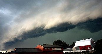
Geoengineering the planet’s climate: even when applied on a massive scale, the most that could be expected is a temperature drop of about 8%, new research shows. Photograph: Nasa/REUTERS

Large-scale human engineering of the Earth’s climate to prevent catastrophic global warming would not only be ineffective but would have severe unintended side effects and could not be safely stopped, a comparison of five proposed methods has concluded.

Science academies around the world as well as some climate activists have called for more research into geoengineering techniques, such as reflecting sunlight from space, adding vast quantities of lime or iron filings to the oceans, pumping deep cold nutrient-rich waters to the surface of oceans and irrigating vast areas of the north African and Australian deserts to grow millions of trees. Each method has been shown to potentially reduce temperature on a planetary scale.

But researchers at the Helmholtz Centre for Ocean Research Kiel, Germany, modelled these five potential methods and concluded that geoengineering could add chaos to complex and not fully understood weather systems. Even when applied on a massive scale, the most that could be expected, they say, is a temperature drop of about 8%.

The potential side effects would be potentially disastrous, say the scientists, writing in Nature Communications. Ocean upwelling, or the bringing up of deep cold waters, would cool surface water temperatures and reduce sea ice melting, but would unbalance the global heat budget, while adding iron filings or lime would affect the oxygen levels in the oceans. Reflecting the sun’s rays into space would alter rainfall patterns and reforesting the deserts could change wind patterns and could even reduce tree growth in other regions.

In addition, say the scientists, two of the five methods considered could not be safely stopped. “We find that, if solar radiation management or ocean upwelling is discontinued then rapid warming occurs. If the other methods are discontinued, less dramatic changes occur. Essentially all of the CO2 that was taken up remains in the ocean.”


Read More Here

.


LiveScience


Diagram of geoengineering ideas
A diagram of the geoengineering projects people have proposed to combat climate change. The laws surrounding such projects are still uncertain.
Credit: Diagram by Kathleen Smith/LLNL


Current schemes to minimize the havoc caused by global warming by purposefully manipulating Earth’s climate are likely to either be relatively useless or actually make things worse, researchers say in a new study.


The dramatic increase in carbon dioxide levels in the atmosphere since the Industrial Revolution is expected to cause rising global sea levels, more-extreme weather and other disruptions to regional and local climates. Carbon dioxide is a greenhouse gas that traps heat, so as levels of the gas rise, the planet overall warms.


In addition to efforts to reduce carbon dioxide emissions, some have suggested artificially manipulating the world’s climate in a last-ditch effort to prevent catastrophic climate change. These strategies, considered radical in some circles, are known as geoengineering or climate engineering.


Many scientists have investigated and questioned how effective individual geoengineering methods could be. However, there have been few attempts to compare and contrast the various methods, which range from fertilizing the ocean so that marine organisms suck up excess carbon dioxide to shooting aerosols into the atmosphere to reflect some of the sun’s incoming rays back into space. [8 Ways Global Warming is Already Changing the World]


Now, researchers using a 3D computer model of the Earth have tested the potential benefits and drawbacks of five different geoengineering technologies.


Will it work?


The scientists found that even when several technologies were combined, geoengineering would be unable to prevent average surface temperatures from rising more than 3.6 degrees Fahrenheit (2 degrees Celsius) above current temperatures by the year 2100. This is, the current limit that international negotiations are focused on. They were unable to do so even when each technology was deployed continuously and at scales as large as currently deemed possible.


“The potential of most climate engineering methods, even when optimistic deployment scenarios were assumed, were much lower than I had expected,” said study author Andreas Oschlies, an earth system modeler at the GEOMAR Helmholtz Centre for Ocean Research in Kiel, Germany.


Read More Here


…..

International Law Encourages Use of Geoengineering Weather Modification


Derrick Broze

According to a new study due to be published in 2014, Geoengineering field research is not only allowed, it is encouraged.

The study was authored by Jesse Reynolds at Tilburg Law School in the Netherlands. Reynolds researched the legal status of geoengineering research by analyzing international documents and treaties.

Geo-engineering is the science of manipulating the climate for the stated purpose of fighting mad made climate change. These include Solar Radiation Management (SRM), the practice of spraying aerosols into the sky in an attempt to deflect the Sun’s rays and combat climate change.

According to a recent congressional report:

“The term “geoengineering” describes this array of technologies that aim, through large-scale and deliberate modifications of the Earth’s energy balance, to reduce temperatures and counteract anthropogenic climate change. Most of these technologies are at the conceptual and research stages, and their effectiveness at reducing global temperatures has yet to be proven. Moreover, very few studies have been published that document the cost, environmental effects, socio-political impacts, and legal implications of geoengineering. If geoengineering technologies were to be deployed, they are expected to have the potential to cause significant transboundary effects.

In general, geoengineering technologies are categorized as either a carbon dioxide removal (CDR) method or a solar radiation management (SRM) method. CDR methods address the warming effects of greenhouse gases by removing carbon dioxide (CO2) from the atmosphere. CDR methods include ocean fertilization, and carbon capture and sequestration. SRM methods address climate change by increasing the reflectivity of the Earth’s atmosphere or surface.

Aerosol injection and space-based reflectors are examples of SRM methods. SRM methods do not remove greenhouse gases from the atmosphere, but can be deployed faster with relatively immediate global cooling results compared to CDR methods.“
Reynolds’ study will be published in the Journal of Energy, Climate and the Environment around the same time that the Intergovernmental Panel on Climate Change presents its Fifth Assessment Report. The study continues the calls for an international body to regulate the controversial weather modification techniques.

Some believe the answer is international agreement for international tests but low-risk domestic research should continue to assist in the overall decision of what to do with geoengineering.

One of the many dangers of manipulating the weather are the loss of blue skies. According to a report by the New Scientist, Ben Kravitz of the Carnegie Institution for Science has shown that releasing sulphate aerosols high in the atmosphere would scatter sunlight into the atmosphere. He says this could decrease the amount of sunlight that hits the ground by 20% and make the sky appear more hazy.


Read More Here


…..

Yale University


09 Jan 2014: Report

Solar Geoengineering: Weighing
Costs of Blocking the Sun’s Rays

With prominent scientists now calling for experiments to test whether pumping sulfates into the atmosphere could safely counteract global warming, critics worry that the world community may be moving a step closer to deploying this controversial technology.

by nicola jones

In 1991, Mount Pinatubo in the Philippines erupted in one of the largest volcanic blasts of the 20th century. It spat up to 20 million tons of sulfur into the upper atmosphere, shielding the earth from the sun’s rays and causing global temperatures to drop by nearly half a degree Celsius in a single year. That’s more than half of the amount the planet has warmed

Studies have shown that such a strategy would be powerful, feasible, fast-acting, and cheap.

due to climate change in 130 years.

Now some scientists are thinking about replicating Mount Pinatubo’s dramatic cooling power by intentionally spewing sulfates into the atmosphere to counteract global warming. Studies have shown that such a strategy would be powerful, feasible, fast-acting, and cheap, capable in principle of reversing all of the expected worst-case warming over the next century or longer, all the while increasing plant productivity. Harvard University physicist David Keith, one of the world’s most vocal advocates of serious research into such a scheme, calls it “a cheap tool that could green the world.” In the face of anticipated rapid climate change, Keith contends that the smart move is to intensively study both the positive and negative effects of using a small fleet of jets to inject

“Mount

Arlan Naeg/AFP/Getty Images
The 1991 Mount Pinatubo eruption lowered temperatures nearly half a degree Celsius.

sulfate aerosols high into the atmosphere to block a portion of the sun’s rays.

Yet even Keith acknowledges that there are serious concerns about solar geoengineering, both in terms of the environment and politics. Growing discussion about experimentation with solar radiation management has touched off an emotional debate, with proponents saying the technique may be needed to avert climate catastrophe and opponents warning that deployment could lead to international conflicts and unintended environmental consequences — and that experimentation would create a slippery slope that would inevitably lead to deployment. University of Chicago geophysicist Raymond Pierrehumbert has called the scheme “barking mad.” Canadian environmentalist David Suzuki has dismissed it as “insane.” Protestors have stopped even harmless, small-scale field experiments that aim to explore the idea. And Keith has received a couple of death threats from the fringe of the environmentalist community.

Clearly, there are good reasons for concern. Solar geoengineering would likely make the planet drier, potentially disrupting monsoons in places like India and creating drought in parts of the tropics. The technique could help eat away the protective ozone shield of our planet, and it would cause air pollution. It would also do nothing to counteract the problem of ocean

Some worry that solar geoengineering would hand politicians an easy reason to avoid emissions reductions.

acidification, which occurs when the seas absorb high levels of CO2 from the atmosphere.

Some worry that solar geoengineering would hand politicians an easy reason to avoid reducing greenhouse gas emissions. And if the impacts of climate change worsen and nations cannot agree on what scheme to deploy, or at what temperature the planet’s thermostat should be set, then conflict or even war could result as countries unilaterally begin programs to inject sulfates into the atmosphere. “My greatest concern is societal disruption and conflict between countries,” says Alan Robock, a climatologist at Rutgers University in New Jersey.

As Keith himself summarizes, “Solar geoengineering is an extraordinarily powerful tool. But it is also dangerous.”

Studies have shown that solar radiation management could be accomplished and that it would cool the planet. Last fall, Keith published a book, A Case for Climate Engineering, that lays out the practicalities of such a scheme. A fleet of ten Gulfstream jets could be used to annually inject 25,000 tons of sulfur — as finely dispersed sulfuric acid, for example — into the lower stratosphere. That would be ramped up to a million tons of sulfur per year by 2070, in order to counter about half of the world’s warming from greenhouse gases. The idea is to combine such a scheme with emissions cuts, and keep it running for about twice as long as it takes for CO2 concentrations in the atmosphere to level out.

Under Keith’s projections, a world that would have warmed 2 degrees C by century’s end would instead warm 1 degree C. Keith says his “moderate, temporary” plan would help to avoid many of the problems associated with full-throttle solar geoengineering schemes that aim to counteract all of the planet’s warming, while reducing the cost of adapting to rapid climate change. He estimates this scheme would cost about $700 million annually — less than 1 percent of what is currently spent on clean energy development. If such relatively modest cost projections prove to be accurate, some individual countries could deploy solar geoengineering technologies without international agreement.

‘The thing that’s surprising is the degree to which it’s being taken more seriously,’ says one scientist.

The idea of solar geoengineering dates back at least to the 1970s; researchers have toyed with a range of ideas, including deploying giant mirrors to deflect solar energy back into space, or spraying salt water into the air to make more reflective clouds. In recent years the notion of spraying sulfates into the stratosphere has moved to the forefront. “Back in 2000 we just thought of it as a ‘what if’ thought experiment,” says atmospheric scientist Ken Caldeira of the Carnegie Institution for Science, who did some of the first global climate modeling work on the concept. “In the last years, the thing that’s surprising is the degree to which it’s being taken more seriously in the policy world.”

In 2010, the first major cost estimates of sulfate-spewing schemes were produced. ‎ In 2012, China listed geoengineering among its earth science research priorities. Last year, the Intergovernmental Panel on Climate Change’s summary statement for policymakers controversially mentioned geoengineering for the first time in the panel’s 25-year history. And the National Academy of Sciences is working on a geoengineering report, funded in part by the U.S. Central Intelligence Agency.

Solar geoengineering cannot precisely counteract global warming. Carbon dioxide warms the planet fairly evenly, while sunshine is patchy: There’s more in the daytime, in the summer, and closer to the equator. Back in the 1990s, Caldeira was convinced that these differences would make geoengineering ineffective. “So we did these simulations, and much to our surprise it did a pretty good job,” he says. The reason is that a third factor has a bigger impact on climate than either CO2 or sunlight: polar ice. If you cool the planet enough to keep that ice, says Caldeira, then this dominates the climate response.


Read More Here


…..

Geoengineering could bring severe drought to the tropics, research shows

Study models impact on global rainfall when artificial volcanic eruptions are created in a bid to reverse climate change
Layers of Volcanic Dust in the Earth's Atmosphere following eruption of Mount Pinatubo, Philippines

A view from the space shuttle Atlantis of three layers of volcanic dust in the Earth’s atmosphere, following the 1991 eruption of Mount Pinatubo in the Philippines. Photograph: ISS/NASA/Corbis

Reversing climate change via huge artificial volcanic eruptions could bring severe droughts to large regions of the tropics, according to new scientific research.

The controversial idea of geoengineering – deliberately changing the Earth’s climate – is being seriously discussed as a last-ditch way of avoiding dangerous global warming if efforts to slash greenhouse gas emissions fail.

But the new work shows that a leading contender – pumping sulphate particles into the stratosphere to block sunlight – could have side-effects just as serious as the effects of warming itself. Furthermore, the impacts would be different around the world, raising the prospect of conflicts between nations that might benefit and those suffering more damage.

“There are a lot of issues regarding governance – who controls the thermostat – because the impacts of geoengineering will not be uniform everywhere,” said Dr Andrew Charlton-Perez, at the University of Reading and a member of the research team.

The study, published in the journal Environmental Research Letters, is the first to convincingly model what happens to rainfall if sulphates were deployed on a huge scale.

While the computer models showed that big temperature rises could be completely avoided, it also showed cuts in rain of up to one-third in South America, Asia and Africa. The consequent droughts would affect billions of people and also fragile tropical rainforests that act as a major store of carbon. “We would see changes happening so quickly that there would be little time for people to adapt,” said Charlton-Perez.

Another member of the research team, Professor Ellie Highwood, said: “On the evidence of this research, stratospheric aerosol geoengineering is not providing world leaders with any easy answers to the problem of climate change.”


Read More Here


…..


Enhanced by Zemanta

New maps show how habitats may shift with climate change

This map shows how marine habitat ranges will shift likely in a segment of the Northern Hemisphere. The length of the black arrows indicates the velocity of temperature change, and the color schemes correspond with the nature of the habitat migration, as follows. SINK: Migrations terminate due to some barrier, such as coastlines. SOURCE: Migrations do not terminate. CORRIDOR: Many migrations passing through. DIVERGENCE: Fewer migrations end than start. CONVERGENCE: More migrations start than end. Credit: Michael Burrows and Jorge Garcia Molinosor (Credit: Michael Burrows and Jorge Garcia Molinosor)

This map shows how marine habitat ranges will shift likely in a segment of the Northern Hemisphere. The length of the black arrows indicates the velocity of temperature change, and the color schemes correspond with the nature of the habitat migration, as follows. SINK: Migrations terminate due to some barrier, such as coastlines. SOURCE: Migrations do not terminate. CORRIDOR: Many migrations passing through. DIVERGENCE: Fewer migrations end than start. CONVERGENCE: More migrations start than end. Credit: Michael Burrows and Jorge Garcia Molinosor

As regional temperatures shift with climate change, many plants and animals will need to relocate to make sure they stay in the range of temperatures they’re used to.

For some species, this shift will mean a fairly direct adjustment toward higher latitudes to stay with cooler temperatures, but for many others, the path will take twists and turns due to differences in the rate at which temperatures change around the world, scientists say.

Now, a team of 21 international researchers has identified potential paths of these twists and turns by mapping out climate velocities— the speed and intensity with which climate change occurs in a given region — averaged from 50 years of satellite data from 1960 through 2009, and projected for the duration of the 21st century.

MSN Weather: What causes global warming?
MSN Weather: How global warming can make cold snaps even worse

“We are taking physical data that we have had for a long time and representing them in a way that is more relevant to other disciplines, like ecology,” said co-author Michael Burrows, a researcher at the Scottish Marine Institute. “This is a relatively simple approach to understanding how climate is going to influence ocean and land systems.”

Where species come and go

The resulting maps indicate regions likely to experience an influx or exodus of new species, or behave as a corridor or, conversely, a barrier, to migration. Barriers, such as coastlines or mountain ranges, could cause local extinctions if they prevent species from relocating, the team says.  [Maps: Habitat Shifts Due to Climate Change]

“For example, because those environments are not adjacent to or directly connected to a warmer place, those species from warmer places won’t be able to get there very easily,” Burrows told Live Science. “They might still get there in other ways, like on the bottoms of ships, but they won’t get there as easily.”

Read More Here

Enhanced by Zemanta

These videos contain some  religious  based opinion that some may not  agree with.  I am posting the  videos  for the  facts  that are  introduced in reference  to  foreign bodies  that have been  observed.

Whether  you accept the  religious  commentary or  not  is completely a  very  personal option  on  your part.  My  main interest  is the information being provided.  Please do not challenge  me on the religious  aspect as this  video  was made  by another  person  not  by me.  Please address any  commentary  or  complaint to the  originator of  the  video itself.  I  will not be  drawn into  an  argument  as  to the  validity  of  the religious commentaries being made.

~Desert Rose~

…..

Unbelievable Endtime Events Now! Part One

BPEarthWatch BPEarthWatch

Published on Jan 17, 2014

The BEST YOUTUBE VIDEO EVER. End Time Events Explained. Anthony Patch and Michael, The Meeting of the Minds.
http://www.blogtalkradio.com/bpearthw…

…..

Unbelievable Endtime Events. Part Two


…..

End Time Events, Part 3


…..