Tag Archive: Greenland


Earth Watch Report Banner photo FSPEarthWatchReport900x228Blogger_zps53ef6af0.jpg          Global Community Report Banner photo FSPLogoGlobalCommunityFulloldworldmapbckgrnd_zps43d3059c.jpg

……………………………………………………………………………………….


GLOBAL WARMING? NASA says Antarctic has been COOLING for past SIX years

ANTARCTIC temperatures have cooled over the past six years, according to US space agency NASA.

PUBLISHED: 07:51, Sat, Nov 28, 2015 | UPDATED: 12:58, Sat, Nov 28, 2015

Heimdal Glacier in southern Greenland, in an image captured on Oct. 13, 2015, from NASA Langley Research Center's Falcon 20 aircraft flying 33,000 feeNASA

Heimdal Glacier southern Greenland, from NASA’s Falcon 20 aircraft at 33,000 feet above sea level.

An intensive scientific study of both Earth’s poles has found that from 2009 to 2016 overall temperature has dropped in the southern polar region.NASA’s Operation IceBridge is an airborne survey of polar ice and has finalised two overlapping research campaigns at both the poles.In the last few weeks NASA has revealed the overall amount of ice has increased at the Antarctic and the amount of sea ice has also extended.Coupled with the latest announcement of slight cooling in the area, it has fuelled claims from climate change deniers that human industrialisation is not having the huge impact on global tenperature as often is claimed.

Map showing the extent of ice during the NASA studiesNASA

Map showing the extent of ice during the NASA studies


Read More Here

……………………………………………………………………………

Examiner.com

New paper claims no pause in warming, but unaltered data says otherwise

November 25, 2015 9:20 AM MST
Authors Naomi Oreskes (L) and Erik Conway attend the 'Merchants of Doubt' premiere during the 2014 Toronto International Film Festival.
Photo by Aaron Harris


Read More Here


Next: How NOAA rewrote climate data to hide global warming pause


………………………………………………………………………………………

Nasa Earth Observatory

Earth is Cooling…No It’s Warming


In 1967 Hansen went to work for NASA’s Goddard Institute for Space Studies, in New York City, where he continued his research on planetary problems. Around 1970, some scientists suspected Earth was entering a period of global cooling. Decades prior, the brilliant Serbian mathematician Milutin Milankovitch had explained how our world warms and cools on roughly 100,000-year cycles due to its slowly changing position relative to the Sun. Milankovitch’s theory suggested Earth should be just beginning to head into its next ice age cycle. The surface temperature data gathered by Mitchell seemed to agree; the record showed that Earth experienced a period of cooling (by about 0.3°C) from 1940 through 1970. Of course, Mitchell was only collecting data over a fraction of the Northern Hemisphere—from 20 to 90 degrees North latitude. Still, the result drew public attention and a number of speculative articles about Earth’s coming ice age appeared in newspapers and magazines.


Graph of Northern Hemisphere temperatures, 1860 through 1970

Initial efforts to observe Earth’s temperature were limited to the Northern Hemisphere, and they showed a cooling trend from 1940 to 1970 (jagged line). Scientists estimated the relative effects of carbon dioxide (warming, top curve) and aerosols (cooling, bottom curve) on climate, but did not have enough data to make precise predictions. (Graph from Mitchell, 1972.)

But other scientists forecasted global warming. Russian climatologist Mikhail Budyko had also observed the three-decade cooling trend. Nevertheless, he published a paper in 1967 in which he predicted the cooling would soon switch to warming due to rising human emissions of carbon dioxide. Budyko’s paper and another paper published in 1975 by Veerabhadran Ramanathan caught Hansen’s attention. Ramanathan pointed out that human-made chlorofluorocarbons (or CFCs) are particularly potent greenhouse gases, with as much as 200 times the heat-retaining capacity of carbon dioxide. Because people were adding CFCs to the lower atmosphere at an increasing rate, Ramanathan expressed concern that these new gases would eventually add to Earth’s greenhouse effect and cause our world to warm. (Because CFCs also erode Earth’s protective ozone layer, their use was mostly abolished in 1989 with the signing of the Montreal Protocol.)

Read More Here

…………………………………………………………………………………….

This graph, based on the comparison of atmospheric samples contained in ice cores and more recent direct measurements, provides evidence that atmospheric CO2 has increased since the Industrial Revolution. (Source: [[LINK||http://www.ncdc.noaa.gov/paleo/icecore/||NOAA]])
This graph, based on the comparison of atmospheric samples contained in ice cores and more recent direct measurements, provides evidence that atmospheric CO2 has increased since the Industrial Revolution. (Credit: Vostok ice core data/J.R. Petit et al.; NOAA Mauna Loa CO2 record.)

The Earth’s climate has changed throughout history. Just in the last 650,000 years there have been seven cycles of glacial advance and retreat, with the abrupt end of the last ice age about 7,000 years ago marking the beginning of the modern climate era — and of human civilization. Most of these climate changes are attributed to very small variations in Earth’s orbit that change the amount of solar energy our planet receives.

Scientific evidence for warming of the climate system is unequivocal.
– Intergovernmental Panel on Climate Change

The current warming trend is of particular significance because most of it is very likely human-induced and proceeding at a rate that is unprecedented in the past 1,300 years.1

Earth-orbiting satellites and other technological advances have enabled scientists to see the big picture, collecting many different types of information about our planet and its climate on a global scale. This body of data, collected over many years, reveals the signals of a changing climate.


Read More Here

The evidence for rapid climate change is compelling:


  • Republic of Maldives: Vulnerable to sea level rise

    Photograph by Shahee Ilyas  

    Malé, capital of Maldives  Wikipedia.org

    Sea level rise

    Global sea level rose about 17 centimeters (6.7 inches) in the last century. The rate in the last decade, however, is nearly double that of the last century.4

    + expand


  • Global temperature rise

    All three major global surface temperature reconstructions show that Earth has warmed since 1880.5 Most of this warming has occurred since the 1970s, with the 20 warmest years having occurred since 1981 and with all 10 of the warmest years occurring in the past 12 years.6 Even though the 2000s witnessed a solar output decline resulting in an unusually deep solar minimum in 2007-2009, surface temperatures continue to increase.7

    + expand


  • Warming oceans

    The oceans have absorbed much of this increased heat, with the top 700 meters (about 2,300 feet) of ocean showing warming of 0.302 degrees Fahrenheit since 1969.8

    + expand


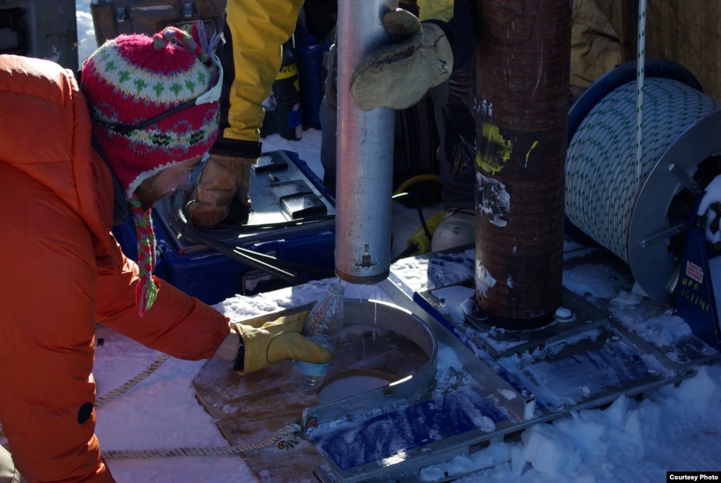
  • Flowing meltwater from the Greenland ice sheet

    Shrinking ice sheets

    The Greenland and Antarctic ice sheets have decreased in mass. Data from NASA’s Gravity Recovery and Climate Experiment show Greenland lost 150 to 250 cubic kilometers (36 to 60 cubic miles) of ice per year between 2002 and 2006, while Antarctica lost about 152 cubic kilometers (36 cubic miles) of ice between 2002 and 2005.

    + expand

Read More Here

Earth Watch Report Banner photo FSPEarthWatchReport900x228Blogger_zps53ef6af0.jpg

……………………………………………………………………………….


Accuweather

NASA: North Atlantic ‘Cold Blob’ May be Culprit Behind Ocean Current Slowdown

By Mark Leberfinger, AccuWeather.com Staff Writer
November 17, 2015; 12:34 AM ET

A major player in the transportation of heat in the Atlantic Ocean is slowing down and may affect higher latitude climates in the Northern Hemisphere, according to a NASA analysis of satellite data.

The “cold blob” that developed off Greenland may be the drag on the Atlantic Meridional Overturning Circulation (AMOC) by producing very chilly to record cold water, the National Oceanic and Atmospheric Administration (NOAA) said earlier this year.

Global warming may be responsible for AMOC’s slowdown but natural forces may also be at work, NASA said. AMOC is part of the complex circulation of currents that help take the warmer Gulf Stream water and move it through the basin.

Data from the Gravity Recovery and Climate Experiment (GRACE) satellites correspond with similar findings that were not satellite-based. The GRACE findings were published in the journal Geophysical Research Letters.

An AMOC slowdown would impact other currents throughout the Atlantic.


Read More Here

ICE WORLD

Preglacial landscape found deep under Greenland ice


by Staff Writers
Washington (AFP) April 18, 2014

US geologists said Thursday they have uncovered a preglacial tundra landscape preserved for 2.7 million years far below the Greenland ice sheet.

Glaciers are known to scrape everything off any given plot of land — vegetation, soil and even the top layer of bedrock — so scientists expressed great surprise that they had found the landscape in pristine condition below two miles (three kilometers) of ice.

The finding provides strong evidence that the ice sheet has existed for much longer than previously known, and survived numerous global warming episodes, according to the lead researcher, University of Vermont geologist Paul Bierman.

Rather than scraping and sculpting the landscape, the ice sheet has been frozen to the ground, effectively creating “a refrigerator that’s preserved this antique landscape,” Bierman said.

The finding suggests that even during the warmest periods of the ice sheet’s life, the center of Greenland was stable and did not fully melt, allowing the tundra landscape to be sealed without modification through millions of years of changing temperatures.


Read More Here


…..

Massive canyon discovered buried under Greenland ice

A vast gorge in the Earth on the same scale as the Grand Canyon lies buried under ice in Greenland, scientists have learned.

The massive hidden canyon is at least 466 miles (740km) long and up to 800 metres (2,600ft) deep in places.

The feature, resembling a meandering river channel, is believed to pre-date the ice sheet that has covered Greenland for millions of years.

3D visualisation of the canyon under Greenland's ice sheet.

3D visualisation of the canyon under Greenland’s ice sheet. Photograph: Professor Jonathan Bamber

Prof Jonathan Bamber, from the school of geographical studies at the University of Bristol, said: “With Google Streetview available for many cities around the world and digital maps for everything from population density to happiness, one might assume that the landscape of the Earth has been fully explored and mapped.

“Our research shows there’s still a lot left to discover.”

The canyon was uncovered by airborne radar which can penetrate ice and bounce off the land beneath.

Scientists pieced together radar measurements covering thousands of kilometres collected by Arctic researchers over several decades. They found evidence of a fissure in the bedrock stretching northwards almost from the centre of Greenland.

The canyon ends in a deep fjord connecting it to the Arctic ocean.


Read More Here


…..

Enhanced by Zemanta

LiveScience

Greenland’s First Coral Reef Found

Greenland coral reef
A piece of the first cold-water coral reef discovered offshore of Greenland.
Credit: Technical University of Denmark

A Canadian research ship sampling water near southwest Greenland’s Cape Desolation discovered the Greenland coral reef in 2012, when its equipment came back to the surface with pieces of coral attached.

“At first, the researchers were swearing and cursing at the smashed equipment, and were just about to throw the pieces of coral back into the sea, when luckily, they realized what they were holding,” Helle Jørgensbye, a doctoral student at the Technical University of Denmark who is studying the reef, said in a statement.

Cold-water corals have been found off of Greenland’s west coast before, but never the stone coral Lophelia pertusa, and never as a reef, according to a report by the researchers published in the journal ICES Insight.

Scientists snapped pictures of the reef and collected coral samples on a return trip, also in 2012, led by the Bedford Institute of Oceanography in Nova Scotia.

Read More Here

…..

Bit chilly for snorkelling! Living coral reef is discovered off the coast of GREENLAND

  • ‘Cold-water’ coral discovered in Cape Desolation, south of Ivittuut
  • It is the first time an entire reef has been discovered in Greenland
  • It was discovered by Canadian researchers purely by accident

By Sam Webb

|

Coral reefs are often associated with tropical climates and enjoyed by snorkellers for their multi-coloured beauty.

But it would take a brave holidaymaker indeed to brave the one recently discovered by Canadian researchers – it’s in the freezing waters of southern Greenland.

The reef is comprised of what are called living cold-water corals and while there are several species of coral in Greenland, this is the first time that an actual reef has been found.

Vibrant: Cold water coral from the newly discovered reef off the coast of Greenland

Vibrant: Cold water coral from the newly discovered reef off the coast of Greenland

The beauty of the depths: This picture of the reef almost cost the research team their camera

The beauty of the depths: This picture of the reef almost cost the research team their camera

The newly discovered living reef is located off Cape Desolation, south of Ivittuut, and lies at a depth of 984 yards (900 metres) in a spot with very strong currents, making it difficult to reach.

This also means that so far little is known about the reef itself and what lives on it.

 The reef was discovered by accident when a Canadian research vessel needed to take some water samples. When the ship sent the measuring instruments down to the depths, they came back up completely smashed.

Read More Here

…..

Enhanced by Zemanta

Greenland glacier hits record speed

Ilulissat Icefjord Jakobshavn is located at the eastern end of the Ilulissat Icefjord (seen here), Greenland

In summer, the Jakobshavn Glacier – widely thought to have spawned the iceberg that sank the Titanic – is moving about four times faster than it was in the 1990s.

The Greenland Ice Sheet has seen record melting in recent years and would raise sea levels 6m were it all to vanish.

Details of the research are published in The Cryosphere journal.

Ian Joughin and Ben Smith of the University of Washington’s Polar Science Center in Seattle analysed pictures from the German TerraSAR-X satellites to measure the speed of the glacier.

“As the glacier moves we can track changes between images to produce maps of the ice flow velocity,” said Dr Joughin, the study’s lead author.

In the summer of 2012, the glacier reached a record speed of more than 17km per year – more than 46m per day.

“We are now seeing summer speeds more than four times what they were in the 1990s on a glacier which at that time was believed to be one of the fastest, if not the fastest, glacier in Greenland,” Ian Joughin explained.

Read More Here

Related Stories

…..

National Geographic

A photo of the Jakobshavn Glacier.

Chunks of ice litter the ocean in front of Greenland’s Jakobshavn glacier.

PHOTOGRAPH BY PAUL SOUDERS

Jane J. Lee

National Geographic

Published February 4, 2014

A Greenland glacier named Jakobshavn Isbrae, which many believe spawned the iceberg that sank the Titanic, has hit record speeds in its race to the ocean. Some may be tempted to call it the king of the glacier world, but this speedy river of ice is nothing to crow about.

A new study published February 3 in the journal Cryosphere finds that Jakobshavn’s averaged annual speed in 2012 and 2013 was nearly three times its rate in the 1990s. Its flow rate during the summer months was even faster.

“We are now seeing summer speeds more than four times what they were in the 1990s on a glacier which at that time was believed to be one of the fastest, if not the fastest, glaciers in Greenland,” Ian Joughin, a researcher at the University of Washington in Seattle, told the BBC.

In summer 2012, Jakobshavn reached speeds of about 150 feet (46 meters) per day.

Other glaciers may periodically flow faster than Jakobshavn, but Greenland’s most well known glacier is the bellwether of climate change in the region and likely contributes more to sea-level rise than any other glacier in the Northern Hemisphere—as much as 4 percent of the global total, Joughin and his colleagues found in an earlier study. (Read about glacial meltdown in National Geographic magazine.)

Read More Here

…..

Enhanced by Zemanta
Water from the Greenland perennial firn aquifer draining from a core extracted 12 m below the surface of the ice sheet. The core was drilled in April, months prior to seasonal melt, with air temperatures -15 C confirming the water was retained at depth th

Water from the Greenland perennial firn aquifer draining from a core extracted 12 m below the surface of the ice sheet. The core was drilled in April, months prior to seasonal melt, with air temperatures -15 C confirming the water was retained at depth th

A massive lake has been found under the ice in Greenland.  The 43,500 square kilometer body of water could have major implications for understanding sea level rise.

Researchers at the University of Utah say the lake, known as a “perennial firn aquifer,” remains liquid year-round despite the otherwise perpetually frozen landscape.

“Large amounts of snow fall on the surface late in the summer and quickly insulates the water from the subfreezing air temperatures above, allowing the water to persist all year long,” said Rick Forster, lead author and professor of geography at the University of Utah.

The Greenland Ice Sheet is vast, covering roughly the same area as the states of California, Nevada, Arizona, New Mexico, Colorado and Utah combined. The average thickness of the ice is 5,000 feet. In 2012, the ice sheet lost volume of 60 cubic miles – a record for melt and runoff.

Read More Here

…..


LiveScience

Greenland’s Snow Hides 100 Billion Tons of Water

Greenland drilling

A drill rig was used to extract old snow (firn) cores from within the Greenland snow aquifer. Credit: Evan Burgess

Big surprises still hide beneath the frozen surface of snowy Greenland. Despite decades of poking and prodding by scientists, only now has the massive ice island revealed a hidden aquifer.

In southeast Greenland, more than 100 billion tons of liquid water soaks a slushy snow layer buried anywhere from 15 to 160 feet (5 to 50 meters) below the surface. This snow aquifer covers more than 27,000 square miles (70,000 square kilometers) — an area bigger than West Virginia — researchers report today (Dec. 22) in the journal Nature Geoscience.

“We thought we had an understanding of how things work in Greenland, but here is this entire storage system of water we didn’t realize was there,” said Richard Forster, lead study author and a glaciologist at the University of Utah.

The discovery will help scientists better understand the fate of Greenland’s annual surface melt, which contributes to sea level rise. When the summer sun warms the Arctic island, a giant water world of stunning blue lakes and streams appears atop the ice. Tracking this surface runoff helps scientists account for ice lost to melting each year. Until now, researchers thought most of this water went to the ocean or refroze on the ice. Now they’ve found a new hiding place.

“This throws an additional complexity into the system,” Forster told LiveScience.

There is enough water in the snow aquifer to raise global sea level by 0.015 inches (0.4 millimeters), according to a separate study by the same team published Nov. 30 in the journal Geophysical Research Letters (GRL). Every year, Greenland adds 0.03 inches (0.7 mm) of water to global sea level rise from melting snow and ice, Forster said. [Top 10 Surprising Results of Global Warming]

Where water flows

No one yet knows how old the water in the aquifer is, and whether it stays trapped in the snow or reaches the ocean in slow streams or catastrophic floods. However, the top of the water table rose after Greenland’s huge surface melt in 2012, the researchers report in their GRL study.

Greenland aquifer

Water from the Greenland snow aquifer draining from a drill core extracted 40 feet (12 meters) below the surface of the ice sheet in April, before the summer surface melt, with air temperatures of 5 degrees Fahrenheit (minus 15 degrees Celsius).
Credit: Ludovic Brucker

The group will return to southeast Greenland in the coming years to answer these and other questions, Forster said. “Just seeing how old it is would answer a lot of questions,” he said.

The final destination of Greenland’s melt water is also key to understanding how the ice sheet ebbs and flows, because water under the ice sheet lubricates flowing glaciers. Researchers know some melt water goes to the bottom of the ice, trickling through cracks and racing through vertical pipes called moulins. Some of the water also simply refreezes on the surface when winter comes. Liquid water sitting in buried snow layers can also slowly warm and melt the ice sheet.

“The existence of this rather flavorless natural snow cone has many implications for the future of the ice sheet, some that may make the ice go away faster and others that help keep the ice a little longer,” said Richard Alley, a glaciologist at Pennsylvania State University, who was not involved in the study. “We would like to understand these implications better so we can help reduce the uncertainties about future changes.”

Read More Here

…..

Enhanced by Zemanta

Published on Apr 5, 2013

Jakobshavn Glacier, one of the fastest moving glaciers in Greenland, has been the focus of IceBridge survey flights for five consecutive years. Here, images from an IceBridge mission on Apr. 4, 2013 and video footage from the 2012 Arctic campaign show this rapidly changing ice stream and how IceBridge is using its suite of airborne instruments to collect crucial data on ice movement and how much glaciers like Jakobshavn might contribute to future sea level rise.

This video is public domain and can be downloaded at: http://svs.gsfc.nasa.gov/vis/a010000/…

Like our videos? Subscribe to NASA’s Goddard Shorts HD podcast:
http://svs.gsfc.nasa.gov/vis/iTunes/f…

Or find NASA Goddard Space Flight Center on Facebook:
http://www.facebook.com/NASA.GSFC

Or find us on Twitter:
http://twitter.com/NASAGoddard

Earth Watch Report  –  Storms

Incredible North Atlantic storm spans Atlantic Ocean, coast to coast

Posted by Jason Samenow on March 28, 2013 at 10:34 pm


I’m not sure I’ve ever seen a storm this big before.

(NASA)

(NASA)

The storm shown here stretches west to east from Newfoundland to Portugal. Its southern tail (cold front) extends into the Caribbean and the north side of its comma head touches southern Greenland.

Not only is it big, but it’s also super intense – comparable to many category 3 hurricanes.  The storm’s central pressure, as analyzed by the Ocean Prediction Center, is 953 mb. Estimated peak wave heights are around 25-30 feet.

(Ocean Prediction Center)

(Ocean Prediction Center)

The storm is forecast to remain more or less stationary over the next few days before substantially weakening and then eventually drifting into western Europe in about a week as a rather ordinary weather system.

Note to Washingtonians: this is the same storm that blanketed the region with 1-4 inches of snow Monday. It’s grown into a monster from humble beginnings.  The storm’s giant circulation has drawn down the cold and windy conditions we’ve had since it passed.

…………………………………………………………………………………………………………………………………………………………………….

Jason Samenow is the Capital Weather Gang’s chief meteorologist and serves as the Washington Post’s Weather Editor. He earned BA and MS degrees in atmospheric science from the University of Virginia and University of Wisconsin-Madison.
**********************************************************************************************

Atlantic Ocean Storm 2013: How One Weather System Affected Nearly Half The Earth

Huffington Post

Posted: 03/29/2013 5:12 pm EDT

Atlantic Ocean Storm 2013

An image of the storm taken by the MODIS instrument on the Aqua satellite on March 27, 2013.

From Douglas Main, OurAmazingPlanet Staff Writer:

There is currently a massive storm churning over the Atlantic that spans the entire ocean basin, stretching all the way from Canada to Europe, and from Greenland to the Caribbean.

It’s the same weather system that brought a massive spring blizzard to much of the United States and Canada earlier this week (on Tuesday (March 26), 44 of 50 states had some snow on the ground), and which has now ballooned in size, according to Jason Samenow, chief meteorologist with the Washington Post’s Capital Weather Gang.

Robert Oszajca, lead forecaster for the National Weather Service’s Ocean Prediction Center, explained that the storm got this big by merging with several low-pressure systems that were hanging out over the Atlantic Ocean. The merging weather systems gave it more power, which was accentuated by a gradient between warm moisture from the southeast, delivered by the Gulf Stream, and frigid air from the north. This intensified the storm, causing it to spin, elongate and grow in size, Oszajca told OurAmazingPlanet.

Normally, the system would have drifted into Europe several days ago. However, a high-pressure system over Greenland blocked the low-pressure system’s advance, which allowed it to strengthen further, fed by cold air from the north. This created winds (which move from high pressure to low pressure) up to 75 mph (120 km/h), equivalent to a Category 1 hurricane, Oszajca said.


Read Full Article and  Watch Video Here

Earth Watch   Report –  Pollution

ICE WORLD


Greenland ice sheet carries evidence of increased atmospheric acidity

by Vince Stricher
Seattle WA (SPX)


This ice core from Summit, Greenland, kept in the laboratory of Jihong Cole-Dai at South Dakota State University, provided data that Lei Geng used in his research. IMage courtesy Jihong Cole-Dai.

Research has shown a decrease in levels of the isotope nitrogen-15 in core samples from Greenland ice starting around the time of the Industrial Revolution. The decrease has been attributed to a corresponding increase in nitrates associated with the burning of fossil fuels.

However, new University of Washington research suggests that the decline in nitrogen-15 is more directly related to increased acidity in the atmosphere.

The increased acidity can be traced to sulfur dioxide, which in the atmosphere is transformed to sulfuric acid, said Lei Geng, a UW research associate in atmospheric sciences. Following the Industrial Revolution, sulfur dioxide emissions increased steadily because of coal burning.

“It changes the chemical properties of the lower troposphere, where we live, and that can have a lot of consequences,” Geng said. He presented his findings Friday (Dec. 7) at the fall meeting of the American Geophysical Union in San Francisco.

The gradual buildup of acidity in the atmosphere over a century got a boost around 1950 with a sharp increase in nitrogen-oxygen compounds, referred to as NOx, mainly produced in high-temperature combustion such as occurs in coal-fired power plants and motor vehicle engines. NOx is easily converted to nitric acid in the atmosphere, further increasing the acidity.

NOx carries a chemical signature – the abundance of nitrogen-15, one of two nitrogen isotopes – which changes depending on the source. That means it is possible to distinguish NOx that came from a forest fire from NOx produced as a result of lightning, soil emissions, car exhaust and power plant emissions. The level of nitrogen-15 can be measured in nitrates that formed from NOx and were deposited in ice sheets such as those in Greenland.

Current evidence indicates NOx from coal-fired power plant and motor vehicle emissions likely carries more nitrogen-15 than NOx produced by natural sources, so nitrogen-15 levels in deposited nitrate could be expected to go up. However, those levels actually went down in the late 1800s, following the Industrial Revolution, Geng said.

That’s because increasing sulfuric acid levels in the atmosphere triggered chemical and physical processes that allowed less nitrogen-15 to remain in vaporized nitrate, which can be carried to remote places such as Greenland.

The growing acidity in the atmosphere was occurring decades before acid rain was recognized as a threat, particularly in industrial areas of North America.

Core samples from Greenland ice sheets reflect a correlation between nitrogen-15 levels and atmospheric acidity, Geng said. Data he studied came primarily from a core that is part of combined research between UW and South Dakota State University, funded by the National Science Foundation.

Geng noted that the core reflects a decline in signals for both NOx and sulfur dioxide emissions in the 1930s, during the Great Depression. The signals increased again following the Depression until the early 1970s, when Western nations experienced an economic downturn and an oil shortage. Shortly after that, the Clean Air Act in the United States began to have an impact on vehicle and power plant emissions.

“We’ve seen a huge drop in sulfate concentrations since the late 1970s,” Geng said. “By 2005, concentrations had dropped to levels similar to the late 1800s.”

Ice core data show nitrate levels have stabilized during that time, he said, because while emission levels from individual vehicles might have decreased substantially, the number of vehicles has increased significantly.

.

Related Links
University of Washington
Beyond the Ice Age

 Earth Watch  Report  –  Wildfires


WHITE OUT

Fire and Ice: Wildfires Darkening Greenland Snowpack, Increasing Melting


by Pam Frost Gorder for OSU News
San Francisco CA (SPX)


NASA CALIPSO satellite scan over Greenland. The circled region (right) is among those researchers have identified as sooty aerosols from wildfires. Image by Jason Box, courtesy of Ohio State University.

At the American Geophysical Union meeting this week, an Ohio State University researcher presented images from NASA’s Cloud-Aerosol Lidar and Infrared Pathfinder Satellite Observation (CALIPSO) satellite, which captured smoke from Arctic fires billowing out over Greenland during the summer of 2012.

Jason Box, associate professor of geography at Ohio State, said that researchers have long been concerned with how the Greenland landscape is losing its sparkly reflective quality as temperatures rise. The surface is darkening as ice melts away, and, since dark surfaces are less reflective than light ones, the surface captures more heat, which leads to stronger and more prolonged melting.

Researchers previously recorded a 6 percent drop in reflectivity in Greenland over the last decade, which Box calculates will cause enough warming to bring the entire surface of the ice sheet to melting each summer, as it did in 2012.

But along with the melting, researchers believe that there is a second environmental effect that is darkening polar ice: soot from wildfires, which may be becoming more common in the Arctic.

“Soot is an extremely powerful light absorber,” Box said. “It settles over the ice and captures the sun’s heat. That’s why increasing tundra wildfires have the potential to accelerate the melting in Greenland.”

Box was inspired to investigate tundra fires after his home state of Colorado suffered devastating wildfires this past year. According to officials, those fires were driven in part by high temperatures.

Meanwhile, in the Arctic, rising temperatures may be causing tundra wildfires to become more common. To find evidence of soot deposition from these fires, Box and his team first used thermal images from NASA’s Moderate Resolution Imaging Spectroradiometer (MODIS) to identify large fires in the region. Then they used computer models to project possible smoke particle trajectories, which suggested that the smoke from various fires could indeed reach Greenland.

Finally, they used that information to examine the CALIPSO data, and pinpoint sooty aerosols-smoke clouds-over Greenland.

Because the only way to truly measure the extent to which soot particles enhance melting is to take ice sheet surface samples, Box is organizing a Greenland ice sheet expedition for 2013. The Dark Snow Project expedition is to be the first of its kind, made possible by crowd-source funding.

The analysis of the MODIS and CALIPSO data was supported by the Ohio State University’s Climate, Water and Carbon initiative. Collaborators on the fire study include Thomas Painter of NASA’s Jet Propulsion Laboratory and graduate student McKenzie Skiles of the University of California, Los Angeles.