Keep those summer beach memories close to hand – the first winter snow is here.
Almost the entire Lika region was caught in snowy weather last night. In Gospić, more than 30 centimetres of snow has fallen, while in mountainous areas the snow cover is even higher. Snow has caused the falling down of many trees which have damaged electrical lines, so the wider area of Gospić was without power this morning. Director of Elektrolika Ernest Petri said that two transmission lines that supply electricity to Gospić have broken down. There are problems with the local phone lines as well, reports Index.hr and Vecernji List on November 22, 2015.
Snow and strong winds are causing traffic problems in the Primorje region. The Lika-Senj Police Department has announced that the Adriatic highway from Karlobag to Sveta Marija Magdalena is completely closed down, and on all the roads in Lika winter tyres are mandatory.
Governments and NGOs:Germany Spied on Friends and Vatican
Efforts to spy on friends and allies by Germany’s foreign intelligence agency, the BND, were more extensive than previously reported. SPIEGEL has learned the agency monitored European and American government ministries and the Vatican.
DPA
The BND’s listening station in Bad Aibling, Bavaria: In addition to spying on friends, German intelligence also monitored Oxfam, Care International and the Red Cross.
Three weeks ago, news emerged that Germany’s foreign intelligence service, the Bundesnachrichtendienst (BND), had systematically spied on friends and allies around the world. In many of those instances, the BND had been doing so of its own accord and not at the request of the NSA. The BND came under heavy criticism earlier this year after news emerged that it had assisted the NSA in spying on European institutions, companies and even Germans using dubious selector data.
SPIEGEL has since learned from sources that the spying went further than previously reported. Since October’s revelations, it has emerged that the BND spied on the United States Department of the Interior and the interior ministries of EU member states including Poland, Austria, Denmark and Croatia. The search terms used by the BND in its espionage also included communications lines belonging to US diplomatic outposts in Brussels and the United Nations in New York. The list even included the US State Department’s hotline for travel warnings.
Germany seeks clarity on whether spy agency snooped on own diplomat
BERLIN
Germany’s BND foreign intelligence service spied on a German diplomat, possibly violating the constitution, and on allies including French Foreign Minister Laurent Fabius, a German radio station reported on Wednesday.
Officials firmly declined to comment on the report, but the parliamentary committee that oversees intelligence agencies was due to meet later in the day with the issue to be discussed.
The report by the Berlin-based rbb Inforadio was the latest twist in a growing scandal over the activities of Germany’s BND stemming from revelations in 2013 by U.S. National Security Agency (NSA) contractor Edward Snowden.
Without identifying its sources, rbb said the BND had monitored German Hansjoerg Haber, from 2008-2011 head of the EU’s observer mission in Georgia and then a senior diplomat in Brussels. He is now head of the EU’s mission in Turkey and married to a state secretary in the Interior Ministry.
The BND declined to comment. A government spokeswoman, quizzed for about 20 minutes at a regular news conference, declined to comment on the report directly and said the oversight body worked “without discussing everything in public”.
No one should be surprised that Germany’s foreign intelligence service spied on French Foreign Minister Laurent Fabius, a former French Air Force intelligence officer told FRANCE 24 Friday.
“We ask that all the information be given to us,” Hollande said Thursday on the sidelines of a migration summit in Malta. “These kinds of practices should not go on between allies.”
“I know that the chancellery will do everything it can to explain the circumstances to us in detail,” he added, saying he had been assured that such spying “had completely stopped”.
According to former French Air Force intelligence officer Alain Charret, who is a member of the French Intelligence Research Centre (CF2R) thinktank, Hollande’s show of outrage is just hot air designed to calm public opinion.
Balkans Submerged by Historic Floods Threatening Thousands
More than 20 people have been killed in the worst floods in more than a century in Serbia and Bosnia.
Alexa Stankovic / AFP – Getty Images
1
A group is evacuated on an amphibious vehicle over flooded streets in the town of Obrenovac, Serbia, on May 17, 2014.
Landslides triggered by unprecedented rains in Bosnia have left hundreds of people homeless, while thousands more have fled their homes in neighboring Croatia and Serbia as Balkan countries battle the region’s worst flooding since modern records began.
Marko Djurica / Reuters
2
Children sit in a bus after being evacuated from the flooded town of Obrenovac, Serbia, on May 17.
Kemal Zorlak / Anadolu via Getty Images
3
Homes sit submerged due to overflowinh rivers in Doboj, a northern city of Bosnia and Herzegovina on May 16.
More than two dozen people have died, said authorities, who warned the death toll could rise.
Marko Djurica / Reuters
4
Serbian army soldiers evacuate people from a flooded house in the town of Obrenovac, Serbia, on May 16. Rapidly rising rivers surged into homes, sometimes reaching up to the second floors, sending people climbing to rooftops for rescue.
Marko Djurica / Reuters
5
People stand in their apartments as they wait to be evacuated in the flooded town of Obrenovac, Serbia, on May 17. Authorities said 25 people have died but warned the death toll could rise.
Alexa Stankovic / AFP – Getty Images
6
A group is evacuated on a boat over flooded streets in the town of Obrenovac, Serbia, on May 17.
Marko Djurica / Reuters
7
Serbian army soldiers evacuate a boy from a flooded house in the town of Obrenovac, Serbia, on May 17.
Ismail Duru / Anadolu via Getty Images
8
Houses sit damaged from heavy rains in Sarajevo, Bosnia and Herzegovina on May 17. Throughout hilly Bosnia, floods are triggering landslides covering roads, homes and whole villages. About 300 landslides have been reported, and stranded villagers often are being rescued by helicopter.
1 of 11. People stand in their apartments as they wait to be evacuated in the flooded town of Obrenovac, southwest of Belgrade, Serbia May 17, 2014.
Credit: Reuters/Marko Djurica
(Reuters) – More than 20 people have been killed in the worst floods in more than a century in Serbia and Bosnia, authorities said on Saturday, with thousands evacuated from towns still under threat from rising rivers.
The death toll in Bosnia alone reached 19, including nine found on Saturday when waters receded from the northeastern town of Doboj.
Thousands of volunteers joined soldiers, police and fire-fighters in building flood barriers made of sandbags in the Serbian capital Belgrade and the western town of Sabac.
The River Sava hit its highest-recorded level in Serbia, the army said, rising at a rate of three centimeters (one inch) per hour after several days of the heaviest rainfall in almost 120 years.
Three people were confirmed dead in Serbia by Friday, and Prime Minister Aleksandar Vucic said there were more fatalities in the town of Obrenovac, 30 km (18 miles) southwest of Belgrade, where soldiers deployed huge amphibious vehicles to rescue hundreds of people crammed into a primary school.
Authorities in Serbia said they would not give a death toll for Obrenovac, a town of some 30,000 people, until the waters had receded and the extent of the damage was clear.
A Reuters photographer said the entire town center was submerged under two to three meters (seven to 10 feet) of water.
Tens of thousands of homes in Serbia were cut off from electricity and around 150,000 in Bosnia, where Doboj suffered the most.
It’s well known by now that NATO and the Gulf States’ initial plans to overturn the sovereign state of Syria has been running behind schedule since their operation was launched two years ago. They had hoped for the sort of slam dunk which they enjoyed in overturning the country of Libya in late 2011.
This same formula could not be applied again, however, so Plan B, a ground war using proxies has meant a longer drawn-out conflict. It hasn’t been working fast enough in Syria, and Western-backed terrorist groups are still sustaining heavy losses in their fight to topple the Assad government on behalf of the NATO and its Gulf allies.
The main obstacle with Plan B is that the very idea of directly arming terrorists in Syria is not one which can be sold openly in either the US or Britain.
From the NATO Allied corner, something drastic needed to be done…
Whilst politicians in the West, namely those in Washington DC, London and parts of Europe, have been publicly denying that they were helping to organise running arms into Syria and issuing very public pleads for ‘humanitarian aid’ for those they identify as the Syrian Opposition,activity back stage has been furious. The debate in government and the media has been mere window dressing for the real operation being quietly carried out.
NATO Gun-running via Croatia
It can now be revealed that NATO allied nations were busy using proxy states to drive their war in Syria – putting together one of the biggest international black operation transfers of military supplies in recent history. So it’s official: large caches of hardware from the West have been transferred to the Syrian jihadist mercenary collective known as the ‘Free Syrian Army’ , ‘Syrian Rebels’, or ‘Syrian Opposition’ – depending on who you ask, a brash move which may be vehemently opposed by other UN Security Council members – namely Russia and China.
Multiple media sources reveal the details of this massive airlift comprised of 75 airplanes, and an estimated 3,000 tons of military weaponry on board has left Croatia and has already been delivered … to Syria.
It is also confirmed from these reports that Saudi Arabia has financed a large portion of this purchase secretly transported to al Qaeda and other FSA fighters – who are working with the support of the CIA, MI6 and others, along with other financial and material support of Qatar and Saudi, to further destabilise and overthrow the Assad government in Syria.
From the start of November last year, till February this year, 75 planes flew out from Zagreb Airport with over 3,000 tons of weapons and ammunition bound for Syrian rebels…
The newspaper, quoting diplomatic sources, says that besides Croatian weapons the planes were full with weapons from other European countries including the UK. The weapons were organised by the United States of America.
Sources say that the first few flights to leave Croatia bound for Syria with weapons were operated by Turkish Cargo, which is owned by Turkish Airlines. After those flights, Jordanian International Air Cargo took over the flights. The deal to provide arms to the rebels was made between American officials and the Croatian Ambassador to the US.
In addition to this huge gun-running operation, Croatia also appears to be guilty of either having advanced knowledge, or possibly coordinating with Syrian terrorists as evidenced by their recently withdraw all of troops from the UN observer mission in Golan Heights, indicating that the recent kidnapping by Free Syrian Army Terrorists of at least 20 UNIFIL peacekeepers in the Golan Heights was known in advance by Croatia. The incident may have been designed to pull Syria’s southern neighbor, Israel, even closer to the conflict, a development which would almost surely prompt the UN to declare this as trigger to a regional crisis, followed by an authorized military intervention.
If it was known by Croatia, then one can only conclude that this was also known by US and British operatives as well. Both the US and Britain will naturally claim deniability as their legal out in this case, by deniability through the use of proxies makes no innocent parties when the prospect of a multi-regional war beckons as a result of the west’s financial, logistical, political, and now material involvement in the overthrow of a sovereign state and internationally recognised government.
An official in Washington said the possibility of the transfers from the Balkans was broached last summer, when a senior Croatian official visited Washington and suggested to American officials that Croatia had many weapons available should anyone be interested in moving them to Syria’s rebels.
Revelations are not limited to the Croatian news report, as we see the US and Europe’s mainstream media wall of silence has begun to crack, including here a recent report from London’s Daily Telegraph sent across Syria’s borders with Jordan and NATO-member Turkey. The article entitled, “US and Europe in ‘major airlift of arms to Syrian rebels through Zagreb’“goes on to give further details of direct European involvement in illegal weapons running:
The United States has coordinated a massive airlift of arms to Syrian rebels from Croatia with the help of Britain and other European states, despite the continuing European Union arms embargo, it was claimed yesterday…
Decisions by William Hague, the Foreign Secretary, to provide non-lethal assistance and training, announced in the past week, were preceded by much greater though less direct Western involvement in the rebel cause, according to a Croat newspaper.
The shipments were allegedly paid for by Saudi Arabia at the bidding of the United States, with assistance on supplying the weapons organised through Turkey and Jordan, Syria’s neighbours.
…as from Croatia, weapons came “from several other European countries including Britain”, without specifying if they were British-supplied or British-procured arms.
British military advisers however are known to be operating in countries bordering Syria alongside French and Americans, offering training to rebel leaders and former Syrian army officers…
… The weapons, including rocket launchers, recoil-less guns and the M79 anti-tank weapon, have been seen in rebel hands in numerous videos, and were first spotted by an arms expert Eliot Higgins, who blogs under the name Brown Moses. He traced them moving from Dera’a in the south, near the Jordanian border, to Aleppo and Idlib provinces in the north.”
Hague denies Britain’s involvement in gun running
It is also no big secret that Britain has deployed a significant contingent of troops and support personnel to Jordan at least as far back as Autumn 2012 as part of its ongoing ‘joint military exercises’ with the Jordan military, but this latest revelation puts into clearer perspective the overwhelming likelihood that high level British military operation have actually been involved in the transfer of arms from Jordan into the hands of the international terrorist confab of mostly foreign fighter running under the west’s media banner of “Syrian Rebels”.
Consequences for Croatia, and Britain
What Britain may be guilty of here, is cynically – and illegally, trying to side-step the EU embargo on arms into Syria by using the fledgling EU state of Croatia as their delivery mechanism, because Croatia does not officially join the EU until July 1, and has not implemented any binding EU legislation. This flagrant violation of both EU and international law should mean that Croatia’s entrance into the EU could be appealed by other members states willing to raise an objection, with what are now clear grounds to mount a legal challenge against Croatia.
Regardless of any EU outcomes however, Croatia at least – is guilty of international war crimes.
Well it looks like the Russians were right when they accused the US of supplying weapons and forces to the Syrian Rebels back in 2012…… Funny how it is quite alright for the US to supply the Terrorists but not for Russia to supply the Government of Syria.
Hmmmm, Hypocritical much ?
….
Russia accuses US of arming Syrian rebels
Russian Foreign Minister Sergei Lavrov on Wednesday accused the United States of supplying weapons to Syria’s rebels after Hillary Clinton said Moscow was supplying the Assad regime with “attack helicopters”.
Russian Foreign Minister Sergei Lavrov and US Secretary of State Hillary Clinton Photo: Reuters/Getty
3:20PM BST 13 Jun 2012
Russia was supplying “anti-air defence systems” to Damascus in a deal that “in no way violates international laws,” Lavrov told a news conference during a brief visit to Iran.
“That contrasts with what the United States is doing with the opposition, which is providing arms to the Syrian opposition which are being used against the Syrian government,” he said, in remarks translated from Russian into Farsi by an official interpreter.
It was the first time Moscow has directly pointed the finger at Washington. Previously, it had said unidentified “foreign powers” were arming Syria’s opposition.
Lavrov’s accusation followed a charge by US Secretary of State Hillary Clinton on Tuesday that she had information Russia was sending to Syria “attack helicopters … which will escalate the conflict quite dramatically.”
Asked in Tehran about the helicopter allegation, Lavrov said only that Moscow was giving Damascus “conventional weapons” related to air defence and asserted that the deal complied with international law.
Russia’s deputy Foreign Minister Gennady Gatilov told reporters last month that Moscow believed “it would be wrong to leave the Syrian government without the means for self-defence.”
Iranian Foreign Minister Ali Akbar Salehi said at the same news conference with Lavrov that Tehran and Moscow were “very close” on the Syria issue.
Western and Arab nations, he said, “are sending weapons to Syria and forces to Syria, and are not allowing the reforms promised by the Syrian president to be applied.”
Reports in Iran allege that Qatar, Saudi Arabia and the United States are arming Syria’s rebels – termed “terrorists” by Damascus – while US officials claim Iran is giving arms and military advisers to Syria’s regime.
Some observers fear the conflict, which the UN’s chief peacekeeper agrees now resembles a civil war, could blow up into a struggle between forces helped by outside nations.
“There is a real risk of it sliding into a proxy war as certain states support the regime or ‘the opposition’,” one Western diplomat told AFP, speaking on condition on anonymity.
“The conflict in Syria certainly appears to be getting more brutal – and not just on one side,” the diplomat warned.
The West has been reluctant to openly arm the rebels
A senior Russian general has said Syrian rebels now have anti-aircraft weapons, including US-made Stingers.
Gen Nikolai Makarov was quoted by the Interfax news service as saying the origin of the surface-to-air missiles should be “cleared up”.
Russia is the biggest supplier of arms to its Syrian government ally.
Aerial bombardment of rebel-held towns continued on Wednesday, as the UN’s Syria envoy prepared to brief the Security Council on ceasefire efforts.
Lakhdar Brahimi has been trying to arrange a ceasefire between rebels and government forces over the Muslim festival of Eid al-Adha, which begins on Friday.
Weapon supplies
“We have reliable information that Syrian militants have foreign portable anti-aircraft missile systems, including those made in the USA… it should be cleared up who delivered them,” Gen Makarov told journalists in Russia.
There have been earlier unconfirmed reports of the Syrian opposition having shoulder-mounted missiles, but the West has been reluctant to openly arm the rebels.
In August, Syrian rebels said they had shot down a fighter jet near the border with Iraq.
Slovenia’s sole nuclear power plant Krsko shut down on Monday following problems in the steam system, the plant’s authorities said in a statement, adding the incident caused no “negative effects”. The statement said: “On Monday, the nuclear power plant of Krsko automatically shut down due to disturbances on a steam line valve of the secondary system.” It added that all systems were functioning properly during the shut down. It said that the incident “had no impact on the environment nor any other negative effects.” The Krsko nuclear plant situated about 90 kilometres (55 miles) east of capital Ljubljana was closed twice last year, once in April for a regular 42-day maintenance and another time in October owing to a steep increase in the flow of the river Sava used for cooling the plant. The plant — jointly built with Croatia in 1984 when they were both part of the former Yugoslavia — accounts for about 40 percent of the EU country’s electricity production.
Heavy snowfall on Saturday disturbed traffic throughout Croatia and caused chaos in the capital Zagreb where the airport had to be closed. Zagreb airport was closed for traffic at 0600 GMT until further notice, an airport official said. National carrier Croatia Airlines’ flights to London, Vienna, Frankfurt, Zurich and Munich were cancelled. Zagred had received up to 40 centimetres (16 inches) of snow by early afternoon, with many tram and bus lines down as a result. Bus traffic across the country was also disrupted. Snow was also falling on the northern Adriatic coast. The rest of the coast was hit by strong winds that caused delays in ferry and catamaran lines with islands. The snowstorm started overnight and was expected to continue in most of the country throughout Saturday.
TEHRAN (FNA)- An earthquake measuring 3.3 on the Richter scale hit the town of Lali in Khuzestan province, Southwestern Iran, on Friday.
The Seismological center of Khuzestan province affiliated to the Geophysics Institute of Tehran University registered the quake at 08:02 hours local time (0332 GMT).
The epicenter of the quake was located in an area 49.2 degrees in longitude and 33.6 degrees in latitude.
Iran sits astride several major faults in the earth’s crust, and is prone to frequent earthquakes, many of which have been devastating.
The worst in recent times hit Bam in southeastern Kerman province in December 2003, killing 31,000 people – about a quarter of its population – and destroying the city’s ancient mud-built citadel.
The deadliest quake in the country was in June 1990 and measured 7.7 on the Richter scale. About 37,000 people were killed and more than 100,000 injured in the northwestern provinces of Gilan and Zanjan. It devastated 27 towns and about 1,870 villages.
Tehran alone sits on two major fault lines, and the capital’s 14 million residents fear a major quake.
ROLPA: Villages in Rolpa got up this morning to an earthquake to the 10 consecutive time, locals said.
According to local Jay Prakash Rokamagar, they felt the shake for at least 10 times till 9.45 today morning. “Villagers have been staying out in the open since the first tremor,” he said.
With the quake’s epicenter in the border areas of Rukum and Baglung, the tremor of the first quake was felt in Kathmandu at 10.15 pm yesterday for 23 seconds. Its magnitude was 5 on the Richter Scale.
The tremor, measured at 28.699 degree North, 82.693 degree East and 38.3 kilometre depth, was mostly felt around Rukum and Rolpa’s eastern region and Rolpa’s northern areas, District Police Office Inspector, Rolpa, Rupesh Khadka said.
Newly build Thawang-4-based Bir Balbhadra Higher Secondary School and two-storey hostel building of Thawang Higher Secondary School have been collapsed by the quake. After the incident, all the students were shifted to safer places.
Likewise, Thawang VDC’s health post’s wall and Area Police Office building were also cracked by the tremors, DSP Kedar Rajaure informed.
More than a dozen houses, including Thawang-8’s Dil Bahadur Pariyar’s house and shed, Ramu Pariyar’s and Utte Pariyar’s houses and Kureli-8’s Reg Bahadur Budha’s two storey house were damaged by the shake.
Almost all the people of headquarters Libang and Rolpa are said to be staying in open after the tremor of the first quake.
The details of the further destruction are yet to arrive, District Police Office said.
An increase in seismic activity at Tangkubanperahu volcano near Bandung, the capital of West Java, has been detected since 13 August and promted the Indonesian Volcanological survey (PVMBG) to increase the alert level of the volcano from 1 (normal) to 2 (alert) on 23 August.
Between 1 July and 23 Aug, 264 volcanic earthquakes were recorded, which is almost double to values measured during similar periods of time at the beginning of the year. In addition, pulses of volcanic tremor could be recognized.
Tangkubanperahu has 2 main craters, each about 1000 m wide and 400 m deep, filled by crater lakes, Kawah Ratu (queen) and Kawah Upas, respectively. The craters and lakes along with fumaroles and warm springs are popular tourist destinations. (It is recommended not to climb the volcano’s crater, which is a popular tourist destination in the area.
The last eruptions of the Tangkubanperahu were phreatic explosions in 1994.
Bosnian authorities put the entire country on red alert Thursday against a heatwave that has seen the Balkan nation bake in its hottest summer on record, the national weather institute said.
Meteorologist Dzenan Zulum said the months of June, July and August had been the hottest since measurements were first recorded 120 years ago.
In some places, the mercury has soared to 41 degrees Celsius (105.8 Fahrenheit) and temperatures in the capital Sarajevo have in recent days been about seven degrees Celsius warmer than normal.
“We predict a similar temperature for the next two or three days followed by a slight cooling from Sunday,” Zulum said.
Farmers say between 50-80 percent of their crops have been damaged in the heatwave, and water distribution to several towns has been disrupted.
Bosnia is also battling dozens of forest fires in the south and east of the country, with many hundreds of hectares (acres) of land burned.
Firefighters on Saturday managed to partially control a large forest fire that broke out on the northeastern outskirts of Athens, officials said. “I believe we are going well,” Pavlos Papageorgiou, a senior fire department officer, told state television NET. “The only front is in a ravine near the town of Afidnes, we are moving forces from other areas where the fire is under control,” he said. The fire broke out before dawn near Afidnes, clouding the skies over the capital’s northern suburbs with smoke and ash. It had earlier threatened an army camp and an industrial park in the vicinity. NET said a number of homes and vehicles had been burnt in the community of Drosopigi and that local residents had heard explosions before the fire broke out, suggesting that arson was involved. Traffic police briefly diverted traffic on the national highway leading north of Athens as a precaution. The same area had also been ravaged by fires in 2009. Greece suffers from a large number of summer fires usually aided by high temperatures and strong winds and are often attributed to arson. The Athens national observatory this week said the months of June and July were among the hottest on record. The worst disaster this season occurred on the Aegean island of Chios where scores of mastic orchards were destroyed by a fire burning for a week.
Flash floods and landslides triggered by heavy rain have killed at least 26 people and destroyed hundreds of houses in northern Pakistan, officials said on Thursday.
Chaudhry Abdul Majeed, the prime minister of Pakistan-administered Kashmir said at least 17 people have been killed and nine others injured in six districts since Monday.
“Some 685 houses and 125 shops have been damaged and roads washed away,” Majeed said, adding that a request has been made to the federal government for financial help.
Irshad Bhatti, a spokesman for the country’s National Disaster Management Authority, said the extent of the damage was still being assessed.
The majority of the deaths in Kashmir came when buildings collapsed due to the rains, and a further nine people died in flooding in the northwestern province of Khyber Pakhtunkhwa, officials said.
Adnan Khan, an official from the Khyber Pakhtunkhwa, said he feared the death toll there could rise.
“Dozens of families have suffered and their houses were destroyed, several people are still missing” Khan told AFP.
Weather officials are predicting heavy rain in the next three days and rescue teams are closely monitoring the situation, Bhatti said.
Floods in Pakistan in the summer of 2011 affected 5.8 million people, with floodwaters killing livestock, destroying crops, homes and infrastructure as the nation struggled to recover from record inundations the previous year.
Florida’s governor declares a state of emergency as residents and tourists flee Key West. Storm preparations are under way all along the Gulf Coast. NBC’s Thanh Truong reports.
By NBC News and wire services
Updated at 6 p.m. ET: Tropical Storm Isaac was hugging the northern coastline of eastern Cuba on Saturday after claiming at least four lives in Haiti. Isaac should become a Category 1 hurricane on Sunday just as it nears the Florida Keys, the U.S. National Hurricane Center said, and then grow into an even stronger Category 2 storm with 100 mph winds.
Isaac “could be significantly stronger than currently forecast” once it enters the Gulf of Mexico, the center said in an advisory.
It will first sweep past southwest Florida and the Florida Keys, where “hurricane conditions are expected … Sunday,” it said in a separate update.
Isaac is a massive storm, with tropical storm-force winds extending 230 miles from the center. Key West International Airport was halting all flights at 7 p.m. Saturday until the storm had passed.
Tropical Storm Isaac is picking up steam as it barrels through the Caribbean. The Weather Channel’s Mike Seidel reports on the storm’s effects.
In Haiti, a woman and a child in the town of Souvenance were killed in the storm, a local official reported. A woman in the southern coastal city of Jacmel was crushed to death when a tree fell on her house, government officials said.
In the capital Port-au-Prince — where some 350,000 people are still living in tents or shelters after the 2010 Haiti earthquake — a girl, 10, was killed when a wall fell on her.
Power outages and flooding were reported as Isaac moved across the hilly and severely deforested Caribbean country.
“There’s a lot of rain, a lot of wind,” said Magdala Jean-Baptiste, who huddled with her frightened children in their home in the southern coastal city of Jacmel. “We haven’t had any power since the storm started yesterday. We passed the night with no sleep.”
Tropical Storm Isaac lashes the island of Hispaniola, killing at least three people in Haiti, where thousands still live in tents after an earthquake over two years ago. NBC’s Mark Potter reports.
In neighboring Dominican Republic, Isaac felled power and phone lines and left at least a dozen towns cut off by flood waters. The most severe damage was reported along the south coast, including the capital Santo Domingo, where more than half the city was without power.
Cuba prepared by closing beaches and evacuating tourists in vulnerable areas, NBC’s Mary Murray and The Weather Channel’s Mike Seidel reported from Havana. Flights across Cuba were also suspended.
In Baracoa, a city on Cuba’s eastern side, high seas began topping the seawall Friday night, Radio Baracoa reported.
Now with 60-mph winds, Isaac should exit Cuba on Sunday and then move south of the Florida Keys and into the Gulf.
Dieu Nalio Chery / AP
Residents wade through a flooded street in Port-au-Prince, Haiti, on Saturday.
Florida Gov. Rick Scott on Saturday declared a state of emergency to make sure local and state agencies would be ready. Republicans effectively canceled the first day of their national convention in Tampa, on Florida’s central Gulf Coast, deciding to gavel it open on Monday, then immediately recess to some time on Tuesday.
Gulf of Mexico operators began shutting down offshore oil and gas rigs on Friday ahead of the storm.
Tampa’s weather forecast includes rain and high winds Sunday night and into Monday, The Weather Channel reported. The winds could gust up to 60 mph.
The Weather Channel’s Bryan Norcross tracks Tropical Storm Isaac’s movement and predictions about where it is headed.
Monday and Tuesday include a risk of tornadoes across south Florida.
Officials were handing out sandbags to residents in the Tampa area, which often floods when heavy rainstorms hit. Sandbags also were being handed out in Homestead, 20 years after Hurricane Andrew devastated the community there. Otherwise, however, convention preparations were moving ahead as usual.
Isaac’s exact path is still unclear, but the hurricane center said models suggest it will make landfall somewhere between the Florida Panhandle and New Orleans on Tuesday night.
The storm’s anticipated path did shift closer to the Keys than previously forecast and emergency managers urged tourists to leave the islands if they could do so safely. A single road links the chain of islands to the Florida Peninsula.
Reuters and The Associated Press contributed to this report.
Tropical Storm Isaac rakes the Dominican Republic, Haiti and Cuba as it makes its way toward Florida, where Tampa will be hosting the Republican National Convention.
In January 2005, the storm Gudrun hit Sweden. It has been estimated to have caused an overall economic damage of 2.4 billion euros in Swedish forestry alone. But has there been more damage to the forest than was clearly visible? A recently published study by Seidl and Blennow shows that Gudrun caused not only immediate damage corresponding to 110% of the average annual harvest in Sweden from only 16% of the country’s forest area but also pervasive effects in terms of growth reduction.
In recent decades, the frequency and severity of natural disturbances by e.g., strong winds and insect outbreaks has increased considerably in many forest ecosystems around the world. Future climate change is expected to further intensify disturbance regimes, which makes addressing disturbances in ecosystem management a top priority. As a prerequisite a broader understanding of disturbance impacts and ecosystem responses is needed. With regard to the effects of strong winds — the most detrimental disturbance agent in central and northern Europe — monitoring and management has focused on structural damage, i.e., tree mortality from uprooting and stem breakage. Effects on the functioning of trees surviving the storm (e.g., their productivity and allocation) have been rarely accounted for to date.
Seidl and Blennow show that growth reduction following the storm was significant and pervasive in a 6.79 million hectare forest landscape. Wind-related growth reduction in Norway spruce forests surviving the storm exceeded 10% in the worst hit regions. At the landscape scale, wind-related growth reduction amounted to 3.0 million m3 in the three years following Gudrun. It thus exceeds the annual long-term average storm damage from uprooting and stem breakage in Sweden and is in the same order of magnitude as the volume damaged by spruce bark beetles after Gudrun.
Seidl and Blennow conclude that the impact of strong winds on forest ecosystems is not limited to the immediately visible area of structural damage, and call for a broader consideration of disturbance effects on ecosystem structure and functioning in the context of forest management and climate change mitigation.
An unusually powerful typhoon packing 250-kilometre per hour gusts is approaching the southern Japanese island of Okinawa. Okinawa weather officials projected that Typhoon Bolaven would be the strongest typhoon to hit the island in several years. The Japan Meteorological Agency said the typhoon was centered about 200 kilometres southeast of Okinawa and was expected to pass directly over the island by this evening, dumping as much as 500 millimetres of rain over a 24-hour period. Public broadcaster NHK warned that the storm’s strong winds could produce heavy damage and told residents to stay indoors and away from windows.
Six tourists died and more than 30 were evacuated after a flash flood that soaked a mountain ravine in Northwest China’s Ningxia Hui autonomous region Saturday, local authorities said. The flash flood, triggered by torrential rains in Inner Mongolia Autonomous Region, hit the Leek Ravine in the Helan Mountain that borders Inner Mongolia’s Alxa League and Shizuishan city of Ningxia at 12 pm, Ningxia’s regional drought relief and flood control headquarters said in a statement. Nine tourists were washed away while playing near a waterfall in the ravine. Six of them were found dead by rescuers and the other three were hospitalized with injuries, it said. At least 30 other tourists were evacuated to the city proper for safety considerations, said Xu Dongtao, an officer with Ningxia’s fire prevention headquarters who led the rescue operation. More than 100 officers and fire fighters joined the search and rescue. The city government of Shizuishan warned citizens Saturday of more mountain torrents and landslides in the Helan Mountain this flood season
At least 15 roads in the Roanoke Rapids area became impassable Saturday morning after flash floods swept through the city following at least one hour of heavy rainfall, according to a Halifax County official. Authorities are asking all residents to stay in their homes and, if they have to drive, to never attempt to pass through any high water. A flash flood warning remains in effect for Halifax County until noon. One shelter is open in the city, at the T.J. Davis Recreation Center, 600 E. 6th St., authorities said. No injuries have been reported, said Roanoke Rapids Police Chief Jeff Hinton. He estimated that some streets are covered with up to 4 feet of water. Flooded roads were also reported in Northampton County. Rain, along with warn temperatures and partly cloudy skies, are on tap throughout central North Carolina for the weekend. The rainfall started Friday night in many areas, including Wake County. Temperatures will climb to the upper 70s on Saturday and the mid-80s on Sunday. Monday’s high temperature could reach the low 90s. Tropical Storm Isaac could end up having an impact on North Carolina later this week. As of 8 p.m. Friday, the storm had maximum sustained winds of 65 mph and was expected to make landfall on Haiti late Friday and could lose some of its intensity over the weekend, as it moves over mountainous terrain. “It may get ripped apart so much that by the time it makes its way into the Gulf of Mexico, it may have a difficult time to reorganize,” WRAL meteorologist Mike Maze said. The storm, however, is expected to strengthen again in the Gulf to a Category 1 hurricane, and if it does, that could mean rain for the Triangle.
Four school girls have died from an unknown disease at Khimna VDC in Palanta area of Kalikot district. Over 65 students have fallen sick due to a breakout of mysterious disease. The victims were the students at the local Kalika Lower Secondary School. Following an outbreak of mysterious illness, an emergency meeting of the school management on last Wednesday decided to close the school until the situation comes under control, said school principal Man Bahadur Budha. Principal Budha has complained that the District Public Health Office has turned a deaf ear towards frequent calls by the school management to take measures to investigate the causes of mass illness and take the situation under control. “The local health centers here are not able to provide even Citamol tablets for the sick,” he said. The locals have submitted an application at the District Administration Office and the District Education Office demanding that lives of the students be saved. Meanwhile, a man who, was found dead on the bank of a glacier at Phoimahadev Ward No-1 in the district few days back, has been identified, said the District Police Office, Jumla. He is Surya Hamal, 29, of Narakot-2 in the district. Mentally ill Hamal had left his home some two weeks ago, said the family source. His body was handed to the family today and his final rites were conducted today itself.
Biohazard name:
Unidentified fatal disease
Biohazard level:
4/4 Hazardous
Biohazard desc.:
Viruses and bacteria that cause severe to fatal disease in humans, and for which vaccines or other treatments are not available, such as Bolivian and Argentine hemorrhagic fevers, H5N1(bird flu), Dengue hemorrhagic fever, Marburg virus, Ebola virus, hantaviruses, Lassa fever, Crimean-Congo hemorrhagic fever, and other hemorrhagic or unidentified diseases. When dealing with biological hazards at this level the use of a Hazmat suit and a self-contained oxygen supply is mandatory. The entrance and exit of a Level Four biolab will contain multiple showers, a vacuum room, an ultraviolet light room, autonomous detection system, and other safety precautions designed to destroy all traces of the biohazard. Multiple airlocks are employed and are electronically secured to prevent both doors opening at the same time. All air and water service going to and coming from a Biosafety Level 4 (P4) lab will undergo similar decontamination procedures to eliminate the possibility of an accidental release.
Your child goes to bed in perfect health. The next morning she wakes up with high fever, malaise and bright red blisters erupting all over her body. Johns Hopkins Children’s Center dermatologists say the disturbing scenario has become quite common in the last few months, sending scared parents to their pediatrician’s office or straight to the emergency room.
Bernard Cohen, M.D., director of pediatric dermatology at Johns Hopkins Children’s Center, and colleague Kate Puttgen, M.D., have seen or consulted on close to 50 such cases in the last few months and have received countless phone calls from scared parents and concerned physicians. Cohen believes this number may be just the tip of the iceberg with primary care pediatricians seeing the bulk of new cases.
Cohen and Puttgen want to reassure parents that most cases of the disease are benign and that nearly all patients recover in seven to 10 days without treatment and without serious complications.
“What we are seeing is relatively common viral illness called hand-foot-and-mouth disease but with a new twist,” Cohen says.
The culprit is an unusual strain of the common coxsackie virus that usually causes the disease. The new strain, coxsackie A6, previously found only in Africa and Asia, is now cropping up all over the United States.
The coxsackie virus strikes infants and children under age 5 in the summer and autumn months. Symptoms include fever and malaise and, a day or two later, a non-itchy skin rash with flat or raised red spots on the hands and feet and/or mouth sores. The new strain, however, behaves somewhat differently from its homegrown cousin, Cohen says. It carries a slightly higher risk for more serious illness and more widespread rash that can involve the arms, legs, face and diaper area. The new strain also seems to affect older as well as younger children.
“We’ve talked with many of our pediatric dermatology colleagues around the country and the number of cases and the severity of the rash is clearly new and different from the typical hand, foot and mouth disease we are used to seeing,” adds Puttgen. “The good news is that it looks bad but hasn’t actually caused severe symptoms for our patients.”
The new virus can also cause a rash that mimics lesions of herpes simplex virus, which requires treatment with antivirals.
“It can look like disseminated herpes simplex, and parents may panic if they don’t know what it is,” Cohen says. “But unlike herpes simplex, this rash evolves very fast. It’s bad for a few days and then gets better very quickly without any treatment at all.”
To reduce the spread of the virus, Cohen and Puttgen advise frequent hand washing and good general hygiene. Pediatricians need not refer patients to a specialist if they recognize the rash for what it is and if the child is otherwise healthy, they say. “If the child has low-grade fever, but is otherwise well, waiting and watching is appropriate,” Cohen says. “If the child is having problems with feeding or drinking or acting ill, it’s time to call the doctor.” Specifically, Cohen says, children with immune deficiencies, cancer or other serious illness should be followed closely by their pediatrician to avoid or promptly treat any complications.
The worst drought to hit the United States in at least 50 years does have one benefit: it has created the smallest “dead zone” in the Gulf of Mexico in years, says a Texas A&M University researcher who has just returned from gulf waters.
Less oxygen dissolved in the water is often referred to as a “dead zone” (in red above) because most marine life either dies, or, if they are mobile such as fish, leave the area. Habitats that would normally be teeming with life become, essentially, biological deserts. (Credit: NOAA)
Oceanography professor Steve DiMarco, one of the world’s leading authorities on the dead zone, says he and other Texas A&M researchers and graduate students analyzed the Gulf Aug. 15-21 and covered more than 1,200 miles of cruise track, from Texas to Louisiana. The team found no hypoxia off the Texas coast while only finding hypoxia near the Mississippi River delta on the Louisiana coast.
“We had to really hunt to find any hypoxia at all and Texas had none,” he explains.
“The most severe hypoxia levels were found near Terrabonne Bay and Barataria Bay off the coast of southeast Louisiana.
“In all, we found about 1,580 square miles of hypoxia compared to about 3,400 square miles in August 2011. What has happened is that the drought has caused very little fresh-water runoff and nutrient load into the Gulf, and that means a smaller region for marine life to be impacted.”
DiMarco has made 27 research trips to investigate the dead zone since 2003.
DiMarco says the size of the dead zone off coastal Louisiana has been routinely monitored for about 25 years. Previous research has also shown that nitrogen levels in the Gulf related to human activities have tripled over the past 50 years. During the past five years, the dead zone has averaged about 5,700 square miles and has reached as high as 9,400 square miles.
Hypoxia is when oxygen levels in seawater drop to dangerously low levels, defined as concentrations less than 2 milligrams per liter, and persistent hypoxia can potentially result in fish kills and harm marine life, thereby creating a “dead zone” of life in that particular area.
The Mississippi is the largest river in the United States, draining 40 percent of the land area of the country. It also accounts for almost 90 percent of the freshwater runoff into the Gulf of Mexico.
“These findings confirm what we found in a trip to the Gulf back in June, and also what other researchers in Louisiana have discovered, so there is general agreement that the dead zone this year is a very, very small one.
“But the situation could certainly change by next spring,” DiMarco adds.
“The changes we see year to year are extreme. For example, last year, record flooding of the Mississippi River and westerly winds in the Gulf led to a much larger hypoxic area, particularly earlier in the summer. We’ll just have to wait and see what kind of rainfall is in store for the Midwest over the next 8-10 months.”
A quick check of Hubble’s gallery shows just 1,300 images; however more than raw 700,000 images reside in a vast archive with hundreds of potentially jaw-dropping astronomical scenes just waiting to be uncovered. That was the idea behind the European Space Agency’s international contest called Hubble’s Hidden Treasures. And now with the hard work of amateur astronomers and more than 3,000 submissions, some of Hubble’s incredible celestial treasures are revealed.
“The response was impressive, with almost 3000 submissions,” the ESA said in a press release. “More than a thousand of these images were fully processed: a difficult and time-consuming task. We’ve already started featuring the best of these in our Hubble Picture of the Week series.”
The top 10 images selected in the Hubble Hidden Treasures basic imaging category. Top row: NGC 6300 by Brian Campbell, V* PV Cephei by Alexey Romashin, IRAS 14568-6304 by Luca Limatola, NGC 1579 by Kathlyn Smith, B 1608+656 by Adam Kill Bottom row: NGC 4490 by Kathy van Pelt, NGC 6153 by Ralf Schoofs, NGC 6153 by Matej Novak, NGC 7814 by Gavrila Alexandru, NGC 7026 by Linda Morgan-O’Connor
Credit: NASA & ESA
Judges ranked images from two categories, an image processing category and basic image searching category. Judges sifted through 1189 entries in the image processing category; a painstaking process of finding promising data and creating an attractive image using professional imaging software. But even if contestants didn’t have the technical know-how to create large mosaics and combine color filters, they could find stunning images in the Hubble archive using using simple online tools. The ESA received more than 1600 entries in this category.
“Every week, we search the archive for hidden treasures, process the scientific data into attractive images and publish them as the Hubble Picture of the Week,” says the ESA on their Hidden Treasures website. “But the archive is so vast that nobody really knows the full extent of what Hubble has observed.”
Josh Lake of the United States won with this awesome image of NGC 1763, part of the N11 star-forming region of the Large Magellanic Cloud.
First place in the processed category, which asked contestants to find promising data within the archive and process that scene into an attractive image, went to Josh Lake, from the United States. The image, which won the public vote, narrowly edged out other images. Lake produced a bold two-color image that is not in natural colors but contrasts light from glowing hydrogen and nitrogen. In natural colors, the two glowing gasses produce almost indistinguishable shades of red. Lake’s image separates them out into red and blue offering a dramatic view of the structure.
Messier 77 produced by Andre van der Hoeven, of the Netherlands came in a close second.
Andre van der Hoeven of the Netherlands came in a close second. The jury noted the impressive nature of Messier 77 in the image as well as the processing which combines several datasets from separate instruments to create the amazing image.
“This was my hardest job until now,” van der Hoeven says on the Flickr page. “Combining the different datasets to get equal colors was really hard. M77 was not fully covered by one dataset, so I had to combine channels of the WFPC2 with different wavelengths and tune the colors to get them to fit. But the result is in my opinion quite astonishing.”
We are as surprised as him that this image had not been released before.
Judy Schmidt of the United States entered this image of XZ Tauri, a new star lighting up a nearby cloud of gas and dust. She entered several images into the contest.
Third place went to an interesting image of XZ Tauri, a newborn star spraying gas into its surroundings as well as lighting up a nearby cloud of gas. The panel said it was a challenging dataset to process because Hubble captured only two colors in the region. “Nevertheless, the end result is an attractive image, and an unusual object that we would never have found without her help,” the panel said.
Revealing the challenge of many Hubble mosaics, the jury was impressed with the technical achievement Renaud Houdinet showed in putting together this ambitious view. He called this “The Great Mosaic Disaster in Chamaeleon. “Sometimes, things don’t turn out as they ought,” Houdinet admits on the Flickr description. Chamaeleon 1 is a large nebula near the south celestial pole and was not covered in one single Hubble image.
Robert Gendler took fifth place with an image of spiral galaxy Messier 96. You may know Gendler’s work as his version of Hubble’s image of NGC 3190 is the default image on the desktop of new Apple computers.
Top image caption: Top ten images selected in the Hubble Hidden Treasures image processing competition. Top row: NGC 1763 by Josh Lake, M 77 by Andre van der Hoeven, XZ Tauri by Judy Schmidt, Chamaeleon I by Renaud Houdinet, M 96 by Robert Gendler. Bottom row: SNR 0519-69 by Claude Cornen, PK 111-2.1 by Josh Barrington, NGC 1501 by kyokugaisha1, Abell 68 by Nick Rose, IC 10 by Nikolaus Sulzenauer. Credit: NASA & ESA
About the Author:John Williams is owner of TerraZoom, a Colorado-based web development shop specializing in web mapping and online image zooms. He also writes the award-winning blog, StarryCritters, an interactive site devoted to looking at images from NASA’s Great Observatories and other sources in a different way. A former contributing editor for Final Frontier, his work has appeared in the Planetary Society Blog, Air & Space Smithsonian, Astronomy, Earth, MX Developer’s Journal, The Kansas City Star and many other newspapers and magazines.
Italian researchers said a new strain of West Nile virus appeared to be spreading in the northeast area of the country. A new report from the University of Padua said the strain of West Nile first detected last month was different from the virus that caused outbreaks in Italy’s Veneto region in 2008 and 2009. Health officials in the area were urged by the researchers to increase their surveillance of mosquito-borne West Nile. West Nile has been appearing more frequently in the Mediterranean and Eastern European nations in recent years. The Padua study published in Eurosurveillance concluded the new virus had found a hospitable home in the area. “This shows that the virus is able to winter in wetland areas near rivers, where it probably has established its endemic cycle”, said Giorgio Palu, one of the authors of the study.
Biohazard name:
West Nile virus
Biohazard level:
0/4 —
Biohazard desc.:
This does not included biological hazard category.
Poplar Island attracts hundreds of species of birds, from shorebirds to waterfowl to birds of prey. But some of them are in trouble. Avian botulism is sickening and killing some of the shorebirds and waterfowl at Poplar, according to the U.S. Fish and Wildlife Services one of the government agencies involved in restoring the Chesapeake Bay island as a wildlife sanctuary. This summer’s heat waves and lack of rain have allowed avian botulism to thrive on the island, where dredged material is being used to reclaim the island as a wildlife habitat, said Chris Guy, a biologist with the Fish and Wildlife Service’s Chesapeake Bay office in Annapolis. Avian botulism is not harmful to humans but can cause lethargy and dehydration in birds. If left untreated, it can be fatal to birds. The concern started Aug. 2 when a black-neck stilt, a large black-and-white shorebird, was spotted with signs of avian botulism. In recent weeks, biologists from the U.S. Fish and Wildlife Service and the Maryland Environmental Service have collected nearly 300 sick or dying birds, mostly sandpipers and mallards. A total of 78 birds have been sent to Tri-State Bird Rescue and Research in Delaware for treatment. The goal is to eventually allow the birds to be released. Biologists think they caught the outbreak in time to prevent a large-scale loss of birds. “By recognizing warning signs and taking decisive action, we were able to keep the number of birds harmed by this event very low,” said Pete McGowan, a biologist with the U.S. Fish and Wildlife Service. More than 130 species of birds have been spotted nesting, feeding or resting at Poplar Island. It has a particularly robust population of cormorants, as well as many egrets, terns and ducks.
Biohazard name:
Avian botulism
Biohazard level:
2/4 Medium
Biohazard desc.:
Bacteria and viruses that cause only mild disease to humans, or are difficult to contract via aerosol in a lab setting, such as hepatitis A, B, and C, influenza A, Lyme disease, salmonella, mumps, measles, scrapie, dengue fever, and HIV. “Routine diagnostic work with clinical specimens can be done safely at Biosafety Level 2, using Biosafety Level 2 practices and procedures. Research work (including co-cultivation, virus replication studies, or manipulations involving concentrated virus) can be done in a BSL-2 (P2) facility, using BSL-3 practices and procedures. Virus production activities, including virus concentrations, require a BSL-3 (P3) facility and use of BSL-3 practices and procedures”, see Recommended Biosafety Levels for Infectious Agents.
Symptoms:
Status:
confirmed
25.08.2012
Biological Hazard
USA
State of California, Burbank [700 block of Screenland Drive]
Health officials are trying to stop the spread of the potentially deadly disease Typhus, primarily transmitted by fleas. “Murine typhus, which is a disease transmitted primarily by fleas, has been slowly increasing in Los Angeles County,” said Dr. Jonathan Fielding, director of the L.A. County Department of Health. “It is not an epidemic. We had a total of 38 cases reported last year. We’ve had 15 confirmed this year and another 17 that we’re investigating.” Health officials say people can get typhus when their pets come in contact with wild, flea-infested animals like possums, rats, feral cats and others. “And some of the fleas have moved from those animals to your animals,” said Fielding. If one of those fleas from your pet bites you, you could end up with typhus. Health officials say the symptoms of typhus are similar to a bad case of the flu: headaches, high fever, chills, muscle aches and more. Another sign of typhus is a rather large rash that can break out over your body. “The good news is when it’s diagnosed it’s very treatable with antibiotics,” said Fielding. At least one human infection had been confirmed so far this year in Burbank, and two have been verified in the San Fernando Valley. Another three cases are under investigation, according to public health officials. In Los Angeles County, 15 cases of typhus have been confirmed so far this year, while another 17 were still under investigation, according to Fielding. The latest infections are part of a trend in which county officials have noticed a slight increase in flea-borne typhus cases over the past five to six years.
[This event happened on 24.08.2012] An ammonia leak at the Pilgrim’s Pride poultry packing plant on FM 127 in Mount Pleasant Friday afternoon resulted in a general evacuation and sent at least 17 people to the hospital. The leak happened about 2:30 p.m. Friday at the plant. Pilgrim’s spokeswoman Margaret McDonald said that contract workers were performing maintenance on the plant roof when the leak began and the plant was evacuated. Titus County first responders provided oxygen and chilled water for the employees as they were examined. Folding cots were also provided for the employees described by the incident as the “walking wounded”. The plant’s cafeteria was re-opened to allow the workers get some relief from the heat; at least 40 employees took advantage of the air conditioning. Because of the large emergency response, FM 127 (Monticello Road) was closed temporarily to through traffic. McDonald says all workers taken to the hospital were examined, treated and released, and the leak was repaired by 3:30 p.m. The incident was formally terminated by Titus County emergency services at 4:10 p.m., although some first responders remained a little longer. TRMC spokesman Shannon Norfleet told the Associated Press says the examinations were precautionary and no serious injuries or illnesses were found.
A patch of oil reached the coast of Wellawatte, a zone of Colombo popular with local swimmers, the coast conservation department said. The national Disaster Management Centre (DMC) has said the slick is about 10 kilometres (six miles) long and warned that areas popular with tourists could be at risk. But the spill had not reached any such areas on Saturday and the conservation department said it did not pose a great danger. “The spill is manageable and the leak from the sunken ship had stopped from last night,” department chief Anil Premarathne told AFP. “About 10 or 15 people would be enough for this clean up.” The rusting 15,000-tonne Thmothrmopolyseara, a Cyprus-flagged carrier, went down late Thursday after remaining anchored outside the Colombo harbour since 2009 following a dispute over its cargo of steel, local officials said. The DMC said it had mobilised 500 volunteers, including security personnel, for a coastal clean up if the problem got worse.
Centre director Sarath Kumara said much of the 600 tonnes of oil from the ship had been pumped out before it sank and only a small residue remained aboard. The coast line from Mount Lavinia, a popular tourist resort just south of the capital Colombo, and Negombo, the first beach resort opened for tourism in the early 1970s, was at risk, the DMC said. The vessel had been detained by Sri Lankan courts following litigation over the cargo of steel valued at over $300 million, according to local media reports. It was not clear who owned the vessel. Sri Lanka’s merchant shipping authority director Ajith Seneviratne said they were ready to tow the ship away to a salvage yard in the island’s east, but were prevented by a court order against the removal.
A huge explosion rocked Venezuela’s biggest oil refinery early Saturday, killing at least 19 people and injuring more than 50 others in the deadliest disaster in memoryfor the country’s key oil industry. Balls of fire rose over the Amuay refinery, one of the largest in the world, in video posted on the Internet by people who were nearby at the time. Those killed included a 10-year-old boy, and at least 53 people were injured, Falcon state Gov. Stella Lugo said on state television. She said firefighters had controlled the flames at the refinery on the Paraguana Peninsula in western Venezuela, where large clouds of smoke were rising. “The areas that had to be evacuated were evacuated,” Lugo said, according to the state-run Venezuelan News Agency. “The situation is controlled. Of course they’re still a fire rising very high, but … the specialists tell me there is no risk of another explosion.” The blast occurred after 1 a.m. when a gas leak created a cloud that ignited, Oil Minister Rafael Ramirez said. Some nearby houses were damaged by the blast, he said on television. “That gas generated a cloud that later exploded and has caused fires in at least two tanks of the refinery and surrounding areas,” Ramirez said on state television. “The blast wave was of a significant magnitude.”
Images in state media showed the flames casting an orange glow against the night sky. One photograph showed an injured man being wheeled away on a stretcher. Ramirez said oil workers will determine what caused the gas leak and were inspecting the damage along with troops. He said supplies of fuel had been cut off to the part of the refinery that was still in flames. Troops were securing the area at the refinery, Lugo said. Vice President Elias Jaua said on his Twitter account that the military was deployed to the area and that air ambulances were dispatched to ferry the wounded. The defense minister was traveling to the refinery along with Ramirez and other officials, Jaua said. Amuay is part of the Paraguana Refinery Complex, which also includes the adjacent Cardon refinery. Together, the two refineries process about 900,000 barrels of crude a day and 200,000 barrels of gasoline. It was unclear to what extent the explosion might affect oil shipments from Venezuela, a member of the Organization of Petroleum Exporting Countries.
A gas leak caused an explosion that killed at least 19 people at Venezuela’s biggest oil refinery on Saturday and wounded more than 50 in the OPEC nation’s worst industrial accident in recent memory. The deadly blast follows a string of minor accidents and unplanned stoppages that have afflicted state oil company PDVSA over the last decade, prompting critics to accuse President Hugo Chavez’s government of mismanagement. It was not immediately clear how the blast would affect operations at the 645,000-barrels-per-day (bpd) Amuay facility, which makes up two-thirds of the world’s second-largest refinery complex, nor for how long output might be affected. State TV showed footage of smoke billowing from the refinery as dawn broke, and emergency workers were on the scene. Stella Lugo, the governor of local Falcon state, said the explosion had also hit homes in the area and that a 10-year-old child was among the dead. “We are deploying our whole fire service team, all our health team, the whole contingency plan on the orders of Comandante Chavez to first of all care for the people affected by this emergency,” Lugo told state TV.
Located on a peninsula overlooking the Caribbean sea in the west of Venezuela, Amuay is part of the Paraguana Refining Center, the second-biggest refinery complex in the world with an overall capacity of 955,000 bpd. “A cloud of gas exploded,” Energy Minister Rafael Ramirez told state TV. “It was a significant explosion. There is appreciable damage to infrastructure and to houses opposite the refinery.” Both Ramirez and Lugo said the situation was under control several hours after the explosion at about 1 a.m. local time. “There’s no risk of another explosion,” Lugo said. Ivan Freites, a union leader at the Paraguana complex, said foam had been used to control the blaze. PDVSA has struggled with repeated refinery problems in recent years, crimping its capacity and its ability to fulfill ambitious expansion plans. Power faults, accidents and stoppages for maintenance have also curbed exports of oil products.
[In accordance with Title 17 U.S.C. Section 107, this material is distributed without profit, for research and/or educational purposes. This constitutes ‘FAIR USE’ of any such copyrighted material.]
Last update: 14 Aug 2012 (1-2 weak explosions per hour) Typical eruption style: Dominantly explosive, construction of lava domes. Plinian eruptions at intervals of several centuries or few thousands of years, vulcanian and strombolian activity in intermittent phases. Popocatépetl volcano eruptions: 1345-47, 1354, 1363(?), 1488, 1504, 1509(?), 1512, 1518, 1519-23(?), 1528, 1530, 1539-40, 1542, 1548, 1571, 1580, 1590, 1592-94, 1642, 1663-65, 1666-67, 1697, 1720, 1802-04, 1827(?), 1834(?), 1852(?), 1919-22, 1923-24, 1925-27(?), 1933, 1942-43, 1947, 1994-95, 1996-2003, 2004-ongoing Last earthquakes nearby:No recent earthquakes
Popocatepetl is one of Mexico’s most active volcanoes. After almost 50 years of dormancy, “Popo” came back to life in 1994 and has since then been producing powerful explosions at irregular intervals.
In the past centuries befor European invasions, large eruptions produced giant mud flows that have buried Atzteque settlements, even entire pyramids.
Background:
Volcán Popocatépetl, whose name is the Aztec word for smoking mountain, towers to 5426 m 70 km SE of Mexico City to form North America’s 2nd-highest volcano. The glacier-clad stratovolcano contains a steep-walled, 250-450 m deep crater. The generally symmetrical volcano is modified by the sharp-peaked Ventorrillo on the NW, a remnant of an earlier volcano.
At least three previous major cones were destroyed by gravitational failure during the Pleistocene, producing massive debris-avalanche deposits covering broad areas south of the volcano. The modern volcano was constructed to the south of the late-Pleistocene to Holocene El Fraile cone. Three major plinian eruptions, the most recent of which took place about 800 AD, have occurred from Popocatépetl since the mid Holocene, accompanied by pyroclastic flows and voluminous lahars that swept basins below the volcano. Frequent historical eruptions, first recorded in Aztec codices, have occurred since precolumbian time.
—
Source: GVP, Smithsonian Institution – Popocatepetl information
A volcano erupted on one of Russia’s far eastern Kuril Islands, releasing a cloud of noxious fumes and raising temperatures in the surrounding area. Emergency officials said in a statement on their website that the volcano, called Ivan the Terrible and located on the sparsely populated island of Iturup to the south of the Kuril archipelago, erupted Wednesday due to increased water flows rushing into the volcano after heavy downpours. Officials stressed that the volcano had released no lava and that it erupts regularly, adding that the last major eruption was in 1989. According to the statement, Iturup residents were exposed to a slight smell of hydrogen peroxide and noticed ash falling as a result of the eruption. By Thursday, the hydrogen peroxide fumes and ash were no longer noticeable. Emergency officials advised citizens to steer clear of Ivan the Terrible and said they were monitoring the volcano’s activity.
Michael Snyder: The worst drought in more than 50 years is having a devastating impact on the Mississippi River. The Mississippi has become very thin and very narrow, and if it keeps on dropping there is a very real possibility that all river traffic could get shut down. And considering the fact that approximately 60 percent of our grain (NYSEARCA:JJG), 22 percent of our oil (NYSEARCA:USO) and natural gas (NYSEARCA:UNG), and and one-fifth of our coal travel down the Mississippi River, that would be absolutely crippling for our economy. It has been estimated that if all Mississippi River traffic was stopped that it would cost the U.S. economy 300 million dollars a day. So far most of the media coverage of this historic drought has focused on the impact that it is having on farmers and ranchers, but the health of the Mississippi River is also absolutely crucial to the economic success of this nation, and right now the Mississippi is in incredibly bad shape. In some areas the river is already 20 feet below normal and the water is expected to continue to drop. If we have another 12 months of weather ahead of us similar to what we have seen over the last 12 months then the mighty Mississippi is going to be a complete and total disaster zone by this time next year.
Most Americans simply do not understand how vitally important the Mississippi River is to all of us. If the Mississippi River continues drying up to the point where commercial travel is no longer possible, it would be an absolutely devastating blow to the U.S. economy.
Unfortunately, vast stretches of the Mississippi are already dangerously low. The following is an excerpt from a transcript of a CNN report that aired on August 14th….
The Euro’s Demise Has Been Set in Motion: Are you protected?
“Nationalism will emerge. Healthier countries will not see fit to spend their hard earned money to bail out their less responsible neighbors.”
CLICK HERE to get your Free E-Book, “Why It’s Curtains for the Euro”
You might think this is some kind of desert just outside of Memphis. It’s not. I’m actually standing on the exposed bottom of the Mississippi River. That’s how dramatic the drought impact is being felt here. Hard to believe, a year ago we were talking about record flooding. Now, they are worried about a new kind of record: a record low. The river was three miles wide here, it’s now down to three tenths of a mile. And that’s causing all kinds of problems. There are some benefits, I mean, take a look over here: new beach front. In fact, some quip that now the Mississippi River has more beaches than the entire state of Florida, which would be funny if it didn’t have an impact on trade.
A lot of stuff we use goes up and down the Mississippi River. We are talking steel, coal, ore, grain. The problem is now a lot of those barges have had to lighten their loads, and even doing that, they are still running aground. There is a real fear that there could be a possibility of closing the Mississippi River. If that happens, well, all that product that used to be carried cheaply by barge is now going to be carried more expensively by truck or train. And guess who is going to pay for all of that.
You can see video footage of what is happening along the Mississippi right here.
It really is amazing that last year we were talking about historic flooding along the Mississippi and this year we are talking about the Mississippi possibly drying up.
As I mentioned earlier, there are some areas along the river that are already 20 feet below normal levels. The following is from a recent article posted on inquisitr.com….
Just outside of Memphis the river is 13 feet below normal depth while the National Weather Service says Vicksburg, Mississippi is 20 feet below normal levels. Overall the Mississippi is 13 feet below normal averages for this time of year.
The drying up river is forcing barge, tugboat and towboat operators to navigate narrower and more shallow spots in the river, slowing their speeds as they pass dangerously close to one another. In some parts of the Mississippi the river is so narrow that one-way traffic is being utilized.
A lot of barges have been forced to go with greatly reduced loads so that they will sit higher in the river, and other commercial craft have been forced to stop operating completely.
Down south, the Mississippi River has gotten so low that saltwater is actually starting to move upriver. The U.S. Army Corps of Engineers is fighting hard to keep that contained.
Other waterways in the middle part of the country are in even worse shape.
For example, a 100 mile stretch of the Platte River has already dried up. Millions of fish are dying as rivers and streams all over the country continue to get shallower and warmer as a result of the ongoing drought.
The last time the condition of the Mississippi River was this bad was back in 1988. At that time, a lot of barge traffic was stopped completely and the shipping industry lost approximately a billion dollars.
If a similar thing were to happen now, the consequences could potentially be far worse.
As I wrote about recently, a standstill along the Mississippi would cost the U.S. economy about 300 million dollars a day.
In fact, one towing company that works on the Mississippi says that it has already been losing about $500,000 a month since May.
In fact, this crisis could end up costing American consumers a whole lot of money….
So here’s the math. If you want to raise the average barge one inch above the water, you’ve got to take off 17-tons of cargo. To raise it a foot, you’re talking 200 tons.
And since, according to the American Waterways Operators, moving cargo by river is $11 a ton cheaper than by train or truck. The more that now has to be moved on land, well, the more the costs go up. Steven Barry says, “And, eventually, the consumer’s gonna pay that price somewhere along the line.”
And considering the fact that we are already facing a potential food crisis due to the drought, the last thing we need is for the Mississippi River to dry up.
So is there any hope on the horizon for the Mississippi?
Unfortunately, things do not look promising.
The fall and the winter are typically drier than the summer is along the Mississippi River. That means that conditions along the river could actually get even worse in the months ahead. The following is from a recent Time Magazine article….
But without significant rainfall, which isn’t in any long-range forecasts, things are likely to get worse. As summer turns to fall, the weather tends to get drier. Lower temperatures generally mean fewer thunderstorms and less rainfall.
“Take away the thunderstorm mechanism and you run into more serious problems,” says Alex Sosnowski, expert senior meteorologist for AccuWeather.com. And while droughts tend to be a temporary setback, longer-range forecasts are troublesome. Sosnowski says he is anticipating an El Niño weather pattern next year, which would mean below-normal snowfall and above-average temperatures.
Let us hope and pray that we don’t see another 12 months similar to the 12 months that we have just been through.
Michael has an undergraduate degree in Commerce from the University of Virginia and a law degree from the University of Florida law school. He also has an LLM from the University of Florida law school. Michael has worked for some of the largest law firms in Washington D.C., but now is mostly focus on trying to make a difference in the world.
An unusually strong storm formed off the coast of Alaska on August 5 and tracked into the center of the Arctic Ocean, where it slowly dissipated over the next several days. The Moderate Resolution Imaging Spectroradiometer (MODIS) on NASA’s Aqua satellite captured this natural-color mosaic image on Aug. 6, 2012. The center of the storm at that date was located in the middle of the Arctic Ocean. The storm had an unusually low central pressure area. Paul A. Newman, chief scientist for Atmospheric Sciences at NASA’s Goddard Space Flight Center in Greenbelt, Md., estimates that there have only been about eight storms of similar strength during the month of August in the last 34 years of satellite records. “It’s an uncommon event, especially because it’s occurring in the summer. Polar lows are more usual in the winter,” Newman said. Arctic storms such as this one can have a large impact on the sea ice, causing it to melt rapidly through many mechanisms, such as tearing off large swaths of ice and pushing them to warmer sites, churning the ice and making it slushier, or lifting warmer waters from the depths of the Arctic Ocean. “It seems that this storm has detached a large chunk of ice from the main sea ice pack. This could lead to a more serious decay of the summertime ice cover than would have been the case otherwise, even perhaps leading to a new Arctic sea ice minimum,” said Claire Parkinson, a climate scientist with NASA Goddard. “Decades ago, a storm of the same magnitude would have been less likely to have as large an impact on the sea ice, because at that time the ice cover was thicker and more expansive.” Aqua passes over the poles many times a day, and the MODIS Rapid Response System stitches together images from throughout each day to generate a daily mosaic view of the Arctic. This technique creates the diagonal lines that give the image its “pie slice” appearance.
……………………………..
Today
Forest / Wild Fire
Canada
Province of British Columbia, [About 15 kilometres northeast of Squamish]
A small forest fire ignited on a cliff face about 15 kilometres northeast of Squamish on Wednesday afternoon, engulfing a five-hectare stretch of trees but posing no threat to people or buildings. Shortly after 4 p.m., the Wildfire Management Branch sent in a repel crew – a three-person initial attack team – to climb down to the blaze from helicopter ropes. With a steep cliff face and no roads, the mountain allows no access except via helicopter, said Coastal Fire Centre spokeswoman Donna MacPherson. A shallow fissure running along the cliff face accelerated the flames – reported by Squamish residents – and funnelled them upward, she said. “If you look closely it looks like there’s an indentation on the cliff.We call it a chimney. And it acts just like a chimney, so that hot air has a tendency to rise up those chimneys that are on the sunny slope,” she said. “It created quite a plume, I guess the people in Squamish could see it.” The repel team later called in an air crew to establish a retardant line at the “head” of the blaze, which had nearly spread into the alpine, by dropping hundreds of gallons of retardant. “They put a retardant line on the top because the fire was going uphill – fire has a tendency to burn uphill,” MacPherson said. As night fell, the repel crew was constructing a makeshift helicopter pad by clearing a small area of forest and building a deck using logs like stilts to prop up the structure on the steeply sloped mountain side, she said. “They’ll feel the trees and cut the logs and then build a little log structure,” MacPherson said, adding the battle will likely continue for several days. “It’s going to be hard work for the crews. It’s incredibly hot up there and we’re going into a hot weekend. Also, we won’t be able to get any machinery in there at all, it’s going to be done all by hand I think the crews are going to have a rough time on this one,” she said. Where terrain allows, crews will typically employ bulldozers, excavators and “feller bunchers” – claw-like industrial arms atop a pair treads – to make no-cross fire trenches more quickly.MacPherson said Coastal Fire Centre members were figuring out a plan Wednesday night for how to battle the blaze Thursday. A lightning storm moved through the Squamish area over a week ago, making a tinderbox of the mountainous region by sparking embers that didn’t ignite immediately into a full-blown wildfire. “When that kind of thing happens, the fire will be retarded. It will smoulder underground or inside of a tree, and it will wait until things are dry enough that it pops to the surface,” MacPherson said. Crews normally stationed in the Interior recently came to the coast in anticipation of area fires.
An emergency situation has been called in southern Bulgarian Black Sea resorts of Nesebar and Pomorie just south of Sunny Beach over a sizeable wildfire blazing for a second day. Some 2,500 acres of of pine and deciduous forests and dry grass and bushes along the road in the Dyulinski Pass. Over 150 firefighters and military servicemen have taken part in extinguishing the fire, aided by two helicopters. However, the situation has been complicated by the arid weather and especially by the hard terrain, leading Burgas Region vice-governor Atanas Terziev to declare an emergency situation in the two municipalities. Work for managing the fire is continuing Thursday evening. There is no danger for nearby settlements and resorts, report authorities.
Hundreds of residents of two small Idaho towns were packing their belongings and clearing out of the way of a massive wildfire burning in a gulch a few miles away and expected to hit the towns later this week. Not only are more of the nation’s wildfires occurring in the West this year than last, but the fires have gotten bigger, said Jennifer Smith of the National Interagency Fire Center in Boise, Idaho. As of Wednesday, 42,933 wildfires have been reported in the nation this season, burning 6.4 million acres. The 10-year average for this period is 52,535 fires, but covering only 5 million acres, she said. “Nevada has been hammered, and Idaho has some big ones that are going to burn until the snow falls,” Smith said. Idaho’s Trinity Ridge fire has burned more than 100 square miles in the past two weeks. It’s bearing down on Pine and Featherville, recreation getaways in the mountains two hours northeast of Boise. On Wednesday, there was a steady stream of traffic, with people leaving Featherville and Pine. The area has 450 homes. About half are inhabited year-round, while the others are summer homes and weekend retreats. Fire crews are battling a total of nine big fires in Idaho, including one in the Salmon-Challis National Forest that stranded 250 rafters floating the Middle Fork of the Salmon River.
Lightning-sparked wildfires in rural East County spread to over 15,000 acres Wednesday and hundreds of residents were still evacuated from their homes. The evacuees, residents of the small towns of Ranchita and San Felipe, got phone calls late Tuesday afternoon by the county’s “reverse 911” emergency system, directing them to clear out of their homes and advising them to the availability of a makeshift shelter at Warner Springs High School. The evacuation orders remained in effect Wednesday evening. Road and highway closures between Borrego Springs, Julian and Ranchita also were in effect through the day. By early evening, the following routes remained off-limits to the public: San Felipe Road from State Route 79 to SR-78; Montezuma Valley Road from San Felipe Road to Palm Canyon; Yaqui Pass Road from Rams Hill Road to SR- 78; and SR-78 between Scissors Crossing and Borrego Springs. No structural damages had been reported by 6 p.m., but two firefighters have suffered minor injuries, including heat exhaustion, Cal Fire Capt. Mike Mohler said. Firefighters were concerned about 69-kilovolt electrical distribution lines that run through Grapevine Canyon and serve Borrego Springs, Ranchita and Warner Springs, but they remained intact Wednesday night, according to Cal Fire. The fires — collectively known as the Vallecito Lightning Complex — had scorched 15,525 acres as of Wednesday evening and was 35 percent contained, according to the agency. The first of the blazes to begin spreading through the remote northeastern reaches of San Diego County was the Vallecito Fire, which charred roughly 520 acres since about 8 p.m. Sunday and was 100 percent contained as of Tuesday night, Cal Fire reported.
A forest fire near Highway 4 in eastern Calaveras County grew to more than 1,000 acres overnight. Fire crews have just 15 percent containment starting the day, though no structures have been destroyed. An out-of-control campfire near the North Fork of the Stanislaus River started the blaze Saturday. Most of the burned area is south of Highway 4, near Dorrington, though there have been embers blown to the north side of the road. Fire crews have quickly put out those flames. People traveling on Highway 4 should expect extended delays and partial closures due the fire crews, fire and heavy smoke across the road. The fire is burning slowly to the east. More than 300 fire personnel are on scene; they are using helicopters, air tankers and bulldozers to try and contain the flames. There have been three minor injuries fighting the fire.
16.08.2012
Forest / Wild Fire
USA
State of California, Aguanga [Riverside County (San Jacinto foothills)]
A fast-moving wildfire stoked by triple-digit temperatures burned 3,000 acres Tuesday in the foothills of the San Jacinto Mountains, creeping perilously close to tinder-dry areas of the San Bernardino National Forest, officials said. At least four structures, including one home, were destroyed by the blaze, which spread rapidly through dry brush and grasslands in a sparsely populated area south of Hemet and east of Temecula. The fire, just 5% contained as of Tuesday evening, was spreading rapidly through the rocky hills and desert scrub, and was within a mile of forest lands west of Anza, where drought has heightened fire danger all summer. “Of course we’re concerned,” said John Miller, spokesman for the San Bernardino National Forest. “This year our big concern is the fact that rainfall and that includes snow for our forest was somewhere between 50% to 70% of normal.” Mandatory evacuations were ordered in the sparsely populated area near Aguanga, and more than 30 homes have been evacuated, according to Jody Hagemann of the California Department of Forestry and Fire Protection. Two firefighters suffered minor injuries and were taken to a hospital, according to radio dispatch reports. One man who lived in a trailer was seriously burned and taken by helicopter to a local hospital. Authorities said the man, whose home was in a remote area, apparently had not received a notice to evacuate.South of the Riverside County fire, fast-moving blazes, some started by lightning strikes from heat-born thunderstorms, have burned more than 2,300 acres in northeast San Diego County, leading to evacuations in the rural communities of Ranchita and the San Felipe area off California 78. The four San Diego County fires are being fought by more than 500 firefighters, along with air tankers and water-dropping helicopters. No structures have yet been reported damaged. “We have very dry vegetation, brush and grass and things like that. Now we have multiple days of very high temperatures,” said Chief Julie Hutchinson, spokeswoman for the state fire agency. “It’s like lighting your fireplace with a blowtorch.” The fire in Riverside County was reported just before 1 p.m. in the community of Aguanga. More than 210 firefighters were working to extinguish the blaze, and six water-carrying helicopters and six water-tender aircraft as well as a DC-10 were assisting, state fire officials said. Crews from the Sierra Nevada mountains areas are being dispatched to assist firefighters. “That’s one thing that’s unique about California. We have a state fire agency, and we’re able to move resources up and down the state,” said Hutchinson, adding that crews from the U.S. Forest Service, local departments and the California National Guard are playing a role in the statewide firefighting efforts. Although flames are more than 14 miles away from Idyllwild, residents and fire officials in the artsy mountain community have been nervously watching television news reports.
Andrea Thompson, OurAmazingPlanet Managing Editor – Aug 16, 2012 09:56 AM ET
Follow Us
NASA’s Aqua satellite captured infrared data on Tropical Storm Gordon on Aug. 15, 2012, when it was still a low pressure system. The purple areas indicate the coldest, strongest thunderstorms and are areas where heavy rain is likely falling. It appears that there was a band of strong thunderstorms northwest of the center.
CREDIT: NASA/JPL, Ed Olsen
A low pressure system out over the Atlantic Ocean that has been watched closely by hurricane forecasters has now developed into Tropical Storm Gordon as expected. It is the seventh named storm of the 2012 Atlantic hurricane season.
As of yesterday (Aug. 15), the low pressure system was given a 90 percent chance of developing into a tropical cyclone, the blanket term for tropical storms, hurricanes and typhoons. Sure enough, the 5 a.m. Atlantic Standard Time update from the U.S. National Hurricane Center (NHC) announced that the system had intensified and was now classified as a tropical storm.
Gordon was the next name on the 2012 Atlantic season name list, which is set by the World Meteorological Organization. Lists are drawn up for seven seasons out and the lists rotate. Names alternate between male and female names.
As of the 5 a.m. update, Gordon had maximum sustained winds of 40 mph (65 kph) and was located about 580 miles (940 kilometers) east of Bermuda and 1,600 miles (2,600 km) west of the Azores.
The storm is not currently a threat to any land areas, but it is moving toward the north-northeast and could threaten the Azores early next week.
Gordon is expected to strengthen over the next 48 hours as it moves over warmer ocean waters, according to the NHC, and could become a hurricane over the weekend. Current projections though have it weakening into an extratropical storm (meaning it lacks tropical characteristics) before it reaches the Azores, though intensity forecasts that far out are highly subject to change.
The NHC update noted that Gordon is a small storm, with tropical-storm force winds extending out for only 25 miles (35 km).
If Gordon doe become a hurricane, it will be the third one of the 2012 Atlantic season. The National Oceanic and Atmospheric Administration, which runs the NHC, updated their forecast for the season last week, upping the number of storms expected. The forecast now estimates that there will be between 12 and 17 named storms, of which five to eight are expected to become hurricanes.
[This event happened on 14th Aug.] At least 20 people were injured and more than 100 cars damaged in a sudden mid-summer hailstorm in a Russian Siberian town on Tuesday (August 14). The weather suddenly changed in the evening with wind bringing a torrential downpour of huge hailstones, some larger than chicken eggs. Witnesses said some hailstones reached seven centimeters in diameter. Town residents had literally to save themselves and run to nearby buildings to find cover. Big hailstones pierced holes in car windows, sometimes smashing the glass altogether. Meteorologists said they believed the sudden summer storm was caused by a sharp temperature drop from 32 degrees Celsius at lunchtime to just 16 degrees Celsius by the evening. The town is located in the Kemerovo region in Central Siberia some 3,800 km east of Moscow.
Folks in Floyd County it came out of nowhere. “A downpour just opened up from the sky. I was traveling up the hollow, noticed that the water was coming down the hollow,” said Roger Varney. Varney says he was driving up Alum Lick Road and before he knew it he was trapped by rising water. “I noticed that I couldn’t travel any further up through there. I looked in my rear view mirror to back up, and I couldn’t get out. The water was up on the door,” he said. Melinda Hager and her dog came to his rescue. “The dog she was throwing a fit so I got up to check and see what was going on and a guy was sitting in my driveway and the flood waters were coming up. I knew he was in trouble if I didn’t get down there and open up the gate to give him room to come up in,” she said. “I was able to pull up into the driveway over here and save the car, keep from having to bail out of it. By the time it was over with the water was probably four or five feet deep in the road,” said Varner. People who live here on Alum Lick Road say this is the forth time since the spring the roads have flooded like this, and they say with just a little more rain they fear it could cause some major home damage. “There’s no creek bank. The creek is full. There’s just nowhere for it to go except out into the road and then into our yard. All you can do is stand and watch and pray that it doesn’t keep coming up,” said Hager. They say they are thankful this time the water receded before it caused any damage.
Flash flood warnings have been issued until 5:30pm today for Brooklyn and Queens amid severe thunderstorms. And they weren’t kidding! Multiple reports from Twitter show that some pretty impressive flooding has hit Brooklyn. The photo above was posted to Twitter by Jezerfic and was taken on Woodbine street in Bushwick, Brooklyn. I’ve also seen pictures from Williamsburg Gowanus and Park Slope.
16.08.2012
Flood
Canada
Province of Saskatchewan, [James Smith First Nation]
A state of emergency has been declared by the James Smith Cree Nation following continued high rainfall and flooding. Local officials are calling for increased assistance from the federal and provincial governments. The drinking water of nine homes has been contaminated due to the high water levels and some roads have flooded over, says a news release issued Tuesday by James Smith. The continued rainfall is adding to the problems caused by last year’s flooding, said the release. “The high rains are destroying what’s left of our roads and water systems, and this is creating dangerous health conditions for our people, especially very young children and our elders,” said James Smith Chief Wally Burns. “We’ve been trying to get assistance since the 2011 flood, but have so far received minimal support.” Last month officials with the provincial disaster assistance program met with band leadership. The program provided $110,000 to repair damage from previous years of flooding, but the band estimates $3.2 million is needed. James Smith is located about 180 kilometres northeast of Saskatoon.
Make-shift homes of cattle dealers are submerged in floods at the Kara slum on Lagos -Ibadan highway, October 23, 2011. Many homes were submerged in floods and valuable properties were destroyed in Lagos following a torrential downpur that lasted for hours during the weekend. The floods that cut across some parts of the city was further aggravated by the overflow of the Odo Ogun River Basin, which has rendered families homeless and ignited traffic log jam in the affected areas. Photo courtesy AFP.
Flooding caused by heavy rains in central Nigeria has killed at least 28 people, with many others still missing, while also destroying homes, bridges and farmland, officials said Tuesday.
“I have counted 28 bodies and many people are still missing after the flood,” said Kemi Nshe, local government chairman for the Shendam district in central Nigeria’s Plateau state.
He said some 1,500 people were displaced from the rains, the worst of which occurred Sunday.
A Red Cross official in the area said relief workers were having difficulties accessing flooded areas, which he said included around five communities. He said heavy rain began Saturday night and continued into Sunday.
“Flooding has affected close to five (districts), and a lot of bridges have been broken, a lot of people have lost their houses,” said Manasseh Panpe.
He said a Red Cross team was able to visit one displaced camp so far where more than 200 people had relocated to.
“They need blankets,” said Panpe. “They need food, water.”
Last month in another area of Plateau state, heavy rainfall forced a dam to overflow, causing flooding that left at least 35 people dead and destroyed or damaged some 200 homes.
Much of Africa’s most populous nation has been affected by heavy seasonal rainfall, and officials have warned more flooding is likely to occur in a number of areas in the coming days.
The rainy season typically runs from March to September.
Also in July, at least three people were killed by flood waters some 150 kilometres (90 miles) north of the economic capital Lagos in Ibadan, an area of southwestern Nigeria where 102 died following torrential rains last year.
At least 20 people died from flooding in Lagos last year, while 24 were killed after rains inundated a neighbourhood in Nigeria’s largest northern city of Kano.
Nigerian officials have faced criticism for failing to put in place measures to mitigate the impact of the annual, often severe floods.
The largest cities in Nigeria are overcrowded, with many residents living in haphazardly constructed slums. Drainage systems are also often poorly maintained and contribute to the problem.
In 2010, flooding affected roughly half a million people in two-thirds of Nigeria’s 36 states.
Seasonal flooding also affects the west African region, with 2010 having been a particularly harsh year.
More than 300 people were killed in the 2010 rainy season in western and central Africa and at least 680,000 people were affected by the floods in neighbouring Benin, a country of some nine million.
The flooding also raises the risk of the spread of diseases such as cholera.
Tokyo Electric Power Co. on Tuesday morning discovered possibly highly radioactive water on the first floor of the No. 4 reactor turbine building at its disaster-crippled Fukushima No. 1 nuclear power plant. The company believes the water leaked from a pipe that is transferring highly radioactive water from the basement of the No. 3 reactor’s turbine building. A TEPCO worker found the water on the floor of a power control room in the No. 4 reactor turbine building at 11:15 a.m. The company confirmed that the leak had stopped by about 1 p.m. after the radioactive water transfer was suspended at 12:20 p.m. According to TEPCO, a puddle of water about one centimeter deep had collected on the floor of the 350-square-meter power control room. There was no water leak outside the room, the company added. The water is estimated to contain tens of thousands of becquerels of radioactive cesium per cubic centimeter, according to the firm.
Dallas Mayor Mike Rawlings on Wednesday declared the city’s recent West Nile virus outbreak to be a state of emergency and authorized the first aerial spraying of insecticide in the city in more than 45 years.
Dallas and other North Texas cities have agreed to the rare use of aerial spraying from planes to combat the nation’s worst outbreak of West Nile virus so far this year. Dallas last had aerial spraying in 1966, when more than a dozen deaths were blamed on encephalitis.
More than 200 cases of West Nile and 10 deaths linked to the virus have been reported across Dallas County, where officials authorized aerial spraying last week. State health department statistics show 381 cases and 16 deaths related to West Nile statewide.
“The number of cases, the number of deaths are remarkable, and we need to sit up and take notice,” Rawlings said during a city council briefing. “We do have a serious problem right now.”
Aerial spraying for mosquitoes could begin Thursday evening, depending on weather conditions. The state health department, which will pay for the $500,000 aerial spraying with emergency funds, has a contract with national spraying company Clarke. Clarke officials have said two to five planes will be used in Dallas County.
Dallas City Council members voiced concerns about aerial spraying’s health effects on humans and animals. Rawlings said the aerial dosage will be much lower than the dosage used so far during ground spraying. He also said aerial spraying recently has been safely used in California, Massachusetts and New York.
The city charter allows Rawlings to declare a state of emergency and request aerial spraying, but the City Council would have to approve additional action beyond seven days.
State health commissioner Dr. David Lakey, who participated in the briefing via telephone, reiterated the seriousness of the situation in Dallas, saying half of all West Nile cases in the United States so far this year are in Texas.
“There is a public health emergency related to West Nile right now,” Lakey said. “The risk of air-based spraying is minimal versus the ongoing spread of West Nile.”
disclaimer: image is for illustration purposes only
After a 2011-2012 winter that saw little snow, the mid-Atlantic and southern New England states will get a snow dump this winter, forecasters say.
Above-normal snowfall during winter 2012-2013 is forecast for the major I-95 cities including New York, Philadelphia, Baltimore and Washington, AccuWeather.com reported Wednesday.
“The I-95 cities could get hit pretty good,” forecaster Paul Pastelok said. “It’s a matter of getting the cold to phase in with the huge systems that we are going to see coming out of the southern branch of the jet stream this year.”
The presence — and strength — of El Nino conditions in the Pacific Ocean are used to project how active the winter season will be, forecasters said.
El Nino warming of ocean water and the air above it causes weather patterns to change globally, and El Nino winters feature a strong southern branch of the jet stream across the United States, AccuWeather.com said.
When the strong southern jet stream phases with the northern branch of the jet stream, meteorologists said, big storms can hit the east coast.
(NaturalNews) The ice in Greenland appears to be less vulnerable than earlier believed to uncontrolled melting that some scientists and climatologists said would drive up sea levels and lead to a host of environmental issues, according to a new study that found a spike in loss of ice had declined.
Kurt Kjaer of the University of Copenhagen, lead author of the new study, said in a statement of findings recently in the journal Science that “it is too early to proclaim that the ‘ice sheet’s future doom'” due to climate change being imminent.
Researchers from the Netherlands, Britain and Denmark wrote that they examined aerial photos taken from aircraft which showed stark glacial thinning in northwest Greenland between 1985 and 1993. They also said another spike in loss of ice took place between 2005 and 2010.
A wash of warm air
From that data some scientists, environmentalists and climatologists had concluded that Greenland could be headed towards a perpetual, endless meltdown of its glacial ice – a phenomenon many experts have attributed to man-made global warming.
In fact, in the latter part of July, scientists at NASA recorded an unprecedented warming event in Greenland, where – over the span of just a few days – nearly the country’s entire massive ice sheet began melting.
“You literally had this wave of warm air wash over the Greenland ice sheet and melt it,” NASA ice scientist Tom Wagner told reporters in describing the phenomenon.
The ice melt area expanded from 40 percent to nearly 97 percent over the span of four days, said NASA scientists, adding that three separate satellites recorded the occurrence that they have yet to be able to explain.
“When we see melting in places that we haven’t seen before, at least in a long period of time, it makes you sit up and ask what’s happening?” said NASA chief scientist Waleed Abdalati.
Until then, scientists had only witnessed a 55 percent melt. Even Greenland’s coldest region, which is also its highest, experienced melting; according to ice core readings, that hasn’t happened since 1889 and only occurs about once every 150 years, The Associated Press reported.
Many scientists and environmentalists have, for years, believed that man-caused activities have contributed to global warming, a debate that has been given new life this summer as record heat blanketed – and continues to blanket – much of the nation.
NASA scientist James Hansen said earlier this month that the likelihood of such temperatures occurring from the 1950s through the 1980s was about 1 in 300, but that likelihood has increased to 1 in 10 today.
“This is not some scientific theory. We are now experiencing scientific fact,” he told AP.
Still, the results of the recent study by Kjaer and his team appears to have at least muddled the debate, for they do not jibe with earlier projections that Greenland’s ice caps – which would raise global sea levels by seven meters if all of it did melt – are on an unstoppable, man-caused course to extinction.
More droughts, heat waves coming?
“It starts and then it stops,” Kjaer told Reuters in reference to the periods of ice loss. “This is a break from thinking that it is something that starts, accelerates and will consume Greenland all at once.”
And, since the sudden melting phenomenon NASA witnessed last month, Greenland’s ice seems to be freezing again.
That said, Kjaer noted in the study that the polar nation’s ice sheet did not get bigger in the pause between the spurts of ice loss.
A panel of United Nations climate scientists still maintains that man-caused activities are creating warming conditions around the world. They say that’s being caused mainly by the burning of fossil fuels, and that the activity will eventually lead to more flooding, rising seas, droughts and heat waves.
Authorities are now investigating the reason behind the explosion and the ensuing collapse of the house, but so far, they have not found any. The house was a two-story building that was located on Prospect Drive in Brentwood and it was razed to the ground due to the explosion. The collapse took place before noon on Tuesday and at that time several people were around the house, due to which the number of people injured was quite high. An 18-month-old toddler by the name of Rah-quan Palmer died in the collapse, while his parents, Christina Morgan, 23, and Rashamel Palmer, 28, were badly injured. Both Palmer and Morgan are still hospitalized along with their tenants, Calvin Harris, 23 and Irving Justiniano, 63.In addition to the occupants of the house, a State Farm Insurance agent and a plumber were also injured in the collapse because they were present at the house at that time to assess a recent claim submitted for flooding of the house. These two people are identified as 46-year-old Patricia Salegna-Maqueda and 48-year-old Michael Ray. A total of 11 people were injured outside the house. They include seven police officers, two firefighters and two neighbors. The injuries of the people outside the house were minor and they were released after getting treated from the hospital. One of the neighbors described a very tragic and chaotic scene when the house collapsed. “One of them came out, and his clothes were all ripped, his face was all bloody,” said Anthony Acevedo, according to a report by nbcnews.com. “The mother of the baby that came out, she was bloody and crying, and she kept screaming, ‘My baby’s in there, my baby’s in there.'”The firefighters promptly arrived at the scene to extricate people from under the rubble, but sadly, the toddler had already died when they got to him. The cause behind this house collapse is still being investigated, but it has been reported that the house was in a very bad condition and the owner had already been summoned for quite a few times for code violations.
Today
Technological Disaster
Democratic Republic of the Congo
Province of Orientale , [AngloGold Ashanti and Randgold Gold Mine, Mambasa territory]
About 60 miners died when a shaft in which they were working collapsed in a remote part of northeastern Democratic Republic of Congo, a UN-backed radio station said on Wednesday. The miners were 100 meters underground when the accident occurred on Monday in Mambasa territory in Orientale Province. Authorities in the Central African nation were not immediately available to comment. Mining companies AngloGold Ashanti and Randgold operate in the region, which is known to be rich in tin and gold. Hundreds of thousands of people in eastern Congo make a living in artisanal mines, where safety precautions are almost nonexistent and accidents are common.
Holidaymakers and fishermen are worried about giant toxic jellyfish showing up in Korea’s coastal areas in record numbers this summer. A girl was killed earlier this month and more than 500 people have been stung by jellyfish in the seas around Busan this season. The southern resort island of Jeju saw more than 130 people stung. Although there have been reports in China and Southeast Asia of deaths caused by poisonous jellyfish, Korea was considered relatively safe from them. However, the scare is spreading following the recent surge in accidents, including the first death associated with jellyfish. “The number of jellyfish species that can be found in Korea is 124, and among them 100 are poisonous. Thus Korea is no longer a safe zone. Furthermore, the most frequently seen are Nomura’s jellyfish and moon jellyfish,” said Yoon Won-duk, a researcher at National Fisheries Research and Development Institute. According to Yoon, the one that killed the girl is most likely Nomura’s jellyfish. Last year, nuclear power plants in Scotland, Japan, Israel and Florida were forced to shut down because the free-moving animals were clogging the water inlets.The swarming of jellyfish has been predicted by many experts since early 2000. In 2002, Japan saw blooms of jellyfish in its coastal waters, and in 2009 Australian marine scientist Anthony Richard foresaw a near future in which marine biodiversity would be dominated by jellyfish. Experts give several causes to the somewhat sudden global increase of jellyfish, all of which have to do with the changing oceanic environment. Warmer temperatures caused by global warming, salinity changes, ocean acidification and pollution all help jellyfish thrive. “Not only higher ocean temperature but also overfishing and pollution have increased the jellyfish population. As the temperature rises even further, more jellyfish will be moving northward,” said Yoon. There are still some weeks left until the summer heat wanes, and in the meantime, beaches will still be the favorite destinations of people on vacation. If one is stung by jellyfish, a few measures can be taken to alleviate the situation. First, get the person out of the water and wash the spot immediately with seawater or running water. Do not rinse with vinegar unless stung by Jimble; it can reactivate stinging cells. Apply tetracycline cream to relieve itching and swelling and use ice packs to relieve sever pain or welts. Call 119 if the person displays signs of a severe allergic reaction.
Biohazard name:
Nomura s Jellyfish invasion (strongly toxic)
Biohazard level:
0/4 —
Biohazard desc.:
This does not included biological hazard category.
Nine people have died from a West Nile virus outbreak that infected 175 people in Dallas County, Texas, prompting officials to declare a state of emergency. The emergency was declared on Friday by Dallas County Judge Clay Jenkins, the county’s director of homeland security and emergency management. “This declaration will expand our avenues DisasterNew assistance in our ongoing battle with West Nile virus,” Jenkins said. “While we are busy doing everything we can to keep residents well informed and as protected as possible, we need your help.” Jenkins also said that planes would be spraying insecticide over areas most effected by the virus, which is spread by mosquitoes. He assured citizens that the insecticide is safe and that the planes will be precise in their spraying. Tarrant County has also received 146 reported cases of West Nile in the last few weeks. The county has not declared a state of emergency, though. Houston officials are warning residents of an increased threat of the virus. “Houston can definitely expect an increase in West Nile disease,” said Kristy Murray, an infectious disease specialist at the Baylor College of Medicine’s National School of Tropical Medicine, DisasterNews reports. “From mid-August through September is the big season here.”
Biohazard name:
West Nile virus outbreak
Biohazard level:
2/4 Medium
Biohazard desc.:
Bacteria and viruses that cause only mild disease to humans, or are difficult to contract via aerosol in a lab setting, such as hepatitis A, B, and C, influenza A, Lyme disease, salmonella, mumps, measles, scrapie, dengue fever, and HIV. “Routine diagnostic work with clinical specimens can be done safely at Biosafety Level 2, using Biosafety Level 2 practices and procedures. Research work (including co-cultivation, virus replication studies, or manipulations involving concentrated virus) can be done in a BSL-2 (P2) facility, using BSL-3 practices and procedures. Virus production activities, including virus concentrations, require a BSL-3 (P3) facility and use of BSL-3 practices and procedures”, see Recommended Biosafety Levels for Infectious Agents.
[In accordance with Title 17 U.S.C. Section 107, this material is distributed without profit, for research and/or educational purposes. This constitutes ‘FAIR USE’ of any such copyrighted material.]
A strong earthquake struck the main island of the Solomon Islands on late Wednesday evening, destroying an unknown number of houses and causing injuries, seismologists and local officials said on Thursday. No tsunami warning was issued. The 6.5-magnitude earthquake at 10:20 p.m. local time (1120 GMT) was centered about 39 kilometers (24 miles) southwest of Honiara, the capital of the Solomon Islands. It struck about 22.9 kilometers (14.2 miles) deep, making it a shallow earthquake, according to the United States Geological Survey (USGS). Emergency management officials in Honiara said they have received reports that a number of houses in settlements near the epicenter were destroyed and damaged, injuring at least one person. But the extent of the damage in the remote area was not immediately clear, and officials were still working to determine if there were other victims. The USGS estimated that some 137,000 people on Guadalcanal island may have felt moderate to strong shaking, while 348,000 others may have felt light shaking. The tremors caused scores of people to run out of their homes and flee inland or to higher ground in fear of a tsunami, which was not generated. Both the Pacific Tsunami Warning Center (PTWC) and the Joint Australian Tsunami Warning Center (JATWC) said there was no threat of a tsunami and did not issue a warning. “A destructive tsunami was not generated based on earthquake and historical tsunami data,” PTWC said in a bulletin.
SYDNEY : A strong 6.5-magnitude earthquake hit the Solomon Islands in the Pacific Ocean late Wednesday, the US Geological Survey said.
The tremor, which was just 22 kilometres (14 miles) deep, had its epicentre on the south coast of the island of Guadalcanal, 39 kilometres southwest of the capital Honiara.
The US Pacific Tsunami Warning Center issued a statement saying: “Based on all available data, a destructive Pacific-wide tsunami is not expected.”
The Solomons National Disaster Management Office could not be reached but Australia said that the quake was unlikely to pose a risk of a tsunami.
“It’s just the usual Pacific kind of event, they get earthquakes of this size regularly,” duty seismologist Mark Leonard told AFP.
“It’s unlikely that it’s going to cause any grief at all.”
The Solomon Islands form part of the Ring of Fire, a zone of tectonic activity around the Pacific Ocean that is subject to earthquakes and volcanic eruptions.
In 2007, a tsunami following an 8.1-magnitude earthquake killed at least 52 people in the Solomons and left thousands homeless.
Leonard said an earthquake of the magnitude experienced Wednesday would need to be much more shallow to cause that kind of impact.
LOS ANGELES (AP) — Seismologists say a mild earthquake widely felt throughout Southern California was centered along the coast west of downtown Los Angeles.
No injuries were reported.
The U.S. Geological Survey says the magnitude-3.7 quake struck at 3:18 a.m. Wednesday. The quake initially was reported as a magnitude-3.8, but seismologist Kate Hutton says it was later found to be a 3.74 so it was downgraded.
The epicenter was 2 miles east-southeast of Marina del Rey near Culver City and Inglewood. A Sheriff’s Department dispatcher says it “wasn’t much of a quake” and no one called about it.
Dozens of people from as far away as Riverside and the San Fernando Valley logged onto the USGS website to report feeling the jolt.
Fire Department spokesman Matt Spence says firefighters rolled out of stations citywide and surveyed 470 square miles. No infrastructure or other damage was found.
000
WEPA42 PHEB 251128
TIBPAC

TSUNAMI BULLETIN NUMBER 001
PACIFIC TSUNAMI WARNING CENTER/NOAA/NWS
ISSUED AT 1128Z 25 JUL 2012

THIS BULLETIN APPLIES TO AREAS WITHIN AND BORDERING THE PACIFIC
OCEAN AND ADJACENT SEAS...EXCEPT ALASKA...BRITISH COLUMBIA...
WASHINGTON...OREGON AND CALIFORNIA.

... TSUNAMI INFORMATION BULLETIN ...

THIS BULLETIN IS FOR INFORMATION ONLY.

THIS BULLETIN IS ISSUED AS ADVICE TO GOVERNMENT AGENCIES.  ONLY
NATIONAL AND LOCAL GOVERNMENT AGENCIES HAVE THE AUTHORITY TO MAKE
DECISIONS REGARDING THE OFFICIAL STATE OF ALERT IN THEIR AREA AND
ANY ACTIONS TO BE TAKEN IN RESPONSE.

AN EARTHQUAKE HAS OCCURRED WITH THESE PRELIMINARY PARAMETERS

 ORIGIN TIME -  1121Z 25 JUL 2012
 COORDINATES -   9.8 SOUTH  160.2 EAST
 DEPTH       -  114 KM
 LOCATION    -  SOLOMON ISLANDS
 MAGNITUDE   -  6.6

EVALUATION

 A DESTRUCTIVE TSUNAMI WAS NOT GENERATED BASED ON EARTHQUAKE AND
 HISTORICAL TSUNAMI DATA.

THIS WILL BE THE ONLY BULLETIN ISSUED FOR THIS EVENT UNLESS
ADDITIONAL INFORMATION BECOMES AVAILABLE.

THE JAPAN METEOROLOGICAL AGENCY MAY ALSO ISSUE TSUNAMI MESSAGES
FOR THIS EVENT TO COUNTRIES IN THE NORTHWEST PACIFIC AND SOUTH
CHINA SEA REGION.  IN CASE OF CONFLICTING INFORMATION... THE
MORE CONSERVATIVE INFORMATION SHOULD BE USED FOR SAFETY.

THE WEST COAST/ALASKA TSUNAMI WARNING CENTER WILL ISSUE PRODUCTS
FOR ALASKA...BRITISH COLUMBIA...WASHINGTON...OREGON...CALIFORNIA.
000
WEIO23 PHEB 250034
TIBIOX

TSUNAMI BULLETIN NUMBER 001
PACIFIC TSUNAMI WARNING CENTER/NOAA/NWS
ISSUED AT 0034Z 25 JUL 2012

THIS BULLETIN IS FOR ALL AREAS OF THE INDIAN OCEAN.

... TSUNAMI INFORMATION BULLETIN ...

THIS MESSAGE IS FOR INFORMATION ONLY.

THIS BULLETIN IS ISSUED AS ADVICE TO GOVERNMENT AGENCIES.  ONLY
NATIONAL AND LOCAL GOVERNMENT AGENCIES HAVE THE AUTHORITY TO MAKE
DECISIONS REGARDING THE OFFICIAL STATE OF ALERT IN THEIR AREA AND
ANY ACTIONS TO BE TAKEN IN RESPONSE.

AN EARTHQUAKE HAS OCCURRED WITH THESE PRELIMINARY PARAMETERS

 ORIGIN TIME -  0028Z 25 JUL 2012
 COORDINATES -   2.5 NORTH   95.8 EAST
 LOCATION    -  OFF W COAST OF NORTHERN SUMATRA
 MAGNITUDE   -  6.6

EVALUATION

 A DESTRUCTIVE WIDESPREAD TSUNAMI THREAT DOES NOT EXIST BASED ON
 HISTORICAL EARTHQUAKE AND TSUNAMI DATA.

 HOWEVER - THERE IS A VERY SMALL POSSIBILITY OF A LOCAL TSUNAMI
 THAT COULD AFFECT COASTS LOCATED USUALLY NO MORE THAN A HUNDRED
 KILOMETERS FROM THE EARTHQUAKE EPICENTER. AUTHORITIES IN THE
 REGION NEAR THE EPICENTER SHOULD BE MADE AWARE OF THIS
 POSSIBILITY.

THIS WILL BE THE ONLY BULLETIN ISSUED BY THE PACIFIC TSUNAMI
WARNING CENTER FOR THIS EVENT UNLESS ADDITIONAL INFORMATION
BECOMES AVAILABLE.

THE JAPAN METEOROLOGICAL AGENCY MAY ISSUE ADDITIONAL INFORMATION
FOR THIS EVENT. IN THE CASE OF CONFLICTING INFORMATION...THE
MORE CONSERVATIVE INFORMATION SHOULD BE USED FOR SAFETY.
A level five would mean that the residents living near the crater would have to be evacuated, while level three warns people not to approach the volcano.
A volcano in Sakurajima in southern Japan has erupted, spewing volcanic ash onto Kagoshima City. The eruption at one of Japan’s most active volcanoes caused ash to cover roads. Residents of Kagoshima donned face masks to protect themselves while sweeping away the ash. The volcano has erupted over 600 times this year and is expected to continue its intermittent eruptions. Currently, the volcano warning there is at level three out of a possible five levels. A level five would mean that the residents living near the crater would have to be evacuated, while level three warns people not to approach the volcano.
MEMPHIS TN
ST LOUIS MO
LINCOLN IL
PEACHTREE CITY GA
SPRINGFIELD MO
TULSA OK
WAKEFIELD VA
MOUNT HOLLY NJ
LITTLE ROCK AR
WILMINGTON OH
LOUISVILLE KY
NASHVILLE TN
CHARLESTON WV
GREENVILLE-SPARTANBURG SC
CLEVELAND OH
NEWPORT/MOREHEAD CITY NC
CHARLESTON SC
JACKSONVILLE FL
INDIANAPOLIS IN
BALTIMORE MD/WASHINGTON DC
STATE COLLEGE PA
PITTSBURGH PA
WILMINGTON NC
RALEIGH NC
More than 800 people from four northern Manitoba First Nations have been flown to Winnipeg and Brandon due to forest fires near their home communities. Officials said people deemed the most vulnerable, such as those with asthma and other breathing conditions, were flown out first, while others may follow if the fire situation gets worse. “We didn’t have anybody who was acutely distressed from smoke inhalation but we did have folks with runny eyes, coughing, sore throats, which is a normal effect from being involved with the forest fires,” said Janice Lowe from the Brandon Regional Health Authority. The Manitoba Association of Native Firefighters is looking after the evacuations and asked both Brandon and Winnipeg to host the evacuees, due to the large number. “This is the largest evacuation that we’ve handled in recent times,” said Brian Kayes from the City of Brandon. On Monday, the province said 77 forest fires are burning in Manitoba. As of July 20, more than 360 firefighters were battling the blazes, with 12 water bombers and 31 helicopters being used. Fires are currently burning in northeastern and western, central and eastern parts of Manitoba, said officials. The largest numbers of fires are currently burning in the northeastern part of Manitoba. Officials from the Manitoba Association of Native Firefighters said people had to leave Red Sucker Lake First Nation, Wasagamack First Nation, St. Theresa Point First Nation and Garden Hill First Nation. They said it’s tough to determine how long people could be out of their homes, due to the unpredictable nature of forest fires. They said, however, people should be prepared to be out of their homes for approximately three to seven days. Community members said homes are not currently at risk of burning. Some evacuees, however, said leaving was still difficult. “Some people don’t want to go because they don’t want to leave their homes,” said Eric Wood from Garden Hill Public Health.
More federal firefighters were being deployed to bone-dry Nebraska, where a huge wildfire is threatening more structures and two smaller fires are still out of control. The handful of people living in Sparks, a gateway to canoeing and tubing on the Niobrara River, were on alert for possible evacuation. A 14-mile stretch of the valley already has been evacuated. While a cold front is expected to provide some relief, highs Wednesday will still be in the mid-90s. The front may also bring some rain, but major storms aren’t likely to develop near the fire. Plus, storms could also bring lightning and spark new fires. Hot, windy weather on Monday helped the main Fairfield Creek Fire expand to 58,000 acres, or nearly 92 square miles. Two other smaller fires about 20 miles east of the main fire had burned more than six square miles. And Tuesday’s high temperature again topped Officials estimate the fires, which have already destroyed at least 10 homes, are about 25 percent contained. Some 200 federal firefighters were being sent to join the more than 300 crews already on the front lines. Four helicopters are also fighting the fires, and three firefighters have been injured. Much of the fire-swept land near the river is rugged, forested and populated with cabins, so only 17 residences had been evacuated as of Tuesday morning.
Reports from Macedonia say two foresters died and one was critically injured on July 24 while trying to put out a forest fire. Four other people — including a teenage boy — were hospitalized after strong winds fanned the flames of the forest fire near Strumica, about 100 kilometers southeast of Skopje. About 50 acres of pine forest was burned before the fire eventually was extinguished by rain. Agriculture Minister Ivo Kotevski said, arson is suspected. The fire appeared to have been started as a result of “carelessness.”
BARCELONA, Spain, (ENS) – Four people have died in two giant wildfires now devastating northeastern Spain’s Catalonia region. Since they blazed up on the weekend, the fires have injured at least 100 people and scorched about 10,000 hectares (38 square miles). Authorities have ordered 150,000 residents to shelter in their homes.
One fire has charred the forests of Costa Brava, one of Spain’s most popular beach and resort destinations.
Inland, the town of La Junquera, in the border area between France and Spain, is at the center of a second huge fire, that police believe was started by a discarded cigarette.
Smoke billows over the Catalonian town of Terrades, July 23, 2012 (Photo by Celia Santacreu)
All four of those who died were French. One man died of a heart attack while trying to protect his home in the Catalonian town of Llers, and another died from burns.
A father and his 15-year-old daughter lost their lives while trying to escape the flames by jumping down a cliff in the Costa Brava town of Port Bou.
Flames forced the father and daughter, as well as three of their family members and some 150 other visitors, out of their cars as they were returning to France from the Spanish coast.
As ash from the Costa Brava fire reaches Barcelona this morning, Spanish firefighters say they are starting to gain control because strong winds that initially fanned the flames have now abated.
Temperatures have soared to over 32 degrees Celsius (90 degrees F.) in the stricken area, and water levels in reservoirs are low there and across the country, according to the Ministry of Agriculture and Environment.
Planes are dropping water in an effort to douse the raging fire in the border area between France and northern Catalonia, but until the fires are under control several cross-border roads connecting Barcelona with France have been closed.
Other fires are taking their toll across southern Europe.
In Croatia, hundreds of firefighters have been called up to battle fires all along the Adriatic coast.
Fire threatens the Croatian town of Crikvenica (Photo by Nika G.)
A firefighter died Monday while putting out a fire near Moscenicka Draga on the Istria peninsula, while other fires blaze near Pula at the southern tip of the peninsula.
At least 350 firefighters battled a large fire near the coastal town of Crikvenica, a favorite vacation spot for residents of the nearby Croatian capital of Zagreb.
Homes in Crikvenica were in danger Monday but the firefighters defended them. Residents fled and gathered to watch the situation from a safe distance.
One of the most serious fires has caused locals and tourists to flee the Croatian coastal towns of Selce and Novi Vinodolski.
In the popular resort town of Selce on a long, sandy beach, more than 1,500 visitors were forced to evacuate the Selce autocamp and nearby Club Adriatica.
“The situation is very serious, everyone is trying their best. Houses are in danger, and some have already been victim to the fires,” Slavko Gaus from the county fire department, told the “Croatian Times.”
Thick smoke has forced authorities to close the D8 road, and also the Adriactic highway, reported daily newspaper “24sata.”
More fires are burning on the islands of Rab and Mljet and near the town of Sibenik, located in central Dalmatia where the river Krka flows into the Adriatic Sea.
A firefighter died and 1,500 tourists were evacuated after forest fires fanned by strong winds broke out on Croatia’s Adriatic coast Monday, with the interior minister warning of a “very difficult” scenario.
“The situation is very difficult … we are doing everything possible to protect people’s lives and property,” Interior Minister Ranko Ostojic told commercial Nova television, as the fires continued to blaze out of control in the increasingly popular tourist area.
“Everything is ready for (further) evacuations,” said the minister, who visited the coastal resort of Selce, close to the northern port of Rijeka, where some 150 firefighters were battling the blaze.
A 45-year firefighter died while battling another blaze that broke out near Moscenicka Draga on the Istria peninsula, fire service official Slavko Gaus told national HRT television.
That fire was brought under control later in the day.
The inferno broke out in the morning in the hinterland of Rijeka, some 180 kilometres (110 miles) southwest of Zagreb, and spread towards Selce.
Strong winds of more than 100 kilometres (60 miles) an hour made tackling the fires very difficult as water-bombing planes could not be used, the authorities said.
In Selce some 1,500 tourists from two campsites, mostly Slovenians and Austrians, were evacuated while a number of other tourists left a nearby hotel, officials said.
Part of the Adriatic coastal highway was closed, police said.
The resort was cut off from electricity and phone lines were down, Nova television reported, showing footage of people in Selce covering their faces with scarves to protect themselves from the thick smoke and ashes.
The roofs of several houses also caught fire.
In fellow former Yugoslav republic Macedonia, 14 people were injured, five of them seriously, in a forest fire at Strumica, 100 kilometres (60 miles) east of Skopje, the country’s farm minister said.
The minister, Lupco Dimovski, said there was information suggesting that this fire may heave been started deliberately
Australia’s feral camel population has dropped by an estimated 250,000 in recent years, but the arid outback is still home to the world’s largest wild herd, officials said Tuesday.
The Australian Feral Camel Management Project said about 750,000 camels were thought to roam the country’s desert heartland.
“Between 2001 and 2008, it was estimated that there could have been as many as a million feral camels in the outback,” said Jan Ferguson, the managing director of Ninti One, which manages the project.
“Since then, however, there has been a major drought, the feral camel management programme has come into effect and population survey techniques have been improved.”
Camels, first introduced as pack animals to help early settlers in the 19th century, roam wild in the states of Western Australia, South Australia and Queensland in the east, as well as the Northern Territory.
About 85,000 were culled under a plan to reduce their impact on sensitive areas and native animals but Ferguson said some populations were still too dense.
Wildlife scientist Glenn Edwards said the latest monitoring, under which about 50 camels fitted with special collars were tracked using satellites, provided a clearer picture of the extensive damage they caused.
“Feral camels can travel 70 kilometres (43 miles) in one day, and hundreds of kilometres within a week, over incredibly harsh terrain,” he said.
“We know that when they herd, they can converge on a natural waterhole used by native animals, and drink it dry within days.
“This has a devastating effect on the local flora and fauna and shows exactly why we need to control the population density of these animals.”
With few natural predators and vast sparsely-populated areas in which to roam, feral camels have put pressure on native Australian species by reducing food sources, destroying habitat and spreading disease.
During some of the worst months of drought, thousands of thirsty camels even besieged a remote town in search of water, leaving residents scared to leave their homes.
Tropical storm Khanun destroyed scores of houses, buildings and transportation infrastructure in southern parts of North Korea this week, killing at least seven people in the reclusive state, state-run media reported on Friday. It weakened quickly over North Korea before Khanun’s remnants dissipated over China. The state-run Korean Central News Agency (KCNA) reported on Friday that flooding triggered by Khanun caused significant damage and casualties in the southern regions of North Korea. It said at least seven people were killed in Kangwon Province, but few other details about casualties were released. “Many hectares of farmland were inundated in Kangwon province and some dwelling houses, public buildings, railways, roads, bridges, breakwaters, electric supply and communication networks were destroyed,” KCNA said in its report, adding that some areas saw up to 200 millimeters (7.8 inches) of rain. “The water supply system was paralyzed in Wonsan and Munchon cities, suspending the provision of drinking water to citizens.” In South Hwanghae province, several houses were destroyed in Haeju City and Jaeryong County while large areas of cropland were submerged in Unchon County. The report did not say whether there were casualties in South Hwanghae province, or in any other regions of North Korea. In South Korea, Khanun also caused flooding, power outages, and affected major transportation systems. One fatality was reported in North Gyeongsang province when the wall of a home collapsed, officials said.
A derecho, the kind of storm that knocked out power to millions in Washington last month, may accompany bad weather forecast for New York City and the rest of the Northeast tomorrow, the U.S. Storm Prediction Center said.
There’s a moderate chance the rare windstorm will develop in an area from Indiana to Massachusetts, the center said on its website. The region is also at risk for severe thunderstorms, hail and possible tornadoes after noon, according to John Hart, a meteorologist at the agency’s Norman, Oklahoma, offices.
“The environment is going to be favorable for considerably severe weather right across the area even if we don’t get a derecho,” Hart said by telephone.
Last month, a derecho knocked out power to at least 4.3 million people from New Jersey to North Carolina as it unleashed winds of as much as 91 miles (146 kilometers) per hour, as powerful as a Category 1 hurricane. Twenty-four deaths were linked to the storm and its aftermath, according to the Associated Press.
A derecho is defined as an event that has wind gusts of at least 58 mph and leaves a swath of damage for 240 miles, according to the storm center’s website.
A storm that swept from Chicago to Kentucky yesterday also seems to have met the definition of a derecho, Hart said. Yesterday’s storm wasn’t as intense as the one that struck the mid-Atlantic, including Washington, on June 29, he said.
Predictions Difficult
Hart said derechos are hard to predict because they require that a number of atmospheric elements come together.
“There is no way to have high confidence in such a forecast,” Hart said. “We decided the risk of that scenario happening was high enough that we would highlight it.”
The area from western Ohio to southern New England will probably be in the path of severe storms tomorrow afternoon, Hart said. New York, Pittsburgh, Cleveland and Cincinnati all have a 45 percent chance of severe thunderstorms, high winds and hail.
Severe storms between the large airline hub cities of Chicago, New York and Atlanta often disrupt air travel throughout the U.S. Such fast-moving storms, which may include tornadoes, accounted for about $8.8 billion in insured losses in the U.S. in the first six months of 2012, according to the Insurance Information Institute in New York.
A much expected downpour bypassed Beijing Wednesday but battered the neighboring city of Tianjin, flooding many downtown streets and vehicles. As of 11 a.m. Thursday, the maximum precipitation had exceeded 300 millimeters, Tianjin’s meteorological center said in a press release. It said the city proper received an average rainfall of 147 mm, while the outer Xiqing district, one of the worst-battered areas, received 309.8 mm. The local fire prevention bureau sent 190 fire engines and 1,140 rescuers to help rescue flood stranded vehicles and pedestrians. The rain had largely stopped by midday, but the center issued another orange alarm at 11:10 a.m., warning residents of a further rainstorm. The downpour has paralyzed traffic in downtown Tianjin, drowning many roads. Dozens of vehicles were stranded on Baidi road in Nankai district after their engines died in the flood. Many pedestrians complained they had to trek in knee-deep water. In some sections of Xianyang Street, flood water was waist deep. On the badly flooded Friendship Road in Hexi district, five workers kept watch next to sewage wells whose manholes had been removed for faster drainage.
The rain disrupted air traffic at Tianjin’s airport, where 20 flights were canceled and 34 delayed.8 The first flight, an incoming flight from Shanghai, landed in Tianjin after the rain subsided at 11:32 a.m., and the first departing flight took off at 12:08 p.m., according to the airport’s official website. Railway transportation, however, was largely unaffected, including the express rail link to Beijing, the city’s railway authorities confirmed. Vegetable prices were up at the city’s major wholesale markets Thursday. “Each kilo is at least 0.4 yuan — about 30 percent — more expensive than yesterday,” said Cui Hongqing, a wholesaler at Hongqi Market. Cui predicted further price hikes Friday as the rain devastated crops and increased transportation costs. China’s capital Beijing was on guard against heavy rain Wednesday, fearing a repeat of Saturday’s mayhem. Saturday’s downpour, which the local weather bureau described as the “heaviest in 61 years,” killed at least 37 people — some were drowned in private cars. Many office workers were allowed to go home early Wednesday for safety considerations, and city authorities bombarded mobile phone subscribers with text message warnings of an imminent downpour. The much expected rain, however, did not fall in Beijing. The capital was still overcast Thursday, as the central weather bureau has forecast rain in seven northern China provinces and municipalities, including Beijing, over the coming three days.
Scores of people were injured and trees were ripped from the ground as a typhoon lashed Hong Kong packing winds in excess of 140 kilometres (87 miles) an hour, officials said Tuesday.
Authorities issued a hurricane warning for the first time since 1999 as Typhoon Vicente roared to within 100 kilometres of Hong Kong shortly after midnight, disrupting dozens of flights to the regional hub.
The alarm was downgraded to a strong wind warning by mid-morning as the cyclone passed to the west and weakened over the southern Chinese coast.
The storm brought down hundreds of trees and sent debris crashing into downtown streets as commuters made their way home from work on Monday evening, when people were told to seek shelter.
Ferry, bus and train services were suspended or ran at reduced capacity, the port and schools were closed, and 44 passenger flights were cancelled. More than 270 flights were delayed.
The stock exchange was also closed for the morning but reopened in the afternoon after authorities gave the all clear to go back to work.
“We haven’t experienced this for 10 years. I could hardly walk, the wind kept pushing me,” marketing research manager Alpha Yung, 28, told AFP as she went to work in the almost deserted streets.
Mignon Chan, a 21-year-old marketing assistant, said the storm was “crazy”.
“Last time I suffered this kind of weather I was small. It’s chaotic here, trees fell down, people fell down, but I still have to work. That’s the worst part,” she said.
Almost 140 people sought medical treatment and 268 people took refuge in storm shelters, officials said. Seventy-one people remained in hospital including one who was in a serious condition.
Local media reported that more than 100 commuters stayed in the Tai Wai train station overnight, unable to get home after services were suspended.
A landslide occurred in the upscale Peak neighbourhood but there were no casualties as a result, officials said.
“The wind and rain were pounding on my windows at home last night — bam, bam, bam — they were so strong that I couldn’t sleep,” security guard Tony Chan said as he cleared shattered glass on the street outside an office tower.
Ocean Park tourist attraction said it would remain closed for the day to carry out a “thorough inspection” of the property for possible storm damage.
In the nearby territory of Macau, three major bridges over the city’s harbour were closed overnight as the typhoon approached, the government said.
Mainland offcials said the typhoon hit Taishan city in Guangdong province at 4:00 am (2000 GMT Monday). There were no immediate reports of casualties but officials said damage was still being assessed.
Flash floods in West Sumatra of Indonesia on Tuesday evening have killed eight people and caused massive infrastructure damage, local officials said on Thursday. Heavy rains caused the river in Padang city overflowed its banks at about 6:30 p.m. Tuesday when people were breaking their fasting, Ade Edward senior official at the local disaster management and mitigation agency said. “Eight people are dead in the floods and scores of buildings and bridges have collapsed,” he reported from Padang, the capital of West Sumatra province. Edward said that the floods had seriously damaged over 90 houses, 11 mosques, five bridges and one health clinic. Some rescuers are still trapped in the flooded areas, he added. The rescuers had difficulty in reaching some areas where water level was chest-deep, said Edward. The local authorities had delcared a state of emergency and warned residents who live near the rivers to be on alert. More than 250 people are taking shelter in their relative houses or mosques, said Edward.
Beijing authorities have reportedly ordered Chinese media to stick to positive news about record weekend floods, after the death of at least 37 people sparked fierce criticism of the government.
Censors also deleted microblog posts criticising the official response to the disaster in China’s rapidly modernising capital, which came at a time of heightened political sensitivity ahead of a 10-yearly handover of power.
City propaganda chief Lu Wei told media outlets to stick to stories of “achievements worthy of praise and tears”, the Beijing Times daily reported, as authorities tried to stem a tide of accusations that they failed to do enough.
Many Beijing residents took to the country’s popular microblogs, or weibos, to complain that some of the deaths could have been prevented if better warnings had been issued and the city’s ancient drainage systems modernised.
A call by the Beijing government for donations to an emergency flood relief fund was also criticised by microbloggers, with many ridiculing the authorities for asking ordinary people to pay for the damage.
On Tuesday, over 72,000 postings on a microblog thread focused on the call for donations were deleted.
David Bandurski, who monitors China’s Internet censorship at the Hong Kong-based China Media Project, said most of the microblog postings censored in China over the last two days related to the Beijing floods.
“There could be a number of reasons for this, but the overarching reason could be the upcoming change of leadership at the (Communist Party’s) 18th Party Congress,” Bandurski told AFP.
“This is an important political meeting, so when people are pointing responsibility at local government incompetence, everyone goes into sensitive mode… no one wants to take responsibility for anything.”
This year’s Congress will see President Hu Jintao step down from his position as head of China’s ruling Communist party in a leadership change that will usher in a new generation of leaders expected to be led by Vice President Xi Jinping.
Authorities were still clearing up the damage from Saturday’s disaster as the country’s top leaders gathered in Beijing on Monday for a meeting addressed by Hu that was given front-page coverage in state newspapers.
The China Daily, a state-run English-language newspaper with a predominantly foreign readership, ran an editorial on Tuesday urging Beijing authorities to improve the drainage system, which it said “leaves much to be desired”.
But much of China’s state-run media steered away from critical stories, focusing on human interest angles of residents helping each other out.
Senior Beijing leaders at an emergency meeting late Monday urged greater efforts to find those still missing, identify the bodies and repair flood-damaged roads.
But residents in the worst hit district of Fangshan on the mountainous southwestern outskirts of China’s sprawling capital told AFP the government was doing little to help find their missing loved-ones.
“The government doesn’t help at all, every family is responsible for searching for their own family members,” said Wang Baoxiang, whose 30-year-old nephew had been missing since going out in Saturday’s rains.
According to official assessments released Monday, seven people remained missing, but in the badly hit Fangshan district, locals told AFP reporters that at least 10 people were missing in one small village.
Tuesday’s Beijing Daily quoted mayor Guo Jinlong as saying any increases in the death toll should be reported immediately, amid suspicion that the authorities may be underplaying the impact of the floods.
Guo also urged journalists to “correctly guide public opinion”, code words in China that which mean to only portray the government in a positive light.
“The news media has played a very good role in timely reporting the developments in emergency response operations, correctly leading the public opinion… and playing a role in boosting morale,” Guo said.
“The focus of our rescue work and news propaganda must now be moved toward the suburban areas, especially those areas severely hit by the disaster like Fangshan.”
The IDF’s top physician has ordered a base in the Golan sealed and cleansed, and its soldiers screened, amid a spreading bacterial infection
By Gabe Kahn
IDF checkpoint
Israel news photo: Flash 90
IDF chief medical officer Gen. Itzik Kreis on Tuesday ordered the Yoav base in the Golan Heights quarantined after several soldiers fell ill with a bacterial infection.
Arutz Sheva has learned many soldiers at the base, including soldiers working in the kitchens, complained of itching all over their bodies.
As a result, the base has been sealed and a full sanitization effort is underway. All equipment, personal belongings, textile goods, and even personnel files are being removed in order to be cleansed.
Arutz Sheva further learned that all mattresses on the base were removed and will be replaced. Hazmat teams are spraying and disenfecting structures, vehicles, and grounds, as well.
Meanwhile, IDF medical personnel are screening soldiers and isolating those affected to ensure the infection does not spread.
The IDF spokesperson’s office has thus far declined to comment on the exact nature and full extent of the infection.
More than 40 workers at a nuclear power station in northern India have been exposed to tritium radiation in two separate leaks in the past five weeks. The first accident occurred on June 23 when 38 people were exposed during maintenance work on a coolant channel at the Rajasthan Atomic Power Station in Rawatbhata, senior plant manager Vinod Kumar said. Two of them received radiation doses equivalent to the annual permissible limit, he said, but all those involved have returned to work. In a second incident last Thursday, another four maintenance workers at the plant were exposed to tritium radiation while they were repairing a faulty seal on a pipe. India is on a nuclear power drive, with a host of plants based on Russian, Japanese, American and French technology under consideration or construction.
The country’s growing economy is currently heavily dependent on coal, getting less than 3% of its energy from its existing atomic plants, and the government hopes to raise the figure to 25% by 2050. But environmental watchdogs have expressed concerns about safety in India, where small-scale industrial accidents due to negligence or poor maintenance are commonplace and regulatory bodies are often under-staffed and under-funded. The director of the Rajasthan power station, C.P. Jamb, confirmed the second accident to AFP but said the radiation was within permissible limits and posed no health threat. “The workers were exposed to radiation from 10 to 25 per cent of the annual limit,” Jamb said. “Such minor leakages keep on happening but they cause no harm.” C.D. Rajput, director of the unit where the leak happened, also said the radiation exposure “was well under the limits and all the workers are working normally”. No explanation was immediately available as to why the first incident at the plant took a month to emerge.
For several days this month, Greenland’s surface ice cover melted over a larger area than at any time in more than 30 years of satellite observations. Nearly the entire ice cover of Greenland, from its thin, low-lying coastal edges to its two-mile-thick center, experienced some degree of melting at its surface, according to measurements from three independent satellites analyzed by NASA and university scientists. On average in the summer, about half of the surface of Greenland’s ice sheet naturally melts. At high elevations, most of that melt water quickly refreezes in place. Near the coast, some of the melt water is retained by the ice sheet and the rest is lost to the ocean. But this year the extent of ice melting at or near the surface jumped dramatically. According to satellite data, an estimated 97 percent of the ice sheet surface thawed at some point in mid-July. Researchers have not yet determined whether this extensive melt event will affect the overall volume of ice loss this summer and contribute to sea level rise. “The Greenland ice sheet is a vast area with a varied history of change. This event, combined with other natural but uncommon phenomena, such as the large calving event last week on Petermann Glacier, are part of a complex story,” said Tom Wagner, NASA’s cryosphere program manager in Washington. “Satellite observations are helping us understand how events like these may relate to one another as well as to the broader climate system.”
Son Nghiem of NASA’s Jet Propulsion Laboratory in Pasadena, Calif., was analyzing radar data from the Indian Space Research Organisation’s (ISRO) Oceansat-2 satellite last week when he noticed that most of Greenland appeared to have undergone surface melting on July 12. Nghiem said, “This was so extraordinary that at first I questioned the result: was this real or was it due to a data error?” Nghiem consulted with Dorothy Hall at NASA’s Goddard Space Flight Center in Greenbelt, Md. Hall studies the surface temperature of Greenland using the Moderate-resolution Imaging Spectroradiometer (MODIS) on NASA’s Terra and Aqua satellites. She confirmed that MODIS showed unusually high temperatures and that melt was extensive over the ice sheet surface. Thomas Mote, a climatologist at the University of Georgia, Athens, Ga; and Marco Tedesco of City University of New York also confirmed the melt seen by Oceansat-2 and MODIS with passive-microwave satellite data from the Special Sensor Microwave Imager/Sounder on a U.S. Air Force meteorological satellite. The melting spread quickly. Melt maps derived from the three satellites showed that on July 8, about 40 percent of the ice sheet’s surface had melted. By July 12, 97 percent had melted.
This extreme melt event coincided with an unusually strong ridge of warm air, or a heat dome, over Greenland. The ridge was one of a series that has dominated Greenland’s weather since the end of May. “Each successive ridge has been stronger than the previous one,” said Mote. This latest heat dome started to move over Greenland on July 8, and then parked itself over the ice sheet about three days later. By July 16, it had begun to dissipate. Even the area around Summit Station in central Greenland, which at 2 miles above sea level is near the highest point of the ice sheet, showed signs of melting. Such pronounced melting at Summit and across the ice sheet has not occurred since 1889, according to ice cores analyzed by Kaitlin Keegan at Dartmouth College in Hanover, N.H. A National Oceanic and Atmospheric Administration weather station at Summit confirmed air temperatures hovered above or within a degree of freezing for several hours July 11-12. “Ice cores from Summit show that melting events of this type occur about once every 150 years on average. With the last one happening in 1889, this event is right on time,” says Lora Koenig, a Goddard glaciologist and a member of the research team analyzing the satellite data. “But if we continue to observe melting events like this in upcoming years, it will be worrisome.” Nghiem’s finding while analyzing Oceansat-2 data was the kind of benefit that NASA and ISRO had hoped to stimulate when they signed an agreement in March 2012 to cooperate on Oceansat-2 by sharing data.
The deputy chairman of the Astronomy Society in Jeddah and member of the Arab Federation for Space Science and Astrophysics, astrophysicist. Sharaf al-Sufiyani revealed that meteorite debris fell on Al-Shifa mountain last Sunday near the village of Al-Ajbel. He pointed out in his statement to the daily Medina newspaper today that the meteorite debris comprises large rocky pieces which before landing disintegrated into smaller pieces and landed on various locations. One of the dwellers told him that there are two other locations similar debris has fallen. Regarding the timing of the meteorite’s falling, Al-Sufiyani said that it would be too difficult to determine the exact timing which requires specialized laboratories, but it looks not too old because parts of the debris are still scattered on the surface and if it is old then it would have been buried under the ground and would have been too difficult to find. He also said that should this meteorite have fallen on a house or heavily populated region it would have inflicted gross damage. However, thanks to divine providence , our planet earth is surrounded by an atmospheric layer which prevents the landing of lots of meteorite debris onto mother earth otherwise it would have caused a great disaster that is many folds of its weight. Meteorites are universal rocky formations orbiting outer space and whenever these pass through the stratosphere the earth attracts them and so they fall onto earth. Such meteorites burnout as a result of friction against air and if burned before arrival onto earth, scientists call them meteorites however should they land on earth they are called universal debris.
A case of anthrax has been confirmed in an injecting drug user in Lanarkshire. The area’s health authority said the patient was being treated at one of its hospitals and was in a critical but stable condition. NHS Lanarkshire believes the patient could have contracted the anthrax bacteria from a contaminated batch of heroin circulating in the area. Anthrax is an acute bacterial infection most commonly found in hoofed animals such as cattle, sheep and goats. It normally infects humans when they inhale or ingest anthrax spores, but cannot be passed from person to person. Symptoms can include a raised, itchy, inflamed pimple which turns into a blister with extensive swelling. The lesion is usually painless, and will later turn into a black eschar. f left untreated the infection can spread to cause blood poisoning. It can take up to a week for symptoms to develop after a person comes into contact with anthrax. Dr David Cromie, consultant in public health medicine at NHS Lanarkshire, said: “It is possible that heroin contaminated with anthrax may be circulating in Lanarkshire and potentially other parts of Scotland.
“There have been recent reports of anthrax from contaminated heroin in other western European countries, the most recent reported outbreak being in Germany. “It is important that drug users are aware of the particular dangers involved when they are injecting heroin.” Dr Cromie said injecting drug users known to Lanarkshire addiction services were being contacted to alert them to the problem. “The advice to drug users is to avoid all heroin use, which we recognise may be very difficult for drug users to follow,” he said. “Muscle-popping, skin-popping, and injecting when a vein has been missed are particularly dangerous. “Smoking heroin carries much less risk than injecting it. If there is any pain or swelling around an injection site drug users should seek urgent medical attention.” The worst outbreak of anthrax in the UK for 50 years occurred among drug users in Scotland between 2009 and 2010. A total of 119 cases were recorded with a total of 14 deaths during the outbreak.
Biohazard name:
Heroin containing anthrax
Biohazard level:
4/4 Hazardous
Biohazard desc.:
Viruses and bacteria that cause severe to fatal disease in humans, and for which vaccines or other treatments are not available, such as Bolivian and Argentine hemorrhagic fevers, H5N1(bird flu), Dengue hemorrhagic fever, Marburg virus, Ebola virus, hantaviruses, Lassa fever, Crimean-Congo hemorrhagic fever, and other hemorrhagic or unidentified diseases. When dealing with biological hazards at this level the use of a Hazmat suit and a self-contained oxygen supply is mandatory. The entrance and exit of a Level Four biolab will contain multiple showers, a vacuum room, an ultraviolet light room, autonomous detection system, and other safety precautions designed to destroy all traces of the biohazard. Multiple airlocks are employed and are electronically secured to prevent both doors opening at the same time. All air and water service going to and coming from a Biosafety Level 4 (P4) lab will undergo similar decontamination procedures to eliminate the possibility of an accidental release.
Symptoms:
Status:
confirmed
Today
Biological Hazard
Canada
Province of Prince Edward Island, [Watershed region]
Watershed groups on P.E.I .are wading through rivers and streams Wednesday, checking to see if there are any dead fish. Parts of the Island got heavy rain Tuesday night and there’s concern about sediment that could have run into streams. Fred Cheverie, head of the Souris Watershed group, said about 75 millimetres of rain fell in that area. “So we’re just out checking the streams … the water’s pretty high in most of all the streams,” Cheverie said. “Everything looks good so far, we haven’t encountered anything. We hit some crucial zones so things are looking pretty good. We definitely have some red water. Some siltation in the water all right but everything’s no problem so far.” Other watershed groups and environment officials are also checking streams.
Biohazard name:
Mass. Die-off (fishes)
Biohazard level:
0/4 —
Biohazard desc.:
This does not included biological hazard category.
Symptoms:
Status:
25.07.2012
HAZMAT
United Kingdom
England, Gravesend [Cascades Leisure Centre, Thong Lane]
A swimming pool had to close after a chlorine leak – just as the school holidays got under way. Fire crews were called to Cascades Leisure Centre, Thong Lane, Gravesend, at 10.30pm yesterday. The pool remained closed today on what was expected to be one of the hottest days of the year so far, but was expected to re-open as soon as it had been given the all-clear by plant engineers. Ambulance crews were put on standby today, but did not attend. A Kent Fire and Rescue spokesman said: “We were called out to a chemical drum that had a spillage in the swimming pool plant room. The building was evacuated as a precaution. “Crews in chemical suits removed the chemical and handed back to building management at about 1am.” A Gravesham council spokesman said: “There was a chemical incident at Cascades Leisure Centre about 10pm last night. “The incident was in the pool plant room and involved a chemical reaction in the system. The fire and rescue service was called. The pool was empty at the time. “The pool remains closed this morning as a precautionary measure. The water has been replaced and the chemicals changed. Suppliers are coming to site to investigate the incident.”
25.07.2012
HAZMAT
USA
State of Minnesota, Willmar [Rice Park (wading pool)]
A Willmar city worker was treated at Rice Memorial Hospital for a chemical reaction experienced while performing maintenance work Tuesday on the Rice Park wading pool. The man’s identity and condition were not released. The pool had been closed for the maintenance work, and no children were endangered, reported Willmar Police Capt. James Felt. Emergency responders were waiting to meet with the worker to learn what chemical or chemicals he was using and apparently spilled in the small maintenance building at the pool site. A Willmar EMS team transported the worker by ambulance to the hospital while Willmar police, fire and the Kandiyohi County Rescue and the Hazardous Materials Emergency Assistance Team, or HEAT responded shortly after 1 p.m. Tuesday. Police cordoned off the area around Rice Park, located between Second and Third Streets and Rice and Kandiyohi Avenues. Police evacuated residents in several homes on Third Street located downwind of the pool for about 1½ hours. Officers also diverted traffic.
About 10 or 11 people were in their homes at the time and very cooperative with the need to evacuate, according to Willmar Police Sgt. Michael Markkanen. “If it had to happen, it was not a bad time to do it,’’ he said. Few people were at home, and most homes were sealed with their air conditioning units running. Also, a steady, southeast breeze of about 8.5 miles per hour kept any possible fumes from the heavy-traffic area of First Street South, only a block from the park. The decision to evacuate the area was based on the initial concern that chlorine or another hazardous material could be leaking. Two Willmar firefighters, also members of the Kandiyohi County Hazardous Material Emergency Assist Team, donned hazardous material suits to enter the pool building. They isolated the chemicals used by the worker, and placed them in a sealed container for safe transportation and handling. As they worked, two other members of the hazardous materials team waited in standby, and two Willmar firefighters using self-contained breathing apparatus also were in standby. City Administrator Charlene Stevens said the name of the employee will not be released due to privacy concerns. Steve Brisendine, director of Willmar Community Education and Recreation, said information to him was not complete as of Tuesday afternoon. His department oversees the operations of the wading pool.
Researchers lower plankton nets over the side during a scientific expedition in northern waters. Credit: Beth Stauffer/Lamont-Doherty Earth Observatory.
For the first time, scientists have identified tropical and subtropical species of marine protozoa living in the Arctic Ocean. Apparently, they traveled thousands of miles on Atlantic currents and ended up above Norway with an unusual-but naturally cyclic-pulse of warm water, not as a direct result of overall warming climate, say the researchers.
On the other hand: arctic waters are warming rapidly, and such pulses are predicted to grow as global climate change causes shifts in long-distance currents.
Thus, colleagues wonder if the exotic creatures offers a preview of climate-induced changes already overtaking the oceans and land, causing redistributions of species and shifts in ecology. The study, by a team from the United States, Norway and Russia, was just published in the British Journal of Micropalaeontology.
The creatures in question are radiolaria-microscopic one-celled plankton that envelop themselves in ornate glassy shells and graze on marine algae, bacteria and other tiny prey.
Different species inhabit characteristic temperature ranges, and their shells coat much of the world’s ocean bottoms in a deep ooze going back millions of years; thus climate scientists routinely analyze layers of them to plot swings in ocean temperatures in the past. The new study looks at where radiolarians are living now.
In 2010, a ship operated by the Norwegian Polar Institute netted plankton samples northwest of the Norwegian archipelago of Svalbard, about midway between the European mainland and the North Pole. When the coauthors analyzed the samples, they were startled to find that of the 145 taxa they spotted, 98 had come from much farther south-some as far as the tropics.
Furthermore, the southern radiolaria were in different sizes and apparently different stages of growth for each species, indicating they were reproducing, despite the harsh conditions.
It was the first time since modern arctic oceanographic research began in the early 20th century that researchers had spotted a living population of such creatures in the northern ocean.
Coauthor O. Roger Anderson, a specialist in one-celled organisms at Columbia University’s Lamont-Doherty Earth Observatory, said, “When we suddenly find tropical plankton in the arctic, the issue of global warming comes right up, and possible inferences about it can become very charged. So, it’s important to examine critically the evidence to account for the observations.”
He said the invaders were apparently swept up in the warm Gulf Stream, which travels from the Caribbean into the north Atlantic, but usually peters out somewhere between Greenland and Europe. Oceanographers have previously shown that sometimes pulses of warm water penetrate along the Norwegian coast and into the arctic basin; such pulses have occurred in the 1920s, 1930s and 1950s.
Further, the authors say that well-dated fossils of foraminifera-protozoans closely related to radiolaria-found on the arctic seafloor suggest that warm-water plankton may have temporarily established themselves at least several times before-around 4200 and 4100 BC, and again around 220, 370 and 1100 AD.
“All the evidence is that this isn’t necessarily immediate evidence of global warming of the ocean,” said Anderson. Lead author Kjell Bjorklund, of the University of Oslo Natural History Museum said of the invaders, “This doesn’t happen continuously-but it happens.”
That said, oceanographers have noted that such pulses seem to be coming more often and penetrating further-“exactly what one would expect from global warming,” said Rainer Froese, an oceanographer at the Helmholtz Centre for Ocean Research who tracks fish global populations. Could this be the start of a switch in currents predicted by climate models?
The most recent pulse began in the early 1980s, and has lasted more or less to the present. Even without that, the arctic ocean itself is warming rapidly; with progressive loss of summer sea ice over past decades, average surface temperature has gone up as much as 5 degrees centigrade (9 degrees Fahrenheit) since 1950 in some patches.
Physical oceanographers have different ideas on the mechanics of how more southerly water–and the things living in it–may arrive in the arctic. However, most agree that it will happen if climate keeps warming, said Arnold Gordon, head of Lamont’s division of ocean and climate physics, who was not involved in the research.
For one, a countercurrent running near Greenland, the North Atlantic Polar Gyre, normally wards off the Gulf Stream; but that gyre is predicted to slow with warming. Atlantic currents might also respond to changing wind patterns, or to the increasing fresh water now pouring into the northern ocean from melting sea ice and glaciers. Either way, this could draw more southerly water into the north, said Gordon.
Louis Fortier, an arctic oceanographer at Laval University in Quebec, said of the recent injections of southerly waters, “Whether or not [such] intrusions are signs of this predicted increased advection in response to climate change, nobody can tell yet, I believe. But for me, the observations so far certainly support the models.”
Paul Snelgrove, a specialist in cold-ocean studies at Memorial University of Newfoundland, agreed. “The question is, are these kinds of incursions becoming more frequent and stronger? If it continues, the case would become more persuasive. Right now, this study is not a definitive test, but it seems like an intriguing teaser as to what might happen.”
Whatever the answer, this is the first time a living population of southern radiolaria has been found so far north. Radiolaria live only about a month, so it must have taken 80-some generations for some species to make the five- to seven-year trip, say the authors. On the way, successive generations could have adapted to colder waters.
In 2009, the surface water in the sample area measured an extraordinary 7.5 degrees C (about 45.5F). A year later, when the samples were taken, it was down to a more normal level of 3.5C (38F), and yet the radiolarians were still there.
However, the fast-changing nature of the ocean makes their presence in the arctic hard to interpret, said Paul Wassman, an arctic biologist at the University of Tromso in Norway. Marine creatures routinely travel vast distances on currents.
Water temperatures may vary widely in the same latitude. Populations of some creatures may live for a while in a narrow tongue of temperate water, then wink out once that gets too diluted, he said.
Bjorklund, Anderson and their coauthor Svetlana Kruglikova of the P.P. Shirshov Institute of Oceanography in Moscow note that it is uncertain whether the southern invaders are still there; they have not gotten any new samples since 2010.
In any case, changes in global ocean ecology are already being detected in many places. Warmer-water species are marching poleward, much as creatures are on land, where butterflies have been shifting ranges northward about 6 kilometers per decade, and amphibians and migratory birds are breeding an average of two days earlier.
A 2011 global study on the impact of climate change on fisheries says that many marine species are moving poleward or into deeper, cooler waters in response to warming–among other places, along the U.S. east coast, the Bering Sea, and off Australia.
The North Sea, off Scandinavia and the United Kingdom, has warmed about 2 degrees F in the last 50 to 100 years; there, 15 of 36 fish species studied have moved northward; fish more common nearer the Mediterranean-anchovy, red mullet, sea bass-are being caught by commercial fishermen, while cod, which prefer colder waters, are moving out.
There is also evidence that zooplankton similar to the radiolaria are shifting northward in the North Atlantic. In the Pacific, poisonous algal blooms harmful to the shellfish industry are being detected farther north, into Alaskan waters.
In the arctic itself, earlier and faster melting of sea ice in the summer appears to be shifting plankton species assemblages toward smaller types. This could ultimately damage the food web that feeds much larger creatures, including seals, walruses and whales, said Jody Deming, a biologist at the University of Washington who studies arctic microbes.
In an email, Deming said the new paper “presents an intriguing observation (warmer species making it into Arctic waters and surviving at least on the short term), but without more knowledge of how living radiolarians fit into the larger ecosystem, as both prey and predator, potential impacts on the whole ecosystem cannot be predicted reliably or at all really.”
The big question, said Bjorklund, is what happens next. In the future, radiolaria may serve as useful indicators of how currents, and ecology, are changing. There are at least 60-some radiolaria species peculiar to the arctic; they may be quite different from the new arrivals, but too little is known about the life cycles of either group to say how either will react if they meet on a long-term basis, and how this might affect arctic ecosystems.
Of the southerly radiolaria, Bjorklund said, “Will they adapt? Will they perish? Will they mix with the native fauna?” He said that he and his colleagues are anxious to receive new samples to find out.
Copies of the paper, “Modern incursions of tropical Radiolaria in the Arctic Ocean” are available from the authors or the Earth Institute press office.
[In accordance with Title 17 U.S.C. Section 107, this material is distributed without profit, for research and/or educational purposes. This constitutes ‘FAIR USE’ of any such copyrighted material.]
GOODLAND KS
LINCOLN IL
OMAHA/VALLEY NE
DES MOINES IA
MEMPHIS TN
WILMINGTON NC
SPRINGFIELD MO
HASTINGS NE
TULSA OK
BIRMINGHAM AL
NASHVILLE TN
WICHITA KS
NEWPORT/MOREHEAD CITY NC
SIOUX FALLS SD
ST LOUIS MO
NORMAN OK
NORTH PLATTE NE
The governor of Missouri on Monday declared a state of emergency due to the drought and prolonged severe heat of this summer, which has so far been blamed in the deaths of 25 people in the state. “The high temperatures and dry conditions across the state are taking their toll on Missourians,” Governor Jay Nixon said in a statement. “Our farmers are suffering tremendous losses in crops and livestock, and we’re seeing more heat-related deaths and emergency room visits, particularly among seniors.” The declaration activates the State Emergency Operations Plan, which authorizes state agencies to help local jurisdictions with their emergency responses. The Missouri Department of Health and Senior Services has confirmed 25 heat-related deaths in the state, including 20 in the St. Louis area. The department also has received hospital reports of 829 heat-related emergency department visits from May 1 through July 22. The weather is also causing a high risk of fire, according to the governor’s office. The most expansive drought in the United States in more than half a century has hurt corn and soybean crops. The temperature in St. Louis was 104 Fahrenheit (40 Celsius) Monday, according to the National Weather Service. Through July 21, this year has been the warmest start to a calendar year on record in St. Louis and Columbia, Missouri, the NWS said. Last week, the U.S. Department of Agriculture declared all 114 Missouri counties as primary natural disaster areas, clearing the way for affected farmers to receive federal assistance through low-interest loans, according to Nixon spokesman Scott Holste.
A severe thunderstorm knocked out power to thousands of homes across eastern Ontario on Monday and blasted hail across many parts of the region. At one point Hydro Ottawa reported 8,600 customers had lost power in communities including Gloucester, Goulbourn, Kanata and Nepean as a result of power lines brought down by the storm. As of 8 p.m. ET that number had been reduced to 2,500 customers. Hydro One reported thousands of homes in an area stretching to Alexandria and Cornwall in the east from Barry’s Bay south of Algonquin Park in the west had been affected by outages The largest of these outages, in an area encompassing Renfrew and Calabogie, saw power cut to about 5,600 homes in the region. Service had only been partially restored as of 8 p.m. ET. Ottawa airport, which had cancelled or delayed arriving and departing flights during the storm, reopened just after 7 p.m. ET. The federal weather agency had issued tornado warnings for several eastern Ontario communities west of Ottawa, including Smiths Falls, Lanark, Sharbot Lake, Barry’s Bay, Killaloe, Renfrew, Arnprior, Calabogie and French River.
Ottawa and regions to the east remain under a severe thunderstorm warning into Monday evening. The weather agency said there have been unconfirmed reports of a tornado touching down near Golden Lake about 140 kilometres west of Ottawa. Campers at a trailer park near Lake Doré, close to where the unconfirmed tornado was sighted, say they are shaken up after heavy rains and winds hit at about 2:30 p.m. No injuries have been reported, but trees fell on several trailers at the Lake Doré Tent & Trailer Park, owner Carol Brisebois said. “We could see some trees falling down, lots of damage to trailers, awnings, trees and boats lifted from the shoreline. I had one of my fishing boats, my row boat, went flying,” Brisebois said. Emergency Management Ontario recommends taking cover immediately when threatening weather approaches. Last Tuesday, two tornadoes touched down in eastern Ontario after a similar group of storms rolled through the region. One hit the area of Athens, near Brockville, and another touched down around Summerstown, east of Cornwall.
A firefighter has died and 1,500 tourists have been evacuated after forest fires fanned by strong winds broke out on Croatia’s Adriatic coast. “The situation is very difficult … we are doing everything possible to protect people’s lives and property,” Interior Minister Ranko Ostojic told commercial Nova television, as the fires continued to blaze out of control on Monday in the increasingly popular tourist area. “Everything is ready for (further) evacuations,” said the minister, who visited the coastal resort of Selce, close to the northern port of Rijeka, where some 150 firefighters were battling the blaze. A firefighter died while battling another blaze that broke out near Moscenicka Draga on the Istria peninsula, fire service official Slavko Gaus told national HRT television. That fire was brought under control later in the day. The inferno broke out in the morning in the hinterland of Rijeka, some 180km southwest of Zagreb, and spread towards Selce. Strong winds of more than 100km an hour made tackling the fires very difficult as water-bombing planes could not be used, the authorities said. In Selce some 1,500 tourists from two campsites, mostly Slovenians and Austrians, were evacuated while a number of other tourists left a nearby hotel, officials said. Part of the Adriatic coastal highway was closed, police said. The resort was cut off from electricity and phone lines were down, Nova television reported, showing footage of people in Selce covering their faces with scarves to protect themselves from the thick smoke and ashes. The roofs of several houses also caught fire.
An aerial photograph released by the Ministry of Natural Resources Pembroke District Office Sunday shows the wildfire at CFB Petawawa as it burned on Friday. The blaze has been contained to a 210-hectare area, however, officials don’t consider it under control yet.
Credits: QMI AGENCY
SEAN CHASE | QMI AGENCY
OTTAWA — A wildfire raging at CFB Petawawa is not spreading into neighbouring Algonquin Park, but officials Sunday feared that could change if the weather deteriorates.
Overcast skies over the region were a sign that things could get worse for firefighters battling the blaze, which has burned up 210 hectares since Thursday in the far western reaches of the base’s training area.
Environment Canada has forecasted a 60% chance of showers with the risk of a thunderstorm in the evening. Those storms might generate lightening strikes that could spawn more fires in the area.
A second fire on the base, which was discovered Saturday, has grown to five hectares, base officials confirmed Sunday.
“The fire is not considered under control but is growing slowly at this time,” said Capt. Sally Ann Cyr, public affairs officer for 2 Canadian Mechanized Brigade Group.
The main fire was largely contained within a perimeter established by firefighters with the Department of National Defence assisted by heavy equipment operators from 2 Combat Engineer, who used bulldozers to dig out fire lanes to contain the flames.
The ministry of natural resources (MNR) also confirmed that the fire is situated south of Montgomery Lake, the site of an abandoned boy scout camp, and remains 100 metres from the Algonquin Park boundary.
The area has largely been clear cut over the years so that the military could construct a Forward Operating Base (FOB) in order to train soldiers for overseas missions.
“We’re in an extreme fire response situation,” MNR spokesman Doug Skeggs said.
The fire is still classified as “not under control” due to the ever-changing wind and weather conditions. The possibility of thunderstorms is causing great concern for firefighters, he added.
“There’s not a great deal of rain associated with those storms,” he said. “So we are looking at the potential for thunder strikes and new (fire) outbreaks.”
A fire behaviour expert with the MNR is on the scene assisting the base fire department with developing fire suppression strategies, while the ministry continues to fly in helicopters to dump water on the flames.
Meanwhile, the evacuation of five campsites inside the park is complete. Park wardens ordered up to 400 people to leave the area on Friday night. It was more challenging locating the campers already canoeing on the Petawawa and Barron rivers and isolated interior lakes, Skeggs said, adding he doesn’t believe there are any stragglers left behind.
“We believe we’ve got everybody but we are continuing to patrol,” he said.
The mandatory closure of the east side of Algonquin Park, ordered on Friday, affected access to Sec Lake gate, McManus Lake gate, Achray Grand Lake gate and Lake Traverse in the park, plus all Crown land between the park boundary and Barron Canyon Road, the main access point.
Ontario Provincial Police and Ontario Parks employees continued Sunday to man roadblocks on Barron Canyon Road west of Petawawa.
Torrential rain that exploded over the Western Bay of Plenty closed one of the region’s major highways and left people stranded at home as floodwaters rose and rivers burst their banks. A heavy rain warning is in place and flooding is expected to affect a number of Western Bay roads until midday today. All areas of the Western Bay fell victim to the ferocious weather but northern areas were the hardest hit. A family was trapped in its Karangahake Gorge home yesterday after the Ohinemuri River burst its banks. The state highway was closed where the floodgates were up at Criterion Bridge. Along the gorge, the swollen river spilled over the barrier and over both lanes of traffic. Wendy Hillerich said in her 23 years in the gorge, she had never experienced conditions as extreme as they were yesterday. “I have never seen it this bad. The river is across both lanes and there’s no way anyone is getting through at the moment,” she said. “The past 48 hours have been really heavy … and the bridges that wind through the gorge, there would be less than half a metre of space under them. That’s how high the water is.” Mrs Hillerich, and her husband Horst, own the Ohinemuri Estate. Visiting friends were caught by the floodwaters and were forced to spend the night, she said.
“We’re totally stranded. There’s no way we can move in any direction.” People in Waihi Beach were stranded as both roads heading into and out of the town were closed for the afternoon and evening. Waihi Beach Rd closed about 3pm while the Athenree Gorge closed shortly after because of a slip. One lane in the gorge was re-opened about 8pm. An NZ Transport Agency (NZTA) spokesperson said a work crew were due to begin to clean up the slip today. NZTA advised motorists to use State Highway 29 via Tauranga over the Kaimai Range and avoid SH2 until floodwaters recede. At the Waihi Beach Top 10 Holiday Park, owner Ian Smith said the heavy rain in Waihi caused serious flooding at the northern end of the beach. He said the rain had caused the Waihi Beach stream to overflow and caused quite a lot of damage to the park. Traffic was delayed in Katikati after flooding on SH2, south of the Uretara Stream bridge, forced one lane to close for the afternoon. North of the township motorists had to negotiate knee-deep water across the highway. The jetty at The Landing on Beach Rd was completely submerged and the Haiku Reserve at the back of Katikati’s central business district was flooded with water lapping the top of the Haiku pedestrian bridge.
Katikati College and Katikati Primary Schools closed early due to the threat of further flooding. The high tide at 10pm yesterday was likely to affect the Uretara, Criterion and Hikuai Bridges. NZTA said this could result in further closures of the bridges. In Papamoa, flooding caused the northbound lane of SH2 to close between Bruce Rd and Domain Rd last night. NZTA Bay of Plenty state highway manager, Brett Gliddon, said the heavy rain and surface flooding caused a number of potholes in areas that were resealed last week. At 9pm yesterday he said contractors were on site to repair the road. “Repairs are being carried out as quickly as possible to enable the highway to be restored to two lanes by morning. We ask motorists to reduce their speed and take extreme care when travelling in this area,” he said. In Tauranga City almost 100mm of rain fell from 7am to 7pm yesterday. Similar levels were expected to fall last night before the rain was due to ease today. MetService forecaster Mad Naeraa said the worst of the weather had passed but it would take some time for the surface flooding and rivers to subside.
Motorists wade through a street flooded by heavy rains brought by Tropical Storm Ferdie in Quezon City, Metro Manila on July 21, 2012. Several colleges in Metro Manila suspended classes on Saturday due to a heavy downpour that began early morning. — PHOTO: REUTERS
MANILA (AFP) – Two people were killed and six others are missing in the Philippines as floods inundated parts of Manila and nearby areas while a storm tore through the country’s north, authorities said on Saturday.
The civil defence office said rescuers are on standby to help residents evacuate if necessary as creeks and open sewers in the capital overflowed from overnight rains, swamping nearby slums and causing traffic jams.
The rains began to ease by midday after plunging some areas in knee-deep waters, but civil defence chief Benito Ramos said he could not rule out further flooding as runoff from nearby mountains descends into Manila Bay.
‘All that rain up there would eventually find their way here,’ he told AFP, referring to the mountains to the east of Manila.
Authorities in central Nigeria say a flood triggered by heavy rains killed at least 35 people.
Plateau state Red Cross chief Mnasseh Pampe said Monday several other Jos residents remain missing and rescue forces expect the death toll to rise further.
He says the flood waters washed away many homes in the area — often built with mud — leaving some 200 residents displaced.
Nigeria is currently experiencing its annual rainy season, which comes with torrential rains that challenge the country’s infrastructure, often leading buildings to collapse and people to drown as many build houses in flood plains.
The Oyster Creek nuclear plant in Lacey Township was shut down early today after a power failure, according to plant owner Exelon. Electrical service from the outside grid was disrupted at around 3:41 a.m., and the plant’s emergency diesel generators kicked in and powered the plant’s safety systems, said a statement from the Nuclear Regulatory Commission. The problem appeared to be a grounded 230-kilovolt line, according to the NRC. Jersey Central Power & Light crews fixed the problem a little after 5:30 a.m., Exelon said. Afterwards the plant was taken to cold shutdown, in which the reactor and associated systems are cooled down and depressurized, according to the NRC. The plant will likely start up again in a matter of days, said Exelon spokeswoman Suzanne D’Ambrosio. “We make sure the plant is shut down and cooled down and then if there’s any little maintenance we need to do we may take advantage of down time to do that,” D’Ambrosio said. “Obviously with the hot summer it’s in our best interest to get running as soon as possible, but it’s a very slow and deliberate process.” Oyster Creek produces 636 megawatts of electricity at full power, enough electricity for about 600,000 homes.
The security situation in the eastern Democratic Republic of Congo (DRC) province of North Kivu has been deteriorating for months because of armed conflict between various renegade soldier groups. The fighting has resulted in the displacement of approximately 250,000 people from the area fleeing the violence in search of safety. Health concerns have also risen in violence-ridden areas of the eastern DRC. According to a World Health Organization (WHO) Global Alert and Response (GAR) issued Monday, the DRC has reported a sharp increase in the number of cholera cases in the armed conflict area of North Kivu. For the three weeks spanning June 11 to July 1, 368 new cases of cholera were reported. Because of the lack of security in the area, there is a concern those stricken with cholera will have difficulty in accessing the health-care facilities and could increase the number of severe and fatal cases. The WHO also reports the fear of the cholera spilling over the borders into neighboring countries Burundi, Rwanda, South Sudan and Uganda. Médecins Sans Frontieres (MSF) and its partners blame the outbreak on a lack of potable drinking water.
Patients are being treated with infusions and antibiotics as appropriate, at treatment centres. Interventions to control the epidemic that are being carried out include education and communication; management of cases; increased surveillance; hygiene and sanitation; and provision of safe drinking water.WHO is working to support national authorities in response to the cholera outbreak and the broader humanitarian emergency resulting from conflict and population displacement. Cholera is an acute bacterial intestinal disease characterized by sudden onset, profuse watery stools (given the appearance as rice water stools because of flecks of mucus in water) due to a very potent enterotoxin. The enterotoxin leads to an extreme loss of fluid and electrolytes in the production of diarrhea. It has been noted that an untreated patient can lose his bodyweight in fluids in hours resulting in shock and death. It is caused by the bacterium, Vibrio cholerae. Serogroups O1 and O139 are the types associated with the epidemiological characteristics of cholera (outbreaks). The bacteria are acquired through ingestion of contaminated water or food through a number of mechanisms. Water is usually contaminated by the feces of infected individuals.
Drinking water can be contaminated at the source, during transport or during storage at home.Food can be contaminated by soiled hands, during preparation or while eating. Beverages and ice prepared with contaminated water and fruits and vegetables washed with this water are other examples. Some outbreaks are linked to raw or undercooked seafood. The incubation for cholera can be from a few hours to 5 days. As long as the stools are positive, the person is infective. Some patients may become carriers of the organism which can last for months. Cholera is diagnosed by growing the bacteria in culture. Treatment consists of replacement of fluids lost, intravenous replacement in severe cases. Doxycycline or tetracycline antibiotic therapy can shorten the course of severe disease. According to Wikipedia, North Kivu is a province bordering Lake Kivu in the eastern Democratic Republic of Congo. Its capital is Goma. North Kivu borders the provinces of Orientale to the north and northwest, Maniema to the southwest, and South Kivu to the south. To the east, it borders the countries of Uganda and Rwanda.
Biohazard name:
Cholera Outbreak
Biohazard level:
2/4 Medium
Biohazard desc.:
Bacteria and viruses that cause only mild disease to humans, or are difficult to contract via aerosol in a lab setting, such as hepatitis A, B, and C, influenza A, Lyme disease, salmonella, mumps, measles, scrapie, dengue fever, and HIV. “Routine diagnostic work with clinical specimens can be done safely at Biosafety Level 2, using Biosafety Level 2 practices and procedures. Research work (including co-cultivation, virus replication studies, or manipulations involving concentrated virus) can be done in a BSL-2 (P2) facility, using BSL-3 practices and procedures. Virus production activities, including virus concentrations, require a BSL-3 (P3) facility and use of BSL-3 practices and procedures”, see Recommended Biosafety Levels for Infectious Agents.
On July 23rd, a coronal mass ejection (CME) blasted away from the sun with rare speed: 3400 km/s or 7.6 million mph. CMEs moving this fast occur only once every ~5 to 10 years. The Solar and Heliospheric Observatory recorded the cloud’s rapid departure from the sun:
The source of the CME was sunspot AR1520, which sparked many bright auroras earlier this montth when it was on the Earthside of the sun. Now, however, the active region is transiting the sun’s farside so this blast was not geoeffective. One can only imagine the geomagnetic storms such a fast CME could produce if it were heading our way.
Update: According to a forecast track prepared by analysts at the Goddard Space Weather Lab, this CME will miss all of the solar system’s inner planets
Strong Far Side Solar Flare – Protons Rising July 23, 2012
Proton Flux Rising July 23, 2012 – 10:36:02 UTC
There was a large eruption from the 1520 sunspot group after it had turned the limb to the far side as seen on stereo ahead. Earth’s magnetic portal foot print was on the back side and very close to the eruption.
A monitoring crew has found a leak inside one of the igloos at the Pueblo Chemical Depot where mustard agent is stored. The storage igloo contains 105 mm projectiles with chemical weapons inside which date back more than fifty years. All the weapons are scheduled for destruction and the plant to destroy them is under construction. This is a fairly common occurrence. When a leaking projectile is found it is sealed in a special case until it can be destroyed.
MessageToEagle.com – Solar Max is due in the year 2013. NASA scientists make analysis of recent solar activity. and say that it’s still more to come.
When solar maximum arrives, the peak of 11-year sunspot cycle will bring more solar flares, more coronal mass ejections, more geomagnetic storms and more auroras than we have experienced in quite some time.
On the weekend of July 14, 2012, sky watchers around the world got a taste of things to come.
It was mid-Saturday in North America when a coronal mass ejection or “CME” crashed into Earth’s magnetic field and triggered the most sustained display of auroras in years. For more than 36 hours, magnetic storms circled Earth’s poles.
Northern Lights spilled across the Canadian border into the United States as far south as California, Colorado, Kansas, and Arkansas.
In the southern hemisphere, skies turned red over Tasmania and New Zealand, while the aurora australis pirouetted around the South Pole.
The source of the CME was giant sunspot AR1520, a seething nest of tangled magnetism more than 15 times wider than Earth itself.
On July 12th, the sunspot’s magnetic field erupted, producing an X-class solar flare and hurling a billion tons of electrified plasma toward our planet.
An experimental NASA computer model of the incoming CME predicted its arrival at Earth on July 14th. Credit: Goddard Space Weather Lab. animation
NASA’s twin STEREO probes and the European Space Agency’s Solar and Heliospheric Observatory monitored the CME as it billowed away from the sun. Using those data, analysts at NOAA and NASA successfully predicted the cloud’s arrival time.
It would take almost two full days for the CME to cross the 93 million mile void between Earth and sun.
The CME’s impact sharply compressed Earth’s magnetosphere, briefly exposing geosynchronous satellites to solar wind plasma. The shaking of Earth’s magnetic field caused compass needles to swing–just a little–and prompted electrical currents to flow through the soil at high latitudes. p> Fortunately, the strike did no harm; satellites survived and power grids stayed online.
Click on image to enlargeAurora, Pawnee Grasslands, CR-61, ColoradoThis was the first time I ever saw an aurora. It is very rare that they are visible from Northern Colorado. As soon as I stepped out of the car, the northern sky appeared as it was on fire. I imaged the event for a good 30 minutes before the Moon-Venus-Jupiter conjunction rose above the horizon. To see the two events side-by-side was incredible! Date: 2012-07-15 Camera: Canon XSi (modified) Lens: Canon 50mm f/1.4 Mount: Astrotrac Shot: 13-panel Mosaic 13×8 seconds f/2.5 ISO 1600 Processing: Photoshop, Topaz. Robert Arn
Click on image to enlargeAurora, Ozark, AR, USAThere was a very faint red glow off and on most of the night but around 2am CDT it began increasing. Around 3am and 330am there were pretty good outburst. The red was naked eye visible at times after 2am but the outburst that included some tall columns was much more visible with the naked eye. Canon T2i. Photo Credits: Brian Emfinger
Click on image to enlargeAurora, Amundsen-Scott South Pole Station, Jul. 15, 2012Hi, besides being inside the oval, we had some crazy auroras the last few days. The last 6 days were the best of the whole winter so far, and we got really nice clear skies as well, but we buy it with temperatures below -100F for more than 24h now, coldest today was around -105F, -76°C both images Canon 7D, 8mm, f3.5, 5sec, iso 6400 cheers, Robert http://www.antarctic-adventures.de. Photo Credit: Robert Schwarz
Next came the light show. As the CME’s wake washed across Earth, the polar regions of our planet lit up like a Christmas tree. Red, green, blue and purple auroras capped both ends of the planet, glowing, dancing, and ultimately spreading to places where auroras are seldom seen.
In Arkansas, for instance, “there was a faint glow off and on for most of the night,” reports Brad Emfinger from a little town called Ozark. “Around 3am there was an outburst of red and purple plainly visible to the naked eye.”
In Pawnee Grasslands, Colorado, photographer Robert Arn saw the Northern Lights for the first time ever: “As soon as I stepped out of the car, the sky looked like it was on fire.
Then the Moon, Venus and Jupiter rose together in the east. To see the conjunction and the auroras side-by-side was incredible!”
Meanwhile at the other end of the planet, “auroras were going crazy over the South Pole,” reports Robert Schwarz at the Amundsen-Scott south pole research station “We enjoyed the show under crystal clear skies with an air temperature of minus 105 degrees F.”
In Ashland, Wisconsin, on the other hand, John Welling watched the show in his shirt sleeves:
“Tonight was absolutely the best with a comfortable temperature of +78 degrees F and Northern Lights dancing overhead. The X-flare definitely lived up to the hype.”
From one end of the planet to the other, spanning more than 90 degrees of combined north-south latitude, 183 degrees of temperature, and 360 degrees of longitude, this was truly a global space weather event. And it was just a taste of things to come
[In accordance with Title 17 U.S.C. Section 107, this material is distributed without profit, for research and/or educational purposes. This constitutes ‘FAIR USE’ of any such copyrighted material.]
The Hunger Site – Your click helps to feed the hungry
Wheatgrass Kits.com
FAIR USE NOTICE
The material on this site is provided for educational and informational purposes. It may contain copyrighted material the use of which has not always been specifically authorized by the copyright owner. It is being made available in an effort to advance the understanding of scientific, environmental, economic, social justice and human rights issues etc. It is believed that this constitutes a 'fair use' of any such copyrighted material as provided for in section 107 of the US Copyright Law. In accordance with Title 17 U.S.C. Section 107, the material on this site is distributed without profit to those who have an interest in using the included information for research and educational purposes. If you wish to use copyrighted material from this site for purposes of your own that go beyond 'fair use', you must obtain permission from the copyright owner. The information on this site does not constitute legal or technical advice.
Any materials (ie. graphics, articles , commentary) that are original to this blog are copyrighted and signed by it's creator. Said original material may be shared with attribution. Please respect the work that goes into these items and give the creator his/her credit. Just as we share articles , graphics and photos always giving credit to their creators when available. Credit and a link back to the original source is required.
If you have an issue with anything posted here or would prefer we not use it . Please contact me. Any items that are requested to be removed by the copyright owner will be removed immediately. No threats needed or lawsuit required. If there is a problem and you do not wish your work to be showcased then we will happily find an alternative from the many sources readily available from creators who would find it amenable to having their work presented to the subscribers of this feed.
Thank you for your time and attention, blessings to all :)


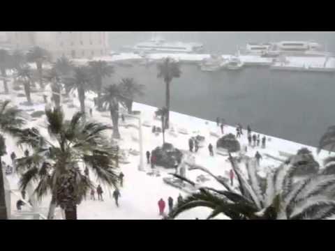


 Dieu Nalio Chery / AP


 MessageToEagle.com – Solar Max is due in the year 2013. NASA scientists make analysis of recent solar activity. and say that it’s still more to come.
 An experimental NASA computer model of the incoming CME predicted its arrival at Earth on July 14th. Credit: Goddard Space Weather Lab. animation


