Earthquakes
EMSC Central Turkey
Apr 03 05:48 AM
2.4 20.0 MAP
USGS Guerrero, Mexico
Apr 03 05:35 AM
4.7 42.8 MAP
EMSC Guerrero, Mexico
Apr 03 05:35 AM
4.8 40.0 MAP
GEOFON Near Coast Of Guerrero, Mexico
Apr 03 05:35 AM
4.6 10.0 MAP
EMSC Eastern Turkey
Apr 03 04:39 AM
2.9 8.0 MAP
EMSC Eastern Turkey
Apr 03 04:34 AM
3.0 2.0 MAP
EMSC Mindanao, Philippines
Apr 03 04:25 AM
5.1 80.0 MAP
USGS Mindanao, Philippines
Apr 03 04:25 AM
5.0 79.2 MAP
GEOFON Mindanao, Philippines
Apr 03 04:25 AM
5.1 10.0 MAP
EMSC Southern Iran
Apr 03 04:19 AM
3.5 26.0 MAP
EMSC France
Apr 03 03:39 AM
2.9 5.0 MAP
EMSC Eastern Turkey
Apr 03 03:20 AM
2.6 2.0 MAP
EMSC Near S. Coast Of Honshu, Japan
Apr 03 03:12 AM
4.9 92.0 MAP
USGS Near The South Coast Of Honshu, Japan
Apr 03 03:12 AM
4.9 88.9 MAP
USGS Near The Coast Of Northern Peru
Apr 03 03:08 AM
5.4 74.5 MAP
EMSC Near Coast Of Northern Peru
Apr 03 03:08 AM
5.3 60.0 MAP
GEOFON Near Coast Of Northern Peru
Apr 03 03:08 AM
5.1 10.0 MAP
EMSC Switzerland
Apr 03 02:45 AM
2.5 5.0 MAP
GEOFON Eastern New Guinea Reg., P.n.g.
Apr 03 02:39 AM
5.0 10.0 MAP
USGS Northern California
Apr 03 02:38 AM
2.8 21.0 MAP
EMSC Dodecanese Islands, Greece
Apr 03 02:18 AM
3.0 5.0 MAP
GEOFON Off Coast Of Central Chile
Apr 03 02:11 AM
5.1 52.0 MAP
USGS Offshore Valparaiso, Chile
Apr 03 02:11 AM
5.1 8.3 MAP
EMSC Offshore Valparaiso, Chile
Apr 03 02:11 AM
5.1 15.0 MAP
USGS Puerto Rico
Apr 03 02:03 AM
2.7 7.0 MAP
EMSC Eastern Turkey
Apr 03 01:35 AM
3.1 17.0 MAP
USGS Central Alaska
Apr 03 01:14 AM
2.9 132.1 MAP
USGS Southern Alaska
Apr 03 01:13 AM
2.6 87.0 MAP
USGS Puerto Rico Region
Apr 03 00:35 AM
2.7 5.7 MAP
EMSC Eastern Turkey
Apr 03 00:06 AM
2.6 5.0 MAP
Mexico City (CNN)
A powerful earthquake with a preliminary magnitude of 6.3 struck southern Mexico on Monday, the U.S. Geological Survey said.
The quake’s epicenter was about 17 miles (27 kilometers) from Ometepec, Guerrero. It was about 7.6 miles (12 kilometers) deep, the USGS said.
There were no immediate reports of damage or injuries.
Officials described the quake as an aftershock of the 7.4-magnitude temblor which struck in the same area on March 20, damaging hundreds of homes.
**************************************************************************************************
Volcanic Activity
Central Colombia
authorities closed the national “Los Nevados” park Sunday after an increase in seismic activity of the Nevado del Ruiz volcano.
Meteorological authorities raised the alert level to orange in 17 municipalities in Tolima and Caldas departments while visitors are prohibited to enter the park in an area in four departments.
The measures came at the beginning of teh holy week in which usually some 20,000 tourists visit the nature reserve.
An orange alert does not mean that an eruption is imminent.
Evacuation of smallest Canary Island begins after earthquake ‘swarm’ sparks fears of volcanic eruption
A holiday island popular with Britons is preparing for a mass evacuation because of a possible volcanic eruption.
Experts have recorded 150 tremors on El Hierro, the smallest of the Canary Islands, since yesterday – raising fears of an imminent eruption.
Last night 53 people were ordered out of their homes over fears of landslides and the army has been called in to prepare for a possible evacuation.
Schools on the tiny island, home to 10,000 people, have been closed and a tunnel linking the two main towns – Frontera and Valverde – has been shut.
Volcano expert Juan Carlos Carrecedo said: ‘There is a ball of magma rising to the surface producing a series of ruptures which generate seismic activity.
‘We don’t know if that ball of magma will break through the crust and cause an eruption.’
But he warned an eruption was possible ‘in days, weeks or months’.
The last volcanic eruption in the Canary Islands took place on the island of La Palma in 1971.
**************************************************************************************************
Storms, Flooding
FIJI
People in flood-ravaged Fiji have begun returning home after spending several days in evacuation centers. At least four people have died in some of the worst flooding the country has seen in decades. Officials in Fiji say locals are likely to be spared a further heavy downpour, with Cyclone Daphne, which formed on Monday afternoon, expected to pass the island. Tafazul Gani, a correspondent for a Fijian magazine, says many of the island’s residents are struggling to cope. “A lot of people are thinking ‘what do we do next? How do we cope?’ And having two floods in a matter of a couple of days, a lot of people they don’t have basically anything,” he said. Mr Gani is in one of the worst affected areas of Nadi. He says flood damage there is extensive. “Basically, if you look at the town, the town is totally decimated. It actually looks like a warzone,” he said. “There is not a single shop in the town which has not been affected. Some shops actually have nothing left, everything that was in the shop, the counter, the merchandise, everything got washed away.” But floodwaters have now begun to drop and the clean-up has started. Tourist flights into Nadi have resumed but power is still cut off in many areas. Fiji government spokeswoman Sharon Johns says the extent of damage is still being assessed. “It’s quite extensive. In Nadi town, shops in Nadi town, the floodwaters went right through that,’ she said. Over the past few days about 8,000 people sought refuge in evacuation centers. “They’re being well looked after that, rations are getting to them. We’re …organizing water sterilizers for the children especially. So evacuation centres we would expect that to decrease slowly over the coming days.” Tourist flights into Fiji were stopped last night but most airlines have resumed all services. Australia has offered $1 million in aid to Fiji for water sanitation, blankets and other supplies.
*************************************************************************************************
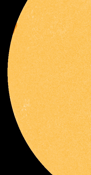
Solar Activity
2MIN News Apr2: Disaster Report, Solar/GeoPhysical Update
**************************************************************************************************
Solar System
Tarek Niazi on Surrounded by Idiots
Uploaded by sunskymysteries on Feb 7, 2012
http://www.sunskymysteries.com
Tarek is the author of More Than 60 Minutes: When Earth Stands Still and like many other science based researchers around the world, has reached the conclusion that in fact we are seeing the approach of an extra-solar body towards the Earth.
‘Unbelievable’ meteor seen in the skies over NZ
A spectacular, bright meteor that left a long trail in the sky has stunned witnesses in Wellington and Christchurch tonight.
The WeatherWatch website has been inundated with reports of the fireball, which witnesses say rushed across the sky at about 6.30pm.
A Nelson resident described it as an “unbelievable” green, orange and white ball flying past at “super speed”, leaving behind a massive trail that lasted for nearly 10 minutes before dissipating.
***************************************************************************************************
Mysterious Booms / Rumblings
Unexplained triple mystery ‘booms’ rattle houses in northern region of France
April 2, 2012 – FRANCE – A “thud” and even “three booms” were heard in the sky near Bigouden Wednesday night, March 23rd. The phenomenon remains unexplained and apparently was repeated on the night of the 24th from north to south of Finistere. There were reports also in Côtes d’Armor and Morbihan. But where do these sounds come from? “It sounded like a thud of a child stamping his feet on the wall of the neighbor,” one witness said. Testimonials are legions Bigouden. But not only. Combrit Chateauneuf-du-Faou through Briec, Quimper, Plogastel-Saint-Germain, Pont l’Abbé, Tréméoc, Cockles, Plobannalec-Lesconil or Clohars-Fouesnant, many people on Wednesday to 21h, were intrigued by the phenomenon. Some alluded that “their houses were shaken three times.’ We’re talking about “three strong rumblings” that “have rattled houses” and even awakened some. Some people, meanwhile, heard what they described as “muffled explosions” while others are convinced that this was from “an earthquake.” But neither a reported earthquake, nor aerial maneuver by aircraft can explain the mystery. Contacted, the central office Seismological French (BCSF) states that nothing abnormal registered in this area. And for its size, Chateauneuf-du-Faou Clohars-Fouesnant, the blasts and aftershocks felt “like the equivalent of a magnitude 3 earthquake in force.” In 2005, Bigoudens remember, an earthquake on the fault of south Armorican which had a magnitude 3 on the Richter scale caused the same feelings. What then of these explosions heard and felt? An air-borne cause? Regional Centre of Western navigation, it is shown have no record this kind of phenomenon. Moreover, some also said they heard a helicopter. Proceeded by “three booms” recalling it sounded like “thunder.” One thinks of an aircraft. When questioned, the communications department of the Brest Maritime Prefecture said that there was no Navy operation in the region and even less involving helicopters. An official from the Joint Staff of the area of defense and security northwest (OGZDS), said there were no operations or “supersonic flights.” Bizarre; especially considering in March of 2003, three earthquakes also hit the Bigouden and that phenomenon also remains unexplained. –Le Télégramme
**************************************************************************************************
Stories of Interest
FEMA chief says agency bracing for ‘maximum’ disaster
By Eric Berger
Recent hurricanes Ike and Katrina may rank among the three costliest storms in U.S. history, but in preparing for disasters the federal government must think bigger still, says America’s top emergency planner.
“As devastating as those two hurricanes were, they’re not as bad as it gets,” said Craig Fugate, administrator of the Federal Emergency Management Agency.
Fugate told reporters Tuesday at the National Hurricane Conference in Orlando, Fla., that his agency has been preparing for realistic worst-case scenarios – not just natural disasters, such as hurricanes and earthquakes, but terrorist attacks, as well.