Tag Archive: earthqiakes


Global Disaster Watch – Tuesday , March 7th, 2012

Earthquakes

Magnitude 5.1 earthquake, Luzon, Philippines

UTC Date / Time
Mar 05 23:06 PM

Depth
10 km

GEO: Longitude
123.780

GEO: Latitude
12.510

Source
GEOFON

Magnitude 4.5 earthquake, SOUTHWESTERN SIBERIA, RUSSIA

UTC Date / Time
Mar 06 06:49 AM

Depth
50 km

GEO: Longitude
95.750

GEO: Latitude
51.570

Source
EMSC

Magnitude 4.6 earthquake, near the east coast of Honshu, Japan

UTC Date / Time
Mar 06 09:50 AM

Depth
46.1 km

GEO: Longitude
141.638

GEO: Latitude
37.761

Source
USGS

Magnitude 4.9 earthquake, Off East Coast of Honshu, Japan

UTC Date / Time
Mar 06 11:17 AM

Depth
10 km

GEO: Longitude
142.040

GEO: Latitude
35.760

Source
GEOFON

Magnitude 4.7 earthquake, off the east coast of Honshu, Japan

UTC Date / Time
Mar 06 14:08 PM

Depth
30.8 km

GEO: Longitude
143.916

GEO: Latitude
39.545

Source
USGS

Magnitude 4.9 earthquake, Southern Sumatra, Indonesia

UTC Date / Time
Mar 06 11:36 AM

Depth
85 km

GEO: Longitude
100.090

GEO: Latitude
-0.850

Source
GEOFON

Magnitude 4.6 earthquake, Banda Sea

UTC Date / Time
Mar 06 15:48 PM

Depth
10 km

GEO: Longitude
129.530

GEO: Latitude
-7.250

Source
GEOFON

Magnitude 4.8 earthquake, Ascension Island Region

UTC Date / Time
Mar 06 16:05 PM

Depth
10 km

GEO: Longitude
-13.210

GEO: Latitude
-11.470

Source
GEOFON

Magnitude 4.9 earthquake, Kuril Islands

UTC Date / Time
Mar 06 22:33 PM

Depth
39.1 km

GEO: Longitude
154.330

GEO: Latitude
47.205

Source
USGS

Magnitude 4.8 earthquake, KYRGYZSTAN

UTC Date / Time
Mar 07 03:03 AM

Depth
1 km

GEO: Longitude
73.740

GEO: Latitude
39.570

Source
EMSC

Magnitude 4.7 earthquake, Panama

UTC Date / Time
Mar 07 04:39 AM

Depth
48.4 km

GEO: Longitude
-79.067

GEO: Latitude
9.546

Source
USGS

Magnitude 5.3 earthquake, Ryukyu Islands, Japan

UTC Date / Time
Mar 07 06:18 AM

Depth
61 km

GEO: Longitude
127.370

GEO: Latitude
25.680

Source
GEOFON

Magnitude 5 earthquake, KURIL ISLANDS

UTC Date / Time
Mar 06 22:33 PM

Depth
60 km

GEO: Longitude
154.150

GEO: Latitude
47.410

Source
EMSC

Magnitude 4.5 earthquake, CENTRAL IRAN

UTC Date / Time
Mar 07 06:57 AM

Depth
10 km

GEO: Longitude
56.760

GEO: Latitude
31.420

Source
EMSC


Magnitude 4.8 earthquake, Xizang

UTC Date / Time
Mar 07 07:23 AM

Depth
10 km

GEO: Longitude
82.000

GEO: Latitude
34.240

Source
GEOFON

Tremor near Mullaperiyar Dam

http://ibnlive.in.com/news/tremor-near-mullaperiyar-dam/236615-60-122.html

Volcanic  Activity

Owner : “It’s like a funeral” as Lava claims last home in Hawaii community.

http://www.videocounty.com/videos/owner–its-like-a-funeral-as-lava-claims-last-home-in-hawaii-community/

Drought

 Spain wilts in driest winter for 70 years

http://www.terradaily.com/reports/Spain_wilts_in_driest_winter_for_70_years_999.html

Storms

Snow, cold add to tornado survivors’ misery

http://usnews.msnbc.msn.com/_news/2012/03/05/10580677-snow-cold-add-to-tornado-survivors-misery

Solar Activity

Sun unleashes another dramatic solar flare

Geomagnetic storms expected to sweep past our planet, sparking auroras

http://www.sott.net/articles/show/242530-Sun-unleashes-another-dramatic-solar-flare

Lights in the Sky

Mystery fireball lights up sky in Victoria and Tasmania

Solar System


Asteroid 2012 DA14 on the mainstream

Uploaded by Envylife904 on Mar 6, 2012

As of today (3/6/12) asteroid 2012 DA14 impact probability look’s like this:

Impact Probability: 2.1e-04

0.021000000% chance of Earth impact
or
1 in 4,760 chance
or
99.97900000% chance the asteroid will miss the Earth

JPL Small-Body Database Browser
http://ssd.jpl.nasa.gov/sbdb.cgi?sstr=2012DA14;cad=1#cad

Impact Probability
http://neo.jpl.nasa.gov/cgi-bin/ip?2.1e-04

Huge asteroid hurtling towards Earth will fly past our planet so close it will go UNDER many man-made satellites

Read more: http://www.dailymail.co.uk/sciencetech/article-2110396/Asteroid-2012-DA14-NOT…
http://www.dailymail.co.uk/sciencetech/article-2110396/Asteroid-2012-DA14-NOT…

NBC News – Recommends To Get Your Affairs In Order – March 6, 2012

Misc

What’s causing the mysterious sounds coming from the sky that are so loud they set off car alarms?

By Ted Thornhill

http://www.dailymail.co.uk/sciencetech/article-2110523/Whats-causing-mysterious-sounds-coming-sky-loud-set-car-alarms.html?ito=feeds-newsxml

Avalanche blankets Afghan village, kills at least 37

http://uk.reuters.com/article/2012/03/06/uk-afghanistan-avalanche-idUKTRE8250KL20120306


Global Disaster Watch – March 5th, 2012

Earthquakes

Magnitude 5.1 earthquake, Off Coast Of Central America

UTC Date / Time  Mar 04 09:44AM

Depth  60 km  GEO: Longitude  -84.470

GEO  Latitude  2.630

Source  EMSC

Magnitude 5.5 earthquake, Southeast of Loyalty Islands

UTC Date / Time   Mar 04 12:49 PM

Depth 10 kmGEO: Longitude169.760GEO: Latitude-21.510

Source
GEOFON

Magnitude 4.5 earthquake , Luzon,Philippines

UTC Date / Time  Mar 04 14:26 PM

Depth 152.5 km    GEO: Longitude120.625   GEO: Latitude14.254

Source
USGS

Magnitude 5.1 earthquake, Southern Sumatra, Indonesia

UTC Date / Time   Mar 04 23:17 PM

Depth 10 km   GEO: Longitude 102.490 GEO: Latitude -4.500

Source
GEOFON

Magnitude 4.5 earthquake, Southwestern, Siberia, Russia

UTC Date / Time   Mar 04 23:33 PM

Depth 14.9 km GEO: Longitude 95.983 GEO: Latitude 51.542

Source
USGS

Magnitude 4.5 earthquake,Northern Algeria

UTC Date / Time   Mar 05 02:45 AM

Depth  10 km GEO: Longitude  0.690 GEO: Latitude 36.520

Source
EMSCKuril Islands,

Magnitude 4.8 earthquake, Kuril Islands

UTC Date / Time Mar 05 03:33 AM

Depth123 km GEO: Longitude153.450 GEO:Latitude  46.250

Source
GEOFON

Magnitude 4.8 earthquake, Southeast of Loyalty

Date / Time  Mar 05 05:14 AM

Depth 287 km GEO: Longitude 169.720

GEO: Latitude –22.130

Source
GEOFON

Solar Activity

BIG SUNSPOT: A sunspot almost four times as wide as Earth itself is rotating onto the solar disk. NASA’s Solar Dynamics Observatory recorded its entrance on March 2nd and 3rd; click to view a 24-hour animation:

The sunspot has a ‘beta-gamma’ magnetic field that harbors energy for strong M-class solar flares. Indeed, it has already unleashed an M3-class eruption on March 2nd that created mild waves of ionization in the atmosphere over Europe.

Earth-effects could become stronger as the sunspot turns toward our planet in the days ahead. NOAA forecasters estimate a 55% chance of additional M-class flares and a 5% chance of an X-flare during the next 24 hours. Solar flare alerts: text,phone.

more images: from Dennis Put of Brielle, The Netherlands; from Pavol Rapavy of Observatory Rimavska Sobota, Slovakia; from Maximilian Teodorescu of Bucharest, Romania; from Jim Werle of Henderson, Nevada;

THE SUN TODAY: 4 March 2012 – ANOTHER HUGE FLARE

Solar System

The Lunar Cataclysm

http://www.astrobio.net/pressrelease/4603/the-lunar-cataclysm

Drought

Portugal prays for rain as drought adds to crisis

http://www.reuters.com/article/2012/03/03/us-portugal-drought-idUSTRE8220EV20120303

Tornadoes

Tornadoes cut violent path across U.S. leaving trail of destruction and 37 dead

Tornadoes cut violent path across U.S. leaving trail of destruction and 38 dead

Whole town ‘completely gone’ after Indiana tornado

http://www.sott.net/articles/show/242398-Whole-town-completely-gone-after-Indiana-tornado

Storms Demolish Small Towns in Indiana, Kentucky; 38 Dead

http://www.sott.net/articles/show/242471-Storms-Demolish-Small-Towns-in-Indiana-Kentucky-38-Dead

Volcanic Activity

The Tungurahua volcano increased its activity level at 18:30 on Saturday. According to the technicians of the Observatory of the Geophysical Institute, this is characterized by the explosive ejection of incandescent rocks with additional steam and ash. Moreover, the intensity of the bellows rose relative to those detected at 14:20 on the start of this new eruptive process.  Jorge Bustillos, a volcanologist, said the expulsion of the material reaches 500 meters above the crater and the vapor cloud 800. “The activity is Strombolian type, this is identified by the output of lava, steam and ash.”  Lookouts of the colossus said there was a fall of volcanic dust cam in communities Puela, Chonglontus and El Manzano, in Chimborazo. The cloudy nights have impeded direct observation of the giant crater.  Serafin Medina, a resident of Palictahua said that since the late bellows have been emitted from the volcano, activity at the volcano has increased. “We listen to what they say the technicians of the Geophysical Institute.” –El Comerico translated

Lights in the Sky

Green Object Reported in the Sky Over Newfoundland

http://www.sott.net/articles/show/242337-Green-Object-Reported-in-the-Sky-Over-Newfoundland

Green Fireball Seen All Over Southeastern Canada

http://www.sott.net/articles/show/242383-Green-Fireball-Seen-All-Over-Southeastern-Canada

Fireball seen from southern Norway and Sweden

http://www.sott.net/articles/show/242443-Fireball-seen-from-southern-Norway-and-Sweden

Meteor Lights up the Sky Across England

http://www.sott.net/articles/show/242478-Meteor-Lights-up-the-Sky-Across-England

Thousands Witness Spectacular Fireball Streak Over UK (VIDEO)

http://www.sott.net/articles/show/242486-Thousands-Witness-Spectacular-Fireball-Streak-Over-UK-VIDEO-

Radioactivity

Tokyo Bay Radioactive Cesium Deposits Now Over 10 Inches Deep

http://www.sott.net/articles/show/242464-Tokyo-Bay-Radioactive-Cesium-Deposits-Now-Over-10-Inches-Deep

Asteroids

Asteroid 2012 DA14 heads for Earth next year

Misc

3MIN News Mar4: Earthquake Watch, M-FLARE WHILE UPLOADING!

Uploaded by on Mar 1, 2012

original text report from Luann Gogglin Patterson (on facebook) many thanks to her for catching the plumes AND REPORTING IT so it can get out on video…

quote from our facebook chat:

“LuAnn Goggin Patterson
Chat Conversation Start
Today
LuAnn Goggin Patterson
Big plume in southern MO right now. And crazy CT’s in northeast MO too.
Michael Janitch
checking now…. !!! you rock for reporting this.. no one else is saying anything!
Michael Janitch
you are a freakin’ HERO !!! i give you a shout out in my video processing now.. your report BEFORE the earthquake hit in the new madrid just now.. GOOD WORK !!!!!!!!!!!!”

I recorded a whole video on the plumes .. then as the video was processing .. a 2.9M earthquake struck the New Madrid Seismic Zone (TN and AR border).

The plume area in Arkansas is coming from near the dormant volcanic chain which includes Murfreesboro Diamond mine state park … a dormant volcano where you can dig for diamonds.

Also in south-east Missouri — there resides a dormant volcano — not marked on any map.. but you can see the county (i have done this already myself) .. go look up that county on google earth .. and look for the ONLY standalone mountain in the area.. zoom in… and you will see it … clearly an UNMARKED or UNKNOWN dormant volcano.. (for sure unnamed).

The whole event happened this afternoon (March 1, 2012) — viewable on College of Dupage (or any other visible satellite of the midwest USA) …

To view the event still live on satellite feed… select the 1km visible satellite view of Arkansas … do this ASAP before its gone into archives…
http://weather.cod.edu/satrad/index.php

Thursday, March 1, 2012

**Love is like war: Easy to begin but hard to end.**
Anonymous

No update tomorrow, March 2 or Sunday, March 4,
due to other obligations.http://globaldisasterwatch.blogspot.com/2012/03/thursday-march-1-2012.html

LARGEST QUAKES –
This morning –
5.1 VANUATU
5.0 OFF EAST COAST OF HONSHU, JAPAN

Yesterday –
2/29/12 –
5.0 JAVA, INDONESIA
5.4 NEAR EAST COAST OF HONSHU, JAPAN
5.8 NEAR EAST COAST OF HONSHU, JAPAN
5.4 NEAR EAST COAST OF HONSHU, JAPAN
5.3 KURIL ISLANDS
5.6 VANUATU
5.2 SANTA CRUZ ISLANDS
5.2 KURIL ISLANDS

VOLCANOES –

Indonesia – Mount Marapi, a volcano located in the Indonesian province of West Sumatra, briefly erupted on early Wednesday morning, officials said. It comes after activity was also reported at the volcano in August 2011.

TROPICAL STORMS
In the Indian Ocean –
-Tropical cyclone 14s (Irina) was located approximately 225 nm west-northwest of Antananarivo, Madagascar.
-Tropical cyclone 15s was located approximately 525 nm northeast of Port Louis, Mauritius.

Tropical Cyclone Irina is set to strengthen between Mozambique and Madagascar and could ultimately make a destructive landfall in the region. Flooding rain could target a wide area along with a growing threat of damaging wind this week.

SEVERE RAIN STORMS, FLOODING, LANDSLIDES –

U.S. – The belt of severe storms that earlier killed at least nine people in the Midwest crashed east through Tennessee Wednesday night, where officials reported that three people died and several homes were destroyed. Severe storms hit central Tennessee, between Nashville and Knoxville, in the early evening, with reports that a tornado touched down near Crossville. An unknown number of others were injured after becoming trapped under several houses destroyed in the storms. Emergency officials were working to rescue those trapped and several were evacuated from the scene by a medical helicopter. Much of Tennessee was under a tornado watch Wednesday, as the deadly storm system rolled east towards North Carolina, South Carolina, Alabama and Virginia – where the NWS also issued tornado watch alerts.
Late Wednesday the NWS was reporting widespread damage to homes, barns and power lines – as well as numerous trees blocking roads – in eastern Tennessee, Alabama and West Virginia. Earlier six people were killed when a tornado reportedly touched down in Harrisburg, Illinois, while three others were killed as the storms struck Missouri. In Harrisburg, officials have not yet confirmed figures for structural damage and injuries, though close to 100 were wounded in the disaster that killed four women and two men.
The twister came out of a severe storm system that ripped through Kansas, Missouri and Illinois overnight and early Wednesday – before many people were awake to tune into local warnings – leaving dozens injured and possibly hundreds of businesses and homes damaged or destroyed across the region. Weary residents may get some good news today as the monster storm system is expected to weaken.

Australia – Residents in a Victorian town are being warned to evacuate, people have been rescued from cars and several towns have experienced RECORD RAINFALL as heavy rain hits the state’s northeast. Some parts of the state’s northeast exceeded their monthly average rainfall today. Wodonga recorded 88mm of rain this morning compared to the previous March record of 84mm in 1926, Rutherglen had 81mm of rain compared to the last record of 61mm in March 1939 and Mangalore recorded 71mm, compared to the previous record of 65 in March 1970. “February and March are usually the driest months. Normally in summer and autumn there’s a lot of dry days, but this has certainly gone above the monthly average in one day.” Heavy showers were forecast again for Saturday.
Residents in Tallygaroopna, north of Shepparton, are being advised to prepare to evacuate. Tallygaroopna received about 70mm of rain overnight and up to 40 properties had experienced flooding. The town was “pretty well inundated”. While residents have been advised to evacuate, most people remained and were trying to save properties.

Tunisia – A combination of melting snow, overflowing rivers, and heavy rains flooded parts of northwestern Tunisia in late February.

Wednesday, February 29, 2012

**Three things can’t be hidden:
coughing, poverty, and love.**
Yiddish proverb

LARGEST QUAKES –
This morning –
5.1 KURIL ISLANDS

Yesterday –
2/28/12 –
5.1 KEPULAUAN BARAT DAYA, INDONESIA
5.4 OFF EAST COAST OF HONSHU, JAPAN
5.0 NEAR EAST COAST OF HONSHU, JAPAN
5.1 OFF EAST COAST OF HONSHU, JAPAN
5.0 OFF EAST COAST OF HONSHU, JAPAN
5.2 KURIL ISLANDS
5.2 KURIL ISLANDS
5.5 BONIN ISLANDS, JAPAN REGION

Moderate quake jolts east Iran, 6 hurt – A magnitude 5.4 quake hit a sparsely populated area at 10 pm on Monday. It damaged buildings, roads, and water canals as well as the nearby dam in the town of Ravar, some 750 kilometers southeast of the capital Tehran. A magnitude 4.6 quake hit late on Tuesday and a 4.7 hit early today.

‘Devil’s chain reaction’ was feared after 2011 Japan quake – Recovery workers at Japan’s crippled Fukushima nuclear plant still fear for the future, one year after the country’s worst ever nuclear accident. The Former Japanese Prime Minister ordered workers to stay at the Fukushima Daiichi nuclear plant after the massive earthquake and tsunami on March 11 last year as fears mounted of a “devil’s chain reaction” that would force tens of millions of people to flee Tokyo, a new investigative report shows. About three days after the March 11 earthquake and tsunami, his staff began referring to a worst case scenario that could threaten Japan’s existence as a nation. That was when fears mounted that thousands of spent fuel rods stored at a damaged reactor would melt and spew radiation after a hydrogen explosion at an adjacent reactor building. Japan’s then top government spokesman said that at the height of tension he feared a “devil’s chain reaction” in which the Fukushima Daiichi plant and the nearby Fukushima Daini facility, as well as the Tokai nuclear plant, spiralled out of control, putting the capital at risk.
He stepped down last September as he came under fire for his handling of the crisis, including flying over the plant by helicopter the morning after the disasters hit – a move some critics said contributed to a delay in the operator’s response. He was haunted by the spectre of a crisis spiralling out of control and forcing the evacuation of the Tokyo greater metropolitan area, 240km away and home to some 35 million people.
After the quake and tsunami struck, three reactors melted down and radiation spewed widely through eastern Japan, forcing tens of thousands of residents to evacuate from near the plant. Plant operator Tokyo Electric Power Co, known as Tepco, managed to avert the worst scenario by pumping water, much of it from the sea, into Daiichi’s damaged reactors and spent fuel pools. The reactors were stabilised by December.
A year after the disaster, however, Fukushima Daiichi still resembles a vast wasteland. High radiation levels hamper a cleanup that is expected to take decades. The damaged 40-metre-high No.2 reactor building stands like a bird’s nest of twisted steel beams. A Tepco official who accompanied foreign media to the plant on Tuesday said metal debris was being painstakingly removed by giant cranes and pincers as radiation doses were too high for workers. Another challenge is keeping a new cooling system, built from a myriad of technologies and prone to breaking down, running without major glitches. “An earthquake or tsunami like the ones seen a year ago could be a source of trouble for these (cooling) systems. But we are currently reinforcing the spent fuel pool and making the sea walls higher against tsunamis. A series of back up systems is also being put in place in case one fails.”
Confused media reports at the time of the accident said Tepco had threatened to withdraw workers from the plant, but that Kan ordered them to keep staff on-site. “Now Tepco is saying there was no request for a complete pullout, that it only asked for a partial withdrawal. The truth may never come out, but as a result, 50 Tepco staff stayed behind and … the worst case scenario was averted.” How many of those who stayed were volunteers is a mystery. “An order was likely given for full-time employees to stay behind. We may eventually find out who volunteered to stay, but the impression from our investigation is that they are under strict orders to remain silent.”

TSUNAMI / FREAK WAVES / ABNORMAL TIDES –

Japan Government quake panel cut tsunami warning from report prior to March 11 – The science ministry’s earthquake research panel omitted a warning from a report, eight days before the March 2011 earthquake and tsunami, that a massive tsunami could hit northeastern Japan “at any moment”, despite having earlier planned to include it. The Earthquake Research Committee had presented the report eight days before the March 11 disaster to an unofficial meeting among the ministry, Tokyo Electric Power Co. and two other utilities but ended up not publicizing it. Committee members decided to delete the warning as they viewed it “inappropriate to use the same expression” as that used to describe an expected major earthquake in the Tokai region, central Japan, which was regarded “more imminent.” Reference to the possible quake in the Pacific off eastern Japan was further weakened at the request of power utilities at the March 3 meeting.
Comprising more than a dozen members, mostly academics, the panel was compiling the report as part of a review of its long-term evaluation on the frequency of big quakes in the region ranging from the Sanriku coast in northeastern Japan to the Boso Peninsula in Chiba Prefecture. The draft report had a new article entitled “from the sea off Miyagi Prefecture to the sea off Fukushima Prefecture” and said a temblor that entails a gigantic tsunami could occur at any moment based on recent research that such tsunami hit the coast four times over the past 2,500 years.But after some membeers argued that such an expression could be linked with the projected Tokai quake, which was said to be 87 percent likely to occur within 30 years, it was weakened to simply noting that a major quake could occur off the Pacific coastline in eastern Japan. References to research having found tsunami-caused sediment at a rate of every 450 to 800 years, and that 500 years had passed since the latest major quake were also deleted. After the March 2011 disaster, the committee under the Education, Culture, Sports, Science and Technology Ministry estimated that the quake, if it were predictable beforehand, was 10 to 20 percent likely to occur within 30 years as of March 11 last year. (photos)

TROPICAL STORMS
In the Indian Ocean –
Tropical cyclone 14s (Irina) was located approximately 270 nm northwest of Antananarivo, Madagascar. Is now intensifying over the Mozambique Channel. Forecasts expect it to move across The Channel and into Mozambique, north of Maputo.

EXTREME HEAT & DROUGHT / WILDFIRES / CLIMATE CHANGE –

Extreme Weather in Western China Continues – Natural calamities are taking a toll on provinces in western China. In the north, people suffer from severe snowstorms, while southwestern areas are coping with prolonged drought. Cold weather continues to plague the northwestern Xinjiang region of China. Over $900,000 of damage was reported. Barns, houses, and livestock have all fallen victim to the freezing temperatures.
Meanwhile in the southwestern Yunnan province, some villagers haven’t seen rain since last November. Over six million people are affected by the drought. “It’s very difficult for our village. If the drought goes on for another two days, we’ll have to fetch water from three kilometers (1.86 miles) away and carry it back on our cattle. There’s nothing we can do. We don’t have a pump to transport water.” State media announced on Wednesday that $19 million has been set aside to assist the areas worst hit by the drought. (video)


Volcanic Activity

Mexico Popocatepetl volcano rumbles with 16 low intensity emissions – alert level, Phase 2, yellow

by The Extinction Protocol

February 28, 2012MEXICO (Notimex) – The National Center for Disaster Prevention (Cenapred) reported that in the last 24 hours, the Popocatepetl volcano registered 16 emissions of low intensity, accompanied by emissions of water vapor, ash, and gas. The body of the Interior Ministry said in a statement that the largest emissions occurred yesterday at 14:50 and 17:12 hours during the night glow was observed on the volcano, while the rest of the monitoring parameters remain approximately unchanged. He said, at the time of the report, a slight emission of water vapor and gas was flashing from the volcano. The volcanic alert remains in Phase 2 yellow. The Ministry said there were moderate exhalations, some with ash emissions, sporadic bursts of low to moderate probability of emission of incandescent fragments within walking distance of the crater and incandescent light in the observable crater overnight. The Cenapred explained that a security parameter remains in a 12 kilometer radius of the volcano, so staying in that area is not permitted and controlled traffic is maintained between Santiago and San Pedro Nexapa Xalitzintla via Paso de Cortes. He called the Civil Protection authorities to maintain preventive procedures, according to their operational plans and to keep people alert to the official information that is released. –Yucatan  translated

Monday, February 27, 2012

Russia – East Siberia Quake to Trigger New Series of Tremors says scientist. The 6.8 magnitude earthquake that struck the Tyva republic in Russia’s East Siberia on Sunday will trigger a new series of earthquakes in the region, a Russian scientist said. “Judging from the data received from our stations, this is not the continuation of the Tyva earthquake that occurred in late 2011 with its epicenter at the Academician Obruchev Ridge but signals a new series of earthquakes.”
The earthquake, the second powerful tremor in East Siberia in the past two months, had its epicenter located 107 km (66 miles) east of the city of Kyzyl near the border with Mongolia, at a depth of 15 km. The earthquake struck at 10:20 a.m. Moscow time (06:20 GMT) with a magnitude of 6 to 7 points in the epicenter. The earthquake caused no casualties or damage, according to preliminary data reported by the Russian Emergencies Ministry. The previous earthquake with a 6.7 magnitude occurred in December 2011 in the Kaa-Khemsky district of Tyva, some 100 km east of the city of Kyzyl, at a depth of 10 km. The tremor caused no destruction or casualties. The next earthquake was expected to strike closer to Lake Baikal. Normally, a fault that becomes active in one area causes a series of decreasing tremors by their magnitude. “In this case, it is most likely that some neighboring fault became active near the previous one. This means that Tyva will now be rattled by two series of earthquakes simultaneously.”


**The most wasted day is that in which we have not laughed.**
Chamfort

LARGEST QUAKES –
This morning –
5.3 SOUTHERN MID-ATLANTIC RIDGE
5.4 KURIL ISLANDS
5.2 SOUTH OF FIJI ISLANDS
5.2 SOUTHWESTERN RYUKYU ISL., JAPAN
5.0 BOUGAINVILLE REGION, P.N.G.

Yesterday –
2/26/12 –
5.1 SOUTH OF FIJI ISLANDS
5.0 FIJI REGION
5.2 SOUTH OF FIJI ISLANDS
5.0 SOUTH OF FIJI ISLANDS
5.4 SOUTH OF FIJI ISLANDS
5.1 SOUTH OF FIJI ISLANDS
5.3 SOUTHWESTERN SIBERIA, RUSSIA
5.2 SOUTHWESTERN SIBERIA, RUSSIA
5.0 SOUTHWESTERN SIBERIA, RUSSIA
6.8 SOUTHWESTERN SIBERIA, RUSSIA
5.1 TARAPACA, CHILE
5.6 SOUTH OF KERMADEC ISLANDS
5.9 TAIWAN

Strong earthquake hits Taiwan, causing minor property damage in south – A strong earthquake struck Taiwan on Sunday, causing minor damage in the southern part of the island. There were no immediate reports of casualties and no tsunami warning was issued.

Magnitude 6.8 quake shakes Siberia – Residents of multistory apartment buildings said objects tumbled off of shelves, windows rattled and chandeliers swayed during the quake. The earthquake hit about 60 miles east of Kyzyl.

TROPICAL STORMS
No current tropical storms.

EXTREME HEAT & DROUGHT / WILDFIRES / CLIMATE CHANGE –

United Arab Emirates – Dust storms cause chaos – but cyclone rumour is just hot air. Dust storms battered large parts of the country yesterday, forcing schools to close and halting operations at ports – and sparking rumours of an imminent cyclone. Dozens of minor traffic accidents were reported in low visibility and light rain that swept the northern emirates and parts of Dubai.
The poor weather was responsible for a flurry of online rumours about an impending cyclone, which forecasters rejected as scaremongering. A top trending subject on Twitter was #sandstorm, with many residents sharing a BBM alert that a cyclone would strike at around 1pm. A forecaster at the National Centre for Meteorology and Seismology in Abu Dhabi said the rumour had “no basis in reality. Many people are interested about the weather and they like to make exciting rumours. We are really suffering from these people.”
When 1pm came and went without incident, many Twitter users lampooned the prediction. Most of the dust had cleared by yesterday afternoon, but temperatures are expected to remain low for a few days. The dust was part of a large sandstorm that swept over parts of Saudi Arabia at the weekend.
The last time sandstorms hit the country, at the beginning of January, dozens of cruise ships were delayed.
Waves off the north coast were expected to reach four metres and a warning was issued to boat owners to stay onshore. In the Kalba area of Sharjah, sea levels were dangerously high, with water flowing over roads close to the coast. “The Kalba corniche itself is fully flooded with water. One could think it rained heavily, but not a single drop came from heaven. All the water is coming from the sea.”
After the ‘cyclone’, UAE wakes up to earthquake rumors. The National Centre of Meteorology and Seismology (NCMS) has cautioned public against believing rumors of an earthquake in the northern parts of the UAE. In a statement issued on Sunday, the NCMS warned against unofficial predictions spreading through text messages and social networking websites, and urged citizens and residents in the UAE to get weather information only from authorised and reliable sources. On Sunday the dusty, hazy and near-zero-visibility weather has sent social networks into a storm of rumours and scaremongering, even as by Sunday evening the massive sandstrom had lost a lot of its velocity. As the evening approached, the winds died down appreciably letting residents breathe a sigh of relief. Traffic continued to remain terribly slow on most roads in and around Dubai and Sharjah. The weather conditions also forced some schools in Dubai to remain closed on Sunday.

SPACE WEATHER –

Five Solar Eruptions in 2 Days – CME On the Way – The sun produced five eruptions over a two day period. From February 23 through February 24 our sun produced an astonishing five solar eruptions, launched from the top, bottom, left and right sides of the solar disk. Four of those eruptions came in just a 24 hour period. One of the eruptions, a large snaking magnetic filament, erupted during the early hours of February 24 and launched the first of two coronal mass ejections (CME) in Earth’s direction. Though the February 24 solar eruption provided quite a show, the associated coronal mass ejection (CME) that impacted Earth’s magnetic field on Feb. 26 around 4:00pm EST (2100 UT) was weak and does not appear set to cause a strong geomagnetic storm. (satellite images)

Food-chain unraveling: Livestock plagues hit U.S., Nepal, and UK, mystery virus killing numerous animals

by The Extinction Protocol

February 27, 2012BRITAIN – Thousands of lambs are dying in Britain. The Schmallenberg virus causes lambs to be born dead or with serious deformities such as fused limbs and twisted necks, which mean they cannot survive. Scientists are urgently trying to find out how the disease, which also affects cattle, spreads and how to fight it, as the number of farms affected increases by the day. So far, 74 farms across southern and eastern England have been hit by the virus, which arrived in this country in January. A thousand farms in Europe have reported cases since the first signs of the virus were seen in the German town of Schmallenberg last summer. The National Farmers Union has called it a potential “catastrophe” and warned farmers to be vigilant. “This is a ticking time bomb,” said Alastair Mackintosh, of the NFU. “We don’t yet know the extent of the disease. We only find out the damage when sheep and cows give birth, and by then it’s too late.” It is unclear exactly how the disease arrived in Britain, but the leading theory is that midges carried the virus across the Channel or North Sea in the autumn. However, scientists cannot yet rule out transmission of the disease from animal to animal. Infected ewes do not show any symptoms of the virus until they give birth, with horrific results. Farmers have described delivering the deformed and stillborn animals as heartbreaking. The lambing season has only just begun, which means that the full impact of the disease will not be felt until the weather warms up and millions more animals are born. On the Continent, some farms have lost half of their lambs. So far the worst hit in Britain have lost 20 per cent, according to the Department for Environment, Food and Rural Affairs (Defra). Approximately 16 million lambs are born in Britain every year and sell at market for about £100 each. The effect of the disease on farms that are already struggling in the downturn could be severe. –Telegraph \
DHADING, Nepal – More than 20,000 chickens have died of unidentified disease in Naubise VDC’s Dharke and surrounding areas in the past one week. Livestock Development Officer Dr Shivaji Prasad Das of District Livestock Service Office said chickens had been dying but since the farmers kept mum more chickens could not be prevented from dying. It was only yesterday that a team including Dr Das went to the incident site. It sent dead chickens for tests to Kathmandu’s Central Livestock Disease Control Laboratory today. According to Dr Das, test report will be out in three days. In the poultry farm owned by Ram Koirala of Dharke 3,500 died within two weeks. In Salikgram’s farm 3,000 fowls have died. Thousands of chickens have died in other farms as well. Farmers estimate that they have lost more than Rs 50 lakhs. Ram Koirala, Proprietor of Dharke-based Ram Laxman Poultry Farm, said, “We had taken the chickens to Kathmandu’s Gauri Shankar Vet Farm as soon as we found out they were suffering from some disease. The vets there said chickens suffered from Ranikhet disease.” Farmers are worried that chickens are dying even after treatment of Ranikhet disease. Meanwhile, the Cabinet decided today to declare three districts of eastern region — Ilam, Sunsari and Jhapa — as bird flu affected areas and directed the government agencies to adopt effective measures to control the disease. – The Himalayan Times 
MAURY COUNTY, Tenn. — Horses are dying and now cattle as well and detectives in Maury County have been at a loss to explain how or why it is happening. First, seven seemingly healthy horses turned up dead last week at a Hampshire farm in Maury County.  The state performed a necropsy and released the results. “They ruled that it’s undetermined. The cause of death cannot be determined at this time. It is a mystery. We don’t know what happened,” said Detective Terry Chandler with the Maury County Sheriff’s Department. Now Detective Chandler is investigating more deaths: Two dead cows at a farm across from the one where the seven horses were found. And he’s consulting with police looking into more mysterious horse deaths in Dickson and Giles County. Chandler said there is no evidence anyone is intentionally harming the animals. He said they have not ruled out the possibility the livestock died from eating contaminated hay or a poison plant.  It’s possible the toxins were not detected by the state testing. –News Channel 5

ALERT! All Seismos Going Off

http://earthquake.usgs.gov/monitoring/operations/heliplots_gsn.php

Sunday, February 26, 2012

 http://globaldisasterwatch.blogspot.com/2012/02/sunday-february-26-2012.html

Russia – A strong 6.8 magnitude earthquake hit Russia’s south-eastern and sparsely populated region of Tuva on Sunday, shaking residents near the Mongolian border from their sleep, but there were no immediate reports of injuries or damage. The epicentre of the quake was some 90km east of the Russian city of Kyzyl in the Tuva region of Siberia. It struck around 0617 GMT (2.17pm Singapore time) at an estimated depth of 11.7km.
It was the second strong quake to rock the region in two months. In December, coal mining operations in Russia’s largest coal producing region, the Kuzbass, were suspended when a 6.9 magnitude quake hit near Kyzyl. Residents in Kyzyl’s city centre gathered outside as the local emergencies ministry warned of potential aftershocks.

**I hope I shall possess firmness and virtue enough
to maintain what I consider the most enviable of all titles,
the character of an honest man.**
George Washington

LARGEST QUAKES –
This morning –
5.3 TARAPACA, CHILE
5.0 SOUTHWESTERN SIBERIA, RUSSIA
6.8 SOUTHWESTERN SIBERIA, RUSSIA
5.7 SOUTH OF FIJI ISLANDS
5.1 SOUTH OF FIJI ISLANDS
5.9 TAIWAN

Yesterday –
2/25/12 –
5.1 KURIL ISLANDS
5.2 SAMAR, PHILIPPINES
5.0 KURIL ISLANDS
5.2 KURIL ISLANDS
5.2 SOUTH OF FIJI ISLANDS
5.2 MAUG ISLANDS REG, N. MARIANA IS.

2/24/12 –
5.1 SOUTHERN SUMATRA, INDONESIA
5.3 MOLUCCA SEA
5.2 NORTHERN COLOMBIA
5.0 LEYTE, PHILIPPINES

Japan’s earthquake could bode ill for U.S. Pacific Northwest – Scientists are still unraveling last year’s giant earthquake and tsunami in Japan, and some of what they’re finding doesn’t bode well for the Pacific Northwest. Detailed analyses of the way the Earth warped along the Japanese coast suggest that shaking from a Cascadia megaquake could be stronger than expected along the coasts of Washington, Oregon and British Columbia. “The Cascadia subduction zone can be seen as a mirror image of the Tohoku, (Japan) area.”
In Japan, the biggest jolts occurred underwater. The seafloor was displaced by 150 feet or more in some places, triggering the massive tsunami. But in the Northwest, it’s the land that will be rocked hardest — because the Pacific coast here lies so close to the subduction zone. “The ground motions that we have from Tohoku may actually be an indication that there could be much stronger shaking in the coastal areas of British Columbia, Washington and Oregon.” Cities like Seattle, Portland and Vancouver, B.C., are far enough from the coast that they might dodge the most violent hammering. But all of the urban areas sit on geologic basins that can amplify ground motion like waves in a bathtub. The U.S. Geological Survey is already at work on a new analysis of how hard the ground is likely to shake and how close the rupture zone might come to urban areas the next time the Cascadia subduction zone really lets loose. The last time was in 1700, and the resulting quake was a magnitude 9 — just like the monster that struck Japan on March 11, 2010.
Japanese scientists are struggling to answer several haunting questions: Why was the quake so big? How did the tsunami swell to such giant proportions? And why was it such a surprise to the world’s most earthquake-savvy nation? Seismologists were fooled by a series of small quakes that rocked the area every 35 years or so. They believed each small quake relieved the pressure on the subduction zone — the boundary where two geologic plates slip past each other as the ocean floor shoves under the continent. Now they realize strain continues to build until the series of small quakes is punctuated by a giant one about every 700 years. Similar quakes and tsunamis struck in the years 869 and 1896, but Japanese scientists failed to look far enough into their own history.
The longest record for a subduction zone is from Cascadia, where scientists have linked buried marshes and submarine landslides with a series of about 22 megaquake quakes going back 10,000 years. The time between quakes ranges from 200 to 1,000 years, with an average of about 500 years. There’s no obvious “supercyle” of supergiant quake in Japan. But it is clear that quakes on Cascadia have varied in size. Some geologists argue the magnitude-9 quake 300 years ago was simply average and that the Northwest has been slammed by quakes twice as big in the distant past. Most earthquake scenarios for the Northwest coast project tsunamis of about 30 feet, and scientists still don’t know how much that needs to be ratcheted up post-Tohoku. Walls of water up to 120 feet high washed away entire communities on the Japanese coast. “Does Cascadia also have a 40-meter tsunami coming onshore?”
One emerging theory suggests seafloor topography might be key. Oceanic plates dotted with mountains seem to hang up and slip more frequently as they scrape under continental plates. The result is a series of smaller quakes that occur when segments of the fault break. Giant quakes seem to occur most frequently where the seafloor is smooth and featureless, as off the Northwest coast. With no surface bumps and hills to interfere, the two plates can stick together over vast distances. When they slip, the whole fault breaks at once.
‘We’ve got a billion dollar problem, but we don’t have a billion dollars.’ – Liquefaction in the recent subduction zone earthquake in Japan caused entire buildings to sink several feet lower than they had been previously. The repercussions of last year’s subduction zone earthquake and tsunami in Japan are now being felt in the Pacific Northwest, as experts and disaster managers better understand the enormous risks facing this region, plan for the challenges ahead and prioritize the most urgent needs.
Before the event, scientists knew that similar concerns faced Oregon, Washington, northern California and British Columbia from the Cascadia Subduction Zone. But they have now seen how such long-lasting events produce soil “liquefaction” far worse than expected, the potential for devastated roads and bridges, a collapsed infrastructure and even threats to their economic future. “Just in Oregon we’ve got a billion dollar problem, but we don’t have a billion dollars. The challenge for Oregon and our neighboring states is to prioritize the concerns, and figure out some way to preserve the most critical lifelines – key roads, airports, port facilities and utility networks. In Japan, nearly 30,000 people died, many in the days after the disaster because no one could reach them. We don’t want that to happen here, and we don’t want our economy to collapse.”
The Japanese event has galvanized some action, but much more remains to be done. It prompted the legislature to call for an Oregon Resilience Plan that will explore many of these issues – an emergency transportation plan, needed seismic upgrades, ways to protect life and public safety and allow a shattered region to rebuild. One of the primary lessons from Japan is the enormous damage done by liquefaction – a continued shaking of the ground that turns soils into mush. In events such as this, it is amplified by the sheer length of the event, an earthquake that can shake not just for 30 seconds but up to five minutes.
Many of the soils in Portland, parts of the Willamette Valley and other areas of Oregon, Washington and California are particularly vulnerable to this phenomenon, , which can magnify the distance and extent of damage. “In Japan, entire structures were tilting and sinking into the sediments, even while they remained intact. The shifts in soil destroyed water, sewer and gas pipelines, crippling the utilities and infrastructure these communities need to function. We saw some places that sank as much as four feet.” The data provided by analyzing the Japanese earthquake is now being used by OSU and others to improve understanding of this soil phenomenon and better prepare for it. Many areas from northern California to British Columbia have younger soils vulnerable to liquefaction – on the coast, near river deposits or in areas with filled ground. The “young” sediments, in geologic terms, may be those deposited within the past 10,000 years or more. In Oregon, for instance, that describes much of downtown Portland, the Portland International Airport, nearby industrial facilities and other cities and parts of the Willamette Valley.
The Oregon Department of Transportation has concluded that 1,100 bridges in Oregon are at risk, and fewer than 15 percent of them have been retrofitted to prevent collapse. Lateral movement is also a concern. “Buildings that are built on soils vulnerable to liquefaction not only tend to sink or tilt during an earthquake, but slide downhill if there’s any slope, like toward a nearby river. This is called lateral spreading. In Portland we might expect this sideways sliding of more than four feet in some cases, more than enough to tear apart buildings and buried pipelines.” Japan had excellent building codes, researchers say, and was far better prepared for this type of earthquake than the U.S. will be. Much of the “legacy” infrastructure in the Pacific Northwest was built before these risks were known. “The disaster in Japan just clarifies what we need to do. And it’s not something we can do in a year or two, but something that will take a decade or two. At stake are the lives of our people and the future of our economy, and that’s something that should matter to every individual.”

VOLCANOES –

Hawaii – An UNUSUAL seismic swarm is occurring near the summit of Kīlauea volcano, Hawai`i, and continued to increase as of Saturday. The Ka`oiki seismic swarm began about 5 km (3 mi) northwest of Halema`uma`u Crater on 21 February and has produced more than 1000 quakes so far. Increased activity overnight included four magnitude 4+ earthquakes amongst more than 70 additional earthquakes in the past 24 hours. 78 earthquakes were strong enough to be located beneath Kilauea in the past day: 74 quakes were related to the earthquake swarm, 2 were within the upper east rift zone, and 2 were on south flank faults.
Some of the quakes were felt at the Hawai`i Volcano Observatory where the shaking caused books fall off shelves, and minor damage was reported at the Volcano Golf Course, which is the closest inhabited area located about 3 km from the earthquakes’ epicentre. Many of these earthquakes were widely felt on-island. Swarms in this area typically indicate movement between Mauna Loa and Kīlauea volcanoes unrelated to magma migration, but continued long-term pressurization of Kīlauea’s summit complicates the local stress field and may have some bearing on the current seismic activity. Similar swarms have occurred in 1990, 1993, 1997, and 2006, some of which lasted up to several weeks.

Iceland – Katla volcano activity update: Minor earthquake cluster. A cluster of minor earthquakes has been showing up under the Katla volcano caldera. This has been following a gradual increase in seismic activity under Katla during the past few weeks. It could be a signal of new volcanic activity to be expected on a timescale of few weeks to months. A new eruption would probably be heralded by a strong seismic swarm, and could start and build up rapidly. It did so in July 2011 when a sudden increase in earthquake activity occurred and there was an small eruption without warning.

TROPICAL STORMS
No current tropical storms.

The Extinction Protocol: 2012 and beyond

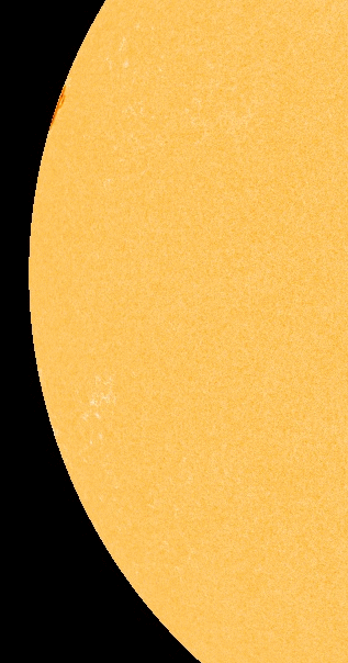
February 26, 2012 – INCOMING CME: Analysts at the Goddard Space Weather Lab say a coronal mass ejection (CME) will hit Earth’s magnetic field on Feb. 26th at 13:30 UT (+/- 7 hr). The impact could spark a G2-class geomagnetic storm. –Space Weather

G2 class solar storm predicted for earth-bound CME


Wyoming state legislators prepare for what amounts to ‘doomsday’

by The Extinction Protocol

February 26, 2012CHEYENNE, WY — State representatives on Friday advanced legislation to launch a study into what Wyoming should do in the event of a complete economic or political collapse in the United States. House Bill 85 passed on first reading by a voice vote. It would create a state-run government continuity task force, which would study and prepare Wyoming for potential catastrophes, from disruptions in food and energy supplies to a complete meltdown of the federal government. The task force would look at the feasibility of Wyoming issuing its own alternative currency, if needed. And House members approved an amendment Friday by state Rep. Kermit Brown, R-Laramie, to have the task force also examine conditions under which Wyoming would need to implement its own military draft, raise a standing army, and acquire strike aircraft and an aircraft carrier.
The bill’s sponsor, state Rep. David Miller, R-Riverton, has said he doesn’t anticipate any major crises hitting America anytime soon. But with the national debt exceeding $15 trillion and protest movements growing around the country, Miller said Wyoming — which has a comparatively good economy and sound state finances — needs to make sure it’s protected should any unexpected emergency hit the U.S. Several House members spoke in favor of the legislation, saying there was no harm in preparing for the worst. “I don’t think there’s anyone in this room today what would come up here and say that this country is in good shape, that the world is stable and in good shape — because that is clearly not the case,” state Rep. Lorraine Quarberg, R-Thermopolis, said. “To put your head in the sand and think that nothing bad’s going to happen, and that we have no obligation to the citizens of the state of Wyoming to at least have the discussion, is not healthy.” Wyoming’s Department of Homeland Security already has a statewide crisis management plan, but it doesn’t cover what the state should do in the event of an extreme nationwide political or economic collapse. In recent years, lawmakers in at least six states have introduced legislation to create a state currency, all unsuccessfully. University of Wyoming political science professor Jim King said the potential for a complete unraveling of the U.S. government and economy is “astronomically remote” in the foreseeable future. –Trib

Very Strong Earthquake Hits Taiwan + Video

http://www.earth-issues.com/2012/02/26/very-strong-earthquake-hits-taiwan-causing-minor-damage-video/?utm_source=rss&utm_medium=rss&utm_campaign=very-strong-earthquake-hits-taiwan-causing-minor-damage-video


Saturday  Feb. 25th, 2012

Worlds Slowing

Meteor Rain?
Natures Savage Beauty
Earths Rumblings
The Final Madness
As We Take It All With Us
Wild Filament Eruptions!

Malaysian island region inundated with massive volcanic mud flow

by The Extinction Protocol

February 24, 2012Borneo, MALAYSIA – Volcanic mud has been spewing at least twice to three times more actively than normal since last week. This has created an overflow of the sulphuric substance that has spread over an area as big as a football field. Apart from excited guests at the nearby Tabin Wildlife Resort, the number of wild animals, too, appears to have increased at the mud pool. Volcanic mud is believed to contain curative properties with iodine, bromine, calcium and magnesium. According to Wikipedia, since the mud solution has no significant toxic substance, it is used as a curative agent for mud baths at spas. Mud baths have existed for thousands of years and can now be found in high-end spas in many countries of the world. The mineral-rich pool serves as a salt lick for animals at the Tabin Wildlife Reserve, including endangered species such as the Sumatran rhino and the pygmy elephants. On a normal day, mud would continuously spew from within the pool and dry up in a day or two once it spills over. Last week, however, according to a wildlife ranger who declined to be named, it was rather active judging by the overflow. “Earlier last week, we saw it to be more active and when we returned a few days later, the mud had flowed over a big area,” he said, adding that people and animals had suddenly started coming to the reserve in droves. Nestled amid 120,500ha of dipterocarp rainforest and tropical plants, some of which are rich in medicinal and therapeutic values, the reserve is a popular haunt for bird watchers and wildlife enthusiasts. Besides the rhinoceroses and elephants, it is also home to the clouded leopard, sambar deer, exotic wild birds and the orangutan. –Strait Times

Magma Plume: Is Hawaii’s most active volcano about to enter a more violent phase?

by The Extinction Protocol

February 24, 2012HAWAII – A magnitude 4.1 earthquake rattled the summit of Kilauea tonight, continuing a swarm of small tremors that shook the region Wednesday. The latest quake, which hit at 9:11 p.m., was the strongest of the swarm so far and was centered 5 miles west of Volcano at a depth of 3.2 miles, according to the U.S. Geological Survey. The shaking was felt up to 75 miles away in Waikoloa, according to the USGS. A flurry of small temblors were recorded after the 4.1 magnitude quake. On Wednesday, USGS officials said a swarm of more than 60 small, shallow quakes — the strongest measuring magnitude 3.2 — were recorded in Hawaii Volcanoes National Park. Swarms of small quakes have been recorded before in the area and sometimes signal a shift in the eruption of the east rift of the volcano, they said. –Star Adviser
Seismic tremors increasing: On Friday, February 24th, 2012, a 4.3 magnitude earthquake, the strongest in the swarm series thus far struck the region near the volcano. On January 24, 2012, the volcano was rattled by a 4.7 maganitude earthquake. Clearly, Kilauea is entering a more violent phase of eruptions. Like El Hierro in the Canary Islands, like Italy’s Mt. Etna, and Icleand’s volcanic fields, the planet’s magma plumes are seen an inordinate rise in activity- a sign of more trouble to come. We began sounding the warnings back in December of 2011, when  a profuse lava flow from Kīlauea breached the West Ka‘ili‘ili ocean for the first time in 4 years. A scientist then warned the volcano was capable of very violent eruptions. Meanwhile, the earthquake swarm continues.  –The Extinction Protocol

Puna area on Hawaii Island shaken by mysterious force

by The Extinction Protocol

 February 23, 2012PUNA, Hawaii – A noisy, unexplained shaking in the Puna area of Hawaii Island remains a mystery at this time, but it certainly has the area talking. A number of people in a triangular area between Seaview Estates, Leilani Estates, and Black Sand Beach Subdivision  report hearing a thunder-like sound, or an explosion, and feeling the ground shake around 9 a.m. on Wednesday. Folks leaving comments on the popular Punaweb forum are saying it happened around 8:42 a.m. John Drummond, the acting administrator of the Hawaii County Civil Defense, says that the incident cannot be explained at this point in time. Drummond says that he spoke to operators of Puna Geothermal Venture, the USGS Hawaiian Volcano Observatory, and personnel on the ground… no one has an explanation. One theory being considered is some sort of sonic boom, although who or what could have produced such an effect is presently unknown. News videographer Daryl Lee, who says he felt the shaking in Hawaiian Paradise Park, immediately hit the road in search of the source of the rumble. What he found were many folks around Puna makai who felt the same thing… but no answers. Drummond says luckily, there are no reports of damage as of 2 p.m. –Big Island VN


Friday, February 24, 2012

**Happiness and moral duty are inseparably connected.**
George Washingtonhttp://globaldisasterwatch.blogspot.com/2012/02/friday-february-24-2012.html

LARGEST QUAKES –
This morning –
5.0 PHILIPPINE ISLANDS REGION

Yesterday –
2/23/12 –
5.0 NEAR EAST COAST OF HONSHU, JAPAN
5.2 KERMADEC ISLANDS REGION
5.1 OFFSHORE CHIAPAS, MEXICO
5.2 NEW BRITAIN REGION, P.N.G.
5.3 SOUTHERN MID-ATLANTIC RIDGE
5.2 FIJI REGION

Earth’s ‘rhythmic throbbing’ may lead to extinctions every 60 million years – A mysterious cycle of booms and busts in marine biodiversity over the past 500 million years could be tied to a periodic uplifting of the world’s continents. Researchers discovered periodic increases in the amount of the isotope strontium-87 found in marine fossils. The timing of these increases corresponds to previously discovered low points in marine biodiversity that occur in the fossil record roughly every 60 million years. “Strontium-87 is produced by radioactive decay of another element, rubidium, which is common in igneous rocks in continental crust. So, when a lot of this type of rock erodes, a lot more Sr-87 is dumped into the ocean, and its fraction rises compared with another strontium isotope, Sr-86.” An uplifting of the continents is the most likely explanation for this type of massive erosion event.
“Continental uplift increases erosion in several ways. First, it pushes the continental basement rocks containing rubidium up to where they are exposed to erosive forces. Uplift also creates highlands and mountains where glaciers and freeze-thaw cycles erode rock. The steep slopes cause faster water flow in streams and sheet-wash from rains, which strips off the soil and exposes bedrock. Uplift also elevates the deeper-seated igneous rocks where the Sr-87 is sequestered, permitting it to be exposed, eroded, and put into the ocean.”
The massive continental uplift suggested by the strontium data would also reduce sea depth along the continental shelf where most sea animals live. That loss of habitat due to shallow water could be the reason for the periodic mass extinctions and periodic decline in diversity found in the marine fossil record. “What we’re seeing could be evidence of a ‘pulse of the earth’ phenomenon. There are some theoretical works which suggest that convection of mantle plumes, rather like a lava lamp, should be coordinated in periodic waves.” The result of this convection deep inside the earth could be a rhythmic throbbing – almost like a cartoon thumb smacked with a hammer – that pushes the continents up and down. The data suggests that such pulses likely affected the North American continent. The same phenomenon may have affected other continents as well, but more research will be needed to show that.

VOLCANOES –

Hawaii – Scientists at the USGS Hawaiian Volcano Observatory are keeping an eye on a swarm of small earthquakes around the active Kilauea volcano. The swarm of small earthquakes was located about three miles from the summit of Kilauea volcano on the Big Island. More than 60 earthquakes were recorded after 1 am Wednesday.

TROPICAL STORMS
No current tropical storms.

Another Tropical Cyclone May Target Madagascar – The southwestern Indian Ocean could see a new tropical cyclone by Sunday. Were a cyclone to form in the area, it could pose a threat to Madagascar, which was dealt a destructive blow by Severe Tropical Giovanna in mid-February. Likewise, the Mascarene Islands, Mauritius and Reunion, could also feel the effects of any cyclone in the area.
The area favorable for development of a tropical cyclone will be a broad swatch of warm tropical ocean well east of northern Madagascar. Once formed, steering winds would then guide the weather system to the west and southwest. Destructive landfall by Giovanna happened shortly after midnight on Feb. 14 near Toamasina, on the east coast of Madagascar. The storm swept inland, unleashing torrential rain and damaging winds in the capital, Antananarivo. (map)
Killer Cyclone Giovanna dumping sediment into Indian Ocean – Throw a 145-mph tropical cyclone accompanied by 10 inches of rain against a low-lying coastline, and you get flooding that New Orleanians can easily understand. The most recent such incident is the horseshoe-shaped path of the Indian Ocean Tropical Cyclone Giovanna, which made landfall on the narrow east coast plain of Madagascar as a Category 4 storm on Feb. 9. Giovanna cut across the island’s mountainous plateau center before entering the channel separating it from Mozambique, and then curved south and back east around the island’s southern tip, churning back into the Indian Ocean, where it was still producing 30-mph winds Wednesday. Giovanna has killed at least 23 people in Madagascar and left about 190,000 homeless in the last week. The sediment-choked Onibe River on Saturday was delivering a thick plume of sediment to the Indian Ocean, similar to the sediment delivered to the Gulf of Mexico by the rain-swollen Mississippi River last fall. But Madagascar’s narrow range of topography, dropping from 9,436 feet to sea level over just 75 miles, results in fast-moving water picking up huge amounts of mud and debris as Giovanna exited the area. (photo)

HEAVY SNOW / EXTREME COLD –

India – Sixteen soldiers killed in avalanches. Two massive avalanches in snowbound regions of Indian-controlled Kashmir have killed at least 16 soldiers, and at least three others were feared trapped in a military camp that was partially buried under snow.

HEALTH THREATS –

H5N1 bird flu infection may be more common, less deadly, than thought.

Thursday, February 23, 2012

A number of UNUSUAL fireballs observed around the USA this month have researchers wondering if Earth is passing through a special “February swarm” of meteoroids. In the middle of the night on February 13th, something disturbed the animal population of rural Portal, Georgia. Cows started mooing anxiously and local dogs howled at the sky. The cause of the commotion was a rock from space. “At 1:43 AM Eastern, I witnessed an amazing fireball. It was very large and lit up half the sky as it fragmented. The event set dogs barking and upset cattle, which began to make excited sounds. I regret I didn’t have a camera; it lasted nearly 6 seconds.”
“This month, some big space rocks have been hitting Earth’s atmosphere. There have been five or six notable fireballs that might have dropped meteorites around the United States.” It’s not the number of fireballs that has researchers puzzled. So far, fireball counts in February 2012 are about normal. Instead, it’s the appearance and trajectory of the fireballs that sets them apart.
“These fireballs are particularly slow and penetrating. They hit the top of the atmosphere moving slower than 15 km/s, decelerate rapidly, and make it to within 50 km of Earth’s surface.” The action began on the evening of February 1st when a fireball over central Texas wowed thousands of onlookers in the Dallas-Fort Worth area.
“It was brighter and long-lasting than anything I’ve seen before. The fireball took about 8 seconds to cross the sky. I could see the fireball start to slow down; then it exploded like a firecracker artillery shell into several pieces, flickered a few more times and then slowly burned out.” Another observer in Coppell, Texas, reported a loud double boom as “the object broke into two major chunks with many smaller pieces.” The fireball was bright enough to be seen on NASA cameras located in New Mexico more than 500 miles away. “It was about as bright as the full Moon.” Estimates are that the object was 1 to 2 meters in diameter.
So far in February, NASA’s All-Sky Fireball Network has photographed about a half a dozen bright meteors that belong to this oddball category. They range in size from basketballs to buses, and all share the same slow entry speed and deep atmospheric penetration. A scientist has analyzed their orbits and come to a surprising conclusion: “They all hail from the asteroid belt – but not from a single location in the asteroid belt. There is no common source for these fireballs, which is puzzling.”
This isn’t the first time sky watchers have noticed odd fireballs in February. In fact, the “Fireballs of February” are a bit of a legend in meteor circles. “Back in the 1960s and 70s, amateur astronomers noticed an increase in the number of bright, sound-producing deep-penetrating fireballs during the month of February. The numbers seemed significant, especially when you consider that there are few people outside at night in winter. Follow-up studies in the late 1980s suggested no big increase in the rate of February fireballs. Nevertheless, we’ve always wondered if something was going on.” Indeed, a 1990 study suggests that the ‘February Fireballs’ are real. They analyzed photographic records of about a thousand fireballs from the 1970s and 80s and found evidence for a fireball stream intersecting Earth’s orbit in February.They allso found signs of fireball streams in late summer and fall. The results are controversial, however.
NASA’s growing All-Sky Fireball Network could end up solving the mystery. They are adding cameras all the time, spreading the network’s coverage across North America for a dense, uninterrupted sampling of the night sky. “The beauty of our smart multi-camera system, is that it measures orbits almost instantly. We know right away when a fireball flurry is underway – and we can tell where the meteoroids came from.” This kind of instant data is almost unprecedented in meteor science, and promises new insights into the origin of February’s fireballs. Meanwhile, the month isn’t over yet. “If the cows and dogs start raising a ruckus tonight, go out and take a look.” (video)

**Be courteous to all, but intimate with few,
and let those few be well tried
before you give them your confidence. **
George Washington

LARGEST QUAKES –
This morning –
5.2 FIJI REGION

Yesterday –
2/22/12 –
5.1 OFF W COAST OF NORTHERN SUMATRA
5.5 KEPULAUAN KAI, INDONESIA
5.2 VANUATU

VOLCANOES –

Chilean volcano’s ash is still disrupting ecosystems – Nine months after the eruption of the Puyehue volcano in Chile forced thousands to flee for their lives, its impact is still being felt in the surrounding region. Puyehue, located in the southern Chilean Andes, began erupting on 3 June 2011.

TSUNAMI / FREAK WAVES / ABNORMAL TIDES –

Almost a year after the Japanese Tohoku earthquake and mega-tsunami, the Pacific Ocean is still dealing with the consequences of the catastrophe. A mass of debris was washed out to sea as floodwaters receded from the land, and some of that wreckage continues to float around the ocean. Most of it headed eastwards, according to modelling work by the Hawaii-based International Pacific Research Center. “So far, the debris field has spread in length more than 2,000 nautical miles, and is more than 1,000 nautical miles wide.” That is approaching 4,000km by 2,000km.
Japanese estimates suggested perhaps 20 million tonnes of debris were generated by the earthquake and the incoming rush of water on 11 March last year. Most would have stayed on land, and a fair proportion pulled out to sea would have sunk rapidly. But it is possible a million tonnes is still floating on the ocean. Video pictures at the time showed all manner of materials caught in the flow, from upturned boats and cars to whole buildings picked up off their foundations. The dominant movement of water off Japan is the Kuroshio Current, the North Pacific equivalent of the Gulf Stream in the Atlantic. It hugs the Asian continental slope until about 35 degrees North, where it is then deflected due east into the deep ocean as the Kuroshio Extension. A lot of the floating material rode this extension.
What a simulation shows is the area of ocean where debris might be found, but look over the side of any ship and you would very probably see no debris at all because the individual items have now become widely separated. However, the information is of immense interest to shipping authorities because objects in the water, depending of their size, can be a serious collision hazard. Another keenly interested party is the Papahanaumokuakea Marine National Monument, the marine park encompassing the northwestern Hawaiian islands and atolls, such as Midway. It is an area of outstanding natural beauty and is home to many interesting and endangered species. So far, the modelling has suggested the bulk of the field is passing to the north of the monument. “However, the currents have changed and so we expect reports [of debris washing up] from Midway and the Kure Atoll soon.” The debris may touch the west coast of the US in another year or two, but what does make landfall will be a small percentage of the overall floating mass. Ultimately, the IPRC work suggests, at least 95% of the debris that has not sunk will move into the North Pacific “Garbage Patch”, a long-lived circulation of floating rubbish trapped by the North Pacific Gyre. Over time it will decay and sink. The concern for conservationists is that smaller, particularly plastic fragments can be ingested by marine organisms. (Animation of how the Japanese tsunami debris field has spread since March 2011)

TROPICAL STORMS
No current tropical storms.