Earthquakes
RSOE EDIS
| Date/Time (UTC) | Magnitude | Area | Country | State/Prov./Gov. | Location | Risk | Source | Details | ||
| 30.05.2012 10:11:35 | 4.8 | Europe | Russia | Sem’desyat Vtoroy Kilometr | EMSC | |||||
| 30.05.2012 10:11:56 | 3.0 | Europe | France | Saint-Martin-aux-Buneaux | EMSC | |||||
| 30.05.2012 10:12:17 | 3.5 | Asia | Taiwan | Hsiang-yang | EMSC | |||||
| 30.05.2012 10:12:39 | 3.6 | Europe | Greece | Thesprotikon | EMSC | |||||
| 30.05.2012 09:25:59 | 2.9 | North America | United States | Alaska | Iniskin | USGS-RSOE | ||||
| 30.05.2012 09:10:55 | 5.1 | Indonesian Archipelago | Indonesia | Trana | EMSC | |||||
| 30.05.2012 09:16:41 | 5.1 | Indonesian archipelago | Indonesia | Trana | USGS-RSOE | |||||
| 30.05.2012 09:20:42 | 4.9 | Middle East | Iran | Ostan-e Fars | Khurab | USGS-RSOE | ||||
| 30.05.2012 09:11:20 | 4.8 | Middle-East | Iran | Khurab | EMSC | |||||
| 30.05.2012 09:11:43 | 2.5 | Europe | Italy | Finale Emilia | EMSC | |||||
| 30.05.2012 08:31:08 | 3.3 | North America | United States | Hawaii | ÂÃpua (historical) | USGS-RSOE | ||||
| 30.05.2012 09:12:15 | 2.9 | Asia | Turkey | Nizin | EMSC | |||||
| 30.05.2012 09:12:38 | 3.8 | Europe | Italy | Coazze | EMSC | |||||
| 30.05.2012 09:13:02 | 2.8 | Europe | France | Sainte-Anne | EMSC | |||||
| 30.05.2012 09:13:27 | 2.7 | Europe | Italy | Quarantoli | EMSC | |||||
| 30.05.2012 09:13:52 | 2.0 | Europe | Greece | Polilofon | EMSC | |||||
| 30.05.2012 09:14:17 | 2.9 | Europe | Italy | La Collevata | EMSC | |||||
| 30.05.2012 08:03:56 | 3.5 | Asia | Turkey | Karagunduz | EMSC | |||||
| 30.05.2012 08:04:23 | 3.3 | Europe | Bulgaria | Slakovtsi | EMSC | |||||
| 30.05.2012 08:04:48 | 2.6 | Europe | Italy | Case Oratorio | EMSC | |||||
| 30.05.2012 08:06:40 | 2.8 | Europe | Greece | Tyrgia | EMSC | |||||
| 30.05.2012 08:07:02 | 2.1 | Europe | Italy | Pioppa | EMSC | |||||
| 30.05.2012 07:21:38 | 4.0 | North America | United States | California | Solromar | USGS-RSOE | ||||
| 30.05.2012 07:22:01 | 2.3 | North America | United States | California | Solromar | USGS-RSOE | ||||
| 30.05.2012 08:07:27 | 2.6 | Europe | Italy | La Balantina | EMSC | |||||
| 30.05.2012 08:07:56 | 3.1 | Europe | Italy | Moglia | EMSC | |||||
| 30.05.2012 07:01:45 | 2.7 | Europe | Italy | Novi di Modena | EMSC | |||||
| 30.05.2012 07:02:07 | 2.8 | Europe | Italy | Palata Pepoli | EMSC | |||||
| 30.05.2012 07:02:29 | 2.8 | Europe | Italy | Ponte di San Pellegrino | EMSC | |||||
| 30.05.2012 07:02:49 | 2.3 | Europe | Italy | La Massara | EMSC | |||||
| 30.05.2012 08:08:33 | 3.1 | Europe | Greece | Sourides | EMSC | |||||
| 30.05.2012 07:03:08 | 2.8 | Europe | Italy | Alberica | EMSC | |||||
| 30.05.2012 07:03:28 | 2.0 | Europe | Italy | La Balantina | EMSC | |||||
| 30.05.2012 07:03:49 | 3.3 | Europe | Greece | Ydroussa | EMSC | |||||
| 30.05.2012 07:04:11 | 2.6 | Europe | Italy | Concordia sulla Secchia | EMSC | |||||
| 30.05.2012 07:04:33 | 2.7 | Europe | Croatia | Skrivena Luka | EMSC | |||||
| 30.05.2012 07:04:54 | 2.4 | Europe | Italy | La Barchessa | EMSC | |||||
| 30.05.2012 07:05:51 | 2.4 | Europe | Italy | Quarantoli | EMSC | |||||
| 30.05.2012 05:55:30 | 2.9 | Europe | Poland | Czeszkow | EMSC | |||||
| 30.05.2012 07:06:19 | 2.9 | Europe | Greece | Kalopirgos | EMSC | |||||
| 30.05.2012 06:41:07 | 3.0 | Caribbean | Puerto Rico | Centro Puntas | USGS-RSOE | |||||
| 30.05.2012 07:06:20 | 2.5 | Europe | Italy | Quarantoli | EMSC | |||||
| 30.05.2012 05:55:49 | 2.6 | Europe | Italy | San Giacomo delle Segnate | EMSC | |||||
| 30.05.2012 05:56:10 | 2.3 | Asia | Turkey | Mezraasadan | EMSC | |||||
| 30.05.2012 05:56:31 | 2.8 | Europe | Italy | Quarantoli | EMSC | |||||
| 30.05.2012 08:08:58 | 2.6 | Europe | Italy | Novi di Modena | EMSC | |||||
| 30.05.2012 05:56:51 | 2.5 | Europe | Italy | La Balantina | EMSC | |||||
| 30.05.2012 05:57:13 | 3.3 | Europe | Italy | Tramuschio | EMSC | |||||
| 30.05.2012 04:50:34 | 2.7 | Europe | Italy | Concordia sulla Secchia | EMSC | |||||
| 30.05.2012 04:45:30 | 2.1 | North America | United States | Hawaii | ÂÃpua (historical) | USGS-RSOE | ||||
| 30.05.2012 04:50:55 | 2.3 | Europe | Italy | La Balantina | EMSC | |||||
| 30.05.2012 05:57:32 | 2.3 | Asia | Turkey | Olucak | EMSC | |||||
| 30.05.2012 05:57:51 | 2.7 | Asia | Turkey | Esencik | EMSC | |||||
| 30.05.2012 04:51:16 | 2.3 | Europe | Italy | La Balantina | EMSC | |||||
| 30.05.2012 04:51:35 | 2.7 | Europe | Italy | Quistello | EMSC | |||||
| 30.05.2012 04:51:53 | 2.6 | Europe | Italy | San Felice sul Panaro | EMSC | |||||
| 30.05.2012 04:52:16 | 2.5 | Europe | Italy | Casa Madonnina | EMSC | |||||
| 30.05.2012 04:52:38 | 3.4 | Europe | Italy | San Biagio | EMSC | |||||
| 30.05.2012 05:58:18 | 2.2 | Asia | Turkey | Cukurgol Yaylasi | EMSC | |||||
| 30.05.2012 04:52:59 | 2.7 | Europe | Italy | Mirandola | EMSC | |||||
| 30.05.2012 03:55:25 | 3.5 | North America | United States | Alaska | Beluga | USGS-RSOE | ||||
| 30.05.2012 04:53:19 | 2.1 | Europe | Italy | San Felice sul Panaro | EMSC | |||||
| 30.05.2012 08:09:23 | 2.4 | Europe | Italy | La Massara | EMSC | |||||
| 30.05.2012 04:53:40 | 2.1 | Europe | Italy | Casa Madonnina | EMSC | |||||
| 30.05.2012 03:45:32 | 2.1 | Europe | Italy | Rovereto | EMSC | |||||
| 30.05.2012 05:58:38 | 2.7 | Asia | Turkey | Karahidirli | EMSC | |||||
| 30.05.2012 03:45:53 | 2.3 | Europe | Albania | Greve | EMSC | |||||
| 30.05.2012 07:06:45 | 2.6 | Europe | Italy | San Giovanni del Dosso | EMSC | |||||
| 30.05.2012 03:46:16 | 2.9 | Europe | Italy | Coazze | EMSC | |||||
| 30.05.2012 03:46:36 | 2.1 | Europe | Italy | Concordia sulla Secchia | EMSC | |||||
| 30.05.2012 03:46:56 | 2.1 | Europe | Italy | Mirandola | EMSC | |||||
| 30.05.2012 03:47:17 | 2.2 | Europe | Italy | Resega | EMSC | |||||
| 30.05.2012 04:00:34 | 4.4 | South America | Colombia | Departamento de Cundinamarca | Paicaguita | USGS-RSOE | ||||
| 30.05.2012 04:54:02 | 4.4 | South-America | Colombia | Paicaguita | EMSC | |||||
| 30.05.2012 03:47:36 | 2.1 | Europe | Italy | Palata Pepoli | EMSC | |||||
| 30.05.2012 05:58:59 | 2.1 | Asia | Turkey | Yesilyayla | EMSC | |||||
| 30.05.2012 03:47:58 | 2.3 | Europe | Italy | Moglia | EMSC | |||||
| 30.05.2012 05:59:18 | 2.7 | Asia | Turkey | Mollakasim | EMSC | |||||
| 30.05.2012 03:48:26 | 2.2 | Europe | Italy | San Giacomo Roncole | EMSC | |||||
| 30.05.2012 02:45:24 | 3.2 | Europe | Greece | Sigrion | EMSC | |||||
| 30.05.2012 07:07:11 | 2.7 | Europe | Albania | Cerjan | EMSC | |||||
| 30.05.2012 05:59:58 | 2.7 | Europe | Greece | Agios Dimitrios | EMSC | |||||
| 30.05.2012 02:25:28 | 2.5 | North America | United States | California | Ukiah Rancheria | USGS-RSOE | ||||
| 30.05.2012 02:45:45 | 2.0 | Europe | Italy | San Biagio | EMSC | |||||
| 30.05.2012 03:48:47 | 2.2 | Europe | Italy | Casa Madonnina | EMSC | |||||
| 30.05.2012 02:10:30 | 2.1 | North America | United States | California | Solromar | USGS-RSOE | ||||
| 30.05.2012 06:00:39 | 2.5 | Asia | Turkey | Gerenler | EMSC | |||||
| 30.05.2012 02:46:09 | 2.0 | Europe | Italy | Alberica | EMSC | |||||
| 30.05.2012 06:00:59 | 2.1 | Asia | Turkey | Esmepinar | EMSC | |||||
| 30.05.2012 02:46:30 | 2.4 | Europe | Italy | San Felice sul Panaro | EMSC | |||||
| 30.05.2012 02:46:49 | 2.4 | Europe | Italy | Resega | EMSC | |||||
| 30.05.2012 01:40:35 | 2.5 | Asia | Turkey | Cetibelikoyu | EMSC | |||||
| 30.05.2012 01:40:55 | 2.5 | Europe | Italy | Zocca | EMSC | |||||
| 30.05.2012 01:41:17 | 2.2 | Europe | Italy | La Balantina | EMSC | |||||
| 30.05.2012 01:41:37 | 2.1 | Europe | Italy | Alberica | EMSC | |||||
| 30.05.2012 01:41:57 | 2.2 | Europe | Italy | Casa Madonnina | EMSC | |||||
| 30.05.2012 01:42:25 | 2.0 | Europe | Italy | Rovereto | EMSC | |||||
| 30.05.2012 01:42:46 | 2.2 | Europe | Italy | La Balantina | EMSC | |||||
| 30.05.2012 01:31:07 | 4.2 | Middle America | Mexico | Estado de Oaxaca | Santa Maria del Rincon | USGS-RSOE | ||||
| 30.05.2012 01:43:06 | 4.2 | Middle-America | Mexico | Santa Maria del Rincon | EMSC | |||||
| 30.05.2012 01:43:27 | 2.7 | Europe | Italy | La Collevata | EMSC | |||||
| 30.05.2012 01:43:49 | 2.3 | Europe | Italy | La Balantina | EMSC | |||||
| 30.05.2012 00:35:45 | 2.0 | Europe | Italy | San Felice sul Panaro | EMSC | |||||
| 30.05.2012 00:25:52 | 2.2 | North America | United States | California | Mesquite Oasis | USGS-RSOE | ||||
| 30.05.2012 00:21:35 | 2.0 | North America | United States | California | San Benito | USGS-RSOE | ||||
| 30.05.2012 00:36:06 | 2.2 | Europe | Italy | La Collevata | EMSC | |||||
| 30.05.2012 00:36:27 | 2.3 | Europe | Italy | Alberica | EMSC | |||||
| 30.05.2012 00:36:48 | 2.6 | Europe | Italy | Resega | EMSC | |||||
| 30.05.2012 00:37:09 | 2.4 | Europe | Italy | La Balantina | EMSC | |||||
| 30.05.2012 00:37:30 | 2.4 | Europe | Italy | San Carlo | EMSC | |||||
| 30.05.2012 00:37:51 | 2.8 | Europe | Italy | San Lorenzo | EMSC | |||||
| 30.05.2012 00:38:15 | 2.1 | Europe | Italy | Mirandola | EMSC | |||||
| 29.05.2012 23:46:25 | 2.7 | North America | United States | California | Toomey | USGS-RSOE | ||||
| 30.05.2012 03:30:44 | 3.2 | Caribbean | Puerto Rico | Soroco | USGS-RSOE | |||||
| 29.05.2012 23:31:47 | 2.0 | North America | United States | Hawaii | Pähala | USGS-RSOE | ||||
| 29.05.2012 23:35:33 | 3.0 | Europe | Italy | La Collevata | EMSC | |||||
| 29.05.2012 23:35:53 | 2.6 | Europe | Italy | La Pettenella | EMSC | |||||
| 29.05.2012 23:36:15 | 2.4 | Europe | Italy | San Biagio | EMSC | |||||
| 29.05.2012 23:36:34 | 2.1 | Europe | Italy | Moglia | EMSC | |||||
| 29.05.2012 22:45:34 | 2.0 | North America | United States | Hawaii | ÂÃpua (historical) | USGS-RSOE | ||||
| 29.05.2012 23:36:54 | 2.8 | Europe | Italy | Cavezzo | EMSC | |||||
| 29.05.2012 22:31:42 | 2.4 | Europe | Italy | Moglia | EMSC | |||||
| 29.05.2012 22:32:08 | 2.1 | Europe | Italy | San Biagio | EMSC | |||||
| 29.05.2012 22:32:30 | 2.5 | Europe | Italy | Ponte di San Pellegrino | EMSC | |||||
| 29.05.2012 22:32:52 | 2.4 | Europe | Italy | La Balantina | EMSC | |||||
| 29.05.2012 22:33:13 | 2.5 | Europe | Italy | Casa Madonnina | EMSC | |||||
| 29.05.2012 22:33:34 | 2.5 | Europe | Greece | Frangoulaiika | EMSC | |||||
| 29.05.2012 22:33:53 | 2.6 | Europe | Italy | La Collevata | EMSC | |||||
| 29.05.2012 22:34:20 | 2.2 | Europe | Italy | Resega | EMSC | |||||
| 29.05.2012 22:34:41 | 2.5 | Asia | Turkey | Alakilise | EMSC | |||||
| 29.05.2012 22:35:00 | 2.9 | Europe | Italy | Casa Madonnina | EMSC | |||||
| 29.05.2012 22:45:00 | 2.8 | Europe | Italy | Alberica | EMSC | |||||
| 29.05.2012 22:46:53 | 2.4 | Europe | Italy | San Lorenzo | EMSC | |||||
| 29.05.2012 21:26:40 | 3.1 | Europe | Italy | L’Orlanda | EMSC | |||||
| 29.05.2012 21:26:59 | 3.2 | Europe | Italy | Piazzetta | EMSC | |||||
| 29.05.2012 21:27:19 | 2.3 | Europe | Italy | Podere San Pancrazio | EMSC | |||||
| 29.05.2012 21:27:39 | 2.5 | Europe | Italy | Melara | EMSC | |||||
| 29.05.2012 21:28:00 | 3.0 | Europe | Italy | La Balantina | EMSC | |||||
| 29.05.2012 21:28:23 | 2.0 | Asia | Turkey | Eksiler | EMSC | |||||
| 29.05.2012 21:22:49 | 4.4 | Europe | Italy | Corte Romana | USGS-RSOE | |||||
| 29.05.2012 21:28:43 | 3.9 | Europe | Italy | Moglia | EMSC | |||||
| 29.05.2012 21:29:02 | 2.6 | Europe | Albania | Panjet | EMSC | |||||
| 29.05.2012 20:29:13 | 2.0 | North America | United States | Hawaii | ÂÃpua (historical) | USGS-RSOE | ||||
| 29.05.2012 21:29:21 | 2.4 | Europe | Italy | L’Orlanda | EMSC | |||||
| 29.05.2012 21:29:40 | 2.8 | Europe | Greece | Kattavia | EMSC | |||||
| 29.05.2012 20:20:55 | 2.6 | North America | United States | California | Citrus View | USGS-RSOE | ||||
| 29.05.2012 20:21:22 | 2.3 | North America | United States | Hawaii | ÂÃpua (historical) | USGS-RSOE | ||||
| 29.05.2012 20:25:50 | 2.7 | Europe | Italy | La Pettenella | EMSC | |||||
| 29.05.2012 20:57:19 | 2.4 | North America | United States | Alaska | Ninilchik | USGS-RSOE | ||||
| 29.05.2012 20:31:28 | 3.3 | Caribbean | Dominican Republic | Provincia de La Altagracia | El Cabo | USGS-RSOE | ||||
| 29.05.2012 20:26:18 | 2.3 | Europe | Italy | Tramuschio | EMSC | |||||
| 29.05.2012 20:26:38 | 2.4 | Europe | Italy | San Lorenzo | EMSC | |||||
| 29.05.2012 20:26:57 | 2.3 | Europe | Italy | Villa Magri | EMSC | |||||
| 29.05.2012 20:27:17 | 2.3 | Europe | Italy | Melara | EMSC | |||||
| 29.05.2012 20:27:36 | 2.6 | Europe | Italy | Ponte di San Pellegrino | EMSC | |||||
| 29.05.2012 20:27:57 | 2.5 | Europe | Greece | Likotrafos | EMSC | |||||
| 29.05.2012 20:28:21 | 2.5 | Europe | Bulgaria | Bogdanovdol | EMSC | |||||
| 29.05.2012 20:28:41 | 2.2 | Europe | Italy | Palata Pepoli | EMSC | |||||
| 29.05.2012 19:16:05 | 2.2 | North America | United States | Alaska | Drift River | USGS-RSOE | ||||
| 29.05.2012 19:21:26 | 2.7 | Europe | Italy | Tramuschio | EMSC | |||||
| 29.05.2012 19:21:46 | 3.0 | Europe | Italy | Resega | EMSC | |||||
| 29.05.2012 19:22:05 | 2.6 | Europe | Italy | Alberica | EMSC | |||||
| 29.05.2012 19:22:31 | 2.6 | Europe | Italy | Ravarino | EMSC | |||||
| 29.05.2012 18:55:53 | 2.2 | North America | United States | Alaska | Drift River | USGS-RSOE | ||||
| 29.05.2012 19:22:51 | 2.9 | Europe | Italy | Casa Madonnina | EMSC | |||||
| 29.05.2012 19:23:11 | 4.8 | North-America | United States | Amchitka | EMSC | |||||
| 29.05.2012 19:16:27 | 4.9 | North America | United States | Alaska | Amchitka | USGS-RSOE | ||||
| 29.05.2012 19:23:30 | 2.5 | Europe | Italy | Casa Madonnina | EMSC | |||||
| 29.05.2012 19:23:50 | 2.4 | Europe | Italy | Casa Calari | EMSC | |||||
| 29.05.2012 19:24:13 | 3.0 | Europe | Italy | San Biagio | EMSC | |||||
| 29.05.2012 19:24:34 | 2.2 | Europe | Italy | Quarantoli | EMSC | |||||
| 29.05.2012 19:24:56 | 2.7 | Europe | Italy | Budrione | EMSC | |||||
| 29.05.2012 18:12:28 | 2.0 | North America | United States | Hawaii | ÂÃpua (historical) | USGS-RSOE | ||||
| 29.05.2012 18:18:31 | 2.8 | Europe | Italy | La Balantina | EMSC | |||||
| 29.05.2012 19:25:49 | 4.6 | Asia | Japan | Naka-toyoni | EMSC | |||||
| 29.05.2012 18:18:57 | 4.7 | Europe | Italy | San Benedetto Po | EMSC | |||||
| 29.05.2012 18:19:19 | 2.8 | Europe | Italy | Rovereto | EMSC | |||||
| 29.05.2012 18:19:38 | 4.9 | Asia | Japan | Aneyoshi | EMSC | |||||
| 29.05.2012 18:19:57 | 3.1 | Europe | Italy | Coazze | EMSC | |||||
| 29.05.2012 17:18:30 | 3.0 | Europe | Italy | La Balantina | EMSC | |||||
| 29.05.2012 17:18:52 | 2.9 | Europe | Italy | Quarantoli | EMSC | |||||
| 29.05.2012 17:19:13 | 2.4 | Europe | Italy | Alberica | EMSC | |||||
| 29.05.2012 17:19:33 | 2.2 | Europe | Italy | Mirandola | EMSC | |||||
| 29.05.2012 17:19:53 | 2.9 | Europe | Italy | San Felice sul Panaro | EMSC | |||||
| 29.05.2012 17:23:48 | 4.0 | Europe | Italy | Alberica | EMSC | |||||
| 29.05.2012 17:24:23 | 2.7 | Europe | Italy | Palidano | EMSC | |||||
| 29.05.2012 18:06:54 | 2.5 | Caribbean | Puerto Rico | Barrio Guaypao | USGS-RSOE | |||||
| 29.05.2012 17:24:53 | 3.1 | Europe | Italy | Il Motto | EMSC | |||||
| 29.05.2012 17:25:36 | 2.5 | Europe | Italy | Messerotti | EMSC | |||||
| 29.05.2012 16:25:36 | 2.1 | North America | United States | Alaska | Tanana | USGS-RSOE | ||||
| 29.05.2012 17:25:57 | 2.7 | Europe | Italy | Concordia sulla Secchia | EMSC | |||||
| 29.05.2012 17:26:19 | 3.1 | Europe | Italy | San Giacomo Roncole | EMSC | |||||
| 29.05.2012 17:26:38 | 2.7 | Asia | Turkey | Baklali | EMSC | |||||
| 29.05.2012 17:26:57 | 2.9 | Europe | Italy | Zocca | EMSC | |||||
| 29.05.2012 16:14:02 | 3.1 | Europe | Italy | Rovereto | EMSC | |||||
| 29.05.2012 16:14:24 | 2.6 | Europe | Italy | Malcantone | EMSC | |||||
| 29.05.2012 16:14:45 | 3.2 | Asia | Turkey | Kizilcagil | EMSC | |||||
| 29.05.2012 16:19:47 | 2.1 | Europe | Italy | San Giacomo Roncole | EMSC | |||||
| 29.05.2012 16:21:16 | 2.2 | Europe | Italy | L’Orlanda | EMSC | |||||
| 29.05.2012 17:27:19 | 2.7 | Asia | Turkey | Amasya | EMSC | |||||
| 29.05.2012 16:21:35 | 2.4 | Europe | Italy | Concordia sulla Secchia | EMSC | |||||
| 29.05.2012 15:35:37 | 2.0 | Middle America | Mexico | Estado de Baja California | Cerro Prieto | USGS-RSOE | ||||
| 29.05.2012 16:21:54 | 2.2 | Europe | Italy | Dogaro | EMSC | |||||
| 29.05.2012 16:22:16 | 2.6 | Asia | Turkey | Demirtas | EMSC | |||||
| 29.05.2012 16:22:37 | 2.8 | Europe | Italy | Casa Fallona | EMSC | |||||
| 29.05.2012 16:22:58 | 2.6 | Europe | Italy | Castelnuovo | EMSC | |||||
| 29.05.2012 16:23:21 | 2.5 | Europe | Italy | La Balantina | EMSC | |||||
| 29.05.2012 16:23:42 | 2.4 | Europe | Italy | Novi di Modena | EMSC | |||||
| 29.05.2012 16:24:03 | 2.8 | Europe | Italy | Borgo Nuovo | EMSC | |||||
| 29.05.2012 16:24:40 | 2.4 | Asia | Turkey | Karakaya | EMSC | |||||
| 29.05.2012 16:25:01 | 3.2 | Europe | Italy | Polesine | EMSC | |||||
| 29.05.2012 16:27:53 | 2.3 | Europe | Italy | Resega | EMSC | |||||
| 29.05.2012 16:28:16 | 3.8 | Middle-East | Iran | Kahriz-e Salah od Din | EMSC | |||||
| 29.05.2012 16:28:38 | 2.8 | Europe | Italy | La Collevata | EMSC | |||||
| 29.05.2012 16:29:02 | 2.5 | Asia | Turkey | Ozdemir | EMSC | |||||
| 29.05.2012 16:29:21 | 2.5 | Europe | Italy | Scortichino | EMSC | |||||
| 29.05.2012 16:29:42 | 2.7 | Europe | Italy | Alberica | EMSC | |||||
| 29.05.2012 16:34:44 | 2.4 | Europe | Italy | Alberica | EMSC | |||||
| 29.05.2012 14:48:05 | 2.2 | Europe | Italy | Rovereto | EMSC | |||||
| 29.05.2012 14:48:26 | 2.7 | Europe | Italy | La Balantina | EMSC | |||||
| 29.05.2012 14:48:47 | 2.7 | Europe | Italy | Moglia | EMSC | |||||
| 29.05.2012 14:49:08 | 2.7 | Europe | Italy | Concordia sulla Secchia | EMSC | |||||
| 29.05.2012 14:49:27 | 2.5 | Europe | Italy | Quarantoli | EMSC | |||||
| 29.05.2012 14:49:47 | 2.7 | Europe | Greece | Ayios Ioannis | EMSC | |||||
| 29.05.2012 14:57:10 | 3.2 | Europe | Italy | Concordia sulla Secchia | EMSC | |||||
| 29.05.2012 14:57:32 | 2.6 | Europe | Italy | La Balantina | EMSC | |||||
| 29.05.2012 14:57:50 | 2.7 | Europe | Italy | La Balantina | EMSC | |||||
| 29.05.2012 14:58:10 | 2.7 | Europe | Italy | Dogaro | EMSC | |||||
| 29.05.2012 13:35:42 | 2.0 | North America | United States | California | Ellis (historical) | USGS-RSOE | ||||
| 29.05.2012 14:58:32 | 2.9 | Europe | Italy | San Giacomo Roncole | EMSC | |||||
| 29.05.2012 14:58:53 | 3.0 | Europe | Italy | La Pettenella | EMSC | |||||
| 29.05.2012 22:36:09 | 3.3 | Pacific Ocean | New Zealand | Woodville County | Eastbourne | GEONET | ||||
| 29.05.2012 14:59:13 | 3.8 | Europe | Italy | Santa Maria di Venezzano | EMSC | |||||
| 29.05.2012 14:59:35 | 4.0 | Europe | Italy | Alberica | EMSC | |||||
| 29.05.2012 13:42:26 | 3.0 | Europe | Greece | Theodhosia | EMSC | |||||
| 29.05.2012 15:50:35 | 5.1 | Europe | Italy | Moglia | USGS-RSOE | |||||
| 29.05.2012 16:35:33 | 5.1 | Europe | Italy | Moglia | EMSC | |||||
| 29.05.2012 13:15:30 | 5.6 | Europe | Italy | Pioppa | USGS-RSOE | |||||
| 29.05.2012 13:42:50 | 5.5 | Europe | Italy | La Balantina | EMSC | |||||
| 29.05.2012 14:59:56 | 2.4 | Europe | Italy | Medolla | EMSC | |||||
| 29.05.2012 13:43:11 | 3.7 | Europe | Italy | Bosellina | EMSC | |||||
| 29.05.2012 15:12:28 | 2.6 | Europe | Italy | San Giacomo Roncole | EMSC | |||||
| 29.05.2012 13:43:32 | 3.4 | Europe | Italy | Sustinente | EMSC | |||||
| 29.05.2012 15:12:49 | 2.5 | Europe | Italy | Quarantoli | EMSC | |||||
| 29.05.2012 15:13:08 | 2.8 | Europe | Italy | La Pettenella | EMSC | |||||
| 29.05.2012 13:43:53 | 2.6 | Europe | Italy | Sant’Agostino | EMSC | |||||
| 29.05.2012 15:13:30 | 3.1 | Europe | Italy | Bosellina | EMSC | |||||
| 29.05.2012 11:51:05 | 2.3 | North America | United States | Alaska | Yakutat | USGS-RSOE | ||||
| 29.05.2012 12:06:10 | 4.4 | Europe | Italy | Casa Pezza | EMSC | |||||
| 29.05.2012 15:13:51 | 4.2 | Europe | Italy | Bastiglia | EMSC | |||||
| 29.05.2012 12:06:32 | 3.0 | Europe | Italy | Bozzolo | EMSC | |||||
| 29.05.2012 15:14:13 | 3.2 | Europe | Italy | Alberica | EMSC | |||||
| 29.05.2012 15:14:34 | 2.5 | Europe | Italy | La Collevata | EMSC | |||||
| 29.05.2012 15:14:55 | 2.8 | Europe | Italy | Alberica | EMSC | |||||
| 29.05.2012 13:00:30 | 2.4 | North America | United States | Tennessee | Morgantown | USGS-RSOE | ||||
| 29.05.2012 12:06:53 | 2.9 | Asia | Turkey | Gerenler | EMSC | |||||
| 29.05.2012 12:07:14 | 3.4 | Europe | Italy | Rovereto | EMSC | |||||
| 29.05.2012 12:07:35 | 4.6 | Europe | Italy | La Collevata | EMSC | |||||
| 29.05.2012 11:06:34 | 4.7 | Europe | Italy | Pioppa | USGS-RSOE | |||||
| 29.05.2012 10:56:39 | 3.9 | Europe | Italy | Tramuschio | EMSC | |||||
| 29.05.2012 14:55:50 | 2.3 | North America | United States | Tennessee | Morgantown | USGS-RSOE | ||||
| 29.05.2012 10:57:00 | 4.7 | Europe | Italy | Concordia sulla Secchia | EMSC | |||||
| 29.05.2012 10:54:11 | 4.7 | Europe | Italy | Madonna dei Ponticelli | USGS-RSOE | |||||
| 29.05.2012 10:57:21 | 3.7 | Europe | Greece | Kaloi Limenes | EMSC | |||||
| 29.05.2012 10:57:42 | 3.8 | Europe | Italy | Alberica | EMSC | |||||
| 29.05.2012 10:48:36 | 2.0 | Caribbean | Puerto Rico | Stella | USGS-RSOE | |||||
| 29.05.2012 13:44:14 | 3.2 | Asia | Turkey | Guvent | EMSC | |||||
| 29.05.2012 10:58:03 | 3.7 | Europe | Italy | Casino Barbieri | EMSC | |||||
| 29.05.2012 13:44:35 | 3.0 | Europe | Italy | Alberica | EMSC | |||||
| 29.05.2012 13:44:55 | 2.9 | Europe | Italy | Alberica | EMSC | |||||
| 29.05.2012 13:45:42 | 3.0 | Europe | Italy | Corte Romana | EMSC | |||||
| 29.05.2012 10:58:40 | 3.2 | Europe | Italy | Alberica | EMSC | |||||
| 29.05.2012 10:48:55 | 4.5 | Europe | Bulgaria | Oblast Pernik | Divotino | USGS-RSOE | ||||
| 29.05.2012 13:46:02 | 3.6 | Europe | Italy | Mirandola | EMSC | |||||
| 29.05.2012 13:46:25 | 3.6 | Europe | Italy | Quarantoli | EMSC | |||||
| 29.05.2012 10:59:01 | 3.2 | Europe | Spain | el Port de la Selva | EMSC | |||||
| 29.05.2012 12:07:54 | 3.4 | Asia | Turkey | Tepekoy | EMSC | |||||
| 29.05.2012 10:49:17 | 2.9 | Caribbean | British Virgin Islands | The Settlement | USGS-RSOE | |||||
| 29.05.2012 13:46:45 | 2.4 | Europe | Greece | Kalon Khorion | EMSC | |||||
| 29.05.2012 10:21:39 | 2.9 | Pacific Ocean | New Zealand | Sumner | GEONET | |||||
Video: Moment of deadly Italy earthquake caught on camera
Published on May 29, 2012 by RussiaToday
A 5.8-magnitude earthquake has struck northern Italy with authorities reporting 15 dead. It comes a week after a 6.0-magnitude tremor hit the same region, killing seven and destroying hundreds of buildings. The video shows evacuees from the previous quake peering out of tents in disbelief as second quake strikes.
READ MORE: http://on.rt.com/uy986n
Building collapsing during Italy earthquake caught on camera
Published on May 29, 2012 by itnnews
The moment tremors from an earthquake in northern Italy bring down a building has been caught on camera. . Report by Sophie Foster.
Italy earthquake: Video of house collapsing after killer quake shakes Modena
Published on May 29, 2012 by RussiaToday
A 5.8-magnitude earthquake has struck northern Italy on Tuesday, May 29 with authorities reporting 15 dead. It comes a week after a 6.0-magnitude tremor hit the same region, killing seven and destroying hundreds of buildings.
Second deadly quake in Italy
Stephen Jewkes, Reuters
Italy quake

A car is destroyed after an earthquake on May 29, 2012 in Cavezzo. As many as 10 people were reported killed when a strong earthquake rocked northeastern Italy on Tuesday, just days after another quake in the same region wrought death and destruction. AFP PHOTO / Pierre Teyssot
CAVEZZO, Italy – An earthquake killed 16 people and injured about 350 in northern Italy on Tuesday, spreading fear among thousands of residents living in tents after a similarly strong tremor in the same region flattened their homes nine days ago.
Rescuers were searching through the rubble of houses and warehouses in the Emilia-Romagna region, where several building sites had just reopened after the previous quake on May 20.
Officials said 16 people were confirmed dead, more than twice the number killed in the May 20 quake that, like Tuesday’s, had its epicentre near the city of Modena. The number of those forced to leave their homes doubled to 14,000.
Many residents ran out of buildings when they felt the 5.8-magnitude tremor, which hit shortly after 0700 GMT just as operations to rebuild the quake-struck region were under way.
“As we were coming down the stairs, we heard the sound of crumbling houses around us. There was a big cloud of dust,” said 72-year-old Giulio in Cavezzo, a badly damaged village about 30 km (20 miles) from Modena where three died.
Rescuers searched tirelessly for survivors despite initial operations being hampered by disruption to the mobile phone network and to the railway network around Bologna.
A woman was pulled alive from the debris of her house in Cavezzo after 12 hours searching, according to Sky Italia.
The quake was the most deadly to strike Italy since 2009 when a tremor partially destroyed the central city of L’Aquila, killing about 300 people and leaving thousands homeless.
With its streets deserted, Cavezzo looked like a ghost town. A shop in the centre still had fruit displayed on stalls outside in the street.
In a nearby empty coffee shop a half-eaten croissant was left on a plate on the bar and an apron lay on the floor.
“It’s a disaster, I’ve never seen anything like it. An endless series of very strong tremors after those of May 20, which had already pulled everything to its knees,” said a very shaken Stefano Draghetti, mayor of Cavezzo.
“We need a lot of help to restart, from those who can – the state, the European community.”
Italian media showed buildings and shopping malls shaking and collapsing under the force of the quake and ambulances racing across towns. Churches and factories were badly damaged.
In Medolla, also near the epicentre, an electromedical equipment plant collapsed, killing a worker. Rescuers were frantically searching for three other workers still believed to be under the rubble, a Reuters witness said.
“The situation is one of great fear and uncertainty,” said Salvatore Iannizzotto, provincial head for the Modena police.
“The population was becoming more relaxed and slowly moving back into their homes. They have now left their homes again.”
The civil protection service was setting up new emergency campsites to provide residents with shelter for the night.
QUAKE WOUNDS ITALY
The quake hit one of the most productive regions in a country struggling with a deep economic recession.
Farmers estimated the damage of the previous quake to agriculture in one of Italy’s most fertile areas at more than 200 million euros ($250 million).
Sports car maker Ferrari and motorcycle firm Ducati closed their plants in the region for safety reasons. The world’s top pasta-maker Barilla, based in Parma, evacuated a plant for 15 minutes but said production had not stopped. Italian bank BPER closed around 20 branches for safety reasons while medical products company Sorin said its plant in Mirabella had been damaged.
The quake was felt across northern and central Italy, including in the most populous northern city Milan. The area was hit by several large aftershocks, one of 5.6 magnitude
Schools and buildings were evacuated as far south as Florence. A soccer match between Italy and Luxembourg in Parma scheduled later on Tuesday was called off.
Emilia-Romagna, famed for its cured ham and mature Parmesan cheese, is in the middle of the Po plain, traditionally considered safer than other areas of seismic Italy.
Several historic buildings, some hit by the previous quake, suffered further damage.
In the town of San Felice sul Panaro whose imposing 14th-century Estense Castle was badly damaged in the quake just over a week ago, three workers were killed by a crumbling warehouse.
“The situation is very serious, some people are stuck under the rubble,” Alberto Silvestri, the town’s mayor, told Italian television.
Italian media also reported serious damage to the Baroque cathedral of Carpi and the Te Palace in Mantua, an architectural masterpiece from the Renaissance.
Prime Minister Mario Monti, whose cabinet is due to approve fresh emergency measures on Wednesday, tried to reassure the population in an impromptu news conference.
“I want to assure everyone that the state will do all that it must do, all that is possible to do, as fast as it can to guarantee the return to normality in a region so special, so important, so productive for Italy,” he said.
French President Francois Hollande’s office said France stood ready to provide Italy with any experts or logistical aid it might need. Greece was among the first nations to offer help.
A 3.8 magnitude quake was also felt in western Bulgaria on Tuesday, causing no casualties or serious damage, the National Geophysical Institute said. It had its epicentre near Pernik.
**********************************************************************************************************
Volcanic Activity
Mount Baker Volcano Washington USA – Active Volcano Warning
Published on May 29, 2012 by ChristiannaGarrett1
Mount Baker Volcano Washington USA – Active Volcano Warning
Rsoe EDIS Code: VA-20120529-35248-USA
May is volcano awareness month and as the summer months approach, officials want to remind those who go out to Mt. Baker that they are skiing and snowboarding and camping on an active volcano.
http://commons.wikimedia.org/wiki/File:Mount_baker_washington.jpg
Public Domain
| 29.05.2012 | Volcano Activity | USA | State of Washington, [Mt. Baker Volcano] |
Volcano Activity in USA on Tuesday, 29 May, 2012 at 16:14 (04:14 PM) UTC.
| Description | |
| As the summer months approach, officials want to remind those who go out to Mt. Baker that they are skiing and snowboarding and camping on an active volcano. May is volcano awareness month, and Carolyn Driedger with the U.S. Geological Survey says the biggest threat from a Baker eruption would be volcanic mud flows. She says those who live in volcano hazard zones around Mt. Baker need to have a plan to get to higher ground. Driedger says officials are confident they will see some warning signs before an eruption on Mt. Baker. West of Baker, the towns of Glacier, Maple Falls, Deming, Everson and Sumas all lie in the pathway for eruption-related mud flows. |
Alert level raised on Colombia’s most dangerous volcano as ash rains down on nearby villages
M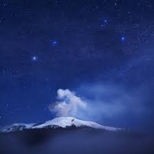 ay 29. 2012 – COLOMBIA – Colombia warned Tuesday of a possible eruption of the Nevado del Ruiz volcano after it began rumbling and spewing gas, sending ashes onto cities and towns in the nearby coffee-growing region. The government’s geology and mining oversight institute Ingeominas said in a statement it raised the warning level to orange from yellow, which means an eruption is possible in days or weeks. The increased seismic activity began at around 3 a.m. local time (4 a.m. EDT). Civil aviation authority Aerocivil said operations have been suspended at the Manizales, Armenia, Cartago and Pereira airports, all in Colombia’s central-western coffee-growing region, due to visibility problems and concerns over aircraft engines getting clogged. This is the second time this year the warning level has been set at orange. It was raised to orange March 31, but brought back to yellow several days later as seismic activity declined. The 17,800-foot volcano, located west of Bogota, hasn’t erupted since the 1980s. An official at the Volcanology Observatory in Manizales, 16 miles northwest of the crater, said the city’s 360,000 residents have been able to see ash falling on the city since before dawn. In 1985, an eruption caused hot volcanic flows to melt the ice- and snow-covered summit area. This unleashed a cascade of debris down the volcano’s eastern slope, which wiped the town of Armero off the map, killing 25,000 people. Another 2,000 people were killed in nearby areas. –WSJ
| 29.05.2012 02:20 PM | Cordillera Central, Andes, Colombia | Nevado del Ruiz Volcano | Volcano Activity | 1501-02= | Stratovolcano | No. 1 |
Volcano Activity in Colombia on Tuesday, 29 May, 2012 at 14:20 (02:20 PM) UTC.
| Description | |
| Colombian volcanologists indicated that the likelihood of an eruption at the Nevado del Ruiz volcano has increased, after an earthquake Tuesday morning in cental Colombia. Local authorities have raised the alert level from yellow to orange following a report issued by the Manizales Volcanological and Seismological Observatory. An orange alert does not mean an eruption is imminent. Web cameras in the area “show the emission of ash,” which “has been felt in the area surrounding the volcano,” according to Seismologic and Volcanic Observation director Gloria Patricia Cortes, who also noted the impact on city of Manizales and municipality of Villamaria. Cortes said that relief agencies in the area are prepped for immediate action, in case of emergency. “The recommendation now is to use masks in the city of Manizales because of the persistent rain of ashes,” said Cortes, who also said that she did not expect a lava flow but did not rule out that the emission of ash could continue for some time. According to officials, small amounts of ash could be dispersed from the volcano to remote areas depending on wind direction and strength. The volcano has been fluctuating at high activity levels for the past several months and was lowered to alert level yellow earlier this month. The last eruption of the volcano in 1985 killed an estimated 25,000 people and destroyed the town of Armero. |
Katla volcano (Iceland): small earthquake swarm, but not likely indicator of activity in the near future
")
A swarm of 14 small to very small mostly very shallow quakes occurred at Katla volcano yesterday and today. Epicenter depths were reported between 0.1 and 12.2 km. Judging from the depth and magnitude of the quakes, the most likely cause for the seismic swarm are adjustments of the hydrothermal system under the icecap, and probably not magmatic intrusions (which would be possible indicators of a future new eruption).
Volcano belches ash in Russia’s Far East
VLADIVOSTOK – A volcano in Russia’s Far East spewed ash high into the sky on Tuesday following a series of tremors, local media reported.
The column of ash from the 3.3-km-high Shiveluch volcano reached up to 7.3 km above sea level, according to the Itar-Tass news agency.
No impact or damage has been reported vis-a-vis the powerful outburst, which came in the wake of a chain of seismic events around the region.
Located on the Kamchatka peninsula, Shiveluch has been active since September 1980.


The Vulcanology and Geological Disaster Mitigation Center (PVMBG) has raised the alert status of Mt. Soputan in Minahasa and Southeast Minahasa regencies in North Sulawesi to level 3 — meaning “standby” — from the previous level 2 (alert), following increasing levels of volcanic activity.
“Based on our observations, as of 3 p.m. on Monday, Mt. Soputan’s alert status was raised to level 3,” center head Surono said on Monday evening.
According to Surono, increasing activity had been detected since May 25, when the volcano spew out white smoke to heights of between 50 meters and 75 meters above the mountain’s peak.
The center has recorded dozens of different types of activity since then. The center’s highest alert status for volcanoes is level 4 (on guard).
Surono has called on local residents to stay beyond a radius of six kilometers from the volcano’s summit.
The center has also warned residents of the threat of a cold lava flood, urging people living near Ranowangko, Pentu, Lawian and Popang rivers to remain alert and aware.
The volcano’s last eruption occurred on July 3, 2011. It erupted 10 hours after its status was raised to alert, forcing local officials to close Sam Ratulangi Airport for a day.
***********************************************************************************************************
Extreme Temperatures/ Weather
Gale Warning
JUNEAU AK
ANCHORAGE ALASKA
KODIAK AK
Red Flag Warning
FIRE WEATHER MESSAGE
MIDLAND/ODESSA TX
GRAND JUNCTION CO
TALLAHASSEE FL
SALT LAKE CITY UT
EL PASO TX/SANTA TERESA NM
***********************************************************************************************************
Storms, Flooding
Tropical Storm Warning
CAPE FEAR TO 31N OUT TO 32N 73W TO 31N 74W
HATTERAS CANYON TO CAPE FEAR OUT TO 34N 71W TO 32N 73W
BALTIMORE CANYON TO HATTERAS CANYON OUT TO 36N 70W TO 34N 71W
| Active tropical storm system(s) | ||||||||||
| Name of storm system | Location | Formed | Last update | Last category | Course | Wind Speed | Gust | Wave | Source | Details |
| Beryl | Atlantic Ocean | 26.05.2012 | 30.05.2012 | Tropical Depression | 65 ° | 46 km/h | 65 km/h | 0.00 m | NHC | |
Tropical Storm data
|
|||||||||||||||||||||||||||||||||||||||||||||||||||||||||||||||||||||||||||||||||||||||||||||||||||||||||||||||||||||||||||||||||||||||||
|
|||||||||||||||||||||||||||||||||||||||||||||||||||||||||||||||||||||||||||||||||||||||||||||||||||||||||||||||||||||||||||||||||||||||||
Severe Thunderstorm Warning
SPRINGFIELD MO
FORT WORTH TX
SHREVEPORT LA
Severe Thunderstorm Watch
NORMAN OK
RALEIGH NC
Flood Warning
DES MOINES IA
SIOUX FALLS SD
TWIN CITIES/CHANHASSEN MN
LA CROSSE WI
GREAT FALLS MT
DULUTH MN
************************************************************************************************************
Epidemic Hazard/ Diseases
| 29.05.2012 | Epidemic Hazard | Cambodia | Province of Kampong Speu, [The area was not defined.] |
Epidemic Hazard in Cambodia on Tuesday, 29 May, 2012 at 16:13 (04:13 PM) UTC.
| Description | |
| A 10-year-old Cambodian girl has died from bird flu, the World Health Organization said Monday, the country’s third fatality from the virulent disease this year. The child developed a fever and shortness of breath on May 20 and died on Sunday, the WHO said in a joint statement with the Cambodian health ministry. Hospital tests confirmed she had contracted the H5N1 strain of avian influenza. “There is evidence of recent deaths among poultry in the village and the patient prepared sick chicken for food prior to becoming sick,” the statement said. The girl, from southwestern Kampong Speu province, is the 21st person in Cambodia to become infected with the H5N1 virus since 2003. Nineteen of those cases have been fatal. The H5N1 strain has killed 357 people worldwide since 2003, according to WHO statistics. | |
| Biohazard name: | A/H5N2 |
| Biohazard level: | 4/4 Hazardous |
| Biohazard desc.: | Viruses and bacteria that cause severe to fatal disease in humans, and for which vaccines or other treatments are not available, such as Bolivian and Argentine hemorrhagic fevers, H5N1(bird flu), Dengue hemorrhagic fever, Marburg virus, Ebola virus, hantaviruses, Lassa fever, Crimean-Congo hemorrhagic fever, and other hemorrhagic or unidentified diseases. When dealing with biological hazards at this level the use of a Hazmat suit and a self-contained oxygen supply is mandatory. The entrance and exit of a Level Four biolab will contain multiple showers, a vacuum room, an ultraviolet light room, autonomous detection system, and other safety precautions designed to destroy all traces of the biohazard. Multiple airlocks are employed and are electronically secured to prevent both doors opening at the same time. All air and water service going to and coming from a Biosafety Level 4 (P4) lab will undergo similar decontamination procedures to eliminate the possibility of an accidental release. |
| Symptoms: | |
| Status: | confirmed |
| 29.05.2012 | Epidemic | Uganda | Northern Region, [Nebbi District] |
Epidemic in Uganda on Tuesday, 29 May, 2012 at 10:21 (10:21 AM) UTC.
| Description | |
| Two people have been confirmed dead and 56 others admitted atNebbi hospital following the fresh outbreak of cholera disease in Nebbi district. The death of the two unidentfied victims and 56 patients who are admitted at Nebbi hospital brings to 17 the number of victims killed and more than 1,150 infected with cholera after the first case was reported in the district in March this year according to health official in the district. Kitts Obima, the Nebbi district health Educator said that the district is alarmed by the persistance outbreak of the disease arguing that cholera is persisting due to relaxity on the side of the community to have sanitary facilites at home and thier poor habits to responds on the cholera symptoms. When New Vision visited Nebbi hospital to ascertain the number of people infetced in the lastest outbreak in Nebbi Town concil on Monday (May, 28,2012) many of the victims mostly youths and children were seen lying with drip on thier connected to thier body at Nebbi hospital isolation ward.
Obima called on leaders in the district to enforce the use of sanitary facilities and educate the communities to avoid eating cold food , “According to public food act, food is purpose to be eaten indoor place but people still eat food in open places which exposes them at high risks of contracting cholera” he said. Cholera is an infection in the small intestine caused by the bacterium Vibrio cholerae. The main symptoms are profuse, watery diarrhea and vomiting. Its transmission occurs primarily by drinking water or eating food that has been contaminated by the feces of an infected person. Obima said that the first case of cholera was reported in Akworo sub-county the district on March 2012. He explained that the worst hit sub-county has been Akworo, Panyimur, Parombo Pakwach sub-county which recorded a total of 15 death and the latest being Nebbi Town Council with over 56 cases reportedly admitted at Nebbi hospital Obima, however,said that drugs that district is still using the previous stocks which were delivered by the ministry and other humantarian organisation in the first outbreak. He added that, the cholera sample have been taken to central public health’s laboratory for test for rapid responds. Mean while to avoid the further spread of the disease, local council leaders have banned the selling of food itmes at the road sides. In Nebbi Town council James Chombe Mucek , the Nebbi town council LC.3 chaiperson said that the council have temporaly suspended selling of food items in the street and open restaurant. He said the move was aimed to control the disease from futher spread by eating cold food. He also said that the council have formed cholera task force who would move door to door to check sanitary facilities like toilets, washing facilities in order to to combat the cholera the disease. |
|
| Biohazard name: | Cholerae Outbreak |
| Biohazard level: | 3/4 Hight |
| Biohazard desc.: | Bacteria and viruses that can cause severe to fatal disease in humans, but for which vaccines or other treatments exist, such as anthrax, West Nile virus, Venezuelan equine encephalitis, SARS virus, variola virus (smallpox), tuberculosis, typhus, Rift Valley fever, Rocky Mountain spotted fever, yellow fever, and malaria. Among parasites Plasmodium falciparum, which causes Malaria, and Trypanosoma cruzi, which causes trypanosomiasis, also come under this level. |
| Symptoms: | |
| Status: | confirmed |
*****************************************************************************************
Solar Activity
3MIN News May29: Quakes, Weather, Middle East, Solar/Planetary Update
Published on May 29, 2012 by Suspicious0bservers
Groundwater: http://www.sciencedaily.com/releases/2012/05/120528154857.htm
http://www.sciencedaily.com/releases/2010/09/100923142503.htm
http://www.sciencedaily.com/releases/2009/08/090812143938.htm
Euro Heat: http://www.sciencedaily.com/releases/2012/05/120527153720.htm
http://www.sciencedaily.com/releases/2011/06/110606113405.htm
http://www.sciencedaily.com/releases/2011/03/110318091141.htm
http://www.sciencedaily.com/releases/2007/08/070803110815.htm
Egypt Protests: http://www.reuters.com/article/2012/05/29/us-egypt-election-idUSBRE84M0A92012…
Dewey: http://www.reuters.com/article/2012/05/29/us-deweyandlebouef-bankruptcy-idUSB…
Israel Gas: http://www.reuters.com/article/2012/05/29/us-israel-security-gas-idUSBRE84S07…
Ireland: http://www.reuters.com/article/2012/05/29/us-ireland-contagion-idUSBRE84S0452…
Iran Sat: http://phys.org/news/2012-05-iran-satellite.html
ChinaBlog: http://phys.org/news/2012-05-china-main-microblog-restricts-user.html
Cyber: http://phys.org/news/2012-05-global-flame-cyber-staggering.html
Blackberry: http://phys.org/news/2012-05-rim-senior.html
Climate: http://phys.org/news/2012-05-climate-collapse-ancient-indus-civilization.html
Spaceweather: http://spaceweather.com/ [Look on the left at the X-ray Flux and Solar Wind Speed/Density]
HAARP: http://www.haarp.alaska.edu/haarp/data.html [Click online data, and have a little fun]
SDO: http://sdo.gsfc.nasa.gov/data/ [Place to find Solar Images and Videos – as seen from earth]
SOHO: http://sohodata.nascom.nasa.gov/cgi-bin/soho_movie_theater [SOHO; Lasco and EIT – as seen from earth]
Stereo: http://stereo.gsfc.nasa.gov/cgi-bin/images [Stereo; Cor, EUVI, HI – as seen from the side]
SunAEON:http://www.sunaeon.com/#/solarsystem/ [Just click it… trust me]
SOLARIMG: http://solarimg.org/artis/ [All purpose data viewing site]
iSWA: http://iswa.gsfc.nasa.gov/iswa/iSWA.html [Free Application; for advanced sun watchers]
NOAA ENLIL SPIRAL: http://www.swpc.noaa.gov/wsa-enlil/cme-based/ [CME Evolution]
RSOE: http://hisz.rsoe.hu/alertmap/index2.php [That cool alert map I use]
LISS: http://earthquake.usgs.gov/monitoring/operations/heliplots_gsn.php
Gamma Ray Bursts: http://grb.sonoma.edu/ [Really? You can’t figure out what this one is for?]
BARTOL Cosmic Rays: http://neutronm.bartol.udel.edu//spaceweather/welcome.html [Top left box, look for BIG blue circles]
TORCON: http://www.weather.com/news/tornado-torcon-index [Tornado Forecast for the day]
GOES Weather: http://rsd.gsfc.nasa.gov/goes/ [Clouds over America]
INTELLICAST: http://www.intellicast.com/ [Weather site used by many youtubers]
NASA News: http://science.nasa.gov/science-news/science-at-nasa/
PHYSORG: http://phys.org/ [GREAT News Site!]
************************************************************************************************************
Mysterious Booms / Rumblings
Authorities puzzled by Mysterious Boom like Explosions sounds; last night in Michigan (May 29, 2012)
Published on May 29, 2012 by adrinilinjunky
http://www.wwmt.com/shared/newsroom/top-stories/stories/wwmt_vid_1905.shtml
“WEST MICHIGAN (NEWSCHANNEL 3) – People are buzzing over what could have possibly caused a loud boom and violent shaking last night and this morning throughout West Michigan.The reports came in from people in Calhoun, Branch and Kalamazoo Counties.People from all over say they felt and heard it, but Newschannel Three has only heard of one case of actual damage happening during the same time.John Nieuwenhuis, who lives in Oshtemo, says that he felt and heard the explosion, which shook his entire house.”Where the two trees are parallel and something completely scrapped both trees off at the same height and laid them to the west,” said Nieuwenhuis.Nieuwenhuis called the fire department but after extensively searching, they couldn’t find the source of an explosion. “I’ve never seen anything like this, we cut down trees, we log trees and what could have taken this down I have no idea,” said Nieuwenhuis.Newschannel Three tried to search into what might have caused the explosions but, it was a clear night and there was no earthquake activity reported anywhere in the Midwest.Air Traffic Control in Kalamazoo says no planes were in the area that might have broken the sound barrier.”
*************************************************************************************************************
Space
Earth approaching objects (objects that are known in the next 30 days) |
|||||||||
| Object Name | Apporach Date | Left | AU Distance | LD Distance | Estimated Diameter* | Relative Velocity | |||
| (2001 CQ36) | 30th May 2012 | 0 day(s) | 0.0258 | 10.0 | 77 m – 170 m | 5.62 km/s | 20232 km/h | ||
| (2002 OA22) | 31st May 2012 | 1 day(s) | 0.1197 | 46.6 | 370 m – 820 m | 7.01 km/s | 25236 km/h | ||
| (2012 KZ41) | 31st May 2012 | 1 day(s) | 0.0209 | 8.1 | 26 m – 57 m | 12.42 km/s | 44712 km/h | ||
| (2007 LE) | 02nd June 2012 | 3 day(s) | 0.0478 | 18.6 | 390 m – 870 m | 19.77 km/s | 71172 km/h | ||
| (2012 KX41) | 02nd June 2012 | 3 day(s) | 0.0371 | 14.4 | 27 m – 61 m | 13.40 km/s | 48240 km/h | ||
| (2012 KO18) | 02nd June 2012 | 3 day(s) | 0.0825 | 32.1 | 100 m – 230 m | 15.27 km/s | 54972 km/h | ||
| (2012 JW11) | 02nd June 2012 | 3 day(s) | 0.1310 | 51.0 | 110 m – 250 m | 5.15 km/s | 18540 km/h | ||
| (2012 HK31) | 04th June 2012 | 5 day(s) | 0.0336 | 13.1 | 22 m – 50 m | 3.03 km/s | 10908 km/h | ||
| (2012 KN18) | 05th June 2012 | 6 day(s) | 0.0425 | 16.6 | 31 m – 70 m | 10.17 km/s | 36612 km/h | ||
| (2008 MG1) | 05th June 2012 | 6 day(s) | 0.1268 | 49.3 | 290 m – 640 m | 22.32 km/s | 80352 km/h | ||
| (2009 LE) | 06th June 2012 | 7 day(s) | 0.1150 | 44.8 | 50 m – 110 m | 13.61 km/s | 48996 km/h | ||
| (2006 SG7) | 06th June 2012 | 7 day(s) | 0.0857 | 33.4 | 71 m – 160 m | 16.47 km/s | 59292 km/h | ||
| (2001 LB) | 07th June 2012 | 8 day(s) | 0.0729 | 28.4 | 200 m – 450 m | 11.56 km/s | 41616 km/h | ||
| (2012 JU11) | 09th June 2012 | 10 day(s) | 0.0736 | 28.6 | 27 m – 60 m | 3.80 km/s | 13680 km/h | ||
| (2012 GX11) | 10th June 2012 | 11 day(s) | 0.1556 | 60.5 | 170 m – 380 m | 6.38 km/s | 22968 km/h | ||
| (2012 KM11) | 14th June 2012 | 15 day(s) | 0.0942 | 36.7 | 30 m – 67 m | 5.92 km/s | 21312 km/h | ||
| (2012 HN40) | 15th June 2012 | 16 day(s) | 0.1182 | 46.0 | 230 m – 510 m | 13.79 km/s | 49644 km/h | ||
| (2002 AC) | 16th June 2012 | 17 day(s) | 0.1598 | 62.2 | 740 m – 1.7 km | 26.71 km/s | 96156 km/h | ||
| 137120 (1999 BJ8) | 16th June 2012 | 17 day(s) | 0.1769 | 68.8 | 670 m – 1.5 km | 14.88 km/s | 53568 km/h | ||
| (2011 KR12) | 19th June 2012 | 20 day(s) | 0.1318 | 51.3 | 140 m – 310 m | 10.10 km/s | 36360 km/h | ||
| (2004 HB39) | 20th June 2012 | 21 day(s) | 0.1605 | 62.5 | 77 m – 170 m | 8.88 km/s | 31968 km/h | ||
| (2008 CE119) | 21st June 2012 | 22 day(s) | 0.1811 | 70.5 | 21 m – 46 m | 3.22 km/s | 11592 km/h | ||
| 308242 (2005 GO21) | 21st June 2012 | 22 day(s) | 0.0440 | 17.1 | 1.4 km – 3.1 km | 13.27 km/s | 47772 km/h | ||
| (2011 AH5) | 25th June 2012 | 26 day(s) | 0.1670 | 65.0 | 17 m – 39 m | 5.84 km/s | 21024 km/h | ||
| (2012 FA14) | 25th June 2012 | 26 day(s) | 0.0322 | 12.5 | 75 m – 170 m | 5.28 km/s | 19008 km/h | ||
| (2004 YG1) | 25th June 2012 | 26 day(s) | 0.0890 | 34.7 | 140 m – 310 m | 11.34 km/s | 40824 km/h | ||
| (2010 AF3) | 25th June 2012 | 26 day(s) | 0.1190 | 46.3 | 16 m – 36 m | 6.54 km/s | 23544 km/h | ||
| (2008 YT30) | 26th June 2012 | 27 day(s) | 0.0715 | 27.8 | 370 m – 820 m | 10.70 km/s | 38520 km/h | ||
| (2010 NY65) | 27th June 2012 | 28 day(s) | 0.1023 | 39.8 | 120 m – 270 m | 15.09 km/s | 54324 km/h | ||
| (2008 WM64) | 28th June 2012 | 29 day(s) | 0.1449 | 56.4 | 200 m – 440 m | 17.31 km/s | 62316 km/h | ||
| (2010 CD55) | 28th June 2012 | 29 day(s) | 0.1975 | 76.8 | 64 m – 140 m | 6.33 km/s | 22788 km/h | ||
|
|||||||||
**************************************************************************************************************
[In accordance with Title 17 U.S.C. Section 107, this material is distributed without profit, for research and/or educational purposes. This constitutes ‘FAIR USE’ of any such copyrighted material.]


